Tarbarrel Rock

Island in Cornwall

England

Tarbarrel Rock

Tresco, Carn Near The southern tip of the island of Tresco.
Tresco, Carn Near Credit: David Dixon

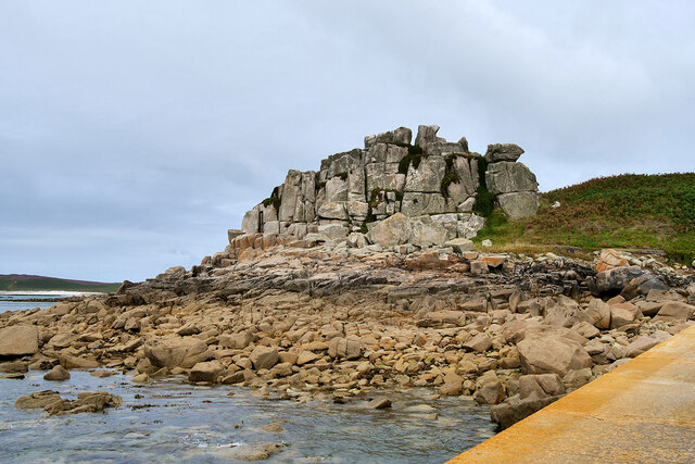
Tarbarrel Rock is a small island located off the coast of Cornwall, England. It is situated approximately 500 meters from the mainland, near the popular tourist destination of St. Ives. The island gets its name from the distinctive rock formation that resembles a tar barrel.

The island itself is quite small, measuring only about 100 meters in diameter. It is composed mainly of granite, which is a common geological feature in this part of Cornwall. The rugged coastline surrounding the island is characterized by towering cliffs and rocky outcrops, adding to its natural beauty.

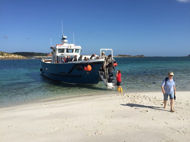
Tarbarrel Rock is accessible by boat during low tide, but caution must be exercised due to its proximity to the mainland and the potential for strong currents. The island is popular among photographers and nature enthusiasts, who are attracted to its unique rock formations and the abundance of marine life in the surrounding waters.

Visitors to Tarbarrel Rock can enjoy breathtaking views of the Atlantic Ocean and the surrounding coastline. The island is also home to a variety of seabirds, such as gulls and cormorants, which nest on the cliffs. During low tide, tide pools are exposed, providing an opportunity for exploration and observation of marine organisms.

Overall, Tarbarrel Rock offers a picturesque and serene escape from the hustle and bustle of mainland Cornwall. Its natural beauty and diverse wildlife make it a must-visit destination for nature lovers and those seeking a tranquil coastal experience.

If you have any feedback on the listing, please let us know in the comments section below.

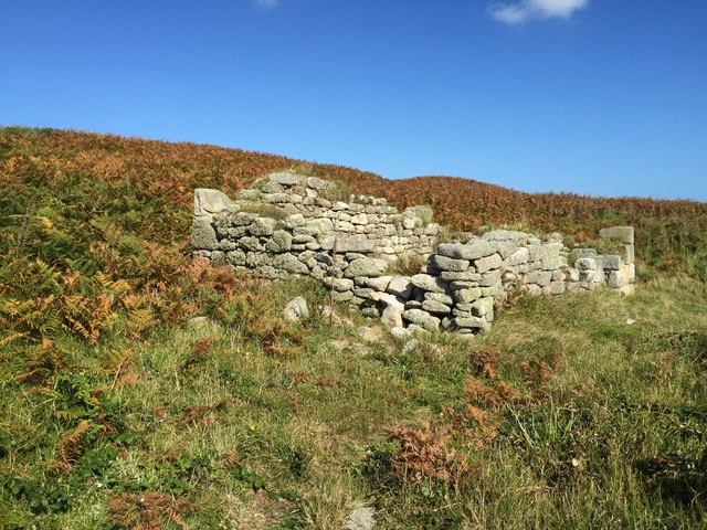
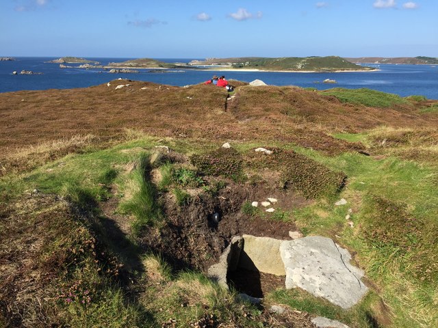
Tarbarrel Rock Images

Images are sourced within 2km of 49.928498/-6.3543673 or Grid Reference SV8712. Thanks to Geograph Open Source API. All images are credited.

Tresco, Carn Near The southern tip of the island of Tresco.
Tresco, Carn Near
The southern tip of the island of Tresco.
Sunset over Samson, Scilly Seen from Star Castle, Hugh Town, St Mary's, Scilly
Sunset over Samson, Scilly
Seen from Star Castle, Hugh Town, St Mary's, Scilly
Alighting on Samson Firethorn dropping off visitors to Samson.
Alighting on Samson
Firethorn dropping off visitors to Samson.
Stonewall on Samson At the uninhabited settlement on Samson
Stonewall on Samson
At the uninhabited settlement on Samson
Remnants on Samson Remnants of housing and stone walls on Samson
Remnants on Samson
Remnants of housing and stone walls on Samson
Abandoned dwelling An abandoned dwelling on Samson
Abandoned dwelling
An abandoned dwelling on Samson
Cairns on North Hill Burial chambers on North Hill, Samson
Cairns on North Hill
Burial chambers on North Hill, Samson
Downhill View, Samson Looking from South Hill over one of the old cottages and on to the Norrard Rocks.
From a print, date uncertain.
Downhill View, Samson
Looking from South Hill over one of the old cottages and on to the Norrard Rocks. From a print, date uncertain.
Ruined Homestead, Samson The last inhabitants left Samson in 1855 and the remains of their settlement are still standing.
Wikipedia says "The island was inhabited until 1855, when the Lord Proprietor Augustus Smith removed the remaining population from the island. By this point, the population was found to be suffering from severe deprivation—particularly due to a diet of limpets and potatoes—and consisted of only two families: the Woodcocks and the Webbers." <span class="nowrap"><a title="https://en.wikipedia.org/wiki/Samson,_Isles_of_Scilly" rel="nofollow ugc noopener" href="https://en.wikipedia.org/wiki/Samson,_Isles_of_Scilly">Link</a><img style="margin-left:2px;" alt="External link" title="External link - shift click to open in new window" src="https://s1.geograph.org.uk/img/external.png" width="10" height="10"/></span>
From a print, date not exact.
Ruined Homestead, Samson
The last inhabitants left Samson in 1855 and the remains of their settlement are still standing. Wikipedia says "The island was inhabited until 1855, when the Lord Proprietor Augustus Smith removed the remaining population from the island. By this point, the population was found to be suffering from severe deprivation—particularly due to a diet of limpets and potatoes—and consisted of only two families: the Woodcocks and the Webbers." LinkExternal link From a print, date not exact.
Ruined Building, Samson Samson had a resident population until 1855 when the last two families left. Even by Victorian standards their lives had become so desperate that the authorities moved them off the island.
The remains of houses and field walls are still obvious.
Ruined Building, Samson
Samson had a resident population until 1855 when the last two families left. Even by Victorian standards their lives had become so desperate that the authorities moved them off the island. The remains of houses and field walls are still obvious.
Great Rag Ledge Puffin Island beyond, with other rocks and reefs in the Tresco Flats.
Great Rag Ledge
Puffin Island beyond, with other rocks and reefs in the Tresco Flats.
Carn Near Hill at the southern tip of Tresco.
Carn Near
Hill at the southern tip of Tresco.
Long Crow Tidal rocks off the southern tip of Tresco. The island of Samson <a href="https://www.geograph.org.uk/gridref/SV8712">SV8712</a> on the horizon, almost split in two by a low isthmus.
Long Crow
Tidal rocks off the southern tip of Tresco. The island of Samson SV8712 on the horizon, almost split in two by a low isthmus.
A prospect of islands Seen from Carn Near at the southern tip of Tresco. To  the left are Great Rag Ledge and Puffin Island <a href="https://www.geograph.org.uk/gridref/SV+8813">SV 8813</a> with the northern tip of Samson <a href="https://www.geograph.org.uk/gridref/SV8713">SV8713</a> beyond. To the right is Works Point <a href="https://www.geograph.org.uk/gridref/SV8714">SV8714</a>, the southern tip of Bryher.

In the distance are the Northern Rocks, most prominent being Castle Bryher <a href="https://www.geograph.org.uk/gridref/SV8613">SV8613</a>.
A prospect of islands
Seen from Carn Near at the southern tip of Tresco. To the left are Great Rag Ledge and Puffin Island SV 8813 with the northern tip of Samson SV8713 beyond. To the right is Works Point SV8714, the southern tip of Bryher. In the distance are the Northern Rocks, most prominent being Castle Bryher SV8613.
A prospect of islands Looking from Oliver's Battery at the southern end of Tresco south-westwards across the shallow waters at low tide. Puffin Island <a href="https://www.geograph.org.uk/gridref/SV8813">SV8813</a> can be seen in the middle distance, with the northern end of Samson beyond.

To the right are the Northern Rocks, most prominent being Castle Bryher <a href="https://www.geograph.org.uk/gridref/SV8613">SV8613</a>.
A prospect of islands
Looking from Oliver's Battery at the southern end of Tresco south-westwards across the shallow waters at low tide. Puffin Island SV8813 can be seen in the middle distance, with the northern end of Samson beyond. To the right are the Northern Rocks, most prominent being Castle Bryher SV8613.
Nut Rock in St Mary's Sound, Scilly Nut Rock is a small rocky islet, one of many east of Samson and south of Tresco in St Mary's Sound. In the background is the south coast of Tresco.
Nut Rock in St Mary's Sound, Scilly
Nut Rock is a small rocky islet, one of many east of Samson and south of Tresco in St Mary's Sound. In the background is the south coast of Tresco.
Raft of Shags off Samson, St Mary's Sound There are several thousand pairs of Shags breeding around the Isles of Scilly. Many will often congregate in these extensive rafts, presumably where the fishing is good.The island in the background is Samson, the largest of the uninhabited islands.
Raft of Shags off Samson, St Mary's Sound
There are several thousand pairs of Shags breeding around the Isles of Scilly. Many will often congregate in these extensive rafts, presumably where the fishing is good.The island in the background is Samson, the largest of the uninhabited islands.
Stony Island and Samson, St Mary's Sound, Scilly Stony Island is one of several rocky reefs east of Samson and south of Tresco. Samson forms the backdrop here to the low-lying reef.
Stony Island and Samson, St Mary's Sound, Scilly
Stony Island is one of several rocky reefs east of Samson and south of Tresco. Samson forms the backdrop here to the low-lying reef.
Show me another place!

Tarbarrel Rock is located at Grid Ref: SV8712 (Lat: 49.928498, Lng: -6.3543673)

Division: Isles of Scilly

Unitary Authority: Isles of Scilly

Police Authority: Devon and Cornwall

What 3 Words

///mute.decimals.classic. Near Bryher, Isles of Scilly

Related Wikis

Samson, Isles of Scilly

Samson (Cornish: (Enys) Sampson) is the largest uninhabited island of the Isles of Scilly, off the southwestern tip of the Cornish peninsula of Great Britain...

HMS Colossus (1787)

HMS Colossus was a 74-gun third-rate ship of the line of the Royal Navy. She was launched at Gravesend on 4 April 1787 and lost on 10 December 1798. During...

Isles of Scilly

The Isles of Scilly ( SIL-ee; Standard Written Form: Syllan, Enesek Syllan, or Enesow Syllan) is an archipelago off the southwestern tip of Cornwall, England...

Oliver's Battery, Tresco

Oliver's Battery is a ruined artillery battery on the island of Tresco in the Isles of Scilly off of Cornwall, England. It was built by the Parliamentarian...

Nearby Amenities

Located within 500m of 49.928498,-6.3543673
South Hill
Natural: peak
Lat/Long: 49.929203/-6.3505036
Barrier: stile
Lat/Long: 49.9304113/-6.351774
The data included in this document is from www.openstreetmap.org. The data is made available under ODbL.

Have you been to Tarbarrel Rock?

Leave your review of Tarbarrel Rock below (or comments, questions and feedback).