Annet Head

Coastal Feature, Headland, Point in Cornwall

England

Annet Head

Table laid-out for the St Agnes Coronation Street Party The “street” in this case is Old Lane.  No traffic order is required to close the road here! The Island Hall on the left had tables groaning under the weight of many cakes and other treats.
Table laid-out for the St Agnes Coronation Street Party Credit: David Lally

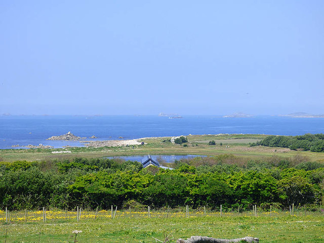
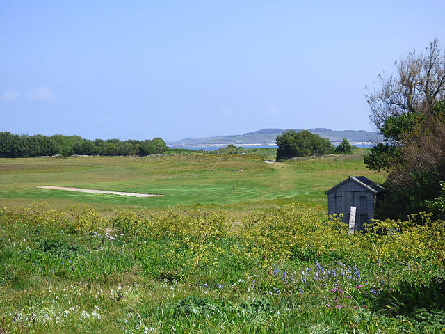
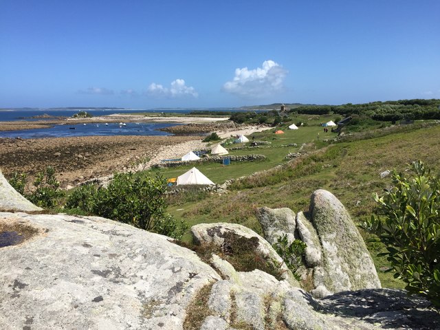
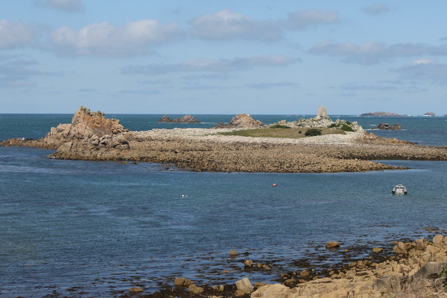
Annet Head is a prominent headland located in Cornwall, England. Situated on the southwestern tip of the county, it juts out into the Atlantic Ocean, offering breathtaking views and serving as a notable coastal feature in the region. With its rugged cliffs and striking rock formations, Annet Head is a popular destination for nature enthusiasts and photographers alike.

The headland is known for its diverse wildlife, particularly its bird population. It is home to a variety of seabirds, including puffins, guillemots, and razorbills. These birds nest in the cliffs and can be observed during the breeding season, making Annet Head a haven for birdwatchers. In addition to the avian inhabitants, the surrounding waters are rich in marine life, attracting divers and snorkelers who are drawn to the area's vibrant underwater world.

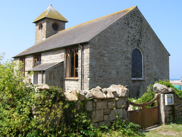
Annet Head is also steeped in history and folklore. It is said to have been a site of Viking raids during the medieval period, and remnants of ancient settlements can still be found on the headland. Additionally, the headland's name is believed to derive from the Old Cornish word "anet," meaning "eagle," emphasizing the significance of the area to the local culture and heritage.

Access to Annet Head is provided through a network of footpaths and trails, allowing visitors to explore the headland's rugged beauty at their leisure. The area is well-maintained and offers ample parking facilities and picnic spots for visitors to enjoy. Whether for its stunning vistas, diverse wildlife, or historical importance, Annet Head remains a cherished coastal feature in Cornwall, attracting visitors from near and far.

If you have any feedback on the listing, please let us know in the comments section below.
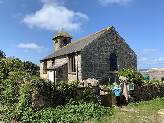
Annet Head Images

Images are sourced within 2km of 49.899189/-6.3732747 or Grid Reference SV8609. Thanks to Geograph Open Source API. All images are credited.

Table laid-out for the St Agnes Coronation Street Party The “street” in this case is Old Lane.  No traffic order is required to close the road here! The Island Hall on the left had tables groaning under the weight of many cakes and other treats.
Table laid-out for the St Agnes Coronation Street Party
The “street” in this case is Old Lane. No traffic order is required to close the road here! The Island Hall on the left had tables groaning under the weight of many cakes and other treats.
A stile to Browarth A tad more conventional than 15 years ago <a href="https://www.geograph.org.uk/photo/827432">SV8708 : Crate Based Stile</a>.
A stile to Browarth
A tad more conventional than 15 years ago SV8708 : Crate Based Stile.
Two post-medieval quays These quays are believed to have been built to land coal for the St Agnes lighthouse.

For more details see the details on their Historic England listing:
List Entry Number:1016512. <span class="nowrap"><a title="https://historicengland.org.uk/listing/the-list/list-entry/1016512?section=official-list-entry" rel="nofollow ugc noopener" href="https://historicengland.org.uk/listing/the-list/list-entry/1016512?section=official-list-entry">Link</a><img style="margin-left:2px;" alt="External link" title="External link - shift click to open in new window" src="https://s1.geograph.org.uk/img/external.png" width="10" height="10"/></span>

The named quay “Uncle Tom’s Quay” is the more eroded of the two but can still be discerned to the right of the picture surmounted by a herring gull.
Two post-medieval quays
These quays are believed to have been built to land coal for the St Agnes lighthouse. For more details see the details on their Historic England listing: List Entry Number:1016512. LinkExternal link The named quay “Uncle Tom’s Quay” is the more eroded of the two but can still be discerned to the right of the picture surmounted by a herring gull.
Refloating Elvera This small launch is probably about 90 years old now.

It's spent the winter in a nearby field undergoing "months of work" according to its owner (on the right of the picture standing on the slipway.)

I expressed surprise that they had towed it down at such a low tide "You are going to let the tide float her?" "Yes, she's full of leaks".
Refloating Elvera
This small launch is probably about 90 years old now. It's spent the winter in a nearby field undergoing "months of work" according to its owner (on the right of the picture standing on the slipway.) I expressed surprise that they had towed it down at such a low tide "You are going to let the tide float her?" "Yes, she's full of leaks".
Refloating Elvera Taken a few minutes before <a href="https://www.geograph.org.uk/photo/7486422">SV8708 : Refloating Elvera</a>. This shows a family group bringing an heirloom back into use.

60 years ago this little launch would take my family (weather permitting) to Catholic Mass on St Mary's when holidaying on St Agnes . It would be sailed by the father of the man on driving the tractor and grandfather of the two men at the stern of the boat.
Refloating Elvera
Taken a few minutes before SV8708 : Refloating Elvera. This shows a family group bringing an heirloom back into use. 60 years ago this little launch would take my family (weather permitting) to Catholic Mass on St Mary's when holidaying on St Agnes . It would be sailed by the father of the man on driving the tractor and grandfather of the two men at the stern of the boat.
Refloating Elvera Taken a minute or two after <a href="https://www.geograph.org.uk/photo/7491445">SV8708 : Refloating Elvera</a>. See that for a bit of history.
Refloating Elvera
Taken a minute or two after SV8708 : Refloating Elvera. See that for a bit of history.
Kate's Bakes Cake stall with honesty box and card reader.  Lovely cakes!
Kate's Bakes
Cake stall with honesty box and card reader. Lovely cakes!
Traditional woven "ink pot" lobster pots Made from tamarisk and willow harvested on the island.  And laid using oar and sail.
Traditional woven "ink pot" lobster pots
Made from tamarisk and willow harvested on the island. And laid using oar and sail.
Old Lifeboat Shed The St Agnes lifeboat shed
Old Lifeboat Shed
The St Agnes lifeboat shed
Old rails for the lifeboat trolley For the St Agnes Lifeboat
Old rails for the lifeboat trolley
For the St Agnes Lifeboat
Daymark on Burnt Island From St Agnes
Daymark on Burnt Island
From St Agnes
View of St. Agnes pool from the road to the lighthouse The strange 'daymark' visible top left of the picture
View of St. Agnes pool from the road to the lighthouse
The strange 'daymark' visible top left of the picture
St. Agnes' cricket pitch with St. Mary's in background The pitch had been mown that morning. Maybe there was a match due!
St. Agnes' cricket pitch with St. Mary's in background
The pitch had been mown that morning. Maybe there was a match due!
Troytown Farm campsite On St Agnes, Isles of Silly
Troytown Farm campsite
On St Agnes, Isles of Silly
St. Agnes church, St. Agnes
Massey Ferguson 265 On St Agnes, Isles of Scilly.
Massey Ferguson 265
On St Agnes, Isles of Scilly.
Church of St Agnes, Isles of Scilly Grade II listed. Listing number 1141238. Early 19th century.
Church of St Agnes, Isles of Scilly
Grade II listed. Listing number 1141238. Early 19th century.
Burnt Island From St Agnes Church.
Burnt Island
From St Agnes Church.
Show me another place!

Annet Head is located at Grid Ref: SV8609 (Lat: 49.899189, Lng: -6.3732747)

Division: Isles of Scilly

Unitary Authority: Isles of Scilly

Police Authority: Devon and Cornwall

What 3 Words

///darling.parent.ourselves. Near St Agnes, Isles of Scilly

Related Wikis

Annet, Isles of Scilly

Annet (Cornish: Anet, lit. 'kittiwake') is the second largest of the fifty or so uninhabited Isles of Scilly, 1 kilometre (0.62 mi) west of St Agnes with...

Thomas W. Lawson (ship)

Thomas W. Lawson was a seven-masted, steel-hulled schooner built for the Pacific trade, but used primarily to haul coal and oil along the East Coast of...

Burnt Island, Isles of Scilly

Burnt Island is a small, uninhabited island in the Isles of Scilly, Cornwall, United Kingdom. It is covered in thrift and long grasses. and is linked to...

St Agnes Lifeboat Station, Isles of Scilly

St Agnes' Lifeboat Station was situated in St Agnes, Isles of Scilly and provided a service for the Royal National Lifeboat Institution from 1891 to 1920...

Bible Christian Chapel, St Agnes, Isles of Scilly

The Bible Christian Chapel, St Agnes was a Bible Christian chapel in St Agnes, Isles of Scilly. == History == Bible Christians arrived in St Agnes in the...

Middle Town, St Agnes

Middle Town (Cornish: Tregres) is a small settlement on the island of St Agnes. It includes the island's primary school, post office and general store...

St Agnes, Isles of Scilly

St Agnes (Cornish: Agenys) is the southernmost populated island of the Isles of Scilly. Thus the island's Troy Town Farm is the southernmost settlement...

Wingletang Down (St Agnes)

Wingletang Down is a Site of Special Scientific Interest (SSSI) on the southern side of the island of St Agnes in the Isles of Scilly, England, UK, which...

Nearby Amenities

Located within 500m of 49.899189,-6.3732747
North West Porth
Natural: bay
Lat/Long: 49.8972168/-6.3760181
Carn Irish
Place: locality
Lat/Long: 49.8961801/-6.3773055
North East Porth
Natural: bay
Source: OS Open Names
Lat/Long: 49.8991155/-6.3717877
The data included in this document is from www.openstreetmap.org. The data is made available under ODbL.

Have you been to Annet Head?

Leave your review of Annet Head below (or comments, questions and feedback).