Moco Rock

Coastal Feature, Headland, Point in Cornwall

England

Moco Rock

Daymark on Burnt Island From St Agnes
Daymark on Burnt Island Credit: Andrew Abbott

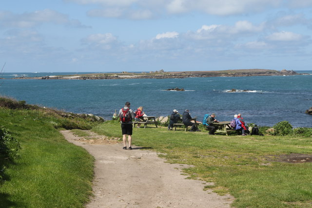
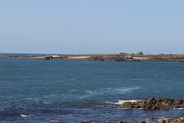
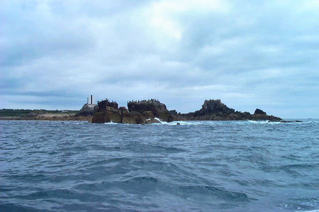
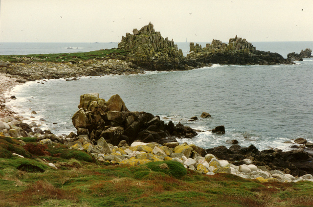
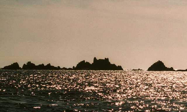
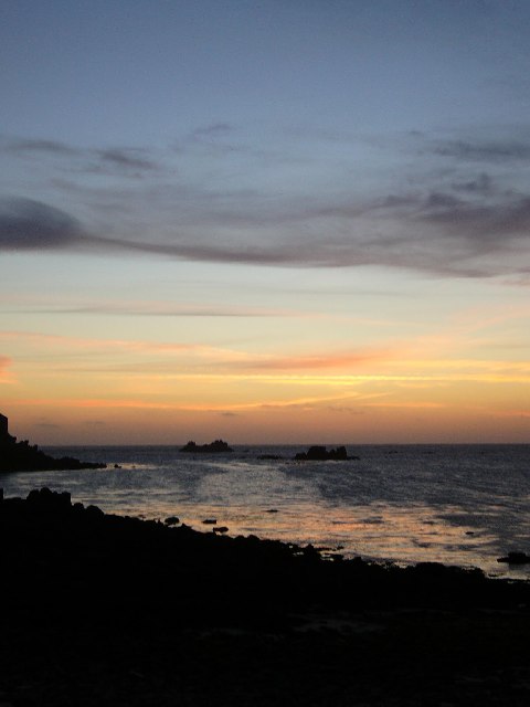
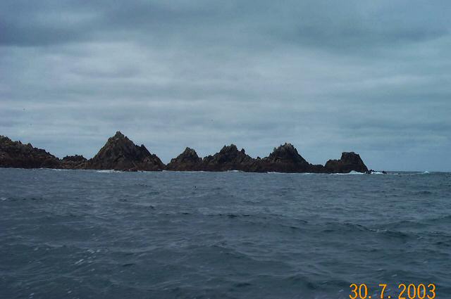
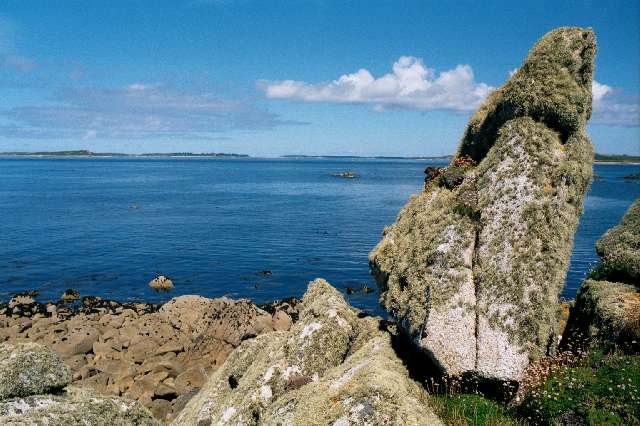
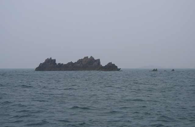
Moco Rock is a prominent coastal feature located in Cornwall, England. It is classified as a headland, also commonly referred to as a point, which extends out into the Atlantic Ocean. The rock formation is situated along the picturesque coastline of Cornwall, known for its stunning cliffs, rugged landscapes, and vibrant marine life.

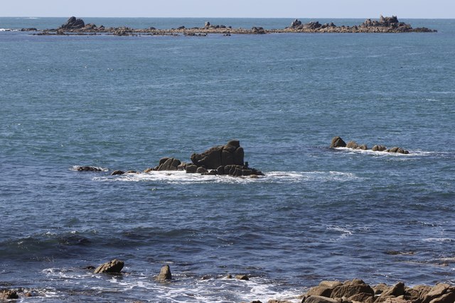
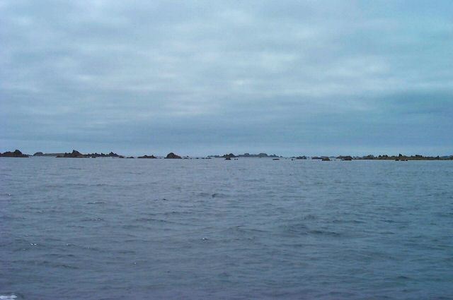
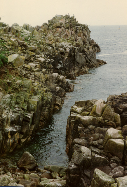
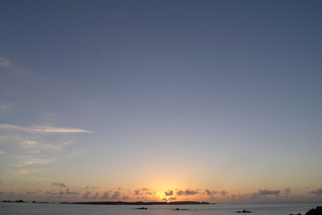
Moco Rock is characterized by its imposing and distinctive appearance. Composed of rugged granite, the rock juts out into the sea, creating a natural promontory that offers breathtaking panoramic views of the surrounding area. The headland is surrounded by crashing waves and is often buffeted by strong winds, making it a popular spot for adventurers seeking an exhilarating coastal experience.

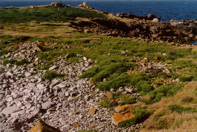
The area surrounding Moco Rock is rich in biodiversity, providing a habitat for a variety of marine and bird species. The rock formation itself is home to colonies of seabirds, including gulls, cormorants, and puffins. Furthermore, the rock's crevices and tide pools are teeming with marine life, making it a haven for snorkelers and divers.

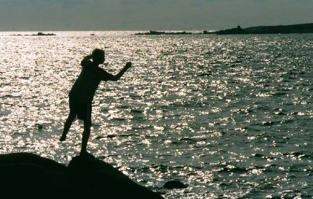
Access to Moco Rock is relatively easy, with a well-maintained coastal path leading visitors to the headland. The path also offers opportunities for hikers and nature enthusiasts to explore the diverse flora and fauna that thrive in the area. Additionally, the headland is a popular destination for photographers, who are captivated by the dramatic coastal scenery and the rock's unique geological formations.

In summary, Moco Rock is a stunning coastal feature in Cornwall, offering visitors a chance to experience the raw beauty of the Atlantic coastline. With its imposing presence, diverse wildlife, and breathtaking views, it is a must-visit destination for nature lovers and outdoor enthusiasts alike.

If you have any feedback on the listing, please let us know in the comments section below.

Moco Rock Images

Images are sourced within 2km of 49.892257/-6.38145 or Grid Reference SV8508. Thanks to Geograph Open Source API. All images are credited.

Daymark on Burnt Island From St Agnes
Daymark on Burnt Island
From St Agnes
Middle Penny and Inner Penny Ledge From Troytown Farm.
Middle Penny and Inner Penny Ledge
From Troytown Farm.
The south end of Annet From St Agnes.
The south end of Annet
From St Agnes.
Carnew Rock From Carnew Point.
Carnew Rock
From Carnew Point.
Islands south of Annet - Scilly Lots of sharp, low lying points of granite. One group is aptly called Hellweathers.
Islands south of Annet - Scilly
Lots of sharp, low lying points of granite. One group is aptly called Hellweathers.
North St Agnes - Scilly Seabirds on Little Smith in front of the daymark on Tinswalbert, with Burnt Island and St Agnes in the background.
North St Agnes - Scilly
Seabirds on Little Smith in front of the daymark on Tinswalbert, with Burnt Island and St Agnes in the background.
Looking NNE across the narrowest part of Annet, Isles of Scilly
Irishman's Carn, North West Par of Annet, Isles of Scilly Looking SW across the North West Par (or Porth) of Annet, Bishop Rock lighthouse is just visible on the horizon (photo by Nat Legg).
Irishman's Carn, North West Par of Annet, Isles of Scilly
Looking SW across the North West Par (or Porth) of Annet, Bishop Rock lighthouse is just visible on the horizon (photo by Nat Legg).
Annet Head, Annet, Isles of Scilly Looking North to Annet Head, Old Wreck navigation buoy is visible in the distance.

Please give photo credit to Nat Legg.
Annet Head, Annet, Isles of Scilly
Looking North to Annet Head, Old Wreck navigation buoy is visible in the distance. Please give photo credit to Nat Legg.
Old Woman's House, Isles of Scilly Looking WSW across Smith Sound to Old Woman's House and Annet Neck (the gap between the rocks), Bishop Rock lighthouse is just visible behind the rocks to the left of the picture.
Old Woman's House, Isles of Scilly
Looking WSW across Smith Sound to Old Woman's House and Annet Neck (the gap between the rocks), Bishop Rock lighthouse is just visible behind the rocks to the left of the picture.
Sunset on the Smiths The rock in the right of this picture is little Smith, you can also see the brow around it and the Bristolman and half-tide ledges behind and to the right, these are the only features in this grid square.
Sunset on the Smiths
The rock in the right of this picture is little Smith, you can also see the brow around it and the Bristolman and half-tide ledges behind and to the right, these are the only features in this grid square.
Haycocks, Annet - Scilly These jags of granite look ideal for trapping and dispatching ships in bad weather.
Haycocks, Annet - Scilly
These jags of granite look ideal for trapping and dispatching ships in bad weather.
Boy on rocks My son Ben, "dancing with the waves" near Troy Town campsite
Boy on rocks
My son Ben, "dancing with the waves" near Troy Town campsite
Scillonian Granite The following winter this rock was subject to the attentions of Trinity House and this <a href="https://www.geograph.org.uk/photo/591035">SV8708 : Navigational Marker on Burnt Island</a> was built on top of it.
Scillonian Granite
The following winter this rock was subject to the attentions of Trinity House and this SV8708 : Navigational Marker on Burnt Island was built on top of it.
Navigational Marker on Burnt Island This marker was built by Trinity House in the spring of 2002 to mark the North-West passage following an incident a few years before when a German cruise liner ran aground entering the Islands. Lining up the marker with the St Agnes lighthouse guides ships safely into the archipelago.

The construction is considered by many to be an unnecessary eyesore.
Navigational Marker on Burnt Island
This marker was built by Trinity House in the spring of 2002 to mark the North-West passage following an incident a few years before when a German cruise liner ran aground entering the Islands. Lining up the marker with the St Agnes lighthouse guides ships safely into the archipelago. The construction is considered by many to be an unnecessary eyesore.
Weed covered rock - Burnt Island This bright green weed appears in a few patches around St Agnes & Gugh it always seems to be on particular, rounded, rocks.
Weed covered rock - Burnt Island
This bright green weed appears in a few patches around St Agnes & Gugh it always seems to be on particular, rounded, rocks.
Sunset over Annet The Isles of Scilly consist far more of sky and sea than land; here the sun sets over Annet which even from just three quarters of a mile away on Troy Town campsite, St Agnes, is just a thin line.

The Islands are the tips of the most westerly of a series of granite domes which form the most of high ground of the South West peninsula of England.  From the west these are Scilly, The Penwith peninsula (Land's End), Bodmin Moor and Dartmoor.

High Willhays on Dartmoor reaches 621m above sea level  <a href="https://www.geograph.org.uk/photo/7909">SX5889 : High Willhays</a>, but time and the Atlantic Ocean have taken their toll on Scilly and the best that can be managed is around 50m at what used to be called “coastguards” on St Mary's <a href="https://www.geograph.org.uk/photo/72884">SV9112 : Corsican Tower, Telegraph</a>.

Probably due to its exposed position at the south west of the archipelago Annet is the largest of the islands to have never been inhabited and has been designated as a bird sanctuary for many years, it is an important breeding site for the Puffin and Manx Shearwater.  

On a 1:50,000 scale map Annet has just one 10 metre contour. The 1:25,000 scale shows that it does pass 15 metres, still “just a wave above the sea”.
Sunset over Annet
The Isles of Scilly consist far more of sky and sea than land; here the sun sets over Annet which even from just three quarters of a mile away on Troy Town campsite, St Agnes, is just a thin line. The Islands are the tips of the most westerly of a series of granite domes which form the most of high ground of the South West peninsula of England. From the west these are Scilly, The Penwith peninsula (Land's End), Bodmin Moor and Dartmoor. High Willhays on Dartmoor reaches 621m above sea level SX5889 : High Willhays, but time and the Atlantic Ocean have taken their toll on Scilly and the best that can be managed is around 50m at what used to be called “coastguards” on St Mary's SV9112 : Corsican Tower, Telegraph. Probably due to its exposed position at the south west of the archipelago Annet is the largest of the islands to have never been inhabited and has been designated as a bird sanctuary for many years, it is an important breeding site for the Puffin and Manx Shearwater. On a 1:50,000 scale map Annet has just one 10 metre contour. The 1:25,000 scale shows that it does pass 15 metres, still “just a wave above the sea”.
Great Smith
Great Smith
Show me another place!

Moco Rock is located at Grid Ref: SV8508 (Lat: 49.892257, Lng: -6.38145)

Division: Isles of Scilly

Unitary Authority: Isles of Scilly

Police Authority: Devon and Cornwall

What 3 Words

///easy.jars.estimates. Near St Agnes, Isles of Scilly

Related Wikis

Thomas W. Lawson (ship)

Thomas W. Lawson was a seven-masted, steel-hulled schooner built for the Pacific trade, but used primarily to haul coal and oil along the East Coast of...

Annet, Isles of Scilly

Annet (Cornish: Anet, lit. 'kittiwake') is the second largest of the fifty or so uninhabited Isles of Scilly, 1 kilometre (0.62 mi) west of St Agnes with...

Burnt Island, Isles of Scilly

Burnt Island is a small, uninhabited island in the Isles of Scilly, Cornwall, United Kingdom. It is covered in thrift and long grasses. and is linked to...

St Agnes Lifeboat Station, Isles of Scilly

St Agnes' Lifeboat Station was situated in St Agnes, Isles of Scilly and provided a service for the Royal National Lifeboat Institution from 1891 to 1920...

Have you been to Moco Rock?

Leave your review of Moco Rock below (or comments, questions and feedback).