Broad Sound

Sea, Estuary, Creek in Cornwall

England

Broad Sound

Two post-medieval quays These quays are believed to have been built to land coal for the St Agnes lighthouse.

For more details see the details on their Historic England listing:
List Entry Number:1016512. <span class="nowrap"><a title="https://historicengland.org.uk/listing/the-list/list-entry/1016512?section=official-list-entry" rel="nofollow ugc noopener" href="https://historicengland.org.uk/listing/the-list/list-entry/1016512?section=official-list-entry">Link</a><img style="margin-left:2px;" alt="External link" title="External link - shift click to open in new window" src="https://s1.geograph.org.uk/img/external.png" width="10" height="10"/></span>

The named quay “Uncle Tom’s Quay” is the more eroded of the two but can still be discerned to the right of the picture surmounted by a herring gull.
Two post-medieval quays Credit: David Lally

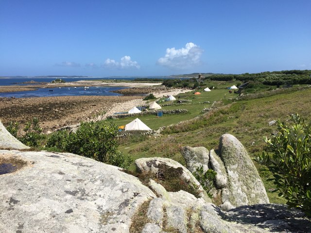
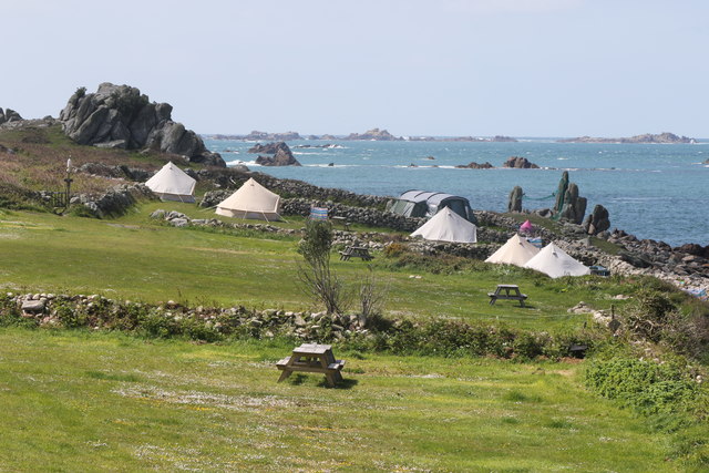
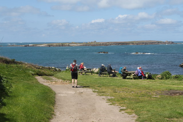
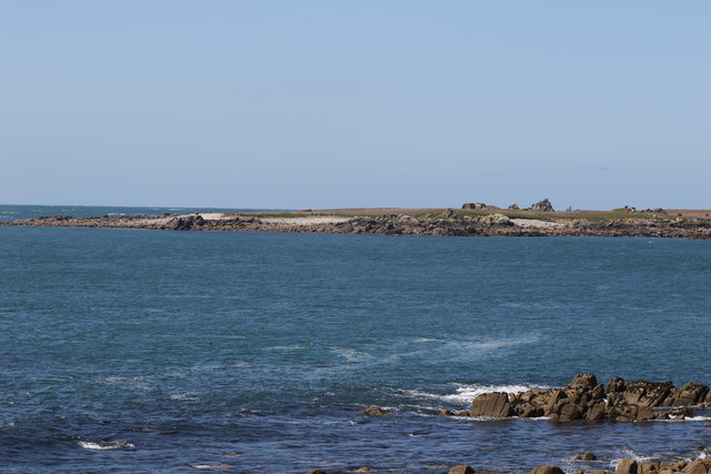
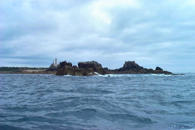
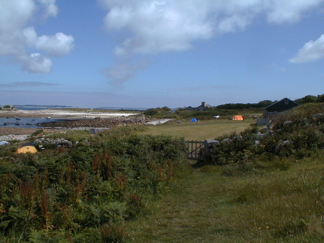
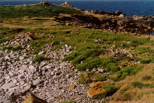
Broad Sound is a picturesque coastal area located in Cornwall, England. It is renowned for its stunning natural beauty, comprising a combination of sea, estuary, and creek landscapes. Situated on the south coast of Cornwall, Broad Sound offers visitors a unique and diverse experience of the region's marine environment.

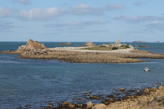
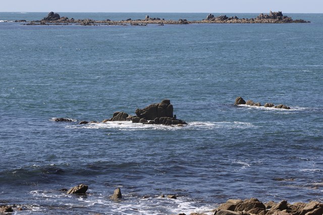
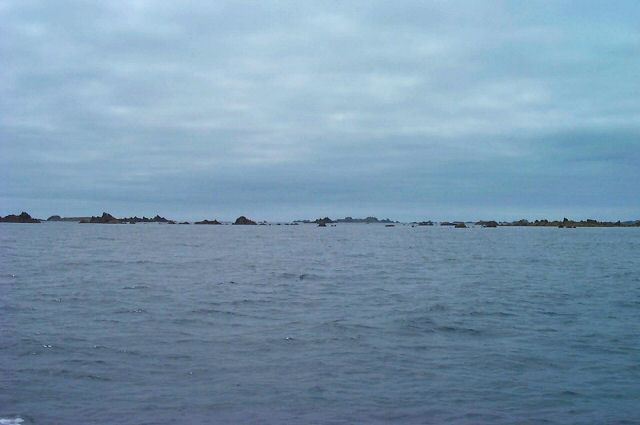
The sea in Broad Sound is characterized by its crystal-clear turquoise waters, which attract water sports enthusiasts and beachgoers alike. The sandy beaches along the coastline provide a perfect spot for sunbathing, picnicking, and enjoying various recreational activities such as swimming and surfing. The area is also home to a rich marine life, making it a popular destination for snorkelers and divers who can explore the underwater world teeming with colorful fish and vibrant coral reefs.

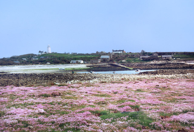
The estuary in Broad Sound is a significant natural feature, formed by the convergence of several rivers, including the Fal and the Percuil. This estuarine ecosystem is a haven for birdwatchers and nature enthusiasts, as it supports a diverse range of bird species and offers breathtaking panoramic views. Visitors can embark on boat trips or kayaking adventures to explore the estuary's hidden creeks and channels, which are often adorned with lush vegetation and wildlife.

Broad Sound's creeks add another layer of beauty to the landscape. These narrow waterways, often lined with ancient stone walls, meander through the coastal countryside, creating a tranquil and idyllic environment. They are a haven for wildlife, including otters, herons, and kingfishers, providing ample opportunities for nature lovers to observe and appreciate the local flora and fauna.

In summary, Broad Sound is a captivating destination in Cornwall that showcases the mesmerizing beauty of the sea, estuary, and creek landscapes. It offers a diverse range of activities and sights, making it an ideal location for adventure seekers, beach lovers, and nature enthusiasts alike.

If you have any feedback on the listing, please let us know in the comments section below.

Broad Sound Images

Images are sourced within 2km of 49.895343/-6.3781222 or Grid Reference SV8508. Thanks to Geograph Open Source API. All images are credited.

Two post-medieval quays These quays are believed to have been built to land coal for the St Agnes lighthouse.

For more details see the details on their Historic England listing:
List Entry Number:1016512. <span class="nowrap"><a title="https://historicengland.org.uk/listing/the-list/list-entry/1016512?section=official-list-entry" rel="nofollow ugc noopener" href="https://historicengland.org.uk/listing/the-list/list-entry/1016512?section=official-list-entry">Link</a><img style="margin-left:2px;" alt="External link" title="External link - shift click to open in new window" src="https://s1.geograph.org.uk/img/external.png" width="10" height="10"/></span>

The named quay “Uncle Tom’s Quay” is the more eroded of the two but can still be discerned to the right of the picture surmounted by a herring gull.
Two post-medieval quays
These quays are believed to have been built to land coal for the St Agnes lighthouse. For more details see the details on their Historic England listing: List Entry Number:1016512. LinkExternal link The named quay “Uncle Tom’s Quay” is the more eroded of the two but can still be discerned to the right of the picture surmounted by a herring gull.
Refloating Elvera This small launch is probably about 90 years old now.

It's spent the winter in a nearby field undergoing "months of work" according to its owner (on the right of the picture standing on the slipway.)

I expressed surprise that they had towed it down at such a low tide "You are going to let the tide float her?" "Yes, she's full of leaks".
Refloating Elvera
This small launch is probably about 90 years old now. It's spent the winter in a nearby field undergoing "months of work" according to its owner (on the right of the picture standing on the slipway.) I expressed surprise that they had towed it down at such a low tide "You are going to let the tide float her?" "Yes, she's full of leaks".
Refloating Elvera Taken a few minutes before <a href="https://www.geograph.org.uk/photo/7486422">SV8708 : Refloating Elvera</a>. This shows a family group bringing an heirloom back into use.

60 years ago this little launch would take my family (weather permitting) to Catholic Mass on St Mary's when holidaying on St Agnes . It would be sailed by the father of the man on driving the tractor and grandfather of the two men at the stern of the boat.
Refloating Elvera
Taken a few minutes before SV8708 : Refloating Elvera. This shows a family group bringing an heirloom back into use. 60 years ago this little launch would take my family (weather permitting) to Catholic Mass on St Mary's when holidaying on St Agnes . It would be sailed by the father of the man on driving the tractor and grandfather of the two men at the stern of the boat.
Refloating Elvera Taken a minute or two after <a href="https://www.geograph.org.uk/photo/7491445">SV8708 : Refloating Elvera</a>. See that for a bit of history.
Refloating Elvera
Taken a minute or two after SV8708 : Refloating Elvera. See that for a bit of history.
Daymark on Burnt Island From St Agnes
Daymark on Burnt Island
From St Agnes
Troytown Farm campsite On St Agnes, Isles of Silly
Troytown Farm campsite
On St Agnes, Isles of Silly
Burnt Island From St Agnes Church.
Burnt Island
From St Agnes Church.
St Agnes Campsite At Troytown Farm.
St Agnes Campsite
At Troytown Farm.
Middle Penny and Inner Penny Ledge From Troytown Farm.
Middle Penny and Inner Penny Ledge
From Troytown Farm.
The south end of Annet From St Agnes.
The south end of Annet
From St Agnes.
Carnew Rock From Carnew Point.
Carnew Rock
From Carnew Point.
Rocks at Long Point Towards Bishop Rock
Rocks at Long Point
Towards Bishop Rock
Troytown maze On the west coast of St Agnes.
Troytown maze
On the west coast of St Agnes.
Flowers on Burnt Island The small area of Burnt Island that is above the tide line is covered in flowers. Sea thrift, I think.
From a print, date not exact.
Flowers on Burnt Island
The small area of Burnt Island that is above the tide line is covered in flowers. Sea thrift, I think. From a print, date not exact.
Islands south of Annet - Scilly Lots of sharp, low lying points of granite. One group is aptly called Hellweathers.
Islands south of Annet - Scilly
Lots of sharp, low lying points of granite. One group is aptly called Hellweathers.
North St Agnes - Scilly Seabirds on Little Smith in front of the daymark on Tinswalbert, with Burnt Island and St Agnes in the background.
North St Agnes - Scilly
Seabirds on Little Smith in front of the daymark on Tinswalbert, with Burnt Island and St Agnes in the background.
Looking towards Periglis from Troy Town Heaven on Earth.
Looking towards Periglis from Troy Town
Heaven on Earth.
Looking NNE across the narrowest part of Annet, Isles of Scilly
Show me another place!

Broad Sound is located at Grid Ref: SV8508 (Lat: 49.895343, Lng: -6.3781222)

Division: Isles of Scilly

Unitary Authority: Isles of Scilly

Police Authority: Devon and Cornwall

What 3 Words

///branded.foreheads.latches. Near St Agnes, Isles of Scilly

Related Wikis

Thomas W. Lawson (ship)

Thomas W. Lawson was a seven-masted, steel-hulled schooner built for the Pacific trade, but used primarily to haul coal and oil along the East Coast of...

Annet, Isles of Scilly

Annet (Cornish: Anet, lit. 'kittiwake') is the second largest of the fifty or so uninhabited Isles of Scilly, 1 kilometre (0.62 mi) west of St Agnes with...

Burnt Island, Isles of Scilly

Burnt Island is a small, uninhabited island in the Isles of Scilly, Cornwall, United Kingdom. It is covered in thrift and long grasses. and is linked to...

St Agnes Lifeboat Station, Isles of Scilly

St Agnes' Lifeboat Station was situated in St Agnes, Isles of Scilly and provided a service for the Royal National Lifeboat Institution from 1891 to 1920...

Nearby Amenities

Located within 500m of 49.895343,-6.3781222
North West Porth
Natural: bay
Lat/Long: 49.8972168/-6.3760181
Carn Irish
Place: locality
Lat/Long: 49.8961801/-6.3773055
The data included in this document is from www.openstreetmap.org. The data is made available under ODbL.

Have you been to Broad Sound?

Leave your review of Broad Sound below (or comments, questions and feedback).