Outer Ranneys

Island in Cornwall

England

Outer Ranneys

The south end of Annet From St Agnes.
The south end of Annet Credit: Andrew Abbott

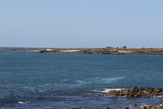
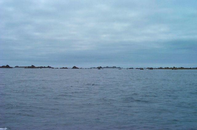
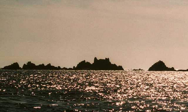
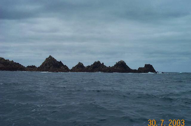
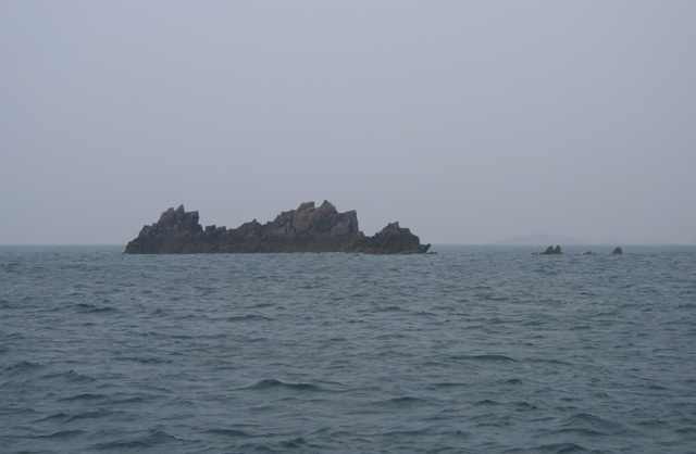
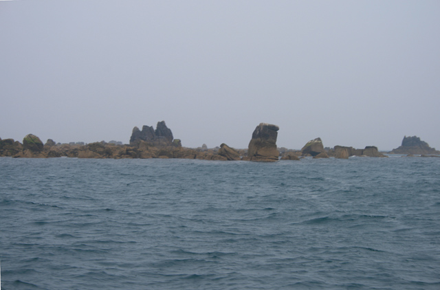
Outer Ranneys is a small island located off the coast of Cornwall, England. It is situated approximately 2 miles southwest of the mainland, making it easily accessible by boat. The island measures around 0.5 square miles and is known for its rugged beauty and diverse wildlife.

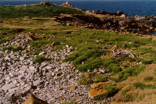
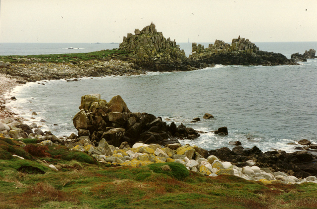
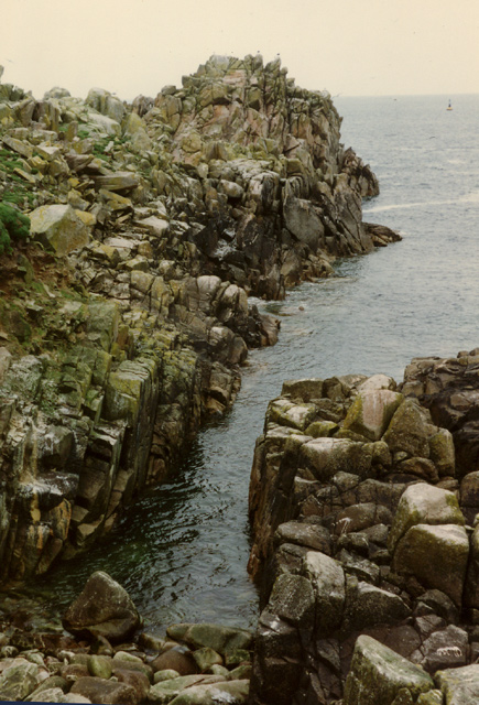
The landscape of Outer Ranneys is characterized by rocky cliffs, sandy beaches, and rolling hills. It offers breathtaking views of the Atlantic Ocean and the surrounding coastline. The island is covered with lush vegetation, including grasses, wildflowers, and some low-lying shrubs.

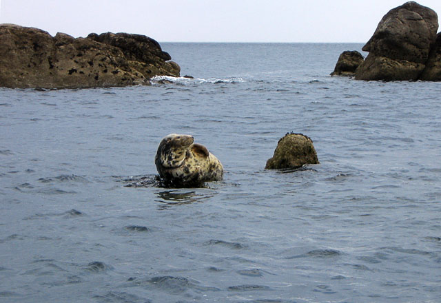
Outer Ranneys is a popular destination for nature lovers and outdoor enthusiasts. It offers various activities such as hiking, bird watching, and fishing. The island is home to a wide range of bird species, including puffins, gulls, and cormorants, making it a haven for birdwatchers. The surrounding waters are also rich in marine life, attracting anglers seeking a catch.

Despite its relatively small size, Outer Ranneys has a unique charm and tranquility that draws visitors seeking a peaceful retreat. There are no permanent residents on the island, but it is occasionally inhabited by researchers or temporary visitors staying in holiday homes or campsites.

In terms of amenities, Outer Ranneys has limited facilities. Visitors are advised to bring their own supplies and equipment, as there are no shops or restaurants on the island. However, the nearby coastal town of Cornwall offers a range of amenities and services, including accommodations, dining options, and boat rentals for those seeking to explore Outer Ranneys.

If you have any feedback on the listing, please let us know in the comments section below.

Outer Ranneys Images

Images are sourced within 2km of 49.892509/-6.384774 or Grid Reference SV8508. Thanks to Geograph Open Source API. All images are credited.

The south end of Annet From St Agnes.
The south end of Annet
From St Agnes.
Western Rocks - Scillies Great Crebawethan - these islands are solely for seabirds and seals. One of the most isolated parts of the Scillies.
Western Rocks - Scillies
Great Crebawethan - these islands are solely for seabirds and seals. One of the most isolated parts of the Scillies.
Islands south of Annet - Scilly Lots of sharp, low lying points of granite. One group is aptly called Hellweathers.
Islands south of Annet - Scilly
Lots of sharp, low lying points of granite. One group is aptly called Hellweathers.
Looking NNE across the narrowest part of Annet, Isles of Scilly
Irishman's Carn, North West Par of Annet, Isles of Scilly Looking SW across the North West Par (or Porth) of Annet, Bishop Rock lighthouse is just visible on the horizon (photo by Nat Legg).
Irishman's Carn, North West Par of Annet, Isles of Scilly
Looking SW across the North West Par (or Porth) of Annet, Bishop Rock lighthouse is just visible on the horizon (photo by Nat Legg).
Annet Head, Annet, Isles of Scilly Looking North to Annet Head, Old Wreck navigation buoy is visible in the distance.

Please give photo credit to Nat Legg.
Annet Head, Annet, Isles of Scilly
Looking North to Annet Head, Old Wreck navigation buoy is visible in the distance. Please give photo credit to Nat Legg.
Old Woman's House, Isles of Scilly Looking WSW across Smith Sound to Old Woman's House and Annet Neck (the gap between the rocks), Bishop Rock lighthouse is just visible behind the rocks to the left of the picture.
Old Woman's House, Isles of Scilly
Looking WSW across Smith Sound to Old Woman's House and Annet Neck (the gap between the rocks), Bishop Rock lighthouse is just visible behind the rocks to the left of the picture.
Haycocks, Annet - Scilly These jags of granite look ideal for trapping and dispatching ships in bad weather.
Haycocks, Annet - Scilly
These jags of granite look ideal for trapping and dispatching ships in bad weather.
Sunset over Annet The Isles of Scilly consist far more of sky and sea than land; here the sun sets over Annet which even from just three quarters of a mile away on Troy Town campsite, St Agnes, is just a thin line.

The Islands are the tips of the most westerly of a series of granite domes which form the most of high ground of the South West peninsula of England.  From the west these are Scilly, The Penwith peninsula (Land's End), Bodmin Moor and Dartmoor.

High Willhays on Dartmoor reaches 621m above sea level  <a href="https://www.geograph.org.uk/photo/7909">SX5889 : High Willhays</a>, but time and the Atlantic Ocean have taken their toll on Scilly and the best that can be managed is around 50m at what used to be called “coastguards” on St Mary's <a href="https://www.geograph.org.uk/photo/72884">SV9112 : Corsican Tower, Telegraph</a>.

Probably due to its exposed position at the south west of the archipelago Annet is the largest of the islands to have never been inhabited and has been designated as a bird sanctuary for many years, it is an important breeding site for the Puffin and Manx Shearwater.  

On a 1:50,000 scale map Annet has just one 10 metre contour. The 1:25,000 scale shows that it does pass 15 metres, still “just a wave above the sea”.
Sunset over Annet
The Isles of Scilly consist far more of sky and sea than land; here the sun sets over Annet which even from just three quarters of a mile away on Troy Town campsite, St Agnes, is just a thin line. The Islands are the tips of the most westerly of a series of granite domes which form the most of high ground of the South West peninsula of England. From the west these are Scilly, The Penwith peninsula (Land's End), Bodmin Moor and Dartmoor. High Willhays on Dartmoor reaches 621m above sea level SX5889 : High Willhays, but time and the Atlantic Ocean have taken their toll on Scilly and the best that can be managed is around 50m at what used to be called “coastguards” on St Mary's SV9112 : Corsican Tower, Telegraph. Probably due to its exposed position at the south west of the archipelago Annet is the largest of the islands to have never been inhabited and has been designated as a bird sanctuary for many years, it is an important breeding site for the Puffin and Manx Shearwater. On a 1:50,000 scale map Annet has just one 10 metre contour. The 1:25,000 scale shows that it does pass 15 metres, still “just a wave above the sea”.
Great Smith
Great Smith
Hellweathers
Hellweathers
Muncoy, from the North West
Muncoy, from the East With the South end of St Agnes just visible on the left horizon.
Muncoy, from the East
With the South end of St Agnes just visible on the left horizon.
Haycocks from the North West
Haycocks & Bishop Rock Lighthouse First glimpse of the Scilly Isles as seen from the morning ferry.  

Beyond the Haycocks and Annet you can see Bishop Rock Lighthouse that is situated on the World's smallest island.

<span class="nowrap"><a title="http://thelongestlistofthelongeststuffatthelongestdomainnameatlonglast.com/smallest31.html" rel="nofollow ugc noopener" href="http://thelongestlistofthelongeststuffatthelongestdomainnameatlonglast.com/smallest31.html">Link</a><img style="margin-left:2px;" alt="External link" title="External link - shift click to open in new window" src="https://s1.geograph.org.uk/img/external.png" width="10" height="10"/></span>
Haycocks & Bishop Rock Lighthouse
First glimpse of the Scilly Isles as seen from the morning ferry. Beyond the Haycocks and Annet you can see Bishop Rock Lighthouse that is situated on the World's smallest island. LinkExternal link
Grey Seal at the Western Rocks, Scilly The Grey Seals on Scilly must be the most laid-back seals in Britain. They will hold their position on a rock despite the tourists passing by and the tide rising. Many, like this one almost seem to be saying "Is this my best side?"
Grey Seal at the Western Rocks, Scilly
The Grey Seals on Scilly must be the most laid-back seals in Britain. They will hold their position on a rock despite the tourists passing by and the tide rising. Many, like this one almost seem to be saying "Is this my best side?"
Kittiwakes on the low cliffs, Annet, Scilly By late June, the Kittiwake chicks have fledged, but the adults are still hanging around the nest sites. These cliffs are only a few metres above high tide mark. The effects of salty spray can be seen by the yellow lichens on the boulders below. At the top is the bracken-covered plateau of Annet, fringed with what look like brambles. The bay, just south of Annet Head, is a favourite spot for the tourist boat passengers to see Kittiwakes and Puffins.
Kittiwakes on the low cliffs, Annet, Scilly
By late June, the Kittiwake chicks have fledged, but the adults are still hanging around the nest sites. These cliffs are only a few metres above high tide mark. The effects of salty spray can be seen by the yellow lichens on the boulders below. At the top is the bracken-covered plateau of Annet, fringed with what look like brambles. The bay, just south of Annet Head, is a favourite spot for the tourist boat passengers to see Kittiwakes and Puffins.
Annet from St. Agnes
Show me another place!

Outer Ranneys is located at Grid Ref: SV8508 (Lat: 49.892509, Lng: -6.384774)

Division: Isles of Scilly

Unitary Authority: Isles of Scilly

Police Authority: Devon and Cornwall

What 3 Words

///twitches.foggy.lousy. Near St Agnes, Isles of Scilly

Related Wikis

Thomas W. Lawson (ship)

Thomas W. Lawson was a seven-masted, steel-hulled schooner built for the Pacific trade, but used primarily to haul coal and oil along the East Coast of...

Annet, Isles of Scilly

Annet (Cornish: Anet, lit. 'kittiwake') is the second largest of the fifty or so uninhabited Isles of Scilly, 1 kilometre (0.62 mi) west of St Agnes with...

Burnt Island, Isles of Scilly

Burnt Island is a small, uninhabited island in the Isles of Scilly, Cornwall, United Kingdom. It is covered in thrift and long grasses. and is linked to...

St Agnes Lifeboat Station, Isles of Scilly

St Agnes' Lifeboat Station was situated in St Agnes, Isles of Scilly and provided a service for the Royal National Lifeboat Institution from 1891 to 1920...

Have you been to Outer Ranneys?

Leave your review of Outer Ranneys below (or comments, questions and feedback).