Gob an Rubha

Coastal Feature, Headland, Point in Inverness-shire

Scotland

Gob an Rubha

Ocean on the west side of the causeway to North Uist
Ocean on the west side of the causeway to North Uist Credit: Gordon Brown

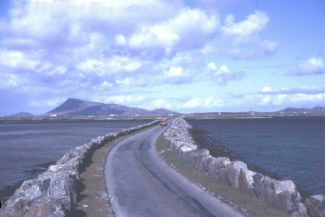
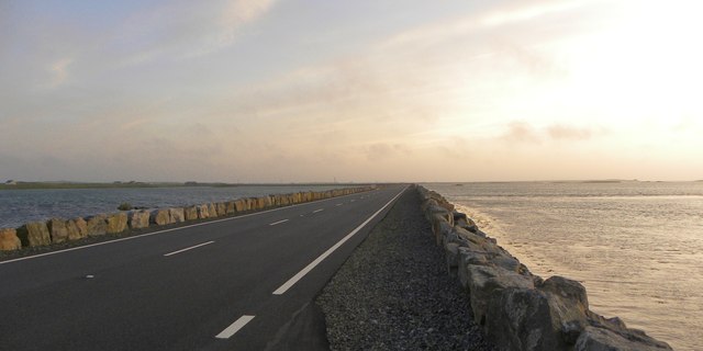
Gob an Rubha, located in Inverness-shire, Scotland, is a prominent coastal feature known for its picturesque headland and stunning views of the surrounding landscape. Situated on the North Atlantic coast, this point juts out into the sea, offering visitors a unique perspective of the rugged coastline.

The name "Gob an Rubha" translates to "the point of the headland" in Gaelic, which aptly describes the geography of this area. The headland is characterized by tall cliffs that provide a dramatic backdrop against the crashing waves below. The rocky terrain is typical of the Scottish coastline, with scattered vegetation clinging to the cliffs, adding a touch of green to the otherwise grey landscape.

The point itself is easily accessible to visitors, with a well-maintained walking path leading to its edge. From here, one can marvel at the panoramic views of the sea, with the horizon stretching out as far as the eye can see. On clear days, it is possible to spot wildlife such as seabirds, seals, and even dolphins swimming in the distance.

Gob an Rubha is a popular destination for outdoor enthusiasts, offering opportunities for hiking, birdwatching, and photography. Its remote location and unspoiled natural beauty make it a haven for those seeking tranquility and a connection with nature.

In summary, Gob an Rubha is a captivating coastal feature in Inverness-shire, boasting a stunning headland with breathtaking views of the North Atlantic. Its rugged cliffs, abundant wildlife, and serene ambiance make it a must-visit destination for nature lovers and explorers alike.

If you have any feedback on the listing, please let us know in the comments section below.

Gob an Rubha Images

Images are sourced within 2km of 57.499144/-7.2755199 or Grid Reference NF8457. Thanks to Geograph Open Source API. All images are credited.
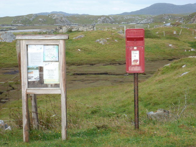
Ocean on the west side of the causeway to North Uist
NCN780 on Grimsay Looking east, Loch an Fhaing on the left and Eaval, North Uist, in the distance.
NCN780 on Grimsay
Looking east, Loch an Fhaing on the left and Eaval, North Uist, in the distance.
Signpost on Grimsay The house beyond the end of Loch an Fhaing is marked as a Post Office on the map, but the may not be up to date information.
Signpost on Grimsay
The house beyond the end of Loch an Fhaing is marked as a Post Office on the map, but the may not be up to date information.
Bus stop and post box on Grimsay At the road-end of a loop that leaves the main road [A865].
Bus stop and post box on Grimsay
At the road-end of a loop that leaves the main road [A865].
House on Grimsay Looking across Bog Cotton from the A865.
House on Grimsay
Looking across Bog Cotton from the A865.
Near Gearraidh Dubh
Near Gearraidh Dubh
Gairbh-eilean
Gairbh-eilean
Oitir Mhòr
Oitir Mhòr
Causeway between Grimsay and Benbecula
Eilean an t-Seagail Seating located at a parking spot just off the A865 near Baile Glas on Benbecula.
Eilean an t-Seagail
Seating located at a parking spot just off the A865 near Baile Glas on Benbecula.
Thatch at Cladach Chairinis
Road on Eilean na h-Airigh Leaving the causeway from Benbecula and heading for Grimsay and North Uist. Eaval / Eabhal is the North Uist mountain in the distance.
<span class="nowrap"><a title="http://www.isle-of-benbecula.co.uk/" rel="nofollow ugc noopener" href="http://www.isle-of-benbecula.co.uk/">Link</a><img style="margin-left:2px;" alt="External link" title="External link - shift click to open in new window" src="https://s1.geograph.org.uk/img/external.png" width="10" height="10"/></span>
Road on Eilean na h-Airigh
Leaving the causeway from Benbecula and heading for Grimsay and North Uist. Eaval / Eabhal is the North Uist mountain in the distance. LinkExternal link
Baile Glas, Grimsay Hamlet on the causewayed road between Benbecula and North Uist.
<span class="nowrap"><a title="http://www.isle-of-benbecula.co.uk/" rel="nofollow ugc noopener" href="http://www.isle-of-benbecula.co.uk/">Link</a><img style="margin-left:2px;" alt="External link" title="External link - shift click to open in new window" src="https://s1.geograph.org.uk/img/external.png" width="10" height="10"/></span>
Baile Glas, Grimsay
Hamlet on the causewayed road between Benbecula and North Uist. LinkExternal link
Sand Flats at Grimsay Tidal flats between Grimsay (foreground) and North Uist (background). Eaval / Eabhal is the distinctive mountain.
Sand Flats at Grimsay
Tidal flats between Grimsay (foreground) and North Uist (background). Eaval / Eabhal is the distinctive mountain.
North Ford Causeway Looking towards Benbecula along the causeway, which has recently been strengthened and widened to take a double lane road.
North Ford Causeway
Looking towards Benbecula along the causeway, which has recently been strengthened and widened to take a double lane road.
Grimsay: the post office The island has had a post office since 2 May 1880 and its current location is in a room of the subpostmistress's house, visible here at the end of her long track driveway. The familiar oval sign stands at the end of the drive.

The post office is open for business from 9am, until 12 noon on Mondays and Tuesdays and for an hour longer on Wednesdays.
Grimsay: the post office
The island has had a post office since 2 May 1880 and its current location is in a room of the subpostmistress's house, visible here at the end of her long track driveway. The familiar oval sign stands at the end of the drive. The post office is open for business from 9am, until 12 noon on Mondays and Tuesdays and for an hour longer on Wednesdays.
Grimsay: postbox № HS6 32 One of four postboxes on the island of Grimsay, this postbox stands at a road junction on the A865 close to the post office (<a href="https://www.geograph.org.uk/photo/3112850">NF8457 : Grimsay: the post office</a>) which is in the house in the background. It therefore might be considered the 'main' box on the island and that is reflected in its later collection times - 2pm on weekdays and at 9:45am on Saturdays.
Grimsay: postbox № HS6 32
One of four postboxes on the island of Grimsay, this postbox stands at a road junction on the A865 close to the post office (NF8457 : Grimsay: the post office) which is in the house in the background. It therefore might be considered the 'main' box on the island and that is reflected in its later collection times - 2pm on weekdays and at 9:45am on Saturdays.
Gearadu: postbox № HS6 34 One of four postboxes on the island of Grimsay. Apart from the one on the main road close to the post office, they are emptied at 11:45am on weekdays and at 9:30am on Saturdays.
Gearadu: postbox № HS6 34
One of four postboxes on the island of Grimsay. Apart from the one on the main road close to the post office, they are emptied at 11:45am on weekdays and at 9:30am on Saturdays.
Show me another place!

Gob an Rubha is located at Grid Ref: NF8457 (Lat: 57.499144, Lng: -7.2755199)

Unitary Authority: Na h-Eileanan an Iar

Police Authority: Highlands and Islands

What 3 Words

///blissful.areas.gossiping. Near Balivanich, Na h-Eileanan Siar

Related Wikis

Baile Glas

Baile Glas or Ballaglasa (Scottish Gaelic: Am Baile Glas) is a settlement on Grimsay in the Outer Hebrides, Scotland. Ballaglasa is within the parish of...

Fraoch-Eilean

Fraoch-eilean is a small island with an uncertain population north of Benbecula in the Outer Hebrides of Scotland. It is about 55 hectares (140 acres...

Grimsay

Grimsay (Scottish Gaelic: Griomasaigh) is a tidal island in the Outer Hebrides of Scotland. == Geography == Grimsay is the largest of the low-lying stepping...

Flodaigh

Flodaigh is a tidal island lying to the north of Benbecula and south of Grimsay in the Outer Hebrides, Scotland. It is connected to Benbecula by a causeway...

Bail' Iochdrach

Bail' Iochdrach or Baliochrach (Scottish Gaelic: Am Baile Ìochdrach) is a village on Benbecula in the Outer Hebrides, Scotland. Baliochrach is within the...

Carinish

Carinish (Scottish Gaelic: Càirinis), is a hamlet on North Uist, in the Outer Hebrides, Scotland. It is in the south of the island, about two miles (three...

Battle of Carinish

The Battle of Carinish was a Scottish clan battle fought in North Uist in 1601. It was part of a year of feuding between Clan MacLeod of Dunvegan and the...

Teampull na Trionaid

Teampull na Trionaid ("trinity church") is a ruined 13th-century Augustinian nunnery at Carinish, on North Uist, in the Outer Hebrides of Scotland. �...

Nearby Amenities

Located within 500m of 57.499144,-7.2755199
Bus Stop
Grimsay Island
Bus: yes
Naptan AtcoCode: 6010731674
Naptan Bearing: E
Naptan CommonName: Grimsay Island
Naptan Indicator: A865 Junction
Naptan Landmark: A865 Junction
Naptan NaptanCode: 94723532
Naptan Street: A865 Junction
Naptan Verified: no
Public Transport: platform
Source: naptan_import
Lat/Long: 57.4976246/-7.2689629
Passing Place
Lat/Long: 57.4975024/-7.2688735
Barrier: cattle_grid
Lat/Long: 57.4982505/-7.2739976
Passing Place
Lat/Long: 57.4973003/-7.2715292
Telephone
Booth: K6
Covered: booth
Man Made: telephone_box
Old Phone: +44 1870 602420
Operator: Grimsay Community Association
Lat/Long: 57.4972228/-7.2688803
Shelter
Description: Has a long narrow bench
Shelter Type: public_transport
Lat/Long: 57.4973413/-7.2689232
Waste Basket
Lat/Long: 57.4972082/-7.2688674
Description: Local Notices
Information: board
Tourism: information
Lat/Long: 57.4972462/-7.2688872
Post Box
Post Box Type: lamp
Lat/Long: 57.497432/-7.2689932
Passing Place
Lat/Long: 57.4960595/-7.2740874
Power: pole
Lat/Long: 57.4969946/-7.268368
Power: pole
Lat/Long: 57.4967237/-7.2696501
Power: pole
Lat/Long: 57.4964542/-7.2709107
Power: pole
Lat/Long: 57.4961717/-7.2723055
Power: pole
Lat/Long: 57.49582/-7.2739497
Power: pole
Lat/Long: 57.4953098/-7.2748241
Power: pole
Lat/Long: 57.4947719/-7.2757631
Power: pole
Lat/Long: 57.4964731/-7.2691327
Power: pole
Lat/Long: 57.4968248/-7.270227
Power: pole
Lat/Long: 57.4968738/-7.2718551
Power: pole
Lat/Long: 57.4970669/-7.2690147
Power: pole
Lat/Long: 57.4961661/-7.2709485
Power: pole
Lat/Long: 57.4968623/-7.2750362
Power: pole
Lat/Long: 57.4962454/-7.276726
Power: pole
Lat/Long: 57.4973595/-7.2736307
Power: pole
Lat/Long: 57.4976449/-7.2728663
Power: pole
Lat/Long: 57.4973394/-7.2718739
Power: pole
Lat/Long: 57.4979692/-7.273215
Power: pole
Lat/Long: 57.4983698/-7.2737219
Power: pole
Lat/Long: 57.4956891/-7.2781932
Power: pole
Lat/Long: 57.4954239/-7.2793733
Power: pole
Lat/Long: 57.4951142/-7.2783773
Power: pole
Lat/Long: 57.4971303/-7.2712068
Power: pole
Lat/Long: 57.4965682/-7.2714608
Power: pole
Lat/Long: 57.4973019/-7.2723996
The data included in this document is from www.openstreetmap.org. The data is made available under ODbL.

Have you been to Gob an Rubha?

Leave your review of Gob an Rubha below (or comments, questions and feedback).