Àird nan Srùban

Coastal Feature, Headland, Point in Inverness-shire

Scotland

Àird nan Srùban

Ocean on the west side of the causeway to North Uist
Ocean on the west side of the causeway to North Uist Credit: Gordon Brown

Àird nan Srùban is a notable coastal feature located in Inverness-shire, Scotland. It is a picturesque headland that juts out into the North Atlantic Ocean, offering breathtaking views of the surrounding landscape. The name "Àird nan Srùban" translates to "Headland of the Whirlpools," which is derived from the turbulent tidal currents that occur in the area.

Situated on the western coast of Scotland, Àird nan Srùban is characterized by its rugged cliffs and rocky terrain. The headland is composed of a variety of geological formations, including sandstone and basalt, which have been shaped by erosion over the years. This has created a dramatic and striking landscape that attracts visitors from near and far.

The headland is also home to a diverse range of flora and fauna. The coastal vegetation includes hardy grasses, heather, and wildflowers, providing a habitat for various small mammals and bird species. Seabirds, such as gannets and puffins, can often be spotted nesting on the cliffs, while seals and dolphins occasionally visit the waters surrounding the headland.

Àird nan Srùban offers an ideal location for outdoor activities such as hiking, birdwatching, and photography. The headland is accessible via a well-maintained footpath that winds its way along the coastline, providing stunning views of the sea and the surrounding countryside. Visitors can explore the rugged coastline, discover hidden coves, and enjoy the tranquility of the area.

Overall, Àird nan Srùban is a captivating coastal feature that showcases the natural beauty and diversity of the Inverness-shire region. Its rugged cliffs, turbulent waters, and abundant wildlife make it a must-visit destination for nature enthusiasts and outdoor adventurers alike.

If you have any feedback on the listing, please let us know in the comments section below.

Àird nan Srùban Images

Images are sourced within 2km of 57.49549/-7.2652307 or Grid Reference NF8457. Thanks to Geograph Open Source API. All images are credited.
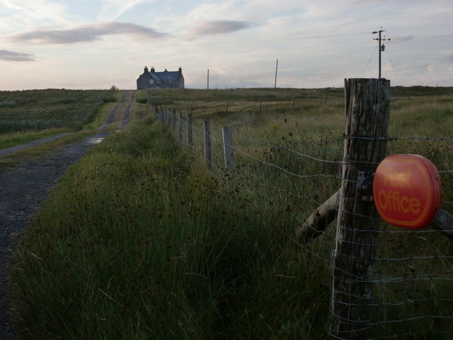
Ocean on the west side of the causeway to North Uist
NCN780 on Grimsay Looking east, Loch an Fhaing on the left and Eaval, North Uist, in the distance.
NCN780 on Grimsay
Looking east, Loch an Fhaing on the left and Eaval, North Uist, in the distance.
Signpost on Grimsay The house beyond the end of Loch an Fhaing is marked as a Post Office on the map, but the may not be up to date information.
Signpost on Grimsay
The house beyond the end of Loch an Fhaing is marked as a Post Office on the map, but the may not be up to date information.
Bus stop and post box on Grimsay At the road-end of a loop that leaves the main road [A865].
Bus stop and post box on Grimsay
At the road-end of a loop that leaves the main road [A865].
House on Grimsay Looking across Bog Cotton from the A865.
House on Grimsay
Looking across Bog Cotton from the A865.
Gearraidh Dubh Looking over the shore near Gearraidh Dubh towards Eabhal.
Gearraidh Dubh
Looking over the shore near Gearraidh Dubh towards Eabhal.
Near Gearraidh Dubh
Near Gearraidh Dubh
Gairbh-eilean
Gairbh-eilean
Oitir Mhòr
Oitir Mhòr
Eilean an t-Seagail Seating located at a parking spot just off the A865 near Baile Glas on Benbecula.
Eilean an t-Seagail
Seating located at a parking spot just off the A865 near Baile Glas on Benbecula.
Thatch at Cladach Chairinis
The summit region of Grimsay Grimsay is a low island between North Uist and Benbecula. It is difficult to be certain of its highest point, but this eminence, 25m or so above Mean Sea Level, is a good contender.
The summit region of Grimsay
Grimsay is a low island between North Uist and Benbecula. It is difficult to be certain of its highest point, but this eminence, 25m or so above Mean Sea Level, is a good contender.
Road on Eilean na h-Airigh Leaving the causeway from Benbecula and heading for Grimsay and North Uist. Eaval / Eabhal is the North Uist mountain in the distance.
<span class="nowrap"><a title="http://www.isle-of-benbecula.co.uk/" rel="nofollow ugc noopener" href="http://www.isle-of-benbecula.co.uk/">Link</a><img style="margin-left:2px;" alt="External link" title="External link - shift click to open in new window" src="https://s1.geograph.org.uk/img/external.png" width="10" height="10"/></span>
Road on Eilean na h-Airigh
Leaving the causeway from Benbecula and heading for Grimsay and North Uist. Eaval / Eabhal is the North Uist mountain in the distance. LinkExternal link
Baile Glas, Grimsay Hamlet on the causewayed road between Benbecula and North Uist.
<span class="nowrap"><a title="http://www.isle-of-benbecula.co.uk/" rel="nofollow ugc noopener" href="http://www.isle-of-benbecula.co.uk/">Link</a><img style="margin-left:2px;" alt="External link" title="External link - shift click to open in new window" src="https://s1.geograph.org.uk/img/external.png" width="10" height="10"/></span>
Baile Glas, Grimsay
Hamlet on the causewayed road between Benbecula and North Uist. LinkExternal link
Sand Flats at Grimsay Tidal flats between Grimsay (foreground) and North Uist (background). Eaval / Eabhal is the distinctive mountain.
Sand Flats at Grimsay
Tidal flats between Grimsay (foreground) and North Uist (background). Eaval / Eabhal is the distinctive mountain.
Sandy inlet on the coast of Grimsay One of a maze of inlets and channels around Grimsay. This view is interesting as there are remains of old field walls [possibly iron age/centre picture] visible in the sand, indicating a lower sea level at some time. Cloud capped Eabhal rises in the distance.
Sandy inlet on the coast of Grimsay
One of a maze of inlets and channels around Grimsay. This view is interesting as there are remains of old field walls [possibly iron age/centre picture] visible in the sand, indicating a lower sea level at some time. Cloud capped Eabhal rises in the distance.
Grimsay: the post office The island has had a post office since 2 May 1880 and its current location is in a room of the subpostmistress's house, visible here at the end of her long track driveway. The familiar oval sign stands at the end of the drive.

The post office is open for business from 9am, until 12 noon on Mondays and Tuesdays and for an hour longer on Wednesdays.
Grimsay: the post office
The island has had a post office since 2 May 1880 and its current location is in a room of the subpostmistress's house, visible here at the end of her long track driveway. The familiar oval sign stands at the end of the drive. The post office is open for business from 9am, until 12 noon on Mondays and Tuesdays and for an hour longer on Wednesdays.
Grimsay: postbox № HS6 32 One of four postboxes on the island of Grimsay, this postbox stands at a road junction on the A865 close to the post office (<a href="https://www.geograph.org.uk/photo/3112850">NF8457 : Grimsay: the post office</a>) which is in the house in the background. It therefore might be considered the 'main' box on the island and that is reflected in its later collection times - 2pm on weekdays and at 9:45am on Saturdays.
Grimsay: postbox № HS6 32
One of four postboxes on the island of Grimsay, this postbox stands at a road junction on the A865 close to the post office (NF8457 : Grimsay: the post office) which is in the house in the background. It therefore might be considered the 'main' box on the island and that is reflected in its later collection times - 2pm on weekdays and at 9:45am on Saturdays.
Show me another place!

Àird nan Srùban is located at Grid Ref: NF8457 (Lat: 57.49549, Lng: -7.2652307)

Unitary Authority: Na h-Eileanan an Iar

Police Authority: Highlands and Islands

Also known as: Ardnastruban

What 3 Words

///same.flickers.pace. Near Balivanich, Na h-Eileanan Siar

Related Wikis

Baile Glas

Baile Glas or Ballaglasa (Scottish Gaelic: Am Baile Glas) is a settlement on Grimsay in the Outer Hebrides, Scotland. Ballaglasa is within the parish of...

Grimsay

Grimsay (Scottish Gaelic: Griomasaigh) is a tidal island in the Outer Hebrides of Scotland. == Geography == Grimsay is the largest of the low-lying stepping...

Fraoch-Eilean

Fraoch-eilean is a small island with an uncertain population north of Benbecula in the Outer Hebrides of Scotland. It is about 55 hectares (140 acres...

Flodaigh

Flodaigh is a tidal island lying to the north of Benbecula and south of Grimsay in the Outer Hebrides, Scotland. It is connected to Benbecula by a causeway...

Bail' Iochdrach

Bail' Iochdrach or Baliochrach (Scottish Gaelic: Am Baile Ìochdrach) is a village on Benbecula in the Outer Hebrides, Scotland. Baliochrach is within the...

Carinish

Carinish (Scottish Gaelic: Càirinis), is a hamlet on North Uist, in the Outer Hebrides, Scotland. It is in the south of the island, about two miles (three...

Battle of Carinish

The Battle of Carinish was a Scottish clan battle fought in North Uist in 1601. It was part of a year of feuding between Clan MacLeod of Dunvegan and the...

Teampull na Trionaid

Teampull na Trionaid ("trinity church") is a ruined 13th-century Augustinian nunnery at Carinish, on North Uist, in the Outer Hebrides of Scotland. �...

Nearby Amenities

Located within 500m of 57.49549,-7.2652307
Bus Stop
Grimsay Island
Bus: yes
Naptan AtcoCode: 6010731674
Naptan Bearing: E
Naptan CommonName: Grimsay Island
Naptan Indicator: A865 Junction
Naptan Landmark: A865 Junction
Naptan NaptanCode: 94723532
Naptan Street: A865 Junction
Naptan Verified: no
Public Transport: platform
Source: naptan_import
Lat/Long: 57.4976246/-7.2689629
Passing Place
Lat/Long: 57.4975024/-7.2688735
Passing Place
Lat/Long: 57.4924969/-7.2651479
Passing Place
Lat/Long: 57.4927808/-7.2659113
Passing Place
Lat/Long: 57.4973003/-7.2715292
Barrier: cattle_grid
Lat/Long: 57.4987481/-7.2644829
Passing Place
Lat/Long: 57.4994997/-7.2628487
Telephone
Booth: K6
Covered: booth
Man Made: telephone_box
Old Phone: +44 1870 602420
Operator: Grimsay Community Association
Lat/Long: 57.4972228/-7.2688803
Barrier: cattle_grid
Lat/Long: 57.4995009/-7.2645807
Barrier: cattle_grid
Lat/Long: 57.4944998/-7.2675774
Barrier: cattle_grid
Lat/Long: 57.4926086/-7.2620139
Shelter
Description: Has a long narrow bench
Shelter Type: public_transport
Lat/Long: 57.4973413/-7.2689232
Waste Basket
Lat/Long: 57.4972082/-7.2688674
Description: Local Notices
Information: board
Tourism: information
Lat/Long: 57.4972462/-7.2688872
Post Box
Post Box Type: lamp
Lat/Long: 57.497432/-7.2689932
Baile Glas
Place: hamlet
Wikidata: Q4848304
Wikipedia: en:Baile Glas
Lat/Long: 57.4992473/-7.2623492
Àird nan Srùban
Place: hamlet
Lat/Long: 57.4955462/-7.2656965
Passing Place
Lat/Long: 57.4989471/-7.2649973
Power: pole
Lat/Long: 57.4985541/-7.2605869
Power: pole
Lat/Long: 57.4984388/-7.2601229
Power: pole
Lat/Long: 57.4983811/-7.2617
Power: pole
Lat/Long: 57.4978436/-7.2642696
Power: pole
Lat/Long: 57.4975611/-7.2655383
Power: pole
Lat/Long: 57.4972656/-7.2669545
Power: pole
Lat/Long: 57.4969946/-7.268368
Power: pole
Lat/Long: 57.4967237/-7.2696501
Power: pole
Lat/Long: 57.4964542/-7.2709107
Power: pole
Lat/Long: 57.4961717/-7.2723055
Power: pole
Lat/Long: 57.4957754/-7.2668741
Power: pole
Lat/Long: 57.4952969/-7.2659729
Power: pole
Lat/Long: 57.4948097/-7.2650529
Power: pole
Lat/Long: 57.4948069/-7.2665227
Power: pole
Lat/Long: 57.4943932/-7.2642723
Power: pole
Lat/Long: 57.4939089/-7.2633416
Power: pole
Lat/Long: 57.4935745/-7.2627193
Power: pole
Lat/Long: 57.4931363/-7.2618476
Power: pole
Lat/Long: 57.4928581/-7.2615365
Power: pole
Lat/Long: 57.4922671/-7.260764
Power: pole
Lat/Long: 57.4919586/-7.2604019
Power: pole
Lat/Long: 57.4924502/-7.2623304
Power: pole
Lat/Long: 57.4942808/-7.2671208
Power: pole
Lat/Long: 57.4937878/-7.2676868
Power: pole
Lat/Long: 57.4964731/-7.2691327
Power: pole
Lat/Long: 57.4962296/-7.2683682
Power: pole
Lat/Long: 57.4968248/-7.270227
Power: pole
Lat/Long: 57.4968738/-7.2718551
Power: pole
Lat/Long: 57.4970669/-7.2690147
Power: pole
Lat/Long: 57.4961661/-7.2709485
Power: pole
Lat/Long: 57.4973394/-7.2718739
Power: pole
Lat/Long: 57.4985053/-7.2617593
Power: pole
Lat/Long: 57.4980283/-7.2641706
Power: pole
Lat/Long: 57.4977948/-7.2653856
Power: pole
Lat/Long: 57.4975411/-7.2666302
Power: pole
Lat/Long: 57.4973033/-7.2678077
Power: pole
Lat/Long: 57.4982646/-7.2630119
Power: pole
Lat/Long: 57.4981075/-7.2629904
Power: pole
Lat/Long: 57.4990243/-7.2619498
Power: pole
Lat/Long: 57.4995821/-7.2621723
Power: pole
Lat/Long: 57.4998952/-7.2638352
Power: pole
Lat/Long: 57.4998741/-7.2645073
Power: pole
Lat/Long: 57.4991907/-7.2637444
Power: pole
Lat/Long: 57.4995731/-7.2634922
Barrier: cattle_grid
Lat/Long: 57.499406/-7.2634832
Passing Place
Lat/Long: 57.4933813/-7.2666143
Barrier: cattle_grid
Lat/Long: 57.4961044/-7.2682786
Power: pole
Lat/Long: 57.4960569/-7.2678001
Power: pole
Lat/Long: 57.4971303/-7.2712068
Power: pole
Lat/Long: 57.4965682/-7.2714608
Power: pole
Lat/Long: 57.4973019/-7.2723996
The data included in this document is from www.openstreetmap.org. The data is made available under ODbL.

Have you been to Àird nan Srùban?

Leave your review of Àird nan Srùban below (or comments, questions and feedback).