Àird nan Srùban

Coastal Feature, Headland, Point in Inverness-shire

Scotland

Àird nan Srùban

Pony and ruin, Carinish
Pony and ruin, Carinish Credit: Hugh Venables

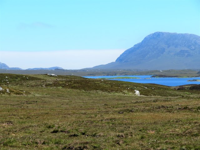
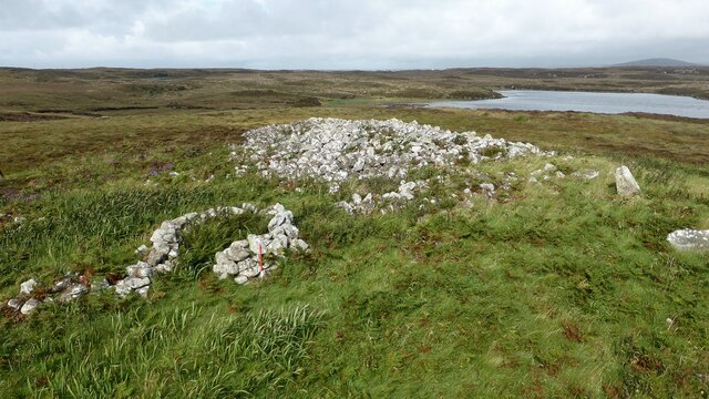
Àird nan Srùban is a prominent coastal feature located in Inverness-shire, Scotland. Situated on the west coast of the Highland region, this headland juts out into the waters of the North Atlantic Ocean. The name Àird nan Srùban translates to "Point of the Straw" in English, referencing the tufted grass and reeds that grow abundantly in the area.

This headland is characterized by its rugged cliffs and stunning panoramic views of the surrounding landscape. Rising to a considerable height, Àird nan Srùban offers a commanding vantage point to observe the vast expanse of the ocean, as well as the nearby coastal areas. The headland is also home to a variety of bird species, making it a popular spot for birdwatching enthusiasts.

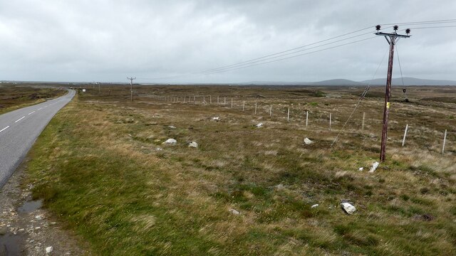
Access to Àird nan Srùban is possible via a scenic coastal path that winds its way along the cliff edge. This path provides visitors with an opportunity to explore the diverse flora and fauna of the area, as well as admire the dramatic geological formations. The headland is also a favored destination for hikers and outdoor enthusiasts, who can enjoy the challenging terrain and breathtaking views.

Due to its natural beauty and unique features, Àird nan Srùban attracts both locals and tourists alike. Many visitors come to witness the awe-inspiring sunsets that paint the sky with vibrant hues, creating a truly mesmerizing experience. Whether it is for a leisurely stroll, wildlife spotting, or simply to soak in the natural splendor, Àird nan Srùban is a must-visit destination for nature lovers and adventure seekers in Inverness-shire.

If you have any feedback on the listing, please let us know in the comments section below.

Àird nan Srùban Images

Images are sourced within 2km of 57.5125/-7.2896259 or Grid Reference NF8359. Thanks to Geograph Open Source API. All images are credited.

Pony and ruin, Carinish
End of the road at Àird Mhòr
House at Carinish
House at Carinish
Marshy area at Carinish Seemingly a naturally infilled loch.
Marshy area at Carinish
Seemingly a naturally infilled loch.
Blar Chairinis Site of battle in 1601.
Blar Chairinis
Site of battle in 1601.
Ocean on the west side of the causeway to North Uist
Gairbh-eilean
Gairbh-eilean
Moorcroft Campsite at low tide
Field and houses at Carinish And also the site of Feith na Fala (The ditch of blood) - a battle waged in 1601 between the MacLeods and the MacDonalds.
Field and houses at Carinish
And also the site of Feith na Fala (The ditch of blood) - a battle waged in 1601 between the MacLeods and the MacDonalds.
Bagh a’ Ghriasaiche
Bagh a’ Ghriasaiche
Fèithe na Fala - The ditch of blood
Free Church, Cairinis Current OS maps show this as a church, but older versions show it as a pub, which was its original purpose. Enough said.
Free Church, Cairinis
Current OS maps show this as a church, but older versions show it as a pub, which was its original purpose. Enough said.
A not very useful gate A rusty old metal gate at the point where a fence once crossed the track.
A not very useful gate
A rusty old metal gate at the point where a fence once crossed the track.
Track above Loch Creag nan Speireag This track, which is indistinct in places, forms part of the Hebridean Way, a relatively new walking route through the Western Isles.
Track above Loch Creag nan Speireag
This track, which is indistinct in places, forms part of the Hebridean Way, a relatively new walking route through the Western Isles.
Cotton grass, Creag nan Speireag Looking over cotton grass towards Loch nan Speireag and the houses at Gearraidh Cladach.
Cotton grass, Creag nan Speireag
Looking over cotton grass towards Loch nan Speireag and the houses at Gearraidh Cladach.
East from Creag nan Speireag Some 200m from the Hebridean Way path which probably cuts the corner of this square and provides some very 'soft' walking over damp moors. This diversion to a low rise gives a view eastwards towards the oddly shaped Loch Carabhat and distant Eabhal.
East from Creag nan Speireag
Some 200m from the Hebridean Way path which probably cuts the corner of this square and provides some very 'soft' walking over damp moors. This diversion to a low rise gives a view eastwards towards the oddly shaped Loch Carabhat and distant Eabhal.
Caravat Barp chambered cairn and shieling Large Neolithic long cairn and later historic shieling or shelter (Scale 1m). <span class="nowrap"><a title="https://canmore.org.uk/site/10254/north-uist-carinish-caravat-barp" rel="nofollow ugc noopener" href="https://canmore.org.uk/site/10254/north-uist-carinish-caravat-barp">Link</a><img style="margin-left:2px;" alt="External link" title="External link - shift click to open in new window" src="https://s1.geograph.org.uk/img/external.png" width="10" height="10"/></span>
Caravat Barp chambered cairn and shieling
Large Neolithic long cairn and later historic shieling or shelter (Scale 1m). LinkExternal link
Carinish stone circle Sadly the road cuts through this stone circle. <span class="nowrap"><a title="https://canmore.org.uk/site/10249/north-uist-carinish" rel="nofollow ugc noopener" href="https://canmore.org.uk/site/10249/north-uist-carinish">Link</a><img style="margin-left:2px;" alt="External link" title="External link - shift click to open in new window" src="https://s1.geograph.org.uk/img/external.png" width="10" height="10"/></span>
Carinish stone circle
Sadly the road cuts through this stone circle. LinkExternal link
Show me another place!

Àird nan Srùban is located at Grid Ref: NF8359 (Lat: 57.5125, Lng: -7.2896259)

Unitary Authority: Na h-Eileanan an Iar

Police Authority: Highlands and Islands

What 3 Words

///dazzling.grit.aviators. Near Balivanich, Na h-Eileanan Siar

Related Wikis

Bail' Iochdrach

Bail' Iochdrach or Baliochrach (Scottish Gaelic: Am Baile Ìochdrach) is a village on Benbecula in the Outer Hebrides, Scotland. Baliochrach is within the...

Carinish

Carinish (Scottish Gaelic: Càirinis), is a hamlet on North Uist, in the Outer Hebrides, Scotland. It is in the south of the island, about two miles (three...

Battle of Carinish

The Battle of Carinish was a Scottish clan battle fought in North Uist in 1601. It was part of a year of feuding between Clan MacLeod of Dunvegan and the...

Teampull na Trionaid

Teampull na Trionaid ("trinity church") is a ruined 13th-century Augustinian nunnery at Carinish, on North Uist, in the Outer Hebrides of Scotland. �...

Nearby Amenities

Located within 500m of 57.5125,-7.2896259
Power: pole
Lat/Long: 57.5156219/-7.2853062
Power: pole
Lat/Long: 57.5150428/-7.2851318
Power: pole
Lat/Long: 57.5144392/-7.2865614
Power: pole
Lat/Long: 57.513935/-7.2877738
Power: pole
Lat/Long: 57.5151595/-7.2839007
The data included in this document is from www.openstreetmap.org. The data is made available under ODbL.

Have you been to Àird nan Srùban?

Leave your review of Àird nan Srùban below (or comments, questions and feedback).