The Gap

Coastal Feature, Headland, Point in Inverness-shire

Scotland

The Gap

St Kilda View from Traigh-stir on North Uist at sunset.
St Kilda Credit: Sandy Gerrard

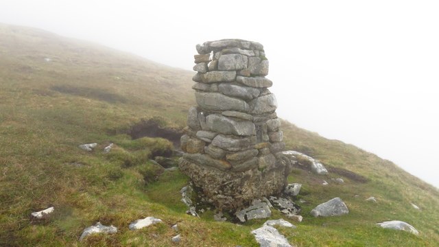
The Gap, located in Inverness-shire, is a prominent coastal feature that is specifically classified as a headland or point. Situated along the rugged coastline of Scotland, it is renowned for its stunning natural beauty and unique geological characteristics. The Gap stands tall and majestic, jutting out into the vast expanse of the North Sea.

With its impressive cliffs and rocky outcrops, The Gap offers breathtaking panoramic views of the surrounding coastline and the endless ocean beyond. Its strategic location provides an ideal vantage point for observing the diverse marine life that inhabits these waters, including seals, dolphins, and various seabird species.

The geological formation of The Gap is primarily composed of sedimentary rock layers, including sandstones and shales, which have been shaped and eroded over millions of years by the relentless forces of wind and water. This erosion has resulted in the creation of deep caves, narrow crevices, and dramatic arches within the headland, further adding to its allure.

Visitors to The Gap can explore the area by following well-marked coastal paths, which offer a safe and enjoyable way to admire the scenery and experience the raw power of nature. The headland is also a popular destination for rock climbers and photographers, who are drawn to its unique features and striking vistas.

In summary, The Gap in Inverness-shire is a captivating coastal feature that stands as a testament to the beauty and power of nature. Its rugged cliffs, deep caves, and breathtaking views make it a must-visit destination for nature enthusiasts and adventure seekers alike.

If you have any feedback on the listing, please let us know in the comments section below.

The Gap Images

Images are sourced within 2km of 57.817791/-8.5622793 or Grid Reference NF1099. Thanks to Geograph Open Source API. All images are credited.

St Kilda View from Traigh-stir on North Uist at sunset.
St Kilda
View from Traigh-stir on North Uist at sunset.
The Amazon's House, Gleann Mor, St Kilda One of the many structures in Gleann Mor, St Kilda, but this one is the most studied and is named on OS Maps. In Gleann Mor, complex clusters of remains bear affinities with the building traditions of Iron Age wheelhouses, of particular note being the Amazon's House, with its central chamber and linked cells beneath turfed corbelling. <span class="nowrap"><a title="https://canmore.org.uk/site/3960/st-kilda-hirta-gleann-mor-the-amazons-house" rel="nofollow ugc noopener" href="https://canmore.org.uk/site/3960/st-kilda-hirta-gleann-mor-the-amazons-house">Link</a><img style="margin-left:2px;" alt="External link" title="External link - shift click to open in new window" src="https://s1.geograph.org.uk/img/external.png" width="10" height="10"/></span>
The Amazon's House, Gleann Mor, St Kilda
One of the many structures in Gleann Mor, St Kilda, but this one is the most studied and is named on OS Maps. In Gleann Mor, complex clusters of remains bear affinities with the building traditions of Iron Age wheelhouses, of particular note being the Amazon's House, with its central chamber and linked cells beneath turfed corbelling. LinkExternal link
Cleit on the side of Mullach Mòr This spot provides a good view into Gleann Mòr towards The Cambir (An Campar).
Cleit on the side of Mullach Mòr
This spot provides a good view into Gleann Mòr towards The Cambir (An Campar).
Village Bay from the side of Ruabhal, Hirta The military encampment is noticeable and this image was taken when the North Uist Rocket Range was extensively used by NATO.
Village Bay from the side of Ruabhal, Hirta
The military encampment is noticeable and this image was taken when the North Uist Rocket Range was extensively used by NATO.
Mina Stac and the cliffs to its south, Hirta
Radar Tracking Station on Mullach Sgar This radar station, located on Mullach Sgar, is one of two stations on the island which serve the South Uist rocket range. They contain equipment which allows them to track test firings on the range by radar, and to record images of missiles in flight. The second radar station on Hirta is located further north, on the summit of Mullach Mòr.
Radar Tracking Station on Mullach Sgar
This radar station, located on Mullach Sgar, is one of two stations on the island which serve the South Uist rocket range. They contain equipment which allows them to track test firings on the range by radar, and to record images of missiles in flight. The second radar station on Hirta is located further north, on the summit of Mullach Mòr.
Hirta, Mina Stac and the cliffs to its south
Former Quarry Site on Hirta
Mina Stac, Hirta Hirta is surrounded by a number of small stacks. Mina Stac rises spectacularly to a height of approximately 70 metres, separated by only a few feet from the spectacular cliffs (the highest sea cliffs in the UK) which descend from the summit Conachair.
Mina Stac, Hirta
Hirta is surrounded by a number of small stacks. Mina Stac rises spectacularly to a height of approximately 70 metres, separated by only a few feet from the spectacular cliffs (the highest sea cliffs in the UK) which descend from the summit Conachair.
St Kilda, Mina Stac Hirta is surrounded by a number of small stacks. Mina Stac rises spectacularly to a height of approximately 70 metres, separated by only a few feet from the spectacular cliffs (the highest sea cliffs in the UK) which descend from the summit of Conachair, the highest point on the island.
St Kilda, Mina Stac
Hirta is surrounded by a number of small stacks. Mina Stac rises spectacularly to a height of approximately 70 metres, separated by only a few feet from the spectacular cliffs (the highest sea cliffs in the UK) which descend from the summit of Conachair, the highest point on the island.
Radar Tracking Station on Mullach Mor This radar station is located on the summit of Mullach Mor. It is one of two radar stations on the island which serve the South Uist rocket range. They contain equipment which allows them to track test firings on the range by radar, and to record images of missiles in flight. The second radar station on Hirta is located further south, on Mullach Sgar (<a href="https://www.geograph.org.uk/photo/7366677">NF0998 : Radar Tracking Station on Mullach Sgar</a>).
Radar Tracking Station on Mullach Mor
This radar station is located on the summit of Mullach Mor. It is one of two radar stations on the island which serve the South Uist rocket range. They contain equipment which allows them to track test firings on the range by radar, and to record images of missiles in flight. The second radar station on Hirta is located further south, on Mullach Sgar (NF0998 : Radar Tracking Station on Mullach Sgar).
Abhainn Mhòr, Hirta Flowing past the western end of the old village.
Abhainn Mhòr, Hirta
Flowing past the western end of the old village.
Abhainn Mhòr With some of the maintained cleits along the banks.
Abhainn Mhòr
With some of the maintained cleits along the banks.
Soay Sheep, Hirta A very old lineage of sheep, living wild on Hirta and Soay. They are tagged to monitor population fluctuations, which can be quite rapid.
Soay Sheep, Hirta
A very old lineage of sheep, living wild on Hirta and Soay. They are tagged to monitor population fluctuations, which can be quite rapid.
Abhainn Mhòr, Hirta
Abhainn Mhòr, Hirta
Former village, Hirta With Soay Sheep now roaming free on what were the farmed fields.
Former village, Hirta
With Soay Sheep now roaming free on what were the farmed fields.
St Kilda - Trig point below Conachair summit This trig point is located high up on the southern slopes of Conachair. Sadly there was no view on this day with a visibility of around twenty yards and driving fine rain so it wasn't a place to linger.
St Kilda - Trig point below Conachair summit
This trig point is located high up on the southern slopes of Conachair. Sadly there was no view on this day with a visibility of around twenty yards and driving fine rain so it wasn't a place to linger.
Radar station and communications mast on Mullach Mor, St Kilda The summit of Mullach Mor is 361m above sea level. The radar station is manned all year round and used for tracking test missiles from the range on South Uist. The road from the village to the summit was built in 1957 by the military.
Radar station and communications mast on Mullach Mor, St Kilda
The summit of Mullach Mor is 361m above sea level. The radar station is manned all year round and used for tracking test missiles from the range on South Uist. The road from the village to the summit was built in 1957 by the military.
Show me another place!

The Gap is located at Grid Ref: NF1099 (Lat: 57.817791, Lng: -8.5622793)

Unitary Authority: Na h-Eileanan an Iar

Police Authority: Highlands and Islands

What 3 Words

///famed.screeches.drips. Near Balivanich, Na h-Eileanan Siar

Related Wikis

Hirta

Hirta (Scottish Gaelic: Hiort) is the largest island in the St Kilda archipelago, on the western edge of Scotland. The names Hiort (in Scottish Gaelic...

St Kilda, Scotland

St Kilda (Scottish Gaelic: Hiort) is an isolated archipelago situated 64 kilometres (40 mi) west-northwest of North Uist in the North Atlantic Ocean. It...

Dùn

Dùn is an island in St Kilda, Scotland. It is nearly 1 mile (1.6 kilometres) long. Its name simply means "fort" in Scottish Gaelic (for more information...

Stac Biorach

Stac Biorach (Scottish Gaelic: "the pointed stack") is a sea stack, 73 metres tall, situated between Hirta and Soay (in the "Sound of Soay") in the St...

Stac Levenish

Stac Levenish or Stac Leibhinis (sometimes simply called Levenish/Leibhinis) is a sea stack in the St Kilda archipelago in Scotland. Lying 2.5 kilometres...

Soay, St Kilda

Soay (Scottish Gaelic: Soaigh) is an uninhabited islet in the St Kilda archipelago, Scotland. The name is from Old Norse Seyðoy, meaning 'island of sheep...

Stac Lee

Stac Lee (Scottish Gaelic: Stac Lì) is a sea stack in the St Kilda group off the west coast of Scotland. An island Marilyn (a point with topographic prominence...

Boreray, St Kilda

Boreray (Scottish Gaelic: Boraraigh; Scots: Boreray) is an uninhabited island in the St Kilda archipelago in the North Atlantic. == Geography == Boreray...

Nearby Amenities

Located within 500m of 57.817791,-8.5622793
Rubha Ghill
Natural: cape
Source: npe
Wikidata: Q24679162
Lat/Long: 57.8168905/-8.5554403
Stac a' Langa
Natural: cape
Source: npe
Wikidata: Q24677220
Lat/Long: 57.8204959/-8.5615766
Natural: rock
Seamark Type: rock
Lat/Long: 57.8195147/-8.5603912
Natural: rock
Seamark Type: rock
Lat/Long: 57.8190297/-8.5600985
Natural: rock
Seamark Type: rock
Lat/Long: 57.8207359/-8.5609685
Natural: rock
Seamark Type: rock
Lat/Long: 57.821498/-8.5636761
Natural: rock
Seamark Type: rock
Lat/Long: 57.8213291/-8.5640176
An Lag bho'n Tuath
Place: locality
Lat/Long: 57.8157439/-8.5654765
Am Broig
Natural: cape
Lat/Long: 57.8177782/-8.5591465
Geo a' Bhroige
Natural: bay
Lat/Long: 57.8184411/-8.5598117
Geo na Eaige
Natural: bay
Lat/Long: 57.8175382/-8.5580307
Glacan Chonachair
Place: locality
Lat/Long: 57.8174582/-8.5699397
The data included in this document is from www.openstreetmap.org. The data is made available under ODbL.

Have you been to The Gap?

Leave your review of The Gap below (or comments, questions and feedback).