Geo na Mol
Coastal Feature, Headland, Point in Inverness-shire
Scotland
Geo na Mol

Geo na Mol is a prominent coastal feature located in Inverness-shire, Scotland. This headland, also known as a point, is situated on the northern coast of the county, overlooking the North Sea. It is positioned near the picturesque town of Wick, which is famous for its stunning coastline and rich maritime history.
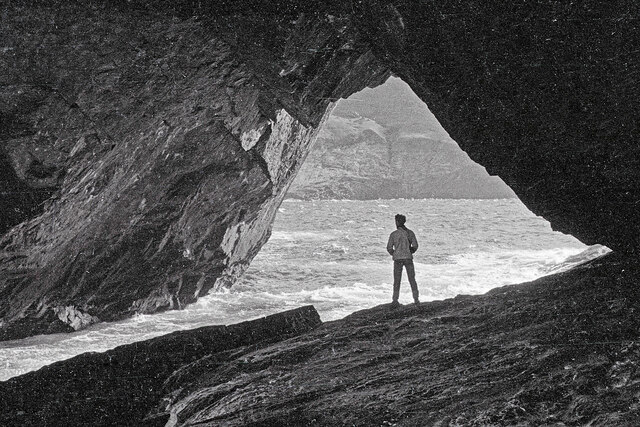
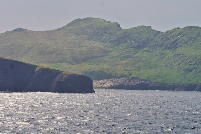
With its rugged cliffs and rocky terrain, Geo na Mol stands as a striking landmark in the region. The headland juts out into the sea, providing breathtaking panoramic views of the surrounding coastal landscape. Its elevated position offers visitors the opportunity to observe the dramatic interplay between land and sea, with crashing waves and coastal erosion shaping the cliffs over time.
The area surrounding Geo na Mol is abundant in diverse wildlife and natural beauty. Seabirds, such as puffins and fulmars, can often be spotted nesting along the cliffs, while seals and dolphins occasionally make appearances in the waters below. The headland is also known for its rich marine ecosystem, with a variety of fish and shellfish species thriving in the nearby waters.
In addition to its natural attractions, Geo na Mol is steeped in history. The headland is believed to have been an important location during Viking times, and remnants of ancient settlements and defensive structures have been discovered in the area. Walking along the coastal path that winds around the headland, visitors can immerse themselves in the fascinating stories and legends that have shaped the region over the centuries.
Overall, Geo na Mol in Inverness-shire is a captivating coastal feature that offers visitors a unique blend of stunning natural scenery, abundant wildlife, and rich historical significance.
If you have any feedback on the listing, please let us know in the comments section below.
Geo na Mol Images
Images are sourced within 2km of 57.822792/-8.5729839 or Grid Reference NA1000. Thanks to Geograph Open Source API. All images are credited.


Geo na Mol is located at Grid Ref: NA1000 (Lat: 57.822792, Lng: -8.5729839)
Unitary Authority: Na h-Eileanan an Iar
Police Authority: Highlands and Islands
What 3 Words
///suspended.marathons.tower. Near Balivanich, Na h-Eileanan Siar
Nearby Locations
Related Wikis

St Kilda, Scotland
St Kilda (Scottish Gaelic: Hiort) is an isolated archipelago situated 64 kilometres (40 mi) west-northwest of North Uist in the North Atlantic Ocean. It...

Hirta
Hirta (Scottish Gaelic: Hiort) is the largest island in the St Kilda archipelago, on the western edge of Scotland. The names Hiort (in Scottish Gaelic...

Stac Biorach
Stac Biorach (Scottish Gaelic: "the pointed stack") is a sea stack, 73 metres tall, situated between Hirta and Soay (in the "Sound of Soay") in the St...

Dùn
Dùn is an island in St Kilda, Scotland. It is nearly 1 mile (1.6 kilometres) long. Its name simply means "fort" in Scottish Gaelic (for more information...
Nearby Amenities
Located within 500m of 57.822792,-8.5729839Have you been to Geo na Mol?
Leave your review of Geo na Mol below (or comments, questions and feedback).