South Channel
Sea, Estuary, Creek in Essex Maldon
England
South Channel
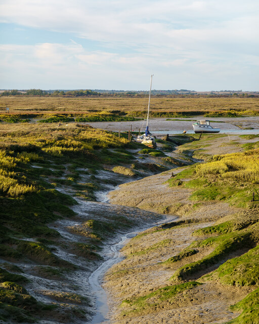
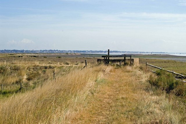
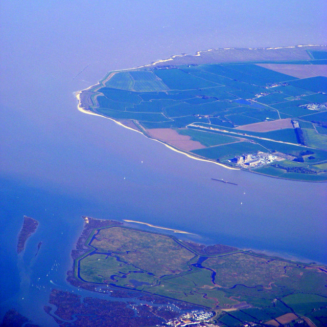
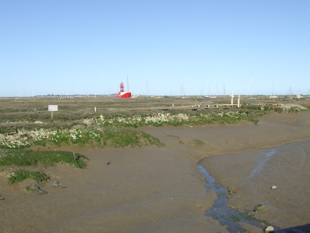
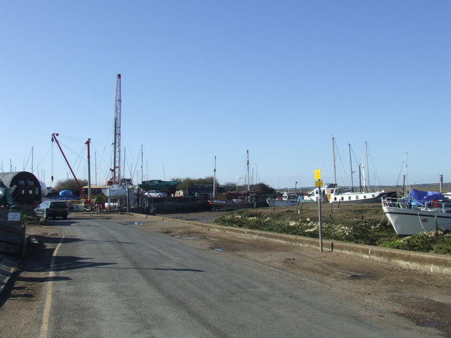
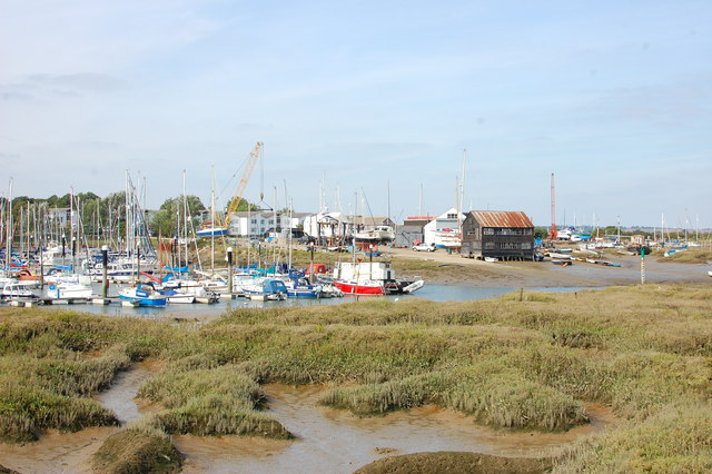
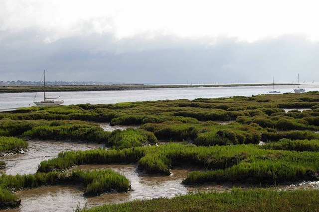
South Channel is a picturesque waterway located in Essex, England. It is a unique combination of sea, estuary, and creek, creating a diverse and stunning natural landscape. The channel stretches for approximately five miles, connecting the River Crouch to the North Sea.
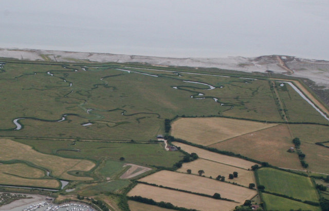
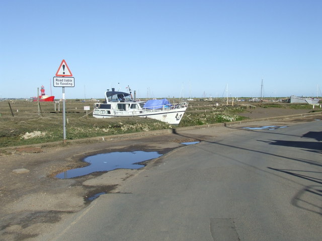
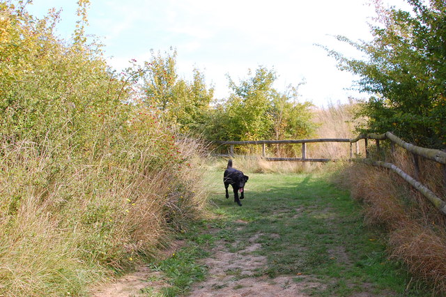
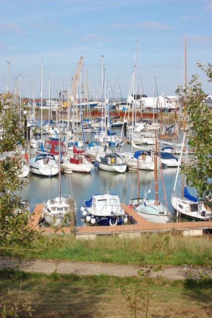
The South Channel is known for its calm, clear waters, making it a popular destination for boating and sailing enthusiasts. The channel is relatively narrow, providing a sense of intimacy and seclusion as it winds its way through the surrounding marshes and saltwater creeks. The area is rich in wildlife, with numerous species of birds, fish, and marine life calling it home.
The channel is also an important navigational route for ships and vessels entering and exiting the River Crouch. It is well-marked with buoys and beacons to guide maritime traffic safely through its waters. The South Channel is known for its strong tidal currents, which can pose challenges for inexperienced sailors.
The surrounding area of the South Channel is a designated nature reserve, with protected habitats and marshland providing a haven for a wide variety of flora and fauna. The channel is also a popular spot for anglers, attracting those seeking to catch the abundant fish that inhabit its waters.
Overall, South Channel in Essex offers a unique blend of natural beauty, recreational opportunities, and ecological significance. Whether it's boating, fishing, or simply enjoying the stunning views, visitors to South Channel are sure to be captivated by its charm and tranquility.
If you have any feedback on the listing, please let us know in the comments section below.
South Channel Images
Images are sourced within 2km of 51.762384/0.86864073 or Grid Reference TL9810. Thanks to Geograph Open Source API. All images are credited.


South Channel is located at Grid Ref: TL9810 (Lat: 51.762384, Lng: 0.86864073)
Administrative County: Essex
District: Maldon
Police Authority: Essex
What 3 Words
///alley.cheetahs.huddle. Near Tollesbury, Essex
Nearby Locations
Related Wikis
Great Cob Island
Great Cob island is a small island in the estuary of the River Blackwater in Essex, England, the United Kingdom. The island is an area of low-lying salt...

Tollesbury Wick
Tollesbury Wick is a 242.8-hectare (600-acre) nature reserve east of Tollesbury in Essex. It is managed by the Essex Wildlife Trust.This is coastal freshwater...

Woodup Pool
Woodup Pool in Tollesbury, Essex (also known as Woodrolfe Pool) is a salt-water pond or lake used as an open-air swimming pool or amenity pool. == History... ==

Tollesbury
Tollesbury is a village in England, located on the Essex coast at the mouth of the River Blackwater. It is situated nine miles east of the historic port...
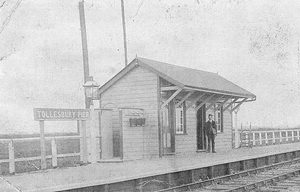
Tollesbury Pier railway station
Tollesbury Pier railway station was a short-lived terminus of an extension of the Kelvedon and Tollesbury Light Railway, serving Tollesbury's pier on the...
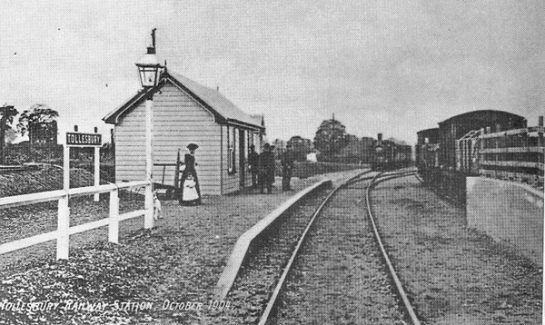
Tollesbury railway station
Tollesbury railway station was on the Kelvedon and Tollesbury Light Railway, serving the village of Tollesbury, Essex. The station was 8 miles 42 chains...

West Mersea Yacht Club
West Mersea Yacht Club (WMYC) is a British yacht club that has its clubhouse in Coast Road, West Mersea, Mersea Island, Essex. It is on the estuary of...
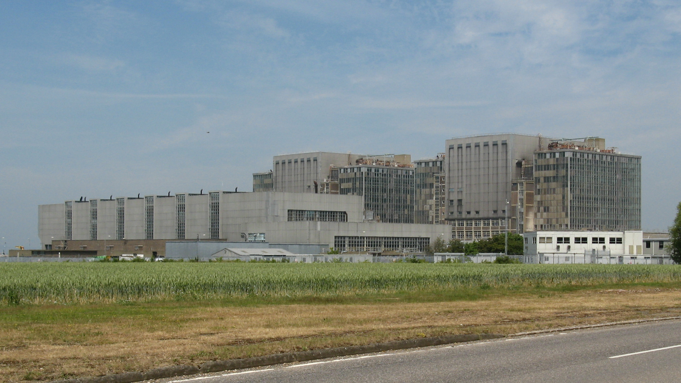
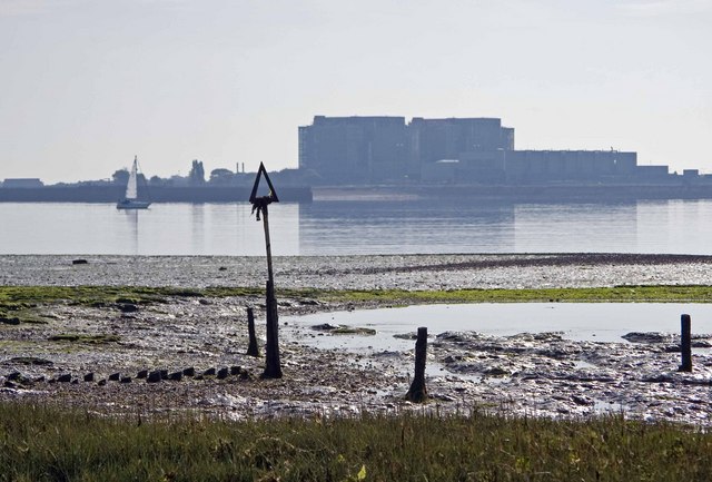
Bradwell nuclear power station
Bradwell nuclear power station is a Magnox-design nuclear power station that is undergoing decommissioning. It is located on the Dengie peninsula at the...
Nearby Amenities
Located within 500m of 51.762384,0.86864073Have you been to South Channel?
Leave your review of South Channel below (or comments, questions and feedback).