Shelford Creek

Sea, Estuary, Creek in Essex Rochford

England

Shelford Creek

Yokesfleet Creek The two yachts spent the night in Yokesfleet Creek and found they had got too near the Foulness Island shoreline and are now waiting for the tide to relift off.
Yokesfleet Creek Credit: TREVOR NORRIS

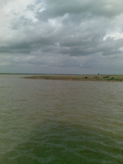
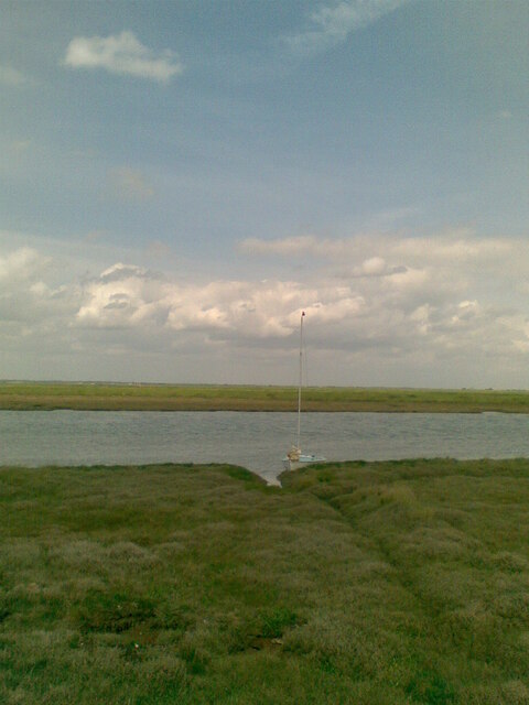
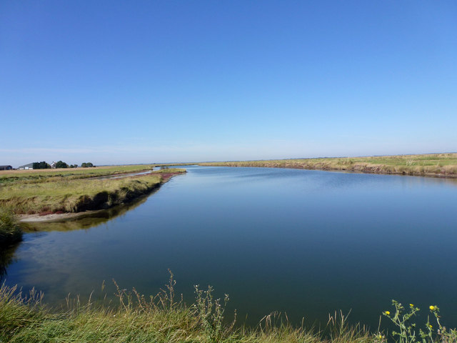
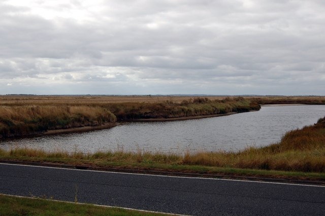
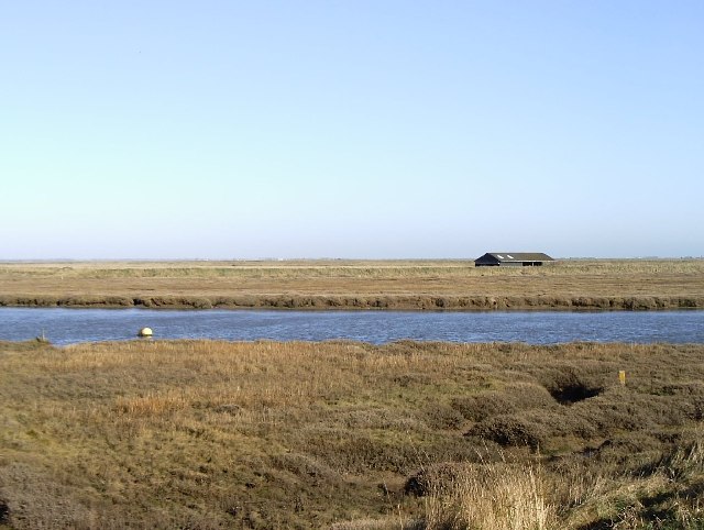
Shelford Creek is a small tidal creek located in Essex, England. It is situated on the eastern coast of the county, near the town of Southminster. The creek flows into the North Sea, making it an estuary that experiences tidal fluctuations.

The creek is surrounded by picturesque marshlands and mudflats, creating a diverse ecosystem that supports a variety of plant and animal species. The area is especially known for its rich birdlife, attracting birdwatchers and nature enthusiasts from across the region. Commonly spotted species include wading birds such as curlews, oystercatchers, and redshanks, as well as various types of ducks and geese.

At low tide, the creek exposes vast stretches of mudflats, which are important feeding grounds for numerous wading birds and other wildlife. It also provides a habitat for various types of marine life, including crabs, shellfish, and fish, which can be observed by visitors during low tide.

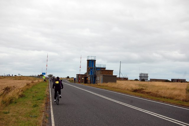
Shelford Creek is a popular destination for outdoor activities such as birdwatching, walking, and fishing. The surrounding marshes offer scenic walking trails, allowing visitors to explore the area's natural beauty. Fishing enthusiasts can enjoy angling in the creek, targeting species such as bass and flounders.

Overall, Shelford Creek in Essex is a tranquil and biodiverse estuary, offering a peaceful retreat for nature lovers and outdoor enthusiasts alike.

If you have any feedback on the listing, please let us know in the comments section below.

Shelford Creek Images

Images are sourced within 2km of 51.577232/0.85375657 or Grid Reference TQ9790. Thanks to Geograph Open Source API. All images are credited.

Yokesfleet Creek The two yachts spent the night in Yokesfleet Creek and found they had got too near the Foulness Island shoreline and are now waiting for the tide to relift off.
Yokesfleet Creek
The two yachts spent the night in Yokesfleet Creek and found they had got too near the Foulness Island shoreline and are now waiting for the tide to relift off.
River Roach Having just left Yokesfleet Creek early in the morning heading east down the River Roach. The water was like a mill pond, giving this effect, the river looked more like the sky than the sky!
River Roach
Having just left Yokesfleet Creek early in the morning heading east down the River Roach. The water was like a mill pond, giving this effect, the river looked more like the sky than the sky!
Deserted roads of Foulness Island Taken on the road going towards Churchend.  This place is very deserted and is property of the MOD.  Limited access.
Deserted roads of Foulness Island
Taken on the road going towards Churchend. This place is very deserted and is property of the MOD. Limited access.
Seals basking at the entrance to Shelford Creek Photo taken from Wayfarer sailing dinghy belonging to the Hostellers Sailing Club, based at Paglesham. <span class="nowrap"><a title="http://www.btinternet.com/~sail/" rel="nofollow ugc noopener" href="http://www.btinternet.com/~sail/">Link</a><img style="margin-left:2px;" alt="External link" title="External link - shift click to open in new window" src="https://s1.geograph.org.uk/img/external.png" width="10" height="10"/></span>
Seals basking at the entrance to Shelford Creek
Photo taken from Wayfarer sailing dinghy belonging to the Hostellers Sailing Club, based at Paglesham. LinkExternal link
The Road on to Foulness Island Normally closed to anyone without a pass, the road on to Foulness was open to those of us taking part in a sponsored cycle event.
The Road on to Foulness Island
Normally closed to anyone without a pass, the road on to Foulness was open to those of us taking part in a sponsored cycle event.
Track to Great Burwood Farm Here the track leaves the road to Churchend, Foulness and later turns north to reach Great Burwood Farm.
Track to Great Burwood Farm
Here the track leaves the road to Churchend, Foulness and later turns north to reach Great Burwood Farm.
Not-so-deserted roads of Foulness Taken in pretty much the same spot as the first geograph for this square, but on the day of the sponsored cycle event organised by the Rotary Club of Thorpe Bay.
Not-so-deserted roads of Foulness
Taken in pretty much the same spot as the first geograph for this square, but on the day of the sponsored cycle event organised by the Rotary Club of Thorpe Bay.
From east shore of Rushley Island across Narrow Cuts towards Havengore Island View east across the saltgrass marshes from near the eastern sea wall of Rushley Island, overlooking the channel known as Narrow Cuts with the western side of Havengore Island in the background.
From east shore of Rushley Island across Narrow Cuts towards Havengore Island
View east across the saltgrass marshes from near the eastern sea wall of Rushley Island, overlooking the channel known as Narrow Cuts with the western side of Havengore Island in the background.
Havengore Farm Taken on a Foulness Heritage Centre open day on the way to Churchend.
Havengore Farm
Taken on a Foulness Heritage Centre open day on the way to Churchend.
New England Creek This creek separates Havengore Island from the smaller New England Island and also Foulness Island itself. The white birds that can just about be seen are a bunch of avocets.
New England Creek
This creek separates Havengore Island from the smaller New England Island and also Foulness Island itself. The white birds that can just about be seen are a bunch of avocets.
Havengore Bridge Looking towards Foulness Island.
Havengore Bridge
Looking towards Foulness Island.
Havengore Farm
Havengore Farm
New England Creek Taken from the road on New England Island
New England Creek
Taken from the road on New England Island
The other side of the road To <a href="https://www.geograph.org.uk/photo/3136836">TQ9889 : New England Creek</a>. Taken from the road on the way to Foulness.
The other side of the road
To TQ9889 : New England Creek. Taken from the road on the way to Foulness.
The Fast Lane Probably the only stretch of dual carriageway on the road to Foulness Island.
This stretch is on New England Island.
The Fast Lane
Probably the only stretch of dual carriageway on the road to Foulness Island. This stretch is on New England Island.
Road over New England Island MOD controlled access.
Road over New England Island
MOD controlled access.
Havengore Island and Havengore Farm This view across Havengore Island towards Havengore Farm was taken on the day of the annual sponsored cycle event around Foulness Island - taken from the road to Churchend, Foulness.
Havengore Island and Havengore Farm
This view across Havengore Island towards Havengore Farm was taken on the day of the annual sponsored cycle event around Foulness Island - taken from the road to Churchend, Foulness.
The Big Fleet This creek forms the north eastern boundary of New England Island.
The Big Fleet
This creek forms the north eastern boundary of New England Island.
Show me another place!

Shelford Creek is located at Grid Ref: TQ9790 (Lat: 51.577232, Lng: 0.85375657)

Administrative County: Essex

District: Rochford

Police Authority: Essex

What 3 Words

///yarn.assurance.panels. Near Great Wakering, Essex

Nearby Locations

Shelford Creek

Related Wikis

New England Island

New England Island is an uninhabited island in Essex, England. One road crosses the island, connecting it with bridges to Foulness and to the mainland...

Havengore Island

Havengore Island is a low-lying, marshy island in the civil parish of Foulness, in the Rochford district, in the county of Essex, England. It is bounded...

Rushley Island

Rushley Island is a small uninhabited island in Essex, England. It is the smallest of six islands comprising an archipelago in Essex, and is privately...

Potton Island

Potton Island is a sparsely populated island west of Foulness in Essex, England. It is connected to the mainland by a swing bridge with a traffic light...

Wallasea Island

Wallasea Island lies in Essex, England. It is bounded to the north by the River Crouch, to the south east by the River Roach, and to the west by Paglesham...

The Broomway

The Broomway, also formerly called the "Broom Road", is a public right of way over the foreshore at Maplin Sands off the coast of Essex, England. Most...

HMS Beagle

HMS Beagle was a Cherokee-class 10-gun brig-sloop of the Royal Navy, one of more than 100 ships of this class. The vessel, constructed at a cost of £7...

Foulness Island

Foulness Island () is a closed island on the east coast of Essex in England, which is separated from the mainland by narrow creeks. In the 2001 census...

Nearby Amenities

Located within 500m of 51.577232,0.85375657
Created By: dmgroom_coastlines
Lat/Long: 51.577293/0.849548
Created By: dmgroom_coastlines
Lat/Long: 51.577301/0.849959
Created By: dmgroom_coastlines
Lat/Long: 51.5768395/0.8519983
Created By: dmgroom_coastlines
Lat/Long: 51.574251/0.858329
The data included in this document is from www.openstreetmap.org. The data is made available under ODbL.

Have you been to Shelford Creek?

Leave your review of Shelford Creek below (or comments, questions and feedback).