Crabs' Hole

Sea, Estuary, Creek in Lincolnshire South Holland

England

Crabs' Hole

Walking to Outer Trial Bank Guided by highly knowledgeable locals to safely walk the 2 miles across sticky mud to Outer Trial Bank.
Walking to Outer Trial Bank Credit: Sarah Dalrymple

Crabs' Hole is a picturesque location situated in Lincolnshire, England, known for its stunning sea views, estuary, and creek. Nestled along the coastline, this hidden gem offers a serene and tranquil environment for visitors seeking a peaceful getaway.

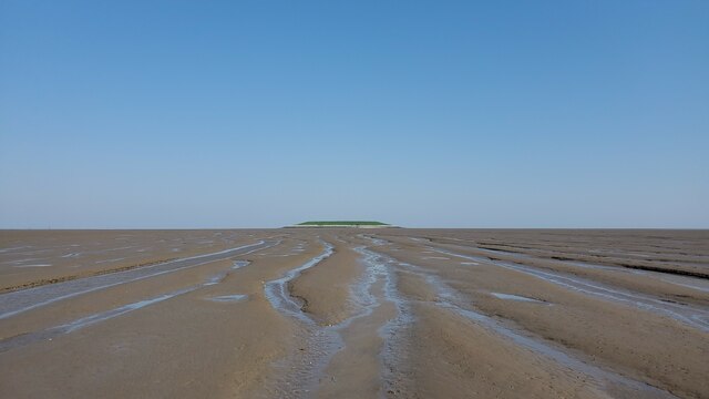
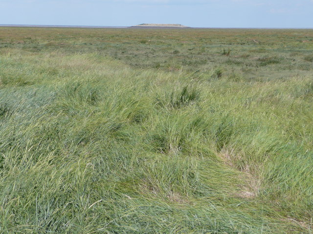
The main attraction at Crabs' Hole is its beautiful sea, which stretches as far as the eye can see. The crystal-clear waters provide a perfect setting for swimming, snorkeling, and a variety of other water activities. The beach itself is a mixture of pebbles and sand, making it a great spot for sunbathing and picnicking.

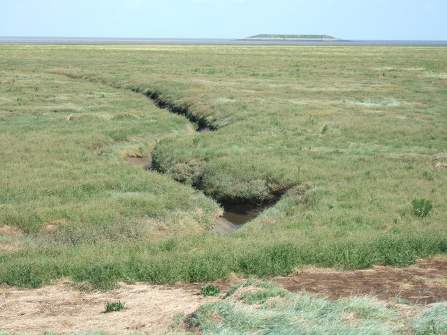
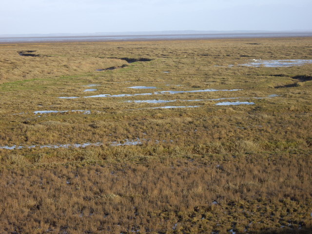
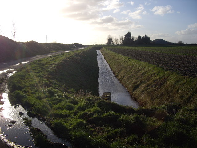
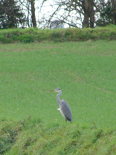
Adjacent to the sea is the estuary, where a river meets the sea. This natural wonder is a haven for wildlife enthusiasts, as it attracts a diverse range of bird species, including herons, swans, and ducks. Visitors can witness the interplay between the freshwater and saltwater ecosystems, creating a unique and dynamic environment.

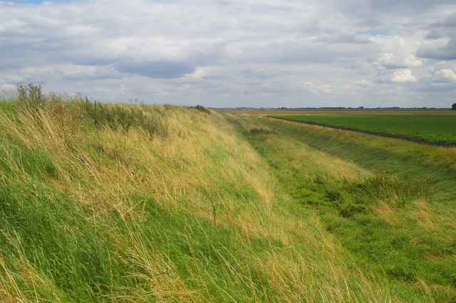
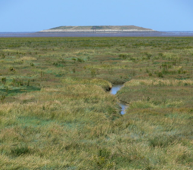
Further inland, a scenic creek winds its way through the landscape. The creek serves as a habitat for various aquatic plants and animals, making it a fantastic spot for nature lovers to explore. Kayaking and paddleboarding are popular activities in the creek, allowing visitors to experience the beauty of the area up close.

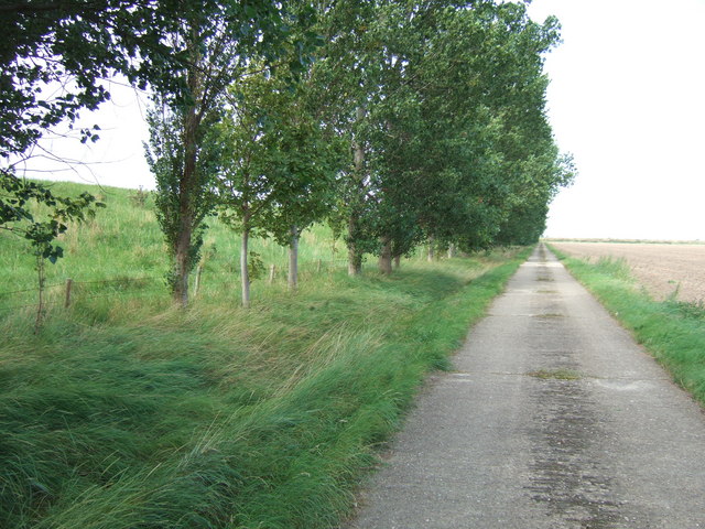
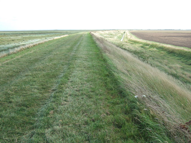
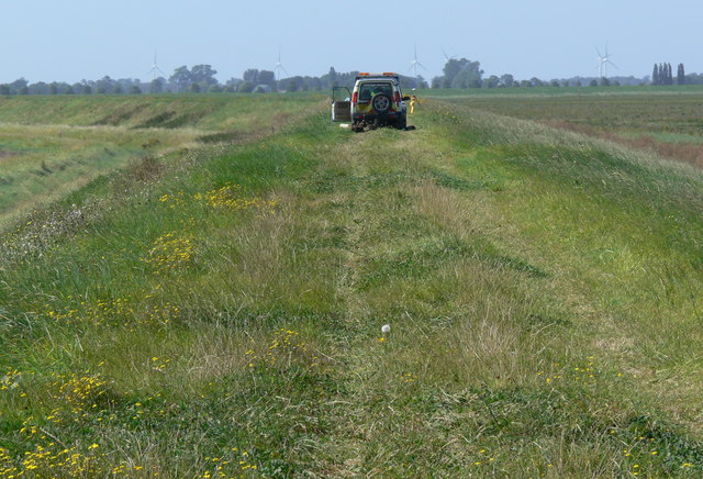
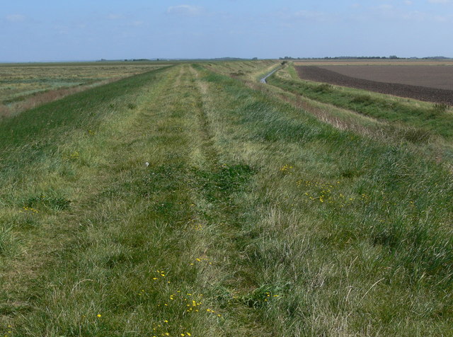
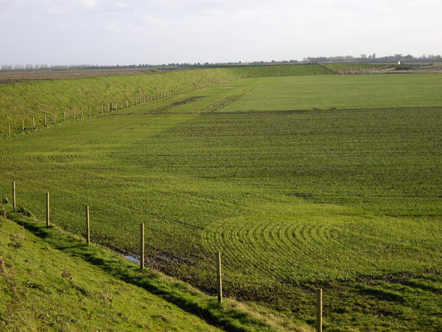
Crabs' Hole also boasts a number of walking trails, providing visitors with the opportunity to discover the surrounding natural beauty. The trails offer breathtaking views of the sea, estuary, and creek, making it the ideal destination for avid hikers and photographers alike.

Overall, Crabs' Hole in Lincolnshire offers a harmonious blend of sea, estuary, and creek, making it a must-visit location for those seeking a peaceful and idyllic coastal getaway.

If you have any feedback on the listing, please let us know in the comments section below.
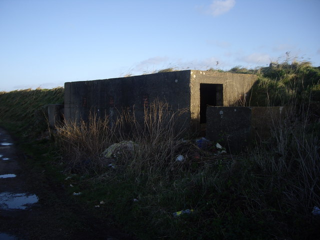
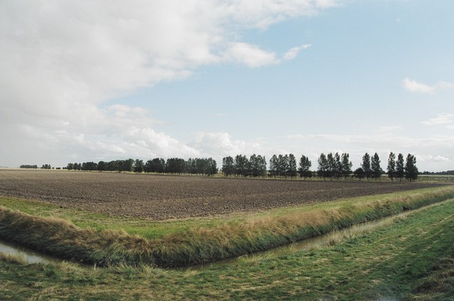
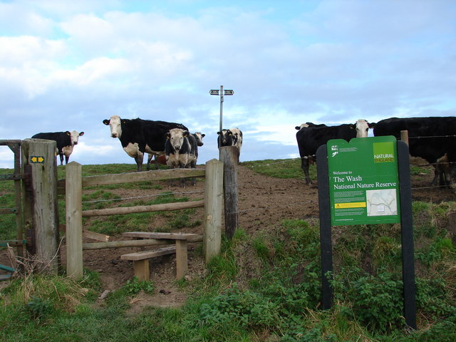
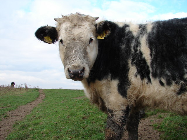
Crabs' Hole Images

Images are sourced within 2km of 52.826435/0.21661095 or Grid Reference TF4927. Thanks to Geograph Open Source API. All images are credited.

Walking to Outer Trial Bank Guided by highly knowledgeable locals to safely walk the 2 miles across sticky mud to Outer Trial Bank.
Walking to Outer Trial Bank
Guided by highly knowledgeable locals to safely walk the 2 miles across sticky mud to Outer Trial Bank.
The inside of the Sea Bank Looking along the inner slope of the Sea Bank, which separates the Wash from the farmland reclaimed from it.  The outer slope is less steep and more overgrown.
The inside of the Sea Bank
Looking along the inner slope of the Sea Bank, which separates the Wash from the farmland reclaimed from it. The outer slope is less steep and more overgrown.
Salt marshland, with fresh-water reservoir in distance The mashland is visited by wildfowl and samphire-gatherers. The "Outer Trial Bank" was built in the 1970s as part of the failed Wash Barrage scheme.
Salt marshland, with fresh-water reservoir in distance
The mashland is visited by wildfowl and samphire-gatherers. The "Outer Trial Bank" was built in the 1970s as part of the failed Wash Barrage scheme.
Farm road and trees next to the sea bank near Sutton Bridge
Creek in the salt marshes near Sutton Bridge The island in the distance is a failed man made reservoir experiment. It does not appear on O. S. explorer map 249 even though it's been there since the 1970's. <span class="nowrap"><a title="http://www.bbc.co.uk/lincolnshire/content/articles/2008/10/08/abandoned_wash_feature.shtml" rel="nofollow ugc noopener" href="http://www.bbc.co.uk/lincolnshire/content/articles/2008/10/08/abandoned_wash_feature.shtml">Link</a><img style="margin-left:2px;" alt="External link" title="External link - shift click to open in new window" src="https://s1.geograph.org.uk/img/external.png" width="10" height="10"/></span>
Creek in the salt marshes near Sutton Bridge
The island in the distance is a failed man made reservoir experiment. It does not appear on O. S. explorer map 249 even though it's been there since the 1970's. LinkExternal link
The edge of The Wash near Sutton Bridge Viewed from the sea bank with the salt marshes of The Wash to the left and farmland to the right.
The edge of The Wash near Sutton Bridge
Viewed from the sea bank with the salt marshes of The Wash to the left and farmland to the right.
4x4 on the sea bank Along the Sir Peter Scott Walk. The workers are near the site where some power cables were recently installed from the Lincs offshore wind farm.
4x4 on the sea bank
Along the Sir Peter Scott Walk. The workers are near the site where some power cables were recently installed from the Lincs offshore wind farm.
Reclaimed farmland behind the sea bank
Slight bend in the sea bank The Sir Peter Scott Walk is following the top of the sea bank, heading east along the Wash coast.
Slight bend in the sea bank
The Sir Peter Scott Walk is following the top of the sea bank, heading east along the Wash coast.
View towards the Outer Trial Bank Looking north across the salt marsh towards an artificial island on the tidal flats of the Wash. <span class="nowrap"><a title="http://en.wikipedia.org/wiki/Outer_Trial_Bank" rel="nofollow ugc noopener" href="http://en.wikipedia.org/wiki/Outer_Trial_Bank">Link</a><img style="margin-left:2px;" alt="External link" title="External link - shift click to open in new window" src="https://s1.geograph.org.uk/img/external.png" width="10" height="10"/></span>
View towards the Outer Trial Bank
Looking north across the salt marsh towards an artificial island on the tidal flats of the Wash. LinkExternal link
Looking towards Crab Hole, The Wash What a desolate place!  There is a footpath along The Wash sea line here accessible through Gedney Drove End. Just keep your fingers crossed you don't meet any oncoming lorries on your way there as it's a long way to reverse!
Looking towards Crab Hole, The Wash
What a desolate place! There is a footpath along The Wash sea line here accessible through Gedney Drove End. Just keep your fingers crossed you don't meet any oncoming lorries on your way there as it's a long way to reverse!
Field and Raised Sea Line Footpath near Gedney Drove End I did like the lush green field and Shore line footpath here, juxtaposed with the starkness of the Wash Salt Marshes that can be seen over the footpath, upper left. It was whilst up here that I realised why this area is so popular for constructing wind farms!
Field and Raised Sea Line Footpath near Gedney Drove End
I did like the lush green field and Shore line footpath here, juxtaposed with the starkness of the Wash Salt Marshes that can be seen over the footpath, upper left. It was whilst up here that I realised why this area is so popular for constructing wind farms!
Disused Military Building Near Gedney Drove End This stretch of Coastline is littered with many 'pill box' type concrete structures. To all intents and purposes, it looked as though this one had squatters!
Disused Military Building Near Gedney Drove End
This stretch of Coastline is littered with many 'pill box' type concrete structures. To all intents and purposes, it looked as though this one had squatters!
Drainage Ditch Near Gedney Drove End A quick flick round adjacent squares will demonstrate that the drainage ditches are very commonplace along this stretch of Coastline.
Drainage Ditch Near Gedney Drove End
A quick flick round adjacent squares will demonstrate that the drainage ditches are very commonplace along this stretch of Coastline.
Ploughed field on the edge of the Wash
Wash Cows These friendly creatures welcomed me to the Wash National Nature Reserve.  
They could have done with a good wash themselves though! <a href="https://www.geograph.org.uk/photo/602357">TF4828 : Dirty Cow</a>
If you are expecting to meet the waters of The Wash over the bank, you still have a bit of a walk ahead of you.
Wash Cows
These friendly creatures welcomed me to the Wash National Nature Reserve. They could have done with a good wash themselves though! TF4828 : Dirty Cow If you are expecting to meet the waters of The Wash over the bank, you still have a bit of a walk ahead of you.
Dirty Cow Very friendly, but she really does need a wash!
Dirty Cow
Very friendly, but she really does need a wash!
Heron near Gedney Drove End
Show me another place!

Crabs' Hole is located at Grid Ref: TF4927 (Lat: 52.826435, Lng: 0.21661095)

Administrative County: Lincolnshire

District: South Holland

Police Authority: Lincolnshire

What 3 Words

///pocket.kiosk.rewrites. Near Sutton Bridge, Lincolnshire

Related Wikis

Outer Trial Bank

The Outer Trial Bank is a circular artificial island in the Wash, East Anglia, England. It is one of two artificial islands constructed during the 1970s...

River Nene

The River Nene ( or : see below) is a river in the east of England that rises from three sources in Northamptonshire. The river is about 105 miles (169...

Gedney Drove End

Gedney Drove End is a village in the civil parish of Gedney and the South Holland district of Lincolnshire, England. It is 40 miles (64 km) south-east...

Holbeach Air Weapons Range

Holbeach Air Weapons Range is a United Kingdom Ministry of Defence academic air weapons range (AWR) situated between Boston and King's Lynn in the civil...

Sutton Bridge

Sutton Bridge is a village and civil parish in the South Holland district of Lincolnshire, England. It is situated on the A17 road, 7 miles (11 km) north...

Lutton, Lincolnshire

Lutton (sometimes Lutton-Bourne) is a village and civil parish in the South Holland district of Lincolnshire, England. The population of the civil parish...

Little Sutton, Lincolnshire

Little Sutton is a small civil parish, containing a few farms and a few houses, lying between the much larger parishes of Long Sutton and Sutton Bridge...

Cross Keys Bridge

Cross Keys Bridge is a swing bridge that carries the busy single carriageway A17 road which runs from Newark in Nottinghamshire to King's Lynn in Norfolk...

Nearby Amenities

Located within 500m of 52.826435,0.21661095
Crabs' Hole
Place: locality
Lat/Long: 52.8265267/0.2146909
The data included in this document is from www.openstreetmap.org. The data is made available under ODbL.

Have you been to Crabs' Hole?

Leave your review of Crabs' Hole below (or comments, questions and feedback).