Cox's Creek

Sea, Estuary, Creek in Lincolnshire South Holland

England

Cox's Creek

Danger passed The view across the last edge of the bombing range across the permissive area and towards the Outer Trial Bank in the distance.  You can just make out a cockle boat stationed off the bank itself.
Danger passed Credit: Ian Paterson

Cox's Creek is a small tidal creek located in the county of Lincolnshire, England. Situated along the eastern coast of the country, it is nestled between the towns of Skegness and Mablethorpe. Cox's Creek is known for its picturesque scenery and diverse ecosystem, making it a popular destination for nature enthusiasts and tourists alike.

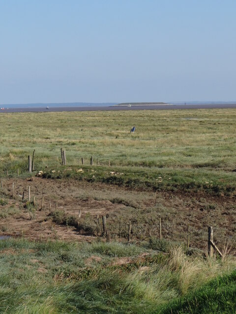
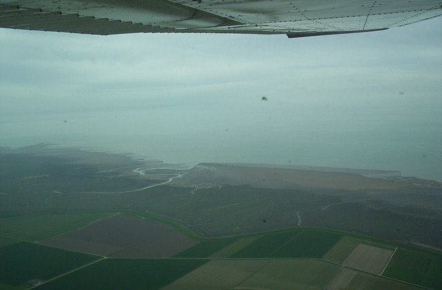
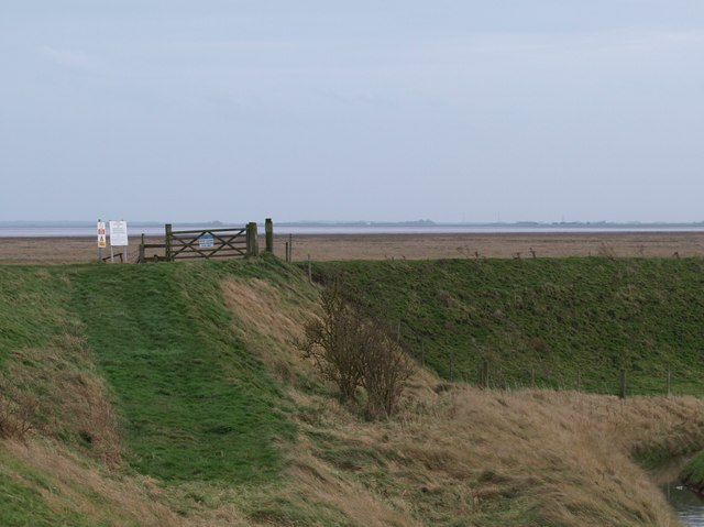
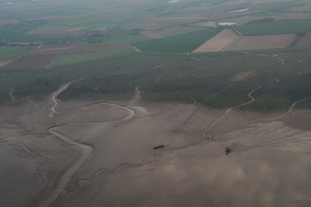
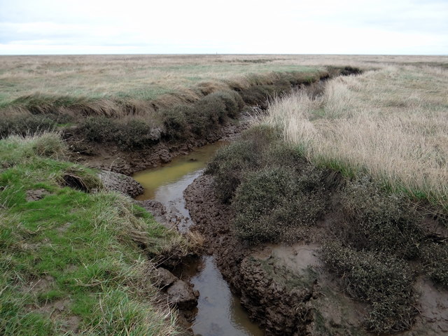
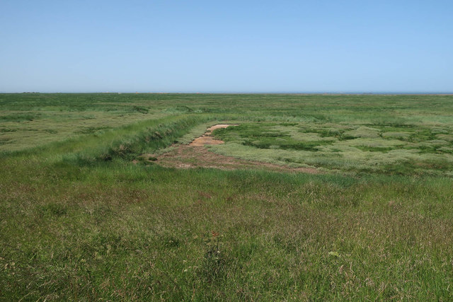
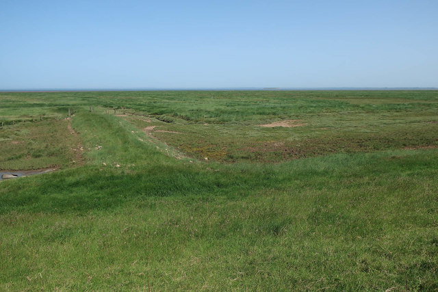
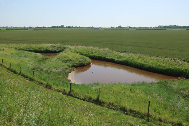
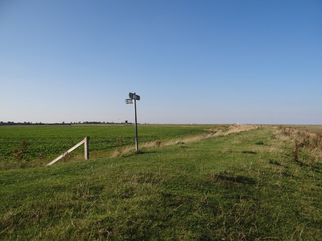
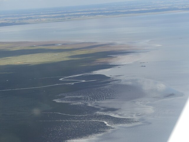
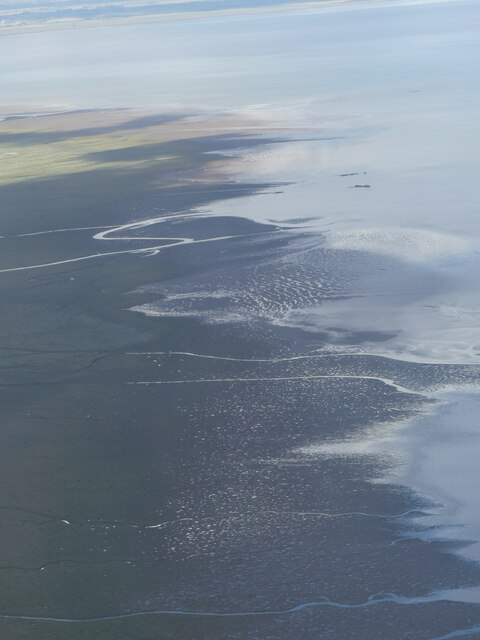
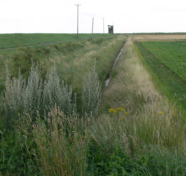
The creek is primarily fed by the North Sea, which lies to its east. As a result, it experiences regular tidal movements, with water levels rising and falling throughout the day. This tidal nature has given rise to a unique estuarine environment, characterized by extensive mudflats and salt marshes. These habitats provide important feeding grounds and breeding sites for a variety of bird species, including waders and waterfowl.

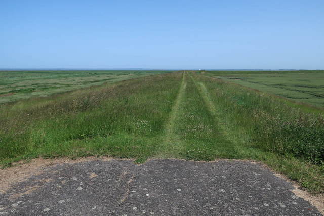
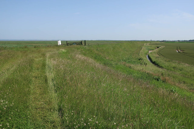
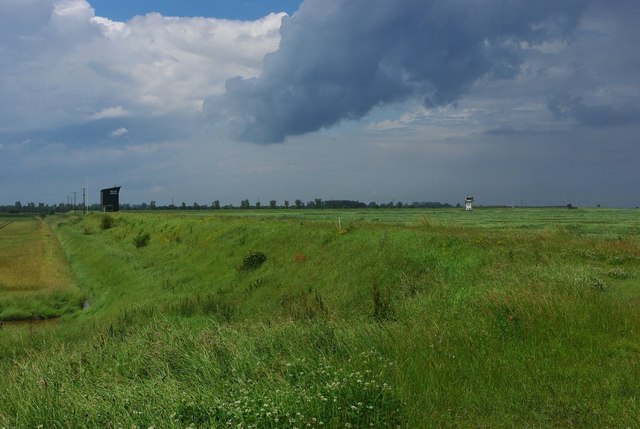
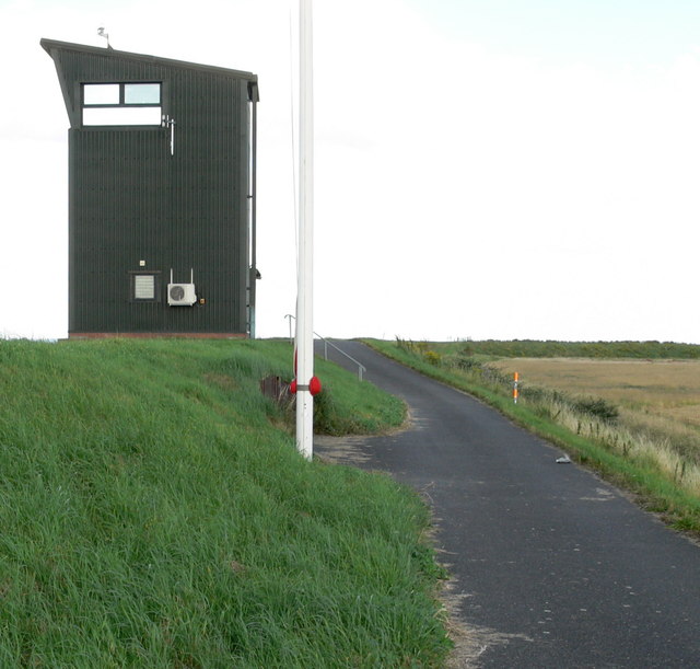
The surrounding area of Cox's Creek is predominantly rural, with farmland and small villages dotting the landscape. The creek itself is flanked by reed beds and grassy banks, offering peaceful and scenic walking routes for visitors. The creek is also a haven for wildlife, with sightings of seals, otters, and various fish species being common.

Additionally, Cox's Creek serves as a recreational spot for water sports enthusiasts. Kayaking, canoeing, and paddleboarding are popular activities, allowing visitors to explore the creek's tranquil waters and observe its diverse marine life up close.

Overall, Cox's Creek in Lincolnshire is a charming and ecologically rich area, offering visitors a chance to immerse themselves in nature and experience the beauty of England's eastern coast.

If you have any feedback on the listing, please let us know in the comments section below.

Cox's Creek Images

Images are sourced within 2km of 52.845581/0.20482971 or Grid Reference TF4829. Thanks to Geograph Open Source API. All images are credited.

Danger passed The view across the last edge of the bombing range across the permissive area and towards the Outer Trial Bank in the distance.  You can just make out a cockle boat stationed off the bank itself.
Danger passed
The view across the last edge of the bombing range across the permissive area and towards the Outer Trial Bank in the distance. You can just make out a cockle boat stationed off the bank itself.
Saltmarshes at Gedney Drove End
Sea Defences This is the first line of defence against ingress of the North Sea. There are many other previous but smaller banks inland.
Sea Defences
This is the first line of defence against ingress of the North Sea. There are many other previous but smaller banks inland.
Dawsmere Creek to Gedney Drove End: aerial 2016
Drainage channels There's plenty of mud-bottomed, steep wide obstacles in this area of open access land to keep you on your toes.  I was zig-zagging east-west until I found a way further east only to come across more of the same.  Maybe in the summer.
Drainage channels
There's plenty of mud-bottomed, steep wide obstacles in this area of open access land to keep you on your toes. I was zig-zagging east-west until I found a way further east only to come across more of the same. Maybe in the summer.
End of the road, RAF Holbeach The tarmacked road for RAF Holbeach becomes a track along the sea wall.
End of the road, RAF Holbeach
The tarmacked road for RAF Holbeach becomes a track along the sea wall.
Saltmarsh in The Wash Part of the RAF Holbeach weapons range.
Saltmarsh in The Wash
Part of the RAF Holbeach weapons range.
Path along the sea wall of The Wash With reclaimed land to the right and the remaining saltmarsh to the left.
Path along the sea wall of The Wash
With reclaimed land to the right and the remaining saltmarsh to the left.
Track into the saltmarsh
Pool inside the sea wall Quite orange and with little sign of life around it.
Pool inside the sea wall
Quite orange and with little sign of life around it.
Watch Towers on Holbeach Air Weapons Range The nearer is an observation tower with the main Control Tower in the distance.
Watch Towers on Holbeach Air Weapons Range
The nearer is an observation tower with the main Control Tower in the distance.
Observation post on RAF Holbeach firing range Lincolnshire is known as Bomber County.
From the early days of the Royal Flying Corps there have been airfields or flying grounds in the county. There are 65 RAF Stations listed, including Administrative Headquarters and Bombing Ranges, not all were Operational Airfields.
Not all the Lincolnshire Stations were Bomber Command Stations, Fighter Command also had their share.

The intention of this SD is to bring together all the information in one place in no particular order or system, where it can be sorted and disseminated by the end user. 
<a title="https://www.geograph.org.uk/article/Royal-Air-Force-Stations-in-Lincolnshire" href="https://www.geograph.org.uk/article/Royal-Air-Force-Stations-in-Lincolnshire">Link</a>
Observation post on RAF Holbeach firing range
Lincolnshire is known as Bomber County. From the early days of the Royal Flying Corps there have been airfields or flying grounds in the county. There are 65 RAF Stations listed, including Administrative Headquarters and Bombing Ranges, not all were Operational Airfields. Not all the Lincolnshire Stations were Bomber Command Stations, Fighter Command also had their share. The intention of this SD is to bring together all the information in one place in no particular order or system, where it can be sorted and disseminated by the end user. Link
Down to Gedney Drove End The footpath leads to the village via some steps down the steep bank.
Down to Gedney Drove End
The footpath leads to the village via some steps down the steep bank.
Cox's Creek, near Gedney Drove End: aerial 2023 (1)
Cox's Creek, near Gedney Drove End: aerial 2023 (2)
All quiet on Holbeach range The flagpoles are bare, with no red flags flying, so the range is open to the public.
All quiet on Holbeach range
The flagpoles are bare, with no red flags flying, so the range is open to the public.
Farmland and drainage ditch On the sea bank in the distance, is the easternmost observation tower at RAF Holbeach bombing range.
Farmland and drainage ditch
On the sea bank in the distance, is the easternmost observation tower at RAF Holbeach bombing range.
Observation tower at RAF Holbeach This is on the eastern edge of the bombing range. The red flag is not flying on the flag pole, so it is safe to proceed westwards along the road and sea bank.
Observation tower at RAF Holbeach
This is on the eastern edge of the bombing range. The red flag is not flying on the flag pole, so it is safe to proceed westwards along the road and sea bank.
Show me another place!

Cox's Creek is located at Grid Ref: TF4829 (Lat: 52.845581, Lng: 0.20482971)

Administrative County: Lincolnshire

District: South Holland

Police Authority: Lincolnshire

What 3 Words

///tripods.parade.marzipan. Near Sutton Bridge, Lincolnshire

Nearby Locations

Cox's Creek

Related Wikis

River Nene

The River Nene ( or : see below) is a river in the east of England that rises from three sources in Northamptonshire. The river is about 105 miles (169...

Gedney Drove End

Gedney Drove End is a village in the civil parish of Gedney and the South Holland district of Lincolnshire, England. It is 40 miles (64 km) south-east...

Holbeach Air Weapons Range

Holbeach Air Weapons Range is a United Kingdom Ministry of Defence academic air weapons range (AWR) situated between Boston and King's Lynn in the civil...

Outer Trial Bank

The Outer Trial Bank is a circular artificial island in the Wash, East Anglia, England. It is one of two artificial islands constructed during the 1970s...

Lutton, Lincolnshire

Lutton (sometimes Lutton-Bourne) is a village and civil parish in the South Holland district of Lincolnshire, England. The population of the civil parish...

University Academy Long Sutton

University Academy Long Sutton (formerly The Peele Community College) is a co-educational secondary school located in Long Sutton in the English county...

Holbeach St Matthew

Holbeach St Matthew is a small fenland village in the South Holland district of southern Lincolnshire, England. It lies 6 miles (10 km) north-east from...

Little Sutton, Lincolnshire

Little Sutton is a small civil parish, containing a few farms and a few houses, lying between the much larger parishes of Long Sutton and Sutton Bridge...

Have you been to Cox's Creek?

Leave your review of Cox's Creek below (or comments, questions and feedback).