Broad Lake

Sea, Estuary, Creek in Hampshire Havant

England

Broad Lake

Hayling Billy Line Hayling Billy Line (old railway between Hayling and Havant) path heading to the Bridge car park
Hayling Billy Line Credit: Shaun Ferguson

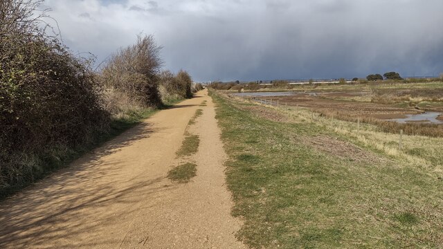
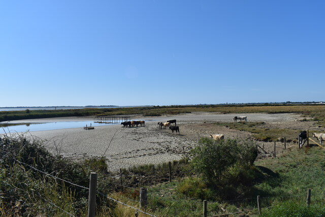
Broad Lake is a picturesque water body located in Hampshire, England. It is a unique combination of a sea, estuary, and creek, offering a diverse and captivating landscape. Situated near the village of Broadwater, the lake covers an area of approximately 150 acres and is known for its natural beauty and tranquil surroundings.

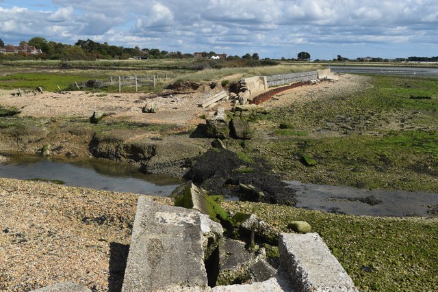
As a sea, Broad Lake is connected to the English Channel, providing a gateway to the vast open waters. Its proximity to the sea allows for a constant ebb and flow of tides, which greatly influences the lake's ecosystem and creates a dynamic environment. The saline water of the sea merges with the freshwater of the lake, resulting in a rich and diverse habitat for various aquatic species.

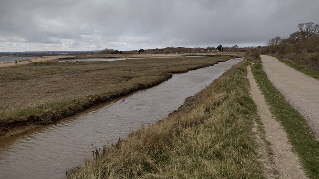
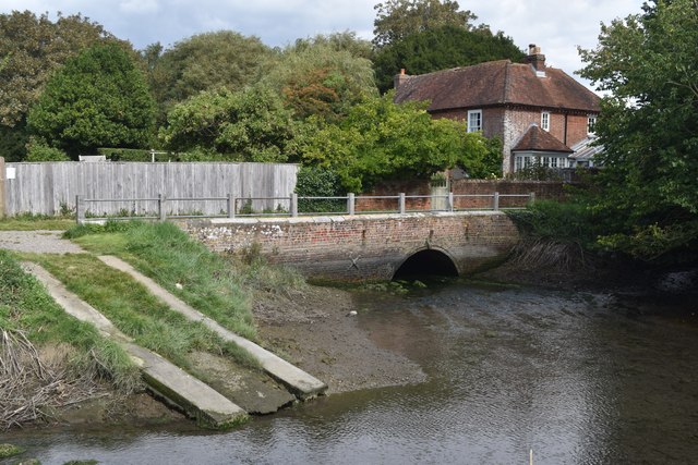
Broad Lake also functions as an estuary, with the convergence of multiple rivers and creeks in its vicinity. The estuarine environment is characterized by brackish water, where freshwater from the rivers mixes with the saltwater from the sea. This unique blend of water creates a nutrient-rich habitat, attracting a wide range of flora and fauna.

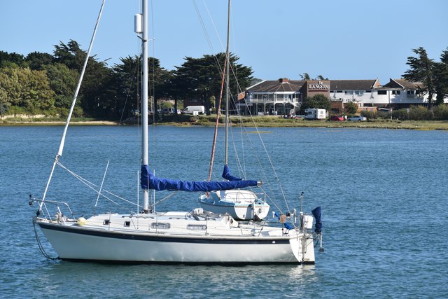
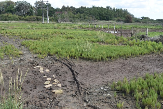
Furthermore, the lake is also home to a creek, a narrow and winding watercourse that meanders through the surrounding marshes and wetlands. The creek adds to the natural beauty of Broad Lake and provides opportunities for boating, kayaking, and exploring its intricate network of channels.

Overall, Broad Lake in Hampshire is a stunning combination of a sea, estuary, and creek, offering visitors a chance to immerse themselves in a diverse and vibrant aquatic ecosystem. Its picturesque landscapes, rich biodiversity, and peaceful ambiance make it a popular destination for nature enthusiasts and those seeking a serene retreat.

If you have any feedback on the listing, please let us know in the comments section below.
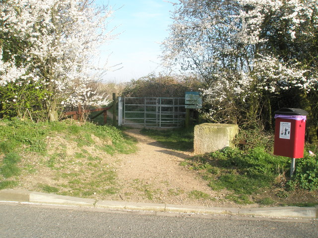
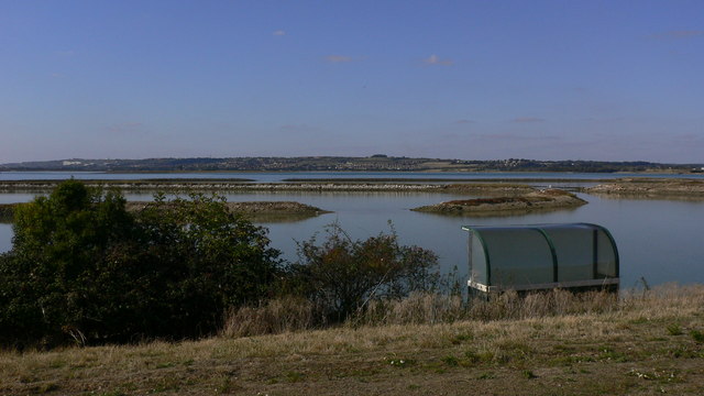
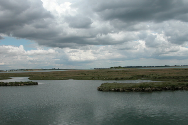
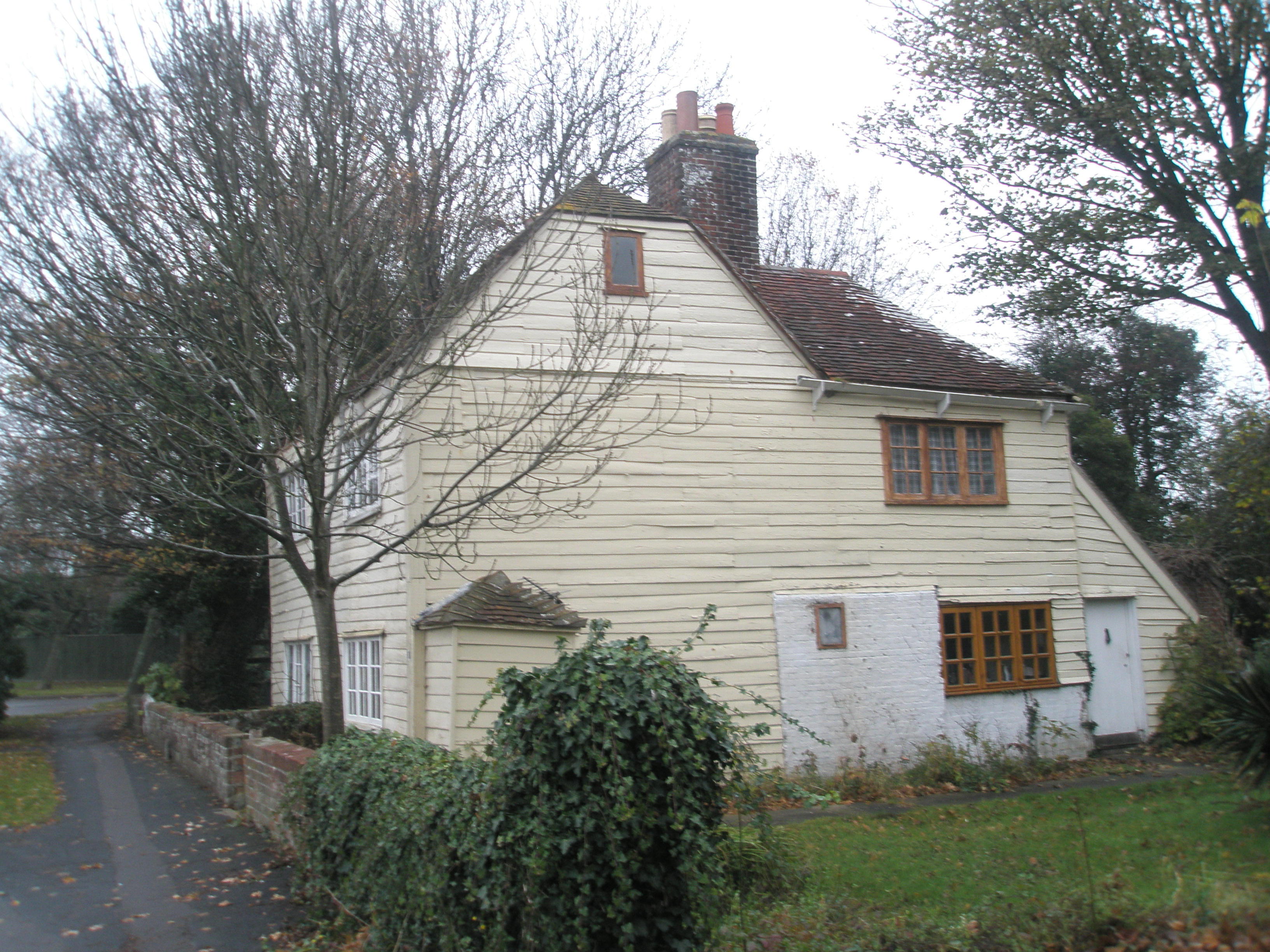
Broad Lake Images

Images are sourced within 2km of 50.833339/-1.0005024 or Grid Reference SU7004. Thanks to Geograph Open Source API. All images are credited.

Hayling Billy Line Hayling Billy Line (old railway between Hayling and Havant) path heading to the Bridge car park
Hayling Billy Line
Hayling Billy Line (old railway between Hayling and Havant) path heading to the Bridge car park
Hayling Billy Line The Hayling Billy Line path heading to the Victoria Road car park
Hayling Billy Line
The Hayling Billy Line path heading to the Victoria Road car park
Milestone, Langstone, Havant District Adjacent to the boundary of Langstone on the approach road to Langstone Bridge. On the SW grass verge.

Inscription: 1 mile☛  / Havant / ☚5 miles / Hayling / Beach /
Langstone Village Association / 1998 

Milestone Society National ID: HA_LNG01
Milestone, Langstone, Havant District
Adjacent to the boundary of Langstone on the approach road to Langstone Bridge. On the SW grass verge. Inscription: 1 mile☛ / Havant / ☚5 miles / Hayling / Beach / Langstone Village Association / 1998 Milestone Society National ID: HA_LNG01
Hayling Billy line The remains of the Hayling Billy Railway line crossing from Havant to Hayling island. The final train ran on Saturday 2 November 1963
Hayling Billy line
The remains of the Hayling Billy Railway line crossing from Havant to Hayling island. The final train ran on Saturday 2 November 1963
The Shipwrights Way joins the A3023 road The A3023 road crosses into Hayling Island via the Langstone Bridge. This is now the only land link onto the Island and is also used by the Shipwrights Way, which is joined by the Hayling Billy Coastal Path on the island. A 2nd bridge onto the island was the Hayling rail branch line, but that closed in 1963.
The Shipwrights Way joins the A3023 road
The A3023 road crosses into Hayling Island via the Langstone Bridge. This is now the only land link onto the Island and is also used by the Shipwrights Way, which is joined by the Hayling Billy Coastal Path on the island. A 2nd bridge onto the island was the Hayling rail branch line, but that closed in 1963.
Mud flats at Bridge Lake The remains of the Langston Harbour rail bridge are visible across the centre of the view. The poor state of the bridge led to the closure of the Hayling branch line in 1963 (but I'm sure, if not for the bridge, another reason to close the line would have been found!). Although much of the bridge infrastructure remains, it cannot be used to cross to the island. There have been recent calls to rebuild it, at a minimum as a walkway, but that seems unlikely in the near future, given the financial constraints which currently prevail. The road bridge to the island is visible on the left.
Mud flats at Bridge Lake
The remains of the Langston Harbour rail bridge are visible across the centre of the view. The poor state of the bridge led to the closure of the Hayling branch line in 1963 (but I'm sure, if not for the bridge, another reason to close the line would have been found!). Although much of the bridge infrastructure remains, it cannot be used to cross to the island. There have been recent calls to rebuild it, at a minimum as a walkway, but that seems unlikely in the near future, given the financial constraints which currently prevail. The road bridge to the island is visible on the left.
View from Langstone Bridge to Langstone Quays Resort
The Royal Oak pub, Langstone A classic view of this pretty waterside pub from the quayside in front of its neighbour, The Ship Inn.
The Royal Oak pub, Langstone
A classic view of this pretty waterside pub from the quayside in front of its neighbour, The Ship Inn.
Shipwrights Way Long-distance footpath and cycle path on the route of the former railway branch line to Hayling Island.
Shipwrights Way
Long-distance footpath and cycle path on the route of the former railway branch line to Hayling Island.
A3023 Langstone Road This busy road is the only vehicle route onto Hayling Island (also reachable on foot by ferry from Portsmouth).
A3023 Langstone Road
This busy road is the only vehicle route onto Hayling Island (also reachable on foot by ferry from Portsmouth).
Path across marshland, Southmoor Nature Reserve
Bridge and former West Mill, Langstone
Channel in marshland, Southmoor Nature Reserve This area is now inundated by high tides, following <a href="https://www.geograph.org.uk/photo/7592560">SU7104 : Breach in sea wall, Southmoor Nature Reserve</a>. Compare <a href="https://www.geograph.org.uk/photo/5887297">SU7104 : South Moor Langstone</a> which shows the same fence in the foreground.
Channel in marshland, Southmoor Nature Reserve
This area is now inundated by high tides, following SU7104 : Breach in sea wall, Southmoor Nature Reserve. Compare SU7104 : South Moor Langstone which shows the same fence in the foreground.
Breach in sea wall, Southmoor Nature Reserve The breach occurred in 2020 and the marshland habitat has changed dramatically, with some areas now under water at each high tide: see <a href="https://www.geograph.org.uk/photo/7592550">SU7104 : Channel in marshland, Southmoor Nature Reserve</a>. The coastal footpath is officially closed.
Breach in sea wall, Southmoor Nature Reserve
The breach occurred in 2020 and the marshland habitat has changed dramatically, with some areas now under water at each high tide: see SU7104 : Channel in marshland, Southmoor Nature Reserve. The coastal footpath is officially closed.
On the shore at Southmoor Nature Reserve The projecting sea wall is at the end of Southmoor Lane.
On the shore at Southmoor Nature Reserve
The projecting sea wall is at the end of Southmoor Lane.
On the shore at Budd's Wall
Path on Budd's Wall Looking back towards Southmoor Lane.
Path on Budd's Wall
Looking back towards Southmoor Lane.
The Deeps, Farlington Marsh This lake is called The Deeps, it's formed by a combination of overwash from the sea and retention of rainfall draining from the marsh. Following a recent extended hot and dry spell it's drying up and currently looks more like something from an African documentary than an English coastal lake.
The Deeps, Farlington Marsh
This lake is called The Deeps, it's formed by a combination of overwash from the sea and retention of rainfall draining from the marsh. Following a recent extended hot and dry spell it's drying up and currently looks more like something from an African documentary than an English coastal lake.
Show me another place!

Broad Lake is located at Grid Ref: SU7004 (Lat: 50.833339, Lng: -1.0005024)

Administrative County: Hampshire

District: Havant

Police Authority: Hampshire

What 3 Words

///cone.loss.pound. Near Havant, Hampshire

Related Wikis

Long Island (Hampshire)

Long Island is an island in Langstone Harbour in Hampshire, England. It is 750 metres (820 yd) long and up to 250 metres (270 yd) wide. Three Bronze Age...

Southmoor Nature Reserve

Southmoor Nature Reserve is a 11-hectare (27-acre) nature reserve in Havant in Hampshire. It is managed by the Hampshire and Isle of Wight Wildlife Trust...

West Hayling

West Hayling is a 76.2-hectare (188-acre) Local Nature Reserve on Hayling Island in Hampshire. It is owned by Havant Borough Council and managed by the...

Baker's Island

Baker's Island is an island in Langstone Harbour, Hampshire, England. It is 400 m (1,300 ft) long and up to 300 m (980 ft) wide but only rises to a little...

South Binness Island

South Binness Island is an island in Langstone Harbour. It is 600 metres (660 yd) long and up to 240 metres (260 yd) wide but only rises to 2 metres (7...

North Binness Island

North Binness Island is an island in Langstone Harbour It is 900 metres (980 yd) long and up to 250 metres (270 yd) wide but only rises to 2.5 metres...

Langston railway station

Langston was a small station on the Hayling Island branch. The station along with the rest of the line closed in 1963, and it served the Langstone area...

Langstone, Hampshire

Langstone is a village near Havant, Hampshire in the south east of England in Portsmouth. It has good railway connections to London, Southampton, Portsmouth...

Nearby Amenities

Located within 500m of 50.833339,-1.0005024
Broad Point
Addr City: Hayling
Addr Housename: Broad Point
Lat/Long: 50.8297604/-1.0004421
Southmoor Point
Addr City: Emsworth
Addr Housename: Southmoor Point
Lat/Long: 50.8305841/-0.9971888
Seamark Beacon Lateral Category: port
Seamark Beacon Lateral Colour: black
Seamark Beacon Lateral Shape: stake
Seamark Type: beacon_lateral
Lat/Long: 50.8360692/-1.0029638
Seamark Beacon Lateral Category: port
Seamark Beacon Lateral Colour: black
Seamark Beacon Lateral Shape: stake
Seamark Type: beacon_lateral
Lat/Long: 50.8337993/-1.0019124
Seamark Beacon Lateral Category: port
Seamark Beacon Lateral Colour: black
Seamark Beacon Lateral Shape: stake
Seamark Type: beacon_lateral
Lat/Long: 50.8314751/-1.0008824
Seamark Beacon Lateral Category: port
Seamark Beacon Lateral Colour: black
Seamark Beacon Lateral Shape: stake
Seamark Type: beacon_lateral
Lat/Long: 50.8293066/-0.9998846
The data included in this document is from www.openstreetmap.org. The data is made available under ODbL.

Have you been to Broad Lake?

Leave your review of Broad Lake below (or comments, questions and feedback).