Code Context <figure class="figure mb-0 pt-2">
<? echo $this->Html->image($images[0]['url'], array('alt' => $images[0]['title'], 'class' => 'img-fluid mx-auto d-block')) ?>
<figcaption class="figure-caption text-center"><? echo $images[0]['title'] ?> Credit: <? echo $images[0]['ownername'] ?>
$viewFile = '/var/www/html/uk_places.millsbomb.com/app/View/Records/view.ctp'
$dataForView = array(
'meta_keywords' => 'Langstone Channel',
'meta_description' => 'Langstone Channel is a waterway located in Hampshire, England, which serves as both a sea passage and an estuary. It connects the mainland with Hayling Island, separating it from Portsea Island. The channel is approximately 4 kilometers long and varies in width, with an average depth of around 3...',
'title_for_layout' => 'Langstone Channel Havant Hampshire',
'videos' => null,
'wikis' => array(
'batchcomplete' => '',
'query' => array(
'geosearch' => array(
[maximum depth reached]
)
)
),
'neighbours' => array(
'prev' => array(
'Record' => array(
[maximum depth reached]
)
),
'next' => array(
'Record' => array(
[maximum depth reached]
)
)
),
'para' => 'Langstone Channel is a Sea, Estuary, Creek in Hampshire',
'record' => array(
'Record' => array(
'id' => '265343',
'GBPNID' => '267816',
'PlaceName' => 'Langstone Channel',
'GridRef' => 'SU6801',
'Lat' => '50.805361',
'Lng' => '-1.0248424',
'HistCounty' => 'Hampshire',
'Division' => null,
'AdCounty' => 'Hampshire',
'District' => 'Havant',
'UniAuth' => null,
'Police' => 'Hampshire',
'Region' => 'England',
'Alternative_Names' => null,
'Type' => 'Sea, Estuary, Creek',
'description' => 'Langstone Channel is a waterway located in Hampshire, England, which serves as both a sea passage and an estuary. It connects the mainland with Hayling Island, separating it from Portsea Island. The channel is approximately 4 kilometers long and varies in width, with an average depth of around 3 meters.
This waterway is an important natural feature of the area, providing a habitat for various marine species and supporting a thriving ecosystem. The channel is home to a diverse range of flora and fauna, including sea birds, fish, and crustaceans. It is also known for its extensive salt marshes, which provide a haven for numerous bird species, including waders and wildfowl.
The Langstone Channel is a popular destination for water sports enthusiasts, offering opportunities for sailing, windsurfing, and kayaking. Its calm and sheltered waters make it an ideal location for beginners and learners, while more experienced sailors can take advantage of the channel's proximity to the Solent, a renowned sailing area. The channel's natural beauty also attracts visitors who enjoy walking along its shores, birdwatching, or simply taking in the scenic views.
In addition to its natural attributes, the Langstone Channel has historically played a significant role in the region's economy. It has served as a trade route for centuries, facilitating the transport of goods between the mainland and the islands. Today, it continues to support commercial activities, including fishing and shellfish harvesting.
Overall, Langstone Channel is a picturesque and ecologically important waterway in Hampshire, offering recreational opportunities, supporting local wildlife, and contributing to the area's economic activity.',
'what3words' => 'slip.patch.exit',
'what3words_place' => 'South Hayling, Hampshire',
'images' => '[{"id":"7239832","title":"Unidentified debris, Sinah Lake, Hayling Island","grid_reference":"SU7000","realname":"Brian Robert Marshall","monthname":"July","hash":"95a40dd3","takenyear":"2022","user_id":"7420","geodist":"1716.198364","description":"The location of the debris is approximate. It is probably something left over from the second world war. It has been given a marker to minimise the risk of marine traffic colliding with it.","url":"https:\/\/s0.geograph.org.uk\/geophotos\/07\/23\/98\/7239832_95a40dd3.jpg"},{"id":"7048972","title":"St James Hospital chapel","grid_reference":"SU6700","realname":"Robin Webster","monthname":"December","hash":"9f3e588e","takenyear":"2013","user_id":"9905","geodist":"1902.433228","description":"A grade II listed building, 1879.","url":"https:\/\/s0.geograph.org.uk\/geophotos\/07\/04\/89\/7048972_9f3e588e.jpg"},{"id":"7048975","title":"St James Hospital chapel","grid_reference":"SU6700","realname":"Robin Webster","monthname":"December","hash":"9ab2717c","takenyear":"2013","user_id":"9905","geodist":"1902.433228","description":"A grade II listed building, 1879.","url":"https:\/\/s3.geograph.org.uk\/geophotos\/07\/04\/89\/7048975_9ab2717c.jpg"},{"id":"7048985","title":"The Limes","grid_reference":"SU6700","realname":"Robin Webster","monthname":"December","hash":"ba4b16bd","takenyear":"2013","user_id":"9905","geodist":"1733.033325","description":"An NHS establishment for mental health inpatients.","url":"https:\/\/s1.geograph.org.uk\/geophotos\/07\/04\/89\/7048985_ba4b16bd.jpg"},{"id":"7048993","title":"The Orchards","grid_reference":"SU6700","realname":"Robin Webster","monthname":"December","hash":"04e6ada4","takenyear":"2013","user_id":"9905","geodist":"1781.609131","description":"An NHS establishment for mental health inpatients.","url":"https:\/\/s1.geograph.org.uk\/geophotos\/07\/04\/89\/7048993_04e6ada4.jpg"},{"id":"7239823","title":"Sinah Lake, Hayling Island","grid_reference":"SU6900","realname":"Brian Robert Marshall","monthname":"July","hash":"b5b6195d","takenyear":"2022","user_id":"7420","geodist":"1375.023193","description":"The tidal lake is quite extensive with an area in excess of 20 km2. however it is also quite shallow. The tide was high when this telephoto image was taken. When the tide is out it is mostly mud. In the background is Havant.","url":"https:\/\/s3.geograph.org.uk\/geophotos\/07\/23\/98\/7239823_b5b6195d.jpg"},{"id":"7504104","title":"Hayling Ferry, Eastney Portsmouth","grid_reference":"SU6800","realname":"Brian Deegan","monthname":"May","hash":"4ecd7656","takenyear":"2023","user_id":"123467","geodist":"1056.245117","description":"","url":"https:\/\/s0.geograph.org.uk\/geophotos\/07\/50\/41\/7504104_4ecd7656.jpg"},{"id":"7615239","title":"Houses on Langstone Harbour shore","grid_reference":"SU6700","realname":"David Martin","monthname":"September","hash":"c7473721","takenyear":"2023","user_id":"13502","geodist":"1428.703979","description":"","url":"https:\/\/s3.geograph.org.uk\/geophotos\/07\/61\/52\/7615239_c7473721.jpg"},{"id":"7615240","title":"Langstone Harbour shore path","grid_reference":"SU6700","realname":"David Martin","monthname":"September","hash":"91452e11","takenyear":"2023","user_id":"13502","geodist":"1343.030518","description":"","url":"https:\/\/s0.geograph.org.uk\/geophotos\/07\/61\/52\/7615240_91452e11.jpg"},{"id":"7615758","title":"View across Lock Lake","grid_reference":"SU6800","realname":"David Martin","monthname":"September","hash":"dad3764e","takenyear":"2023","user_id":"13502","geodist":"1050.537598","description":"The gravel spit is on the eastern end of Portsea Island, the distant wooded shore is Hayling Island.","url":"https:\/\/s2.geograph.org.uk\/geophotos\/07\/61\/57\/7615758_dad3764e.jpg"},{"id":"7615764","title":"Shoreline complexity at Langstone Harbour entrance","grid_reference":"SU6800","realname":"David Martin","monthname":"September","hash":"47e25c56","takenyear":"2023","user_id":"13502","geodist":"1093.167480","description":"A view across two bodies of water and two islands. The nearest water is Lock Lake, then a gravel spit with some houseboats on the eastern tip of Portsea Island. The blue shed (belonging to the Langstone Harbour Board), modern waterfront houses and Ferry Boat Inn are on Hayling Island, across the entrance to Langstone Harbour.","url":"https:\/\/s0.geograph.org.uk\/geophotos\/07\/61\/57\/7615764_47e25c56.jpg"},{"id":"7615766","title":"Langstone Harbour Board shed and the Ferry Boat Inn","grid_reference":"SU6800","realname":"David Martin","monthname":"September","hash":"63808eda","takenyear":"2023","user_id":"13502","geodist":"1068.644531","description":"On the extreme western tip of Hayling Island, seen from the shelter on the ferry landing stage.","url":"https:\/\/s2.geograph.org.uk\/geophotos\/07\/61\/57\/7615766_63808eda.jpg"},{"id":"7615767","title":"Fishing boat \"St Ruan\" at the ferry landing stage","grid_reference":"SU6800","realname":"David Martin","monthname":"September","hash":"4fdd8123","takenyear":"2023","user_id":"13502","geodist":"1008.561279","description":"","url":"https:\/\/s3.geograph.org.uk\/geophotos\/07\/61\/57\/7615767_4fdd8123.jpg"},{"id":"7615770","title":"Hayling ferry \"Pride of Hayling\"","grid_reference":"SU6800","realname":"David Martin","monthname":"September","hash":"12e9fa6e","takenyear":"2023","user_id":"13502","geodist":"1010.105896","description":"Operating a passenger and bicycle service across the entrance to Langstone Harbour, between Hayling and Portsea Islands. The ferry has backed away from the Hayling landing stage and is here turning towards Portsmouth.","url":"https:\/\/s2.geograph.org.uk\/geophotos\/07\/61\/57\/7615770_12e9fa6e.jpg"},{"id":"5440976","title":"Langstone Harbour: aerial 2017","grid_reference":"SU7002","realname":"Chris","monthname":"June","hash":"327dfc77","takenyear":"2017","user_id":"79357","geodist":"1904.389648","description":"","url":"https:\/\/s0.geograph.org.uk\/geophotos\/05\/44\/09\/5440976_327dfc77.jpg"},{"id":"7049347","title":"Locksway Road, Milton, Portsmouth","grid_reference":"SZ6799","realname":"Robin Webster","monthname":"December","hash":"eaba03f2","takenyear":"2013","user_id":"9905","geodist":"1816.674194","description":"The houses on the right are built over the course of the Portsea Canal section of the Portsmouth and Arundel Canal. This was the least successful part of an unsuccessful enterprise, in use for about four years, although most of its remains east of Milton Road lasted for a considerable time.","url":"https:\/\/s3.geograph.org.uk\/geophotos\/07\/04\/93\/7049347_eaba03f2.jpg"},{"id":"7049372","title":"Old Oyster House pub, Milton Locks, Portsmouth","grid_reference":"SZ6799","realname":"Robin Webster","monthname":"December","hash":"8b310b6a","takenyear":"2013","user_id":"9905","geodist":"1668.496338","description":"Not looking very old, perhaps referring to a nearby feature. Neither pub nor identified oyster house are on old maps.","url":"https:\/\/s0.geograph.org.uk\/geophotos\/07\/04\/93\/7049372_8b310b6a.jpg"},{"id":"7049377","title":"Thatched House pub, Milton Locks, Portsmouth","grid_reference":"SZ6799","realname":"Robin Webster","monthname":"December","hash":"424238e2","takenyear":"2013","user_id":"9905","geodist":"1666.050415","description":"Not thatched, although the earliest pub of this name on this site probably was.","url":"https:\/\/s1.geograph.org.uk\/geophotos\/07\/04\/93\/7049377_424238e2.jpg"}]',
'wikis' => '{"batchcomplete":"","query":{"geosearch":[{"pageid":41982553,"ns":0,"title":"Portsmouth Lifeboat Station","lat":50.795194444444,"lon":-1.0298055555556,"dist":1183.1,"primary":"","url":"https:\/\/en.wikipedia.org\/wiki\/Portsmouth_Lifeboat_Station","image":"https:\/\/upload.wikimedia.org\/wikipedia\/commons\/1\/12\/Portsmouth_Lifeboat_Station_15_April_2014.JPG","extract":"Portsmouth Lifeboat Station is located on Eastney Point near Southsea, in the English county of Hampshire. The station is owned and operated by the RNLI..."},{"pageid":64065204,"ns":0,"title":"The Kench, Hayling Island","lat":50.793611111111,"lon":-1.0186111111111,"dist":1378,"primary":"","url":"https:\/\/en.wikipedia.org\/wiki\/The_Kench,_Hayling_Island","image":"https:\/\/upload.wikimedia.org\/wikipedia\/commons\/a\/ad\/The_Kench%2C_Hayling_Island_-_geograph.org.uk_-_105473.jpg","extract":"The Kench, Hayling Island is a 6-hectare (15-acre) Local Nature Reserve on Hayling Island in Hampshire. It is owned by Hampshire County Council and managed..."},{"pageid":5305225,"ns":0,"title":"Staunton Way","lat":50.81,"lon":-1.006,"dist":1420.9,"primary":"","url":"https:\/\/en.wikipedia.org\/wiki\/Staunton_Way","image":"https:\/\/upload.wikimedia.org\/wikipedia\/commons\/f\/fa\/Staunton_Way_Waymarker.jpg","extract":"The Staunton Way is a 20.5 mile recreational circular walk in Hampshire, southern England, that connects Queen Elizabeth Country Park to Staunton Country..."},{"pageid":24629672,"ns":0,"title":"Portsmouth College","lat":50.808322,"lon":-1.0458,"dist":1509,"primary":"","url":"https:\/\/en.wikipedia.org\/wiki\/Portsmouth_College","image":"https:\/\/upload.wikimedia.org\/wikipedia\/commons\/8\/81\/Portsmouth_College.jpg","extract":"Portsmouth College is a sixth form college on Tangier Road, Baffins, in the city of Portsmouth, England.\n\n\n== Admissions ==\nThe principal at Portsmouth College..."},{"pageid":1117502,"ns":0,"title":"Sinah, Hayling Island","lat":50.790117,"lon":-1.015652,"dist":1814,"primary":"","url":"https:\/\/en.wikipedia.org\/wiki\/Sinah,_Hayling_Island","extract":"Sinah is the area at the southwestern end of Hayling Island. It incorporates the Ferrypoint, Sinah Beach, The Kench, Sinah Warren, and Sinah Common. It..."},{"pageid":2322100,"ns":0,"title":"Langstone Harbour","lat":50.818055555556,"lon":-1.0083333333333,"dist":1827,"primary":"","url":"https:\/\/en.wikipedia.org\/wiki\/Langstone_Harbour","image":"https:\/\/upload.wikimedia.org\/wikipedia\/commons\/d\/d5\/Langstone_Harbour_-_geograph.org.uk_-_1077639.jpg","extract":"Langstone Harbour is a 2,085.4-hectare (5,153-acre) biological Site of Special Scientific Interest in Hampshire. It is an inlet of the English Channel..."},{"pageid":64119342,"ns":0,"title":"Milton Locks","lat":50.793,"lon":-1.042,"dist":1828.5,"primary":"","url":"https:\/\/en.wikipedia.org\/wiki\/Milton_Locks","image":"https:\/\/upload.wikimedia.org\/wikipedia\/commons\/a\/a0\/The_shoreline_by_Eastney_Lake_%28geograph_2696641%29.jpg","extract":"Milton Locks is a 1-hectare (2.5-acre) nature reserve in Milton in Hampshire. It is managed by the Hampshire and Isle of Wight Wildlife Trust.This site..."},{"pageid":1014550,"ns":0,"title":"Fort Cumberland (England)","lat":50.788888888889,"lon":-1.0325,"dist":1909.1,"primary":"","url":"https:\/\/en.wikipedia.org\/wiki\/Fort_Cumberland_(England)","image":"https:\/\/upload.wikimedia.org\/wikipedia\/commons\/e\/e3\/Inside_Fort_Cumberland_-_geograph.org.uk_-_411752.jpg","extract":"Fort Cumberland is a pentagonal artillery fortification erected to guard the entrance to Langstone Harbour, east of the Dockyard of Portsmouth on the south..."}]}}',
'videos' => null,
'places' => '{
"version": 0.6,
"generator": "Overpass API 0.7.62.1 084b4234",
"osm3s": {
"timestamp_osm_base": "2024-06-10T10:52:39Z",
"copyright": "The data included in this document is from www.openstreetmap.org. The data is made available under ODbL."
},
"elements": [
{
"type": "node",
"id": 9157379697,
"lat": 50.8081653,
"lon": -1.0294962,
"tags": {
"seamark:buoy_lateral:category": "starboard",
"seamark:buoy_lateral:colour": "green",
"seamark:buoy_lateral:shape": "conical",
"seamark:buoy_lateral:system": "iala-a",
"seamark:light:character": "Fl",
"seamark:light:colour": "green",
"seamark:light:period": "3",
"seamark:type": "buoy_lateral"
}
},
{
"type": "node",
"id": 9157379698,
"lat": 50.8059991,
"lon": -1.0278225,
"tags": {
"seamark:buoy_lateral:category": "starboard",
"seamark:buoy_lateral:colour": "green",
"seamark:buoy_lateral:shape": "conical",
"seamark:buoy_lateral:system": "iala-a",
"seamark:light:character": "Fl",
"seamark:light:colour": "green",
"seamark:light:group": "3",
"seamark:light:period": "5",
"seamark:name": "Sword Pt",
"seamark:type": "buoy_lateral"
}
},
{
"type": "node",
"id": 9157379699,
"lat": 50.8052906,
"lon": -1.0237804,
"tags": {
"seamark:beacon_isolated_danger:colour": "black;red;black",
"seamark:beacon_isolated_danger:colour_pattern": "horizontal",
"seamark:beacon_isolated_danger:shape": "stake",
"seamark:topmark:colour": "black",
"seamark:topmark:shape": "2 spheres",
"seamark:type": "beacon_isolated_danger"
}
},
{
"type": "node",
"id": 9157379700,
"lat": 50.8054161,
"lon": -1.0236222,
"tags": {
"seamark:type": "wreck",
"seamark:wreck:category": "dangerous",
"seamark:wreck:water_level": "submerged"
}
},
{
"type": "node",
"id": 9157379701,
"lat": 50.8026531,
"lon": -1.0265458,
"tags": {
"seamark:buoy_lateral:category": "starboard",
"seamark:buoy_lateral:colour": "green",
"seamark:buoy_lateral:shape": "can",
"seamark:buoy_lateral:system": "iala-a",
"seamark:light:character": "Fl",
"seamark:light:colour": "green",
"seamark:light:period": "5",
"seamark:name": "Nw Sinah",
"seamark:type": "buoy_lateral"
}
},
{
"type": "node",
"id": 9157379702,
"lat": 50.8028497,
"lon": -1.0295606,
"tags": {
"seamark:buoy_lateral:category": "port",
"seamark:buoy_lateral:colour": "red",
"seamark:buoy_lateral:shape": "can",
"seamark:buoy_lateral:system": "iala-a",
"seamark:light:character": "Fl",
"seamark:light:colour": "red",
"seamark:light:group": "4",
"seamark:light:period": "10",
"seamark:name": "E. Milton",
"seamark:type": "buoy_lateral"
}
},
{
"type": "node",
"id": 9157611308,
"lat": 50.8074941,
"lon": -1.0267067,
"tags": {
"seamark:buoy_special_purpose:colour": "yellow",
"seamark:buoy_special_purpose:shape": "spherical",
"seamark:type": "buoy_special_purpose"
}
},
{
"type": "node",
"id": 9157611309,
"lat": 50.8033854,
"lon": -1.0208059,
"tags": {
"seamark:buoy_special_purpose:colour": "yellow",
"seamark:buoy_special_purpose:shape": "spherical",
"seamark:type": "buoy_special_purpose"
}
}
]
}
'
)
),
'nearbyPlaces' => array(
(int) 0 => array(
'Record' => array(
[maximum depth reached]
)
),
(int) 1 => array(
'Record' => array(
[maximum depth reached]
)
),
(int) 2 => array(
'Record' => array(
[maximum depth reached]
)
),
(int) 3 => array(
'Record' => array(
[maximum depth reached]
)
)
),
'noIndex' => false,
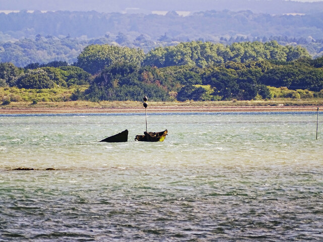
'images' => array(
(int) 0 => array(
'id' => '7239832',
'title' => 'Unidentified debris, Sinah Lake, Hayling Island',
'grid_reference' => 'SU7000',
'realname' => 'Brian Robert Marshall',
'monthname' => 'July',
'hash' => '95a40dd3',
'takenyear' => '2022',
'user_id' => '7420',
'geodist' => '1716.198364',
'description' => 'The location of the debris is approximate. It is probably something left over from the second world war. It has been given a marker to minimise the risk of marine traffic colliding with it.',
'url' => 'https://s0.geograph.org.uk/geophotos/07/23/98/7239832_95a40dd3.jpg'
),
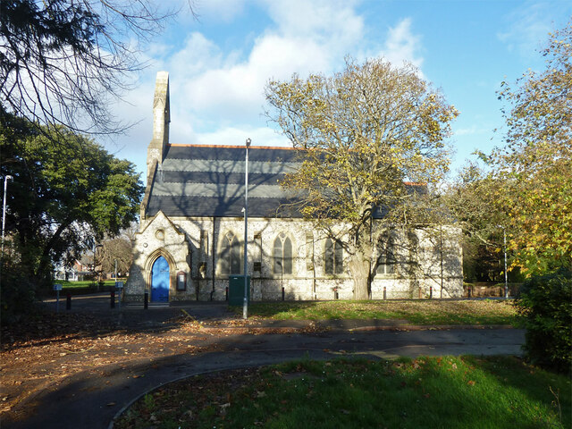
(int) 1 => array(
'id' => '7048972',
'title' => 'St James Hospital chapel',
'grid_reference' => 'SU6700',
'realname' => 'Robin Webster',
'monthname' => 'December',
'hash' => '9f3e588e',
'takenyear' => '2013',
'user_id' => '9905',
'geodist' => '1902.433228',
'description' => 'A grade II listed building, 1879.',
'url' => 'https://s0.geograph.org.uk/geophotos/07/04/89/7048972_9f3e588e.jpg'
),
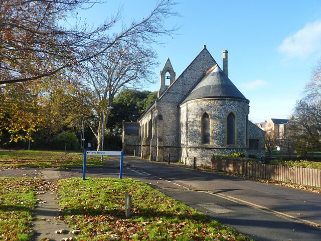
(int) 2 => array(
'id' => '7048975',
'title' => 'St James Hospital chapel',
'grid_reference' => 'SU6700',
'realname' => 'Robin Webster',
'monthname' => 'December',
'hash' => '9ab2717c',
'takenyear' => '2013',
'user_id' => '9905',
'geodist' => '1902.433228',
'description' => 'A grade II listed building, 1879.',
'url' => 'https://s3.geograph.org.uk/geophotos/07/04/89/7048975_9ab2717c.jpg'
),
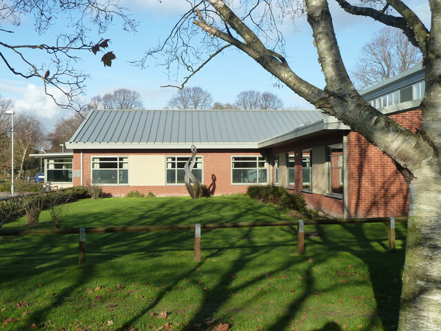
(int) 3 => array(
'id' => '7048985',
'title' => 'The Limes',
'grid_reference' => 'SU6700',
'realname' => 'Robin Webster',
'monthname' => 'December',
'hash' => 'ba4b16bd',
'takenyear' => '2013',
'user_id' => '9905',
'geodist' => '1733.033325',
'description' => 'An NHS establishment for mental health inpatients.',
'url' => 'https://s1.geograph.org.uk/geophotos/07/04/89/7048985_ba4b16bd.jpg'
),
(int) 4 => array(
'id' => '7048993',
'title' => 'The Orchards',
'grid_reference' => 'SU6700',
'realname' => 'Robin Webster',
'monthname' => 'December',
'hash' => '04e6ada4',
'takenyear' => '2013',
'user_id' => '9905',
'geodist' => '1781.609131',
'description' => 'An NHS establishment for mental health inpatients.',
'url' => 'https://s1.geograph.org.uk/geophotos/07/04/89/7048993_04e6ada4.jpg'
),
(int) 5 => array(
'id' => '7239823',
'title' => 'Sinah Lake, Hayling Island',
'grid_reference' => 'SU6900',
'realname' => 'Brian Robert Marshall',
'monthname' => 'July',
'hash' => 'b5b6195d',
'takenyear' => '2022',
'user_id' => '7420',
'geodist' => '1375.023193',
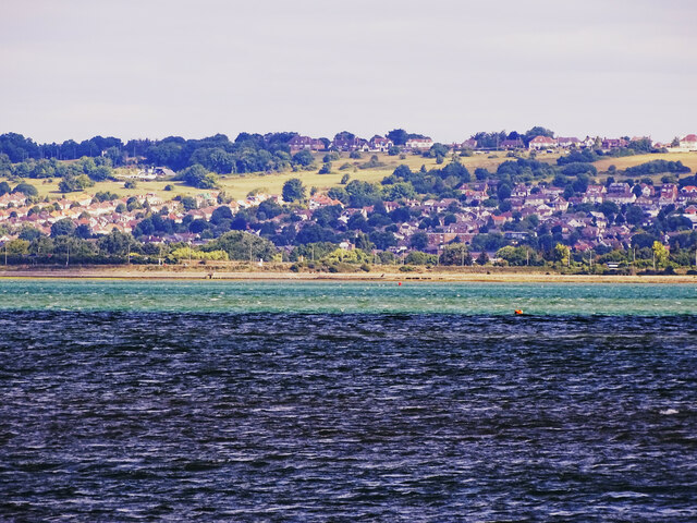
'description' => 'The tidal lake is quite extensive with an area in excess of 20 km2. however it is also quite shallow. The tide was high when this telephoto image was taken. When the tide is out it is mostly mud. In the background is Havant.',
'url' => 'https://s3.geograph.org.uk/geophotos/07/23/98/7239823_b5b6195d.jpg'
),
(int) 6 => array(
'id' => '7504104',
'title' => 'Hayling Ferry, Eastney Portsmouth',
'grid_reference' => 'SU6800',
'realname' => 'Brian Deegan',
'monthname' => 'May',
'hash' => '4ecd7656',
'takenyear' => '2023',
'user_id' => '123467',
'geodist' => '1056.245117',
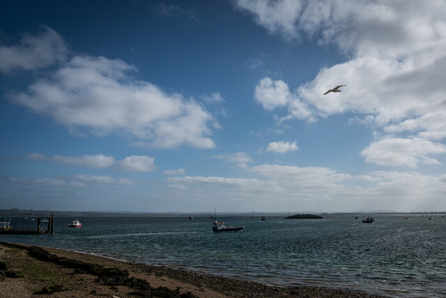
'description' => '',
'url' => 'https://s0.geograph.org.uk/geophotos/07/50/41/7504104_4ecd7656.jpg'
),
(int) 7 => array(
'id' => '7615239',
'title' => 'Houses on Langstone Harbour shore',
'grid_reference' => 'SU6700',
'realname' => 'David Martin',
'monthname' => 'September',
'hash' => 'c7473721',
'takenyear' => '2023',
'user_id' => '13502',
'geodist' => '1428.703979',
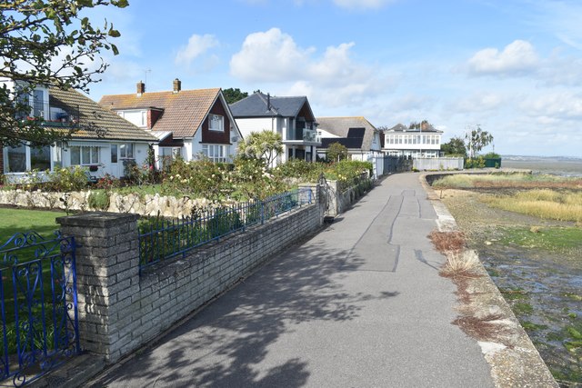
'description' => '',
'url' => 'https://s3.geograph.org.uk/geophotos/07/61/52/7615239_c7473721.jpg'
),
(int) 8 => array(
'id' => '7615240',
'title' => 'Langstone Harbour shore path',
'grid_reference' => 'SU6700',
'realname' => 'David Martin',
'monthname' => 'September',
'hash' => '91452e11',
'takenyear' => '2023',
'user_id' => '13502',
'geodist' => '1343.030518',
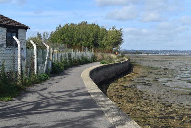
'description' => '',
'url' => 'https://s0.geograph.org.uk/geophotos/07/61/52/7615240_91452e11.jpg'
),
(int) 9 => array(
'id' => '7615758',
'title' => 'View across Lock Lake',
'grid_reference' => 'SU6800',
'realname' => 'David Martin',
'monthname' => 'September',
'hash' => 'dad3764e',
'takenyear' => '2023',
'user_id' => '13502',
'geodist' => '1050.537598',
'description' => 'The gravel spit is on the eastern end of Portsea Island, the distant wooded shore is Hayling Island.',
'url' => 'https://s2.geograph.org.uk/geophotos/07/61/57/7615758_dad3764e.jpg'
),
(int) 10 => array(
'id' => '7615764',
'title' => 'Shoreline complexity at Langstone Harbour entrance',
'grid_reference' => 'SU6800',
'realname' => 'David Martin',
'monthname' => 'September',
'hash' => '47e25c56',
'takenyear' => '2023',
'user_id' => '13502',
'geodist' => '1093.167480',
'description' => 'A view across two bodies of water and two islands. The nearest water is Lock Lake, then a gravel spit with some houseboats on the eastern tip of Portsea Island. The blue shed (belonging to the Langstone Harbour Board), modern waterfront houses and Ferry Boat Inn are on Hayling Island, across the entrance to Langstone Harbour.',
'url' => 'https://s0.geograph.org.uk/geophotos/07/61/57/7615764_47e25c56.jpg'
),
(int) 11 => array(
'id' => '7615766',
'title' => 'Langstone Harbour Board shed and the Ferry Boat Inn',
'grid_reference' => 'SU6800',
'realname' => 'David Martin',
'monthname' => 'September',
'hash' => '63808eda',
'takenyear' => '2023',
'user_id' => '13502',
'geodist' => '1068.644531',
'description' => 'On the extreme western tip of Hayling Island, seen from the shelter on the ferry landing stage.',
'url' => 'https://s2.geograph.org.uk/geophotos/07/61/57/7615766_63808eda.jpg'
),
(int) 12 => array(
'id' => '7615767',
'title' => 'Fishing boat "St Ruan" at the ferry landing stage',
'grid_reference' => 'SU6800',
'realname' => 'David Martin',
'monthname' => 'September',
'hash' => '4fdd8123',
'takenyear' => '2023',
'user_id' => '13502',
'geodist' => '1008.561279',
'description' => '',
'url' => 'https://s3.geograph.org.uk/geophotos/07/61/57/7615767_4fdd8123.jpg'
),
(int) 13 => array(
'id' => '7615770',
'title' => 'Hayling ferry "Pride of Hayling"',
'grid_reference' => 'SU6800',
'realname' => 'David Martin',
'monthname' => 'September',
'hash' => '12e9fa6e',
'takenyear' => '2023',
'user_id' => '13502',
'geodist' => '1010.105896',
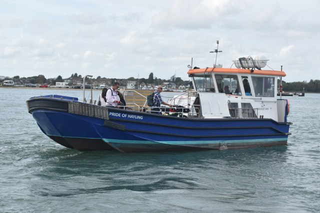
'description' => 'Operating a passenger and bicycle service across the entrance to Langstone Harbour, between Hayling and Portsea Islands. The ferry has backed away from the Hayling landing stage and is here turning towards Portsmouth.',
'url' => 'https://s2.geograph.org.uk/geophotos/07/61/57/7615770_12e9fa6e.jpg'
),
(int) 14 => array(
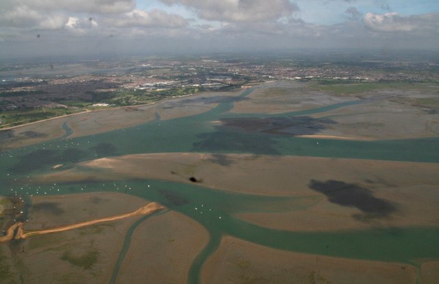
'id' => '5440976',
'title' => 'Langstone Harbour: aerial 2017',
'grid_reference' => 'SU7002',
'realname' => 'Chris',
'monthname' => 'June',
'hash' => '327dfc77',
'takenyear' => '2017',
'user_id' => '79357',
'geodist' => '1904.389648',
'description' => '',
'url' => 'https://s0.geograph.org.uk/geophotos/05/44/09/5440976_327dfc77.jpg'
),
(int) 15 => array(
'id' => '7049347',
'title' => 'Locksway Road, Milton, Portsmouth',
'grid_reference' => 'SZ6799',
'realname' => 'Robin Webster',
'monthname' => 'December',
'hash' => 'eaba03f2',
'takenyear' => '2013',
'user_id' => '9905',
'geodist' => '1816.674194',
'description' => 'The houses on the right are built over the course of the Portsea Canal section of the Portsmouth and Arundel Canal. This was the least successful part of an unsuccessful enterprise, in use for about four years, although most of its remains east of Milton Road lasted for a considerable time.',
'url' => 'https://s3.geograph.org.uk/geophotos/07/04/93/7049347_eaba03f2.jpg'
),
(int) 16 => array(
'id' => '7049372',
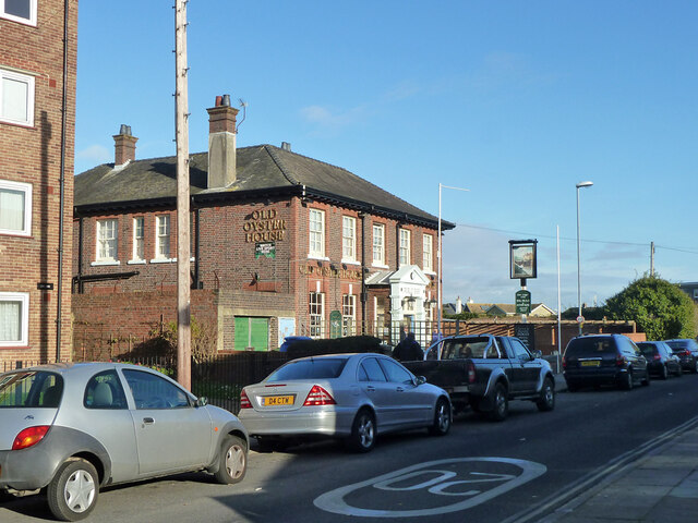
'title' => 'Old Oyster House pub, Milton Locks, Portsmouth',
'grid_reference' => 'SZ6799',
'realname' => 'Robin Webster',
'monthname' => 'December',
'hash' => '8b310b6a',
'takenyear' => '2013',
'user_id' => '9905',
'geodist' => '1668.496338',
'description' => 'Not looking very old, perhaps referring to a nearby feature. Neither pub nor identified oyster house are on old maps.',
'url' => 'https://s0.geograph.org.uk/geophotos/07/04/93/7049372_8b310b6a.jpg'
),
(int) 17 => array(
'id' => '7049377',
'title' => 'Thatched House pub, Milton Locks, Portsmouth',
'grid_reference' => 'SZ6799',
'realname' => 'Robin Webster',
'monthname' => 'December',
'hash' => '424238e2',
'takenyear' => '2013',
'user_id' => '9905',
'geodist' => '1666.050415',
'description' => 'Not thatched, although the earliest pub of this name on this site probably was.',
'url' => 'https://s1.geograph.org.uk/geophotos/07/04/93/7049377_424238e2.jpg'
)
),
'amp' => false
)
$meta_keywords = 'Langstone Channel'
$meta_description = 'Langstone Channel is a waterway located in Hampshire, England, which serves as both a sea passage and an estuary. It connects the mainland with Hayling Island, separating it from Portsea Island. The channel is approximately 4 kilometers long and varies in width, with an average depth of around 3...'
$title_for_layout = 'Langstone Channel Havant Hampshire'
$videos = null
$wikis = array(
'batchcomplete' => '',
'query' => array(
'geosearch' => array(
(int) 0 => array(
[maximum depth reached]
),
(int) 1 => array(
[maximum depth reached]
),
(int) 2 => array(
[maximum depth reached]
),
(int) 3 => array(
[maximum depth reached]
),
(int) 4 => array(
[maximum depth reached]
),
(int) 5 => array(
[maximum depth reached]
),
(int) 6 => array(
[maximum depth reached]
),
(int) 7 => array(
[maximum depth reached]
)
)
)
)
$neighbours = array(
'prev' => array(
'Record' => array(
'id' => '265342',
'GBPNID' => '267815',
'PlaceName' => 'Russell's Lake',
'GridRef' => 'SU6801',
'Lat' => '50.812633',
'Lng' => '-1.0254859',
'HistCounty' => 'Hampshire',
'Division' => null,
'AdCounty' => 'Hampshire',
'District' => 'Havant',
'UniAuth' => null,
'Police' => 'Hampshire',
'Region' => 'England',
'Alternative_Names' => null,
'Type' => 'Sea, Estuary, Creek',
'description' => 'Russell's Lake is a picturesque body of water located in Hampshire, England. It is a unique combination of a sea, estuary, and creek, offering visitors a diverse and captivating natural landscape.
Situated along the Solent, a stretch of water separating the Isle of Wight from the mainland, Russell's Lake benefits from the ebb and flow of the tides, resulting in constantly changing water levels and a rich variety of marine life. The lake is also connected to the River Hamble, a significant waterway in the region, further enhancing its ecological importance.
The lake's shoreline is characterized by sandy beaches, rocky outcrops, and salt marshes, creating a vibrant ecosystem that supports a wide range of flora and fauna. Birdwatchers flock to Russell's Lake to observe its thriving avian population, which includes wading birds, ducks, and gulls. The surrounding woodland provides a habitat for numerous species of mammals, such as foxes, badgers, and deer.
For water enthusiasts, Russell's Lake offers ample opportunities for recreational activities such as boating, sailing, and fishing. Its calm waters and gentle currents make it an ideal spot for beginners and experienced sailors alike. The lake is also a popular destination for anglers, who can try their luck catching a variety of fish, including bass, flounder, and mullet.
In addition to its natural beauty, Russell's Lake is surrounded by charming villages and towns, offering visitors a chance to explore the local culture and history. With its diverse ecosystems and stunning vistas, Russell's Lake is a must-visit destination for nature lovers and those seeking a tranquil escape in Hampshire.',
'what3words' => 'logo.lakes.liability',
'what3words_place' => 'South Hayling, Hampshire',
'images' => '[{"id":"7048692","title":"Climbing apparatus, watersports centre, Portsmouth","grid_reference":"SU6702","realname":"Robin Webster","monthname":"December","hash":"8a16fbfa","takenyear":"2013","user_id":"9905","geodist":"1508.574707","description":"This appears to have, in part, tasks simulating boat rigging.","url":"https:\/\/s0.geograph.org.uk\/geophotos\/07\/04\/86\/7048692_8a16fbfa.jpg"},{"id":"7048702","title":"Kendalls Wharf, Portsmouth","grid_reference":"SU6703","realname":"Robin Webster","monthname":"December","hash":"ad72acd6","takenyear":"2013","user_id":"9905","geodist":"1755.296997","description":"For marine aggregates.","url":"https:\/\/s2.geograph.org.uk\/geophotos\/07\/04\/87\/7048702_ad72acd6.jpg"},{"id":"7239823","title":"Sinah Lake, Hayling Island","grid_reference":"SU6900","realname":"Brian Robert Marshall","monthname":"July","hash":"b5b6195d","takenyear":"2022","user_id":"7420","geodist":"1979.026367","description":"The tidal lake is quite extensive with an area in excess of 20 km2. however it is also quite shallow. The tide was high when this telephoto image was taken. When the tide is out it is mostly mud. In the background is Havant.","url":"https:\/\/s3.geograph.org.uk\/geophotos\/07\/23\/98\/7239823_b5b6195d.jpg"},{"id":"7248314","title":"The Deeps, Farlington Marsh","grid_reference":"SU6803","realname":"Martyn Pattison","monthname":"August","hash":"f8693146","takenyear":"2022","user_id":"8","geodist":"1996.413086","description":"This lake is called The Deeps, it's formed by a combination of overwash from the sea and retention of rainfall draining from the marsh. Following a recent extended hot and dry spell it's drying up and currently looks more like something from an African documentary than an English coastal lake.","url":"https:\/\/s2.geograph.org.uk\/geophotos\/07\/24\/83\/7248314_f8693146.jpg"},{"id":"7504104","title":"Hayling Ferry, Eastney Portsmouth","grid_reference":"SU6800","realname":"Brian Deegan","monthname":"May","hash":"4ecd7656","takenyear":"2023","user_id":"123467","geodist":"1840.297119","description":"","url":"https:\/\/s0.geograph.org.uk\/geophotos\/07\/50\/41\/7504104_4ecd7656.jpg"},{"id":"7615240","title":"Langstone Harbour shore path","grid_reference":"SU6700","realname":"David Martin","monthname":"September","hash":"91452e11","takenyear":"2023","user_id":"13502","geodist":"1962.698608","description":"","url":"https:\/\/s0.geograph.org.uk\/geophotos\/07\/61\/52\/7615240_91452e11.jpg"},{"id":"7615758","title":"View across Lock Lake","grid_reference":"SU6800","realname":"David Martin","monthname":"September","hash":"dad3764e","takenyear":"2023","user_id":"13502","geodist":"1805.792358","description":"The gravel spit is on the eastern end of Portsea Island, the distant wooded shore is Hayling Island.","url":"https:\/\/s2.geograph.org.uk\/geophotos\/07\/61\/57\/7615758_dad3764e.jpg"},{"id":"7615764","title":"Shoreline complexity at Langstone Harbour entrance","grid_reference":"SU6800","realname":"David Martin","monthname":"September","hash":"47e25c56","takenyear":"2023","user_id":"13502","geodist":"1890.480225","description":"A view across two bodies of water and two islands. The nearest water is Lock Lake, then a gravel spit with some houseboats on the eastern tip of Portsea Island. The blue shed (belonging to the Langstone Harbour Board), modern waterfront houses and Ferry Boat Inn are on Hayling Island, across the entrance to Langstone Harbour.","url":"https:\/\/s0.geograph.org.uk\/geophotos\/07\/61\/57\/7615764_47e25c56.jpg"},{"id":"7615766","title":"Langstone Harbour Board shed and the Ferry Boat Inn","grid_reference":"SU6800","realname":"David Martin","monthname":"September","hash":"63808eda","takenyear":"2023","user_id":"13502","geodist":"1877.653931","description":"On the extreme western tip of Hayling Island, seen from the shelter on the ferry landing stage.","url":"https:\/\/s2.geograph.org.uk\/geophotos\/07\/61\/57\/7615766_63808eda.jpg"},{"id":"7615767","title":"Fishing boat \"St Ruan\" at the ferry landing stage","grid_reference":"SU6800","realname":"David Martin","monthname":"September","hash":"4fdd8123","takenyear":"2023","user_id":"13502","geodist":"1817.267334","description":"","url":"https:\/\/s3.geograph.org.uk\/geophotos\/07\/61\/57\/7615767_4fdd8123.jpg"},{"id":"7615770","title":"Hayling ferry \"Pride of Hayling\"","grid_reference":"SU6800","realname":"David Martin","monthname":"September","hash":"12e9fa6e","takenyear":"2023","user_id":"13502","geodist":"1816.499390","description":"Operating a passenger and bicycle service across the entrance to Langstone Harbour, between Hayling and Portsea Islands. The ferry has backed away from the Hayling landing stage and is here turning towards Portsmouth.","url":"https:\/\/s2.geograph.org.uk\/geophotos\/07\/61\/57\/7615770_12e9fa6e.jpg"},{"id":"5440976","title":"Langstone Harbour: aerial 2017","grid_reference":"SU7002","realname":"Chris","monthname":"June","hash":"327dfc77","takenyear":"2017","user_id":"79357","geodist":"1487.559692","description":"","url":"https:\/\/s0.geograph.org.uk\/geophotos\/05\/44\/09\/5440976_327dfc77.jpg"},{"id":"7615773","title":"Seafront cafe overlooking Langstone Harbour entrance","grid_reference":"SZ6899","realname":"David Martin","monthname":"September","hash":"32b430fb","takenyear":"2023","user_id":"13502","geodist":"1997.284668","description":"The light blue building in the background is the Ferry Boat Inn.","url":"https:\/\/s1.geograph.org.uk\/geophotos\/07\/61\/57\/7615773_32b430fb.jpg"},{"id":"2872731","title":"Oh, I Do Like to be Beside the Seaside","grid_reference":"SZ6899","realname":"Colin Smith","monthname":"March","hash":"9982b37e","takenyear":"2012","user_id":"3972","geodist":"1917.529785","description":"Waterside beer garden at Hayling Island, seen across the Langstone Channel mouth from Portsmouth.","url":"https:\/\/s3.geograph.org.uk\/geophotos\/02\/87\/27\/2872731_9982b37e.jpg"},{"id":"2872748","title":"Langstone Channel Mouth","grid_reference":"SZ6899","realname":"Colin Smith","monthname":"March","hash":"28f114af","takenyear":"2012","user_id":"3972","geodist":"1992.041260","description":"Narrow channel, with fast tidal currents, between Portsmouth and Hayling Island. The passenger ferry terminal is visible on the far bank.","url":"https:\/\/s0.geograph.org.uk\/geophotos\/02\/87\/27\/2872748_28f114af.jpg"},{"id":"2873775","title":"Bench on Ferry Road","grid_reference":"SZ6899","realname":"Colin Smith","monthname":"March","hash":"e1b6ac55","takenyear":"2012","user_id":"3972","geodist":"1974.318115","description":"Fine viewpoint across tidal Langstone Channel to the eastern terminal of the Hayling Island passenger ferry.\r\n<span class=\"nowrap\"><a title=\"http:\/\/en.wikipedia.org\/wiki\/Portsmouth\" rel=\"nofollow ugc noopener\" href=\"http:\/\/en.wikipedia.org\/wiki\/Portsmouth\">Link<\/a><img style=\"margin-left:2px;\" alt=\"External link\" title=\"External link - shift click to open in new window\" src=\"https:\/\/s1.geograph.org.uk\/img\/external.png\" width=\"10\" height=\"10\"\/><\/span>","url":"https:\/\/s3.geograph.org.uk\/geophotos\/02\/87\/37\/2873775_e1b6ac55.jpg"},{"id":"3095706","title":"Portsmouth Lifeboat Station","grid_reference":"SZ6899","realname":"Barry Shimmon","monthname":"July","hash":"7b53d49f","takenyear":"2012","user_id":"20970","geodist":"1967.274780","description":"For this station's website click on this <span class=\"nowrap\"><a title=\"http:\/\/www.portsmouthlifeboat.co.uk\" rel=\"nofollow ugc noopener\" href=\"http:\/\/www.portsmouthlifeboat.co.uk\">Link<\/a><img style=\"margin-left:2px;\" alt=\"External link\" title=\"External link - shift click to open in new window\" src=\"https:\/\/s1.geograph.org.uk\/img\/external.png\" width=\"10\" height=\"10\"\/><\/span>","url":"https:\/\/s2.geograph.org.uk\/geophotos\/03\/09\/57\/3095706_7b53d49f.jpg"},{"id":"3389609","title":"Looking across Langstone Harbour mouth towards Portsmouth Lifeboat Station","grid_reference":"SZ6899","realname":"Graham Robson","monthname":"June","hash":"67029367","takenyear":"2010","user_id":"8664","geodist":"1975.812134","description":"Looking across the entrance to Langstone Harbour towards Eastney Point and Portsmouth Lifeboat Station.","url":"https:\/\/s1.geograph.org.uk\/geophotos\/03\/38\/96\/3389609_67029367.jpg"}]',
'wikis' => '{"batchcomplete":"","query":{"geosearch":[{"pageid":2322100,"ns":0,"title":"Langstone Harbour","lat":50.818055555556,"lon":-1.0083333333333,"dist":1347.5,"primary":"","url":"https:\/\/en.wikipedia.org\/wiki\/Langstone_Harbour","image":"https:\/\/upload.wikimedia.org\/wikipedia\/commons\/d\/d5\/Langstone_Harbour_-_geograph.org.uk_-_1077639.jpg","extract":"Langstone Harbour is a 2,085.4-hectare (5,153-acre) biological Site of Special Scientific Interest in Hampshire. It is an inlet of the English Channel..."},{"pageid":5305225,"ns":0,"title":"Staunton Way","lat":50.81,"lon":-1.006,"dist":1400.1,"primary":"","url":"https:\/\/en.wikipedia.org\/wiki\/Staunton_Way","image":"https:\/\/upload.wikimedia.org\/wikipedia\/commons\/f\/fa\/Staunton_Way_Waymarker.jpg","extract":"The Staunton Way is a 20.5 mile recreational circular walk in Hampshire, southern England, that connects Queen Elizabeth Country Park to Staunton Country..."},{"pageid":24629672,"ns":0,"title":"Portsmouth College","lat":50.808322,"lon":-1.0458,"dist":1505.7,"primary":"","url":"https:\/\/en.wikipedia.org\/wiki\/Portsmouth_College","image":"https:\/\/upload.wikimedia.org\/wikipedia\/commons\/8\/81\/Portsmouth_College.jpg","extract":"Portsmouth College is a sixth form college on Tangier Road, Baffins, in the city of Portsmouth, England.\n\n\n== Admissions ==\nThe principal at Portsmouth College..."},{"pageid":5018147,"ns":0,"title":"A2030 road","lat":50.8203,"lon":-1.0435,"dist":1525.9,"primary":"","url":"https:\/\/en.wikipedia.org\/wiki\/A2030_road","image":"https:\/\/upload.wikimedia.org\/wikipedia\/commons\/3\/32\/UK_road_A2030.svg","extract":"The A2030 is a road in Hampshire. The road starts off at junction 5 of the A3(M), near the village of Bedhampton. The road then runs west along the base..."},{"pageid":3061462,"ns":0,"title":"South Binness Island","lat":50.823,"lon":-1.009,"dist":1634.1,"primary":"","url":"https:\/\/en.wikipedia.org\/wiki\/South_Binness_Island","extract":"South Binness Island is an island in Langstone Harbour. It is 600 metres (660 yd) long and up to 240 metres (260 yd) wide but only rises to 2 metres (7..."},{"pageid":50643070,"ns":0,"title":"Baffins Milton Rovers F.C.","lat":50.823405,"lon":-1.0435048333333,"dist":1742.7,"primary":"","url":"https:\/\/en.wikipedia.org\/wiki\/Baffins_Milton_Rovers_F.C.","extract":"Baffins Milton Rovers Football Club is a football club based in Portsmouth, Hampshire, England. They are currently members of the Wessex League Premier..."},{"pageid":3061452,"ns":0,"title":"Baker's Island","lat":50.8274,"lon":-1.0145,"dist":1814.3,"primary":"","url":"https:\/\/en.wikipedia.org\/wiki\/Baker%27s_Island","extract":"Baker's Island is an island in Langstone Harbour, Hampshire, England. It is 400 m (1,300 ft) long and up to 300 m (980 ft) wide but only rises to a little..."},{"pageid":41982553,"ns":0,"title":"Portsmouth Lifeboat Station","lat":50.795194444444,"lon":-1.0298055555556,"dist":1962.7,"primary":"","url":"https:\/\/en.wikipedia.org\/wiki\/Portsmouth_Lifeboat_Station","image":"https:\/\/upload.wikimedia.org\/wikipedia\/commons\/1\/12\/Portsmouth_Lifeboat_Station_15_April_2014.JPG","extract":"Portsmouth Lifeboat Station is located on Eastney Point near Southsea, in the English county of Hampshire. The station is owned and operated by the RNLI..."}]}}',
'videos' => null,
'places' => '{
"version": 0.6,
"generator": "Overpass API 0.7.62.1 084b4234",
"osm3s": {
"timestamp_osm_base": "2024-06-09T17:30:29Z",
"copyright": "The data included in this document is from www.openstreetmap.org. The data is made available under ODbL."
},
"elements": [
{
"type": "node",
"id": 9157379694,
"lat": 50.8123923,
"lon": -1.0274577,
"tags": {
"seamark:buoy_cardinal:category": "south",
"seamark:buoy_cardinal:colour": "yellow;black",
"seamark:buoy_cardinal:colour_pattern": "horizontal",
"seamark:buoy_cardinal:shape": "spar",
"seamark:name": "Mallard Sands S",
"seamark:topmark:colour": "black",
"seamark:topmark:shape": "2 cones down",
"seamark:type": "buoy_cardinal"
}
},
{
"type": "node",
"id": 9157379695,
"lat": 50.8115822,
"lon": -1.0303384,
"tags": {
"seamark:buoy_lateral:category": "port",
"seamark:buoy_lateral:colour": "red",
"seamark:buoy_lateral:shape": "can",
"seamark:buoy_lateral:system": "iala-a",
"seamark:light:character": "VQ",
"seamark:light:colour": "red",
"seamark:type": "buoy_lateral"
}
},
{
"type": "node",
"id": 9162230720,
"lat": 50.8139481,
"lon": -1.0241747,
"tags": {
"seamark:type": "anchorage"
}
}
]
}
'
)
),
'next' => array(
'Record' => array(
'id' => '265344',
'GBPNID' => '267817',
'PlaceName' => 'Northeast Mouth',
'GridRef' => 'HU6971',
'Lat' => '60.422666',
'Lng' => '-0.74410511',
'HistCounty' => 'Shetland',
'Division' => null,
'AdCounty' => null,
'District' => null,
'UniAuth' => 'Shetland Islands',
'Police' => 'Highlands and Islands',
'Region' => 'Scotland',
'Alternative_Names' => null,
'Type' => 'Sea, Estuary, Creek',
'description' => 'Located on the northeastern coast of Shetland, Northeast Mouth is a prominent geographical feature characterized by its unique combination of sea, estuary, and creek. Situated in the North Sea, this area boasts a diverse marine ecosystem that is home to a wide variety of marine life.
Northeast Mouth is primarily a sea area, with its coastal waters influenced by the cold currents of the North Atlantic. These waters support a rich diversity of fish species such as cod, haddock, and mackerel, attracting both commercial and recreational fishermen. The sea area also provides important foraging grounds for seabirds like puffins, gannets, and fulmars.
At the mouth of the estuary, the landscape transitions into a more sheltered and brackish environment. This estuary serves as a vital habitat for various species of migratory birds, including waders and ducks, which rely on its mudflats and salt marshes for feeding and nesting.
Further inland, the estuary gradually narrows into a creek, characterized by its shallow and calm waters. This creek is an important breeding ground for various fish species, such as salmon and trout, which use the area for spawning. It also provides a serene and picturesque setting for recreational activities such as boating, kayaking, and wildlife observation.
Overall, Northeast Mouth in Shetland is an ecologically significant area, encompassing a diverse range of habitats and supporting a wide array of marine and birdlife. Its combination of sea, estuary, and creek provides a unique and dynamic environment that is of both ecological and recreational importance.',
'what3words' => 'dried.widget.treble',
'what3words_place' => 'Symbister, Shetland Islands',
'images' => '[{"id":"5795830","title":"Lighthouse on Bound Skerry, Out Skerries","grid_reference":"HU7071","realname":"Mike Pennington","monthname":"June","hash":"d6007f77","takenyear":"2018","user_id":"9715","geodist":"902.724670","description":"","url":"https:\/\/s2.geograph.org.uk\/geophotos\/05\/79\/58\/5795830_d6007f77.jpg"},{"id":"6994402","title":"Bound Skerry Light and lighthouse cottages on Grunay, Out Skerries","grid_reference":"HU7071","realname":"Donald MacDonald","monthname":"July","hash":"bfb584bf","takenyear":"2017","user_id":"7565","geodist":"909.083496","description":"","url":"https:\/\/s2.geograph.org.uk\/geophotos\/06\/99\/44\/6994402_bfb584bf.jpg"},{"id":"749210","title":"Lighthouse on Bound Skerry","grid_reference":"HU7071","realname":"Mike Hackston","monthname":"August","hash":"0c057cac","takenyear":"2003","user_id":"24328","geodist":"932.547974","description":"The lighthouse is the first sign of human habitation on the Out Skerries, approaching on the ferry from Vidlin","url":"https:\/\/s2.geograph.org.uk\/photos\/74\/92\/749210_0c057cac.jpg"},{"id":"1409555","title":"Bound Skerry Lighthouse","grid_reference":"HU7071","realname":"joost","monthname":"June","hash":"5b8bb326","takenyear":"2009","user_id":"39135","geodist":"923.240173","description":"The characteristic Out Skerries lighthouse can be seen from almost anywhere on the islands. It is located on a small rocky island named Bound Skerry, the most easterly island of the Skerries.","url":"https:\/\/s3.geograph.org.uk\/geophotos\/01\/40\/95\/1409555_5b8bb326.jpg"},{"id":"1971657","title":"Bound Skerry Lighthouse","grid_reference":"HU7071","realname":"Steve Bryan","monthname":"September","hash":"2190965d","takenyear":"1988","user_id":"3239","geodist":"920.132019","description":"","url":"https:\/\/s1.geograph.org.uk\/geophotos\/01\/97\/16\/1971657_2190965d.jpg"},{"id":"3558870","title":"Out Skerries: Bound Skerry from the ferry","grid_reference":"HU7071","realname":"Chris Downer","monthname":"July","hash":"5deb1f1d","takenyear":"2013","user_id":"14700","geodist":"992.971863","description":"The lighthouse stands at the easternmost extremity of Scotland.","url":"https:\/\/s2.geograph.org.uk\/geophotos\/03\/55\/88\/3558870_5deb1f1d.jpg"},{"id":"3651372","title":"Out Skerries: Bound Skerry from Bruray Ward","grid_reference":"HU7071","realname":"Chris Downer","monthname":"July","hash":"08972e02","takenyear":"2013","user_id":"14700","geodist":"927.282593","description":"Looking down from the top of Bruray Ward towards the lighthouse on the easternmost piece of Scotland, Bound Skerry.","url":"https:\/\/s0.geograph.org.uk\/geophotos\/03\/65\/13\/3651372_08972e02.jpg"},{"id":"3651374","title":"Out Skerries: Bound Skerry lighthouse","grid_reference":"HU7071","realname":"Chris Downer","monthname":"July","hash":"1db85a43","takenyear":"2013","user_id":"14700","geodist":"907.857727","description":"The lighthouse stands on Bound Skerry, the easternmost piece of land in Scotland.","url":"https:\/\/s2.geograph.org.uk\/geophotos\/03\/65\/13\/3651374_1db85a43.jpg"},{"id":"3935730","title":"Bound Skerry Lighthouse from the Out Skerries Ferry","grid_reference":"HU7071","realname":"Julian Paren","monthname":"April","hash":"d2fb4547","takenyear":"2014","user_id":"9616","geodist":"964.241821","description":"Three minutes after leaving the pier at Bruray you have a good view of the lighthouse. The light is now automated.","url":"https:\/\/s2.geograph.org.uk\/geophotos\/03\/93\/57\/3935730_d2fb4547.jpg"},{"id":"5493433","title":"Lamba Stack and Bound Skerry","grid_reference":"HU6972","realname":"Greg Fitchett","monthname":"September","hash":"2c4cb22d","takenyear":"1988","user_id":"61750","geodist":"634.811096","description":"Fine rock scenery with the sea-girt Lamba Stack in the foreground and the lighthouse on Bound Skerry, the most easterly point of Scotland, in the distance.","url":"https:\/\/s1.geograph.org.uk\/geophotos\/05\/49\/34\/5493433_2c4cb22d.jpg"},{"id":"5795821","title":"Holm Geo, Out Skerries","grid_reference":"HU6771","realname":"Mike Pennington","monthname":"June","hash":"8590dfbd","takenyear":"2018","user_id":"9715","geodist":"1363.583008","description":"","url":"https:\/\/s1.geograph.org.uk\/geophotos\/05\/79\/58\/5795821_8590dfbd.jpg"},{"id":"5795824","title":"Walrus (Odobenus rosmarus), Holm Geo, Out Skerries","grid_reference":"HU6771","realname":"Mike Pennington","monthname":"June","hash":"c4548115","takenyear":"2018","user_id":"9715","geodist":"1336.523560","description":"This individual has been touring northern Scotland for several weeks, and has finally paid Shetland a visit.","url":"https:\/\/s0.geograph.org.uk\/geophotos\/05\/79\/58\/5795824_c4548115.jpg"},{"id":"5795827","title":"LK52 Renown at Out Skerries pier","grid_reference":"HU6871","realname":"Mike Pennington","monthname":"June","hash":"811104f3","takenyear":"2018","user_id":"9715","geodist":"435.256104","description":"","url":"https:\/\/s3.geograph.org.uk\/geophotos\/05\/79\/58\/5795827_811104f3.jpg"},{"id":"5795828","title":"Buildings on Grunay, Out Skerries","grid_reference":"HU6971","realname":"Mike Pennington","monthname":"June","hash":"6376a2dc","takenyear":"2018","user_id":"9715","geodist":"153.450531","description":"","url":"https:\/\/s0.geograph.org.uk\/geophotos\/05\/79\/58\/5795828_6376a2dc.jpg"},{"id":"5795829","title":"Lamba Stack and Bruray Ward, Out Skerries","grid_reference":"HU6972","realname":"Mike Pennington","monthname":"June","hash":"e46993a2","takenyear":"2018","user_id":"9715","geodist":"644.884155","description":"","url":"https:\/\/s1.geograph.org.uk\/geophotos\/05\/79\/58\/5795829_e46993a2.jpg"},{"id":"5796919","title":"Holm Geo, Out Skerries","grid_reference":"HU6771","realname":"Mike Pennington","monthname":"June","hash":"d70410eb","takenyear":"2018","user_id":"9715","geodist":"1382.983154","description":"Looking towards the skerries known as the Benelips.","url":"https:\/\/s3.geograph.org.uk\/geophotos\/05\/79\/69\/5796919_d70410eb.jpg"},{"id":"5796922","title":"Holm Geo, Out Skerries","grid_reference":"HU6771","realname":"Mike Pennington","monthname":"June","hash":"fbcfe934","takenyear":"2018","user_id":"9715","geodist":"1339.201294","description":"","url":"https:\/\/s2.geograph.org.uk\/geophotos\/05\/79\/69\/5796922_fbcfe934.jpg"},{"id":"5796928","title":"The view to the Benelips from Holm Geo, Out Skerries","grid_reference":"HU6771","realname":"Mike Pennington","monthname":"June","hash":"dfb908e4","takenyear":"2018","user_id":"9715","geodist":"1417.107544","description":"","url":"https:\/\/s0.geograph.org.uk\/geophotos\/05\/79\/69\/5796928_dfb908e4.jpg"}]',
'wikis' => '{"batchcomplete":"","query":{"geosearch":[{"pageid":6905244,"ns":0,"title":"Grunay","lat":60.422,"lon":-0.74,"dist":237.2,"primary":"","url":"https:\/\/en.wikipedia.org\/wiki\/Grunay","image":"https:\/\/upload.wikimedia.org\/wikipedia\/commons\/8\/88\/Grunay.jpg","extract":"Grunay is an uninhabited island in the Out Skerries group, the most easterly part of Shetland, Scotland. Its area is 55.58 acres, or 22.49 hectares.\nThe..."},{"pageid":2890200,"ns":0,"title":"Bruray","lat":60.426,"lon":-0.75,"dist":492,"primary":"","url":"https:\/\/en.wikipedia.org\/wiki\/Bruray","image":"https:\/\/upload.wikimedia.org\/wikipedia\/commons\/6\/66\/Outskerriesroad.jpg","extract":"Bruray is one of the three Out Skerries islands of Shetland, and contains Scotland's most easterly settlement.\nIt is separated from Housay by North Mouth..."},{"pageid":864557,"ns":0,"title":"Bound Skerry","lat":60.424,"lon":-0.728,"dist":896.3,"primary":"","url":"https:\/\/en.wikipedia.org\/wiki\/Bound_Skerry","image":"https:\/\/upload.wikimedia.org\/wikipedia\/commons\/8\/88\/Grunay.jpg","extract":"Bound Skerry is part of the Out Skerries group in the Shetland Islands. As well as being the most easterly island of that group, it is also the easternmost..."},{"pageid":1750726,"ns":0,"title":"Housay","lat":60.423,"lon":-0.767,"dist":1257.1,"primary":"","url":"https:\/\/en.wikipedia.org\/wiki\/Housay","extract":"Housay, also known as West Isle, is one of the three islands that form the Out Skerries island group, the most easterly part of the Shetland Isles.\n\n\ufffd..."}]}}',
'videos' => null,
'places' => '{
"version": 0.6,
"generator": "Overpass API 0.7.62.1 084b4234",
"osm3s": {
"timestamp_osm_base": "2024-06-06T03:10:08Z",
"copyright": "The data included in this document is from www.openstreetmap.org. The data is made available under ODbL."
},
"elements": [
{
"type": "node",
"id": 1025492906,
"lat": 60.4248359,
"lon": -0.7516962,
"tags": {
"amenity": "fire_station"
}
},
{
"type": "node",
"id": 1025538780,
"lat": 60.4215337,
"lon": -0.7432751,
"tags": {
"is_in": "Scotland;GB",
"name": "Grunay",
"place": "hamlet"
}
},
{
"type": "node",
"id": 1026554562,
"lat": 60.4227175,
"lon": -0.7517574,
"tags": {
"amenity": "ferry_terminal",
"ferry": "yes",
"name": "Bruray Pier, Out Skerries",
"operator": "Shetland Islands Council",
"public_transport": "station"
}
},
{
"type": "node",
"id": 5730005919,
"lat": 60.4233471,
"lon": -0.7500174,
"tags": {
"height": "8",
"man_made": "mast",
"tower:construction": "dish",
"tower:type": "communication"
}
},
{
"type": "node",
"id": 5730005937,
"lat": 60.4225473,
"lon": -0.7501715,
"tags": {
"amenity": "fuel",
"name": "Independent Fuel Station"
}
},
{
"type": "node",
"id": 5730113616,
"lat": 60.4242114,
"lon": -0.7497867,
"tags": {
"height": "10",
"man_made": "mast",
"tower:type": "communication"
}
},
{
"type": "node",
"id": 6376011391,
"lat": 60.4198835,
"lon": -0.7402681,
"tags": {
"description": "21/2/1942 Bristol Blenheim MkIV EE-F of 404 Squadron (RAF Sumburgh) crashed here after sustaining damage during a mission in Norway. All three crew were killed.",
"historic": "memorial",
"memorial": "war_memorial",
"name": "WWII Blenheim Crash Memorial"
}
},
{
"type": "node",
"id": 9721383867,
"lat": 60.4228769,
"lon": -0.7492272,
"tags": {
"power": "pole"
}
},
{
"type": "node",
"id": 9721383868,
"lat": 60.4235486,
"lon": -0.7498993,
"tags": {
"power": "pole"
}
},
{
"type": "node",
"id": 9721383869,
"lat": 60.4236931,
"lon": -0.7506243,
"tags": {
"power": "pole"
}
},
{
"type": "node",
"id": 9721383870,
"lat": 60.4242024,
"lon": -0.7516560,
"tags": {
"power": "pole"
}
},
{
"type": "node",
"id": 9721383871,
"lat": 60.4245657,
"lon": -0.7523671,
"tags": {
"power": "pole"
}
}
]
}
'
)
)
)
$para = 'Langstone Channel is a Sea, Estuary, Creek in Hampshire'
$record = array(
'Record' => array(
'id' => '265343',
'GBPNID' => '267816',
'PlaceName' => 'Langstone Channel',
'GridRef' => 'SU6801',
'Lat' => '50.805361',
'Lng' => '-1.0248424',
'HistCounty' => 'Hampshire',
'Division' => null,
'AdCounty' => 'Hampshire',
'District' => 'Havant',
'UniAuth' => null,
'Police' => 'Hampshire',
'Region' => 'England',
'Alternative_Names' => null,
'Type' => 'Sea, Estuary, Creek',
'description' => 'Langstone Channel is a waterway located in Hampshire, England, which serves as both a sea passage and an estuary. It connects the mainland with Hayling Island, separating it from Portsea Island. The channel is approximately 4 kilometers long and varies in width, with an average depth of around 3 meters.
This waterway is an important natural feature of the area, providing a habitat for various marine species and supporting a thriving ecosystem. The channel is home to a diverse range of flora and fauna, including sea birds, fish, and crustaceans. It is also known for its extensive salt marshes, which provide a haven for numerous bird species, including waders and wildfowl.
The Langstone Channel is a popular destination for water sports enthusiasts, offering opportunities for sailing, windsurfing, and kayaking. Its calm and sheltered waters make it an ideal location for beginners and learners, while more experienced sailors can take advantage of the channel's proximity to the Solent, a renowned sailing area. The channel's natural beauty also attracts visitors who enjoy walking along its shores, birdwatching, or simply taking in the scenic views.
In addition to its natural attributes, the Langstone Channel has historically played a significant role in the region's economy. It has served as a trade route for centuries, facilitating the transport of goods between the mainland and the islands. Today, it continues to support commercial activities, including fishing and shellfish harvesting.
Overall, Langstone Channel is a picturesque and ecologically important waterway in Hampshire, offering recreational opportunities, supporting local wildlife, and contributing to the area's economic activity.',
'what3words' => 'slip.patch.exit',
'what3words_place' => 'South Hayling, Hampshire',
'images' => '[{"id":"7239832","title":"Unidentified debris, Sinah Lake, Hayling Island","grid_reference":"SU7000","realname":"Brian Robert Marshall","monthname":"July","hash":"95a40dd3","takenyear":"2022","user_id":"7420","geodist":"1716.198364","description":"The location of the debris is approximate. It is probably something left over from the second world war. It has been given a marker to minimise the risk of marine traffic colliding with it.","url":"https:\/\/s0.geograph.org.uk\/geophotos\/07\/23\/98\/7239832_95a40dd3.jpg"},{"id":"7048972","title":"St James Hospital chapel","grid_reference":"SU6700","realname":"Robin Webster","monthname":"December","hash":"9f3e588e","takenyear":"2013","user_id":"9905","geodist":"1902.433228","description":"A grade II listed building, 1879.","url":"https:\/\/s0.geograph.org.uk\/geophotos\/07\/04\/89\/7048972_9f3e588e.jpg"},{"id":"7048975","title":"St James Hospital chapel","grid_reference":"SU6700","realname":"Robin Webster","monthname":"December","hash":"9ab2717c","takenyear":"2013","user_id":"9905","geodist":"1902.433228","description":"A grade II listed building, 1879.","url":"https:\/\/s3.geograph.org.uk\/geophotos\/07\/04\/89\/7048975_9ab2717c.jpg"},{"id":"7048985","title":"The Limes","grid_reference":"SU6700","realname":"Robin Webster","monthname":"December","hash":"ba4b16bd","takenyear":"2013","user_id":"9905","geodist":"1733.033325","description":"An NHS establishment for mental health inpatients.","url":"https:\/\/s1.geograph.org.uk\/geophotos\/07\/04\/89\/7048985_ba4b16bd.jpg"},{"id":"7048993","title":"The Orchards","grid_reference":"SU6700","realname":"Robin Webster","monthname":"December","hash":"04e6ada4","takenyear":"2013","user_id":"9905","geodist":"1781.609131","description":"An NHS establishment for mental health inpatients.","url":"https:\/\/s1.geograph.org.uk\/geophotos\/07\/04\/89\/7048993_04e6ada4.jpg"},{"id":"7239823","title":"Sinah Lake, Hayling Island","grid_reference":"SU6900","realname":"Brian Robert Marshall","monthname":"July","hash":"b5b6195d","takenyear":"2022","user_id":"7420","geodist":"1375.023193","description":"The tidal lake is quite extensive with an area in excess of 20 km2. however it is also quite shallow. The tide was high when this telephoto image was taken. When the tide is out it is mostly mud. In the background is Havant.","url":"https:\/\/s3.geograph.org.uk\/geophotos\/07\/23\/98\/7239823_b5b6195d.jpg"},{"id":"7504104","title":"Hayling Ferry, Eastney Portsmouth","grid_reference":"SU6800","realname":"Brian Deegan","monthname":"May","hash":"4ecd7656","takenyear":"2023","user_id":"123467","geodist":"1056.245117","description":"","url":"https:\/\/s0.geograph.org.uk\/geophotos\/07\/50\/41\/7504104_4ecd7656.jpg"},{"id":"7615239","title":"Houses on Langstone Harbour shore","grid_reference":"SU6700","realname":"David Martin","monthname":"September","hash":"c7473721","takenyear":"2023","user_id":"13502","geodist":"1428.703979","description":"","url":"https:\/\/s3.geograph.org.uk\/geophotos\/07\/61\/52\/7615239_c7473721.jpg"},{"id":"7615240","title":"Langstone Harbour shore path","grid_reference":"SU6700","realname":"David Martin","monthname":"September","hash":"91452e11","takenyear":"2023","user_id":"13502","geodist":"1343.030518","description":"","url":"https:\/\/s0.geograph.org.uk\/geophotos\/07\/61\/52\/7615240_91452e11.jpg"},{"id":"7615758","title":"View across Lock Lake","grid_reference":"SU6800","realname":"David Martin","monthname":"September","hash":"dad3764e","takenyear":"2023","user_id":"13502","geodist":"1050.537598","description":"The gravel spit is on the eastern end of Portsea Island, the distant wooded shore is Hayling Island.","url":"https:\/\/s2.geograph.org.uk\/geophotos\/07\/61\/57\/7615758_dad3764e.jpg"},{"id":"7615764","title":"Shoreline complexity at Langstone Harbour entrance","grid_reference":"SU6800","realname":"David Martin","monthname":"September","hash":"47e25c56","takenyear":"2023","user_id":"13502","geodist":"1093.167480","description":"A view across two bodies of water and two islands. The nearest water is Lock Lake, then a gravel spit with some houseboats on the eastern tip of Portsea Island. The blue shed (belonging to the Langstone Harbour Board), modern waterfront houses and Ferry Boat Inn are on Hayling Island, across the entrance to Langstone Harbour.","url":"https:\/\/s0.geograph.org.uk\/geophotos\/07\/61\/57\/7615764_47e25c56.jpg"},{"id":"7615766","title":"Langstone Harbour Board shed and the Ferry Boat Inn","grid_reference":"SU6800","realname":"David Martin","monthname":"September","hash":"63808eda","takenyear":"2023","user_id":"13502","geodist":"1068.644531","description":"On the extreme western tip of Hayling Island, seen from the shelter on the ferry landing stage.","url":"https:\/\/s2.geograph.org.uk\/geophotos\/07\/61\/57\/7615766_63808eda.jpg"},{"id":"7615767","title":"Fishing boat \"St Ruan\" at the ferry landing stage","grid_reference":"SU6800","realname":"David Martin","monthname":"September","hash":"4fdd8123","takenyear":"2023","user_id":"13502","geodist":"1008.561279","description":"","url":"https:\/\/s3.geograph.org.uk\/geophotos\/07\/61\/57\/7615767_4fdd8123.jpg"},{"id":"7615770","title":"Hayling ferry \"Pride of Hayling\"","grid_reference":"SU6800","realname":"David Martin","monthname":"September","hash":"12e9fa6e","takenyear":"2023","user_id":"13502","geodist":"1010.105896","description":"Operating a passenger and bicycle service across the entrance to Langstone Harbour, between Hayling and Portsea Islands. The ferry has backed away from the Hayling landing stage and is here turning towards Portsmouth.","url":"https:\/\/s2.geograph.org.uk\/geophotos\/07\/61\/57\/7615770_12e9fa6e.jpg"},{"id":"5440976","title":"Langstone Harbour: aerial 2017","grid_reference":"SU7002","realname":"Chris","monthname":"June","hash":"327dfc77","takenyear":"2017","user_id":"79357","geodist":"1904.389648","description":"","url":"https:\/\/s0.geograph.org.uk\/geophotos\/05\/44\/09\/5440976_327dfc77.jpg"},{"id":"7049347","title":"Locksway Road, Milton, Portsmouth","grid_reference":"SZ6799","realname":"Robin Webster","monthname":"December","hash":"eaba03f2","takenyear":"2013","user_id":"9905","geodist":"1816.674194","description":"The houses on the right are built over the course of the Portsea Canal section of the Portsmouth and Arundel Canal. This was the least successful part of an unsuccessful enterprise, in use for about four years, although most of its remains east of Milton Road lasted for a considerable time.","url":"https:\/\/s3.geograph.org.uk\/geophotos\/07\/04\/93\/7049347_eaba03f2.jpg"},{"id":"7049372","title":"Old Oyster House pub, Milton Locks, Portsmouth","grid_reference":"SZ6799","realname":"Robin Webster","monthname":"December","hash":"8b310b6a","takenyear":"2013","user_id":"9905","geodist":"1668.496338","description":"Not looking very old, perhaps referring to a nearby feature. Neither pub nor identified oyster house are on old maps.","url":"https:\/\/s0.geograph.org.uk\/geophotos\/07\/04\/93\/7049372_8b310b6a.jpg"},{"id":"7049377","title":"Thatched House pub, Milton Locks, Portsmouth","grid_reference":"SZ6799","realname":"Robin Webster","monthname":"December","hash":"424238e2","takenyear":"2013","user_id":"9905","geodist":"1666.050415","description":"Not thatched, although the earliest pub of this name on this site probably was.","url":"https:\/\/s1.geograph.org.uk\/geophotos\/07\/04\/93\/7049377_424238e2.jpg"}]',
'wikis' => '{"batchcomplete":"","query":{"geosearch":[{"pageid":41982553,"ns":0,"title":"Portsmouth Lifeboat Station","lat":50.795194444444,"lon":-1.0298055555556,"dist":1183.1,"primary":"","url":"https:\/\/en.wikipedia.org\/wiki\/Portsmouth_Lifeboat_Station","image":"https:\/\/upload.wikimedia.org\/wikipedia\/commons\/1\/12\/Portsmouth_Lifeboat_Station_15_April_2014.JPG","extract":"Portsmouth Lifeboat Station is located on Eastney Point near Southsea, in the English county of Hampshire. The station is owned and operated by the RNLI..."},{"pageid":64065204,"ns":0,"title":"The Kench, Hayling Island","lat":50.793611111111,"lon":-1.0186111111111,"dist":1378,"primary":"","url":"https:\/\/en.wikipedia.org\/wiki\/The_Kench,_Hayling_Island","image":"https:\/\/upload.wikimedia.org\/wikipedia\/commons\/a\/ad\/The_Kench%2C_Hayling_Island_-_geograph.org.uk_-_105473.jpg","extract":"The Kench, Hayling Island is a 6-hectare (15-acre) Local Nature Reserve on Hayling Island in Hampshire. It is owned by Hampshire County Council and managed..."},{"pageid":5305225,"ns":0,"title":"Staunton Way","lat":50.81,"lon":-1.006,"dist":1420.9,"primary":"","url":"https:\/\/en.wikipedia.org\/wiki\/Staunton_Way","image":"https:\/\/upload.wikimedia.org\/wikipedia\/commons\/f\/fa\/Staunton_Way_Waymarker.jpg","extract":"The Staunton Way is a 20.5 mile recreational circular walk in Hampshire, southern England, that connects Queen Elizabeth Country Park to Staunton Country..."},{"pageid":24629672,"ns":0,"title":"Portsmouth College","lat":50.808322,"lon":-1.0458,"dist":1509,"primary":"","url":"https:\/\/en.wikipedia.org\/wiki\/Portsmouth_College","image":"https:\/\/upload.wikimedia.org\/wikipedia\/commons\/8\/81\/Portsmouth_College.jpg","extract":"Portsmouth College is a sixth form college on Tangier Road, Baffins, in the city of Portsmouth, England.\n\n\n== Admissions ==\nThe principal at Portsmouth College..."},{"pageid":1117502,"ns":0,"title":"Sinah, Hayling Island","lat":50.790117,"lon":-1.015652,"dist":1814,"primary":"","url":"https:\/\/en.wikipedia.org\/wiki\/Sinah,_Hayling_Island","extract":"Sinah is the area at the southwestern end of Hayling Island. It incorporates the Ferrypoint, Sinah Beach, The Kench, Sinah Warren, and Sinah Common. It..."},{"pageid":2322100,"ns":0,"title":"Langstone Harbour","lat":50.818055555556,"lon":-1.0083333333333,"dist":1827,"primary":"","url":"https:\/\/en.wikipedia.org\/wiki\/Langstone_Harbour","image":"https:\/\/upload.wikimedia.org\/wikipedia\/commons\/d\/d5\/Langstone_Harbour_-_geograph.org.uk_-_1077639.jpg","extract":"Langstone Harbour is a 2,085.4-hectare (5,153-acre) biological Site of Special Scientific Interest in Hampshire. It is an inlet of the English Channel..."},{"pageid":64119342,"ns":0,"title":"Milton Locks","lat":50.793,"lon":-1.042,"dist":1828.5,"primary":"","url":"https:\/\/en.wikipedia.org\/wiki\/Milton_Locks","image":"https:\/\/upload.wikimedia.org\/wikipedia\/commons\/a\/a0\/The_shoreline_by_Eastney_Lake_%28geograph_2696641%29.jpg","extract":"Milton Locks is a 1-hectare (2.5-acre) nature reserve in Milton in Hampshire. It is managed by the Hampshire and Isle of Wight Wildlife Trust.This site..."},{"pageid":1014550,"ns":0,"title":"Fort Cumberland (England)","lat":50.788888888889,"lon":-1.0325,"dist":1909.1,"primary":"","url":"https:\/\/en.wikipedia.org\/wiki\/Fort_Cumberland_(England)","image":"https:\/\/upload.wikimedia.org\/wikipedia\/commons\/e\/e3\/Inside_Fort_Cumberland_-_geograph.org.uk_-_411752.jpg","extract":"Fort Cumberland is a pentagonal artillery fortification erected to guard the entrance to Langstone Harbour, east of the Dockyard of Portsmouth on the south..."}]}}',
'videos' => null,
'places' => '{
"version": 0.6,
"generator": "Overpass API 0.7.62.1 084b4234",
"osm3s": {
"timestamp_osm_base": "2024-06-10T10:52:39Z",
"copyright": "The data included in this document is from www.openstreetmap.org. The data is made available under ODbL."
},
"elements": [
{
"type": "node",
"id": 9157379697,
"lat": 50.8081653,
"lon": -1.0294962,
"tags": {
"seamark:buoy_lateral:category": "starboard",
"seamark:buoy_lateral:colour": "green",
"seamark:buoy_lateral:shape": "conical",
"seamark:buoy_lateral:system": "iala-a",
"seamark:light:character": "Fl",
"seamark:light:colour": "green",
"seamark:light:period": "3",
"seamark:type": "buoy_lateral"
}
},
{
"type": "node",
"id": 9157379698,
"lat": 50.8059991,
"lon": -1.0278225,
"tags": {
"seamark:buoy_lateral:category": "starboard",
"seamark:buoy_lateral:colour": "green",
"seamark:buoy_lateral:shape": "conical",
"seamark:buoy_lateral:system": "iala-a",
"seamark:light:character": "Fl",
"seamark:light:colour": "green",
"seamark:light:group": "3",
"seamark:light:period": "5",
"seamark:name": "Sword Pt",
"seamark:type": "buoy_lateral"
}
},
{
"type": "node",
"id": 9157379699,
"lat": 50.8052906,
"lon": -1.0237804,
"tags": {
"seamark:beacon_isolated_danger:colour": "black;red;black",
"seamark:beacon_isolated_danger:colour_pattern": "horizontal",
"seamark:beacon_isolated_danger:shape": "stake",
"seamark:topmark:colour": "black",
"seamark:topmark:shape": "2 spheres",
"seamark:type": "beacon_isolated_danger"
}
},
{
"type": "node",
"id": 9157379700,
"lat": 50.8054161,
"lon": -1.0236222,
"tags": {
"seamark:type": "wreck",
"seamark:wreck:category": "dangerous",
"seamark:wreck:water_level": "submerged"
}
},
{
"type": "node",
"id": 9157379701,
"lat": 50.8026531,
"lon": -1.0265458,
"tags": {
"seamark:buoy_lateral:category": "starboard",
"seamark:buoy_lateral:colour": "green",
"seamark:buoy_lateral:shape": "can",
"seamark:buoy_lateral:system": "iala-a",
"seamark:light:character": "Fl",
"seamark:light:colour": "green",
"seamark:light:period": "5",
"seamark:name": "Nw Sinah",
"seamark:type": "buoy_lateral"
}
},
{
"type": "node",
"id": 9157379702,
"lat": 50.8028497,
"lon": -1.0295606,
"tags": {
"seamark:buoy_lateral:category": "port",
"seamark:buoy_lateral:colour": "red",
"seamark:buoy_lateral:shape": "can",
"seamark:buoy_lateral:system": "iala-a",
"seamark:light:character": "Fl",
"seamark:light:colour": "red",
"seamark:light:group": "4",
"seamark:light:period": "10",
"seamark:name": "E. Milton",
"seamark:type": "buoy_lateral"
}
},
{
"type": "node",
"id": 9157611308,
"lat": 50.8074941,
"lon": -1.0267067,
"tags": {
"seamark:buoy_special_purpose:colour": "yellow",
"seamark:buoy_special_purpose:shape": "spherical",
"seamark:type": "buoy_special_purpose"
}
},
{
"type": "node",
"id": 9157611309,
"lat": 50.8033854,
"lon": -1.0208059,
"tags": {
"seamark:buoy_special_purpose:colour": "yellow",
"seamark:buoy_special_purpose:shape": "spherical",
"seamark:type": "buoy_special_purpose"
}
}
]
}
'
)
)
$nearbyPlaces = array(
(int) 0 => array(
'Record' => array(
'id' => '265342',
'PlaceName' => 'Russell's Lake'
)
),
(int) 1 => array(
'Record' => array(
'id' => '279427',
'PlaceName' => 'Sword Sands'
)
),
(int) 2 => array(
'Record' => array(
'id' => '279426',
'PlaceName' => 'Sword Point'
)
),
(int) 3 => array(
'Record' => array(
'id' => '265343',
'PlaceName' => 'Langstone Channel'
)
)
)
$noIndex = false
$images = array(
(int) 0 => array(
'id' => '7239832',
'title' => 'Unidentified debris, Sinah Lake, Hayling Island',
'grid_reference' => 'SU7000',
'realname' => 'Brian Robert Marshall',
'monthname' => 'July',
'hash' => '95a40dd3',
'takenyear' => '2022',
'user_id' => '7420',
'geodist' => '1716.198364',
'description' => 'The location of the debris is approximate. It is probably something left over from the second world war. It has been given a marker to minimise the risk of marine traffic colliding with it.',
'url' => 'https://s0.geograph.org.uk/geophotos/07/23/98/7239832_95a40dd3.jpg'
),
(int) 1 => array(
'id' => '7048972',
'title' => 'St James Hospital chapel',
'grid_reference' => 'SU6700',
'realname' => 'Robin Webster',
'monthname' => 'December',
'hash' => '9f3e588e',
'takenyear' => '2013',
'user_id' => '9905',
'geodist' => '1902.433228',
'description' => 'A grade II listed building, 1879.',
'url' => 'https://s0.geograph.org.uk/geophotos/07/04/89/7048972_9f3e588e.jpg'
),
(int) 2 => array(
'id' => '7048975',
'title' => 'St James Hospital chapel',
'grid_reference' => 'SU6700',
'realname' => 'Robin Webster',
'monthname' => 'December',
'hash' => '9ab2717c',
'takenyear' => '2013',
'user_id' => '9905',
'geodist' => '1902.433228',
'description' => 'A grade II listed building, 1879.',
'url' => 'https://s3.geograph.org.uk/geophotos/07/04/89/7048975_9ab2717c.jpg'
),
(int) 3 => array(
'id' => '7048985',
'title' => 'The Limes',
'grid_reference' => 'SU6700',
'realname' => 'Robin Webster',
'monthname' => 'December',
'hash' => 'ba4b16bd',
'takenyear' => '2013',
'user_id' => '9905',
'geodist' => '1733.033325',
'description' => 'An NHS establishment for mental health inpatients.',
'url' => 'https://s1.geograph.org.uk/geophotos/07/04/89/7048985_ba4b16bd.jpg'
),
(int) 4 => array(
'id' => '7048993',
'title' => 'The Orchards',
'grid_reference' => 'SU6700',
'realname' => 'Robin Webster',
'monthname' => 'December',
'hash' => '04e6ada4',
'takenyear' => '2013',
'user_id' => '9905',
'geodist' => '1781.609131',
'description' => 'An NHS establishment for mental health inpatients.',
'url' => 'https://s1.geograph.org.uk/geophotos/07/04/89/7048993_04e6ada4.jpg'
),
(int) 5 => array(
'id' => '7239823',
'title' => 'Sinah Lake, Hayling Island',
'grid_reference' => 'SU6900',
'realname' => 'Brian Robert Marshall',
'monthname' => 'July',
'hash' => 'b5b6195d',
'takenyear' => '2022',
'user_id' => '7420',
'geodist' => '1375.023193',
'description' => 'The tidal lake is quite extensive with an area in excess of 20 km2. however it is also quite shallow. The tide was high when this telephoto image was taken. When the tide is out it is mostly mud. In the background is Havant.',
'url' => 'https://s3.geograph.org.uk/geophotos/07/23/98/7239823_b5b6195d.jpg'
),
(int) 6 => array(
'id' => '7504104',
'title' => 'Hayling Ferry, Eastney Portsmouth',
'grid_reference' => 'SU6800',
'realname' => 'Brian Deegan',
'monthname' => 'May',
'hash' => '4ecd7656',
'takenyear' => '2023',
'user_id' => '123467',
'geodist' => '1056.245117',
'description' => '',
'url' => 'https://s0.geograph.org.uk/geophotos/07/50/41/7504104_4ecd7656.jpg'
),
(int) 7 => array(
'id' => '7615239',
'title' => 'Houses on Langstone Harbour shore',
'grid_reference' => 'SU6700',
'realname' => 'David Martin',
'monthname' => 'September',
'hash' => 'c7473721',
'takenyear' => '2023',
'user_id' => '13502',
'geodist' => '1428.703979',
'description' => '',
'url' => 'https://s3.geograph.org.uk/geophotos/07/61/52/7615239_c7473721.jpg'
),
(int) 8 => array(
'id' => '7615240',
'title' => 'Langstone Harbour shore path',
'grid_reference' => 'SU6700',
'realname' => 'David Martin',
'monthname' => 'September',
'hash' => '91452e11',
'takenyear' => '2023',
'user_id' => '13502',
'geodist' => '1343.030518',
'description' => '',
'url' => 'https://s0.geograph.org.uk/geophotos/07/61/52/7615240_91452e11.jpg'
),
(int) 9 => array(
'id' => '7615758',
'title' => 'View across Lock Lake',
'grid_reference' => 'SU6800',
'realname' => 'David Martin',
'monthname' => 'September',
'hash' => 'dad3764e',
'takenyear' => '2023',
'user_id' => '13502',
'geodist' => '1050.537598',
'description' => 'The gravel spit is on the eastern end of Portsea Island, the distant wooded shore is Hayling Island.',
'url' => 'https://s2.geograph.org.uk/geophotos/07/61/57/7615758_dad3764e.jpg'
),
(int) 10 => array(
'id' => '7615764',
'title' => 'Shoreline complexity at Langstone Harbour entrance',
'grid_reference' => 'SU6800',
'realname' => 'David Martin',
'monthname' => 'September',
'hash' => '47e25c56',
'takenyear' => '2023',
'user_id' => '13502',
'geodist' => '1093.167480',
'description' => 'A view across two bodies of water and two islands. The nearest water is Lock Lake, then a gravel spit with some houseboats on the eastern tip of Portsea Island. The blue shed (belonging to the Langstone Harbour Board), modern waterfront houses and Ferry Boat Inn are on Hayling Island, across the entrance to Langstone Harbour.',
'url' => 'https://s0.geograph.org.uk/geophotos/07/61/57/7615764_47e25c56.jpg'
),
(int) 11 => array(
'id' => '7615766',
'title' => 'Langstone Harbour Board shed and the Ferry Boat Inn',
'grid_reference' => 'SU6800',
'realname' => 'David Martin',
'monthname' => 'September',
'hash' => '63808eda',
'takenyear' => '2023',
'user_id' => '13502',
'geodist' => '1068.644531',
'description' => 'On the extreme western tip of Hayling Island, seen from the shelter on the ferry landing stage.',
'url' => 'https://s2.geograph.org.uk/geophotos/07/61/57/7615766_63808eda.jpg'
),
(int) 12 => array(
'id' => '7615767',
'title' => 'Fishing boat "St Ruan" at the ferry landing stage',
'grid_reference' => 'SU6800',
'realname' => 'David Martin',
'monthname' => 'September',
'hash' => '4fdd8123',
'takenyear' => '2023',
'user_id' => '13502',
'geodist' => '1008.561279',
'description' => '',
'url' => 'https://s3.geograph.org.uk/geophotos/07/61/57/7615767_4fdd8123.jpg'
),
(int) 13 => array(
'id' => '7615770',
'title' => 'Hayling ferry "Pride of Hayling"',
'grid_reference' => 'SU6800',
'realname' => 'David Martin',
'monthname' => 'September',
'hash' => '12e9fa6e',
'takenyear' => '2023',
'user_id' => '13502',
'geodist' => '1010.105896',
'description' => 'Operating a passenger and bicycle service across the entrance to Langstone Harbour, between Hayling and Portsea Islands. The ferry has backed away from the Hayling landing stage and is here turning towards Portsmouth.',
'url' => 'https://s2.geograph.org.uk/geophotos/07/61/57/7615770_12e9fa6e.jpg'
),
(int) 14 => array(
'id' => '5440976',
'title' => 'Langstone Harbour: aerial 2017',
'grid_reference' => 'SU7002',
'realname' => 'Chris',
'monthname' => 'June',
'hash' => '327dfc77',
'takenyear' => '2017',
'user_id' => '79357',
'geodist' => '1904.389648',
'description' => '',
'url' => 'https://s0.geograph.org.uk/geophotos/05/44/09/5440976_327dfc77.jpg'
),
(int) 15 => array(
'id' => '7049347',
'title' => 'Locksway Road, Milton, Portsmouth',
'grid_reference' => 'SZ6799',
'realname' => 'Robin Webster',
'monthname' => 'December',
'hash' => 'eaba03f2',
'takenyear' => '2013',
'user_id' => '9905',
'geodist' => '1816.674194',
'description' => 'The houses on the right are built over the course of the Portsea Canal section of the Portsmouth and Arundel Canal. This was the least successful part of an unsuccessful enterprise, in use for about four years, although most of its remains east of Milton Road lasted for a considerable time.',
'url' => 'https://s3.geograph.org.uk/geophotos/07/04/93/7049347_eaba03f2.jpg'
),
(int) 16 => array(
'id' => '7049372',
'title' => 'Old Oyster House pub, Milton Locks, Portsmouth',
'grid_reference' => 'SZ6799',
'realname' => 'Robin Webster',
'monthname' => 'December',
'hash' => '8b310b6a',
'takenyear' => '2013',
'user_id' => '9905',
'geodist' => '1668.496338',
'description' => 'Not looking very old, perhaps referring to a nearby feature. Neither pub nor identified oyster house are on old maps.',
'url' => 'https://s0.geograph.org.uk/geophotos/07/04/93/7049372_8b310b6a.jpg'
),
(int) 17 => array(
'id' => '7049377',
'title' => 'Thatched House pub, Milton Locks, Portsmouth',
'grid_reference' => 'SZ6799',
'realname' => 'Robin Webster',
'monthname' => 'December',
'hash' => '424238e2',
'takenyear' => '2013',
'user_id' => '9905',
'geodist' => '1666.050415',
'description' => 'Not thatched, although the earliest pub of this name on this site probably was.',
'url' => 'https://s1.geograph.org.uk/geophotos/07/04/93/7049377_424238e2.jpg'
)
)
$amp = false
$image = array(
'id' => '7049377',
'title' => 'Thatched House pub, Milton Locks, Portsmouth',
'grid_reference' => 'SZ6799',
'realname' => 'Robin Webster',
'monthname' => 'December',
'hash' => '424238e2',
'takenyear' => '2013',
'user_id' => '9905',
'geodist' => '1666.050415',
'description' => 'Not thatched, although the earliest pub of this name on this site probably was.',
'url' => 'https://s1.geograph.org.uk/geophotos/07/04/93/7049377_424238e2.jpg'
)
$key = (int) 17
$img = 'https://s1.geograph.org.uk/geophotos/07/04/93/7049377_424238e2.jpg'include - APP/View/Records/view.ctp, line 101
View::_evaluate() - CORE/Cake/View/View.php, line 971
View::_render() - CORE/Cake/View/View.php, line 933
View::render() - CORE/Cake/View/View.php, line 473
Controller::render() - CORE/Cake/Controller/Controller.php, line 963
Dispatcher::_invoke() - CORE/Cake/Routing/Dispatcher.php, line 200
Dispatcher::dispatch() - CORE/Cake/Routing/Dispatcher.php, line 167
[main] - APP/webroot/index.php, line 118