Bassie Sound

Sea, Estuary, Creek in Shetland

Scotland

Bassie Sound

Peat extraction, Virdi Field
Peat extraction, Virdi Field Credit: John Lucas

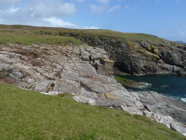
Bassie Sound is a body of water located in the Shetland Islands, an archipelago in Scotland, United Kingdom. It is situated between the islands of Mainland Shetland and the smaller island of Burra. Bassie Sound is classified as an estuary, as it is a semi-enclosed coastal body of water where freshwater from the surrounding land mixes with seawater from the North Sea.

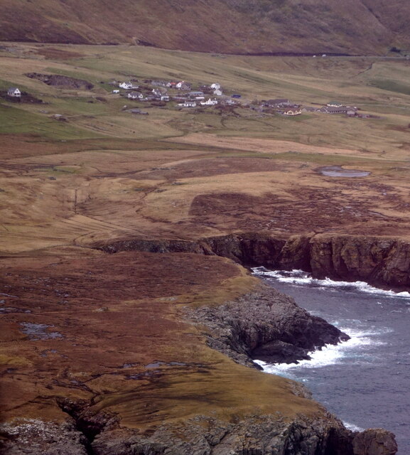
The estuary is approximately 3 miles wide at its widest point and stretches for about 6 miles in length. It is characterized by its calm and sheltered waters, making it a popular spot for a variety of recreational activities such as boating, fishing, and wildlife observation. The Sound is home to a diverse range of marine life, including various species of fish, seals, and seabirds.

The area surrounding Bassie Sound is known for its stunning natural beauty, with rolling hills, rocky coastlines, and picturesque beaches. The estuary itself is lined with rocky shores and sandy areas, providing habitat for numerous intertidal species. The water in Bassie Sound is generally clear and relatively shallow, with an average depth of around 15 meters.

The Sound plays an important role in the local economy, particularly in terms of fishing and aquaculture. It supports a number of fish farms, where species such as Atlantic salmon and mussels are cultivated. The calm waters and nutrient-rich environment contribute to the success of these operations.

Overall, Bassie Sound is a significant and scenic estuary in the Shetland Islands, providing a valuable habitat for marine life and offering a range of recreational opportunities for locals and visitors alike.

If you have any feedback on the listing, please let us know in the comments section below.
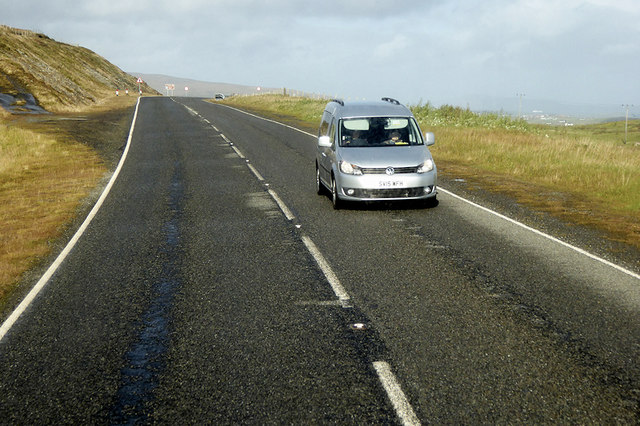
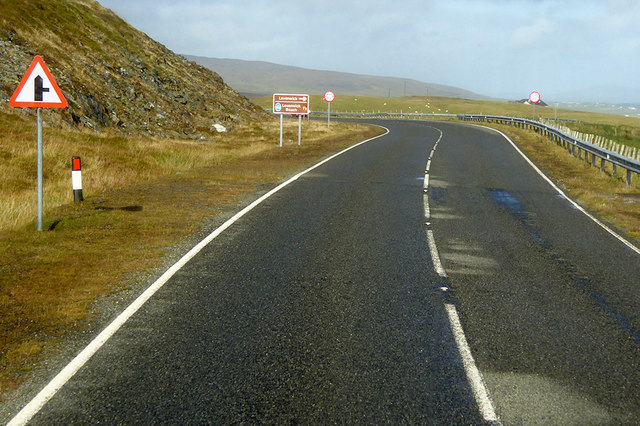
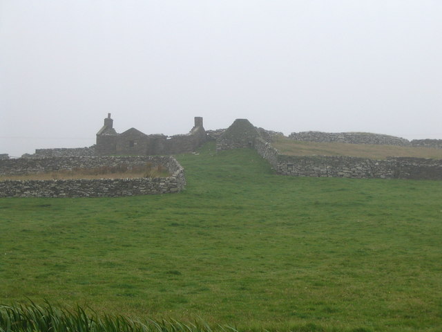
Bassie Sound Images

Images are sourced within 2km of 59.955223/-1.2519083 or Grid Reference HU4119. Thanks to Geograph Open Source API. All images are credited.

Peat extraction, Virdi Field
A970 near Southpunds The A970 runs for 71 miles across most of the length of the "Mainland" in the Shetland Islands. It is a good-quality single-carriageway road for most of its route. Travelling from south to north, the road begins at Grutness near Sumburgh Airport and winds around the many hills and inlets passing close to a number of small villages without going through any large ones before Lerwick. After looping around Lerwick, a short spur runs to Scalloway whilst the main route continues northwards towards Brae where it crosses the narrow isthmus of Mavis Grind. At Sandy Lochs the road splits and a four-mile spur goes through Urafirth to Hillswick. The main route continuing to the right towards its northern terminus at Isbister. This last part of the route tends to be narrower with passing places.

<span class="nowrap"><a title="https://www.sabre-roads.org.uk/wiki/index.php?title=A970" rel="nofollow ugc noopener" href="https://www.sabre-roads.org.uk/wiki/index.php?title=A970">Link</a><img style="margin-left:2px;" alt="External link" title="External link - shift click to open in new window" src="https://s1.geograph.org.uk/img/external.png" width="10" height="10"/></span>  SABRE
A970 near Southpunds
The A970 runs for 71 miles across most of the length of the "Mainland" in the Shetland Islands. It is a good-quality single-carriageway road for most of its route. Travelling from south to north, the road begins at Grutness near Sumburgh Airport and winds around the many hills and inlets passing close to a number of small villages without going through any large ones before Lerwick. After looping around Lerwick, a short spur runs to Scalloway whilst the main route continues northwards towards Brae where it crosses the narrow isthmus of Mavis Grind. At Sandy Lochs the road splits and a four-mile spur goes through Urafirth to Hillswick. The main route continuing to the right towards its northern terminus at Isbister. This last part of the route tends to be narrower with passing places. LinkExternal link SABRE
A970 Northwards The A970 runs for 71 miles across most of the length of the "Mainland" in the Shetland Islands. It is a good-quality single-carriageway road for most of its route. Travelling from south to north, the road begins at Grutness near Sumburgh Airport and winds around the many hills and inlets passing close to a number of small villages without going through any large ones before Lerwick. After looping around Lerwick, a short spur runs to Scalloway whilst the main route continues northwards towards Brae where it crosses the narrow isthmus of Mavis Grind. At Sandy Lochs the road splits and a four-mile spur goes through Urafirth to Hillswick. The main route continuing to the right towards its northern terminus at Isbister. This last part of the route tends to be narrower with passing places.

<span class="nowrap"><a title="https://www.sabre-roads.org.uk/wiki/index.php?title=A970" rel="nofollow ugc noopener" href="https://www.sabre-roads.org.uk/wiki/index.php?title=A970">Link</a><img style="margin-left:2px;" alt="External link" title="External link - shift click to open in new window" src="https://s1.geograph.org.uk/img/external.png" width="10" height="10"/></span>  SABRE
A970 Northwards
The A970 runs for 71 miles across most of the length of the "Mainland" in the Shetland Islands. It is a good-quality single-carriageway road for most of its route. Travelling from south to north, the road begins at Grutness near Sumburgh Airport and winds around the many hills and inlets passing close to a number of small villages without going through any large ones before Lerwick. After looping around Lerwick, a short spur runs to Scalloway whilst the main route continues northwards towards Brae where it crosses the narrow isthmus of Mavis Grind. At Sandy Lochs the road splits and a four-mile spur goes through Urafirth to Hillswick. The main route continuing to the right towards its northern terminus at Isbister. This last part of the route tends to be narrower with passing places. LinkExternal link SABRE
Levenwick Broch Broch with associated outbuildings and later wheelhouse. <span class="nowrap"><a title="https://canmore.org.uk/site/908/levenwick" rel="nofollow ugc noopener" href="https://canmore.org.uk/site/908/levenwick">Link</a><img style="margin-left:2px;" alt="External link" title="External link - shift click to open in new window" src="https://s1.geograph.org.uk/img/external.png" width="10" height="10"/></span>
Levenwick Broch
Broch with associated outbuildings and later wheelhouse. LinkExternal link
Ruined croft house and broch at Clumlie Stones from the ruined broch (on the right) were probably re-used in constructing the croft buildings
Ruined croft house and broch at Clumlie
Stones from the ruined broch (on the right) were probably re-used in constructing the croft buildings
Shetland ponies near Clothie, South Mainland The square is mainly rough grassland. The few scattered houses in it didn't seem to me more distinctive than the ponies!
Shetland ponies near Clothie, South Mainland
The square is mainly rough grassland. The few scattered houses in it didn't seem to me more distinctive than the ponies!
Peat hill, south of Levenwick Old peat-workings and mires on a hill south of Levenwick.
Peat hill, south of Levenwick
Old peat-workings and mires on a hill south of Levenwick.
Loch of Troswickness Looking to the NW
Loch of Troswickness
Looking to the NW
Quinni Geo, Levenwick, from the air
Gorgeous walk The descent from the high point of Lee Taing.
On the left is the Burn of Briegeo as it exits the square to tumble into the sea.
A whole series of picturesque geos resolve as one walks north along here.
The ground is soft, the going easy - the day was wonderful!
Gorgeous walk
The descent from the high point of Lee Taing. On the left is the Burn of Briegeo as it exits the square to tumble into the sea. A whole series of picturesque geos resolve as one walks north along here. The ground is soft, the going easy - the day was wonderful!
Cliff-top wall This short wall is marked clearly on the larger scale map.  It is a good navaid to anyone trying to get a precise location.
Possibly an old stock barrier to prevent animals from venturing onto Lee Taing.
Cliff-top wall
This short wall is marked clearly on the larger scale map. It is a good navaid to anyone trying to get a precise location. Possibly an old stock barrier to prevent animals from venturing onto Lee Taing.
Lee Taing The cliff edge south of Lee Taing.
The unnamed geo is hidden here but the pasture atop the taing invites a detour.
Lee Taing
The cliff edge south of Lee Taing. The unnamed geo is hidden here but the pasture atop the taing invites a detour.
Levenwick Broch Approaching the (shamefully unnamed) Broch one might think it simply a heap of stones in disarray.
But it is lovely example of the structure-type.
True, time and Nature have done much to reduce its height - it is also certain that much stone has been removed to produce the nearby, more modern yet derelict, walled structures. Nevertheless, it is possible to get inside to feel the shelter and protection for which it was built.
Simon Clarke says it all here - <span class="nowrap"><a title="https://www.megalithic.co.uk/article.php?sid=26619" rel="nofollow ugc noopener" href="https://www.megalithic.co.uk/article.php?sid=26619">Link</a><img style="margin-left:2px;" alt="External link" title="External link - shift click to open in new window" src="https://s1.geograph.org.uk/img/external.png" width="10" height="10"/></span>
Levenwick Broch
Approaching the (shamefully unnamed) Broch one might think it simply a heap of stones in disarray. But it is lovely example of the structure-type. True, time and Nature have done much to reduce its height - it is also certain that much stone has been removed to produce the nearby, more modern yet derelict, walled structures. Nevertheless, it is possible to get inside to feel the shelter and protection for which it was built. Simon Clarke says it all here - LinkExternal link
The Broch of Levenwick Inside the Broch it is still possible to feel the shelter and protection for which it was originally built.
A good precis here - 
<span class="nowrap"><a title="https://communities.uhi.ac.uk/sh01sc/weblog/3421.html" rel="nofollow ugc noopener" href="https://communities.uhi.ac.uk/sh01sc/weblog/3421.html">Link</a><img style="margin-left:2px;" alt="External link" title="External link - shift click to open in new window" src="https://s1.geograph.org.uk/img/external.png" width="10" height="10"/></span>
The Broch of Levenwick
Inside the Broch it is still possible to feel the shelter and protection for which it was originally built. A good precis here - LinkExternal link
Stock Control Wall At the bottom of this wall is a crossing point purposely built into the structure
Stock Control Wall
At the bottom of this wall is a crossing point purposely built into the structure
View of the day Looking north across along the coast on a bright September day
View of the day
Looking north across along the coast on a bright September day
Small enclosure One of a number of derelict walled enclosures hereabouts.
Probably originally for stock management.
The low walls now give vital shelter at lambing time.
Small enclosure
One of a number of derelict walled enclosures hereabouts. Probably originally for stock management. The low walls now give vital shelter at lambing time.
Show me another place!

Bassie Sound is located at Grid Ref: HU4119 (Lat: 59.955223, Lng: -1.2519083)

Unitary Authority: Shetland Islands

Police Authority: Highlands and Islands

What 3 Words

///hound.reminds.fencing. Near Sandwick, Shetland Islands

Related Wikis

Clumlie Broch

Clumlie Broch is an Iron Age broch located on Mainland, Shetland, in Scotland (grid reference HU40451811). == Location == Clumlie Broch is located in Dunrossness...

Levenwick

Levenwick is a small village about 17 miles (27 km) south of Lerwick, on the east side of the South Mainland of Shetland, Scotland. It is part of the parish...

Dunrossness

Dunrossness, (Old Norse: Dynrastarnes meaning "headland of the loud tide-race", referring to the noise of Sumburgh Roost) is the southernmost parish of...

Boddam, Shetland

Boddam is a village on the island of Mainland, in Shetland, Scotland. Boddam is an area of Dunrossness in the South Mainland of Shetland. Although Boddam...

Scousburgh

Scousburgh is a small community in the parish of Dunrossness, in the South Mainland of Shetland, Scotland, overlooking the picturesque Scousburgh Sand...

Bigton

Bigton is a small settlement on South Mainland, Shetland, UK. Bigton is within the civil parish of Dunrossness.Bigton lies on the Atlantic coast of the...

Hoswick

Hoswick is a settlement in Sandwick in the south mainland of Shetland, Scotland, on the eastern part of the Dunrossness civil parish. It is separated from...

Sandwick, Dunrossness

see also Sandwick, Whalsay and Sandwick, OrkneySandwick (Old Norse: Sandvik "Sandy Bay") is a village and an ancient parish in the Shetland Islands, Scotland...

Have you been to Bassie Sound?

Leave your review of Bassie Sound below (or comments, questions and feedback).