Hudson Dock Channel

Sea, Estuary, Creek in Durham

England

Hudson Dock Channel

Roker Pier Lighthouse, Sunderland The lighthouse at the pier head was completed in 1903. Its distinctive stripes are of naturally coloured red and white Aberdeen granite. When built it was said to be Britain's most powerful port lighthouse.

<span class="nowrap"><a title="https://en.wikipedia.org/wiki/Roker" rel="nofollow ugc noopener" href="https://en.wikipedia.org/wiki/Roker">Link</a><img style="margin-left:2px;" alt="External link" title="External link - shift click to open in new window" src="https://s1.geograph.org.uk/img/external.png" width="10" height="10"/></span>
Roker Pier Lighthouse, Sunderland Credit: Brian Deegan

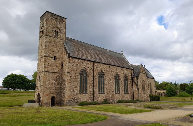
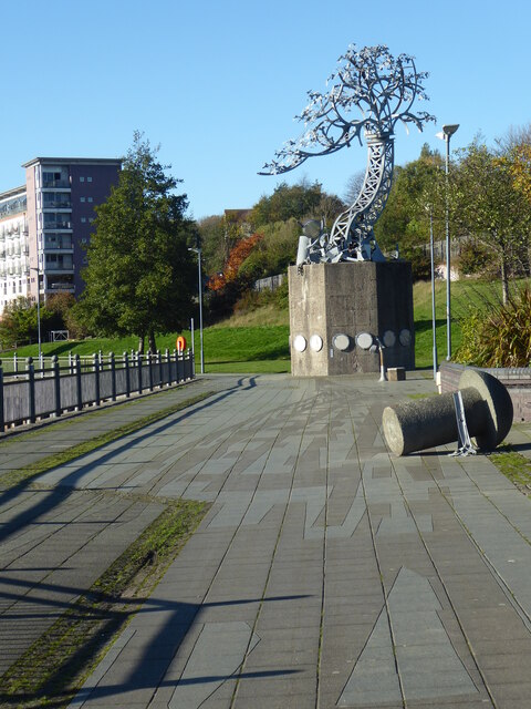
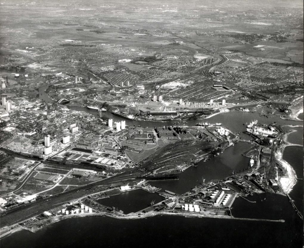
Hudson Dock Channel is a narrow waterway located in Durham, England. It is a man-made channel that connects the River Wear to the North Sea, allowing ships to access the port facilities in the area. The channel is surrounded by industrial buildings and warehouses, serving as a vital link for the transportation of goods to and from the port.

Hudson Dock Channel plays a crucial role in the economic development of the region, facilitating trade and commerce by providing a convenient route for ships to navigate through. The channel is also used by recreational boaters and fishermen, who can enjoy the scenic views of the surrounding area while out on the water.

The channel is subject to tidal influences due to its connection to the North Sea, with water levels rising and falling throughout the day. This can create challenging conditions for navigation, requiring skilled pilots to safely guide vessels through the channel.

Overall, Hudson Dock Channel is a bustling waterway that serves as a lifeline for the port of Durham, supporting both commercial and leisure activities in the area.

If you have any feedback on the listing, please let us know in the comments section below.

Hudson Dock Channel Images

Images are sourced within 2km of 54.905719/-1.3519798 or Grid Reference NZ4156. Thanks to Geograph Open Source API. All images are credited.

Roker Pier Lighthouse, Sunderland The lighthouse at the pier head was completed in 1903. Its distinctive stripes are of naturally coloured red and white Aberdeen granite. When built it was said to be Britain's most powerful port lighthouse.

<span class="nowrap"><a title="https://en.wikipedia.org/wiki/Roker" rel="nofollow ugc noopener" href="https://en.wikipedia.org/wiki/Roker">Link</a><img style="margin-left:2px;" alt="External link" title="External link - shift click to open in new window" src="https://s1.geograph.org.uk/img/external.png" width="10" height="10"/></span>
Roker Pier Lighthouse, Sunderland
The lighthouse at the pier head was completed in 1903. Its distinctive stripes are of naturally coloured red and white Aberdeen granite. When built it was said to be Britain's most powerful port lighthouse. LinkExternal link
Sunderland North Dock Marina
St Peter's Church, Monkwearmouth, Sunderland Grade I listed Church 

<span class="nowrap"><a title="https://en.wikipedia.org/wiki/St_Peter%27s_Church,_Monkwearmouth" rel="nofollow ugc noopener" href="https://en.wikipedia.org/wiki/St_Peter%27s_Church,_Monkwearmouth">Link</a><img style="margin-left:2px;" alt="External link" title="External link - shift click to open in new window" src="https://s1.geograph.org.uk/img/external.png" width="10" height="10"/></span>
St Peter's Church, Monkwearmouth, Sunderland
Grade I listed Church LinkExternal link
St Peter's Church in the parish of Monkwearmouth St Peter's Church, Monkwearmouth is the parish church of Monkwearmouth in Sunderland, Tyne and Wear, England. It is one of three churches in the Parish of Monkwearmouth. The others are the Victorian All Saints' Church, Monkwearmouth and the Edwardian St Andrew's Church, Roker.

St Peter's was founded in AD 674–5 as one of the two churches of the Benedictine double monastery of Monkwearmouth–Jarrow Abbey. The other church is St Paul's Church, Jarrow. St Peter's is a Grade I listed building and part of a scheduled monument.
St Peter's Church in the parish of Monkwearmouth
St Peter's Church, Monkwearmouth is the parish church of Monkwearmouth in Sunderland, Tyne and Wear, England. It is one of three churches in the Parish of Monkwearmouth. The others are the Victorian All Saints' Church, Monkwearmouth and the Edwardian St Andrew's Church, Roker. St Peter's was founded in AD 674–5 as one of the two churches of the Benedictine double monastery of Monkwearmouth–Jarrow Abbey. The other church is St Paul's Church, Jarrow. St Peter's is a Grade I listed building and part of a scheduled monument.
Beach south of Roker Pier Looking across the beach between Roker Pier and North Pier.
Beach south of Roker Pier
Looking across the beach between Roker Pier and North Pier.
Pier at Roker Looking along the northern breakwater at the mouth of the River Wear.
Pier at Roker
Looking along the northern breakwater at the mouth of the River Wear.
Roker pier and lighthouse Looking along the northern breakwater at the mouth of the River Wear.
Roker pier and lighthouse
Looking along the northern breakwater at the mouth of the River Wear.
Mouth of the Wear Looking across the inside of the breakwaters where the River Wear enters the sea.
Mouth of the Wear
Looking across the inside of the breakwaters where the River Wear enters the sea.
Beach between Roker Pier and North Pier Looking across the little bay inside the breakwaters.
Beach between Roker Pier and North Pier
Looking across the little bay inside the breakwaters.
Mouth of the Wear Looking across the River Wear as it enters the sea at Sunderland harbour.
Mouth of the Wear
Looking across the River Wear as it enters the sea at Sunderland harbour.
North bank of the Wear Looking inland along the River Wear in Sunderland.
North bank of the Wear
Looking inland along the River Wear in Sunderland.
North Dock Basin Looking towards boats moored on the north side of the Wear.
North Dock Basin
Looking towards boats moored on the north side of the Wear.
Boats in North Dock Basin Looking towards boats moored on the north side of the Wear.
Boats in North Dock Basin
Looking towards boats moored on the north side of the Wear.
"Shadows in another light" Dating from 1998, one of the sculptures forming part of the St Peter's Riverside Sculpture Project. The base is actually the original base of a riverside crane. Sometimes alternatively known as "The Iron Tree". To the east, the supposed shadow of the original crane is picked out in the paving slabs along the riverside path. The University of Sunderland Library can be seen in the distance.
"Shadows in another light"
Dating from 1998, one of the sculptures forming part of the St Peter's Riverside Sculpture Project. The base is actually the original base of a riverside crane. Sometimes alternatively known as "The Iron Tree". To the east, the supposed shadow of the original crane is picked out in the paving slabs along the riverside path. The University of Sunderland Library can be seen in the distance.
"Shadows in another light" Dating from 1998, one of the sculptures forming part of the St Peter's Riverside Sculpture Project. The base is actually the original base of a riverside crane. Sometimes alternatively known as "The Iron Tree". To the east, the supposed shadow of the original crane is picked out in the paving slabs along the riverside path.
"Shadows in another light"
Dating from 1998, one of the sculptures forming part of the St Peter's Riverside Sculpture Project. The base is actually the original base of a riverside crane. Sometimes alternatively known as "The Iron Tree". To the east, the supposed shadow of the original crane is picked out in the paving slabs along the riverside path.
Shadow on St Peter's Riverside path The supposed shadow of a crane is picked out in the paving slabs along the riverside path. The University of Sunderland Library can be seen in the distance. See also <a href="https://www.geograph.org.uk/photo/7333203">NZ4057 : "Shadows in another light"</a>.
Shadow on St Peter's Riverside path
The supposed shadow of a crane is picked out in the paving slabs along the riverside path. The University of Sunderland Library can be seen in the distance. See also NZ4057 : "Shadows in another light".
Sculpture and "shadow" on St Peter's Riverside The supposed shadow of a crane (originally standing on the concrete base of the sculpture) is picked out in the paving slabs along the riverside path. A concrete "rivet" can also be seen, commemorating the days of shipbuilding.  See also <a href="https://www.geograph.org.uk/photo/7333203">NZ4057 : "Shadows in another light"</a>.
Sculpture and "shadow" on St Peter's Riverside
The supposed shadow of a crane (originally standing on the concrete base of the sculpture) is picked out in the paving slabs along the riverside path. A concrete "rivet" can also be seen, commemorating the days of shipbuilding. See also NZ4057 : "Shadows in another light".
Shadow beside St Peter's Riverside The actual shadow of the "Shadows in another light" sculpture. See also <a href="https://www.geograph.org.uk/photo/7333246">NZ4057 : Sculpture and "shadow" on St Peter's Riverside</a>.
Shadow beside St Peter's Riverside
The actual shadow of the "Shadows in another light" sculpture. See also NZ4057 : Sculpture and "shadow" on St Peter's Riverside.
Show me another place!

Hudson Dock Channel is located at Grid Ref: NZ4156 (Lat: 54.905719, Lng: -1.3519798)

Unitary Authority: Sunderland

Police Authority: Northumbria

What 3 Words

///risks.roofs.solo. Near Sunderland, Tyne & Wear

Related Wikis

Hendon Dock Junction Bridge

Hendon Dock Junction Bridge was a bridge within Sunderland Docks, England. It was unique for being made of aluminium, rather than the more usual steel...

Sunderland Docks

Sunderland Docks is an area of Sunderland, Tyne and Wear, England. Home to the Port of Sunderland, the docks have access to the North Sea. Sunderland City...

Town Moor, Sunderland

The Town Moor is a large common land located in the East End of Sunderland, otherwise known as Hendon. First established as a public common in 1718 alongside...

Sunderland Orphan Asylum

Sunderland Orphan Asylum was opened in 1861 following the Sunderland Orphan Asylum Act of 1852 and stands on the edge of Town Moor in Sunderland, Tyne...

Nearby Amenities

Located within 500m of 54.905719,-1.3519798
Created By: almien_coastlines
Source: PGS
Lat/Long: 54.9028119/-1.3567842
Source: PGS
Lat/Long: 54.903043/-1.3562869
Source: PGS
Lat/Long: 54.903142/-1.3561413
Source: PGS
Lat/Long: 54.9052384/-1.3516696
Source: PGS
Lat/Long: 54.9096481/-1.3539069
Source: Landsat photo
Lat/Long: 54.9085779/-1.3578746
Source: Landsat photo
Lat/Long: 54.9082549/-1.3579458
Source: Landsat photo
Lat/Long: 54.90715/-1.3580807
Source: Landsat photo
Lat/Long: 54.9064857/-1.3584707
Source: Landsat photo
Lat/Long: 54.9044057/-1.3583122
The data included in this document is from www.openstreetmap.org. The data is made available under ODbL.

Have you been to Hudson Dock Channel?

Leave your review of Hudson Dock Channel below (or comments, questions and feedback).