East Voe of Scalloway

Sea, Estuary, Creek in Shetland

Scotland

East Voe of Scalloway

Trondra bridge from the air
Trondra bridge from the air Credit: Mike Pennington

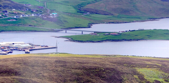
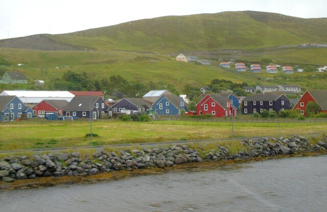
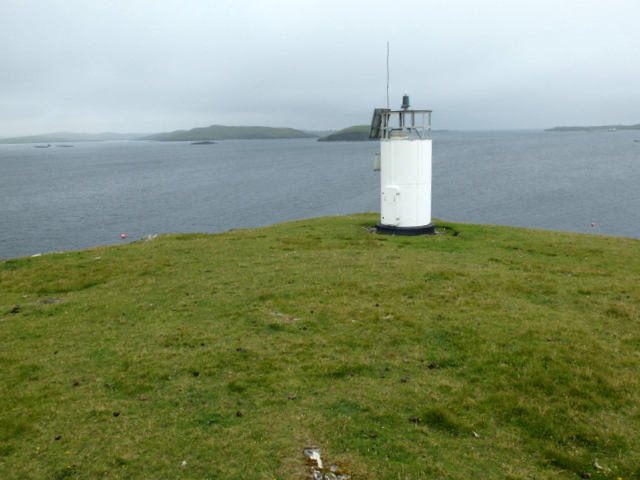
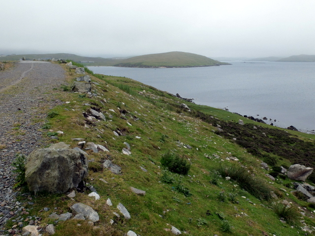
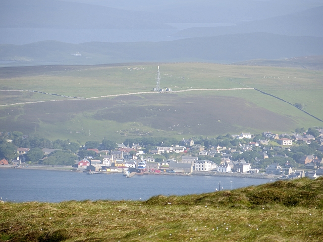
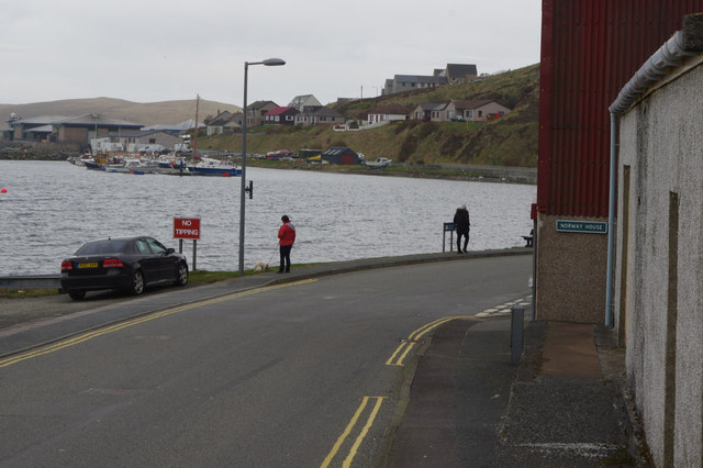
East Voe of Scalloway is a picturesque sea inlet located on the west coast of the Shetland Mainland in Scotland. It stretches approximately 1.5 kilometers inland, forming a narrow and winding estuary that terminates at the village of Scalloway. The voe, which is a Scottish term for a sea inlet, offers breathtaking views of the surrounding rugged hills and cliffs, making it a popular destination for nature enthusiasts and photographers.

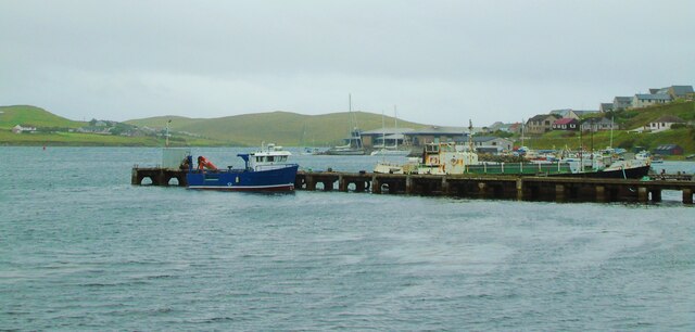
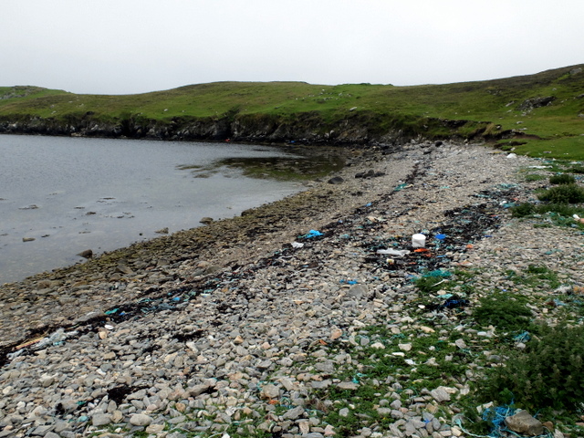
The East Voe of Scalloway is known for its tranquil and clear waters, which are teeming with marine life. The inlet is home to a diverse range of species, including seals, otters, and various seabirds, making it a haven for wildlife enthusiasts. The voe also provides an important habitat for several fish species, such as herring and mackerel, attracting both recreational and commercial fishermen.

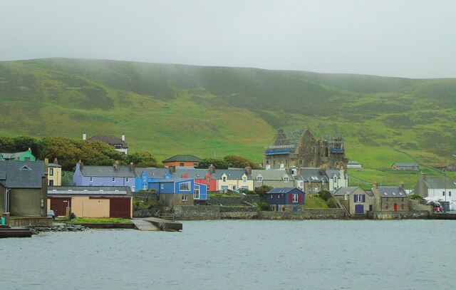
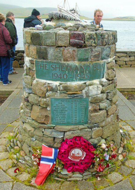
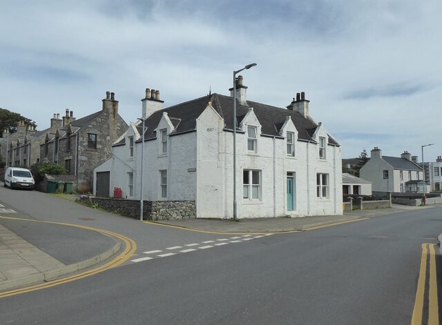
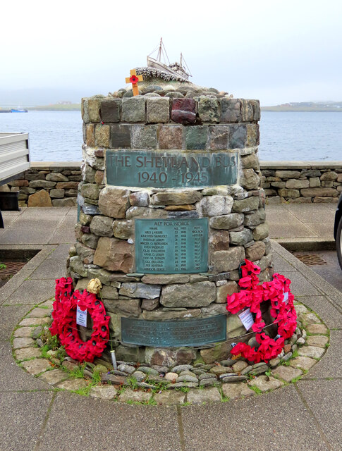
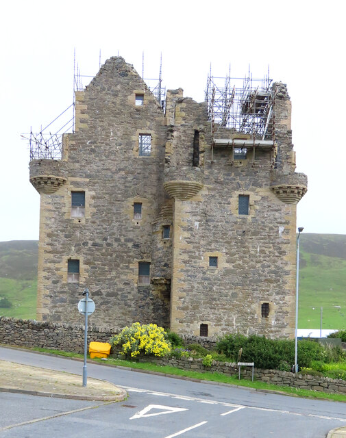
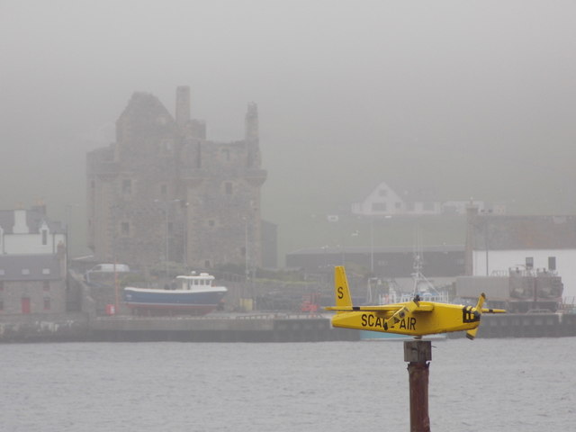
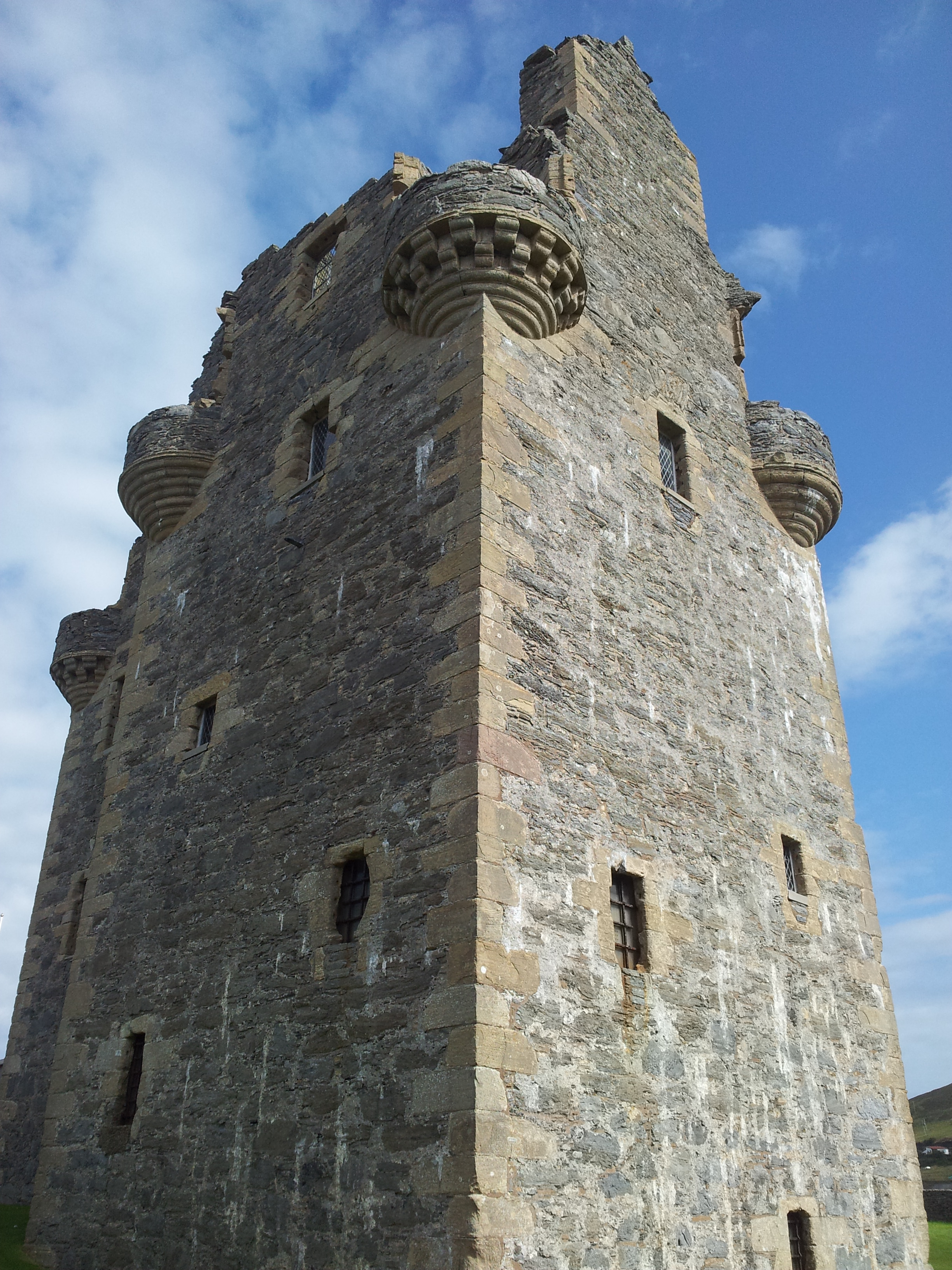
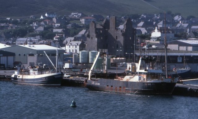
The area surrounding the East Voe of Scalloway is steeped in history. Just off the coast, visitors can catch a glimpse of the ruins of Scalloway Castle, a 17th-century fortified tower that served as the residence of the infamous Earl Patrick Stewart. The voe was also a strategic location during World War II, with remnants of military structures still visible today.

In addition to its natural beauty and historical significance, the East Voe of Scalloway offers a range of recreational activities. Visitors can enjoy boating, kayaking, and sailing on the calm waters, or explore the numerous walking trails that follow the coastline. The voe also hosts an annual regatta, attracting sailing enthusiasts from across the region.

Overall, the East Voe of Scalloway is a captivating destination that showcases the stunning natural landscape and rich cultural heritage of the Shetland Islands.

If you have any feedback on the listing, please let us know in the comments section below.

East Voe of Scalloway Images

Images are sourced within 2km of 60.131616/-1.2717955 or Grid Reference HU4038. Thanks to Geograph Open Source API. All images are credited.

Trondra bridge from the air
Scalloway Piers Taken at the viewing area beside the Shetland Bus Memorial, Scalloway, Shetland, I am looking southwest across Scalloway Harbour to the piers and the marina beyond. The islets and settlements of Trondra can be seen on the other side of the Voe.
Scalloway Piers
Taken at the viewing area beside the Shetland Bus Memorial, Scalloway, Shetland, I am looking southwest across Scalloway Harbour to the piers and the marina beyond. The islets and settlements of Trondra can be seen on the other side of the Voe.
Scalloway Castle Taken on the viewing point beside the Shetland Bus Memorial, Scalloway, Shetland, I am looking across the eastern side of the harbour to Scalloway Castle which at the time of my visit was undergoing repairs.
Scalloway Castle
Taken on the viewing point beside the Shetland Bus Memorial, Scalloway, Shetland, I am looking across the eastern side of the harbour to Scalloway Castle which at the time of my visit was undergoing repairs.
Shetland Bus Memorial This is the memorial to what became known as the Shetland Bus, a special operation which ran between Shetland and occupied Norway from 1941 until the surrender of Nazi Germany in 1945. The purpose was to transport arms and other supplies to the Norwegian resistance and fishing boats were used as cover with crossings being made under cover of darkness however stormy the weather. The nearby Scalloway Museum has an excellent exhibit detailing the operations and the people involved.
Shetland Bus Memorial
This is the memorial to what became known as the Shetland Bus, a special operation which ran between Shetland and occupied Norway from 1941 until the surrender of Nazi Germany in 1945. The purpose was to transport arms and other supplies to the Norwegian resistance and fishing boats were used as cover with crossings being made under cover of darkness however stormy the weather. The nearby Scalloway Museum has an excellent exhibit detailing the operations and the people involved.
East Voe, Scalloway This was taken from our coach as we were leaving Scalloway, Shetland. I was charmed by the Scandinavian appearance of these houses in East Voe.
East Voe, Scalloway
This was taken from our coach as we were leaving Scalloway, Shetland. I was charmed by the Scandinavian appearance of these houses in East Voe.
House on the corner of Kirkpark and Main Street Dated 1887.
House on the corner of Kirkpark and Main Street
Dated 1887.
Road blocks During World War II, these road blocks were kept by the road in to the village, intended to be rolled into position in case of invasion. Now sited outside Scalloway Museum.
Road blocks
During World War II, these road blocks were kept by the road in to the village, intended to be rolled into position in case of invasion. Now sited outside Scalloway Museum.
Scalloway Museum In the window, the flags of Shetland and Norway. Shetland retains a very strong affinity with Norway. The Museum was opened in 2012 by Jens Stoltenberg, then Prime Minister of Norway, now head of NATO.
Scalloway Museum
In the window, the flags of Shetland and Norway. Shetland retains a very strong affinity with Norway. The Museum was opened in 2012 by Jens Stoltenberg, then Prime Minister of Norway, now head of NATO.
Memorial to the Shetland Bus This is the memorial to the bravery of the men who sailed what became known as the Shetland Bus between occupied Norway and Shetland during WW2. The full story can be learned at the nearby Scalloway Museum - <span class="nowrap"><a title="https://www.scallowaymuseum.org/the-shetland-bus.html" rel="nofollow ugc noopener" href="https://www.scallowaymuseum.org/the-shetland-bus.html">Link</a><img style="margin-left:2px;" alt="External link" title="External link - shift click to open in new window" src="https://s1.geograph.org.uk/img/external.png" width="10" height="10"/></span>
Memorial to the Shetland Bus
This is the memorial to the bravery of the men who sailed what became known as the Shetland Bus between occupied Norway and Shetland during WW2. The full story can be learned at the nearby Scalloway Museum - LinkExternal link
Scalloway Castle Scalloway Castle, Scalloway, Shetland, once home to the infamous Earl Patrick Stewart (see <span class="nowrap"><a title="https://www.historicenvironment.scot/visit-a-place/places/scalloway-castle/history/" rel="nofollow ugc noopener" href="https://www.historicenvironment.scot/visit-a-place/places/scalloway-castle/history/">Link</a><img style="margin-left:2px;" alt="External link" title="External link - shift click to open in new window" src="https://s1.geograph.org.uk/img/external.png" width="10" height="10"/></span> )
Scalloway Castle
Scalloway Castle, Scalloway, Shetland, once home to the infamous Earl Patrick Stewart (see LinkExternal link )
Scalloway: postbox № ZE2 16 Looking along the main road just as it has passed through the main part of Scalloway, past this George V-reign postbox which is emptied at 10:15am on weekdays and Saturdays.
Scalloway: postbox № ZE2 16
Looking along the main road just as it has passed through the main part of Scalloway, past this George V-reign postbox which is emptied at 10:15am on weekdays and Saturdays.
Trondra: postbox № ZE2 55 The postbox serving Trondra stands alongside a bus shelter by a road junction towards the northeast of the island. We are looking along the B9074 back towards Scalloway on the Shetland mainland.
Trondra: postbox № ZE2 55
The postbox serving Trondra stands alongside a bus shelter by a road junction towards the northeast of the island. We are looking along the B9074 back towards Scalloway on the Shetland mainland.
Light at Point of Pund A navigational light at the entrance to Scalloway Voe.
Light at Point of Pund
A navigational light at the entrance to Scalloway Voe.
Beach at the head of Pund Voe Plenty of maritime debris is washed up onto the beach.
Beach at the head of Pund Voe
Plenty of maritime debris is washed up onto the beach.
Maa Ness A small promontory on the north side of the entry to Scalloway.
Maa Ness
A small promontory on the north side of the entry to Scalloway.
Scalloway: model plane at the harbour A model plane set on top of an otherwise unused post along the western side of the harbour. The castle is visible somewhat mistily in the background.
Scalloway: model plane at the harbour
A model plane set on top of an otherwise unused post along the western side of the harbour. The castle is visible somewhat mistily in the background.
Scalloway View from Scrae Field.
Scalloway
View from Scrae Field.
Port Arthur Road, Scalloway Scalloway's Main Street turns into Port Arthur Road as it comes adjacent to the waterfront. Straight ahead is Norway House which was used to house Norwegians during World War II engaged in the operation of the 'Shetland Bus' which supplied Norway's resistance.
Port Arthur Road, Scalloway
Scalloway's Main Street turns into Port Arthur Road as it comes adjacent to the waterfront. Straight ahead is Norway House which was used to house Norwegians during World War II engaged in the operation of the 'Shetland Bus' which supplied Norway's resistance.
Show me another place!

East Voe of Scalloway is located at Grid Ref: HU4038 (Lat: 60.131616, Lng: -1.2717955)

Unitary Authority: Shetland Islands

Police Authority: Highlands and Islands

What 3 Words

///debating.motivates.hears. Near Scalloway, Shetland Islands

Related Wikis

Cutts, Shetland

Cutts is a settlement in the Shetland Islands, United Kingdom. It is on the island of Trondra off the west coast of Shetland Mainland. The B9074 crosses...
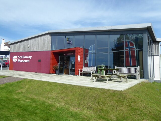
Scalloway Museum

Scalloway Museum is a local museum in Scalloway, Shetland. The museum has collections that cover the history of the Shetland Islands as well as historical...

Scalloway Castle

Scalloway Castle is a tower house in Scalloway, on the Shetland Mainland, the largest island in the Shetland Islands of Scotland. The tower was built in...

Scalloway

Scalloway (Old Norse: Skálavágr, "bay with the large house(s)") is the largest settlement on the west coast of the Mainland, the largest island of the...

Trondra

Trondra (Scots: Trondra) is one of the Scalloway Islands, a subgroup of the Shetland Islands in Scotland. It shelters the harbour of Scalloway and has...

Green Holm

Green Holm, (HU382379), is a small uninhabited island 500 metres north of Burra Ness at the north end of the island of Burra and on the west side of the...

Burwick Holm

Burwick Holm is a small island off the west coast of Mainland, Shetland. It is located in the Bur Wick inlet, and near Scalloway.

Burwick

Burwick is a small peninsula north of Scalloway in the Shetland Islands, Scotland. The Hill of Burwick rises to 107 metres (351 ft), the Ness of Burwick...

Nearby Amenities

Located within 500m of 60.131616,-1.2717955
Power: pole
Source: bing
Lat/Long: 60.1328843/-1.2667368
Power: pole
Source: bing
Lat/Long: 60.133499/-1.2664452
Power: pole
Source: bing
Lat/Long: 60.1344162/-1.2660172
Power: pole
Source: bing
Lat/Long: 60.1337272/-1.2663368
Power: pole
Source: bing
Lat/Long: 60.1321682/-1.2670792
Power: pole
Source: bing
Lat/Long: 60.1314246/-1.2674253
Give Way
Direction: backward
Lat/Long: 60.129013/-1.2748303
Give Way
Direction: forward
Lat/Long: 60.1292257/-1.2704488
Parking
Lat/Long: 60.1356962/-1.2746258
Barrier: cattle_grid
Lat/Long: 60.1301605/-1.2757947
Barrier: cattle_grid
Lat/Long: 60.1287468/-1.2679814
Man Made: silo
Lat/Long: 60.1335951/-1.2751483
Man Made: silo
Lat/Long: 60.1335791/-1.2750008
Man Made: silo
Lat/Long: 60.1336472/-1.2750195
Fast Food
Hai Yang
Addr City: Shetland
Addr Housenumber: 2
Addr Postcode: ZE1 0TQ
Addr Street: New Street
Addr Suburb: Scalloway
Cuisine: chinese
Fhrs Id: 408841
Lat/Long: 60.1358016/-1.274762
Barrier: cattle_grid
Lat/Long: 60.12899/-1.2756995
East Voe
Place: hamlet
Lat/Long: 60.1303592/-1.2658236
Blackness Quay
Place: locality
Lat/Long: 60.1337947/-1.2756512
Marker: cable
Lat/Long: 60.1301775/-1.2739628
Barrier: cattle_grid
Lat/Long: 60.1300786/-1.2766267
Power: pole
Lat/Long: 60.1293721/-1.2683576
Power: pole
Lat/Long: 60.1297741/-1.2682879
Power: pole
Lat/Long: 60.1304033/-1.2681672
Power: pole
Lat/Long: 60.1288404/-1.2779841
Power: pole
Lat/Long: 60.1293079/-1.2771016
Power: pole
Lat/Long: 60.1320543/-1.2679204
Power: pole
Lat/Long: 60.1316443/-1.2679553
Power: pole
Lat/Long: 60.1311634/-1.2680411
Power: pole
Lat/Long: 60.1307346/-1.2686875
Power: pole
Lat/Long: 60.1298583/-1.2749492
Power: pole
Lat/Long: 60.1295905/-1.275963
Power: pole
Lat/Long: 60.1302891/-1.2693393
Marker: cable
Lat/Long: 60.1298262/-1.2700675
Location Transition: yes
Power: pole
Lat/Long: 60.1298469/-1.2700179
Location Transition: yes
Power: pole
Lat/Long: 60.1301348/-1.27395
The data included in this document is from www.openstreetmap.org. The data is made available under ODbL.

Have you been to East Voe of Scalloway?

Leave your review of East Voe of Scalloway below (or comments, questions and feedback).