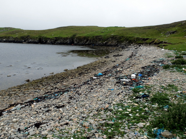
South Ayre

Beach in Shetland

Scotland

South Ayre

Trondra bridge from the air
Trondra bridge from the air Credit: Mike Pennington

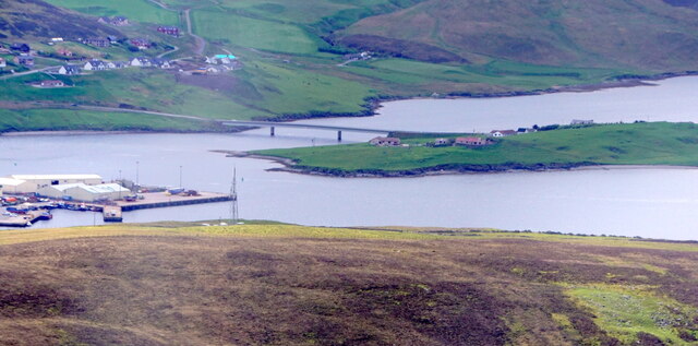
South Ayre is a picturesque beach located in the southern part of Ayre, a small coastal settlement in Shetland, Scotland. With its stunning natural beauty and tranquil atmosphere, it is a popular destination for both locals and tourists alike.

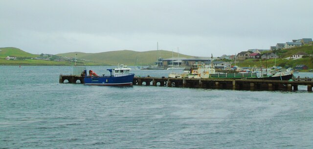
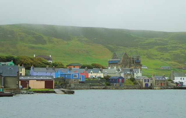
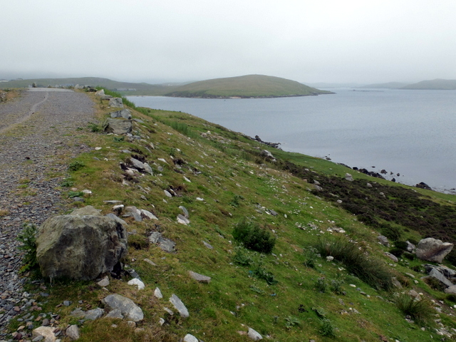
Stretching along the southern coastline of Shetland, South Ayre offers a long stretch of golden sands, crystal-clear waters, and breathtaking views of the North Sea. The beach is relatively secluded, providing visitors with a sense of tranquility and peacefulness. The surrounding cliffs and dunes add to the charm of the area, creating a picturesque backdrop for nature enthusiasts and photographers.

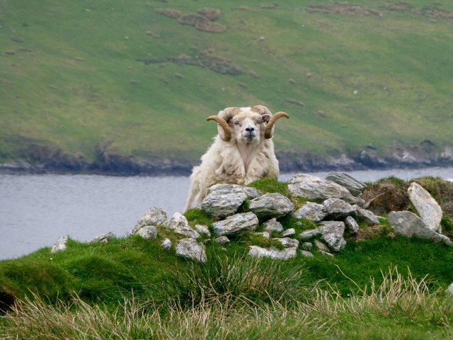
South Ayre is known for its rich wildlife and diverse bird population. It serves as an important breeding ground for various seabirds, including terns and gulls, making it a haven for birdwatchers. Visitors can often spot otters playing in the rock pools or seals basking on the nearby skerries.

The beach is easily accessible by car, with parking available nearby. It is a great spot for a leisurely stroll, a picnic, or simply relaxing while enjoying the stunning coastal scenery. However, caution is advised when swimming due to the strong currents and tides in the area.

South Ayre is also a starting point for various coastal walks, including the popular Ayre circular walk. Nature lovers can explore the surrounding countryside, taking in the rugged cliffs, rolling hills, and stunning coastal views.

Overall, South Ayre in Shetland is a hidden gem, offering a peaceful and scenic beach experience for those seeking solace in nature's beauty.

If you have any feedback on the listing, please let us know in the comments section below.
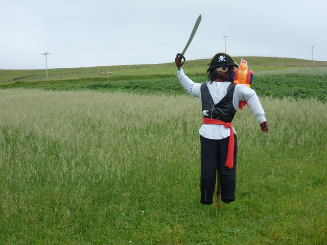
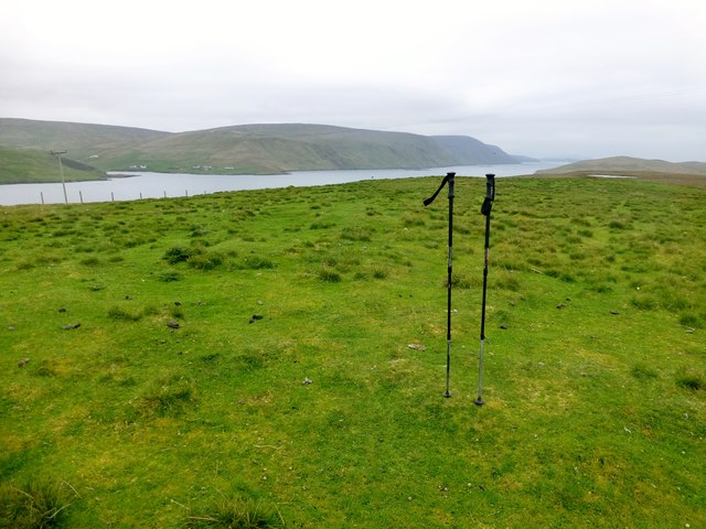
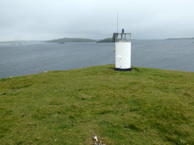
South Ayre Images

Images are sourced within 2km of 60.125742/-1.2813196 or Grid Reference HU4038. Thanks to Geograph Open Source API. All images are credited.

Trondra bridge from the air
Scalloway Piers Taken at the viewing area beside the Shetland Bus Memorial, Scalloway, Shetland, I am looking southwest across Scalloway Harbour to the piers and the marina beyond. The islets and settlements of Trondra can be seen on the other side of the Voe.
Scalloway Piers
Taken at the viewing area beside the Shetland Bus Memorial, Scalloway, Shetland, I am looking southwest across Scalloway Harbour to the piers and the marina beyond. The islets and settlements of Trondra can be seen on the other side of the Voe.
Scalloway Castle Taken on the viewing point beside the Shetland Bus Memorial, Scalloway, Shetland, I am looking across the eastern side of the harbour to Scalloway Castle which at the time of my visit was undergoing repairs.
Scalloway Castle
Taken on the viewing point beside the Shetland Bus Memorial, Scalloway, Shetland, I am looking across the eastern side of the harbour to Scalloway Castle which at the time of my visit was undergoing repairs.
Shetland Bus Memorial This is the memorial to what became known as the Shetland Bus, a special operation which ran between Shetland and occupied Norway from 1941 until the surrender of Nazi Germany in 1945. The purpose was to transport arms and other supplies to the Norwegian resistance and fishing boats were used as cover with crossings being made under cover of darkness however stormy the weather. The nearby Scalloway Museum has an excellent exhibit detailing the operations and the people involved.
Shetland Bus Memorial
This is the memorial to what became known as the Shetland Bus, a special operation which ran between Shetland and occupied Norway from 1941 until the surrender of Nazi Germany in 1945. The purpose was to transport arms and other supplies to the Norwegian resistance and fishing boats were used as cover with crossings being made under cover of darkness however stormy the weather. The nearby Scalloway Museum has an excellent exhibit detailing the operations and the people involved.
East Voe, Scalloway This was taken from our coach as we were leaving Scalloway, Shetland. I was charmed by the Scandinavian appearance of these houses in East Voe.
East Voe, Scalloway
This was taken from our coach as we were leaving Scalloway, Shetland. I was charmed by the Scandinavian appearance of these houses in East Voe.
House on the corner of Kirkpark and Main Street Dated 1887.
House on the corner of Kirkpark and Main Street
Dated 1887.
Road blocks During World War II, these road blocks were kept by the road in to the village, intended to be rolled into position in case of invasion. Now sited outside Scalloway Museum.
Road blocks
During World War II, these road blocks were kept by the road in to the village, intended to be rolled into position in case of invasion. Now sited outside Scalloway Museum.
Scalloway Museum In the window, the flags of Shetland and Norway. Shetland retains a very strong affinity with Norway. The Museum was opened in 2012 by Jens Stoltenberg, then Prime Minister of Norway, now head of NATO.
Scalloway Museum
In the window, the flags of Shetland and Norway. Shetland retains a very strong affinity with Norway. The Museum was opened in 2012 by Jens Stoltenberg, then Prime Minister of Norway, now head of NATO.
Memorial to the Shetland Bus This is the memorial to the bravery of the men who sailed what became known as the Shetland Bus between occupied Norway and Shetland during WW2. The full story can be learned at the nearby Scalloway Museum - <span class="nowrap"><a title="https://www.scallowaymuseum.org/the-shetland-bus.html" rel="nofollow ugc noopener" href="https://www.scallowaymuseum.org/the-shetland-bus.html">Link</a><img style="margin-left:2px;" alt="External link" title="External link - shift click to open in new window" src="https://s1.geograph.org.uk/img/external.png" width="10" height="10"/></span>
Memorial to the Shetland Bus
This is the memorial to the bravery of the men who sailed what became known as the Shetland Bus between occupied Norway and Shetland during WW2. The full story can be learned at the nearby Scalloway Museum - LinkExternal link
Scalloway Castle Scalloway Castle, Scalloway, Shetland, once home to the infamous Earl Patrick Stewart (see <span class="nowrap"><a title="https://www.historicenvironment.scot/visit-a-place/places/scalloway-castle/history/" rel="nofollow ugc noopener" href="https://www.historicenvironment.scot/visit-a-place/places/scalloway-castle/history/">Link</a><img style="margin-left:2px;" alt="External link" title="External link - shift click to open in new window" src="https://s1.geograph.org.uk/img/external.png" width="10" height="10"/></span> )
Scalloway Castle
Scalloway Castle, Scalloway, Shetland, once home to the infamous Earl Patrick Stewart (see LinkExternal link )
Scalloway: postbox № ZE2 16 Looking along the main road just as it has passed through the main part of Scalloway, past this George V-reign postbox which is emptied at 10:15am on weekdays and Saturdays.
Scalloway: postbox № ZE2 16
Looking along the main road just as it has passed through the main part of Scalloway, past this George V-reign postbox which is emptied at 10:15am on weekdays and Saturdays.
Trondra: postbox № ZE2 55 The postbox serving Trondra stands alongside a bus shelter by a road junction towards the northeast of the island. We are looking along the B9074 back towards Scalloway on the Shetland mainland.
Trondra: postbox № ZE2 55
The postbox serving Trondra stands alongside a bus shelter by a road junction towards the northeast of the island. We are looking along the B9074 back towards Scalloway on the Shetland mainland.
Trondra: pirate scarecrow An unusual scarecrow in a field alongside the B9074.
Trondra: pirate scarecrow
An unusual scarecrow in a field alongside the B9074.
Trondra, Island High Point Bagged with Tricky Speirs.
Name:Trondra
Hill number: 104032
Height: 61m / 200ft
Area:22: Shetland Islands
Class: 0
Grid ref: HU395363 (est)
Drop: 61m
Col: Sea
Trondra, Island High Point
Bagged with Tricky Speirs. Name:Trondra Hill number: 104032 Height: 61m / 200ft Area:22: Shetland Islands Class: 0 Grid ref: HU395363 (est) Drop: 61m Col: Sea
Shetland Ram This was as close as I got to this nervous Shetland ram grazing in the field that contain the island high point of Tronda.
Shetland Ram
This was as close as I got to this nervous Shetland ram grazing in the field that contain the island high point of Tronda.
Light at Point of Pund A navigational light at the entrance to Scalloway Voe.
Light at Point of Pund
A navigational light at the entrance to Scalloway Voe.
Beach at the head of Pund Voe Plenty of maritime debris is washed up onto the beach.
Beach at the head of Pund Voe
Plenty of maritime debris is washed up onto the beach.
Maa Ness A small promontory on the north side of the entry to Scalloway.
Maa Ness
A small promontory on the north side of the entry to Scalloway.
Show me another place!

South Ayre is located at Grid Ref: HU4038 (Lat: 60.125742, Lng: -1.2813196)

Unitary Authority: Shetland Islands

Police Authority: Highlands and Islands

What 3 Words

///live.rural.worlds. Near Scalloway, Shetland Islands

Related Wikis

Cutts, Shetland

Cutts is a settlement in the Shetland Islands, United Kingdom. It is on the island of Trondra off the west coast of Shetland Mainland. The B9074 crosses...

Trondra

Trondra (Scots: Trondra) is one of the Scalloway Islands, a subgroup of the Shetland Islands in Scotland. It shelters the harbour of Scalloway and has...
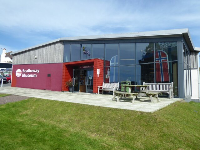
Scalloway Museum

Scalloway Museum is a local museum in Scalloway, Shetland. The museum has collections that cover the history of the Shetland Islands as well as historical...
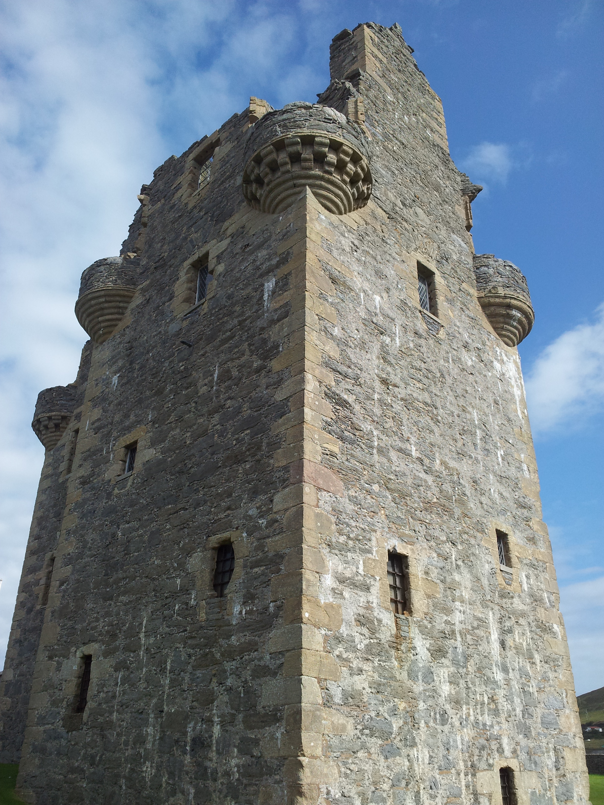
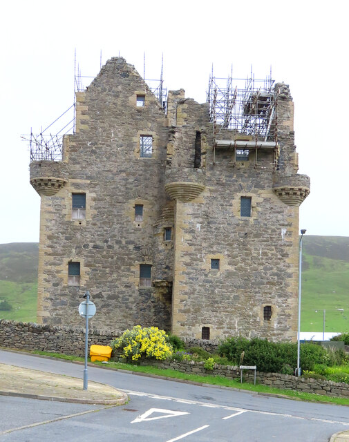
Scalloway Castle

Scalloway Castle is a tower house in Scalloway, on the Shetland Mainland, the largest island in the Shetland Islands of Scotland. The tower was built in...
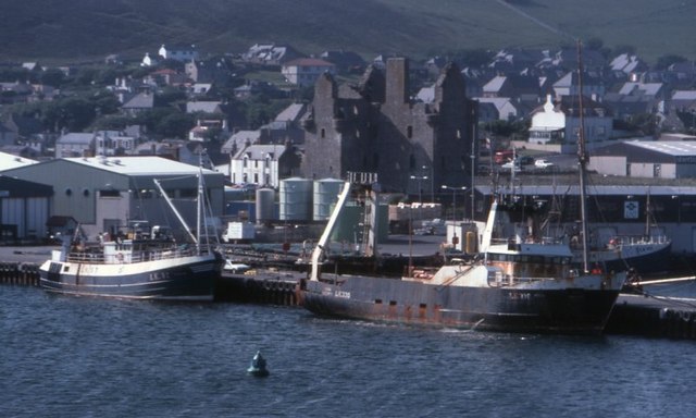
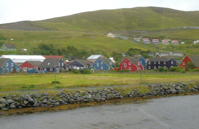
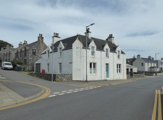
Scalloway

Scalloway (Old Norse: Skálavágr, "bay with the large house(s)") is the largest settlement on the west coast of the Mainland, the largest island of the...

Green Holm

Green Holm, (HU382379), is a small uninhabited island 500 metres north of Burra Ness at the north end of the island of Burra and on the west side of the...

Langa, Shetland

Langa (Old Norse: Langey ) is the collective name for two uninhabited islands off Hildasay, in Shetland, Scotland. The islands are connected by a tombolo...

Burwick Holm

Burwick Holm is a small island off the west coast of Mainland, Shetland. It is located in the Bur Wick inlet, and near Scalloway.

Related Videos

Driving from Scalloway to Lerwick

3rd October 2020. Rainy day. Start at the junction of Meadowfield road and Houll road, then via the 'Brig'o'Fitch', finish at the ...

SCALLOWAY CASTLE,SCALLOWAY,SHETLAND-2017

Scallowaycastle #Scalloway #Shetland Traveling Shetland Scalloway Castle is a tower house in Scalloway, on the Shetland ...

Nearby Amenities

Located within 500m of 60.125742,-1.2813196
Cutts
Place: hamlet
Lat/Long: 60.127244/-1.2758821
Post Box
Brand: Royal Mail
Brand Wikidata: Q638098
Mapillary: 5138437286251099
Operator: Royal Mail
Operator Wikidata: Q638098
Post Box Mounting: pier
Post Box Type: lamp
Ref: ZE1 55
Survey Date: 2022-05-17
Lat/Long: 60.1253991/-1.2839673
Barrier: cattle_grid
Lat/Long: 60.12899/-1.2756995
Scarfataing
Place: hamlet
Lat/Long: 60.1286066/-1.2811873
Cauldhame
Place: hamlet
Lat/Long: 60.127292/-1.2882898
Power: pole
Lat/Long: 60.126393/-1.2892199
Power: pole
Lat/Long: 60.1262139/-1.2884098
Power: pole
Lat/Long: 60.1258973/-1.2871009
Power: pole
Lat/Long: 60.1254551/-1.2863633
Power: pole
Lat/Long: 60.1232479/-1.2877983
Power: pole
Lat/Long: 60.1240148/-1.2873557
Power: pole
Lat/Long: 60.1246107/-1.2867683
Power: pole
Lat/Long: 60.1250783/-1.2857303
Power: pole
Lat/Long: 60.1253843/-1.2850517
Power: pole
Lat/Long: 60.1258198/-1.2840968
Power: pole
Lat/Long: 60.1263676/-1.2828523
Power: pole
Lat/Long: 60.1268606/-1.2819162
Power: pole
Lat/Long: 60.1273468/-1.2809426
Power: pole
Lat/Long: 60.1278278/-1.2799796
Power: pole
Lat/Long: 60.1284076/-1.2788451
Power: pole
Lat/Long: 60.1288404/-1.2779841
Power: pole
Lat/Long: 60.1293079/-1.2771016
Power: pole
Lat/Long: 60.1282343/-1.281121
Power: pole
Lat/Long: 60.1286154/-1.2821879
Power: pole
Lat/Long: 60.127439/-1.2788996
Power: pole
Lat/Long: 60.1272105/-1.2782866
Power: pole
Lat/Long: 60.1269626/-1.2775976
Bus Stop
Trondra
Bus: yes
Fixme: Location unknown
Public Transport: platform
Lat/Long: 60.1231183/-1.286417
Bus Stop
Trondra
Bus: yes
Fixme: Location unknown
Public Transport: platform
Lat/Long: 60.1230916/-1.2861434
The data included in this document is from www.openstreetmap.org. The data is made available under ODbL.

Have you been to South Ayre?

Leave your review of South Ayre below (or comments, questions and feedback).