Sound of Longataing

Sea, Estuary, Creek in Orkney

Scotland

Sound of Longataing

Egilsay: a view from Rousay Looking across the Rousay Sound from the isle of Rousay towards Egilsay, with the distinctive round tower of <a href="https://www.geograph.org.uk/photo/2584979">HY4630 : Egilsay: St. Magnus church</a> roughly centre of the picture.

Behind Egilsay are Muckle Green Holm and its companion Little Green Holm, with Stronsay silhouetted right across the picture beyond.
Egilsay: a view from Rousay Credit: Chris Downer

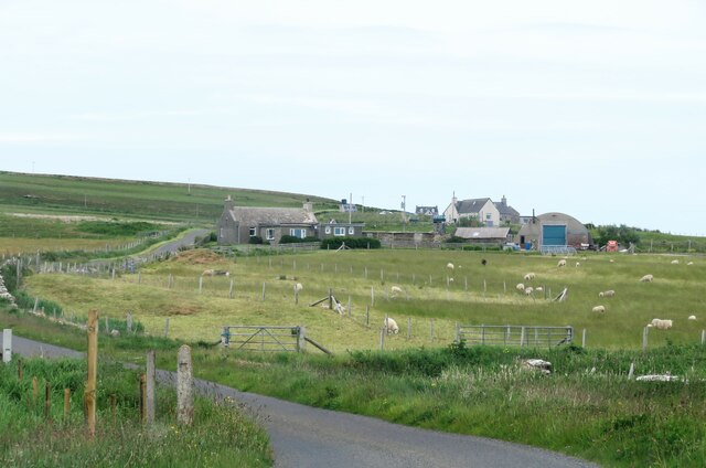
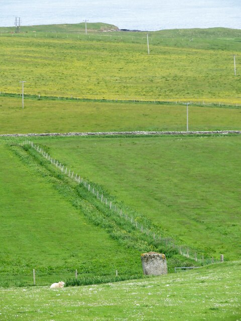
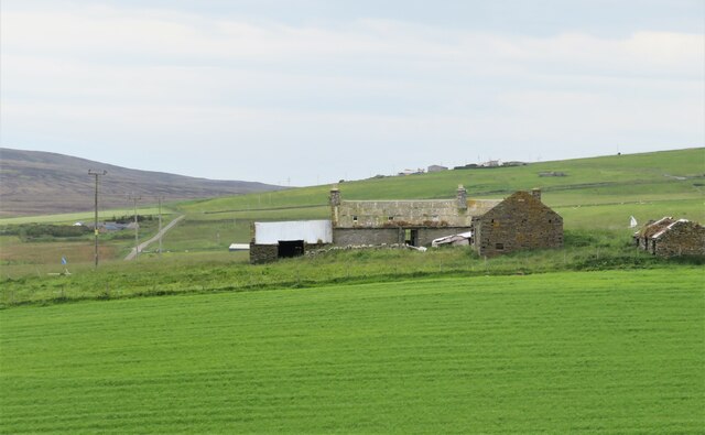
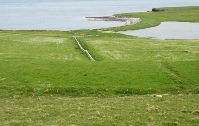
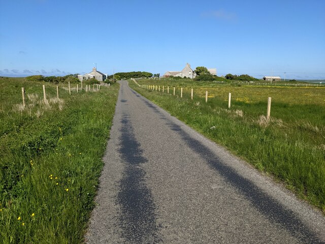
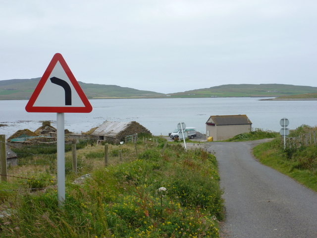
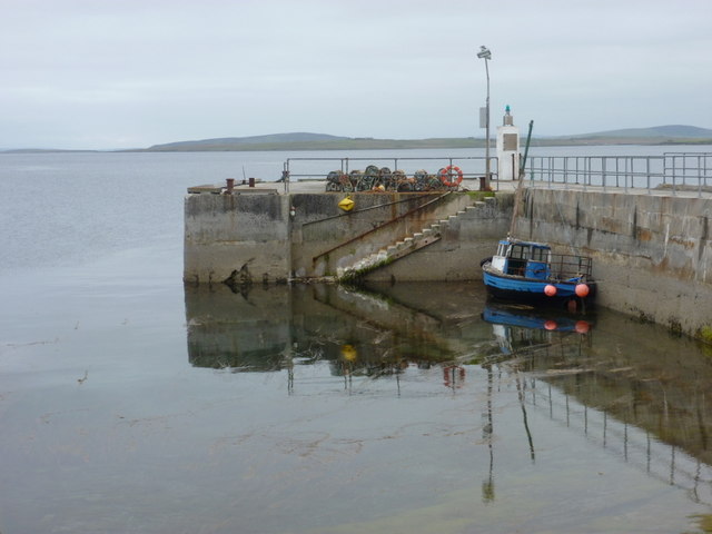
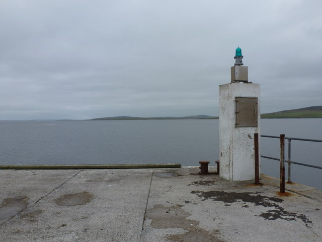
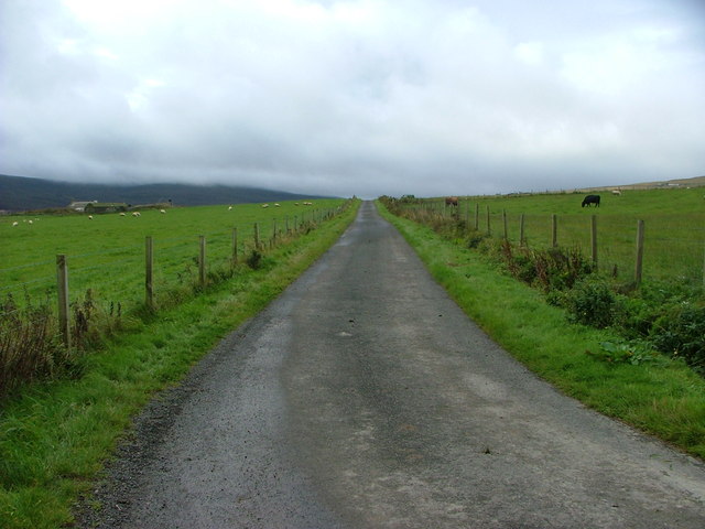
The Sound of Longataing is a picturesque body of water located in Orkney, Scotland. It is characterized as a narrow sea channel that stretches between the mainland of Orkney and the island of Hoy. Also referred to as an estuary or creek, the Sound of Longataing is approximately 5 miles long and connects the North Sea with Scapa Flow.

The sound is renowned for its stunning natural beauty, with rugged cliffs and rolling hills surrounding its shores. The crystal-clear waters of the sound are home to an array of marine life, including seals, dolphins, and various species of seabirds. This makes it a popular spot for wildlife enthusiasts and birdwatchers.

The Sound of Longataing also holds historical significance, as it played a crucial role during both World Wars. It served as a vital waterway for naval vessels, leading to the establishment of the nearby naval base at Scapa Flow. Today, remnants of this military presence can still be seen, including old gun emplacements and lookout posts along the coastline.

Visitors to the Sound of Longataing can enjoy breathtaking views, whether by taking a leisurely stroll along the shoreline or embarking on a boat trip to fully appreciate the area's natural wonders. The sound's tranquil atmosphere and pristine surroundings provide a serene escape, allowing visitors to immerse themselves in the beauty of Orkney's coastal landscapes.

If you have any feedback on the listing, please let us know in the comments section below.

Sound of Longataing Images

Images are sourced within 2km of 59.171729/-2.9473362 or Grid Reference HY4532. Thanks to Geograph Open Source API. All images are credited.

Egilsay: a view from Rousay Looking across the Rousay Sound from the isle of Rousay towards Egilsay, with the distinctive round tower of <a href="https://www.geograph.org.uk/photo/2584979">HY4630 : Egilsay: St. Magnus church</a> roughly centre of the picture.

Behind Egilsay are Muckle Green Holm and its companion Little Green Holm, with Stronsay silhouetted right across the picture beyond.
Egilsay: a view from Rousay
Looking across the Rousay Sound from the isle of Rousay towards Egilsay, with the distinctive round tower of HY4630 : Egilsay: St. Magnus church roughly centre of the picture. Behind Egilsay are Muckle Green Holm and its companion Little Green Holm, with Stronsay silhouetted right across the picture beyond.
Lane towards Breck Lane heading past Breck towards Faraclett and Scockness. A chapel is shown on the map here, but there's nothing resembling such a building amongst those to the right of the road.
Lane towards Breck
Lane heading past Breck towards Faraclett and Scockness. A chapel is shown on the map here, but there's nothing resembling such a building amongst those to the right of the road.
Hillside down to the Yetnasteen stone No an easy subject to photograph as access across nearby fields is discouraged. The stone - 'Jotunna-steinn' in old Norse, which simply means 'giant stone' is over 2m high and is said to be a giant who was turned into stone. The giant must still have a thirst as legend says that the stone makes a few strides down the nearby Loch of Scockness at Hogmanay for a drink before returning. I guess that most locals would prefer a rather stronger drink at Hogmanay.
Hillside down to the Yetnasteen stone
No an easy subject to photograph as access across nearby fields is discouraged. The stone - 'Jotunna-steinn' in old Norse, which simply means 'giant stone' is over 2m high and is said to be a giant who was turned into stone. The giant must still have a thirst as legend says that the stone makes a few strides down the nearby Loch of Scockness at Hogmanay for a drink before returning. I guess that most locals would prefer a rather stronger drink at Hogmanay.
Farmstead for superheros? The abandoned farmstead is shown as Pow on the map, but maybe that should read as 'POW!' if owned by a local superhero. Slowly decaying with roofs collapsing and weeds rampant.
Farmstead for superheros?
The abandoned farmstead is shown as Pow on the map, but maybe that should read as 'POW!' if owned by a local superhero. Slowly decaying with roofs collapsing and weeds rampant.
Fields down to the shore A near straight stone wall heads down the hillside towards the bar separating the Loch of Scockness from the sea.
Fields down to the shore
A near straight stone wall heads down the hillside towards the bar separating the Loch of Scockness from the sea.
The minor road near Hurtiso
St. Magnus Church, Egilsay
Egilsay: St. Magnus Kirk from the road Looking towards the distinctive round tower of this historic church, from the road running north-south along the island. A lump of the island of Rousay is in the background.
Egilsay: St. Magnus Kirk from the road
Looking towards the distinctive round tower of this historic church, from the road running north-south along the island. A lump of the island of Rousay is in the background.
Egilsay: St. Magnus Kirk from the harbour Looking across the island's new jetty, on which is the road sign, towards its most famous landmark.
Egilsay: St. Magnus Kirk from the harbour
Looking across the island's new jetty, on which is the road sign, towards its most famous landmark.
Egilsay: St. Magnus church The ruins of the 12th-century church dedicated to Earl Magnus, who was killed a short distance southeast of here in about 1116.<span class="nowrap"><a title="https://canmore.org.uk/site/2697/egilsay-st-magnuss-church" rel="nofollow ugc noopener" href="https://canmore.org.uk/site/2697/egilsay-st-magnuss-church">Link</a><img style="margin-left:2px;" alt="External link" title="External link - shift click to open in new window" src="https://s1.geograph.org.uk/img/external.png" width="10" height="10"/></span>
Egilsay: St. Magnus church
The ruins of the 12th-century church dedicated to Earl Magnus, who was killed a short distance southeast of here in about 1116.LinkExternal link
Egilsay: St. Magnus church is pointed out Pretty much the only proper road sign on the island - apart from a couple of weight restrictions facing traffic coming off the ferry - gives advance notice to turn left at the crossroads for <a href="https://www.geograph.org.uk/photo/2584979">HY4630 : Egilsay: St. Magnus church</a>, which we see in the field beyond.
Egilsay: St. Magnus church is pointed out
Pretty much the only proper road sign on the island - apart from a couple of weight restrictions facing traffic coming off the ferry - gives advance notice to turn left at the crossroads for HY4630 : Egilsay: St. Magnus church, which we see in the field beyond.
Egilsay: approaching the ferry slipway I believe the road signs in this photo are, with the exception of a tourist direction sign for the church, the only ones on the island. The road is seen here as it curves round to the slipway where the ferry berths.
Egilsay: approaching the ferry slipway
I believe the road signs in this photo are, with the exception of a tourist direction sign for the church, the only ones on the island. The road is seen here as it curves round to the slipway where the ferry berths.
Egilsay: public telephone The phone is in the waiting room for the ferry.
Egilsay: public telephone
The phone is in the waiting room for the ferry.
Egilsay: boat moored at the pier Standing on the ferry slipway, we look out past a small fishing boat which is moored on the subatantial concrete pier which I believe has been recently rebuilt.
Egilsay: boat moored at the pier
Standing on the ferry slipway, we look out past a small fishing boat which is moored on the subatantial concrete pier which I believe has been recently rebuilt.
Egilsay: end of the pier Looking along the Rousay Sound past the green beacon on the end of the concrete pier.
Egilsay: end of the pier
Looking along the Rousay Sound past the green beacon on the end of the concrete pier.
Egilsay: ferry arriving The ferry, which serves Rousay and Wyre as well, approaches the slipway at Egilsay. I would be the only passenger embarking, just as I was the only person arriving here a few hours ago!
Egilsay: ferry arriving
The ferry, which serves Rousay and Wyre as well, approaches the slipway at Egilsay. I would be the only passenger embarking, just as I was the only person arriving here a few hours ago!
Looking down the road from the junction below the car park at Faraclett Head
St Magnus's Church, Egilsay (1994) A 12thC Viking tower church on a calm and peaceful Orkney island.
St Magnus's Church, Egilsay (1994)
A 12thC Viking tower church on a calm and peaceful Orkney island.
Show me another place!

Sound of Longataing is located at Grid Ref: HY4532 (Lat: 59.171729, Lng: -2.9473362)

Unitary Authority: Orkney Islands

Police Authority: Highlands and Islands

What 3 Words

///ferrying.slurping.giggle. Near Brinian, Orkney Islands

Related Wikis

Holm of Scockness

The Holm of Scockness is a small island in the Orkney Islands, between Rousay and Egilsay. It is currently used for grazing. Its name is Norse in origin...

Kili Holm

Kili Holm is a tidal island in the Orkney Islands, linked to Egilsay. Unusually, like its neighbour Egilsay, it may have a partly Gaelic etymology, in...

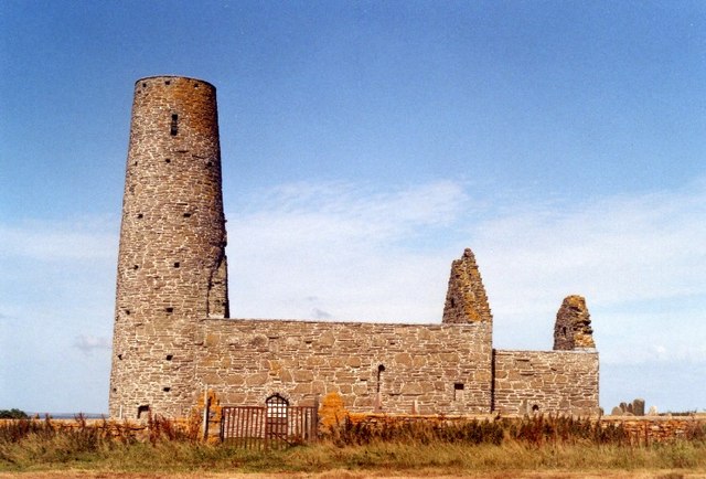
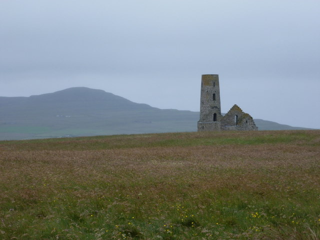
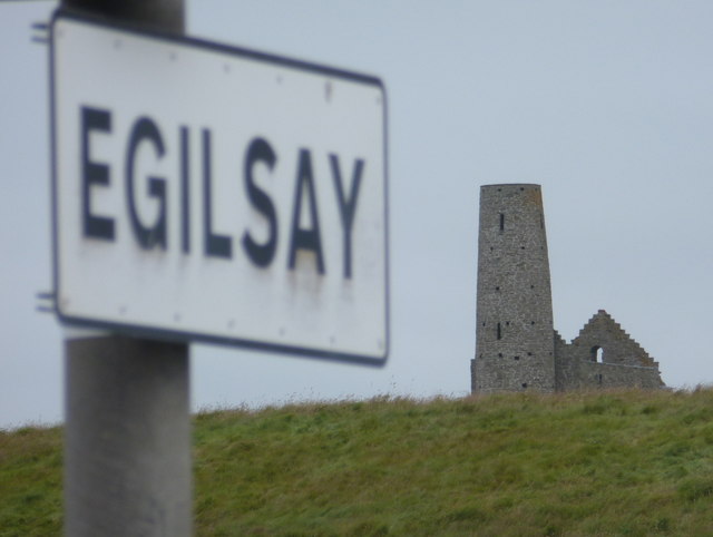
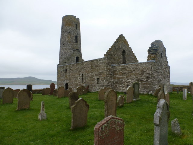
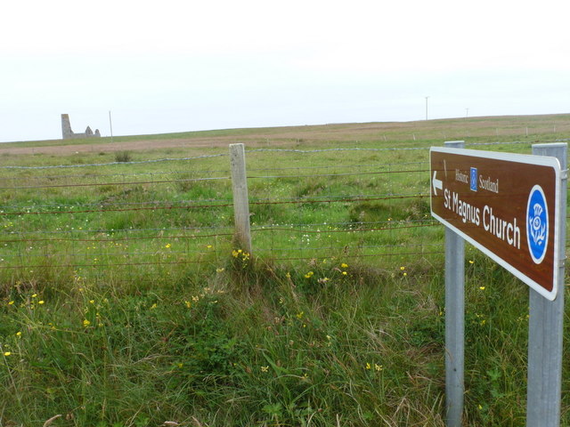
St Magnus Church, Egilsay

St Magnus's Church is a ruined medieval church located on the island of Egilsay, in Orkney, Scotland. The site is recognized as the place of execution...

Rinyo

Rinyo was a Neolithic settlement on Rousay in Orkney, Scotland. The site was discovered in the winter of 1837–38 on the lands of Bigland Farm in the north...

Related Videos

Orkney 2022-08-16 Egilsay

This is my tour around the small island of Egilsay. Started off super cold and windy, eventually brightening up. Visibility got much ...

St Magnus Church With Music On History Visit To Island Of Egilsay Orkney Islands Scotland

Tour Scotland short 4K travel video clip, with Scottish music, on ancestry, genealogy family history visit and trip to St Magnus's ...

Have you been to Sound of Longataing?

Leave your review of Sound of Longataing below (or comments, questions and feedback).