Llanon

Settlement in Cardiganshire

Wales

Llanon

Morfa Mawr Farm from the coastal path
Morfa Mawr Farm from the coastal path Credit: Sandy Gerrard

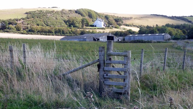
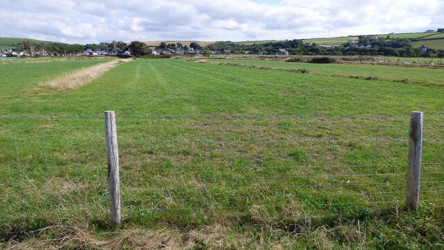
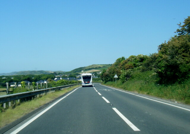
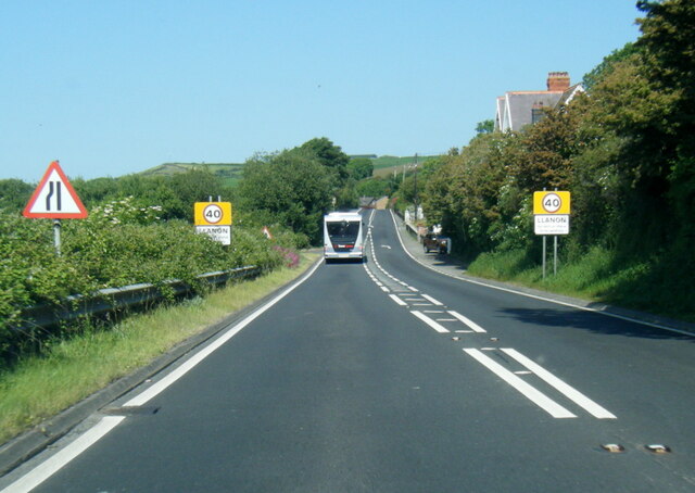
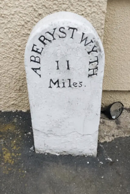
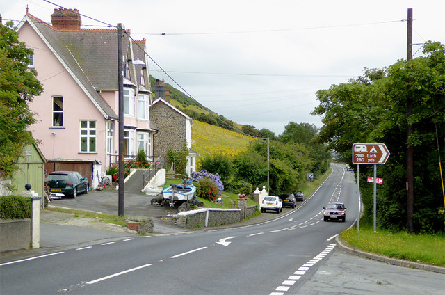
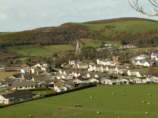
Llanon is a small village located in the county of Cardiganshire, Wales. Situated on the west coast of the country, it lies approximately 10 miles south of Aberystwyth. With a population of around 1,000 residents, Llanon is a close-knit community surrounded by beautiful countryside and stunning coastal views.

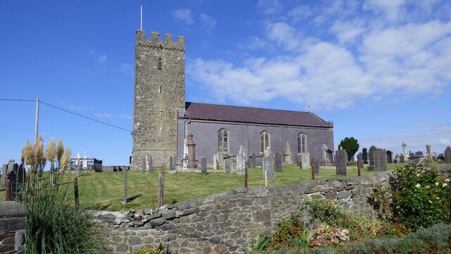
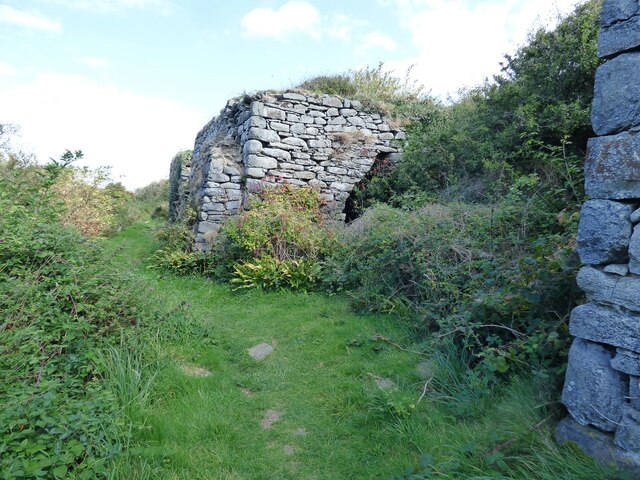
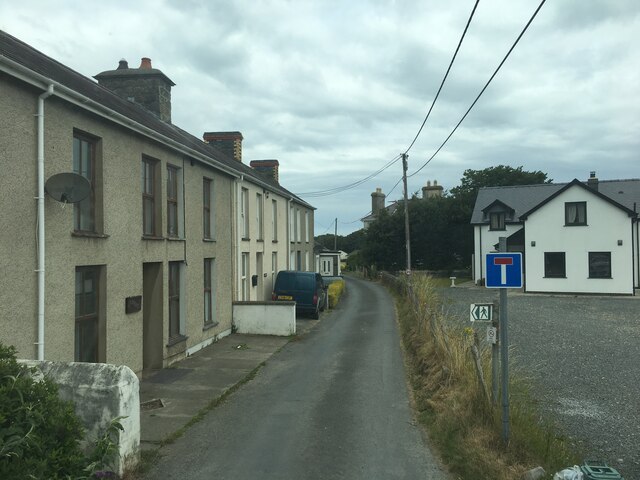
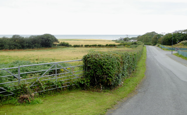
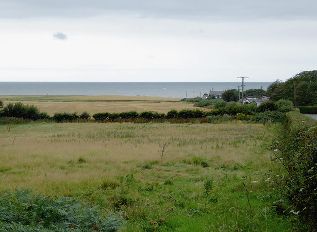
The village has a rich history, dating back to medieval times when it was an important center for agriculture and fishing. Today, Llanon retains its rural charm and is known for its picturesque landscapes and tranquil atmosphere. The village is characterized by its traditional Welsh architecture, with many stone cottages lining the streets.

Llanon offers a range of amenities to its residents and visitors. The village has a primary school, a post office, a grocery store, and a village hall where community events and gatherings take place. There are also several pubs and restaurants, offering a taste of local cuisine and a welcoming atmosphere.

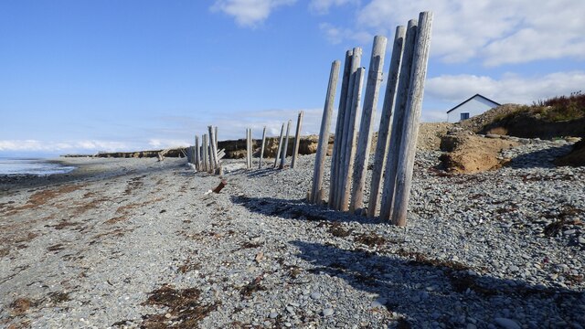
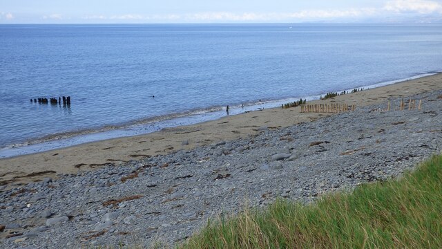
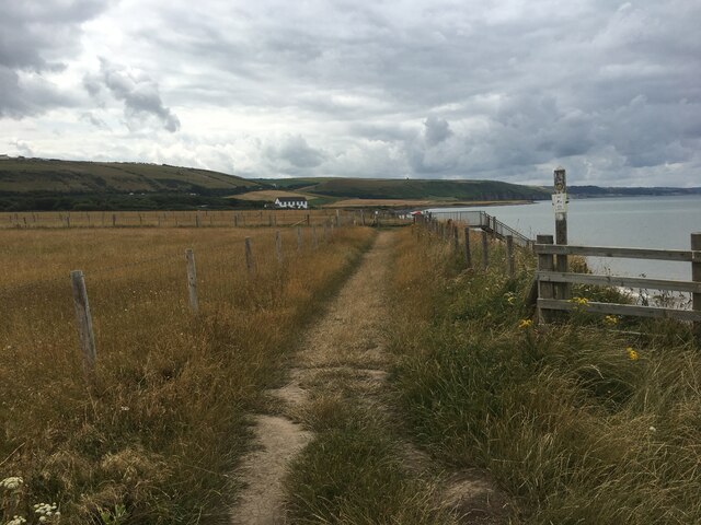
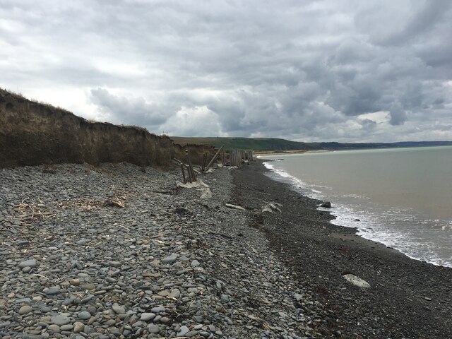
The natural beauty of Llanon and its surroundings make it a popular destination for outdoor enthusiasts. The village is close to the stunning Ceredigion coastline, offering opportunities for beach walks, fishing, and watersports. Additionally, the nearby Cambrian Mountains provide ample opportunities for hiking, cycling, and wildlife spotting.

Overall, Llanon is a charming village that offers a peaceful and idyllic lifestyle. Its rich history, beautiful landscapes, and strong sense of community make it a wonderful place to visit or call home.

If you have any feedback on the listing, please let us know in the comments section below.
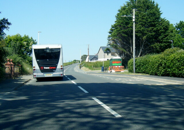
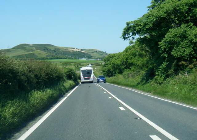
Llanon Images

Images are sourced within 2km of 52.282273/-4.18055 or Grid Reference SN5167. Thanks to Geograph Open Source API. All images are credited.

Morfa Mawr Farm from the coastal path
Sea Defences near Llanon/Llannon The defences along this part of the coast have failed.
Sea Defences near Llanon/Llannon
The defences along this part of the coast have failed.
Strip Fields at Llansantffraed/Llansantffraid
Parish church at Llansantffraed/Llansantffraid
Lime kilns at Craiglas The coastal path leads past these kilns.
Lime kilns at Craiglas
The coastal path leads past these kilns.
Old fish net supports
A487 near Tanrallt
A487 near Tanrallt
A487 at Llanon village boundary
A487 leaving Llanon
A487 leaving Llanon
A487 near Plas Gwyn
A487 near Plas Gwyn
Stryd-Yr-Eglwys, Llansantffraed
Coastal path near Llanon
Shoreline near Llanon
Old Milestone by the A487, Llanon, Llansantffraid Parish Aberystwyth tombstone by the A487, in parish of Llansantffraid (Ceredigion District), by "Mile End", Llanon, Stryd Fawr, on pavement back to wall.

Inscription read:-
ABERYSTWYTH
11
MILES

Grade II listed by Cadw. Reference Number: 17905 <span class="nowrap"><a title="https://cadwpublic-api.azurewebsites.net/reports/listedbuilding/FullReport?lang=&id=17905" rel="nofollow ugc noopener" href="https://cadwpublic-api.azurewebsites.net/reports/listedbuilding/FullReport?lang=&id=17905">Link</a><img style="margin-left:2px;" alt="External link" title="External link - shift click to open in new window" src="https://s1.geograph.org.uk/img/external.png" width="10" height="10"/></span>


Surveyed

Milestone Society National ID: CRD_AYCA11
Old Milestone by the A487, Llanon, Llansantffraid Parish
Aberystwyth tombstone by the A487, in parish of Llansantffraid (Ceredigion District), by "Mile End", Llanon, Stryd Fawr, on pavement back to wall. Inscription read:- ABERYSTWYTH 11 MILES Grade II listed by Cadw. Reference Number: 17905 LinkExternal link Surveyed Milestone Society National ID: CRD_AYCA11
Lane south-west of Llanon, Ceredigion The narrow lane is a cul-de-sac leading to a coastal caravan park and campsite.
Lane south-west of Llanon, Ceredigion
The narrow lane is a cul-de-sac leading to a coastal caravan park and campsite.
Rough pasture south-east of Llanon, Ceredigion The lane is a cul-de-sac leading to a coastal caravan park and campsite.
Rough pasture south-east of Llanon, Ceredigion
The lane is a cul-de-sac leading to a coastal caravan park and campsite.
The A487 south-west of Llanon, Ceredigion The A487 has come from Aberystwyth and is seen here leading towards Aberaeron,  Cardigan and Fishguard.
The A487 south-west of Llanon, Ceredigion
The A487 has come from Aberystwyth and is seen here leading towards Aberaeron, Cardigan and Fishguard.
Ordnance Survey Flush Bracket G2988 This can be found on the parapet of Pont Morfa.
For more detail see : <span class="nowrap"><a title="http://www.bench-marks.org.uk/bm15293" rel="nofollow ugc noopener" href="http://www.bench-marks.org.uk/bm15293">Link</a><img style="margin-left:2px;" alt="External link" title="External link - shift click to open in new window" src="https://s1.geograph.org.uk/img/external.png" width="10" height="10"/></span>
Ordnance Survey Flush Bracket G2988
This can be found on the parapet of Pont Morfa. For more detail see : LinkExternal link
Show me another place!

Llanon is located at Grid Ref: SN5167 (Lat: 52.282273, Lng: -4.18055)

Unitary Authority: Ceredigion

Police Authority: Dyfed Powys

Also known as: Llan-non

What 3 Words

///fresh.awoke.weaned. Near Llanon, Ceredigion

Related Wikis

Llanon

Llanon (also spelled Llan-non) is a village in Ceredigion, Wales. It adjoins the village of Llansantffraed on the coast of Cardigan Bay, 5 mi (8.0 km)...
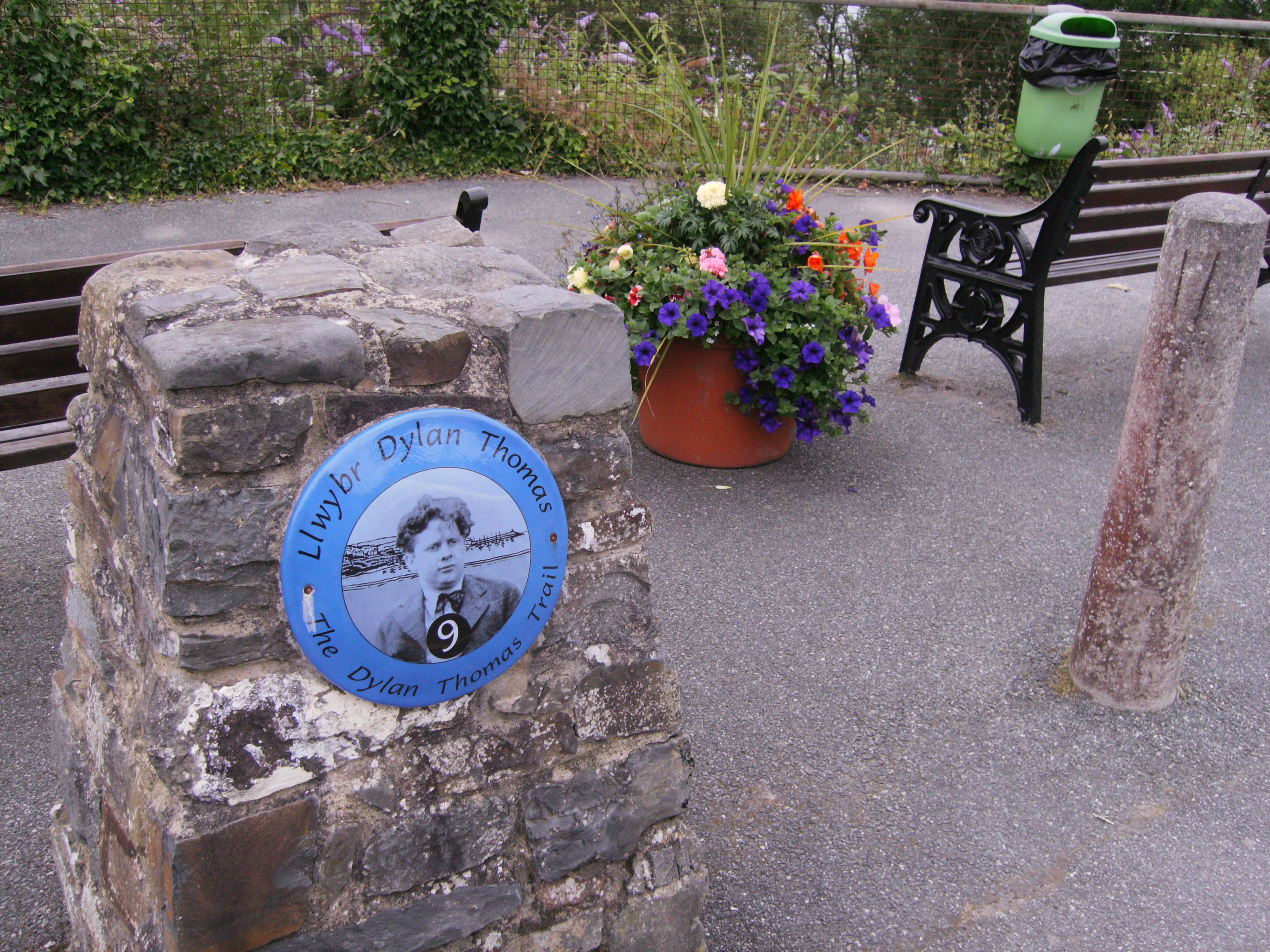
Dylan Thomas Trail

The Dylan Thomas Trail (Welsh: Llwybr Dylan Thomas) runs through places associated with the poet Dylan Thomas in Ceredigion, west Wales. It was officially...

Llansantffraid, Ceredigion

Llansantffraid or Llansantffraed (Welsh: Llansanffraid) is a small rural village and community and practically merged with the village of Llanon just west...

Afon Wyre

Afon Wyre (Welsh pronunciation: [ˈʊɨ̯rɛ] ), (English: River Wyre), is a small river in the county of Ceredigion, Wales; also called Afon Wyre Fawr ("Great...

Tŷ-Newydd, Ceredigion

Tŷ-Newydd is a small village in the community of Llanrhystud, Ceredigion, Wales, which is 69.5 miles (111.8 km) from Cardiff and 179.1 miles (288.2 km...

Llanrhystud

Llanrhystud is a seaside village and electoral division on the A487 road in the county of Ceredigion, in Wales, 9 miles (14 km) south of Aberystwyth, and...

Pennant, Ceredigion

Pennant is a village in the community of Dyffryn Arth, Ceredigion, Wales. Pennant is represented in the Senedd by Elin Jones (Plaid Cymru) and is part...

Gaer Penrhôs

Gaer Penrhôs, in Ceredigion, Wales, was a ringwork castle at the summit of a steep hill near the village of Llanrhystud; now all that remains are the outlines...

Nearby Amenities

Located within 500m of 52.282273,-4.18055
Created By: dmgroom_coastlines
Source: PGS
Lat/Long: 52.28427/-4.186628
Created By: dmgroom_coastlines
Source: PGS
Lat/Long: 52.2835273/-4.1872405
Source: PGS
Lat/Long: 52.282462/-4.1877048
Llansantffraid
Alt Name: Llansantffraed
Is In: Ceredigion, Wales, UK
Name Cy: Llansanffraid
Place: hamlet
Source: npe
Wikidata: Q6661753
Lat/Long: 52.2839777/-4.1832624
Post Box
Post Box Type: wall
Ref: SY23 64
Lat/Long: 52.2822703/-4.1767891
Llannon
Is In: Ceredigion, Wales, UK
Place: village
Wikidata: Q6661685
Lat/Long: 52.2827412/-4.1755579
Barrier: kissing_gate
Lat/Long: 52.2855949/-4.1822526
Telephone
Booth: K6
Covered: booth
Lat/Long: 52.2813437/-4.1773598
Fuel
Brand: Dragon
Shop: convenience;car_repair
Lat/Long: 52.2808432/-4.1781288
Fast Food
Cuisine: fish_and_chips
Wheelchair: no
Lat/Long: 52.2818346/-4.1770483
Bus Stop
Old Mill Bakery
Bench: yes
Kerb: raised
Public Transport: platform
Shelter: yes
Lat/Long: 52.2781226/-4.1801012
Post Office
Shop: convenience
Wheelchair: limited
Lat/Long: 52.2816777/-4.1773945
Crossing
Crossing: uncontrolled
Kerb: lowered
Tactile Paving: yes
Lat/Long: 52.2803559/-4.1786391
Bus Stop
Old Post Office
Public Transport: platform
Wheelchair: limited
Lat/Long: 52.2795518/-4.1791105
Bus Stop
Old Mill Bakery
Naptan AtcoCode: 5230AWD71705
Naptan NaptanCode: cejdatg
Public Transport: platform
Shelter: yes
Source: photograph
Wheelchair: limited
Lat/Long: 52.2783742/-4.1793665
Bus Stop
Central Hotel
Kerb: raised
Naptan AtcoCode: 5230AWD71706
Naptan NaptanCode: cejdatj
Public Transport: platform
Shelter: yes
Lat/Long: 52.2816797/-4.177174
Fast Food
Central Hotel
Cuisine: chinese
Wheelchair: no
Lat/Long: 52.2817495/-4.1771028
Post Box
Brand: Royal Mail
Brand Wikidata: Q638098
Mapillary: 746323963290431
Operator: Royal Mail
Operator Wikidata: Q638098
Post Box Mounting: pier
Post Box Type: lamp
Ref: SY23 189
Source Position: Mapillary 2022-08-14
Survey Date: 2022-08-14
Lat/Long: 52.2849858/-4.1821966
Post Box
Post Box Type: lamp
Ref: SY23 143
Royal Cypher: EIIR
Royal Cypher Wikidata: Q33102113
Lat/Long: 52.2817172/-4.1773364
Shop: bakery
Wheelchair: no
Lat/Long: 52.2785915/-4.1795237
Power: pole
Source: bing
Lat/Long: 52.2784416/-4.1779716
Power: pole
Source: bing
Lat/Long: 52.2793972/-4.1751139
Turning Circle
Lat/Long: 52.2782409/-4.1807911
Shop: car
Lat/Long: 52.2832523/-4.1764008
Bus Stop
Central Hotel
Kerb: raised
Physically Present: no
Public Transport: platform
Lat/Long: 52.2817867/-4.1773107
Direction: 185
Generator Method: photovoltaic
Generator Output Electricity: yes
Generator Solar Modules: 10
Generator Source: solar
Generator Type: solar_photovoltaic_panel
Location: roof
Power: generator
Lat/Long: 52.2847605/-4.181875
Direction: SSW
Generator Method: photovoltaic
Generator Output Electricity: yes
Generator Solar Modules: 12
Generator Source: solar
Generator Type: solar_photovoltaic_panel
Location: roof
Power: generator
Lat/Long: 52.2846096/-4.1809469
Direction: 145
Generator Method: photovoltaic
Generator Output Electricity: yes
Generator Solar Modules: 6
Generator Source: solar
Generator Type: solar_photovoltaic_panel
Location: roof
Power: generator
Lat/Long: 52.2837227/-4.1847859
Direction: 145
Generator Method: photovoltaic
Generator Output Electricity: yes
Generator Solar Modules: 14
Generator Source: solar
Generator Type: solar_photovoltaic_panel
Location: roof
Power: generator
Lat/Long: 52.2836956/-4.1848496
Direction: ESE
Generator Method: photovoltaic
Generator Output Electricity: yes
Generator Solar Modules: 6
Generator Source: solar
Generator Type: solar_photovoltaic_panel
Location: roof
Power: generator
Lat/Long: 52.283493/-4.1851768
Direction: 130
Generator Method: photovoltaic
Generator Output Electricity: yes
Generator Solar Modules: 16
Generator Source: solar
Generator Type: solar_photovoltaic_panel
Location: roof
Power: generator
Lat/Long: 52.2781043/-4.1788743
Direction: 190
Generator Method: photovoltaic
Generator Output Electricity: yes
Generator Solar Modules: 15
Generator Source: solar
Generator Type: solar_photovoltaic_panel
Location: roof
Power: generator
Lat/Long: 52.2818267/-4.176017
Direction: 255
Generator Method: photovoltaic
Generator Output Electricity: yes
Generator Solar Modules: 16
Generator Source: solar
Generator Type: solar_photovoltaic_panel
Location: roof
Power: generator
Lat/Long: 52.2829737/-4.1799358
Source: PGS
Lat/Long: 52.282467/-4.187737
Source: PGS
Lat/Long: 52.2824317/-4.1878255
Barrier: kissing_gate
Lat/Long: 52.2853808/-4.1824919
The data included in this document is from www.openstreetmap.org. The data is made available under ODbL.

Have you been to Llanon?

Leave your review of Llanon below (or comments, questions and feedback).