Caolas Mhic Phadruig

Sea, Estuary, Creek in Argyllshire

Scotland

Caolas Mhic Phadruig

A82, North Ballachulish
A82, North Ballachulish Credit: Steven Brown

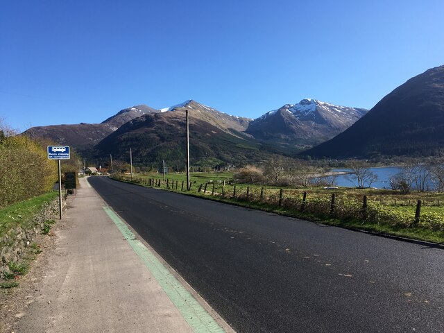
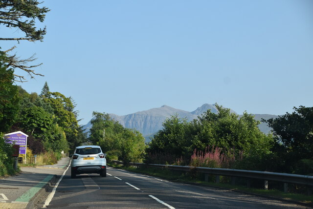
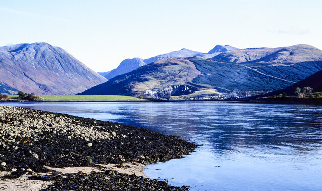
Caolas Mhic Phadruig is a picturesque sea inlet located in Argyllshire, Scotland. Nestled amidst stunning natural landscapes, it is a breathtaking sight for visitors and locals alike.

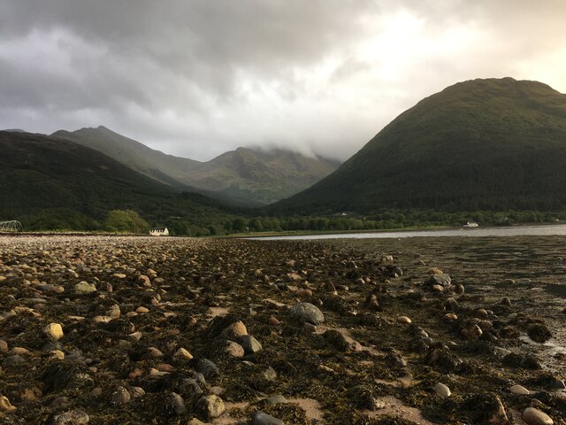
The caolas, which is the Gaelic word for "narrow sound," is formed by the confluence of the sea, estuary, and creek. It stretches for approximately 2 kilometers, creating a unique and diverse habitat for a variety of marine and bird species.

The sea surrounding Caolas Mhic Phadruig is a vibrant azure blue, reflecting the clear skies above. It is home to numerous fish species, including salmon and trout, making it a popular spot for fishing enthusiasts. The estuary, with its calm and shallow waters, serves as an important breeding ground for various marine creatures and is an ideal location for birdwatching.

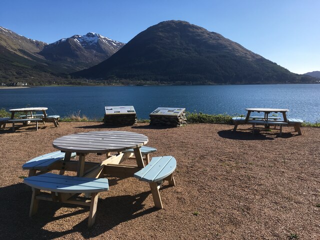
The creek found within Caolas Mhic Phadruig winds its way through the surrounding hills and forests, creating a picturesque landscape. Its gentle flow and peaceful atmosphere make it an ideal place for boating and kayaking.

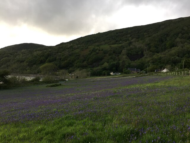
The caolas is also surrounded by lush greenery, with rolling hills and dense forests providing a stunning backdrop. The area is teeming with wildlife, including deer, otters, and a wide variety of bird species.

Caolas Mhic Phadruig is not just a place of natural beauty, but also holds historical significance. It has been a crucial trade route for centuries, connecting nearby settlements and serving as a gateway to the sea.

Overall, Caolas Mhic Phadruig is a captivating location that offers a wonderful blend of natural beauty, diverse wildlife, and historical importance. It is a must-visit destination for anyone seeking tranquility and a chance to immerse themselves in Scotland's stunning landscapes.

If you have any feedback on the listing, please let us know in the comments section below.

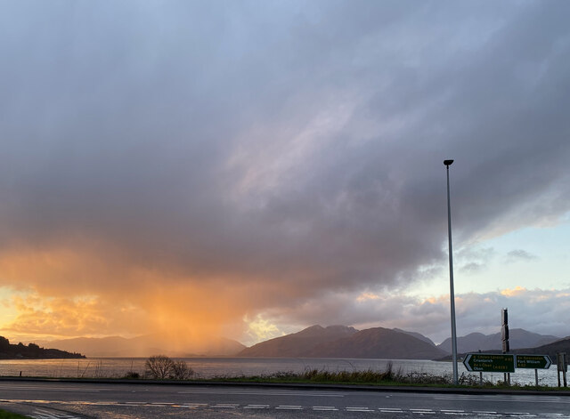
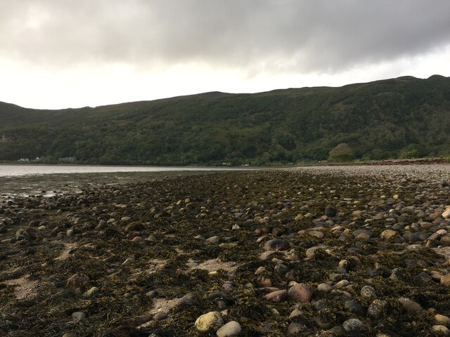
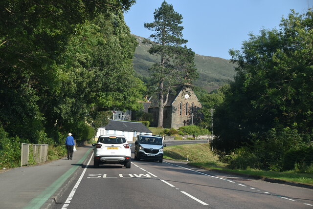
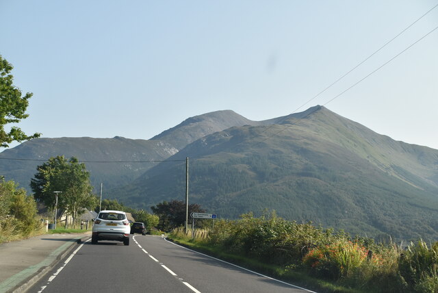
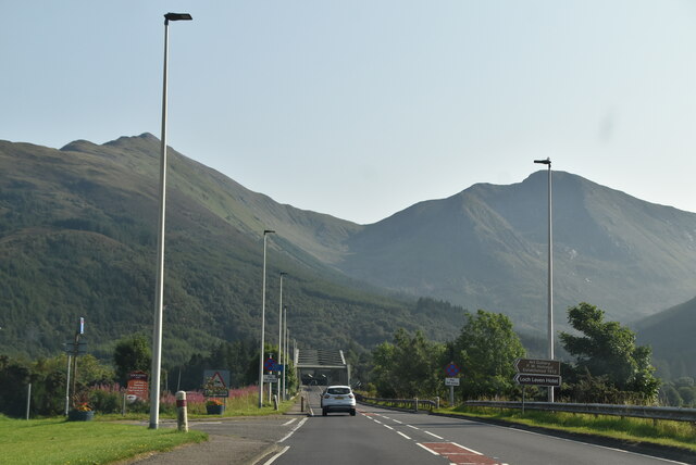
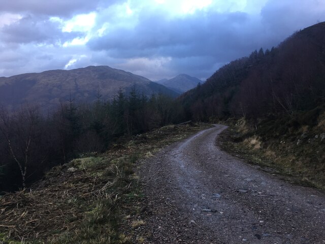
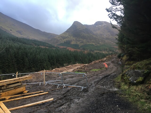
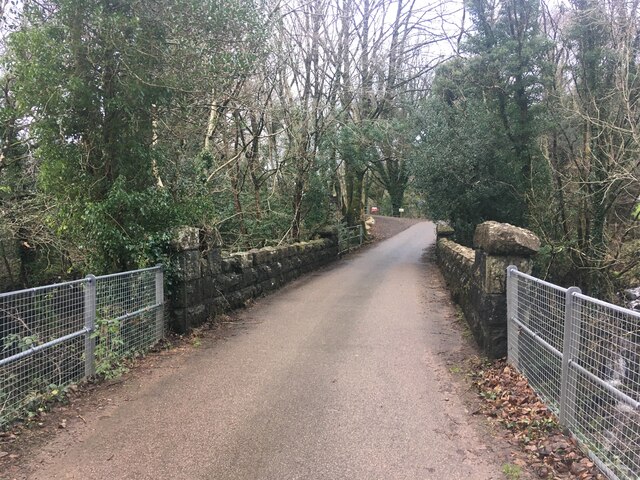
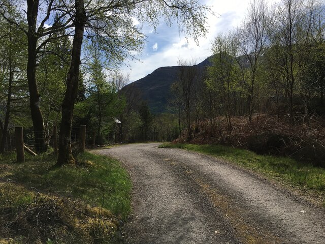
Caolas Mhic Phadruig Images

Images are sourced within 2km of 56.689486/-5.1864422 or Grid Reference NN0459. Thanks to Geograph Open Source API. All images are credited.

A82, North Ballachulish
Picnic benches adjactent to Onich Filling Station
Road junction North Ballachulish
Shoreline at North Ballachulish
Bluebell laden fields, North Ballachulish
Nether Lochaber Village Hall The A82 is a trunk road in Scotland. It is the principal route from Lowland Scotland to the western Scottish Highlands, running from Glasgow to Inverness, going by Loch Lomond, Glen Coe, Fort William and the Great Glen. It is 167 miles long.
<span class="nowrap"><a title="https://www.sabre-roads.org.uk/wiki/index.php?title=A82" rel="nofollow ugc noopener" href="https://www.sabre-roads.org.uk/wiki/index.php?title=A82">Link</a><img style="margin-left:2px;" alt="External link" title="External link - shift click to open in new window" src="https://s1.geograph.org.uk/img/external.png" width="10" height="10"/></span>
Nether Lochaber Village Hall
The A82 is a trunk road in Scotland. It is the principal route from Lowland Scotland to the western Scottish Highlands, running from Glasgow to Inverness, going by Loch Lomond, Glen Coe, Fort William and the Great Glen. It is 167 miles long. LinkExternal link
A82 The A82 is a trunk road in Scotland. It is the principal route from Lowland Scotland to the western Scottish Highlands, running from Glasgow to Inverness, going by Loch Lomond, Glen Coe, Fort William and the Great Glen. It is 167 miles long.
<span class="nowrap"><a title="https://www.sabre-roads.org.uk/wiki/index.php?title=A82" rel="nofollow ugc noopener" href="https://www.sabre-roads.org.uk/wiki/index.php?title=A82">Link</a><img style="margin-left:2px;" alt="External link" title="External link - shift click to open in new window" src="https://s1.geograph.org.uk/img/external.png" width="10" height="10"/></span>
A82
The A82 is a trunk road in Scotland. It is the principal route from Lowland Scotland to the western Scottish Highlands, running from Glasgow to Inverness, going by Loch Lomond, Glen Coe, Fort William and the Great Glen. It is 167 miles long. LinkExternal link
A82, Onich Services The A82 is a trunk road in Scotland. It is the principal route from Lowland Scotland to the western Scottish Highlands, running from Glasgow to Inverness, going by Loch Lomond, Glen Coe, Fort William and the Great Glen. It is 167 miles long.
<span class="nowrap"><a title="https://www.sabre-roads.org.uk/wiki/index.php?title=A82" rel="nofollow ugc noopener" href="https://www.sabre-roads.org.uk/wiki/index.php?title=A82">Link</a><img style="margin-left:2px;" alt="External link" title="External link - shift click to open in new window" src="https://s1.geograph.org.uk/img/external.png" width="10" height="10"/></span>
A82, Onich Services
The A82 is a trunk road in Scotland. It is the principal route from Lowland Scotland to the western Scottish Highlands, running from Glasgow to Inverness, going by Loch Lomond, Glen Coe, Fort William and the Great Glen. It is 167 miles long. LinkExternal link
A82 The A82 is a trunk road in Scotland. It is the principal route from Lowland Scotland to the western Scottish Highlands, running from Glasgow to Inverness, going by Loch Lomond, Glen Coe, Fort William and the Great Glen. It is 167 miles long.
<span class="nowrap"><a title="https://www.sabre-roads.org.uk/wiki/index.php?title=A82" rel="nofollow ugc noopener" href="https://www.sabre-roads.org.uk/wiki/index.php?title=A82">Link</a><img style="margin-left:2px;" alt="External link" title="External link - shift click to open in new window" src="https://s1.geograph.org.uk/img/external.png" width="10" height="10"/></span>
A82
The A82 is a trunk road in Scotland. It is the principal route from Lowland Scotland to the western Scottish Highlands, running from Glasgow to Inverness, going by Loch Lomond, Glen Coe, Fort William and the Great Glen. It is 167 miles long. LinkExternal link
A82, North Ballachulish The A82 is a trunk road in Scotland. It is the principal route from Lowland Scotland to the western Scottish Highlands, running from Glasgow to Inverness, going by Loch Lomond, Glen Coe, Fort William and the Great Glen. It is 167 miles long.
<span class="nowrap"><a title="https://www.sabre-roads.org.uk/wiki/index.php?title=A82" rel="nofollow ugc noopener" href="https://www.sabre-roads.org.uk/wiki/index.php?title=A82">Link</a><img style="margin-left:2px;" alt="External link" title="External link - shift click to open in new window" src="https://s1.geograph.org.uk/img/external.png" width="10" height="10"/></span>
A82, North Ballachulish
The A82 is a trunk road in Scotland. It is the principal route from Lowland Scotland to the western Scottish Highlands, running from Glasgow to Inverness, going by Loch Lomond, Glen Coe, Fort William and the Great Glen. It is 167 miles long. LinkExternal link
A82 The A82 is a trunk road in Scotland. It is the principal route from Lowland Scotland to the western Scottish Highlands, running from Glasgow to Inverness, going by Loch Lomond, Glen Coe, Fort William and the Great Glen. It is 167 miles long.
<span class="nowrap"><a title="https://www.sabre-roads.org.uk/wiki/index.php?title=A82" rel="nofollow ugc noopener" href="https://www.sabre-roads.org.uk/wiki/index.php?title=A82">Link</a><img style="margin-left:2px;" alt="External link" title="External link - shift click to open in new window" src="https://s1.geograph.org.uk/img/external.png" width="10" height="10"/></span>
A82
The A82 is a trunk road in Scotland. It is the principal route from Lowland Scotland to the western Scottish Highlands, running from Glasgow to Inverness, going by Loch Lomond, Glen Coe, Fort William and the Great Glen. It is 167 miles long. LinkExternal link
Stones on shore of Loch Leven The stones with seaweed are on and alongside the slipway at North Ballachulish which was the northern landing for the vehicle ferry service which operated prior to the opening of the Ballachulish Bridge.
The view beyond is to the east where the Glen Coe peaks rise, Sgorr nam Fiannaidh being at the left side of the image.
Stones on shore of Loch Leven
The stones with seaweed are on and alongside the slipway at North Ballachulish which was the northern landing for the vehicle ferry service which operated prior to the opening of the Ballachulish Bridge. The view beyond is to the east where the Glen Coe peaks rise, Sgorr nam Fiannaidh being at the left side of the image.
Forestry road above Glenachulish
Forestry work in Glenachulish
Bridge over river in Glenachulish
Private road to Carness
A82 approaching Ballachulish Bridge The A82 is a trunk road in Scotland. It is the principal route from Lowland Scotland to the western Scottish Highlands, running from Glasgow to Inverness, going by Loch Lomond, Glen Coe, Fort William and the Great Glen. It is 167 miles long.
<span class="nowrap"><a title="https://www.sabre-roads.org.uk/wiki/index.php?title=A82" rel="nofollow ugc noopener" href="https://www.sabre-roads.org.uk/wiki/index.php?title=A82">Link</a><img style="margin-left:2px;" alt="External link" title="External link - shift click to open in new window" src="https://s1.geograph.org.uk/img/external.png" width="10" height="10"/></span>
A82 approaching Ballachulish Bridge
The A82 is a trunk road in Scotland. It is the principal route from Lowland Scotland to the western Scottish Highlands, running from Glasgow to Inverness, going by Loch Lomond, Glen Coe, Fort William and the Great Glen. It is 167 miles long. LinkExternal link
Show me another place!

Caolas Mhic Phadruig is located at Grid Ref: NN0459 (Lat: 56.689486, Lng: -5.1864422)

Unitary Authority: Highland

Police Authority: Highlands and Islands

What 3 Words

///spurring.valued.sizes. Near Glencoe, Highland

Related Wikis

Ballachulish Ferry railway station

Ballachulish Ferry was a railway station on the south shore at the narrows of Loch Leven at South Ballachulish in Highland region, Scotland. It was on...

Ballachulish House

Ballachulish House is a restaurant located in Ballachulish, Highland, Scotland. As of 2008, the restaurant holds one star in the Michelin Guide. ��2�...

Nether Lochaber

Nether Lochaber ( NEDH-ər lokh-AH-bər) in Lochaber, Highland, Scotland, is the modern (1950s) name for the Parish of Ballachulish and Onich. This Parish...

Glenachulish

Glenachulish (Scottish Gaelic: Gleann a' Chaolais: valley of the narrows; pronounced Glen – ah – hoolish) is a hamlet and glen which lie close to the village...

Nearby Amenities

Located within 500m of 56.689486,-5.1864422
Source: PGS
Lat/Long: 56.6874487/-5.1793828
Source: PGS
Lat/Long: 56.6876137/-5.17993
Source: PGS
Lat/Long: 56.6876785/-5.1804235
Source: PGS
Lat/Long: 56.687655/-5.1806488
Source: PGS
Lat/Long: 56.6896774/-5.1816961
Source: PGS
Lat/Long: 56.689587/-5.1808778
Source: PGS
Lat/Long: 56.6892184/-5.1784395
Source: PGS
Lat/Long: 56.69382/-5.185776
Source: PGS
Lat/Long: 56.6926209/-5.1860612
Source: PGS
Lat/Long: 56.6915428/-5.1859539
Source: PGS
Lat/Long: 56.6911598/-5.1858788
Source: PGS
Lat/Long: 56.6909886/-5.1857646
Source: PGS
Lat/Long: 56.6908685/-5.1852483
Source: PGS
Lat/Long: 56.6907444/-5.1847696
Source: PGS
Lat/Long: 56.6901174/-5.1835545
Source: PGS
Lat/Long: 56.68983/-5.1828166
Source: PGS
Lat/Long: 56.6896988/-5.1819652
Source: PGS
Lat/Long: 56.6880085/-5.1825156
Source: PGS
Lat/Long: 56.6879614/-5.1855626
Source: PGS
Lat/Long: 56.6879967/-5.1857665
Source: PGS
Lat/Long: 56.6881322/-5.1860561
Source: PGS
Lat/Long: 56.6883031/-5.1863136
Source: PGS
Lat/Long: 56.688309/-5.1866891
Source: PGS
Lat/Long: 56.688144/-5.1869895
Source: PGS
Lat/Long: 56.6878259/-5.1877084
Source: PGS
Lat/Long: 56.6877434/-5.1880517
Source: PGS
Lat/Long: 56.6876903/-5.1884809
Source: PGS
Lat/Long: 56.687761/-5.18891
Source: PGS
Lat/Long: 56.6879732/-5.1894786
Source: PGS
Lat/Long: 56.6879496/-5.1899722
Source: PGS
Lat/Long: 56.6872543/-5.1912918
Source: OS OpenData StreetView
Lat/Long: 56.6869008/-5.1921179
Leisure: slipway
Lat/Long: 56.6892983/-5.1798635
Cnap a' Chaolais James of the Glen hanged 1752
Historic: memorial
Source: survey
Url: http://en.wikipedia.org/wiki/James_of_the_Glen
Lat/Long: 56.6875588/-5.1827805
Bus Stop
Ballachulish Bridge
Naptan AtcoCode: 670010030
Naptan Bearing: N
Naptan CommonName: Ballachulish Bridge
Naptan Indicator: Southside
Naptan Landmark: Ballachulish Bridge
Naptan NaptanCode: 45323864
Naptan PlusbusZoneRef: FRTWLM
Naptan Street: A82
Naptan Verified: no
Source: naptan_import
Lat/Long: 56.687645/-5.1815948
Bus Stop
Ballachulish Hotel
Naptan AtcoCode: 670010039
Naptan Bearing: E
Naptan CommonName: Ballachulish Hotel
Naptan Indicator: opp
Naptan Landmark: Ballachulish Hotel
Naptan NaptanCode: 45323747
Naptan PlusbusZoneRef: FRTWLM
Naptan Street: A828
Naptan Verified: no
Source: naptan_import
Lat/Long: 56.6877256/-5.185473
Bus Stop
Ballachulish Hotel
Naptan AtcoCode: 670085102
Naptan Bearing: W
Naptan CommonName: Ballachulish Hotel
Naptan Indicator: o/s
Naptan Landmark: Ballachulish Hotel
Naptan NaptanCode: 45323759
Naptan PlusbusZoneRef: FRTWLM
Naptan Street: A828
Naptan Verified: no
Source: naptan_import
Lat/Long: 56.6876194/-5.1850556
Leisure: slipway
Lat/Long: 56.687947/-5.1834402
Rubha Mor
Place: locality
Lat/Long: 56.6912106/-5.184866
Benvoulin
Place: locality
Lat/Long: 56.6922274/-5.1800867
Clach Mhic Phadruig
Place: locality
Lat/Long: 56.6876949/-5.1793637
Post Box
Collection Times: Mo-Fr 13:00; Sa 13:00
Operator: Royal Mail
Post Box Manufacturer: W.T. Allen & Co. London
Post Box Type: wall
Ref: PH49 116
Royal Cypher: GR
Source: survey
Lat/Long: 56.6877339/-5.1839764
Generator Method: photovoltaic
Generator Output Electricity: yes
Generator Source: solar
Generator Type: solar_photovoltaic_panel
Location: roof
Power: generator
Lat/Long: 56.6916723/-5.1803137
Generator Method: photovoltaic
Generator Output Electricity: yes
Generator Source: solar
Generator Type: solar_photovoltaic_panel
Location: roof
Power: generator
Lat/Long: 56.6908104/-5.1815828
Generator Method: photovoltaic
Generator Output Electricity: yes
Generator Source: solar
Generator Type: solar_photovoltaic_panel
Location: roof
Power: generator
Lat/Long: 56.6905659/-5.1795749
Generator Method: photovoltaic
Generator Output Electricity: yes
Generator Source: solar
Generator Type: solar_photovoltaic_panel
Location: roof
Power: generator
Lat/Long: 56.690303/-5.1804855
Power: pole
Lat/Long: 56.6908174/-5.1820812
The data included in this document is from www.openstreetmap.org. The data is made available under ODbL.

Have you been to Caolas Mhic Phadruig?

Leave your review of Caolas Mhic Phadruig below (or comments, questions and feedback).