Llangwm Pill

Sea, Estuary, Creek in Pembrokeshire

Wales

Llangwm Pill

Landshipping Quay, Martletwy This quay was reconstructed in 1801 by Sir Hugh Owen, for the export of coal from his mine nearby.
Landshipping Quay, Martletwy Credit: Humphrey Bolton

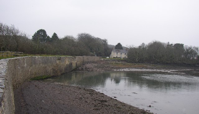
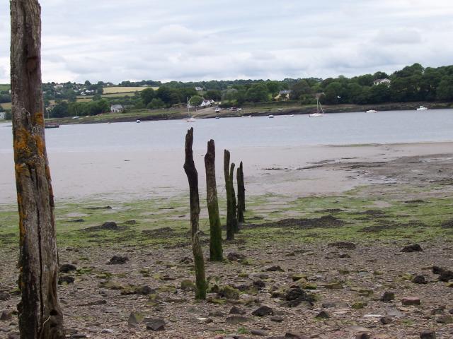
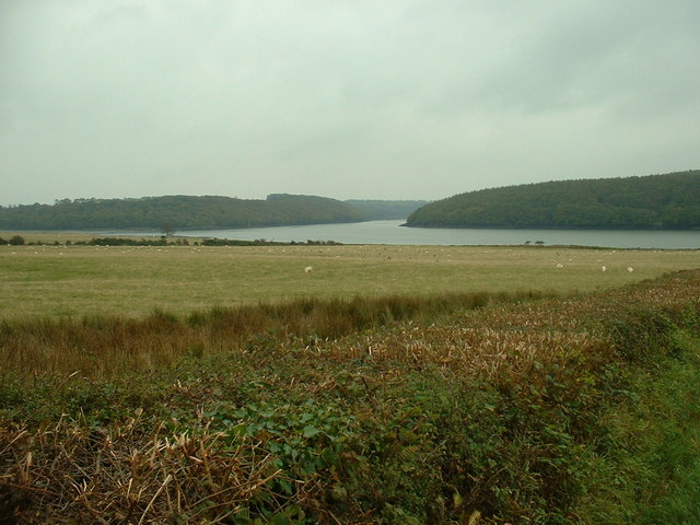
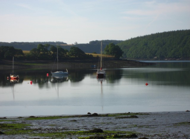
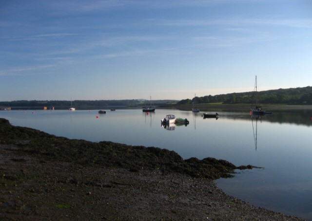
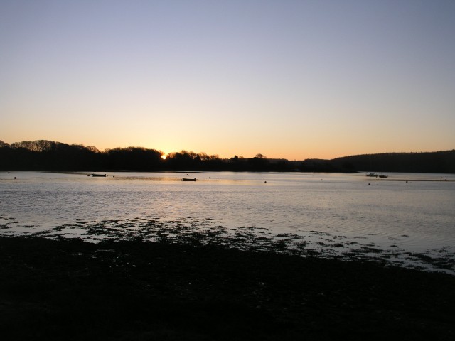
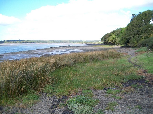
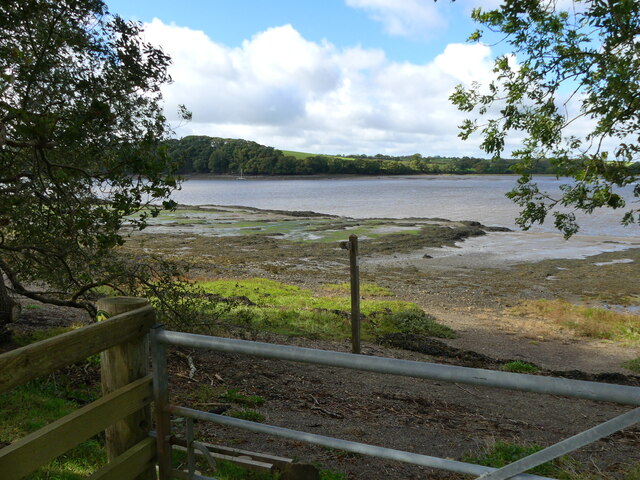
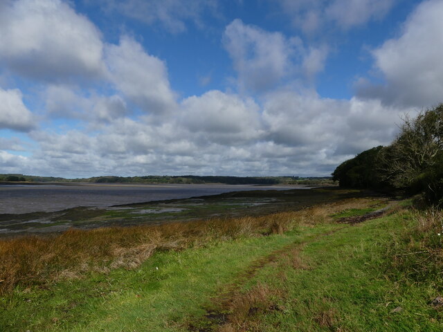
Llangwm Pill is a picturesque coastal feature located in the county of Pembrokeshire, Wales. It is a small, narrow inlet or creek that extends inland from the Cleddau Estuary. The word "pill" is derived from the Welsh language, meaning a tidal inlet or creek.

This charming waterway is surrounded by lush greenery and offers breathtaking views of the sea and surrounding landscape. It is influenced by the tides, resulting in water levels that rise and fall throughout the day. At high tide, the creek is a haven for small boats and provides a peaceful setting for leisure activities such as kayaking and paddleboarding.

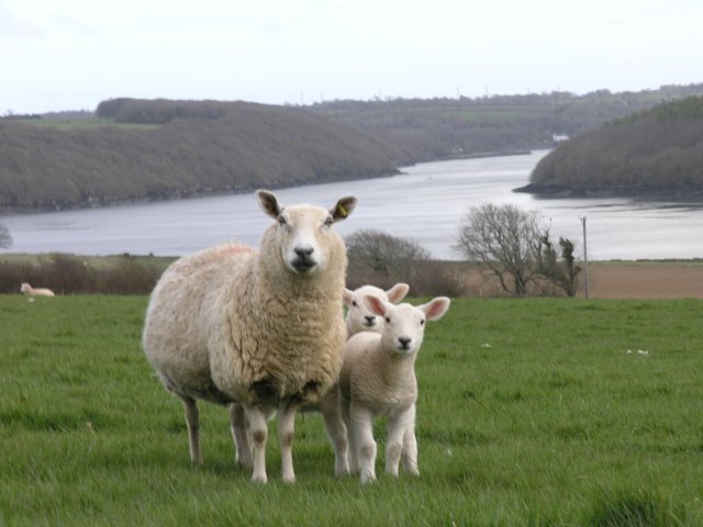
The banks of Llangwm Pill are teeming with wildlife, making it a popular spot for nature enthusiasts and birdwatchers. The diverse ecosystem supports a variety of bird species, including herons, egrets, and kingfishers. The surrounding marshes and mudflats provide an ideal habitat for wading birds and other coastal creatures.

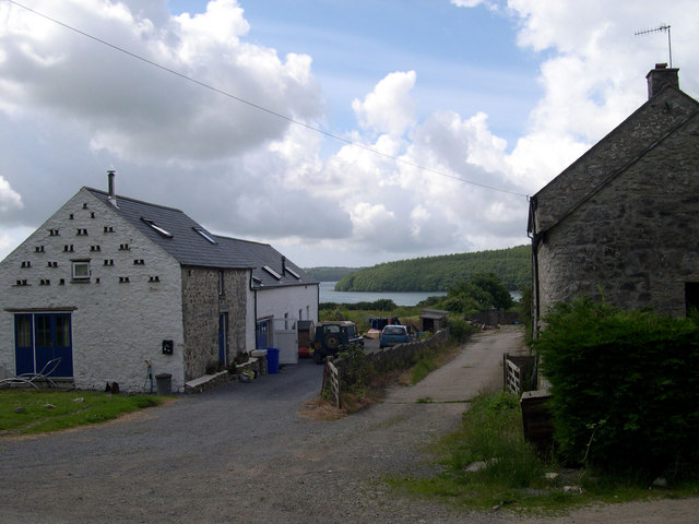
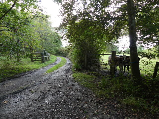
The village of Llangwm, from which the creek takes its name, sits nearby and offers a charming and traditional Welsh atmosphere. Visitors can explore the narrow streets, admire the quaint cottages, and enjoy the warm hospitality of the locals.

Llangwm Pill is not only a natural beauty but also holds historical significance. In the past, it served as a busy port, facilitating trade and transportation of goods. Today, it remains a peaceful and idyllic location where visitors can enjoy the tranquility of nature and immerse themselves in the rich history and natural beauty of Pembrokeshire.

If you have any feedback on the listing, please let us know in the comments section below.

Llangwm Pill Images

Images are sourced within 2km of 51.745673/-4.9050844 or Grid Reference SM9909. Thanks to Geograph Open Source API. All images are credited.

Landshipping Quay, Martletwy This quay was reconstructed in 1801 by Sir Hugh Owen, for the export of coal from his mine nearby.
Landshipping Quay, Martletwy
This quay was reconstructed in 1801 by Sir Hugh Owen, for the export of coal from his mine nearby.
A field near Sprinkle Pill
The bridleway near Sprinkle Farm
The minor road near Sprinkle Farm
Cleddau River Looking across the River Cleddau towards the village of Llangwm.
Cleddau River
Looking across the River Cleddau towards the village of Llangwm.
Beggars Reach With Garron Pill running off to the left.
Beggars Reach
With Garron Pill running off to the left.
Farmland near Broadley Looking a bit uncared for just here.
Farmland near Broadley
Looking a bit uncared for just here.
Ewe and Lambs A ewe protects her lambs from a nearby photographer, with the Daugleddau estuary in the background.
Ewe and Lambs
A ewe protects her lambs from a nearby photographer, with the Daugleddau estuary in the background.
Coedcanlas at dawn
Coedcanlas at dawn
Western Cleddau at dawn
Sunrise over Coedcanlas from Black Tar
Coedcanlas farm cottages
Coedcanlas farm
Coedcanlas farm
Cleddau River south of Landshipping Looking north up the east side of the Cleddau
Cleddau River south of Landshipping
Looking north up the east side of the Cleddau
Track junction near Woodhouse, Landshipping Quay, Pembrokeshire
Part of the Landsker Borderlands Trail, near Landshipping Quay, Pembrokeshire
The Landsker Borderlands Trail is diverted on to the beach
The Landsker Borderlands Trail  on the beach
The Landsker Borderlands Trail on the beach
Show me another place!

Llangwm Pill is located at Grid Ref: SM9909 (Lat: 51.745673, Lng: -4.9050844)

Unitary Authority: Pembrokeshire

Police Authority: Dyfed Powys

What 3 Words

///kipper.deliver.heightens. Near Llangwm, Pembrokeshire

Related Wikis

Llangwm, Pembrokeshire

Llangwm (; Welsh pronunciation: [ˈɬangʊm]) is a small village, parish and community of around 450 properties situated on the Llangwm Pill off the River...

Coedcanlas

Coedcanlas is a small parish in Pembrokeshire, Wales, on the eastern shore of the Daugleddau estuary, 5 miles (8.0 km) north of Pembroke, in the Pembrokeshire...

Foxhall, Pembrokeshire

Foxhall is a rural hamlet of a few houses between Hill Mountain and Port Lion in the community of Llangwm, and the parish of Burton, Pembrokeshire, Wales...

Great Nash

Great Nash was an important gentry house at Llangwm, Pembrokeshire, Wales. The house was occupied by the Nash family in the 15th and 16th Century. An heiress...

Nearby Amenities

Located within 500m of 51.745673,-4.9050844
Created By: dmgroom_coastlines
Lat/Long: 51.745866/-4.909901
Clwb Rygbi Llangwm
Addr City: Llangwm
Addr Postcode: SA62 4HT
Addr Street: Pill Parks Way
Club: sport
Name Cy: Clwb Rygbi Llangwm
Name En: Llangwm RFC
Operator: Llangwm R.F.C.
Phone: +44 1437 890 462
Rugby: union
Sport: rugby
Website: https://llangwm.rfc.wales/
Lat/Long: 51.7477412/-4.9105315
Black Tar Slipway
Description: Layby parking a short distance back along the road. Area to unload by the shoreline / slipway.
Leisure: slipway
Lat/Long: 51.7481869/-4.8995909
Direction: 195
Generator Method: photovoltaic
Generator Output Electricity: yes
Generator Solar Modules: 16
Generator Source: solar
Generator Type: solar_photovoltaic_panel
Location: roof
Power: generator
Lat/Long: 51.7441139/-4.9094148
Direction: SSW
Generator Method: photovoltaic
Generator Output Electricity: yes
Generator Solar Modules: 7
Generator Source: solar
Generator Type: solar_photovoltaic_panel
Location: roof
Power: generator
Lat/Long: 51.7437398/-4.9115431
Direction: 175
Generator Method: photovoltaic
Generator Output Electricity: yes
Generator Solar Modules: 15
Generator Source: solar
Generator Type: solar_photovoltaic_panel
Location: roof
Power: generator
Lat/Long: 51.7462546/-4.9095932
Direction: S
Generator Method: photovoltaic
Generator Output Electricity: yes
Generator Solar Modules: 10
Generator Source: solar
Generator Type: solar_photovoltaic_panel
Location: roof
Power: generator
Lat/Long: 51.7462845/-4.9086383
Direction: 170
Generator Method: photovoltaic
Generator Output Electricity: yes
Generator Solar Modules: 16
Generator Source: solar
Generator Type: solar_photovoltaic_panel
Location: roof
Power: generator
Lat/Long: 51.7458876/-4.9063101
Direction: S
Generator Method: photovoltaic
Generator Output Electricity: yes
Generator Solar Modules: 16
Generator Source: solar
Generator Type: solar_photovoltaic_panel
Location: roof
Power: generator
Lat/Long: 51.747269/-4.911008
Direction: 195
Generator Method: photovoltaic
Generator Output Electricity: yes
Generator Solar Modules: 6
Generator Source: solar
Generator Type: solar_photovoltaic_panel
Location: roof
Power: generator
Lat/Long: 51.7432246/-4.9038707
Direction: 195
Generator Method: photovoltaic
Generator Output Electricity: yes
Generator Solar Modules: 8
Generator Source: solar
Generator Type: solar_photovoltaic_panel
Location: roof
Power: generator
Lat/Long: 51.7432827/-4.9038868
The data included in this document is from www.openstreetmap.org. The data is made available under ODbL.

Have you been to Llangwm Pill?

Leave your review of Llangwm Pill below (or comments, questions and feedback).