Edward's Pill

Sea, Estuary, Creek in Pembrokeshire

Wales

Edward's Pill

Landshipping Quay, Martletwy This quay was reconstructed in 1801 by Sir Hugh Owen, for the export of coal from his mine nearby.
Landshipping Quay, Martletwy Credit: Humphrey Bolton

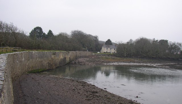
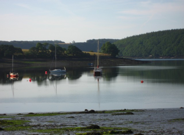
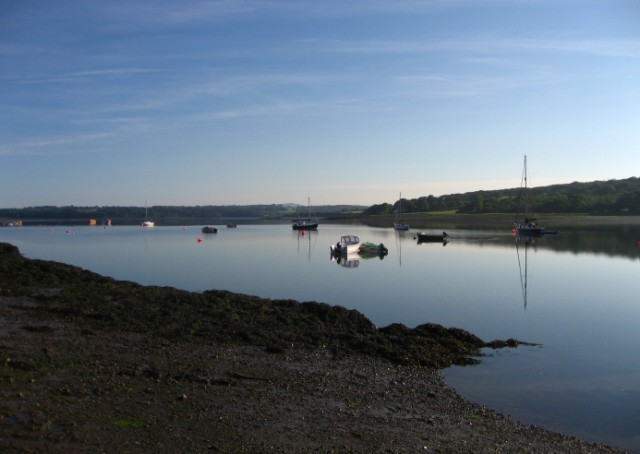
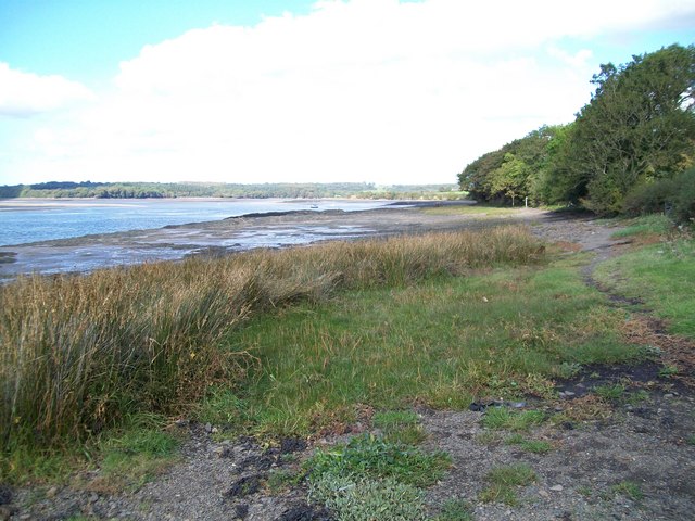
Edward's Pill is a picturesque and serene waterway located in Pembrokeshire, Wales. Situated on the western coast of the country, it offers a unique blend of sea, estuary, and creek, making it a popular destination for nature enthusiasts and outdoor adventurers.

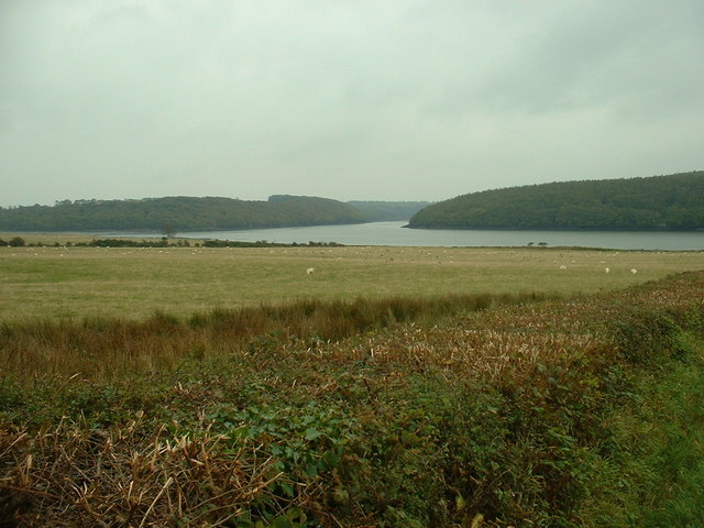
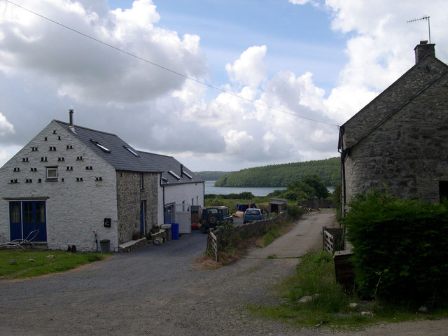
This tranquil spot is nestled within the beautiful Pembrokeshire Coast National Park, renowned for its stunning landscapes and diverse wildlife. Edward's Pill is formed by the convergence of the Western Cleddau River and the Milford Haven Waterway, creating a peaceful and idyllic setting.

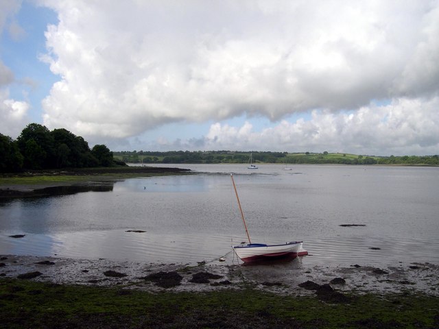
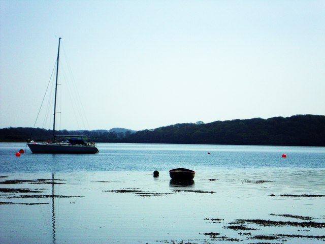
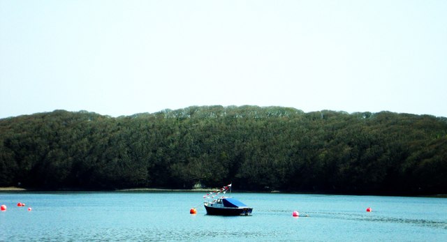
The crystal-clear waters of Edward's Pill are perfect for a variety of recreational activities, including kayaking, canoeing, and boating. Exploring the surrounding estuary and creek allows visitors to immerse themselves in the natural beauty of the area, as well as observe the rich flora and fauna that call this place home.

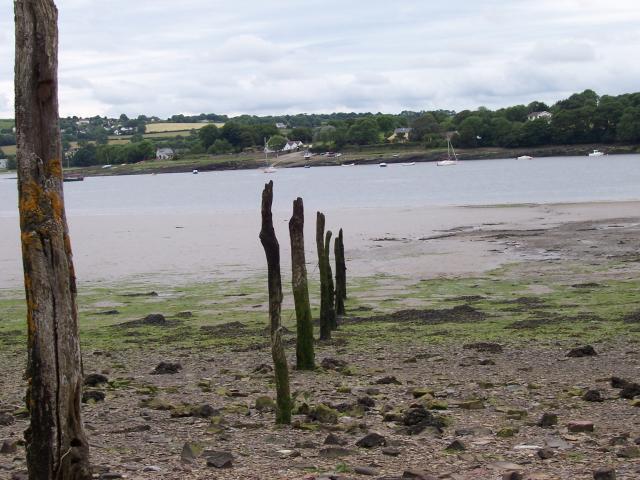
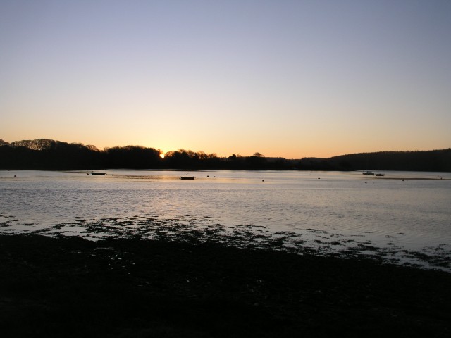
The tidal nature of Edward's Pill adds another layer of charm, as the water levels constantly change, revealing hidden sandbanks and small islands during low tide. This provides an excellent opportunity for leisurely walks along the sandy shores and the chance to discover unique marine life in the rock pools.

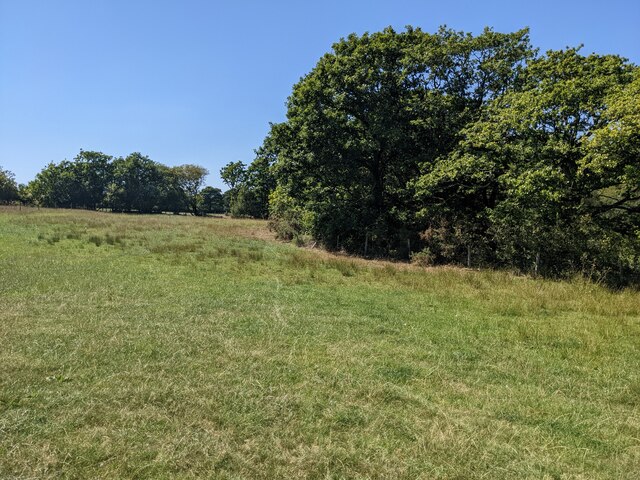
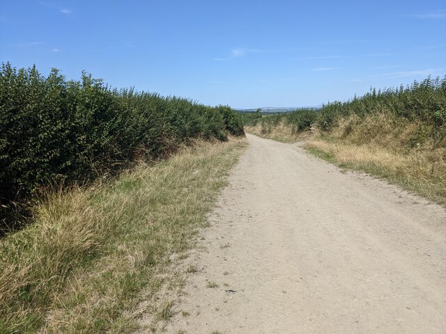
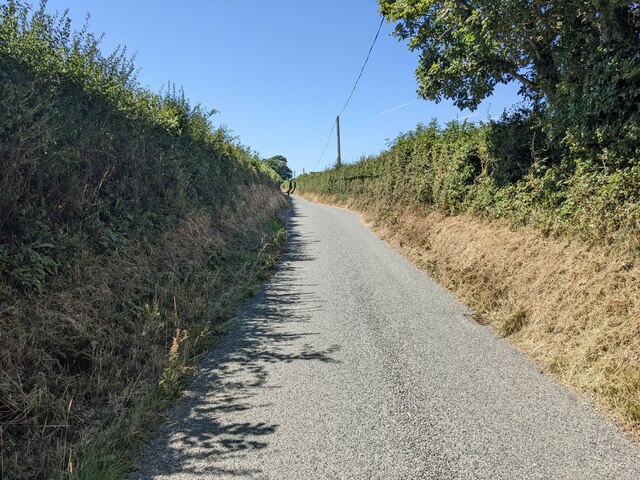
The area surrounding Edward's Pill is also known for its remarkable coastal walks, offering breathtaking views of the rugged cliffs and sweeping vistas of the sea. The nearby Pembrokeshire Coastal Path is a popular route among hikers, providing access to stunning viewpoints and hidden coves along the way.

Edward's Pill is a hidden gem that showcases the natural beauty and tranquility of Pembrokeshire. Its combination of sea, estuary, and creek makes it a haven for outdoor enthusiasts and those seeking a peaceful retreat amidst nature's splendor.

If you have any feedback on the listing, please let us know in the comments section below.

Edward's Pill Images

Images are sourced within 2km of 51.746406/-4.9045374 or Grid Reference SM9909. Thanks to Geograph Open Source API. All images are credited.

Landshipping Quay, Martletwy This quay was reconstructed in 1801 by Sir Hugh Owen, for the export of coal from his mine nearby.
Landshipping Quay, Martletwy
This quay was reconstructed in 1801 by Sir Hugh Owen, for the export of coal from his mine nearby.
Landshipping Quay Looking over to Black Tar
Landshipping Quay
Looking over to Black Tar
A field near Sprinkle Pill
The bridleway near Sprinkle Farm
The minor road near Sprinkle Farm
Cleddau River Looking across the River Cleddau towards the village of Llangwm.
Cleddau River
Looking across the River Cleddau towards the village of Llangwm.
Beggars Reach With Garron Pill running off to the left.
Beggars Reach
With Garron Pill running off to the left.
Farmland near Broadley Looking a bit uncared for just here.
Farmland near Broadley
Looking a bit uncared for just here.
Ewe and Lambs A ewe protects her lambs from a nearby photographer, with the Daugleddau estuary in the background.
Ewe and Lambs
A ewe protects her lambs from a nearby photographer, with the Daugleddau estuary in the background.
Coedcanlas at dawn
Coedcanlas at dawn
Western Cleddau at dawn
Sunrise over Coedcanlas from Black Tar
Coedcanlas farm cottages
Coedcanlas farm
Coedcanlas farm
Cleddau River south of Landshipping Looking north up the east side of the Cleddau
Cleddau River south of Landshipping
Looking north up the east side of the Cleddau
View Upriver The division of Pembrokeshire.
View Upriver
The division of Pembrokeshire.
Mid river  Looking across the divide to South Pembrokeshire.
Mid river
Looking across the divide to South Pembrokeshire.
Benton Woods The river is just visible through the trees and Coedcanlas Farm is across the water
Benton Woods
The river is just visible through the trees and Coedcanlas Farm is across the water
Show me another place!

Edward's Pill is located at Grid Ref: SM9909 (Lat: 51.746406, Lng: -4.9045374)

Unitary Authority: Pembrokeshire

Police Authority: Dyfed Powys

What 3 Words

///museum.sandbags.doll. Near Llangwm, Pembrokeshire

Related Wikis

Llangwm, Pembrokeshire

Llangwm (; Welsh pronunciation: [ˈɬangʊm]) is a small village, parish and community of around 450 properties situated on the Llangwm Pill off the River...

Coedcanlas

Coedcanlas is a small parish in Pembrokeshire, Wales, on the eastern shore of the Daugleddau estuary, 5 miles (8.0 km) north of Pembroke, in the Pembrokeshire...

Foxhall, Pembrokeshire

Foxhall is a rural hamlet of a few houses between Hill Mountain and Port Lion in the community of Llangwm, and the parish of Burton, Pembrokeshire, Wales...

Great Nash

Great Nash was an important gentry house at Llangwm, Pembrokeshire, Wales. The house was occupied by the Nash family in the 15th and 16th Century. An heiress...

Nearby Amenities

Located within 500m of 51.746406,-4.9045374
Created By: dmgroom_coastlines
Lat/Long: 51.745866/-4.909901
Clwb Rygbi Llangwm
Addr City: Llangwm
Addr Postcode: SA62 4HT
Addr Street: Pill Parks Way
Club: sport
Name Cy: Clwb Rygbi Llangwm
Name En: Llangwm RFC
Operator: Llangwm R.F.C.
Phone: +44 1437 890 462
Rugby: union
Sport: rugby
Website: https://llangwm.rfc.wales/
Lat/Long: 51.7477412/-4.9105315
Black Tar Slipway
Description: Layby parking a short distance back along the road. Area to unload by the shoreline / slipway.
Leisure: slipway
Lat/Long: 51.7481869/-4.8995909
Direction: 195
Generator Method: photovoltaic
Generator Output Electricity: yes
Generator Solar Modules: 16
Generator Source: solar
Generator Type: solar_photovoltaic_panel
Location: roof
Power: generator
Lat/Long: 51.7441139/-4.9094148
Direction: 175
Generator Method: photovoltaic
Generator Output Electricity: yes
Generator Solar Modules: 15
Generator Source: solar
Generator Type: solar_photovoltaic_panel
Location: roof
Power: generator
Lat/Long: 51.7462546/-4.9095932
Direction: S
Generator Method: photovoltaic
Generator Output Electricity: yes
Generator Solar Modules: 10
Generator Source: solar
Generator Type: solar_photovoltaic_panel
Location: roof
Power: generator
Lat/Long: 51.7462845/-4.9086383
Direction: 170
Generator Method: photovoltaic
Generator Output Electricity: yes
Generator Solar Modules: 16
Generator Source: solar
Generator Type: solar_photovoltaic_panel
Location: roof
Power: generator
Lat/Long: 51.7458876/-4.9063101
Direction: S
Generator Method: photovoltaic
Generator Output Electricity: yes
Generator Solar Modules: 16
Generator Source: solar
Generator Type: solar_photovoltaic_panel
Location: roof
Power: generator
Lat/Long: 51.747269/-4.911008
Direction: 195
Generator Method: photovoltaic
Generator Output Electricity: yes
Generator Solar Modules: 6
Generator Source: solar
Generator Type: solar_photovoltaic_panel
Location: roof
Power: generator
Lat/Long: 51.7432246/-4.9038707
Direction: 195
Generator Method: photovoltaic
Generator Output Electricity: yes
Generator Solar Modules: 8
Generator Source: solar
Generator Type: solar_photovoltaic_panel
Location: roof
Power: generator
Lat/Long: 51.7432827/-4.9038868
The data included in this document is from www.openstreetmap.org. The data is made available under ODbL.

Have you been to Edward's Pill?

Leave your review of Edward's Pill below (or comments, questions and feedback).