Caolas Bàn

Sea, Estuary, Creek in Argyllshire

Scotland

Caolas Bàn

Eilean Chormaic, Port Uisken
Eilean Chormaic, Port Uisken Credit: Steven Brown

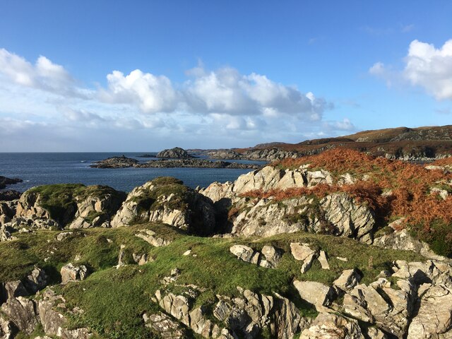
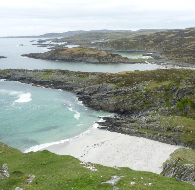
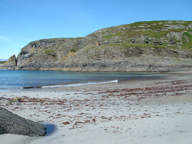
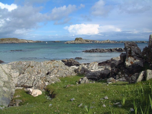
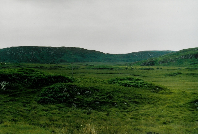
Caolas Bàn is a picturesque sea inlet located in Argyllshire, Scotland. Nestled between the rugged hills and stunning coastline, this estuary, also known as a sea creek, offers a tranquil and scenic retreat for visitors.

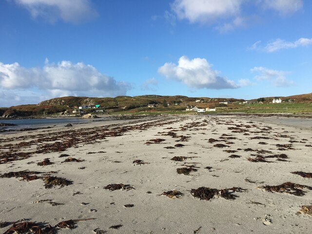
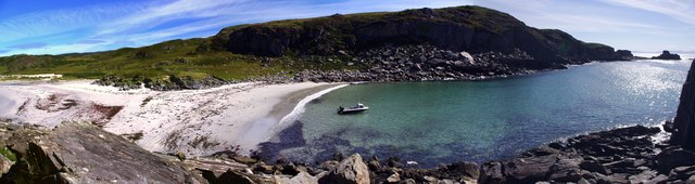
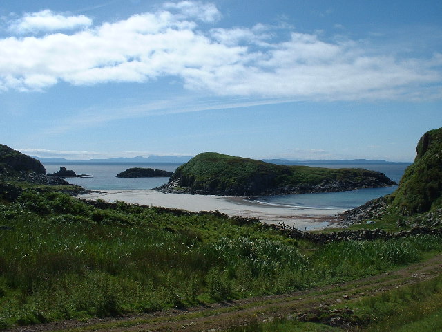
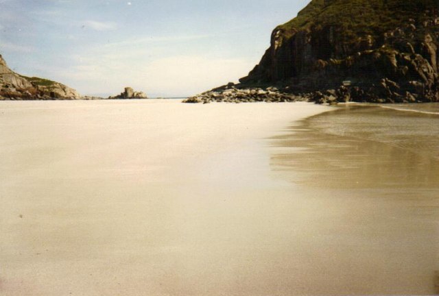
The name "Caolas Bàn" translates to "White Strait" in Gaelic, referencing the pale sandy beaches that line its shores. The estuary stretches for approximately 2 miles and is characterized by its crystal-clear turquoise waters, which are influenced by the nearby Atlantic Ocean.

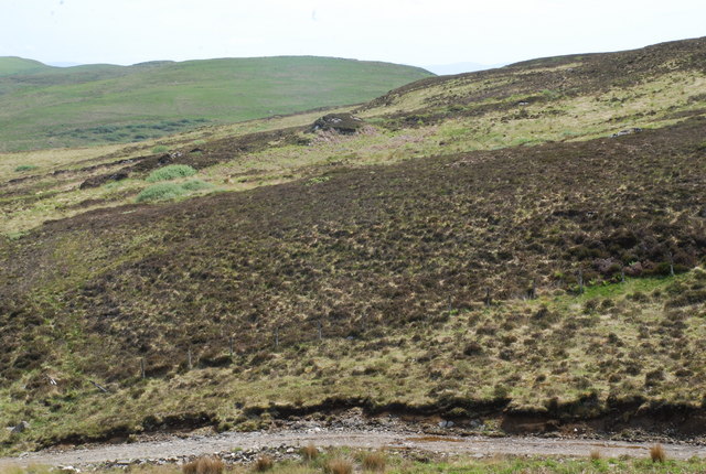
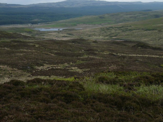
Surrounded by lush greenery, Caolas Bàn is a haven for wildlife enthusiasts. The area is home to a diverse range of bird species, including herons, oystercatchers, and gulls, making it an ideal spot for birdwatching. The shallow waters and rich marine life also attract seals, dolphins, and occasional sightings of otters.

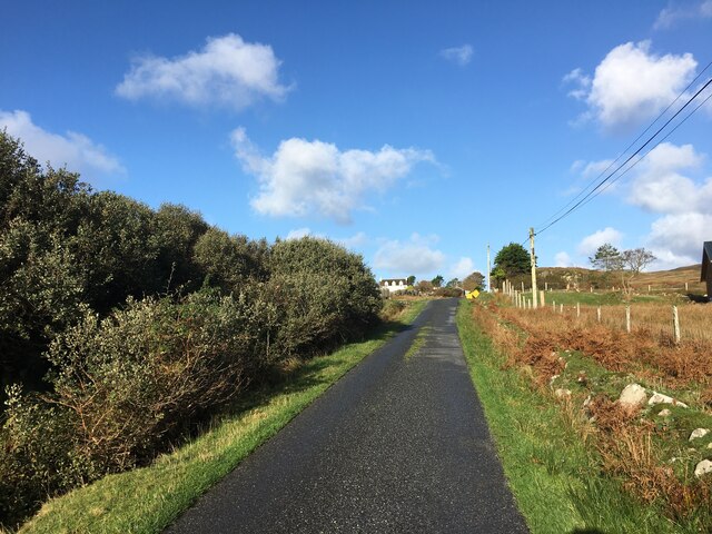
The estuary is accessible by foot or boat, with a small slipway available for launching kayaks or canoes. Visitors can explore the calm waters and take in the breathtaking views of the surrounding hills and sea cliffs. The sandy beaches provide an opportunity for picnicking, sunbathing, or simply enjoying the peaceful atmosphere.

Caolas Bàn is a popular destination for nature lovers and outdoor enthusiasts seeking a serene and unspoiled coastal experience. Its natural beauty, diverse wildlife, and tranquil surroundings make it a must-visit location for those exploring the Argyllshire region.

If you have any feedback on the listing, please let us know in the comments section below.

Caolas Bàn Images

Images are sourced within 2km of 56.28737/-6.2115535 or Grid Reference NM3918. Thanks to Geograph Open Source API. All images are credited.

Eilean Chormaic, Port Uisken
Beach at Uisken
Beach at Uisken
Near the road end at Uisken
Phone box and postbox near Uisken
Dun a' Gheird, Mull The name is probably a corruption of Dun nan Geard (Fort of the Guard). It is a well-preserved galleried dun with spectacular views west across the south coast of the Ross of Mull and south to Colonsay, Islay and Jura. At the time of our visit, however, we could only imagine such views!

For more information, visit <span class="nowrap"><a title="http://www.scotlandsplaces.gov.uk/record/rcahms/21974/dun-gheird-mull/rcahms" rel="nofollow ugc noopener" href="http://www.scotlandsplaces.gov.uk/record/rcahms/21974/dun-gheird-mull/rcahms">Link</a><img style="margin-left:2px;" alt="External link" title="External link - shift click to open in new window" src="https://s1.geograph.org.uk/img/external.png" width="10" height="10"/></span>
Dun a' Gheird, Mull
The name is probably a corruption of Dun nan Geard (Fort of the Guard). It is a well-preserved galleried dun with spectacular views west across the south coast of the Ross of Mull and south to Colonsay, Islay and Jura. At the time of our visit, however, we could only imagine such views! For more information, visit LinkExternal link
View south-west from Dun a' Gheird, Mull The south coast of the Ross of Mull is dotted with rocky islets and many attractive beaches, like this one.
View south-west from Dun a' Gheird, Mull
The south coast of the Ross of Mull is dotted with rocky islets and many attractive beaches, like this one.
Looking east from Garbh Eilean One of many beautiful and undisturbed beaches on the Ross of Mull
Looking east from Garbh Eilean
One of many beautiful and undisturbed beaches on the Ross of Mull
Garbh Eilean and  Kilvickeon Beach, Mull Garbh Eilean is a tidal island on a beautiful beach. The grid line runs right down the middle of Garbh Eilean, so the left-hand side as seen here is actually in <a href="https://www.geograph.org.uk/gridref/NM4118">NM4118</a>. The islands of Jura and Islay are visible on the horizon.
Garbh Eilean and Kilvickeon Beach, Mull
Garbh Eilean is a tidal island on a beautiful beach. The grid line runs right down the middle of Garbh Eilean, so the left-hand side as seen here is actually in NM4118. The islands of Jura and Islay are visible on the horizon.
Kilvickeon Beach, Isle of Mull This is the beach in the North-East corner of the square - the photo is taken from NM409186 looking West. For a panoramic view of this beach, see adjoining grid square <a href="https://www.geograph.org.uk/gridref/NM4118">NM4118</a>.
Kilvickeon Beach, Isle of Mull
This is the beach in the North-East corner of the square - the photo is taken from NM409186 looking West. For a panoramic view of this beach, see adjoining grid square NM4118.
Cnoc Mòr, L.Assapol, Mull Heather moorland in the foreground, but bracken and grass on Cnoc Mòr in the distance.
Cnoc Mòr, L.Assapol, Mull
Heather moorland in the foreground, but bracken and grass on Cnoc Mòr in the distance.
View over hillside towards Loch Assapol
Garbh Eilean and Kilvickeon Beach, Mull at low tide Near to Scoor, on the south side of Mull, lies Garbh Eilean, an island only when the tide comes in.  Here it can be seen on the right of the picture.  The areas of sand on both sides form a kind of double-beach when the tide is out.
Garbh Eilean and Kilvickeon Beach, Mull at low tide
Near to Scoor, on the south side of Mull, lies Garbh Eilean, an island only when the tide comes in. Here it can be seen on the right of the picture. The areas of sand on both sides form a kind of double-beach when the tide is out.
High tide at Kilvickeon Beach, Isle of Mull View from Kilvickeon Beach, with Garbh Eilean on the right of the picture.
High tide at Kilvickeon Beach, Isle of Mull
View from Kilvickeon Beach, with Garbh Eilean on the right of the picture.
Sheep near Kilvickeon Beach, Isle of Mull Near to Scoor, on the Ross of Mull.  Sheep graze near to Kilvickeon Beach.  The island in the centre of the photo is Garbh Eilean, which becomes part of the mainland again once the tide goes out.
Sheep near Kilvickeon Beach, Isle of Mull
Near to Scoor, on the Ross of Mull. Sheep graze near to Kilvickeon Beach. The island in the centre of the photo is Garbh Eilean, which becomes part of the mainland again once the tide goes out.
Garbh Eilean, Isle of Mull On Garbh Eilean, looking towards mainland Mull (the island is an island only when the tide is in, as it is in this photo).  Fishermen have wedged their fishing rods in cracks in the rocks.
Garbh Eilean, Isle of Mull
On Garbh Eilean, looking towards mainland Mull (the island is an island only when the tide is in, as it is in this photo). Fishermen have wedged their fishing rods in cracks in the rocks.
Kilvickeon Beach from Garbh Eilean, Isle of Mull View from Garbh Eilean towards Kilvickeon Beach, near Scoor, Isle of Mull.
Kilvickeon Beach from Garbh Eilean, Isle of Mull
View from Garbh Eilean towards Kilvickeon Beach, near Scoor, Isle of Mull.
Port Uisken, Mull Coastline at Uisken on the south side of the Ross of Mull
Port Uisken, Mull
Coastline at Uisken on the south side of the Ross of Mull
Grazing land near Uisken Poor quality grazing is standard on Mull - no different here on the south coast. Looking northeast (inland) from the road to Uisken.
Grazing land near Uisken
Poor quality grazing is standard on Mull - no different here on the south coast. Looking northeast (inland) from the road to Uisken.
Show me another place!

Caolas Bàn is located at Grid Ref: NM3918 (Lat: 56.28737, Lng: -6.2115535)

Unitary Authority: Argyll and Bute

Police Authority: Argyll and West Dunbartonshire

What 3 Words

///foreheads.hikes.flank. Near Fionnphort, Argyll & Bute

Related Wikis

Uisken

Uisken (Scottish Gaelic: Uisgean, meaning "water-bay") is a settlement on a sandy bay on the Ross of Mull in the south of the Isle of Mull, on the west...

Ardalanish

Ardalanish (Scottish Gaelic: Àird Dealanais) is a village on the Isle of Mull in Argyll and Bute, Scotland. It is now an organic farm and weaving mill...

Knocknafenaig

Knocknafenaig (Scottish Gaelic: Cnoc na Fennaig) is a ruined township on the Isle of Mull, Scotland. Located in the south-western portion of the island...

Bunessan

Bunessan (Scottish Gaelic: Bun Easain) is a small village on the Ross of Mull in the south-west of the Isle of Mull, off the west coast of Scotland. The...

Suidhe

Suidhe (Scottish Gaelic: Suidhe) is a ruined township located on the southwestern peninsula of the Isle of Mull, Scotland. It lies just over 1 km to the...

Shiaba

Shiaba (Scottish Gaelic: Siaba) is a ruined township located on the southwestern peninsula of the Isle of Mull, Scotland. It lies about 8 km to the east...

Ardtun

Ardtun (Scottish Gaelic: Àird Tunna) is a settlement on the Isle of Mull, in Argyll and Bute, Scotland. Ardtun is within the parish of Kilfinichen and...

Ross of Mull

The Ross of Mull (Scottish Gaelic: An Ros Mhuileach) is the largest peninsula of the Isle of Mull, about 28 kilometres (17 mi) long, and makes up the south...

Nearby Amenities

Located within 500m of 56.28737,-6.2115535
Source: PGS
Lat/Long: 56.2860506/-6.2121803
Source: PGS
Lat/Long: 56.2859523/-6.2125585
Source: PGS
Lat/Long: 56.2859751/-6.2126682
Source: PGS
Lat/Long: 56.2860224/-6.212758
Source: PGS
Lat/Long: 56.286272/-6.2128742
Source: PGS
Lat/Long: 56.2866646/-6.2129216
Source: PGS
Lat/Long: 56.2867159/-6.2131548
Source: PGS
Lat/Long: 56.2868727/-6.2132851
Source: PGS
Lat/Long: 56.2870576/-6.2131725
Source: PGS
Lat/Long: 56.2872296/-6.2128272
Source: PGS
Lat/Long: 56.2874188/-6.2127679
Source: PGS
Lat/Long: 56.2874012/-6.2123383
Source: PGS
Lat/Long: 56.2870846/-6.2121243
Source: PGS
Lat/Long: 56.2865784/-6.2118383
Source: PGS
Lat/Long: 56.2862799/-6.2118101
Source: PGS
Lat/Long: 56.2862539/-6.2119059
Source: PGS
Lat/Long: 56.2861827/-6.211924
Source: PGS
Lat/Long: 56.288848/-6.2050354
Source: PGS
Lat/Long: 56.2886851/-6.2059199
Created By: dmgroom_coastlines
Source: PGS
Lat/Long: 56.28839/-6.20626
Source: PGS
Lat/Long: 56.2883223/-6.2062745
Source: PGS
Lat/Long: 56.2882974/-6.2072673
Source: PGS
Lat/Long: 56.2889985/-6.206813
Created By: dmgroom_coastlines
Source: PGS
Lat/Long: 56.28942/-6.20641
Source: PGS
Lat/Long: 56.2897747/-6.2061705
Source: PGS
Lat/Long: 56.2899783/-6.2065657
Source: PGS
Lat/Long: 56.2900657/-6.2068242
Created By: dmgroom_coastlines
Source: PGS
Lat/Long: 56.29008/-6.20729
Source: PGS
Lat/Long: 56.2897224/-6.2074055
Source: PGS
Lat/Long: 56.2894617/-6.2079564
Source: PGS
Lat/Long: 56.2891633/-6.2081172
Source: PGS
Lat/Long: 56.2888538/-6.2084592
Created By: dmgroom_coastlines
Source: PGS
Lat/Long: 56.28883/-6.20876
Source: PGS
Lat/Long: 56.2891361/-6.2099461
Source: PGS
Lat/Long: 56.2893774/-6.2107719
Source: PGS
Lat/Long: 56.28919/-6.21134
Source: PGS
Lat/Long: 56.2890271/-6.2119641
Source: PGS
Lat/Long: 56.2888269/-6.2113736
Created By: dmgroom_coastlines
Source: PGS
Lat/Long: 56.28823/-6.21065
Source: PGS
Lat/Long: 56.2880828/-6.2097627
Source: PGS
Lat/Long: 56.287054/-6.2095558
Source: PGS
Lat/Long: 56.2869803/-6.2099732
Created By: dmgroom_coastlines
Source: PGS
Lat/Long: 56.28719/-6.21003
Source: PGS
Lat/Long: 56.2873336/-6.2101456
Source: PGS
Lat/Long: 56.2874854/-6.210235
Source: PGS
Lat/Long: 56.2881146/-6.210824
Source: PGS
Lat/Long: 56.2878854/-6.2112279
Source: PGS
Lat/Long: 56.2879176/-6.2127403
Source: PGS
Lat/Long: 56.2886965/-6.2125684
Source: PGS
Lat/Long: 56.2887864/-6.2126278
Source: PGS
Lat/Long: 56.2889238/-6.2126257
Source: PGS
Lat/Long: 56.289495/-6.2125304
Source: PGS
Lat/Long: 56.2894813/-6.2123256
Source: PGS
Lat/Long: 56.28938/-6.21225
Source: PGS
Lat/Long: 56.289867/-6.2134518
Source: PGS
Lat/Long: 56.2898744/-6.2149425
Source: PGS
Lat/Long: 56.2897794/-6.2157742
Source: PGS
Lat/Long: 56.2897304/-6.215948
Source: PGS
Lat/Long: 56.2893772/-6.2171044
Source: PGS
Lat/Long: 56.2891586/-6.2171636
Source: PGS
Lat/Long: 56.2888502/-6.2173941
Source: PGS
Lat/Long: 56.2880839/-6.2183324
Source: PGS
Lat/Long: 56.2878677/-6.2180157
Source: PGS
Lat/Long: 56.28759/-6.2177301
Source: PGS
Lat/Long: 56.2875825/-6.2179559
Source: PGS
Lat/Long: 56.2863224/-6.2187756
Created By: dmgroom_coastlines
Source: PGS
Lat/Long: 56.28611/-6.21886
Created By: dmgroom_coastlines
Source: PGS
Lat/Long: 56.2856/-6.2189
Basic Site
Tourism: camp_site
Lat/Long: 56.2904671/-6.2168954
Source: PGS
Lat/Long: 56.2878566/-6.2093919
Source: PGS
Lat/Long: 56.2887227/-6.2107889
Source: PGS
Lat/Long: 56.29023/-6.21418
The data included in this document is from www.openstreetmap.org. The data is made available under ODbL.

Have you been to Caolas Bàn?

Leave your review of Caolas Bàn below (or comments, questions and feedback).