Annet Neck

Sea, Estuary, Creek in Cornwall

England

Annet Neck

Field with prehistoric cairn and field system To the east of Barnaby Lane, which runs just over the wall on the right.

Scheduled Monument List Entry Number:1015002  <span class="nowrap"><a title="https://historicengland.org.uk/listing/the-list/list-entry/1015002?section=official-list-entry" rel="nofollow ugc noopener" href="https://historicengland.org.uk/listing/the-list/list-entry/1015002?section=official-list-entry">Link</a><img style="margin-left:2px;" alt="External link" title="External link - shift click to open in new window" src="https://s1.geograph.org.uk/img/external.png" width="10" height="10"/></span>
Field with prehistoric cairn and field system Credit: David Lally

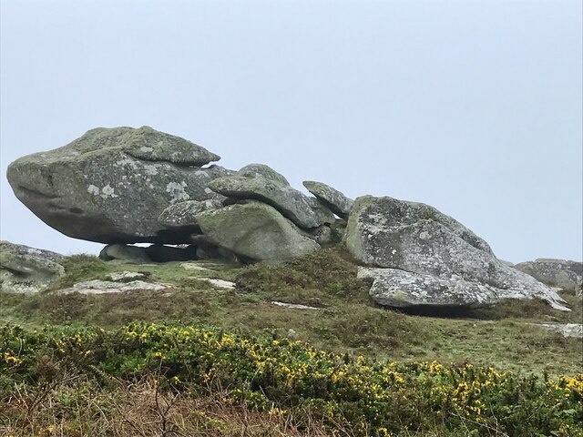
Annet Neck, situated in Cornwall, is a picturesque coastal area that boasts stunning natural beauty and an abundance of marine life. It is located at the confluence of a sea, estuary, and creek, making it a unique and diverse ecosystem.

The sea at Annet Neck is characterized by its crystal-clear turquoise waters and sandy beaches. It offers a range of recreational activities such as swimming, snorkeling, and fishing. The sea is home to various species of marine life, including dolphins, seals, and a wide variety of fish.

The estuary at Annet Neck is a haven for birdwatchers and nature enthusiasts. Its muddy banks are home to a rich array of bird species, including herons, egrets, and oystercatchers. During low tide, the estuary reveals vast mudflats teeming with marine invertebrates, providing a feeding ground for wading birds.

The creek at Annet Neck is a tranquil waterway that meanders through lush marshlands. It is lined with reeds and grasses, creating a serene and peaceful atmosphere. The creek is navigable by small boats and kayaks, allowing visitors to explore its hidden corners and discover its secluded beauty.

Annet Neck's unique combination of sea, estuary, and creek creates a diverse and thriving ecosystem. It is a haven for wildlife and a paradise for nature lovers. Whether you seek adventure on the open sea, tranquility in the estuary, or serenity along the creek, Annet Neck offers something for everyone who appreciates the beauty of nature.

If you have any feedback on the listing, please let us know in the comments section below.

Annet Neck Images

Images are sourced within 2km of 49.891317/-6.3651102 or Grid Reference SV8608. Thanks to Geograph Open Source API. All images are credited.

Field with prehistoric cairn and field system To the east of Barnaby Lane, which runs just over the wall on the right.

Scheduled Monument List Entry Number:1015002  <span class="nowrap"><a title="https://historicengland.org.uk/listing/the-list/list-entry/1015002?section=official-list-entry" rel="nofollow ugc noopener" href="https://historicengland.org.uk/listing/the-list/list-entry/1015002?section=official-list-entry">Link</a><img style="margin-left:2px;" alt="External link" title="External link - shift click to open in new window" src="https://s1.geograph.org.uk/img/external.png" width="10" height="10"/></span>
Field with prehistoric cairn and field system
To the east of Barnaby Lane, which runs just over the wall on the right. Scheduled Monument List Entry Number:1015002 LinkExternal link
Table laid-out for the St Agnes Coronation Street Party The “street” in this case is Old Lane.  No traffic order is required to close the road here! The Island Hall on the left had tables groaning under the weight of many cakes and other treats.
Table laid-out for the St Agnes Coronation Street Party
The “street” in this case is Old Lane. No traffic order is required to close the road here! The Island Hall on the left had tables groaning under the weight of many cakes and other treats.
Remains of a 19th century gig-shed On the north east edge of Per Askin. 

Of all the islands St Agnes as it is the most south westerly was in the best-placed to spot incoming vessels and launch a pilot-gig . Per Askin at the south west of the island would further increase the chance of getting a pilot aboard first. St Agnes pilots (typically named Hicks)  would then guide the ships as far as Bristol or the south coast ports. A major source of income for the Island throughout the 19th century.

A Scheduled Monument List Entry Number:1009280 <span class="nowrap"><a title="https://historicengland.org.uk/listing/the-list/list-entry/1009280?section=official-list-entry" rel="nofollow ugc noopener" href="https://historicengland.org.uk/listing/the-list/list-entry/1009280?section=official-list-entry">Link</a><img style="margin-left:2px;" alt="External link" title="External link - shift click to open in new window" src="https://s1.geograph.org.uk/img/external.png" width="10" height="10"/></span>
Remains of a 19th century gig-shed
On the north east edge of Per Askin. Of all the islands St Agnes as it is the most south westerly was in the best-placed to spot incoming vessels and launch a pilot-gig . Per Askin at the south west of the island would further increase the chance of getting a pilot aboard first. St Agnes pilots (typically named Hicks) would then guide the ships as far as Bristol or the south coast ports. A major source of income for the Island throughout the 19th century. A Scheduled Monument List Entry Number:1009280 LinkExternal link
A stile to Browarth A tad more conventional than 15 years ago <a href="https://www.geograph.org.uk/photo/827432">SV8708 : Crate Based Stile</a>.
A stile to Browarth
A tad more conventional than 15 years ago SV8708 : Crate Based Stile.
Two post-medieval quays These quays are believed to have been built to land coal for the St Agnes lighthouse.

For more details see the details on their Historic England listing:
List Entry Number:1016512. <span class="nowrap"><a title="https://historicengland.org.uk/listing/the-list/list-entry/1016512?section=official-list-entry" rel="nofollow ugc noopener" href="https://historicengland.org.uk/listing/the-list/list-entry/1016512?section=official-list-entry">Link</a><img style="margin-left:2px;" alt="External link" title="External link - shift click to open in new window" src="https://s1.geograph.org.uk/img/external.png" width="10" height="10"/></span>

The named quay “Uncle Tom’s Quay” is the more eroded of the two but can still be discerned to the right of the picture surmounted by a herring gull.
Two post-medieval quays
These quays are believed to have been built to land coal for the St Agnes lighthouse. For more details see the details on their Historic England listing: List Entry Number:1016512. LinkExternal link The named quay “Uncle Tom’s Quay” is the more eroded of the two but can still be discerned to the right of the picture surmounted by a herring gull.
Refloating Elvera This small launch is probably about 90 years old now.

It's spent the winter in a nearby field undergoing "months of work" according to its owner (on the right of the picture standing on the slipway.)

I expressed surprise that they had towed it down at such a low tide "You are going to let the tide float her?" "Yes, she's full of leaks".
Refloating Elvera
This small launch is probably about 90 years old now. It's spent the winter in a nearby field undergoing "months of work" according to its owner (on the right of the picture standing on the slipway.) I expressed surprise that they had towed it down at such a low tide "You are going to let the tide float her?" "Yes, she's full of leaks".
The St Agnes Lighthouse and attached house From Old lane.

The lighthouse is both a Grade II* listed building List Entry Number:1328835 <span class="nowrap"><a title="https://historicengland.org.uk/listing/the-list/list-entry/1328835" rel="nofollow ugc noopener" href="https://historicengland.org.uk/listing/the-list/list-entry/1328835">Link</a><img style="margin-left:2px;" alt="External link" title="External link - shift click to open in new window" src="https://s1.geograph.org.uk/img/external.png" width="10" height="10"/></span>

and a Scheduled Monument List Entry Number:1014999 <span class="nowrap"><a title="https://historicengland.org.uk/listing/the-list/list-entry/1014999?section=official-list-entry" rel="nofollow ugc noopener" href="https://historicengland.org.uk/listing/the-list/list-entry/1014999?section=official-list-entry">Link</a><img style="margin-left:2px;" alt="External link" title="External link - shift click to open in new window" src="https://s1.geograph.org.uk/img/external.png" width="10" height="10"/></span>

The house is Grade II List Entry Number:1218288 <span class="nowrap"><a title="https://historicengland.org.uk/listing/the-list/list-entry/1218288" rel="nofollow ugc noopener" href="https://historicengland.org.uk/listing/the-list/list-entry/1218288">Link</a><img style="margin-left:2px;" alt="External link" title="External link - shift click to open in new window" src="https://s1.geograph.org.uk/img/external.png" width="10" height="10"/></span>
The St Agnes Lighthouse and attached house
From Old lane. The lighthouse is both a Grade II* listed building List Entry Number:1328835 LinkExternal link and a Scheduled Monument List Entry Number:1014999 LinkExternal link The house is Grade II List Entry Number:1218288 LinkExternal link
Aboard The Sapphire It was great to have this fine Association (<span class="nowrap"><a title="https://www.scillyboating.co.uk" rel="nofollow ugc noopener" href="https://www.scillyboating.co.uk">Link</a><img style="margin-left:2px;" alt="External link" title="External link - shift click to open in new window" src="https://s1.geograph.org.uk/img/external.png" width="10" height="10"/></span> ) open boat to ourselves.  It had just dropped off a full load of day-trippers from St Mary's on the St Agnes quay.  We "hitched" a ride back to St Mary's as the Spirit of St Agnes was out of service due to engine trouble.
Aboard The Sapphire
It was great to have this fine Association (LinkExternal link ) open boat to ourselves. It had just dropped off a full load of day-trippers from St Mary's on the St Agnes quay. We "hitched" a ride back to St Mary's as the Spirit of St Agnes was out of service due to engine trouble.
Refloating Elvera Taken a few minutes before <a href="https://www.geograph.org.uk/photo/7486422">SV8708 : Refloating Elvera</a>. This shows a family group bringing an heirloom back into use.

60 years ago this little launch would take my family (weather permitting) to Catholic Mass on St Mary's when holidaying on St Agnes . It would be sailed by the father of the man on driving the tractor and grandfather of the two men at the stern of the boat.
Refloating Elvera
Taken a few minutes before SV8708 : Refloating Elvera. This shows a family group bringing an heirloom back into use. 60 years ago this little launch would take my family (weather permitting) to Catholic Mass on St Mary's when holidaying on St Agnes . It would be sailed by the father of the man on driving the tractor and grandfather of the two men at the stern of the boat.
Refloating Elvera Taken a minute or two after <a href="https://www.geograph.org.uk/photo/7491445">SV8708 : Refloating Elvera</a>. See that for a bit of history.
Refloating Elvera
Taken a minute or two after SV8708 : Refloating Elvera. See that for a bit of history.
Old Lane A small group of isolated cottages between the lighthouse and Periglis do not merit even a Scillonian recognition as a "Town".
Old Lane
A small group of isolated cottages between the lighthouse and Periglis do not merit even a Scillonian recognition as a "Town".
Kate's Bakes Cake stall with honesty box and card reader.  Lovely cakes!
Kate's Bakes
Cake stall with honesty box and card reader. Lovely cakes!
Traditional woven "ink pot" lobster pots Made from tamarisk and willow harvested on the island.  And laid using oar and sail.
Traditional woven "ink pot" lobster pots
Made from tamarisk and willow harvested on the island. And laid using oar and sail.
Wingletang Carn Subject of the first for this square.  <a href="https://www.geograph.org.uk/photo/45046">SV8807 : Wingletang Down</a>
Wingletang Carn
Subject of the first for this square. SV8807 : Wingletang Down
St Agnes orchard Now used for cider.
St Agnes orchard
Now used for cider.
Old Lifeboat Shed The St Agnes lifeboat shed
Old Lifeboat Shed
The St Agnes lifeboat shed
Old rails for the lifeboat trolley For the St Agnes Lifeboat
Old rails for the lifeboat trolley
For the St Agnes Lifeboat
Daymark on Burnt Island From St Agnes
Daymark on Burnt Island
From St Agnes
Show me another place!

Annet Neck is located at Grid Ref: SV8608 (Lat: 49.891317, Lng: -6.3651102)

Division: Isles of Scilly

Unitary Authority: Isles of Scilly

Police Authority: Devon and Cornwall

What 3 Words

///gladiator.sprinter.batches. Near St Agnes, Isles of Scilly

Related Wikis

Annet, Isles of Scilly

Annet (Cornish: Anet, lit. 'kittiwake') is the second largest of the fifty or so uninhabited Isles of Scilly, 1 kilometre (0.62 mi) west of St Agnes with...

Burnt Island, Isles of Scilly

Burnt Island is a small, uninhabited island in the Isles of Scilly, Cornwall, United Kingdom. It is covered in thrift and long grasses. and is linked to...

St Agnes Lifeboat Station, Isles of Scilly

St Agnes' Lifeboat Station was situated in St Agnes, Isles of Scilly and provided a service for the Royal National Lifeboat Institution from 1891 to 1920...

Thomas W. Lawson (ship)

Thomas W. Lawson was a seven-masted, steel-hulled schooner built for the Pacific trade, but used primarily to haul coal and oil along the East Coast of...

Bible Christian Chapel, St Agnes, Isles of Scilly

The Bible Christian Chapel, St Agnes was a Bible Christian chapel in St Agnes, Isles of Scilly. == History == Bible Christians arrived in St Agnes in the...

Middle Town, St Agnes

Middle Town (Cornish: Tregres) is a small settlement on the island of St Agnes. It includes the island's primary school, post office and general store...

St Agnes, Isles of Scilly

St Agnes (Cornish: Agenys) is the southernmost populated island of the Isles of Scilly. Thus the island's Troy Town Farm is the southernmost settlement...

Wingletang Down (St Agnes)

Wingletang Down is a Site of Special Scientific Interest (SSSI) on the southern side of the island of St Agnes in the Isles of Scilly, England, UK, which...

Nearby Amenities

Located within 500m of 49.891317,-6.3651102
Smith's Carn
Place: locality
Lat/Long: 49.8921576/-6.3668234
The data included in this document is from www.openstreetmap.org. The data is made available under ODbL.

Have you been to Annet Neck?

Leave your review of Annet Neck below (or comments, questions and feedback).