Loch Ruel

Sea, Estuary, Creek in Argyllshire

Scotland

Loch Ruel

All terrain vehicle track below Creag Maoile
All terrain vehicle track below Creag Maoile Credit: Alan Reid

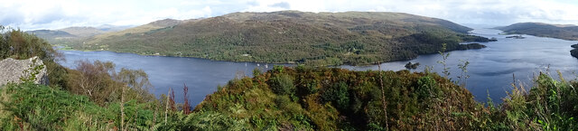
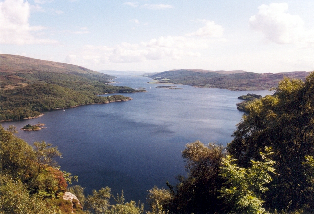
Loch Ruel, located in Argyllshire, Scotland, is a picturesque sea loch situated on the Cowal Peninsula. With its stunning natural surroundings and tranquil atmosphere, it offers a serene escape for visitors and locals alike.

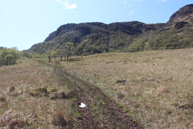
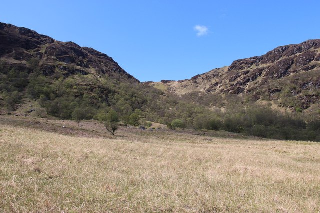
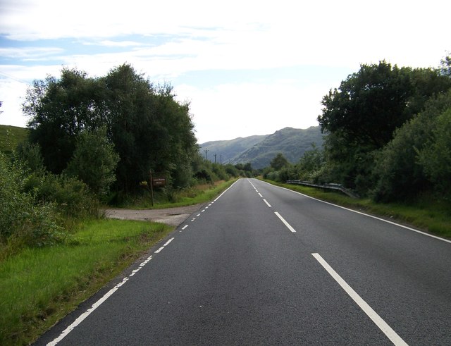
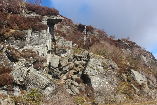
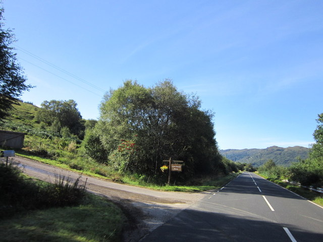
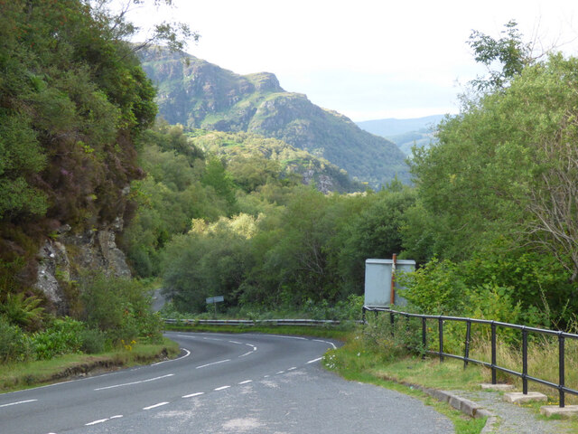
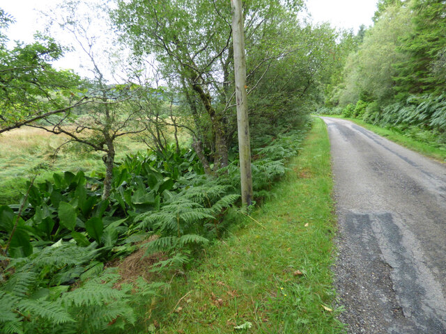
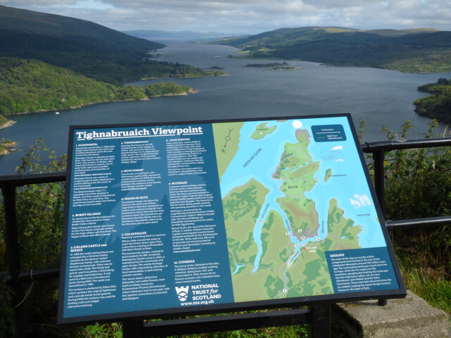
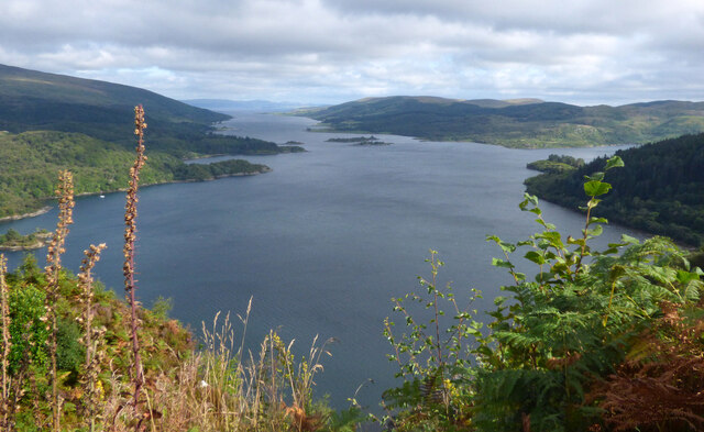
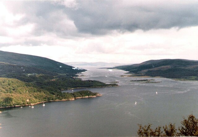
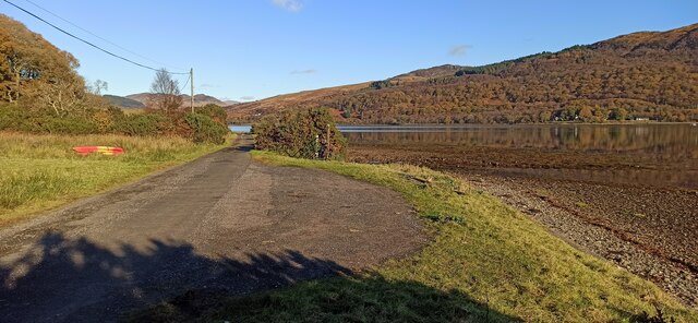
Stretching approximately 8 kilometers inland, Loch Ruel is a narrow body of water that branches off from the Kyles of Bute, forming an estuary. It is surrounded by rolling hills and dense forests, providing a scenic backdrop to the loch's sparkling waters. The loch's shoreline is dotted with small, secluded beaches and rocky outcrops, creating a diverse and captivating landscape.

The loch is fed by several small streams and creeks that flow down from the surrounding hills, ensuring a constant flow of fresh water. This, combined with the influence of the nearby sea, gives Loch Ruel its unique blend of brackish water, creating a rich and varied ecosystem. The loch is home to a variety of fish species, including trout and salmon, making it a popular spot for fishing enthusiasts.

The surrounding area of Loch Ruel is also known for its abundant wildlife. Otters, seals, and a wide range of bird species can often be spotted along the loch's shores. The loch is a designated Special Protection Area due to its importance as a habitat for several bird species, such as black-throated divers and red-throated divers.

In addition to its natural beauty, Loch Ruel offers opportunities for recreational activities such as kayaking, sailing, and hiking. Its calm waters and stunning scenery make it an ideal location for exploring by boat or taking leisurely walks along the shoreline.

Overall, Loch Ruel in Argyllshire presents a captivating blend of natural beauty, diverse wildlife, and recreational opportunities, making it a must-visit destination for nature enthusiasts and those seeking tranquility in the heart of Scotland.

If you have any feedback on the listing, please let us know in the comments section below.

Loch Ruel Images

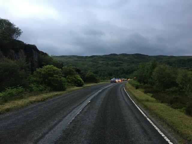
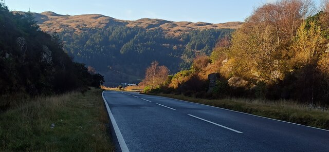
Images are sourced within 2km of 55.956048/-5.1911837 or Grid Reference NS0078. Thanks to Geograph Open Source API. All images are credited.

All terrain vehicle track below Creag Maoile
East face of Creag Mheadhonach A broad shelf of rough pasture leads into the wooded slopes. Buzzard country.
East face of Creag Mheadhonach
A broad shelf of rough pasture leads into the wooded slopes. Buzzard country.
A8003 heading to Tighnabruaich
A886 heading for Conintraive
Shattered rock on An Creagan
The entrance to Loch Riddon House
The A8003 road out of Tighnabruaich Looking north from the lay-by at the Loch Riddon viewpoint, where the road peaks and starts to descend again..
The A8003 road out of Tighnabruaich
Looking north from the lay-by at the Loch Riddon viewpoint, where the road peaks and starts to descend again..
The A8003 road Descending northwards towards Shellfield.
The A8003 road
Descending northwards towards Shellfield.
The B866 road at Loch Riddon A patch of Skunk Cabbage can be seen on the left. See also <a href="https://www.geograph.org.uk/photo/6978368">NS0177 : Skunk Cabbage by the B866 road at Loch Riddon</a>.
The B866 road at Loch Riddon
A patch of Skunk Cabbage can be seen on the left. See also NS0177 : Skunk Cabbage by the B866 road at Loch Riddon.
Skunk Cabbage by the B866 road at Loch Riddon By the roadside near Eilean Dearg, see also <a href="https://www.geograph.org.uk/photo/6978366">NS0177 : The B866 road at Loch Riddon</a>.
Skunk Cabbage by the B866 road at Loch Riddon
By the roadside near Eilean Dearg, see also NS0177 : The B866 road at Loch Riddon.
Boulder above Loch Riddon Is the boulder a glacial erratic, or is it an exposure of country rock? It commands a fine view over Loch Riddon.
Boulder above Loch Riddon
Is the boulder a glacial erratic, or is it an exposure of country rock? It commands a fine view over Loch Riddon.
Loch Riddon and Kyles of Bute A fine view in 'panorama' format from the viewpoint above Loch Riddon, which is to the left, and includes the Kyles of Bute to the right.
Loch Riddon and Kyles of Bute
A fine view in 'panorama' format from the viewpoint above Loch Riddon, which is to the left, and includes the Kyles of Bute to the right.
Tighnabruaich Viewpoint Also known as Loch Ruel viewpoint, by the side of the A8003 road, around three miles from Tighnabruaich. Looking down the east side of the Kyles of Bute.
Tighnabruaich Viewpoint
Also known as Loch Ruel viewpoint, by the side of the A8003 road, around three miles from Tighnabruaich. Looking down the east side of the Kyles of Bute.
Loch Riddon and the Kyles of Bute As seen from the viewpoint by the A8003 road <a href="https://www.geograph.org.uk/photo/6997204">NS0077 : Tighnabruaich Viewpoint</a>.
Loch Riddon and the Kyles of Bute
As seen from the viewpoint by the A8003 road NS0077 : Tighnabruaich Viewpoint.
Loch Riddon, Kyles of Bute Rubha na Croiche at the north end of the Kyles of Bute.
Loch Riddon, Kyles of Bute
Rubha na Croiche at the north end of the Kyles of Bute.
A886 towards Colintraive
Lay by near Craig Lodge Near the end of the metalled road from the A8003. Loch Riddon is on the right.
Lay by near Craig Lodge
Near the end of the metalled road from the A8003. Loch Riddon is on the right.
The A886 road Dropping down to Loch Riddon, with the 297m high Creagan Dubh in the distance.
The A886 road
Dropping down to Loch Riddon, with the 297m high Creagan Dubh in the distance.
Show me another place!

Loch Ruel is located at Grid Ref: NS0078 (Lat: 55.956048, Lng: -5.1911837)

Unitary Authority: Argyll and Bute

Police Authority: Argyll and West Dunbartonshire

Also known as: Loch Riddon

What 3 Words

///crust.joys.nosedive. Near Port Bannatyne, Argyll & Bute

Related Wikis

Loch Ruel

Loch Ruel or Loch Riddon; extends north from the Kyles of Bute and is a sea loch in Argyll and Bute, Scotland. == See also == River Ruel == References... ==

Eilean Dearg, Loch Ruel

Eilean Dearg is a small island in Loch Ruel (or Loch Riddon) in Argyll, Scotland. The island was once home to a castle, which was destroyed by naval action...

Eilean Dubh, Kyles of Bute

This particular Eilean Dubh (Scottish Gaelic: Black Island) is sometimes known as Glen Caladh Island and lies just off the Cowal peninsula in the Kyles...

Kyles of Bute

The Kyles of Bute (Scottish Gaelic: Na Caoil Bhòdach) form a narrow sea channel that separates the northern end of the Isle of Bute from the Cowal peninsula...

Nearby Amenities

Located within 500m of 55.956048,-5.1911837
Source: PGS
Lat/Long: 55.9570728/-5.1988715
Source: PGS
Lat/Long: 55.9574752/-5.1983286
Source: PGS
Lat/Long: 55.9580707/-5.197989
Source: PGS
Lat/Long: 55.9591926/-5.1860575
Source: PGS
Lat/Long: 55.9590359/-5.1861476
Source: PGS
Lat/Long: 55.9587776/-5.186095
Source: PGS
Lat/Long: 55.9585335/-5.1858563
Source: PGS
Lat/Long: 55.9583347/-5.1855994
Source: PGS
Lat/Long: 55.95732/-5.1854009
Source: PGS
Lat/Long: 55.956847/-5.1852662
Source: PGS
Lat/Long: 55.9565118/-5.1852571
Source: PGS
Lat/Long: 55.9548388/-5.1859974
Source: PGS
Lat/Long: 55.9544207/-5.1862469
Source: PGS
Lat/Long: 55.9539903/-5.1867248
Source: PGS
Lat/Long: 55.9537495/-5.1872436
Source: PGS
Lat/Long: 55.9535047/-5.1872033
Source: PGS
Lat/Long: 55.9520781/-5.187464
The data included in this document is from www.openstreetmap.org. The data is made available under ODbL.

Have you been to Loch Ruel?

Leave your review of Loch Ruel below (or comments, questions and feedback).