The Gull

Sea, Estuary, Creek in Suffolk East Suffolk

England

The Gull

River  Ore  toward  quay  and  ferry  terminal Long abandoned boats stuck in the mud.
River Ore toward quay and ferry terminal Credit: Martin Dawes

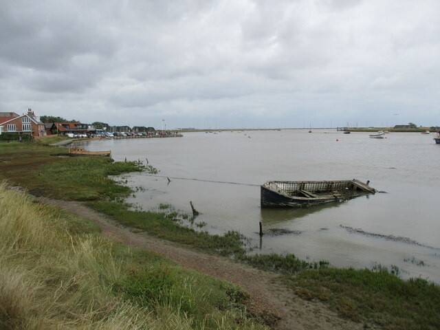
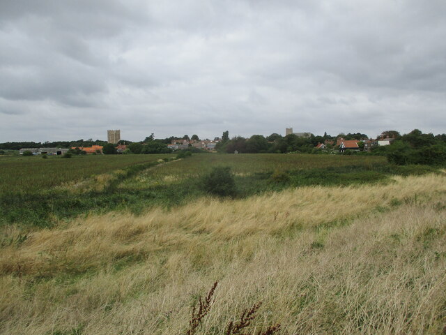
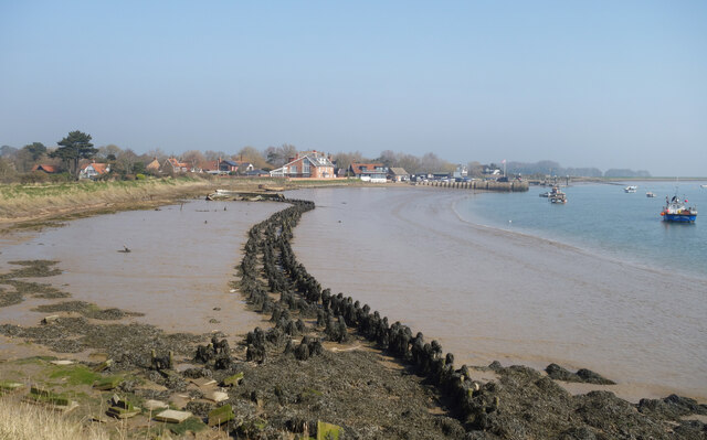
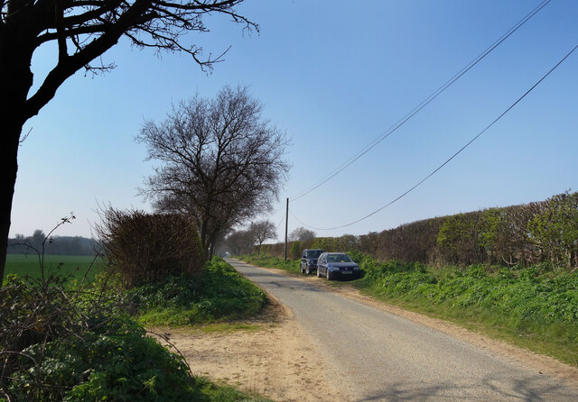
The Gull, Suffolk is a picturesque coastal area located in the eastern region of England. It is characterized by its stunning sea views, estuaries, and creeks, making it a popular destination for nature lovers and outdoor enthusiasts.

The area boasts a diverse ecosystem, with a variety of habitats supporting a rich array of wildlife. The sea surrounding The Gull is home to numerous species of fish, shellfish, and marine mammals, such as seals and dolphins. Birdwatchers are also in for a treat, as the estuaries and creeks attract a wide range of avian species, including waders, terns, and ducks.

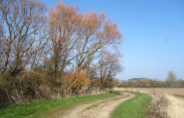
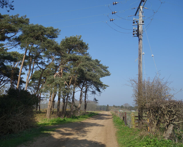
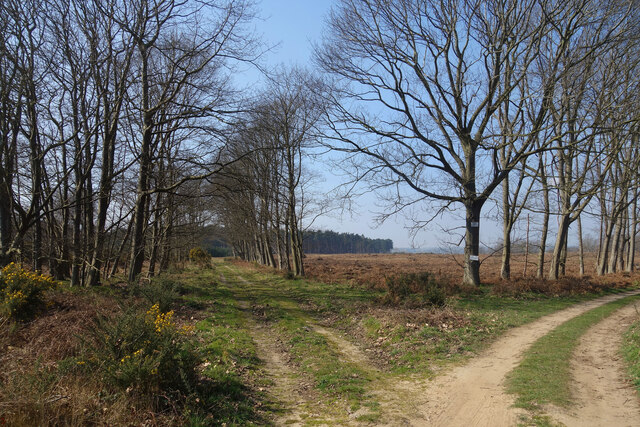
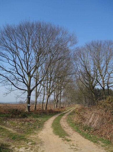
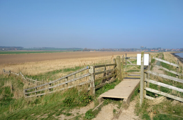
The Gull is renowned for its tranquil and untouched landscapes. Visitors can take leisurely walks along the coastal paths, enjoying the fresh sea breeze and taking in the breathtaking scenery. The estuaries and creeks offer the opportunity for boating and kayaking, allowing visitors to explore the waterways and discover hidden gems along the shore.

For those interested in history, The Gull has a rich maritime heritage. The area was once a bustling port, and remnants of its past can still be seen in the form of old fishing huts and boatyards. The local museums and heritage centers offer insight into the area's seafaring past, providing visitors with a glimpse into the region's history and culture.

In conclusion, The Gull, Suffolk is a stunning coastal area with its beautiful sea, estuary, and creek landscapes. Its diverse wildlife, tranquil surroundings, and rich history make it a must-visit destination for nature lovers and history enthusiasts alike.

If you have any feedback on the listing, please let us know in the comments section below.

The Gull Images

Images are sourced within 2km of 52.077191/1.5205256 or Grid Reference TM4147. Thanks to Geograph Open Source API. All images are credited.

River  Ore  toward  quay  and  ferry  terminal Long abandoned boats stuck in the mud.
River Ore toward quay and ferry terminal
Long abandoned boats stuck in the mud.
Over  marshes  to  Orford  from  River  Ore  floodbank Castle to left, St Bartholomew parish church to the right
Over marshes to Orford from River Ore floodbank
Castle to left, St Bartholomew parish church to the right
Stakes in the Mud Like some fossilised prehistoric snaky thing, the remains of a bygone wooden structure are exposed in the mud at low tide. 
An earlier attempt at coastal defence at a guess.
Stakes in the Mud
Like some fossilised prehistoric snaky thing, the remains of a bygone wooden structure are exposed in the mud at low tide. An earlier attempt at coastal defence at a guess.
Abandoned Old Boats Poor old things. I always wonder what the story is behind scenes like this.
The foreshore at Orford on the non sailing club side.
Abandoned Old Boats
Poor old things. I always wonder what the story is behind scenes like this. The foreshore at Orford on the non sailing club side.
Gate onto Gedgrave Marshes The public footpath comes down off the levee and heads inland. 
Gedgrave is a small rural parish with a population of 30 at  the last count. It once had a church, St Andrew's, but that's gone and the parish is now just a few scattered houses, including Gedgrave Hall.
<span class="nowrap"><a title="https://en.wikipedia.org/wiki/Gedgrave" rel="nofollow ugc noopener" href="https://en.wikipedia.org/wiki/Gedgrave">Link</a><img style="margin-left:2px;" alt="External link" title="External link - shift click to open in new window" src="https://s1.geograph.org.uk/img/external.png" width="10" height="10"/></span>
Gate onto Gedgrave Marshes
The public footpath comes down off the levee and heads inland. Gedgrave is a small rural parish with a population of 30 at the last count. It once had a church, St Andrew's, but that's gone and the parish is now just a few scattered houses, including Gedgrave Hall. LinkExternal link
Drain on Gedgrave Marshes One of the many channels draining the marsh.
Drain on Gedgrave Marshes
One of the many channels draining the marsh.
Tree Colours on Gedgrave Marshes Willow trees coming back to life after the winter.
Tree Colours on Gedgrave Marshes
Willow trees coming back to life after the winter.
Gedgrave Road A no through road leading to Gedgrave Hall and a few other houses.
The soil is very sandy round here.
Gedgrave Road
A no through road leading to Gedgrave Hall and a few other houses. The soil is very sandy round here.
Track past Pine Trees Away from the marshes by the coast the land is dry and sandy.
Track past Pine Trees
Away from the marshes by the coast the land is dry and sandy.
Flat countryside near Orford A walk through farmland west of the town.
Flat countryside near Orford
A walk through farmland west of the town.
Tracks, Gedgrave Broom A lot of this has been cut down by the look of it.
Tracks, Gedgrave Broom
A lot of this has been cut down by the look of it.
Track to The Broom A road to a premises called The Broom. On the right is Broom Covert, on the left is Gedgrave Broom.
TM4049 is kind of Broomy.
Track to The Broom
A road to a premises called The Broom. On the right is Broom Covert, on the left is Gedgrave Broom. TM4049 is kind of Broomy.
Gate at a Footpath Junction A path leaves the levee for a shortcut avoiding the slightly longer walk round Chantry Point.
Gate at a Footpath Junction
A path leaves the levee for a shortcut avoiding the slightly longer walk round Chantry Point.
Chantry Point The inside of a meander on the River Ore.
Chantry Point
The inside of a meander on the River Ore.
Orford Quay, Suffolk Orford Quay. A working quay and departure point for the ferry across the River Ore to Orford Ness
Orford Quay, Suffolk
Orford Quay. A working quay and departure point for the ferry across the River Ore to Orford Ness
River Ore at Orford, Suffolk The River Ore and estuary at Orford, Suffolk
River Ore at Orford, Suffolk
The River Ore and estuary at Orford, Suffolk
View to the south from Orford Castle  View to the south from Orford Castle when under scaffolding.
View to the south from Orford Castle
View to the south from Orford Castle when under scaffolding.
Orford, Jolly Sailor PH The benchmark is cut into the north east face of the pub. Despite the weathered brick, the mark remains in good condition.
Orford, Jolly Sailor PH
The benchmark is cut into the north east face of the pub. Despite the weathered brick, the mark remains in good condition.
Show me another place!

The Gull is located at Grid Ref: TM4147 (Lat: 52.077191, Lng: 1.5205256)

Administrative County: Suffolk

District: East Suffolk

Police Authority: Suffolk

What 3 Words

///thinnest.clumped.raven. Near Rendlesham, Suffolk

Related Wikis

Havergate Island

Havergate Island is the only island in the county of Suffolk, England. It is found at the confluence of the River Ore and the Butley River near the village...

Gedgrave Hall Pit

Gedgrave Hall Pit is a 0.65-hectare (1.6-acre) geological Site of Special Scientific Interest in Gedgrave, south of Saxmundham in Suffolk. It is a Geological...

Gedgrave

Gedgrave is a civil parish in the East Suffolk district, in the English county of Suffolk in eastern England. In 2005 its population was 30. Gedgrave once...

Richmond Farm Pit, Gedgrave

Richmond Farm Pit, Gedgrave is a 0.57-hectare (1.4-acre) geological Site of Special Scientific Interest south-west of Orford in Suffolk. It is a Geological...

Butley River

The Butley River or Butley Creek is a tributary of the River Ore in the English county of Suffolk. The river has its source in the Rendlesham Forest area...
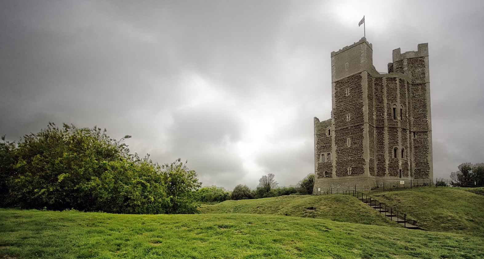
Orford Castle

Orford Castle is a castle in Orford in the English county of Suffolk, 12 miles (19 km) northeast of Ipswich, with views over Orford Ness. It was built...

Orford, Suffolk

Orford is a village in Suffolk, England, within the Suffolk Coast and Heaths Area of Outstanding Natural Beauty. It is 9 miles (14 km) east of Woodbridge...

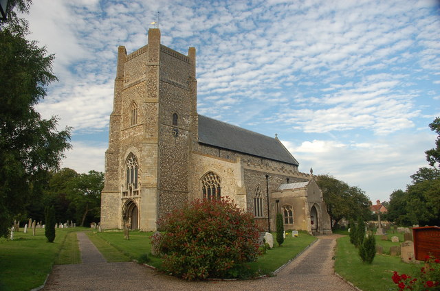
St Bartholomew's Church, Orford

The Church of St Bartholomew is the parish church of the town of Orford, England. A medieval church, dating from the fourteenth century, with reconstructions...

Related Videos

A walk around Orford in Suffolk

Today join me as I take a walk around the idyllic seaside village of Orford in Suffolk. Like many Suffolk coastal villages it was of ...

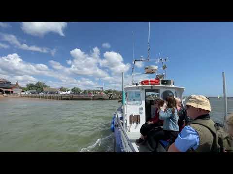
Havergate Island boat trip and top secret site.

Fantastic boat trip starting at Orford Quay and circling round Havergate Island. Notable landmarks were the top secret buildings on ...

Orford & the River Ore 6km Loop Walk #Orford #walk

This walk combines the delights of historic and picturesque Orford, with its bracing estuary path and glimpses of a secret military ...

Nearby Amenities

Located within 500m of 52.077191,1.5205256
Source: PGS
Lat/Long: 52.0731208/1.5191036
Source: PGS
Lat/Long: 52.0736286/1.5198278
Source: PGS
Lat/Long: 52.0792104/1.524071
Source: PGS
Lat/Long: 52.0796061/1.5243392
Source: PGS
Lat/Long: 52.0800775/1.5249561
Source: PGS
Lat/Long: 52.0803445/1.5255408
Source: PGS
Lat/Long: 52.0738693/1.5167432
Source: PGS
Lat/Long: 52.0740803/1.5167861
Source: PGS
Lat/Long: 52.074476/1.5174299
Source: PGS
Lat/Long: 52.074621/1.5174084
Source: PGS
Lat/Long: 52.0757816/1.5183311
Source: PGS
Lat/Long: 52.0769818/1.5191894
Source: PGS
Lat/Long: 52.0779576/1.5199619
Source: PGS
Lat/Long: 52.0788544/1.5206914
Source: PGS
Lat/Long: 52.0797907/1.5214425
Source: PGS
Lat/Long: 52.0804237/1.5221506
Source: PGS
Lat/Long: 52.0809775/1.5231162
Source: PGS
Lat/Long: 52.0811622/1.5233012
The Gull
Place: locality
Lat/Long: 52.0746001/1.5193748
Gedgrave Marshes
Place: locality
Lat/Long: 52.077396/1.5140533
The data included in this document is from www.openstreetmap.org. The data is made available under ODbL.

Have you been to The Gull?

Leave your review of The Gull below (or comments, questions and feedback).