Sandwich Haven

Sea, Estuary, Creek in Kent Dover

England

Sandwich Haven

Debris blocking footpath The path follows the fence posts and continues to end a short way beyond the bridge, that carries the railway between Minster and Sandwich. When I got home, I sent an email to East Kent Public Rights of Way to report the blockage and attached this image.
Debris blocking footpath Credit: John Baker

Sandwich Haven is a picturesque coastal town located in the county of Kent, England. Situated near the mouth of the River Stour, it is nestled between the sea, estuary, and creek, offering a diverse and scenic landscape.

With its origins dating back to Roman times, Sandwich Haven boasts a rich history. The town's strategic location made it an important trading port during medieval times, attracting merchants from across Europe. Today, remnants of its historic past can be seen in the form of charming timber-framed buildings and narrow, cobbled streets.

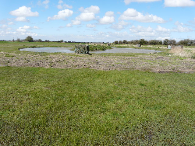
The sea plays a significant role in the town's identity. Sandwich Bay, with its long stretch of golden sand, is a popular destination for beachgoers and water sports enthusiasts. The bay also serves as an important habitat for a variety of bird species, making it a haven for birdwatchers and nature lovers.

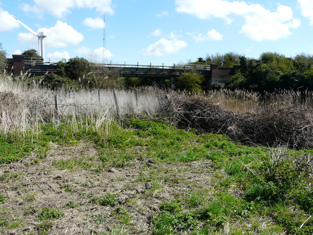
The River Stour estuary is another prominent feature of Sandwich Haven. Its tranquil waters provide a picturesque backdrop for leisurely boat trips and fishing excursions. The estuary is home to a diverse range of wildlife, including seals, otters, and various bird species, offering abundant opportunities for nature enthusiasts to explore and discover.

The creek, known as the Stonar Cut, is a navigable waterway that connects the River Stour to the open sea. It serves as a vital link for commercial vessels and recreational boaters, allowing access to the wider coastline and beyond.

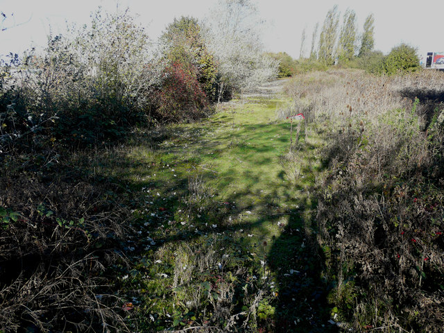
Overall, Sandwich Haven's unique blend of sea, estuary, and creek creates a captivating environment that attracts visitors from far and wide. Whether it's exploring its historic streets, enjoying the sandy beaches, or immersing oneself in the natural beauty of the estuary and creek, Sandwich Haven offers something for everyone to enjoy.

If you have any feedback on the listing, please let us know in the comments section below.

Sandwich Haven Images

Images are sourced within 2km of 51.308701/1.3547032 or Grid Reference TR3361. Thanks to Geograph Open Source API. All images are credited.

Debris blocking footpath The path follows the fence posts and continues to end a short way beyond the bridge, that carries the railway between Minster and Sandwich. When I got home, I sent an email to East Kent Public Rights of Way to report the blockage and attached this image.
Debris blocking footpath
The path follows the fence posts and continues to end a short way beyond the bridge, that carries the railway between Minster and Sandwich. When I got home, I sent an email to East Kent Public Rights of Way to report the blockage and attached this image.
Hides round a small lake As the exteriors of the hides are camouflaged, the purpose of the lake is presumably to attract water-loving birds for the sport of shooting or just to be observed.
Hides round a small lake
As the exteriors of the hides are camouflaged, the purpose of the lake is presumably to attract water-loving birds for the sport of shooting or just to be observed.
Derelict signalbox There used to be sidings leading to Richborough Power Station, so this signalbox may have been used to operate the points, on the main line, for the sidings. It may have also been used for trains using a railway line, which the Royal Engineers built from 'Weatherlees Junction' on the SECR. The line ran along the north side of the derelict power station (now known as <a href="https://www.geograph.org.uk/photo/5211188">TR3361 : Thanet Wind 132kV Onshore Substation</a>) (pace recent publications, this line was not the same as the power station spur), crossed the Thanet to Sandwich road just north of the filling stations and arrived at the New Quay behind Pfizer's sports ground. It then ran down the east side of the road, crossed the Stonar Cut and split in two at the Red Lion pub, about where the entrance to the recycling plant now is. One branch crossed the road, and both ran along the road verges to army camps where Pfizer's now is. The eastern branch also served Pierson's Quay. Some anonymous army official coined the name 'Richborough Port' <span class="nowrap"><a title="http://www.disused-stations.org.uk/r/richborough_port/index1.shtml" rel="nofollow ugc noopener" href="http://www.disused-stations.org.uk/r/richborough_port/index1.shtml">Link</a><img style="margin-left:2px;" alt="External link" title="External link - shift click to open in new window" src="https://s1.geograph.org.uk/img/external.png" width="10" height="10"/></span>.
Derelict signalbox
There used to be sidings leading to Richborough Power Station, so this signalbox may have been used to operate the points, on the main line, for the sidings. It may have also been used for trains using a railway line, which the Royal Engineers built from 'Weatherlees Junction' on the SECR. The line ran along the north side of the derelict power station (now known as TR3361 : Thanet Wind 132kV Onshore Substation) (pace recent publications, this line was not the same as the power station spur), crossed the Thanet to Sandwich road just north of the filling stations and arrived at the New Quay behind Pfizer's sports ground. It then ran down the east side of the road, crossed the Stonar Cut and split in two at the Red Lion pub, about where the entrance to the recycling plant now is. One branch crossed the road, and both ran along the road verges to army camps where Pfizer's now is. The eastern branch also served Pierson's Quay. Some anonymous army official coined the name 'Richborough Port' LinkExternal link.
Gate beside A256 Beyond the gate, the grass covered track used to be a railway line, which the Royal Engineers built from 'Weatherlees Junction' on the SECR. The line ran along the north side of the derelict power station (now known as <a href="https://www.geograph.org.uk/photo/5211188">TR3361 : Thanet Wind 132kV Onshore Substation</a>) (pace recent publications, this line was not the same as the power station spur), crossed the Thanet to Sandwich road just north of the filling stations and arrived at the New Quay behind Pfizer's sports ground. It then ran down the east side of the road, crossed the Stonar Cut and split in two at the Red Lion pub, about where the entrance to the recycling plant now is. One branch crossed the road, and both ran along the road verges to army camps where Pfizer's now is. The eastern branch also served Pierson's Quay. Some anonymous army official coined the name 'Richborough Port' <span class="nowrap"><a title="http://www.disused-stations.org.uk/r/richborough_port/index1.shtml" rel="nofollow ugc noopener" href="http://www.disused-stations.org.uk/r/richborough_port/index1.shtml">Link</a><img style="margin-left:2px;" alt="External link" title="External link - shift click to open in new window" src="https://s1.geograph.org.uk/img/external.png" width="10" height="10"/></span>
Gate beside A256
Beyond the gate, the grass covered track used to be a railway line, which the Royal Engineers built from 'Weatherlees Junction' on the SECR. The line ran along the north side of the derelict power station (now known as TR3361 : Thanet Wind 132kV Onshore Substation) (pace recent publications, this line was not the same as the power station spur), crossed the Thanet to Sandwich road just north of the filling stations and arrived at the New Quay behind Pfizer's sports ground. It then ran down the east side of the road, crossed the Stonar Cut and split in two at the Red Lion pub, about where the entrance to the recycling plant now is. One branch crossed the road, and both ran along the road verges to army camps where Pfizer's now is. The eastern branch also served Pierson's Quay. Some anonymous army official coined the name 'Richborough Port' LinkExternal link
Thanet Wind 132kV Onshore Substation This building can be seen in Roger W Haworth’s <a href="https://www.geograph.org.uk/photo/4424265">TR3361 : The remains of Richborough Power Station</a>.
Thanet Wind 132kV Onshore Substation
This building can be seen in Roger W Haworth’s TR3361 : The remains of Richborough Power Station.
Looking WNW along a former railway line The grass covered track used to be a railway line, which the Royal Engineers built from 'Weatherlees Junction' on the SECR. The line ran along the north side of the derelict power station (now known as <a href="https://www.geograph.org.uk/photo/5211188">TR3361 : Thanet Wind 132kV Onshore Substation</a>) (pace recent publications, this line was not the same as the power station spur), crossed the Thanet to Sandwich road just north of the filling stations and arrived at the New Quay behind Pfizer's sports ground. It then ran down the east side of the road, crossed the Stonar Cut and split in two at the Red Lion pub, about where the entrance to the recycling plant now is. One branch crossed the road, and both ran along the road verges to army camps where Pfizer's now is. The eastern branch also served Pierson's Quay. Some anonymous army official coined the name 'Richborough Port' <span class="nowrap"><a title="http://www.disused-stations.org.uk/r/richborough_port/index1.shtml" rel="nofollow ugc noopener" href="http://www.disused-stations.org.uk/r/richborough_port/index1.shtml">Link</a><img style="margin-left:2px;" alt="External link" title="External link - shift click to open in new window" src="https://s1.geograph.org.uk/img/external.png" width="10" height="10"/></span> Although puddles are visible on the track, it was firm underfoot.

Pontoon sections of the Mulberry harbour were stored on the Weatherlees railway sidings during 1944 and were moved from there by Bulleid Austerity Q1 class locomotives.
Looking WNW along a former railway line
The grass covered track used to be a railway line, which the Royal Engineers built from 'Weatherlees Junction' on the SECR. The line ran along the north side of the derelict power station (now known as TR3361 : Thanet Wind 132kV Onshore Substation) (pace recent publications, this line was not the same as the power station spur), crossed the Thanet to Sandwich road just north of the filling stations and arrived at the New Quay behind Pfizer's sports ground. It then ran down the east side of the road, crossed the Stonar Cut and split in two at the Red Lion pub, about where the entrance to the recycling plant now is. One branch crossed the road, and both ran along the road verges to army camps where Pfizer's now is. The eastern branch also served Pierson's Quay. Some anonymous army official coined the name 'Richborough Port' LinkExternal link Although puddles are visible on the track, it was firm underfoot. Pontoon sections of the Mulberry harbour were stored on the Weatherlees railway sidings during 1944 and were moved from there by Bulleid Austerity Q1 class locomotives.
Looking ESE along a former railway line The grass covered track used to be a railway line, which the Royal Engineers built from 'Weatherlees Junction' on the SECR. The line ran along the north side of the derelict power station (now known as <a href="https://www.geograph.org.uk/photo/5211188">TR3361 : Thanet Wind 132kV Onshore Substation</a>) (pace recent publications, this line was not the same as the power station spur), crossed the Thanet to Sandwich road just north of the filling stations and arrived at the New Quay behind Pfizer's sports ground. It then ran down the east side of the road, crossed the Stonar Cut and split in two at the Red Lion pub, about where the entrance to the recycling plant now is. One branch crossed the road, and both ran along the road verges to army camps where Pfizer's now is. The eastern branch also served Pierson's Quay. Some anonymous army official coined the name 'Richborough Port' <span class="nowrap"><a title="http://www.disused-stations.org.uk/r/richborough_port/index1.shtml" rel="nofollow ugc noopener" href="http://www.disused-stations.org.uk/r/richborough_port/index1.shtml">Link</a><img style="margin-left:2px;" alt="External link" title="External link - shift click to open in new window" src="https://s1.geograph.org.uk/img/external.png" width="10" height="10"/></span> Although puddles are visible on the track, it was firm underfoot.

Pontoon sections of the Mulberry harbour were stored on the Weatherlees railway sidings during 1944 and were moved from there by Bulleid Austerity Q1 class locomotives.
Looking ESE along a former railway line
The grass covered track used to be a railway line, which the Royal Engineers built from 'Weatherlees Junction' on the SECR. The line ran along the north side of the derelict power station (now known as TR3361 : Thanet Wind 132kV Onshore Substation) (pace recent publications, this line was not the same as the power station spur), crossed the Thanet to Sandwich road just north of the filling stations and arrived at the New Quay behind Pfizer's sports ground. It then ran down the east side of the road, crossed the Stonar Cut and split in two at the Red Lion pub, about where the entrance to the recycling plant now is. One branch crossed the road, and both ran along the road verges to army camps where Pfizer's now is. The eastern branch also served Pierson's Quay. Some anonymous army official coined the name 'Richborough Port' LinkExternal link Although puddles are visible on the track, it was firm underfoot. Pontoon sections of the Mulberry harbour were stored on the Weatherlees railway sidings during 1944 and were moved from there by Bulleid Austerity Q1 class locomotives.
Derelict building Due to the dense bramble growth, I gave up trying to get any closer.
Derelict building
Due to the dense bramble growth, I gave up trying to get any closer.
Site of former railway junction On the line between Minster and Sandwich. It was constructed by the Royal Engineers and the railway line then ran along the north side of the derelict power station (now known as <a href="https://www.geograph.org.uk/photo/5211188">TR3361 : Thanet Wind 132kV Onshore Substation</a>) (pace recent publications, this line was not the same as the power station spur), crossed the Thanet to Sandwich road just north of the filling stations and arrived at the New Quay behind Pfizer's sports ground. It then ran down the east side of the road, crossed the Stonar Cut and split in two at the Red Lion pub, about where the entrance to the recycling plant now is. One branch crossed the road, and both ran along the road verges to army camps where Pfizer's now is. The eastern branch also served Pierson's Quay. Some anonymous army official coined the name 'Richborough Port' <span class="nowrap"><a title="http://www.disused-stations.org.uk/r/richborough_port/index1.shtml" rel="nofollow ugc noopener" href="http://www.disused-stations.org.uk/r/richborough_port/index1.shtml">Link</a><img style="margin-left:2px;" alt="External link" title="External link - shift click to open in new window" src="https://s1.geograph.org.uk/img/external.png" width="10" height="10"/></span>

Pontoon sections of the Mulberry harbour were stored on the Weatherlees railway sidings during 1944 and were moved from there by Bulleid Austerity Q1 class locomotives.
Site of former railway junction
On the line between Minster and Sandwich. It was constructed by the Royal Engineers and the railway line then ran along the north side of the derelict power station (now known as TR3361 : Thanet Wind 132kV Onshore Substation) (pace recent publications, this line was not the same as the power station spur), crossed the Thanet to Sandwich road just north of the filling stations and arrived at the New Quay behind Pfizer's sports ground. It then ran down the east side of the road, crossed the Stonar Cut and split in two at the Red Lion pub, about where the entrance to the recycling plant now is. One branch crossed the road, and both ran along the road verges to army camps where Pfizer's now is. The eastern branch also served Pierson's Quay. Some anonymous army official coined the name 'Richborough Port' LinkExternal link Pontoon sections of the Mulberry harbour were stored on the Weatherlees railway sidings during 1944 and were moved from there by Bulleid Austerity Q1 class locomotives.
Looking ESE along a former railway line The grass covered track used to be a railway line, which the Royal Engineers built from 'Weatherlees Junction' on the SECR. The line ran along the north side of the derelict power station (now known as <a href="https://www.geograph.org.uk/photo/5211188">TR3361 : Thanet Wind 132kV Onshore Substation</a>) (pace recent publications, this line was not the same as the power station spur), crossed the Thanet to Sandwich road just north of the filling stations and arrived at the New Quay behind Pfizer's sports ground. It then ran down the east side of the road, crossed the Stonar Cut and split in two at the Red Lion pub, about where the entrance to the recycling plant now is. One branch crossed the road, and both ran along the road verges to army camps where Pfizer's now is. The eastern branch also served Pierson's Quay. Some anonymous army official coined the name 'Richborough Port' <span class="nowrap"><a title="http://www.disused-stations.org.uk/r/richborough_port/index1.shtml" rel="nofollow ugc noopener" href="http://www.disused-stations.org.uk/r/richborough_port/index1.shtml">Link</a><img style="margin-left:2px;" alt="External link" title="External link - shift click to open in new window" src="https://s1.geograph.org.uk/img/external.png" width="10" height="10"/></span>

Pontoon sections of the Mulberry harbour were stored on the Weatherlees railway sidings during 1944 and were moved from there by Bulleid Austerity Q1 class locomotives.
Looking ESE along a former railway line
The grass covered track used to be a railway line, which the Royal Engineers built from 'Weatherlees Junction' on the SECR. The line ran along the north side of the derelict power station (now known as TR3361 : Thanet Wind 132kV Onshore Substation) (pace recent publications, this line was not the same as the power station spur), crossed the Thanet to Sandwich road just north of the filling stations and arrived at the New Quay behind Pfizer's sports ground. It then ran down the east side of the road, crossed the Stonar Cut and split in two at the Red Lion pub, about where the entrance to the recycling plant now is. One branch crossed the road, and both ran along the road verges to army camps where Pfizer's now is. The eastern branch also served Pierson's Quay. Some anonymous army official coined the name 'Richborough Port' LinkExternal link Pontoon sections of the Mulberry harbour were stored on the Weatherlees railway sidings during 1944 and were moved from there by Bulleid Austerity Q1 class locomotives.
Looking WNW along a former railway line The grass covered track used to be a railway line, which the Royal Engineers built from 'Weatherlees Junction' on the SECR. The line ran along the north side of the derelict power station (now known as <a href="https://www.geograph.org.uk/photo/5211188">TR3361 : Thanet Wind 132kV Onshore Substation</a>) (pace recent publications, this line was not the same as the power station spur), crossed the Thanet to Sandwich road just north of the filling stations and arrived at the New Quay behind Pfizer's sports ground. It then ran down the east side of the road, crossed the Stonar Cut and split in two at the Red Lion pub, about where the entrance to the recycling plant now is. One branch crossed the road, and both ran along the road verges to army camps where Pfizer's now is. The eastern branch also served Pierson's Quay. Some anonymous army official coined the name 'Richborough Port' <span class="nowrap"><a title="http://www.disused-stations.org.uk/r/richborough_port/index1.shtml" rel="nofollow ugc noopener" href="http://www.disused-stations.org.uk/r/richborough_port/index1.shtml">Link</a><img style="margin-left:2px;" alt="External link" title="External link - shift click to open in new window" src="https://s1.geograph.org.uk/img/external.png" width="10" height="10"/></span> The tree on the right can also be seen, lit up by the sun, in the view of <a href="https://www.geograph.org.uk/photo/5213323">TR3262 : Looking ESE along a former railway line</a>.

Pontoon sections of the Mulberry harbour were stored on the Weatherlees railway sidings during 1944 and were moved from there by Bulleid Austerity Q1 class locomotives.
Looking WNW along a former railway line
The grass covered track used to be a railway line, which the Royal Engineers built from 'Weatherlees Junction' on the SECR. The line ran along the north side of the derelict power station (now known as TR3361 : Thanet Wind 132kV Onshore Substation) (pace recent publications, this line was not the same as the power station spur), crossed the Thanet to Sandwich road just north of the filling stations and arrived at the New Quay behind Pfizer's sports ground. It then ran down the east side of the road, crossed the Stonar Cut and split in two at the Red Lion pub, about where the entrance to the recycling plant now is. One branch crossed the road, and both ran along the road verges to army camps where Pfizer's now is. The eastern branch also served Pierson's Quay. Some anonymous army official coined the name 'Richborough Port' LinkExternal link The tree on the right can also be seen, lit up by the sun, in the view of TR3262 : Looking ESE along a former railway line. Pontoon sections of the Mulberry harbour were stored on the Weatherlees railway sidings during 1944 and were moved from there by Bulleid Austerity Q1 class locomotives.
Looking ESE along a former railway line The grass covered track used to be a railway line, which the Royal Engineers built from 'Weatherlees Junction' on the SECR. The line ran along the north side of the derelict power station (now known as <a href="https://www.geograph.org.uk/photo/5211188">TR3361 : Thanet Wind 132kV Onshore Substation</a>) (pace recent publications, this line was not the same as the power station spur), crossed the Thanet to Sandwich road just north of the filling stations and arrived at the New Quay behind Pfizer's sports ground. It then ran down the east side of the road, crossed the Stonar Cut and split in two at the Red Lion pub, about where the entrance to the recycling plant now is. One branch crossed the road, and both ran along the road verges to army camps where Pfizer's now is. The eastern branch also served Pierson's Quay. Some anonymous army official coined the name 'Richborough Port' <span class="nowrap"><a title="http://www.disused-stations.org.uk/r/richborough_port/index1.shtml" rel="nofollow ugc noopener" href="http://www.disused-stations.org.uk/r/richborough_port/index1.shtml">Link</a><img style="margin-left:2px;" alt="External link" title="External link - shift click to open in new window" src="https://s1.geograph.org.uk/img/external.png" width="10" height="10"/></span> Photographed from beside the tree seen in the view of <a href="https://www.geograph.org.uk/photo/5213341">TR3262 : Looking WNW along a former railway line</a> but looking the other way.

Pontoon sections of the Mulberry harbour were stored on the Weatherlees railway sidings during 1944 and were moved from there by Bulleid Austerity Q1 class locomotives.
Looking ESE along a former railway line
The grass covered track used to be a railway line, which the Royal Engineers built from 'Weatherlees Junction' on the SECR. The line ran along the north side of the derelict power station (now known as TR3361 : Thanet Wind 132kV Onshore Substation) (pace recent publications, this line was not the same as the power station spur), crossed the Thanet to Sandwich road just north of the filling stations and arrived at the New Quay behind Pfizer's sports ground. It then ran down the east side of the road, crossed the Stonar Cut and split in two at the Red Lion pub, about where the entrance to the recycling plant now is. One branch crossed the road, and both ran along the road verges to army camps where Pfizer's now is. The eastern branch also served Pierson's Quay. Some anonymous army official coined the name 'Richborough Port' LinkExternal link Photographed from beside the tree seen in the view of TR3262 : Looking WNW along a former railway line but looking the other way. Pontoon sections of the Mulberry harbour were stored on the Weatherlees railway sidings during 1944 and were moved from there by Bulleid Austerity Q1 class locomotives.
Looking SE along a former railway line The grass covered track used to be a railway line, which the Royal Engineers built from 'Weatherlees Junction' on the SECR. The line ran along the north side of the derelict power station (now known as <a href="https://www.geograph.org.uk/photo/5211188">TR3361 : Thanet Wind 132kV Onshore Substation</a>) (pace recent publications, this line was not the same as the power station spur), crossed the Thanet to Sandwich road just north of the filling stations and arrived at the New Quay behind Pfizer's sports ground. It then ran down the east side of the road, crossed the Stonar Cut and split in two at the Red Lion pub, about where the entrance to the recycling plant now is. One branch crossed the road, and both ran along the road verges to army camps where Pfizer's now is. The eastern branch also served Pierson's Quay. Some anonymous army official coined the name 'Richborough Port' <span class="nowrap"><a title="http://www.disused-stations.org.uk/r/richborough_port/index1.shtml" rel="nofollow ugc noopener" href="http://www.disused-stations.org.uk/r/richborough_port/index1.shtml">Link</a><img style="margin-left:2px;" alt="External link" title="External link - shift click to open in new window" src="https://s1.geograph.org.uk/img/external.png" width="10" height="10"/></span> The track ends at a gate, which is just visible but can be better viewed as <a href="https://www.geograph.org.uk/photo/5183825">TR3362 : Gate beside A256</a>.

Pontoon sections of the Mulberry harbour were stored on the Weatherlees railway sidings during 1944 and were moved from there by Bulleid Austerity Q1 class locomotives.
Looking SE along a former railway line
The grass covered track used to be a railway line, which the Royal Engineers built from 'Weatherlees Junction' on the SECR. The line ran along the north side of the derelict power station (now known as TR3361 : Thanet Wind 132kV Onshore Substation) (pace recent publications, this line was not the same as the power station spur), crossed the Thanet to Sandwich road just north of the filling stations and arrived at the New Quay behind Pfizer's sports ground. It then ran down the east side of the road, crossed the Stonar Cut and split in two at the Red Lion pub, about where the entrance to the recycling plant now is. One branch crossed the road, and both ran along the road verges to army camps where Pfizer's now is. The eastern branch also served Pierson's Quay. Some anonymous army official coined the name 'Richborough Port' LinkExternal link The track ends at a gate, which is just visible but can be better viewed as TR3362 : Gate beside A256. Pontoon sections of the Mulberry harbour were stored on the Weatherlees railway sidings during 1944 and were moved from there by Bulleid Austerity Q1 class locomotives.
Former alignment of A256
Buildings under construction Seen across Ramsgate Road (A256).
Buildings under construction
Seen across Ramsgate Road (A256).
Looking SE along a former railway line This was the alignment of a railway line, which the Royal Engineers built from 'Weatherlees Junction' on the SECR. The line ran along the north side of the derelict power station (now known as <a href="https://www.geograph.org.uk/photo/5211188">TR3361 : Thanet Wind 132kV Onshore Substation</a>) (pace recent publications, this line was not the same as the power station spur), crossed the Thanet to Sandwich road just north of the filling stations, at the location of the <a href="https://www.geograph.org.uk/photo/5183825">TR3362 : Gate beside A256</a>  and arrived at the New Quay behind Pfizer's sports ground. It then ran down the east side of the road, crossed the Stonar Cut and split in two at the Red Lion pub, about where the entrance to the recycling plant now is. One branch crossed the road, and both ran along the road verges to army camps where Pfizer's now is. The eastern branch also served Pierson's Quay. Some anonymous army official coined the name 'Richborough Port' 
<span class="nowrap"><a title="http://www.disused-stations.org.uk/r/richborough_port/index1.shtml" rel="nofollow ugc noopener" href="http://www.disused-stations.org.uk/r/richborough_port/index1.shtml">Link</a><img style="margin-left:2px;" alt="External link" title="External link - shift click to open in new window" src="https://s1.geograph.org.uk/img/external.png" width="10" height="10"/></span>
Looking SE along a former railway line
This was the alignment of a railway line, which the Royal Engineers built from 'Weatherlees Junction' on the SECR. The line ran along the north side of the derelict power station (now known as TR3361 : Thanet Wind 132kV Onshore Substation) (pace recent publications, this line was not the same as the power station spur), crossed the Thanet to Sandwich road just north of the filling stations, at the location of the TR3362 : Gate beside A256 and arrived at the New Quay behind Pfizer's sports ground. It then ran down the east side of the road, crossed the Stonar Cut and split in two at the Red Lion pub, about where the entrance to the recycling plant now is. One branch crossed the road, and both ran along the road verges to army camps where Pfizer's now is. The eastern branch also served Pierson's Quay. Some anonymous army official coined the name 'Richborough Port' LinkExternal link
Looking out over Pegwell Bay On a fairly bleak Sunday morning in February
Looking out over Pegwell Bay
On a fairly bleak Sunday morning in February
Large building It was one of these <a href="https://www.geograph.org.uk/photo/5518439">TR3361 : Buildings under construction</a> but I have not been able to discover its purpose. However is does form part of the <a href="https://www.geograph.org.uk/photo/5211188">TR3361 : Thanet Wind 132kV Onshore Substation</a>.
Large building
It was one of these TR3361 : Buildings under construction but I have not been able to discover its purpose. However is does form part of the TR3361 : Thanet Wind 132kV Onshore Substation.
Show me another place!

Sandwich Haven is located at Grid Ref: TR3361 (Lat: 51.308701, Lng: 1.3547032)

Administrative County: Kent

District: Dover

Police Authority: Kent

What 3 Words

///trading.towels.nuptials. Near Sandwich, Kent

Related Wikis

Battle of Wippedesfleot

The Battle of Wippedesfleot was a battle in 466 between the Anglo-Saxons (or Jutes), led by Hengest, and the Britons. It is described in the Anglo-Saxon...

Richborough Power Station

Richborough power station was a 336 MW power station close to the mouth of the River Stour near Sandwich, on the east coast of Kent. It was built on land...

Richborough Energy Park

Richborough Energy Park is a site of non-traditional power generation, on the site of the former Richborough power station close to the mouth of the River...

Ebbsfleet, Thanet

Ebbsfleet is a hamlet near Ramsgate, Kent, at the head of Pegwell Bay. Historically it was a peninsula on the southern coast of the Isle of Thanet, marking...

Nearby Amenities

Located within 500m of 51.308701,1.3547032
Created By: dmgroom_coastlines
Lat/Long: 51.3100847/1.3572585
Bus Stop
Pfizer Social Club
Bus: yes
Naptan AtcoCode: 2400A045970A
Naptan Bearing: NE
Naptan CommonName: Pfizer Social Club
Naptan Indicator: opp
Naptan Landmark: Pfizer Social Club
Naptan NaptanCode: kntdwjpg
Naptan PlusbusZoneRef: DEAL
Naptan Street: Ramsgate Road
Naptan Verified: no
Public Transport: platform
Shelter: no
Source: naptan_import
Lat/Long: 51.3111851/1.3501638
Bus Stop
Pfizer Social Club
Bus: yes
Naptan AtcoCode: 2400A045980A
Naptan Bearing: SW
Naptan CommonName: Pfizer Social Club
Naptan Indicator: adj
Naptan Landmark: Pfizer Social Club
Naptan NaptanCode: kntdwjpj
Naptan Street: Ramsgate Road
Naptan Verified: no
Public Transport: platform
Source: naptan_import
Lat/Long: 51.3108386/1.3525872
Fuel
Texaco
Brand: Gulf
Mapillary: 464037434670570
Survey Date: 2020-07-30
Lat/Long: 51.3107653/1.3500347
Crossing
Crossing: unmarked
Crossing Island: no
Crossing Markings: no
Tactile Paving: yes
Lat/Long: 51.3083924/1.3484726
Crossing
Crossing: unmarked
Crossing Island: no
Crossing Markings: no
Tactile Paving: yes
Lat/Long: 51.3084967/1.3485054
Crossing
Crossing: traffic_signals
Crossing Ref: toucan
Lat/Long: 51.3114254/1.3502085
Barrier: kissing_gate
Lat/Long: 51.3122922/1.3554009
Crossing
Crossing: unmarked
Crossing Island: no
Crossing Markings: no
Kerb: lowered
Tactile Paving: yes
Lat/Long: 51.3111731/1.3505859
Crossing
Crossing: traffic_signals
Crossing Ref: toucan
Lat/Long: 51.3113996/1.350009
Communication Microwave: yes
Communication Mobile Phone: yes
Man Made: mast
Tower Type: communication
Lat/Long: 51.3123279/1.350611
Crossing
Crossing: unmarked
Crossing Island: no
Crossing Markings: no
Tactile Paving: yes
Lat/Long: 51.3109331/1.350074
Childcare
Pegwell Bay Nursery
Addr City: Sandwich
Addr Country: GB
Addr County: Kent
Addr District: Dover
Addr Postcode: CT13 9QL
Addr Street: Ramsgate Road
Fhrs Authority: Dover
Fhrs Id: 1085331
Fhrs Local Authority Id: PI/000080193
Source: FHRS Open Data
Lat/Long: 51.3109842/1.3529196
Claires Kitchen
Addr City: Sandwich
Addr Country: GB
Addr County: Kent
Addr Street: Ramsgate Road
Craft: caterer
Fhrs Authority: Dover
Fhrs Id: 591667
Fhrs Local Authority Id: PI/000072732
Operator: Ambrosetti Uk Ltd
Source: FHRS Open Data
Lat/Long: 51.3111099/1.3524824
Crossing
Crossing: unmarked
Crossing Island: no
Crossing Markings: no
Tactile Paving: yes
Lat/Long: 51.3107861/1.3498358
Fuel
Esso
Brand: Esso
Brand Wikidata: Q867662
Operator: Rontec
Operator Website: http://www.rontec-servicestations.co.uk/ss_results-id.cfm?id=7157
Operator Wikidata: Q107439152
Lat/Long: 51.3100603/1.3486281
The data included in this document is from www.openstreetmap.org. The data is made available under ODbL.

Have you been to Sandwich Haven?

Leave your review of Sandwich Haven below (or comments, questions and feedback).