Rye Harbour

Sea, Estuary, Creek in Sussex Rother

England

Rye Harbour

Martello Tower Grade II listed.
Martello Tower Credit: N Chadwick

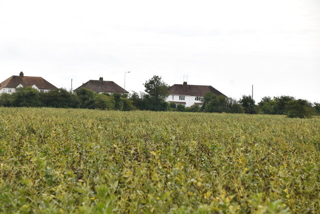
Rye Harbour is a picturesque coastal village located in East Sussex, England. Situated at the mouth of the River Rother, it is bordered by the English Channel to the south and is renowned for its stunning sea views, estuary, and creek.

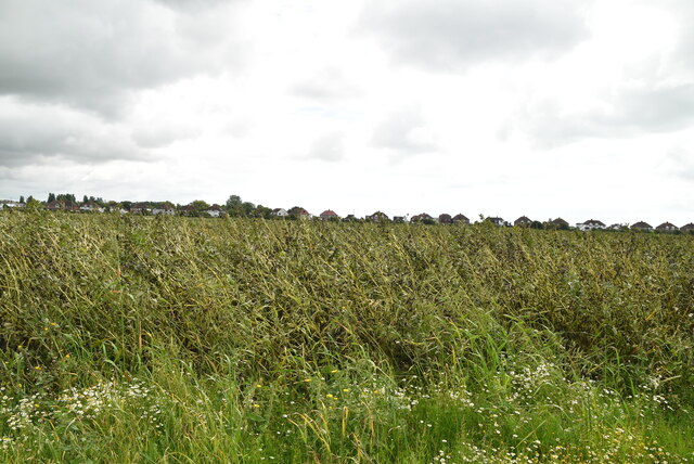
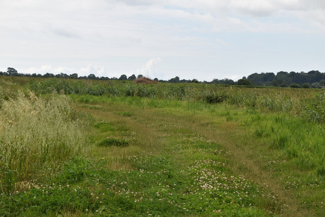
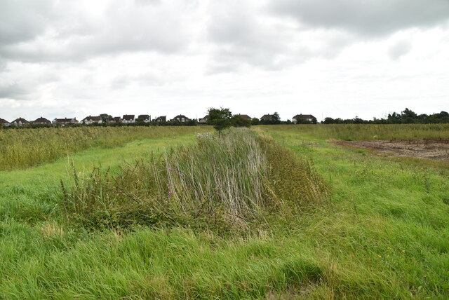
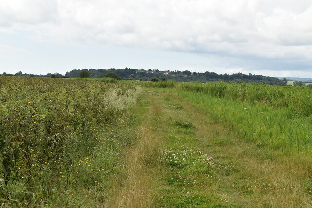
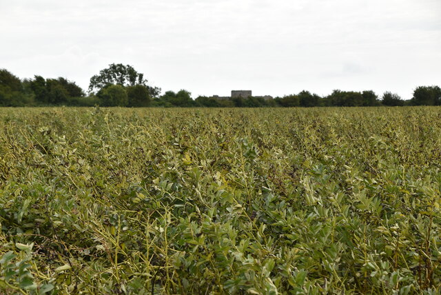
The village is nestled within the Rye Bay Nature Reserve, a designated Site of Special Scientific Interest and a haven for wildlife enthusiasts. Its diverse habitats, including intertidal mudflats, saltmarshes, shingle beaches, and reed beds, attract a wide range of bird species, making it a popular destination for birdwatching. The reserve also supports a variety of rare plants and animals, such as the little tern and the marsh mallow.

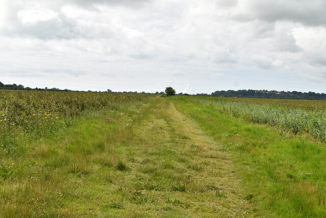
Rye Harbour is not only a paradise for nature lovers but also offers a range of recreational activities. Visitors can take leisurely walks along the beach or explore the network of footpaths and cycle routes that wind through the surrounding countryside. The village is also home to a thriving boating community, with a harbor that provides moorings for both pleasure and fishing boats.

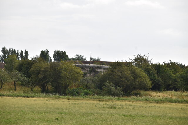
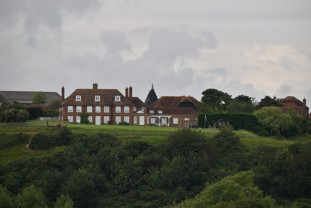
For history enthusiasts, Rye Harbour offers a glimpse into its maritime past. The village was once a bustling port and played a significant role in the region's smuggling trade during the 18th century. Today, remnants of the old fishing industry can still be seen, including traditional fishermen's huts and the iconic black timbered Rye Harbour Water Tower.

In summary, Rye Harbour is a charming coastal village in Sussex, boasting a stunning natural landscape that encompasses the sea, estuary, and creek. With its rich biodiversity, recreational activities, and historical significance, it is a destination that offers something for everyone.

If you have any feedback on the listing, please let us know in the comments section below.

Rye Harbour Images

Images are sourced within 2km of 50.949205/0.74056204 or Grid Reference TQ9220. Thanks to Geograph Open Source API. All images are credited.

Martello Tower Grade II listed.
Martello Tower
Grade II listed.
Dairy Cottage
Dairy Cottage
Footpath
Footpath
Arable field
Arable field
Footpath to Winchelsea
Field of legumes
Field of legumes
Drainage ditch
Drainage ditch
Cadborough Oast Single round kiln oast house. Brick built kiln roof. The oast house originally had three round kilns.
Cadborough Oast
Single round kiln oast house. Brick built kiln roof. The oast house originally had three round kilns.
Footpath to Winchelsea
Legumes A group of plants belonging to the Leguminosae family. The main types that are grown as crops are clover, peas, beans, lupins, soy and lentils. They are an important crop in a crop rotation cycle, as a break crop, they have the ability to fix nitrogen into the soil. They have a variety of uses as food and forage crops.
Legumes
A group of plants belonging to the Leguminosae family. The main types that are grown as crops are clover, peas, beans, lupins, soy and lentils. They are an important crop in a crop rotation cycle, as a break crop, they have the ability to fix nitrogen into the soil. They have a variety of uses as food and forage crops.
Footpath to Winchelsea
Stile on path to Winchelsea
Drainage ditch
Drainage ditch
Footbridge on path to Winchelsea
Drainage ditch
Drainage ditch
National Cycleroute 2 1066 Country Walk is a 31 mile (50 kilometre) walk from Pevensey to Rye. You can follow in the steps of William the Conqueror taking in historical sites on a generally low level walk. The route includes the Normans' landing point at Pevensey, the battle site, and the castles at Pevensey and Herstmonceux.
There are links from the main route between Battle and Bexhill and between Doleham and Hastings. It is waymarked using red circles with a sword.
Website: <span class="nowrap"><a title="http://www.highweald.org/text.asp?PageId=30" rel="nofollow ugc noopener" href="http://www.highweald.org/text.asp?PageId=30">Link</a><img style="margin-left:2px;" alt="External link" title="External link - shift click to open in new window" src="https://s1.geograph.org.uk/img/external.png" width="10" height="10"/></span>
National Cycleroute 2
1066 Country Walk is a 31 mile (50 kilometre) walk from Pevensey to Rye. You can follow in the steps of William the Conqueror taking in historical sites on a generally low level walk. The route includes the Normans' landing point at Pevensey, the battle site, and the castles at Pevensey and Herstmonceux. There are links from the main route between Battle and Bexhill and between Doleham and Hastings. It is waymarked using red circles with a sword. Website: LinkExternal link
1066 Country Walk 1066 Country Walk is a 31 mile (50 kilometre) walk from Pevensey to Rye. You can follow in the steps of William the Conqueror taking in historical sites on a generally low level walk. The route includes the Normans' landing point at Pevensey, the battle site, and the castles at Pevensey and Herstmonceux.
There are links from the main route between Battle and Bexhill and between Doleham and Hastings. It is waymarked using red circles with a sword.
Website: <span class="nowrap"><a title="http://www.highweald.org/text.asp?PageId=30" rel="nofollow ugc noopener" href="http://www.highweald.org/text.asp?PageId=30">Link</a><img style="margin-left:2px;" alt="External link" title="External link - shift click to open in new window" src="https://s1.geograph.org.uk/img/external.png" width="10" height="10"/></span>
1066 Country Walk
1066 Country Walk is a 31 mile (50 kilometre) walk from Pevensey to Rye. You can follow in the steps of William the Conqueror taking in historical sites on a generally low level walk. The route includes the Normans' landing point at Pevensey, the battle site, and the castles at Pevensey and Herstmonceux. There are links from the main route between Battle and Bexhill and between Doleham and Hastings. It is waymarked using red circles with a sword. Website: LinkExternal link
Show me another place!

Rye Harbour is located at Grid Ref: TQ9220 (Lat: 50.949205, Lng: 0.74056204)

Administrative County: East Sussex

District: Rother

Police Authority: Sussex

What 3 Words

///ashes.force.concerned. Near Rye, East Sussex

Related Wikis

Rye Castle

Rye Castle, also known as Ypres Tower, was built in the 13th or 14th centuries, and is situated in Rye, East Sussex, England. It is a Grade I listed building...

Rye railway station (Rye and Camber Tramway)

Rye railway station was a terminal station on the Rye and Camber Tramway in East Sussex, connecting Rye to Camber. Although the station was close to the...
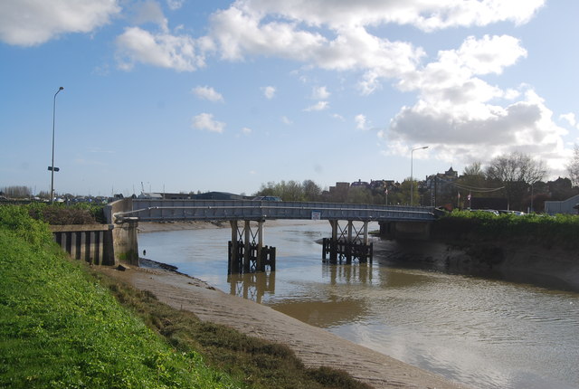
Monk Bretton Bridge

The Monk Bretton Bridge is a road bridge over the River Rother in Rye, East Sussex. It carries the A259 road, a major road between Folkestone and Hastings...

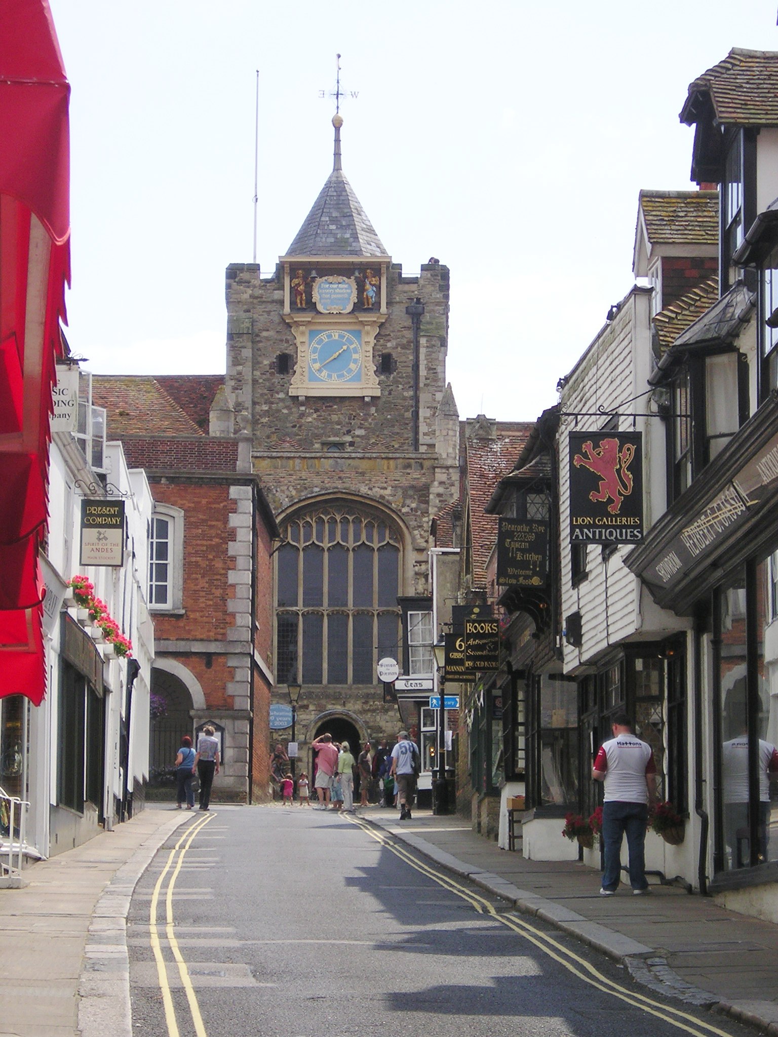
St Mary's Church, Rye

St Mary-the-Virgin, Rye is the Anglican parish church of the civil parish of Rye in East Sussex. Since 1951 it is a Grade I listed building because of...

Nearby Amenities

Located within 500m of 50.949205,0.74056204
Source: PGS
Lat/Long: 50.9457464/0.7441291
Source: PGS
Lat/Long: 50.9460107/0.7430894
Source: PGS
Lat/Long: 50.9462377/0.7426101
Source: PGS
Lat/Long: 50.9489629/0.7393699
Source: PGS
Lat/Long: 50.9492128/0.7400304
Source: PGS
Lat/Long: 50.9494313/0.7399222
Source: PGS
Lat/Long: 50.94956/0.739879
Source: PGS
Lat/Long: 50.9497307/0.7396569
Source: PGS
Lat/Long: 50.9502778/0.7392627
Source: PGS
Lat/Long: 50.9505566/0.7388388
Source: PGS
Lat/Long: 50.9506418/0.7386135
Source: PGS
Lat/Long: 50.9508366/0.7383077
Source: PGS
Lat/Long: 50.9511657/0.7376398
Source: PGS
Lat/Long: 50.9513269/0.7375245
Source: PGS
Lat/Long: 50.9520654/0.737605
Source: PGS
Lat/Long: 50.9524611/0.7380534
Source: PGS
Lat/Long: 50.9528077/0.7384901
Source: PGS
Lat/Long: 50.9530285/0.7389568
Source: PGS
Lat/Long: 50.9532874/0.7396088
Source: PGS
Lat/Long: 50.9522493/0.7391821
Source: PGS
Lat/Long: 50.9516339/0.7391017
Crossing
Button Operated: yes
Crossing: traffic_signals
Crossing Island: no
Crossing Markings: dots
Tactile Paving: yes
Traffic Signals Sound: yes
Traffic Signals Vibration: yes
Lat/Long: 50.952316/0.7357002
Rye
Historic Railway: station
Railway: site
Lat/Long: 50.9529069/0.7398605
Cafe
Simon the Pieman
Addr Housenumber: 3
Addr Postcode: TN31 7LB
Addr Street: Lion Street
Check Date: 2023-07-01
Diet Vegetarian: yes
Opening Hours: Mo-Fr 09:30-17:00; Sa 09:30-17:30; Su 11:30-17:00
Lat/Long: 50.9503917/0.733973
Townhall
Rye Town Hall
Addr Postcode: TN31 7LA
Addr Street: Market Street
Lat/Long: 50.9504134/0.7342498
Rye Community Information Centre
Addr Postcode: TN31 7LB
Addr Street: Lion Street
Information: office
Tourism: information
Lat/Long: 50.950522/0.7338868
Restaurant
The Flushing Inn
Addr Housenumber: 4
Addr Postcode: TN31 7LA
Addr Street: Market Street
Wikidata: Q17556089
Lat/Long: 50.950542/0.7346441
Barrier: bollard
Bollard: fixed
Lat/Long: 50.9514567/0.7344856
Crossing: informal
Lat/Long: 50.9533134/0.7400491
Tourism: viewpoint
Lat/Long: 50.9517711/0.7354101
Tourism: viewpoint
Lat/Long: 50.9520839/0.7354541
Cafe
Fletcher's
Addr Housenumber: 2
Addr Postcode: TN31 7LB
Addr Street: Lion Street
Check Date: 2023-07-01
Lat/Long: 50.9503133/0.7340007
Cafe
The Apothecary
Addr Housenumber: 104a
Addr Postcode: TN31 7JN
Addr Street: High Street
Check Date: 2023-07-01
Lat/Long: 50.9512638/0.7343521
Clive Sawyer Gallery
Addr City: Rye
Addr Housenumber: 104
Addr Postcode: TN31 7JN
Addr Street: High Street
Shop: art
Lat/Long: 50.9512402/0.7342731
Addr Housenumber: 103a
Addr Postcode: TN31 7JN
Addr Street: High Street
Old Name: Curtain Design Studio
Shop: vacant
Lat/Long: 50.9512275/0.7342126
Adams
Addr Housenumber: 8
Addr Postcode: TN31 7JH
Addr Street: High Street
Check Date: 2023-07-01
Opening Hours: Mo-Sa 09:00-17:15; Su 11:00-16:00
Shop: stationery
Lat/Long: 50.9514167/0.7343842
The Pette Shoppe
Addr Housenumber: 111a
Addr Postcode: TN31 7JE
Addr Street: High Street
Check Date: 2023-07-01
Opening Hours: Mo-Sa 09:00-17:00; Su off
Shop: pet
Lat/Long: 50.9516237/0.7351125
Rye Art Gallery
Addr Housenumber: 107
Addr Postcode: TN31 7JE
Addr Street: High Street
Check Date: 2023-07-01
Check Date Opening Hours: 2023-12-08
Opening Hours: Mo-Sa 11:00-17:00; Tu off; Su 11:00-16:00
Shop: art
Website: https://www.ryeartgallery.co.uk/
Lat/Long: 50.951475/0.7348241
Restaurant
Scallop.Org
Addr Housenumber: 108
Addr Postcode: TN31 7JE
Addr Street: High Street
Cuisine: seafood
Lat/Long: 50.9515096/0.7348924
Cafe
Corridor Cafe
Addr City: Rye
Addr County: East Sussex
Addr Housenumber: 105a
Addr Postcode: TN31 7JE
Addr Street: High Street
Addr Suburb: High Street
Fhrs Id: 955304
Source Addr: FHRS Open Data
Lat/Long: 50.9514083/0.7347021
Soldiers of Rye
Addr Housenumber: 110
Addr Postcode: TN31 7JE
Addr Street: High Street
Shop: antiques
Wikidata: Q26553468
Lat/Long: 50.95157/0.7350163
Linda Gilfrin
Addr Housenumber: 114
Addr Postcode: TN31 7JE
Addr Street: High Street
Check Date: 2023-07-01
Opening Hours: We-Sa 10:00-16:00; Su-Tu off
Shop: jewelry
Lat/Long: 50.9516863/0.7352908
Britcher and Rivers
Addr City: Rye
Addr County: East Sussex
Addr Housenumber: 109
Addr Postcode: TN31 7JE
Addr Street: High Street
Addr Suburb: High Street
Check Date: 2023-07-01
Fhrs Id: 781301
Shop: confectionery
Source Addr: FHRS Open Data
Wikidata: Q26553505
Lat/Long: 50.9515436/0.7349539
Ethel Loves Me
Addr City: Rye
Addr Housenumber: 105
Addr Postcode: TN31 7JE
Addr Street: High Street
Check Date: 2023-07-01
Shop: gift
Lat/Long: 50.9513441/0.7345827
Wideye
Addr Housenumber: 113
Addr Postcode: TN31 7JE
Addr Street: High Street
Check Date: 2023-07-01
Shop: beauty
Lat/Long: 50.9516659/0.7352358
Addr Housenumber: 112
Addr Postcode: TN31 7JE
Addr Street: High Street
Lat/Long: 50.9516473/0.7351715
Purdie Art Gallery
Addr Housenumber: 106
Addr Postcode: TN31 7JE
Addr Street: High Street
Check Date: 2023-07-01
Shop: art
Lat/Long: 50.9514446/0.7347693
Cafe
Shades
Addr Housenumber: 7
Addr Postcode: TN31 7JE
Addr Street: High Street
Lat/Long: 50.951524/0.7345613
Addr Housenumber: 4
Addr Postcode: TN31 7JE
Addr Street: High Street
Lat/Long: 50.9516694/0.7349128
Addr Housename: Custom House
Addr Postcode: TN31 7JE
Addr Street: High Street
Lat/Long: 50.9515451/0.7346176
My Sweet Old Etcetera
Addr Housenumber: 3
Addr Postcode: TN31 7JE
Addr Street: High Street
Check Date: 2023-07-01
Shop: jewelry
Wikidata: Q26553595
Lat/Long: 50.9517099/0.7349623
Cafe
The Fig
Addr City: Rye
Addr County: East Sussex
Addr Housenumber: 2
Addr Postcode: TN31 7JE
Addr Street: High Street
Addr Suburb: High Street
Check Date: 2023-07-01
Fhrs Id: 874931
Source Addr: FHRS Open Data
Lat/Long: 50.9517369/0.7350373
Restaurant
Cafe Zara
Addr City: Rye
Addr County: East Sussex
Addr Housename: Customs House
Addr Housenumber: 7
Addr Postcode: TN31 7JE
Addr Street: High Street
Addr Suburb: High Street
Fhrs Id: 781294
Source Addr: FHRS Open Data
Lat/Long: 50.9515714/0.7346726
Restaurant
Catcher in the Rye
Addr Postcode: TN31 7JE
Addr Street: High Street
Cuisine: fish_and_chips
Takeaway: yes
Lat/Long: 50.9516187/0.734776
Addr Housenumber: 1
Addr Postcode: TN31 7JE
Addr Street: High Street
Check Date: 2018-11-04
Disused Shop: hardware
Old Name: Ironmongers
Lat/Long: 50.9517843/0.7351446
Pocket Full of Rye
Addr Housenumber: 5a
Addr Postcode: TN31 7JE
Addr Street: High Street
Check Date: 2023-07-01
Shop: jewelry
Lat/Long: 50.9516423/0.7348497
Restaurant
The Devil in Rye
Addr Housenumber: 6
Addr Postcode: TN31 7JE
Addr Street: High Street
Lat/Long: 50.951595/0.7347155
Addr Housename: The Vaults
Addr Postcode: TN31 7LB
Addr Street: Lion Street
Lat/Long: 50.9505888/0.734049
Addr Housenumber: 15
Addr Postcode: TN31 7LA
Addr Street: Market Street
Lat/Long: 50.9507188/0.734623
Durrant House
Addr Housenumber: 1
Addr Postcode: TN31 7LA
Addr Street: Market Street
Tourism: guest_house
Wikidata: Q26543803
Lat/Long: 50.9506166/0.7348308
Lion Street Stores
Addr Housenumber: 6
Addr Postcode: TN31 7LB
Addr Street: Lion Street
Shop: stationery
Wikidata: Q26553422
Lat/Long: 50.9506538/0.7338438
The Bay Tree
Addr Housenumber: 11
Addr Postcode: TN31 7LA
Addr Street: Market Street
Shop: gift
Lat/Long: 50.9505859/0.7343252
Watermans
Addr Housenumber: 23a
Addr Postcode: TN31 7LB
Addr Street: Lion Street
Check Date: 2023-07-01
Shop: leather
Lat/Long: 50.9506301/0.7340221
Addr Housenumber: 14
Addr Postcode: TN31 7LA
Addr Street: Market Street
Lat/Long: 50.9506961/0.7345747
Addr Housenumber: 13
Addr Postcode: TN31 7LA
Addr Street: Market Street
Lat/Long: 50.9506695/0.7345178
Addr Housename: Chequer
Addr Postcode: TN31 7JY
Addr Street: East Street
Lat/Long: 50.9508039/0.7349087
Addr Housenumber: 10
Addr Postcode: TN31 7LA
Addr Street: Market Street
Lat/Long: 50.9505665/0.7342717
Addr Housenumber: 16
Addr Postcode: TN31 7JY
Addr Street: East Street
Lat/Long: 50.9510185/0.7347665
Addr Housenumber: 17
Addr Postcode: TN31 7JY
Addr Street: East Street
Lat/Long: 50.9511232/0.7346928
Rye Castle Museum
Addr Housenumber: 3
Addr Postcode: TN31 7JY
Addr Street: East Street
Fee: no
Opening Hours: Apr-Oct Sa,Su 10:30-16:00
Tourism: museum
Website: https://ryemuseum.co.uk/
Wikidata: Q113370155
Lat/Long: 50.9510978/0.7344956
Addr Housenumber: 12
Addr Postcode: TN31 7LA
Addr Street: Market Street
Lat/Long: 50.9506345/0.7344393
Dentist
D & S Dental Practice
Addr Housenumber: 6
Addr Postcode: TN31 7JY
Addr Street: East Street
Healthcare: dentist
Lat/Long: 50.9509686/0.7345654
Addr Housename: La Rochelle
Addr Postcode: TN31 7JY
Addr Street: East Street
Lat/Long: 50.9507067/0.7349154
Pub
Union Inn
Addr City: Rye
Addr County: East Sussex
Addr Housenumber: 8
Addr Postcode: TN31 7JY
Addr Street: East Street
Fhrs Id: 761436
Source Addr: FHRS Open Data
Wikidata: Q26635768
Lat/Long: 50.9508672/0.734627
Addr Housenumber: 15
Addr Postcode: TN31 7JY
Addr Street: East Street
Lat/Long: 50.9509306/0.7348215
Addr Housenumber: 7
Addr Postcode: TN31 7LA
Addr Street: Market Street
Lat/Long: 50.9504465/0.7343548
Addr Housenumber: 6
Addr Postcode: TN31 7LA
Addr Street: Market Street
Lat/Long: 50.9504608/0.7344286
Addr Housename: Cannon House
Addr Postcode: TN31 7JY
Addr Street: East Street
Lat/Long: 50.9508774/0.7348564
Secondhand Goods
Addr Housenumber: 2
Addr Postcode: TN31 7JY
Addr Street: East Street
Shop: second_hand
Wikidata: Q26296349
Lat/Long: 50.9511638/0.7344609
Addr Housenumber: 1
Addr Postcode: TN31 7JY
Addr Street: East Street
Lat/Long: 50.9512077/0.7344339
Addr Housenumber: 8
Addr Postcode: TN31 7LA
Addr Street: Market Street
Lat/Long: 50.9505208/0.7341295
Addr Housenumber: 9
Addr Postcode: TN31 7LA
Addr Street: Market Street
Lat/Long: 50.9505458/0.7342221
Addr Housenumber: 24
Addr Postcode: TN31 7HE
Addr Street: Church Square
Lat/Long: 50.9497707/0.7344437
Addr Housenumber: 40
Addr Postcode: TN31 7HE
Addr Street: Church Square
Lat/Long: 50.9495796/0.7339176
Addr Housenumber: 20
Addr Postcode: TN31 7HE
Addr Street: Church Square
Lat/Long: 50.9497976/0.7345318
Addr Housenumber: 22
Addr Postcode: TN31 7HE
Addr Street: Church Square
Lat/Long: 50.9497884/0.7345
Addr Housenumber: 42
Addr Postcode: TN31 7HE
Addr Street: Church Square
Lat/Long: 50.9495534/0.7338292
Addr Housenumber: 36
Addr Postcode: TN31 7HE
Addr Street: Church Square
Lat/Long: 50.9496472/0.7341027
Addr Housenumber: 50
Addr Postcode: TN31 7HF
Addr Street: Church Square
Lat/Long: 50.9497165/0.7334724
Addr Housenumber: 26
Addr Postcode: TN31 7HE
Addr Street: Church Square
Lat/Long: 50.9497486/0.7343763
Addr Housenumber: 28
Addr Postcode: TN31 7HE
Addr Street: Church Square
Lat/Long: 50.9497064/0.7343012
Historic: memorial
Memorial: war_memorial
Memorial Conflict: WW1
Lat/Long: 50.9500435/0.7346954
Addr Housenumber: 48
Addr Postcode: TN31 7HF
Addr Street: Church Square
Lat/Long: 50.9496565/0.7335072
Addr Housenumber: 44
Addr Postcode: TN31 7HE
Addr Street: Church Square
Lat/Long: 50.9495357/0.7337555
Addr Housenumber: 16
Addr Postcode: TN31 7HE
Addr Street: Church Square
Lat/Long: 50.9498424/0.7347008
Addr Housenumber: 38
Addr Postcode: TN31 7HE
Addr Street: Church Square
Lat/Long: 50.9496143/0.7340115
Addr Housenumber: 29
Addr Postcode: TN31 7HB
Addr Street: Watchbell Street
Lat/Long: 50.9494783/0.7335461
Addr Housenumber: 1
Addr Street: Watchbell Street
Lat/Long: 50.9495889/0.7334871
Addr Housenumber: 67
Addr Postcode: TN31 7HN
Addr Street: South Undercliff
Lat/Long: 50.9488131/0.7339617
Addr Housenumber: 139
Addr Postcode: TN31 7HW
Addr Street: South Undercliff
Lat/Long: 50.9494299/0.7361571
Addr Housenumber: 117
Addr Postcode: TN31 7HW
Addr Street: South Undercliff
Lat/Long: 50.9492076/0.7354999
Addr Housenumber: 69
Addr Postcode: TN31 7HW
Addr Street: South Undercliff
Lat/Long: 50.9488232/0.7340837
Addr Housenumber: 51
Addr Postcode: TN31 7HN
Addr Street: South Undercliff
Lat/Long: 50.9487049/0.7334695
Addr Housenumber: 119
Addr Postcode: TN31 7HW
Addr Street: South Undercliff
Lat/Long: 50.9492389/0.7356072
Addr Housenumber: 40
Addr Postcode: TN31 7HN
Addr Street: South Undercliff
Lat/Long: 50.9493208/0.7351673
Addr Housenumber: 38
Addr Postcode: TN31 7HN
Addr Street: South Undercliff
Lat/Long: 50.9492912/0.7350667
Addr Housenumber: 27a
Addr Postcode: TN31 7LP
Addr Street: Fishmarket Road
Lat/Long: 50.9506006/0.7355596
Addr Housenumber: 36
Addr Postcode: TN31 7LP
Addr Street: Fishmarket Road
Lat/Long: 50.950827/0.735494
Addr Housenumber: 32
Addr Postcode: TN31 7LP
Addr Street: Fishmarket Road
Lat/Long: 50.9507611/0.735514
Addr Housenumber: 42
Addr Postcode: TN31 7LP
Addr Street: Fishmarket Road
Lat/Long: 50.9510273/0.7354161
Addr Housenumber: 52
Addr Postcode: TN31 7LP
Addr Street: Fishmarket Road
Lat/Long: 50.9511996/0.7354
Addr Housenumber: 2a
Addr Postcode: TN31 7LP
Addr Street: Fishmarket Road
Lat/Long: 50.9501174/0.7361912
Addr Housenumber: 38
Addr Postcode: TN31 7LP
Addr Street: Fishmarket Road
Lat/Long: 50.9508626/0.7354818
Addr Housenumber: 2
Addr Postcode: TN31 7LP
Addr Street: Fishmarket Road
Lat/Long: 50.9501351/0.7362288
Addr Housenumber: 26
Addr Postcode: TN31 7LP
Addr Street: Fishmarket Road
Lat/Long: 50.9505634/0.7356642
Addr Housenumber: 26a
Addr Postcode: TN31 7LP
Addr Street: Fishmarket Road
Lat/Long: 50.9506234/0.7356159
Addr Housenumber: 34
Addr Postcode: TN31 7LP
Addr Street: Fishmarket Road
Lat/Long: 50.9507958/0.7355034
Addr Housenumber: 12
Addr Postcode: TN31 7LP
Addr Street: Fishmarket Road
Lat/Long: 50.9503378/0.7359432
Addr Housenumber: 28
Addr Postcode: TN31 7HB
Addr Street: Watchbell Street
Lat/Long: 50.949459/0.7334746
Addr Housenumber: 30
Addr Postcode: TN31 7HB
Addr Street: Watchbell Street
Lat/Long: 50.9494648/0.7336195
Addr Housename: Catcher's
Addr Housenumber: 8
Addr Postcode: TN31 7HE
Addr Street: Church Square
Lat/Long: 50.9501948/0.7348701
Addr Housenumber: 1
Addr Postcode: TN31 7HE
Addr Street: Church Square
Lat/Long: 50.9504137/0.7344965
Addr Housenumber: 2
Addr Postcode: TN31 7HE
Addr Street: Church Square
Lat/Long: 50.9504496/0.7346414
Addr Housenumber: 3
Addr Postcode: TN31 7HE
Addr Street: Church Square
Lat/Long: 50.9503629/0.7345382
Addr Housenumber: 6
Addr Postcode: TN31 7HE
Addr Street: Church Square
Lat/Long: 50.9502831/0.734797
Addr Housenumber: 4
Addr Postcode: TN31 7HE
Addr Street: Church Square
Lat/Long: 50.9503837/0.7347132
Addr Housename: Church House
Addr Housenumber: 12
Addr Postcode: TN31 7HE
Addr Street: Church Square
Lat/Long: 50.950115/0.7349291
Bus Stop
Shipyard Lane
Bus: yes
Public Transport: platform
Lat/Long: 50.9489447/0.73429
Bus Stop
Bowling Green
Bus: yes
Naptan AtcoCode: 1400RR0222
Naptan NaptanCode: esuapwpw
Public Transport: platform
Lat/Long: 50.9518389/0.7357701
Barrier: stile
Lat/Long: 50.9530204/0.7396739
Post Box
Collection Times: Mo-Fr 09:00; Sa 07:00
Operator: Royal Mail
Operator Wikidata: Q638098
Post Box Type: lamp
Ref: TN31 39D
Royal Cypher: EIIR
Royal Cypher Wikidata: Q33102113
Lat/Long: 50.9502038/0.7363208
Dentist
Rye Dental Surgery
Check Date: 2023-07-01
Healthcare: dentist
Lat/Long: 50.9513737/0.7346382
Bar
Grapevine
Addr City: Rye
Addr County: East Sussex
Addr Postcode: TN31 7LE
Addr Street: Conduit Hill
Check Date: 2023-07-01
Fhrs Id: 941718
Source Addr: FHRS Open Data
Lat/Long: 50.9515586/0.7344858
Post Box
Collection Times: Mo-Fr 09:00; Sa 07:00
Operator: Royal Mail
Operator Wikidata: Q638098
Post Box Type: wall
Ref: TN31 32D
Royal Cypher: VR
Royal Cypher Wikidata: Q33102356
Lat/Long: 50.9496117/0.7337387
Rye Chocolates
Addr City: Rye
Addr County: East Sussex
Addr Housenumber: 110
Addr Postcode: TN31 7JE
Addr Street: High Street
Addr Suburb: High Street
Check Date: 2023-07-01
Fhrs Id: 852545
Shop: confectionery
Source Addr: FHRS Open Data
Lat/Long: 50.9515892/0.7350526
Bench
Backrest: yes
Lat/Long: 50.9520666/0.7354459
Barrier: height_restrictor
Maxheight: 2
Lat/Long: 50.9524223/0.7358805
Bench
Backrest: yes
Check Date: 2023-07-01
Lat/Long: 50.9517574/0.735368
Bench
Backrest: yes
Check Date: 2023-07-01
Lat/Long: 50.9517342/0.7353699
Crossing
Crossing: unmarked
Crossing Markings: no
Lat/Long: 50.9461507/0.7378823
Historic: cannon
Lat/Long: 50.9497228/0.7357609
Historic: cannon
Lat/Long: 50.9496742/0.7356781
Historic: cannon
Lat/Long: 50.9496197/0.7355896
Historic: cannon
Lat/Long: 50.9495795/0.7354887
Historic: cannon
Lat/Long: 50.9497683/0.7358522
Binoculars
Lat/Long: 50.9498349/0.7360283
Board Type: history
Information: board
Tourism: information
Lat/Long: 50.9502814/0.7374482
Traffic Signals
Traffic Signals: pedestrian_crossing
Traffic Signals Direction: forward
Lat/Long: 50.9523418/0.7357031
Traffic Signals
Traffic Signals: pedestrian_crossing
Traffic Signals Direction: backward
Lat/Long: 50.9522903/0.7356982
Crossing
Crossing: unmarked
Crossing Island: no
Crossing Markings: no
Tactile Paving: no
Lat/Long: 50.9529972/0.7382802
Bicycle Parking
Bicycle Parking: stands
Capacity: 2
Colour: silver
Covered: yes
Cyclestreets Id: 197838
Material: metal
Lat/Long: 50.9523788/0.7361577
Crossing: informal
Lat/Long: 50.9529589/0.7377461
Barrier: kerb
Lat/Long: 50.9530186/0.7382689
Barrier: kerb
Lat/Long: 50.9529767/0.7382901
Barrier: kerb
Lat/Long: 50.9531238/0.7388932
Barrier: kerb
Lat/Long: 50.9532587/0.7396934
The data included in this document is from www.openstreetmap.org. The data is made available under ODbL.

Have you been to Rye Harbour?

Leave your review of Rye Harbour below (or comments, questions and feedback).