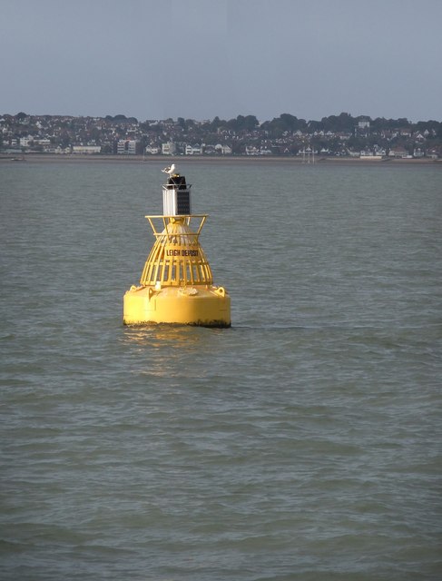
Leigh Middle

Sea, Estuary, Creek in Essex Castle Point

England

Leigh Middle

Sea Reach North 6 and Sea Reach South 6 buoys One pair of a set of buoys marking the deep dredged Yantlet Channel, which passes between them. The subject location in for the nearer, North buoy on the right. Viewed from P.S. Waverley, which was heading upriver after a call at Southend Pier.
Sea Reach North 6 and Sea Reach South 6 buoys Credit: Robin Webster

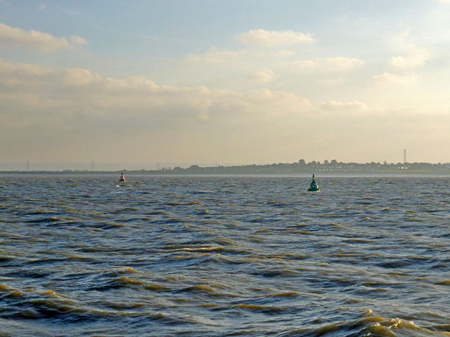
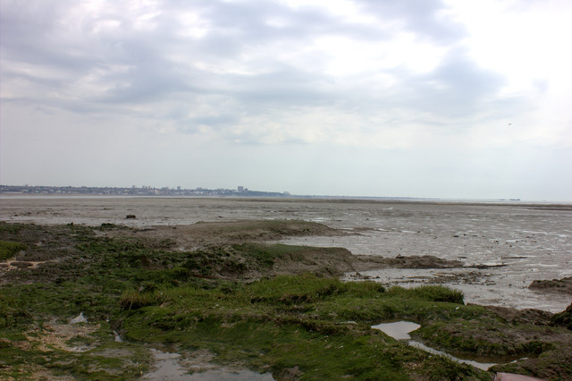
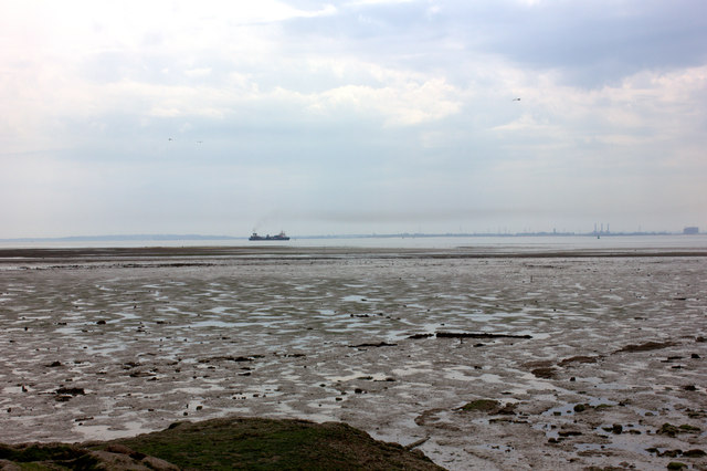
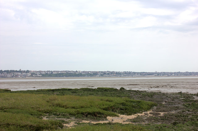
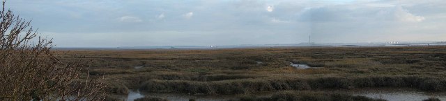
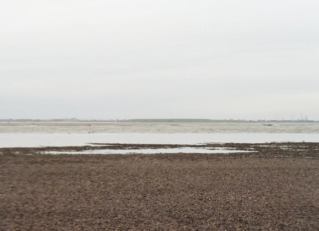
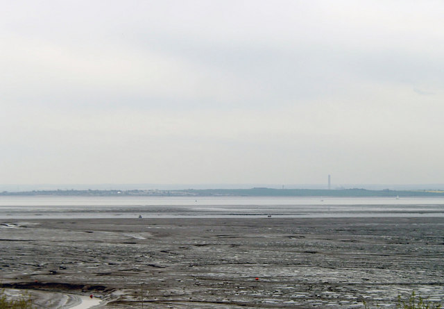
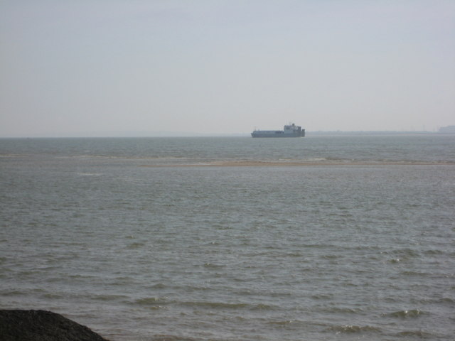
Leigh Middle is a small coastal town located in the county of Essex, England. Situated on the shores of the Thames Estuary, it is bordered by the towns of Southend-on-Sea to the east and Westcliff-on-Sea to the west. The town is renowned for its picturesque seafront and its close proximity to the Leigh Creek, a charming tidal creek that flows into the estuary.

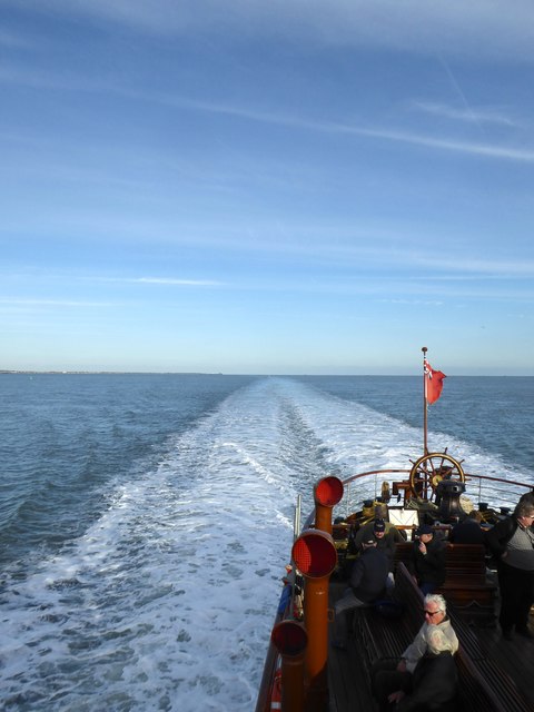
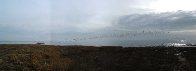
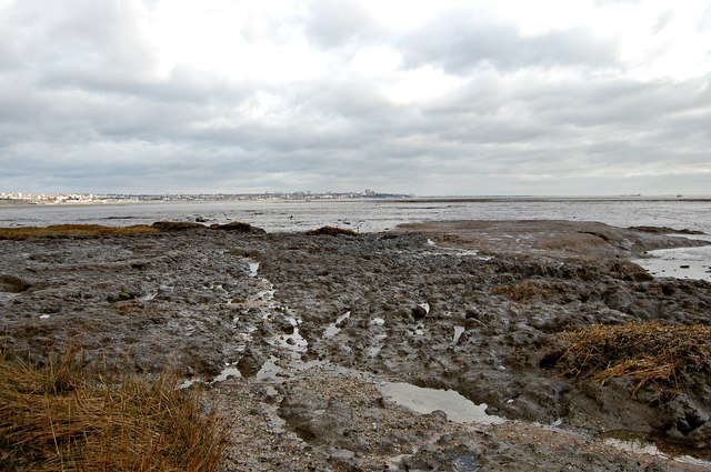
The town's seafront is a popular destination for both locals and tourists, offering stunning views of the estuary and the vast expanse of the North Sea. The sandy beaches are perfect for leisurely walks, sunbathing, and picnicking. The seafront is also lined with a variety of seaside shops, cafes, and restaurants, providing visitors with a range of dining and shopping options.

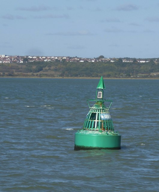
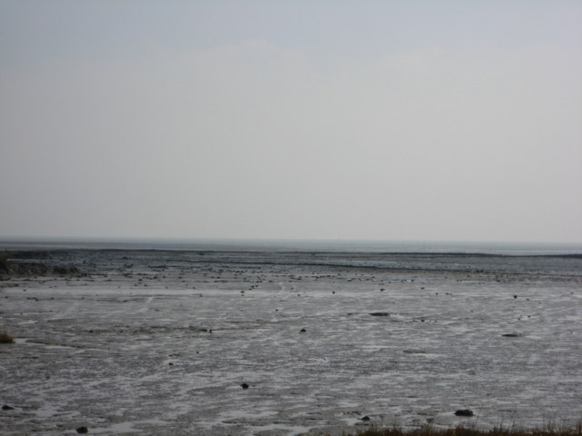
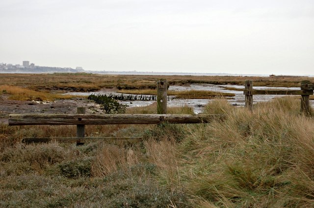
Leigh Creek, located to the north of the town, is a haven for nature enthusiasts. The creek is home to a diverse range of flora and fauna, including various bird species, fish, and marine wildlife. It is an ideal spot for fishing, boating, and birdwatching. The creek's tranquil ambiance and serene surroundings make it a popular destination for those seeking a peaceful retreat.

Leigh Middle benefits from excellent transport links, with regular train services connecting it to London and other major cities in the region. The town also has a vibrant community, with a range of amenities including schools, healthcare facilities, and recreational areas.

Overall, Leigh Middle offers a unique blend of natural beauty, coastal charm, and convenient amenities, making it a desirable place to live and visit for those seeking a coastal getaway.

If you have any feedback on the listing, please let us know in the comments section below.

Leigh Middle Images

Images are sourced within 2km of 51.515382/0.66018901 or Grid Reference TQ8482. Thanks to Geograph Open Source API. All images are credited.

Sea Reach North 6 and Sea Reach South 6 buoys One pair of a set of buoys marking the deep dredged Yantlet Channel, which passes between them. The subject location in for the nearer, North buoy on the right. Viewed from P.S. Waverley, which was heading upriver after a call at Southend Pier.
Sea Reach North 6 and Sea Reach South 6 buoys
One pair of a set of buoys marking the deep dredged Yantlet Channel, which passes between them. The subject location in for the nearer, North buoy on the right. Viewed from P.S. Waverley, which was heading upriver after a call at Southend Pier.
Canvey Point This and much of the path to it is submerged at high tide.
Canvey Point
This and much of the path to it is submerged at high tide.
South from Canvey Point
Northwards from Canvey Point looking towards Leigh
'Waverley' in mid-river: full steam ahead Photo taken on board paddle-steamer Waverley shortly after passing the West Leigh Middle marker buoy, while heading up-river at speed.

Waverley was throwing up a tremendous wake because we'd lost 15 minutes or so at Southend and were heading up-Thames at a gallop.  Approaching Southend pierhead against an ebb-tide and a north-west breeze, we'd lost steerway and failed to berth at the first attempt.  The skipper then let the ship drift out into the stream for some minutes - before re-starting the engines.  We looped out towards mid-river before a second - successful - approach.

Photos I'd taken on previous trips show Waverley's wake when proceeding at a more modest pace: <a title="https://www.geograph.org.uk/photo/2618503" href="https://www.geograph.org.uk/photo/2618503">Link</a>     <a title="https://www.geograph.org.uk/photo/4210060" href="https://www.geograph.org.uk/photo/4210060">Link</a>
<a title="https://www.geograph.org.uk/photo/4213538" href="https://www.geograph.org.uk/photo/4213538">Link</a>
'Waverley' in mid-river: full steam ahead
Photo taken on board paddle-steamer Waverley shortly after passing the West Leigh Middle marker buoy, while heading up-river at speed. Waverley was throwing up a tremendous wake because we'd lost 15 minutes or so at Southend and were heading up-Thames at a gallop. Approaching Southend pierhead against an ebb-tide and a north-west breeze, we'd lost steerway and failed to berth at the first attempt. The skipper then let the ship drift out into the stream for some minutes - before re-starting the engines. We looped out towards mid-river before a second - successful - approach. Photos I'd taken on previous trips show Waverley's wake when proceeding at a more modest pace: Link Link Link
The West Leigh Middle channel-marker buoy Both name-plates on this buoy were badly faded, but identification is correct.  Seen in the background is the Essex coast near Hadleigh Castle.  The location was determined by overlaying maritime chart and OS grid.

Photo taken from PS Waverley.
The West Leigh Middle channel-marker buoy
Both name-plates on this buoy were badly faded, but identification is correct. Seen in the background is the Essex coast near Hadleigh Castle. The location was determined by overlaying maritime chart and OS grid. Photo taken from PS Waverley.
River Thames, Sea Reach North 6 Buoy One of a series of buoys marking the deep dredged Yantlet Channel and one of a pair with <a href="https://www.geograph.org.uk/photo/6260594">TQ8481 : River Thames, Sea Reach South 6 Buoy</a> which together mark both sides of the channel. Southend Pier is in the background.
River Thames, Sea Reach North 6 Buoy
One of a series of buoys marking the deep dredged Yantlet Channel and one of a pair with TQ8481 : River Thames, Sea Reach South 6 Buoy which together mark both sides of the channel. Southend Pier is in the background.
River Thames, Sea Reach South 6 Buoy One of a series of buoys marking the deep dredged Yantlet Channel and one of a pair with <a href="https://www.geograph.org.uk/photo/6260580">TQ8581 : River Thames, Sea Reach North 6 Buoy</a> which together mark both sides of the channel. The Isle of Grain is in the background.
River Thames, Sea Reach South 6 Buoy
One of a series of buoys marking the deep dredged Yantlet Channel and one of a pair with TQ8581 : River Thames, Sea Reach North 6 Buoy which together mark both sides of the channel. The Isle of Grain is in the background.
Two Tree Island Panorama This view takes in a panorama from approximately 120 to 210 degrees magnetic from the photographer position. It shows the saltmarsh on the southeast corner of Two Tree Island nature reserve <span class="nowrap"><a title="http://www.essexwt.org.uk/visitor_centres__nature_reserves/two_tree_island/" rel="nofollow ugc noopener" href="http://www.essexwt.org.uk/visitor_centres__nature_reserves/two_tree_island/">Link</a><img style="margin-left:2px;" alt="External link" title="External link - shift click to open in new window" src="https://s1.geograph.org.uk/img/external.png" width="10" height="10"/></span> . The reserve is maintained by Essex Wildlife Trust <span class="nowrap"><a title="http://www.essexwt.org.uk/" rel="nofollow ugc noopener" href="http://www.essexwt.org.uk/">Link</a><img style="margin-left:2px;" alt="External link" title="External link - shift click to open in new window" src="https://s1.geograph.org.uk/img/external.png" width="10" height="10"/></span>
Two Tree Island Panorama
This view takes in a panorama from approximately 120 to 210 degrees magnetic from the photographer position. It shows the saltmarsh on the southeast corner of Two Tree Island nature reserve LinkExternal link . The reserve is maintained by Essex Wildlife Trust LinkExternal link
Canvey Point This is Canvey Point looking east. Canvey Point is reached via a footpath that is flooded at high tide. This area of saltmarsh is a haven for over wintering wild fowl and other sea birds.
Canvey Point
This is Canvey Point looking east. Canvey Point is reached via a footpath that is flooded at high tide. This area of saltmarsh is a haven for over wintering wild fowl and other sea birds.
Leigh Creek Leigh Creek (referred to on OS maps as Leigh Swatch) is the channel that flows between the pebbly area in the foreground and the area of mud just beyond it.
Leigh Creek
Leigh Creek (referred to on OS maps as Leigh Swatch) is the channel that flows between the pebbly area in the foreground and the area of mud just beyond it.
Estuarial mudflats at Leigh-on-Sea Leigh Sand is the area of inter-tidal mudflat to the right of the creek that can be seen winding its way through the left of the image. The channel that runs across the centre of the image is Ray Gut and the area of mud between Ray Gut and the main course of the Thames is Chapman Sands.
Estuarial mudflats at Leigh-on-Sea
Leigh Sand is the area of inter-tidal mudflat to the right of the creek that can be seen winding its way through the left of the image. The channel that runs across the centre of the image is Ray Gut and the area of mud between Ray Gut and the main course of the Thames is Chapman Sands.
Outward bound Cobelfret's 'Cymbeline' passing Canvey Point heading for Flushing with a cargo of cars from Fords.
Outward bound
Cobelfret's 'Cymbeline' passing Canvey Point heading for Flushing with a cargo of cars from Fords.
In and Out Two Cobelfret car carriers passing off Canvey Point. One heading for Flushing, the other for Fords in Dagenham.
In and Out
Two Cobelfret car carriers passing off Canvey Point. One heading for Flushing, the other for Fords in Dagenham.
Chapman Sands Although called 'sands' they are in fact 90% mud and shingle.
Chapman Sands
Although called 'sands' they are in fact 90% mud and shingle.
Footpath to Canvey Point I was hoping to cross this square and get to Canvey Point but I think wellies might be more appropriate than my hiking boots as the mud looked a bit deep. Not to be attempted on a rising tide as the path is obviously submerged at high tide.
Footpath to Canvey Point
I was hoping to cross this square and get to Canvey Point but I think wellies might be more appropriate than my hiking boots as the mud looked a bit deep. Not to be attempted on a rising tide as the path is obviously submerged at high tide.
Canvey Point The most easterly point on Canvey Island. The OS map shows another sliver of land to the east of this point but I couldn't see it on the ground and Google Earth doesn't show it either. Coastal erosion one assumes.
Canvey Point
The most easterly point on Canvey Island. The OS map shows another sliver of land to the east of this point but I couldn't see it on the ground and Google Earth doesn't show it either. Coastal erosion one assumes.
The Leigh Deposit marker-buoy Marking a shoal in mid-river, about midway between the mouth of Yantlet Creek (on the Kentish side) and Chalkwell Oaze on the Essex shore.  Seen here from onboard the paddle steamer 'Waverley', bound for Tilbury.   

The buoy is clearly visible in satellite imagery, and I was able to read off grid co-ordinates using 'Where's the path?'.
The Leigh Deposit marker-buoy
Marking a shoal in mid-river, about midway between the mouth of Yantlet Creek (on the Kentish side) and Chalkwell Oaze on the Essex shore. Seen here from onboard the paddle steamer 'Waverley', bound for Tilbury. The buoy is clearly visible in satellite imagery, and I was able to read off grid co-ordinates using 'Where's the path?'.
Show me another place!

Leigh Middle is located at Grid Ref: TQ8482 (Lat: 51.515382, Lng: 0.66018901)

Administrative County: Essex

District: Castle Point

Police Authority: Essex

What 3 Words

///belong.crowned.shapes. Near Leigh-on-Sea, Essex

Nearby Locations

Leigh Middle

Related Wikis

Canvey Point

Canvey Point is situated in the easternmost part of Canvey Island in the borough of Castle Point, Essex. Canvey Point is commonly referred to as just...
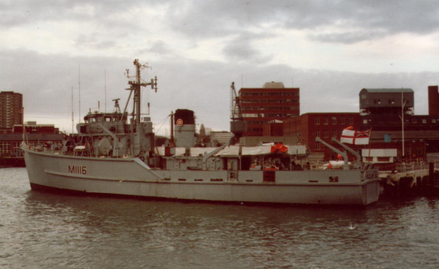
HMS Wilton (M1116)

HMS Wilton (M1116) was a prototype coastal minesweeper/minehunter for the Royal Navy. She was the first warship in the world to be constructed from glass...

Chalkwell railway station

Chalkwell railway station is on the London, Tilbury and Southend line, serving the locality of Chalkwell in Southend-on-Sea, Essex. It is 33 miles 69 chains...

St Clement's Church, Leigh-on-Sea

St Clement's Church is a parish church affiliated with the Church of England in Leigh-on-Sea, Essex. It is a Grade II* listed building dedicated to Saint...

Leigh-on-Sea

Leigh-on-Sea ( ), commonly referred to simply as Leigh, is a town and civil parish in the city of Southend-on-Sea, in the ceremonial county of Essex, England...

Chalkwell

Chalkwell is a suburb of the city of Southend-on-Sea, in the ceremonial county of Essex, England. It is situated on the north bank of the Thames Estuary...

Benfleet F.C.

Benfleet Football Club is a football club based in Benfleet, Essex, England. They are currently members of the Eastern Counties League Division One South...

Canvey Island F.C.

Canvey Island Football Club is a football club based in Canvey Island, Essex, England. They are currently members of the Isthmian League Premier Division...

Have you been to Leigh Middle?

Leave your review of Leigh Middle below (or comments, questions and feedback).