Brandyhole Reach
Sea, Estuary, Creek in Essex Rochford
England
Brandyhole Reach

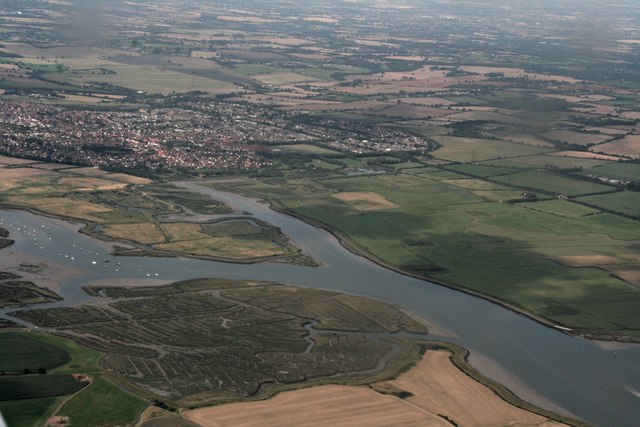
Brandyhole Reach is a picturesque waterway located in Essex, England. Situated along the southeastern coast, it encompasses a mix of sea, estuary, and creek, offering a diverse and captivating natural landscape.
The reach is formed by the confluence of two rivers, the Crouch and the Roach, as they flow into the North Sea. This unique geographical location gives Brandyhole Reach its distinct character, with a dynamic interplay between tidal movements and freshwater influence.
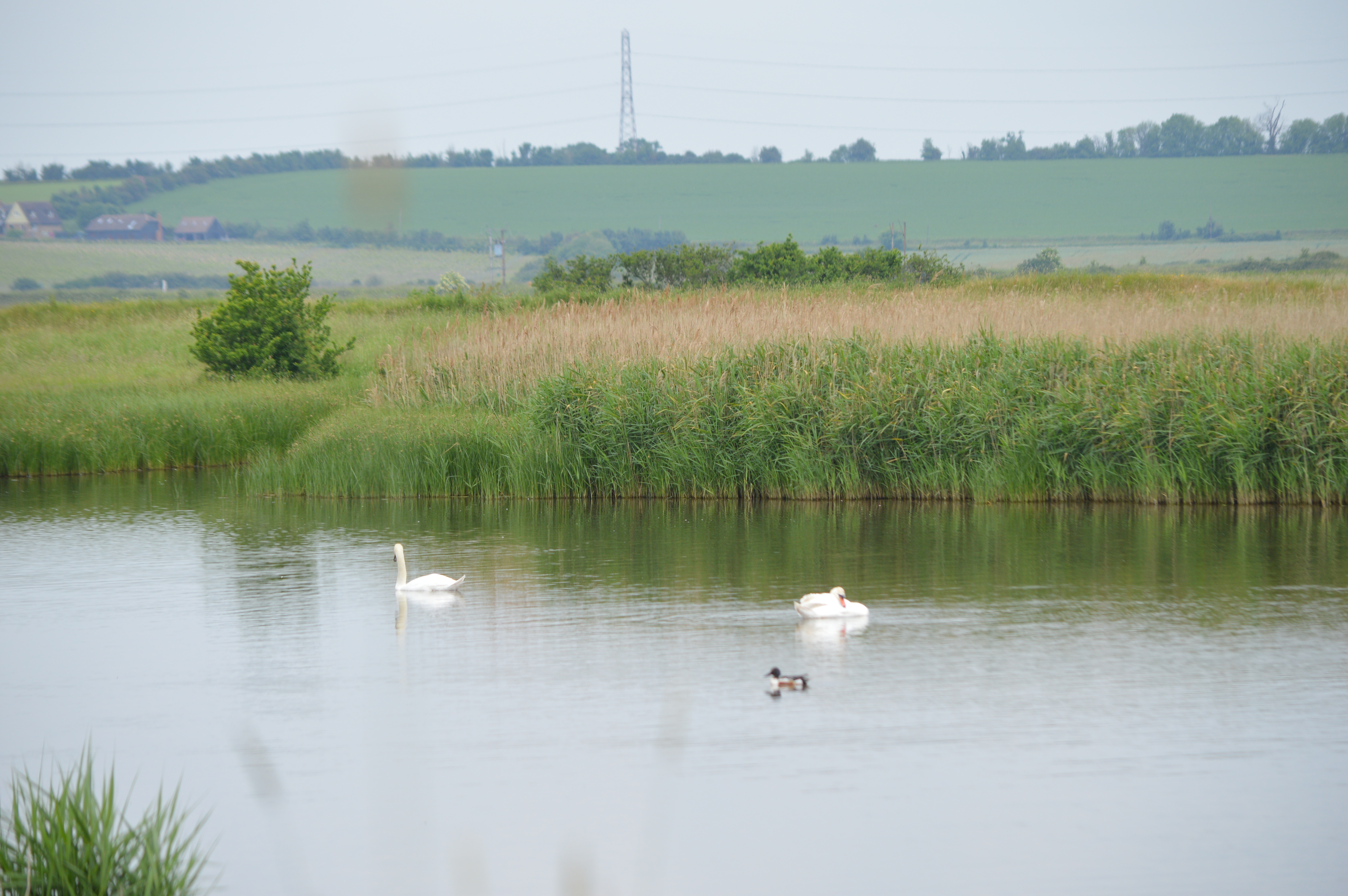
The area is renowned for its rich biodiversity and is a haven for wildlife enthusiasts. The estuarine environment provides a vital habitat for various bird species, including waders, ducks, and terns. Additionally, the marshes and mudflats are home to an abundance of marine life, such as seals, crabs, and fish, contributing to the reach's ecological significance.
Brandyhole Reach is also a popular destination for recreational activities. The calm and sheltered waters make it ideal for boating, sailing, and kayaking, attracting water sports enthusiasts from near and far. The scenic beauty of the reach, coupled with its tranquil atmosphere, also makes it a favored spot for fishing and birdwatching.
Visitors to Brandyhole Reach can enjoy stunning panoramic views of the surrounding coastline and estuary, with its vibrant mix of salt marshes, sandbanks, and meadows. The reach's natural splendor, combined with its ecological importance and recreational opportunities, make it a cherished part of Essex's coastal heritage.
If you have any feedback on the listing, please let us know in the comments section below.
Brandyhole Reach Images
Images are sourced within 2km of 51.635399/0.64714843 or Grid Reference TQ8396. Thanks to Geograph Open Source API. All images are credited.


Brandyhole Reach is located at Grid Ref: TQ8396 (Lat: 51.635399, Lng: 0.64714843)
Administrative County: Essex
District: Rochford
Police Authority: Essex
What 3 Words
///bordering.shoelaces.newlywed. Near Cold Norton, Essex
Nearby Locations
Related Wikis

7th Cruiser Squadron
The 7th Cruiser Squadron (also known as Cruiser Force C) was a blockading force of the Royal Navy during the First World War used to close the English...

North Fambridge
North Fambridge is a village and civil parish on the Dengie peninsula in the English county of Essex. North Fambridge is on the north bank of the River...

South Fambridge
South Fambridge is a village and former civil parish, now in the parish of Ashingdon, in the Rochford district, in the county of Essex, England. It is...

William de Ferrers School
William de Ferrers School is a co-educational British secondary school in the town of South Woodham Ferrers, in the English county of Essex. It is an academy...
Blue House Farm
Blue House Farm is a 242.8-hectare (600-acre) nature reserve and farm in North Fambridge, on the north bank of the River Crouch between Burnham-on-Crouch...
Brandy Hole
Brandy Hole is the name of a large area of saltmarsh and saltings on the River Crouch in Rochford District in the County of Essex, England. It is located...
Hullbridge
Hullbridge is a village and civil parish in the Rochford district of Essex in England. Bordered to the north by the River Crouch, as well a distance from...

Kendal Park
Kendal Park or Hullbridge Foreshore is a 2.8 hectare Local Nature Reserve in Hullbridge in Essex. It is owned by Rochford District Council and managed...
Nearby Amenities
Located within 500m of 51.635399,0.64714843Have you been to Brandyhole Reach?
Leave your review of Brandyhole Reach below (or comments, questions and feedback).