Brandy Hole

Sea, Estuary, Creek in Essex Rochford

England

Brandy Hole

Arable field off Lower Road, Hullbridge
Arable field off Lower Road, Hullbridge Credit: Roger Jones

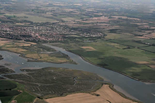
Brandy Hole is a small, picturesque coastal village located in Essex, England. Situated on the Dengie Peninsula, it lies on the northern bank of the River Crouch, which flows into the North Sea. Brandy Hole is renowned for its stunning views of the estuary and its tranquil and idyllic atmosphere.

The village takes its name from the creek that runs through it, known as Brandy Hole Creek. This creek is a tidal waterway that ebbs and flows with the tides, creating a unique and ever-changing landscape. The creek is flanked by salt marshes, which are home to a diverse range of flora and fauna, including wading birds and various species of fish.

Brandy Hole is a popular destination for boating enthusiasts and nature lovers alike. Its proximity to the North Sea makes it an ideal spot for sailing, fishing, and other water-based activities. The estuary is teeming with marine life, making it a haven for birdwatchers and wildlife enthusiasts.

The village itself is a charming collection of traditional cottages and buildings, many of which date back several centuries. The local community is tight-knit, and visitors to Brandy Hole can expect a warm welcome from its friendly residents.

Overall, Brandy Hole is a hidden gem on the Essex coast, offering a peaceful retreat for those seeking natural beauty and a sense of tranquility. Whether you are interested in exploring the estuary, enjoying water sports, or simply taking in the stunning views, Brandy Hole is sure to captivate visitors with its unspoiled charm.

If you have any feedback on the listing, please let us know in the comments section below.

Brandy Hole Images

Images are sourced within 2km of 51.631618/0.64372002 or Grid Reference TQ8395. Thanks to Geograph Open Source API. All images are credited.

Arable field off Lower Road, Hullbridge
Marshy ground Greener and wetter than when I last photographed this area behind the dam <a href="https://www.geograph.org.uk/photo/2600225">TQ8297 : Dry Marsh</a>
Marshy ground
Greener and wetter than when I last photographed this area behind the dam TQ8297 : Dry Marsh
Low tide in Hawbush Creek
Marshland between the Crouch and the southern edge of South Woodham Ferrers
Land reclamation on River Crouch east of Hullbridge: aerial 2022
Marshland near South Woodham Ferrers Marshland draining into the River Crouch near South Woodham Ferrers
Marshland near South Woodham Ferrers
Marshland draining into the River Crouch near South Woodham Ferrers
The River Crouch from the air Fambridge Yacht Haven can be seen to the right of the centre of the photo. South Woodham Ferrers is at the bottom. Cold Norton is in the distance.
The River Crouch from the air
Fambridge Yacht Haven can be seen to the right of the centre of the photo. South Woodham Ferrers is at the bottom. Cold Norton is in the distance.
Fambridge Yacht Haven from the air On Stow Creek off the River Crouch near South Woodham Ferrers.

See also <a href="https://www.geograph.org.uk/photo/4670686">TQ8496 : Fambridge Yacht Haven from the air</a>.
Fambridge Yacht Haven from the air
On Stow Creek off the River Crouch near South Woodham Ferrers. See also TQ8496 : Fambridge Yacht Haven from the air.
Fambridge Yacht Haven from the air On Stow Creek off the River Crouch near South Woodham Ferrers.

See also <a href="https://www.geograph.org.uk/photo/4670680">TQ8396 : Fambridge Yacht Haven from the air</a>.
Fambridge Yacht Haven from the air
On Stow Creek off the River Crouch near South Woodham Ferrers. See also TQ8396 : Fambridge Yacht Haven from the air.
Lower Road Heading towards Hullbridge.
Lower Road
Heading towards Hullbridge.
The Dome Village To quote their web site: 'The Dome Village is a semi retirement residential park home estate'.
The Dome Village
To quote their web site: 'The Dome Village is a semi retirement residential park home estate'.
River Crouch, South Woodham Ferrers and land to the east: aerial 2017
Mud near the River Crouch
Looking to Cracknell's Farm, Hullbridge
Lower Road, Hullbridge
The entrance to La Vallee Farm Shop, Hullbridge
Show me another place!

Brandy Hole is located at Grid Ref: TQ8395 (Lat: 51.631618, Lng: 0.64372002)

Administrative County: Essex

District: Rochford

Police Authority: Essex

What 3 Words

///headlines.necklaces.league. Near Cold Norton, Essex

Nearby Locations

Brandy Hole

Related Wikis

Brandy Hole

Brandy Hole is the name of a large area of saltmarsh and saltings on the River Crouch in Rochford District in the County of Essex, England. It is located...
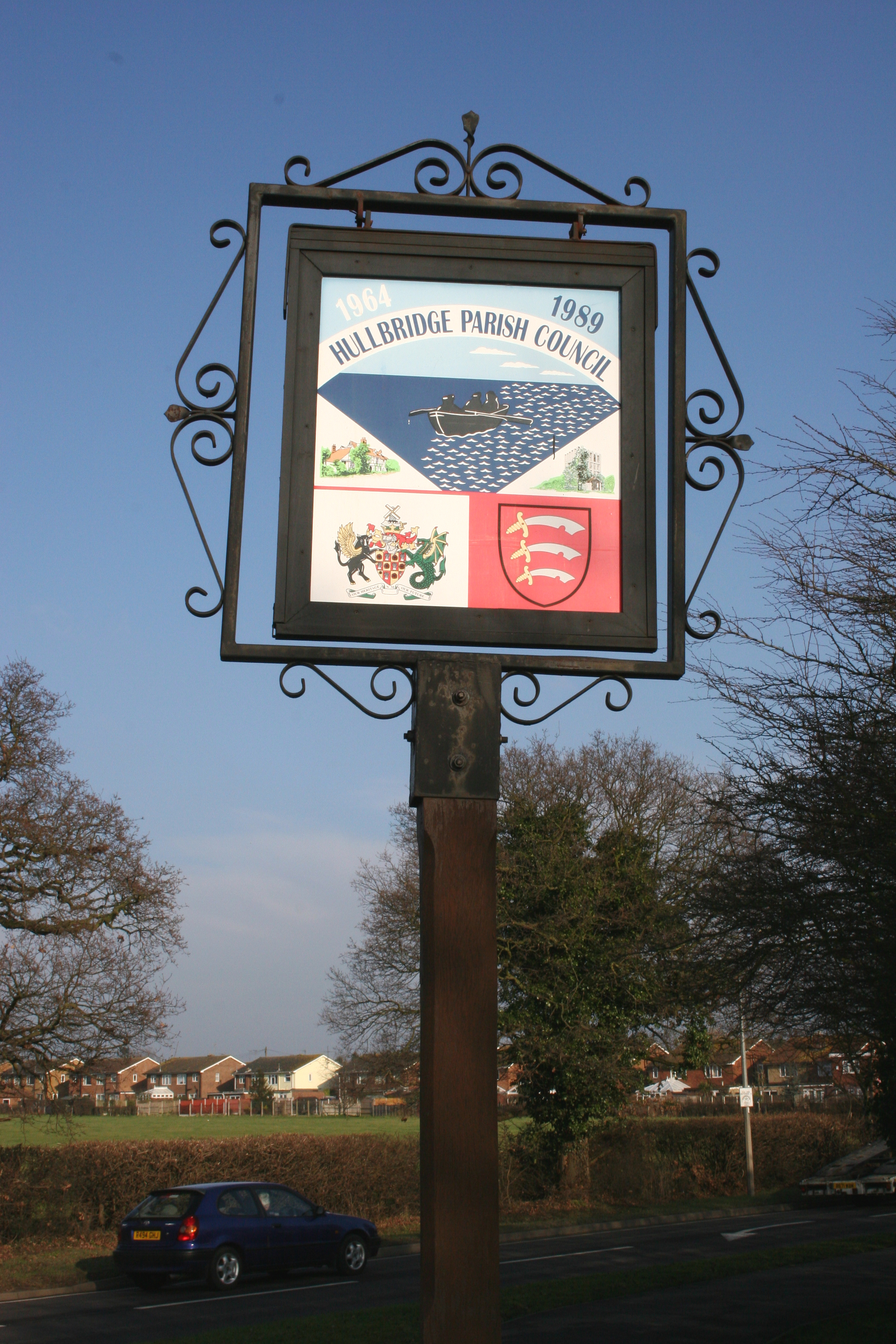
Hullbridge

Hullbridge is a village and civil parish in the Rochford district of Essex in England. Bordered to the north by the River Crouch, as well a distance from...

7th Cruiser Squadron

The 7th Cruiser Squadron (also known as Cruiser Force C) was a blockading force of the Royal Navy during the First World War used to close the English...

William de Ferrers School

William de Ferrers School is a co-educational British secondary school in the town of South Woodham Ferrers, in the English county of Essex. It is an academy...

Kendal Park

Kendal Park or Hullbridge Foreshore is a 2.8 hectare Local Nature Reserve in Hullbridge in Essex. It is owned by Rochford District Council and managed...

South Fambridge

South Fambridge is a village and former civil parish, now in the parish of Ashingdon, in the Rochford district, in the county of Essex, England. It is...

Hullbridge Sports F.C.

Hullbridge Sports Football Club is a football club based in Hullbridge, Essex, England. They are currently members of the Essex Senior League and play...

North Fambridge

North Fambridge is a village and civil parish on the Dengie peninsula in the English county of Essex. North Fambridge is on the north bank of the River...

Nearby Amenities

Located within 500m of 51.631618,0.64372002
Created By: dmgroom_coastlines
Source: PGS
Lat/Long: 51.629111/0.644892
Created By: dmgroom_coastlines
Source: PGS
Lat/Long: 51.629214/0.643651
Created By: dmgroom_coastlines
Source: PGS
Lat/Long: 51.629197/0.642828
Created By: dmgroom_coastlines
Source: PGS
Lat/Long: 51.629065/0.642628
Created By: dmgroom_coastlines
Source: PGS
Lat/Long: 51.628933/0.64243
Created By: dmgroom_coastlines
Source: PGS
Lat/Long: 51.628925/0.642019
Created By: dmgroom_coastlines
Source: PGS
Lat/Long: 51.6291667/0.6411876
Created By: dmgroom_coastlines
Source: PGS
Lat/Long: 51.6291681/0.6405362
Created By: dmgroom_coastlines
Source: PGS
Lat/Long: 51.6295306/0.64016
Source: PGS
Lat/Long: 51.6289621/0.6397339
Source: PGS
Lat/Long: 51.6293084/0.6380816
Source: PGS
Lat/Long: 51.6297879/0.6381675
Source: PGS
Lat/Long: 51.633609/0.6376243
Source: PGS
Lat/Long: 51.6333893/0.6376028
Source: PGS
Lat/Long: 51.6332228/0.6381929
Source: PGS
Lat/Long: 51.6332827/0.640167
Source: PGS
Lat/Long: 51.6335624/0.6404138
Source: PGS
Lat/Long: 51.6335691/0.6408107
Source: PGS
Lat/Long: 51.6336623/0.6414652
Source: PGS
Lat/Long: 51.6335957/0.6422377
Source: PGS
Lat/Long: 51.6338687/0.6427419
Created By: dmgroom_coastlines
Source: PGS
Lat/Long: 51.634343/0.643797
Source: PGS
Lat/Long: 51.6346612/0.6444585
Source: PGS
Lat/Long: 51.6352472/0.6452632
Source: PGS
Lat/Long: 51.6354602/0.6451345
Source: PGS
Lat/Long: 51.6356933/0.645113
Created By: dmgroom_coastlines
Source: PGS
Lat/Long: 51.627843/0.645574
Created By: dmgroom_coastlines
Source: PGS
Lat/Long: 51.628359/0.645754
Created By: dmgroom_coastlines
Source: PGS
Lat/Long: 51.6287875/0.6452965
Created By: dmgroom_coastlines
Source: PGS
Lat/Long: 51.6274373/0.6455532
Seamark Buoy Lateral Category: starboard
Seamark Buoy Lateral Colour: green
Seamark Buoy Lateral Shape: conical
Seamark Buoy Lateral System: iala-a
Seamark Name: Brandy Hole
Seamark Type: buoy_lateral
Lat/Long: 51.6331667/0.6446667
The data included in this document is from www.openstreetmap.org. The data is made available under ODbL.

Have you been to Brandy Hole?

Leave your review of Brandy Hole below (or comments, questions and feedback).