Nene Outfall Cut
Sea, Estuary, Creek in Lincolnshire South Holland
England
Nene Outfall Cut

The Nene Outfall Cut is a significant waterway located in Lincolnshire, England. It serves as a crucial link between the River Nene and The Wash, a large bay and estuary on the east coast of England. This waterway plays a vital role in managing water levels and preventing flooding in the surrounding areas.
The Nene Outfall Cut is approximately 30 kilometers long and was constructed in the mid-19th century as part of a drainage system for the extensive low-lying fenlands in the region. It is primarily used as a flood relief channel, diverting excess water from the River Nene and directing it towards The Wash. This helps to alleviate pressure on the river during times of heavy rainfall, reducing the risk of overflow and subsequent flooding in nearby towns and farmland.
The waterway is a mix of natural and man-made features, with sections of the cut following the path of former tidal creeks. It is lined with grassy banks and surrounded by a diverse range of flora and fauna. The Nene Outfall Cut serves as an important habitat for various bird species, including waders, ducks, and geese, which can be seen feeding and nesting along its banks.
Recreationally, the Nene Outfall Cut attracts boating and fishing enthusiasts who appreciate its serene surroundings and the opportunity to explore the picturesque waterway. Additionally, the cut provides a popular walking route for locals and visitors alike, offering beautiful views of the surrounding countryside and the chance to spot wildlife in its natural habitat.
If you have any feedback on the listing, please let us know in the comments section below.
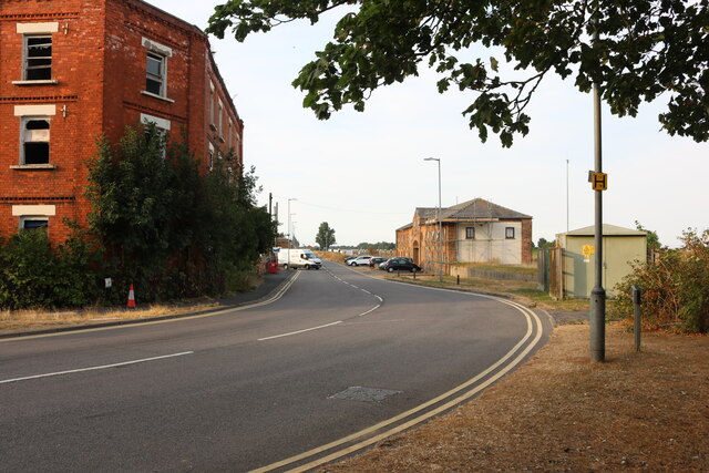
Nene Outfall Cut Images
Images are sourced within 2km of 52.764367/0.19349053 or Grid Reference TF4820. Thanks to Geograph Open Source API. All images are credited.


Nene Outfall Cut is located at Grid Ref: TF4820 (Lat: 52.764367, Lng: 0.19349053)
Administrative County: Lincolnshire
District: South Holland
Police Authority: Lincolnshire
What 3 Words
///throwaway.bandaged.cabs. Near Sutton Bridge, Lincolnshire
Nearby Locations
Related Wikis

Cross Keys Bridge
Cross Keys Bridge is a swing bridge that carries the busy single carriageway A17 road which runs from Newark in Nottinghamshire to King's Lynn in Norfolk...
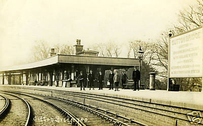
Sutton Bridge railway station
Sutton Bridge railway station was a station in Sutton Bridge, south Lincolnshire, England, which opened in the 19th century. It became part of the Midland...

RAF Sutton Bridge
Royal Air Force Sutton Bridge or more simply RAF Sutton Bridge is a former Royal Air Force station found next to the village of Sutton Bridge in the south...
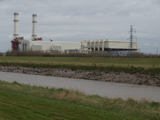
Sutton Bridge Power Station
Sutton Bridge Power Station is an 819 MW gas-fired power station in Sutton Bridge in the south-east of Lincolnshire in South Holland, England. It is situated...

Sutton Bridge
Sutton Bridge is a village and civil parish in the South Holland district of Lincolnshire, England. It is situated on the A17 road, 7 miles (11 km) north...

Little Sutton, Lincolnshire
Little Sutton is a small civil parish, containing a few farms and a few houses, lying between the much larger parishes of Long Sutton and Sutton Bridge...
Tydd railway station
Tydd railway station was a station, opened by the Peterborough, Wisbech and Sutton Bridge Railway on 1 August 1866, in Lincolnshire serving the villages...
Walpole Cross Keys
Walpole Cross Keys is a village and civil parish in the English county of Norfolk. It covers an area of 4.03 km2 (1.56 sq mi) and had a population of 469...
Nearby Amenities
Located within 500m of 52.764367,0.19349053Have you been to Nene Outfall Cut?
Leave your review of Nene Outfall Cut below (or comments, questions and feedback).