Bow Creek
Sea, Estuary, Creek in Essex
England
Bow Creek
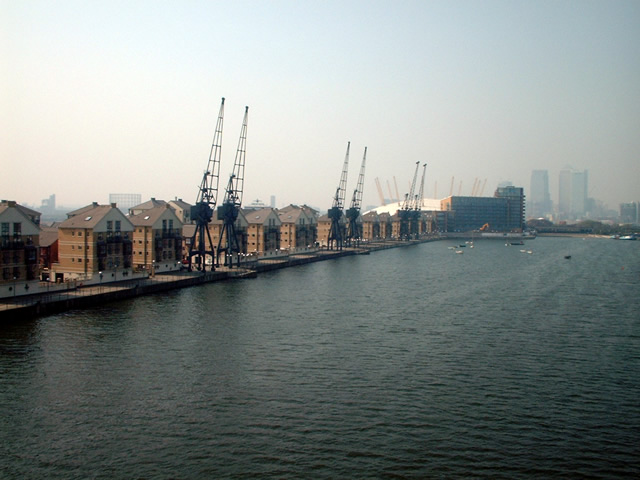
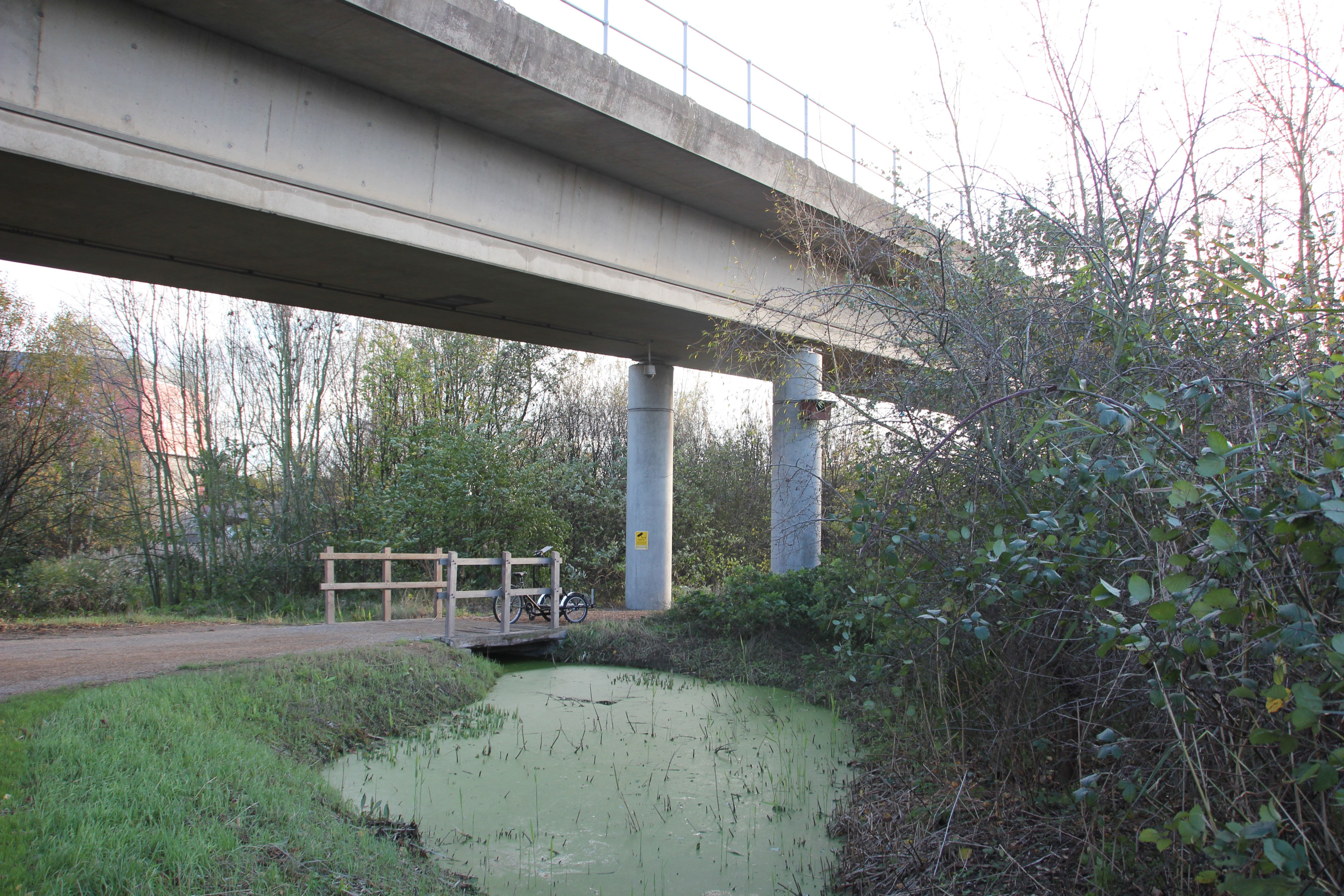
Bow Creek is a tidal creek located in East London, within the borough of Newham, Essex. It is an estuary of the River Lea, which flows into the Thames Estuary. The creek runs for approximately 2.25 miles (3.6 kilometers) and is known for its industrial history and diverse ecosystem.
Bow Creek is surrounded by a mix of residential, commercial, and industrial areas. Throughout the 19th and 20th centuries, it played a significant role in the shipping and trade activities of London's docks. The creek was once lined with wharves, warehouses, and shipbuilding facilities, but many of these have been replaced by modern developments. Today, it is mainly used for recreational purposes, with several marinas and boating clubs along its banks.
The creek is home to a variety of wildlife, including fish, birds, and invertebrates. It serves as an important habitat for migratory and nesting birds, with species such as herons, ducks, and swans frequently sighted. Additionally, the creek supports a range of marine life, including flounder, eels, and crabs.
While Bow Creek has undergone significant changes over the years, there are ongoing efforts to preserve and enhance its natural and cultural heritage. The area surrounding the creek has seen regeneration projects aimed at creating green spaces, improving water quality, and providing recreational opportunities for the local community.
Overall, Bow Creek is a historically significant and ecologically diverse waterway that continues to play an important role in the landscape of Essex and London.
If you have any feedback on the listing, please let us know in the comments section below.
Bow Creek Images
Images are sourced within 2km of 51.517134/-0.000616904 or Grid Reference TQ3881. Thanks to Geograph Open Source API. All images are credited.


Bow Creek is located at Grid Ref: TQ3881 (Lat: 51.517134, Lng: -0.000616904)
Unitary Authority: Tower Hamlets
Police Authority: Metropolitan
What 3 Words
///charmingly.regard.type. Near Poplar, London
Nearby Locations
Related Wikis
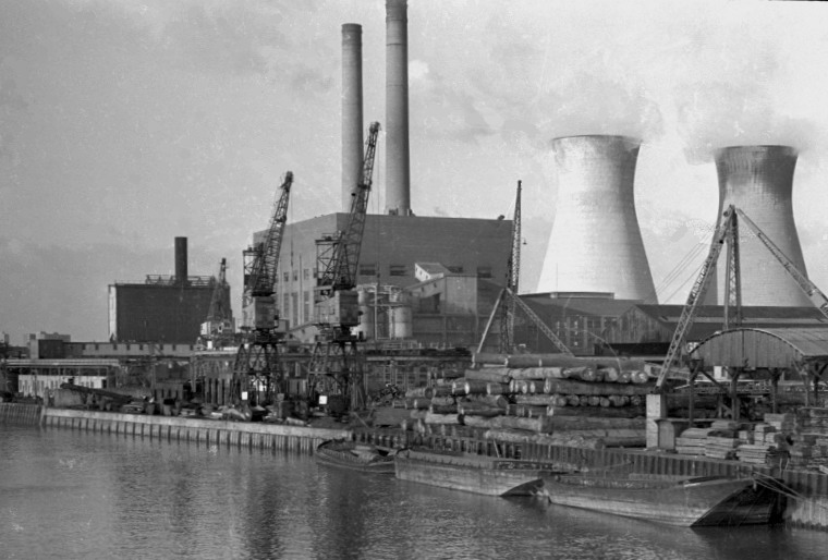
West Ham Power Station
West Ham Power Station was a coal-fired power station on Bow Creek (the tidal mouth of the River Lea) at Canning Town, in east London. It was often referred...
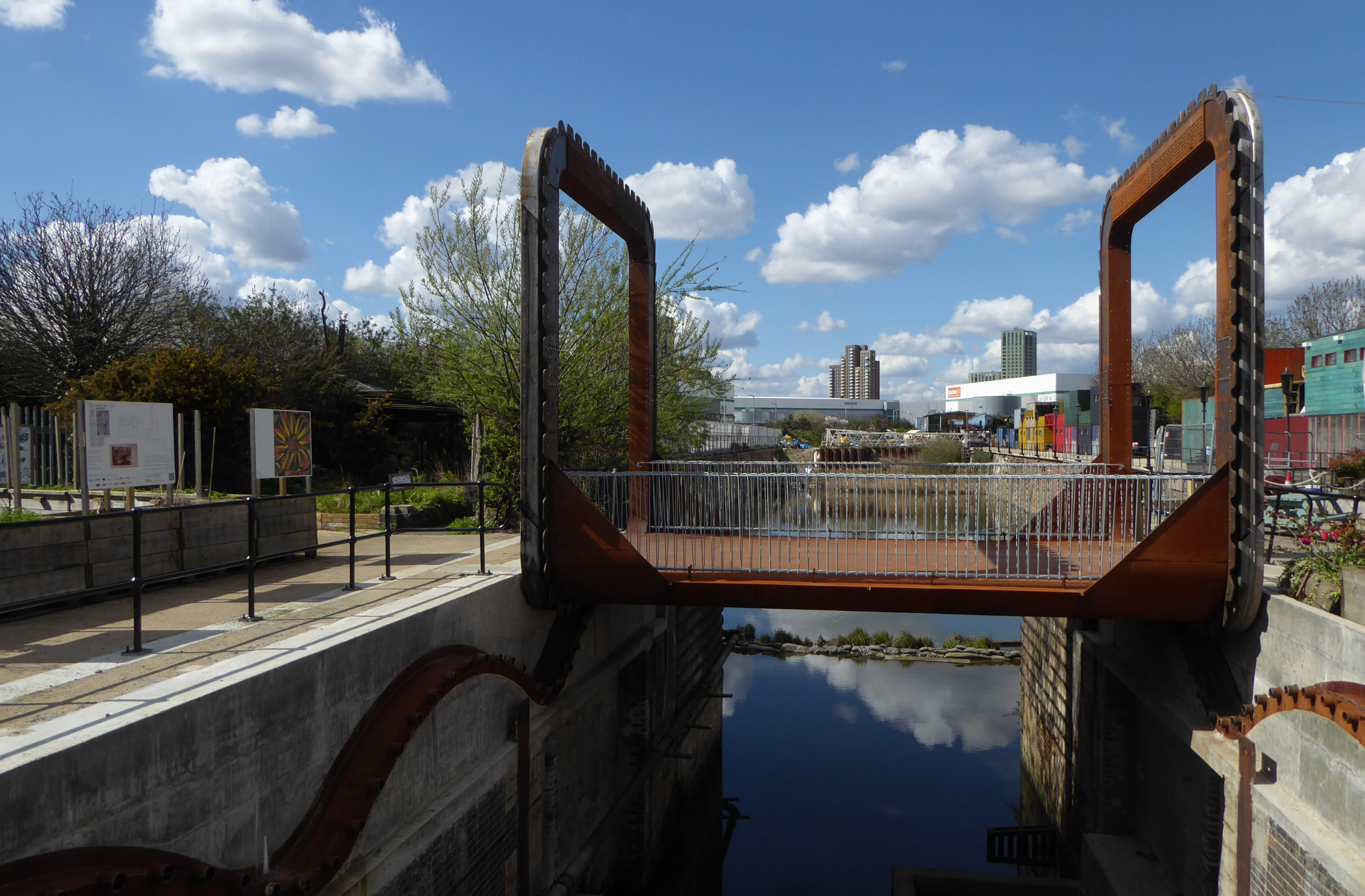
Cody Dock Rolling Bridge
The Cody Dock Rolling Bridge is a moveable pedestrian bridge in London, England at Cody Dock. The bridge is manually rolled using winches to alternate...

Poplar and Canning Town (UK Parliament constituency)
Poplar and Canning Town was a borough constituency represented in the House of Commons of the Parliament of the United Kingdom. It elected one Member of...

St Gabriel's Church, Canning Town
St Gabriel's Church, Canning Town was a Church of England church in Canning Town, east London. It originated as an undedicated iron church between the...
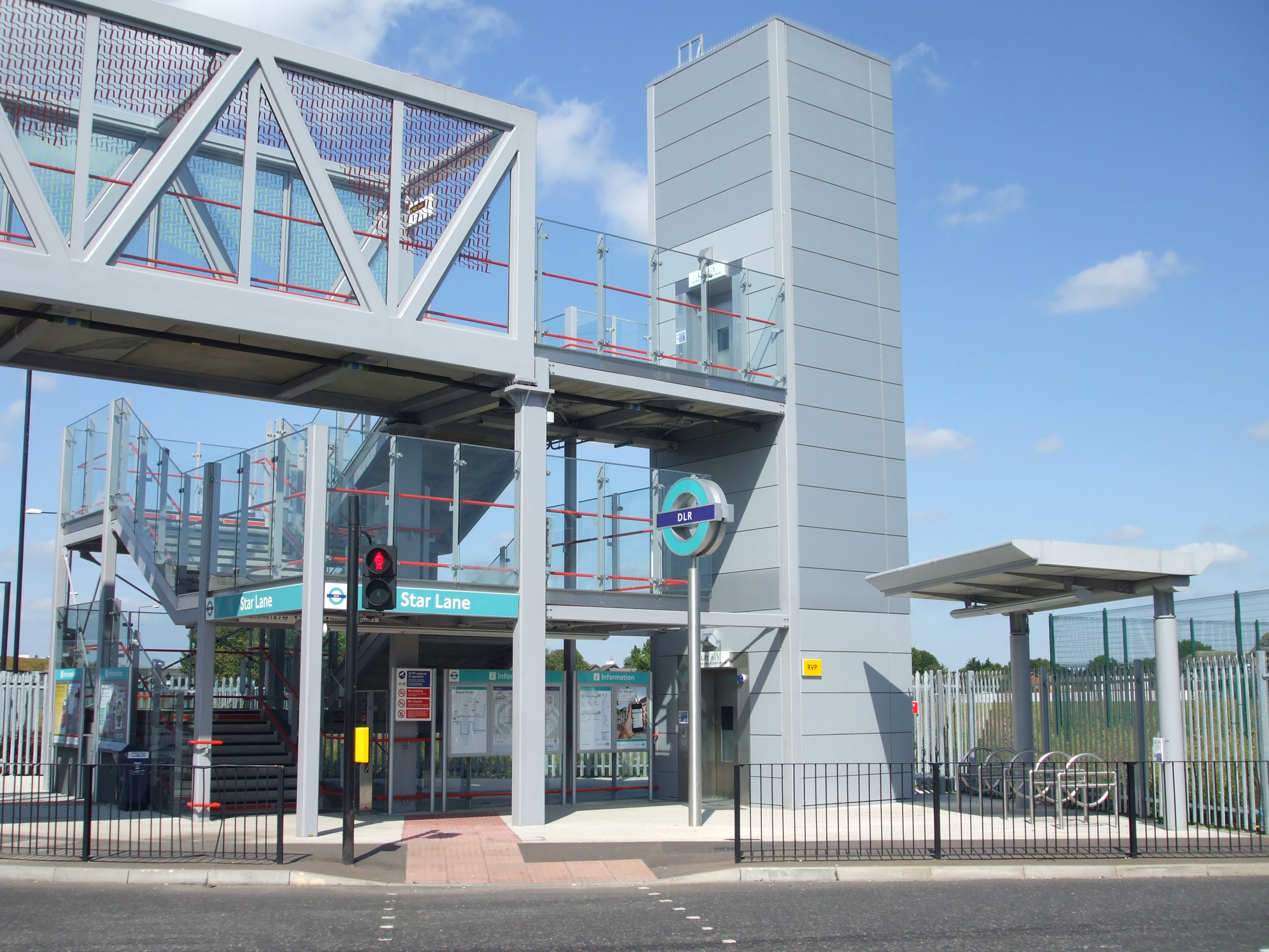
Star Lane DLR station
Star Lane is a Docklands Light Railway (DLR) station in Canning Town, east London. Located on the Stratford International extension of the Docklands Light...
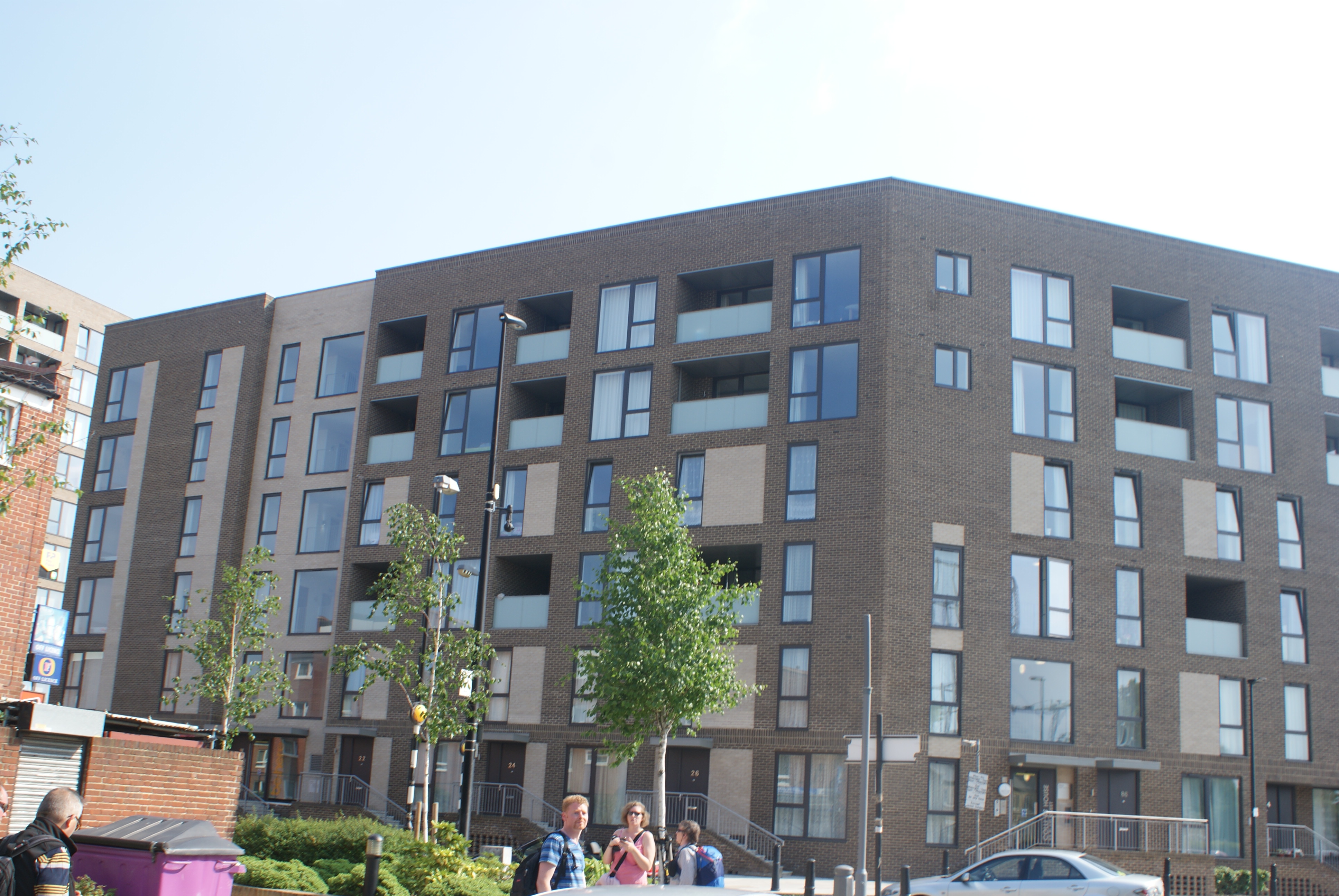
Aberfeldy Village
Aberfeldy Village is an urban village in a part of Poplar that was once part of Bromley in London, England, which is in the process of being redeveloped...
Telehouse Europe
Telehouse is a major carrier-neutral colocation, information and communications technology services provider based in Docklands, London. Established in...
Bow Creek Ecology Park
Bow Creek Ecology Park is a small open space along Bow Creek tidal estuary of the River Lea in Canning Town in Newham, in east London. It is operated by...
Related Videos
![LONDON, Canary Wharf Walk 🇬🇧 Financial & Skyscraper District | East London Walking Tour [4K HDR]](https://i.ytimg.com/vi/iXIWL0x4hDg/hqdefault.jpg)
LONDON, Canary Wharf Walk 🇬🇧 Financial & Skyscraper District | East London Walking Tour [4K HDR]
It is a Central London Spring Walk in 2023 | LONDON, Canary Wharf Walk Financial & Skyscraper District | East London ...

Canary Wharf and Crossrail Place - London Travel Walk 4K with Captions
Hello friends! Today's walk is in London's Canary Wharf walking along the West India Quay and ending at the beautiful Roof ...

The O2 Walking Tour. London. Amazing experience. 🇬🇧🇬🇧 #uk #london #attraction #walking
The O2 Arena, commonly known as the O2, is a multi-purpose indoor arena in the centre of The O2 entertainment complex on the ...
London The O2 Arena - Walking Tour
The O2 Arena, commonly known as the O2, is a multi-purpose indoor arena in the centre of The O2 entertainment complex on the ...
Nearby Amenities
Located within 500m of 51.517134,-0.000616904Have you been to Bow Creek?
Leave your review of Bow Creek below (or comments, questions and feedback).