Shoreham Harbour

Sea, Estuary, Creek in Sussex Adur

England

Shoreham Harbour

Path by Widewater Lagoon, lancing Widewater Lagoon is an area of brackish water landlocked by a man-made shingle bank. It lies between the beach and A259 coast road (Brighton Road) in Lancing; between the far east of Lancing Beach and the far west of Shoreham Beach.
This path runs between the beach and lagoon
Path by Widewater Lagoon, lancing Credit: Richard Rogerson

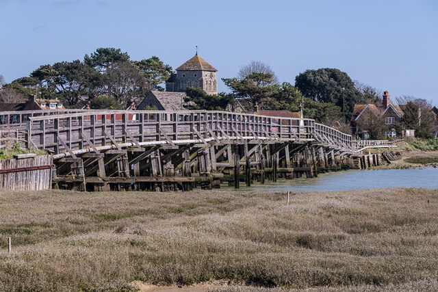
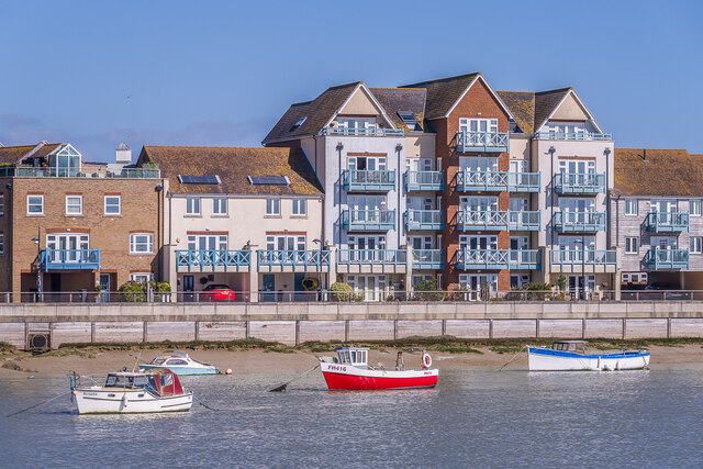
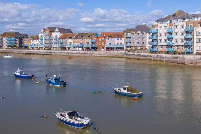
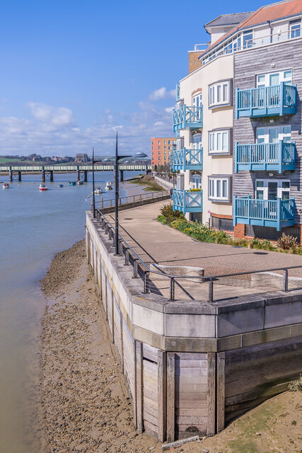
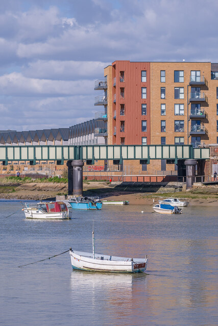
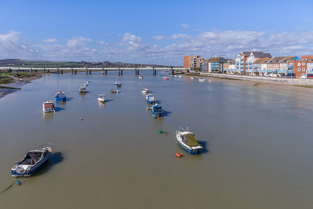
Shoreham Harbour is a picturesque coastal area located in Sussex, England. It is situated at the mouth of the River Adur, where it meets the English Channel. The harbor is a combination of a sea, estuary, and creek, offering a diverse range of natural landscapes.

The sea at Shoreham Harbour is a stretch of the English Channel, characterized by its sandy beaches and glistening blue waters. It provides a popular destination for locals and tourists alike, offering opportunities for swimming, sailing, and other water sports. The sea is also home to a variety of marine life, including seals and seabirds, making it a haven for nature enthusiasts.

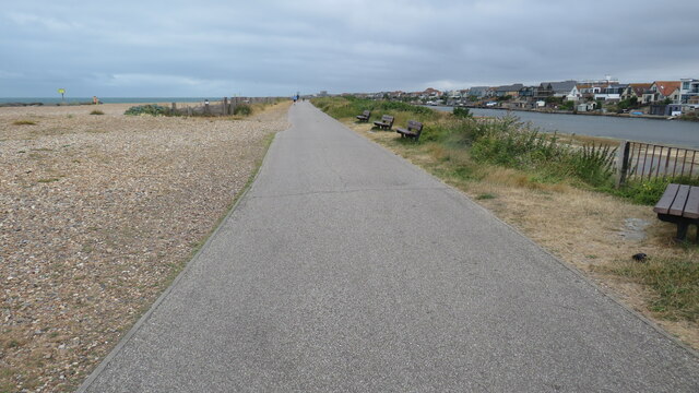
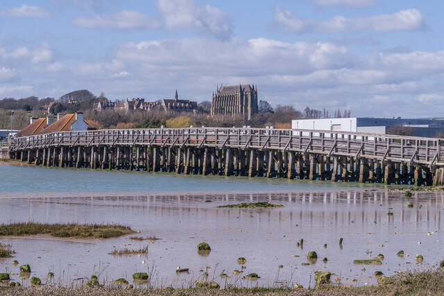
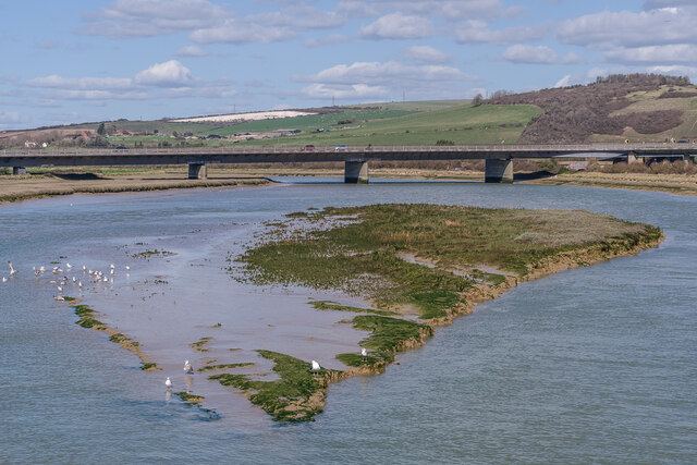
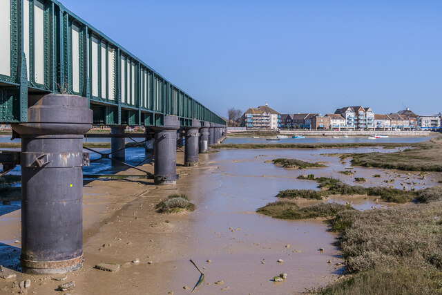
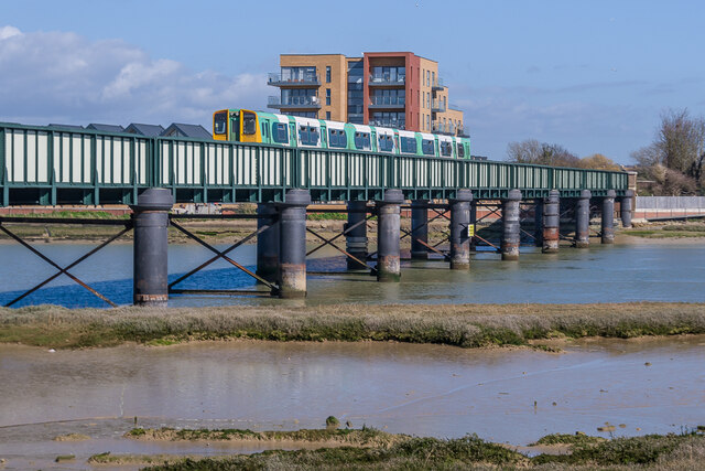
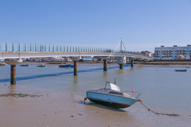
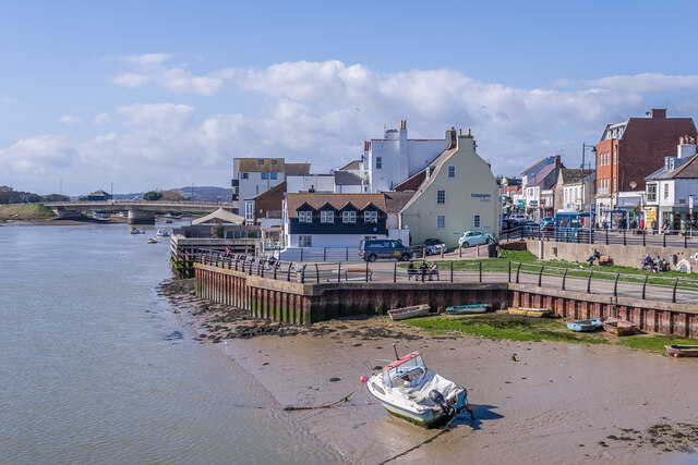
Moving inland from the sea, the harbor transitions into an estuary. The River Adur flows into the harbor, forming a wide tidal basin. This estuarine environment is a vital habitat for numerous bird species, which flock to the area during migration seasons. The estuary is also home to salt marshes, mudflats, and reed beds, creating a rich ecosystem that supports a diverse range of flora and fauna.

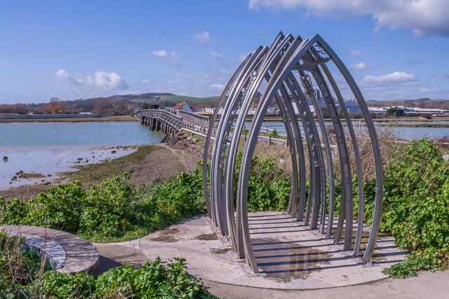
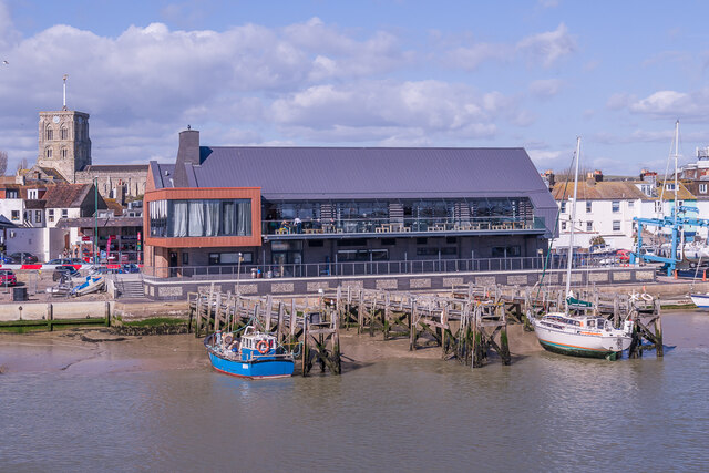
Further inland, the harbor extends into a creek. The Adur River splits into smaller channels, creating a network of waterways that wind through the surrounding countryside. These creeks are navigable by small boats, providing an opportunity for leisurely exploration of the area's tranquil and scenic landscape.

Overall, Shoreham Harbour in Sussex offers a unique blend of sea, estuary, and creek environments, providing a haven for wildlife, outdoor activities, and stunning natural beauty.

If you have any feedback on the listing, please let us know in the comments section below.

Shoreham Harbour Images

Images are sourced within 2km of 50.8334/-0.28324721 or Grid Reference TQ2005. Thanks to Geograph Open Source API. All images are credited.

Path by Widewater Lagoon, lancing Widewater Lagoon is an area of brackish water landlocked by a man-made shingle bank. It lies between the beach and A259 coast road (Brighton Road) in Lancing; between the far east of Lancing Beach and the far west of Shoreham Beach.
This path runs between the beach and lagoon
Path by Widewater Lagoon, lancing
Widewater Lagoon is an area of brackish water landlocked by a man-made shingle bank. It lies between the beach and A259 coast road (Brighton Road) in Lancing; between the far east of Lancing Beach and the far west of Shoreham Beach. This path runs between the beach and lagoon
Houses on Brighton Road
Paddock A horse feeding in a paddock off the A283 near Old Shoreham, with Lancing College in the left background.
Paddock
A horse feeding in a paddock off the A283 near Old Shoreham, with Lancing College in the left background.
Artwork Artwork alongside the Downs Link cycle/foot trail, with Old Shoreham Bridge across the River Adur in the background.
Artwork
Artwork alongside the Downs Link cycle/foot trail, with Old Shoreham Bridge across the River Adur in the background.
Old Shoreham Bridge Bridge over the River Adur near Old Shoreham, now a foot/cycle bridge.  Originally built in 1781, it was rebuilt to the same design during the First World War.  Until 1970 it formed part of the A27, with a toll for its use, until relieved by the opening of the Shoreham bypass, with a new viaduct over the river around 300m north of the old bridge.  It was then closed to road traffic and made a bridleway.  It underwent a full restoration in 2008.  Grade II* listed - see <span class="nowrap"><a title="https://historicengland.org.uk/listing/the-list/list-entry/1027895?section=official-list-entry" rel="nofollow ugc noopener" href="https://historicengland.org.uk/listing/the-list/list-entry/1027895?section=official-list-entry">Link</a><img style="margin-left:2px;" alt="External link" title="External link - shift click to open in new window" src="https://s1.geograph.org.uk/img/external.png" width="10" height="10"/></span>.

In the background is Lancing College.
Old Shoreham Bridge
Bridge over the River Adur near Old Shoreham, now a foot/cycle bridge. Originally built in 1781, it was rebuilt to the same design during the First World War. Until 1970 it formed part of the A27, with a toll for its use, until relieved by the opening of the Shoreham bypass, with a new viaduct over the river around 300m north of the old bridge. It was then closed to road traffic and made a bridleway. It underwent a full restoration in 2008. Grade II* listed - see LinkExternal link. In the background is Lancing College.
Old Shoreham Bridge Bridge over the River Adur near Old Shoreham, now a foot/cycle bridge.  Originally built in 1781, it was rebuilt to the same design during the First World War.  Until 1970 it formed part of the A27, with a toll for its use, until relieved by the opening of the Shoreham bypass, with a new viaduct over the river around 300m north of the old bridge.  It was then closed to road traffic and made a bridleway.  It underwent a full restoration in 2008.  Grade II* listed - see <span class="nowrap"><a title="https://historicengland.org.uk/listing/the-list/list-entry/1027895?section=official-list-entry" rel="nofollow ugc noopener" href="https://historicengland.org.uk/listing/the-list/list-entry/1027895?section=official-list-entry">Link</a><img style="margin-left:2px;" alt="External link" title="External link - shift click to open in new window" src="https://s1.geograph.org.uk/img/external.png" width="10" height="10"/></span>.

In the background is St Nicolas' Church, Old Shoreham.
Old Shoreham Bridge
Bridge over the River Adur near Old Shoreham, now a foot/cycle bridge. Originally built in 1781, it was rebuilt to the same design during the First World War. Until 1970 it formed part of the A27, with a toll for its use, until relieved by the opening of the Shoreham bypass, with a new viaduct over the river around 300m north of the old bridge. It was then closed to road traffic and made a bridleway. It underwent a full restoration in 2008. Grade II* listed - see LinkExternal link. In the background is St Nicolas' Church, Old Shoreham.
River Adur Looking along the River Adur from the Old Shoreham Bridge with the A27 Adur Viaduct, completed in 1970, in the background.
River Adur
Looking along the River Adur from the Old Shoreham Bridge with the A27 Adur Viaduct, completed in 1970, in the background.
Shoreham Railway Viaduct Viaduct carrying the West Coastway railway over the River Adur.  It was built in 1893, replacing an earlier wooden trestle viaduct opened in 1845.
Shoreham Railway Viaduct
Viaduct carrying the West Coastway railway over the River Adur. It was built in 1893, replacing an earlier wooden trestle viaduct opened in 1845.
Shoreham Railway Viaduct Viaduct carrying the West Coastway railway over the River Adur.  It was built in 1893, replacing an earlier wooden trestle viaduct opened in 1845.  Seen here with Class 313 no 313215 crossing on a westbound stopping service.
Shoreham Railway Viaduct
Viaduct carrying the West Coastway railway over the River Adur. It was built in 1893, replacing an earlier wooden trestle viaduct opened in 1845. Seen here with Class 313 no 313215 crossing on a westbound stopping service.
Linemans View Part of the Ropetackle development overlooking the River Adur, completed in 2005.
Linemans View
Part of the Ropetackle development overlooking the River Adur, completed in 2005.
Marline Court Part of the Ropetackle development overlooking the River Adur, completed in 2006.
Marline Court
Part of the Ropetackle development overlooking the River Adur, completed in 2006.
Linemans View and Marline Court Parts of the Ropetackle development overlooking the River Adur, completed in 2005 and 2006 respectively.
Linemans View and Marline Court
Parts of the Ropetackle development overlooking the River Adur, completed in 2005 and 2006 respectively.
Marline Court Part of the Ropetackle development overlooking the River Adur, completed in 2006.  In the background is the viaduct carrying the West Coastway railway over the river, with Lancing College beyond.
Marline Court
Part of the Ropetackle development overlooking the River Adur, completed in 2006. In the background is the viaduct carrying the West Coastway railway over the river, with Lancing College beyond.
River Adur Looking across the River Adur towards the viaduct carrying the West Coastway railway over the river, with Ringed Plover Apartments in Salt Marsh Road beyond.
River Adur
Looking across the River Adur towards the viaduct carrying the West Coastway railway over the river, with Ringed Plover Apartments in Salt Marsh Road beyond.
River Adur Looking up the River Adur towards the viaduct carrying the West Coastway railway over the river.
River Adur
Looking up the River Adur towards the viaduct carrying the West Coastway railway over the river.
Adur Ferry Bridge Footbridge over the River Adur, connecting the main part of Shoreham with Shoreham Beach.  Built in 2013, it replaced a previous one dating from 1921.  The central section is a swingbridge, allowing boats to access the next section of the river.
Adur Ferry Bridge
Footbridge over the River Adur, connecting the main part of Shoreham with Shoreham Beach. Built in 2013, it replaced a previous one dating from 1921. The central section is a swingbridge, allowing boats to access the next section of the river.
River Adur shoreline The shoreline of the River Adur, with buildings in High Street on the right.
River Adur shoreline
The shoreline of the River Adur, with buildings in High Street on the right.
Sussex Yacht Club The clubhouse of Sussex Yacht Club on the banks of the River Adur, completed in 2021.  In the left background is the tower of St Mary's Church.
Sussex Yacht Club
The clubhouse of Sussex Yacht Club on the banks of the River Adur, completed in 2021. In the left background is the tower of St Mary's Church.
Show me another place!

Shoreham Harbour is located at Grid Ref: TQ2005 (Lat: 50.8334, Lng: -0.28324721)

Administrative County: West Sussex

District: Adur

Police Authority: Sussex

What 3 Words

///voltages.loafer.starfish. Near Shoreham-by-Sea, West Sussex

Related Wikis

Adur Estuary

Adur Estuary is a 62.2-hectare (154-acre) biological Site of Special Scientific Interest on the western outskirts of Shoreham-by-Sea in West Sussex. Part...

St Peter's Church, Shoreham-by-Sea

The name St Peter's Church has been borne by two Roman Catholic churches in the town of Shoreham-by-Sea in the district of Adur, in the English county...

Shoreham Town Hall

Shoreham Town Hall is a municipal building in the High Street, Shoreham-by-Sea, West Sussex, England. The town hall, which was the headquarters of Shoreham...

Marlipins Museum

Marlipins Museum, is a 12th to early-13th century Grade II* listed building on the High Street in Shoreham-by-Sea, a town in Adur district in West Sussex...

Saltings (electoral division)

Saltings is an electoral division of West Sussex in the United Kingdom, and returns one member to sit on West Sussex County Council. == Extent == It comprises...

St Mary de Haura Church, Shoreham-by-Sea

St Mary de Haura Church is an Anglican church in the ancient "New Shoreham" area of Shoreham-by-Sea in the district of Adur, one of seven local government...
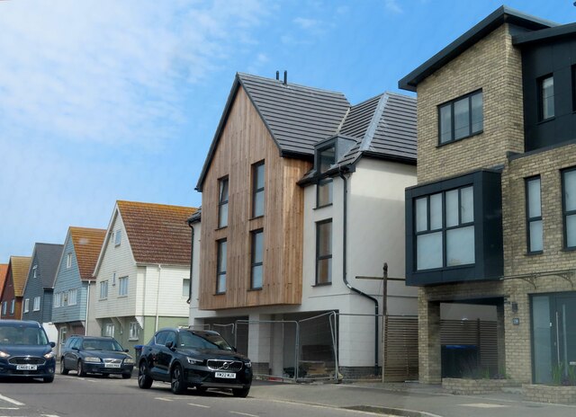
Shoreham-by-Sea

Shoreham-by-Sea (often shortened to Shoreham) is a coastal town and port in West Sussex, England. The town is bordered to its north by the South Downs...

Red Lion Inn, Shoreham-by-Sea

The Red Lion Inn is a 16th-century public house in the ancient Old Shoreham part of the town of Shoreham-by-Sea, in the Adur district of West Sussex, England...

Related Videos

HIDDEM GEM! | Walking Tour in Stunning English Town - Virtual Seaside 4k Walking Tour

Today we walk round the lovely town of Shoreham By Sea in West Sussex. Situated on the South Coast of England, this really is a ...

The Walking Dad - Episode 11 - Shoreham Beach

In this episode Dylan and I head out to Shoreham Beach and take a walk around Shoreham Fort.

Nearby Amenities

Located within 500m of 50.8334,-0.28324721
Source: PGS
Lat/Long: 50.8290912/-0.2838795
Source: PGS
Lat/Long: 50.8294502/-0.2849645
Source: PGS
Lat/Long: 50.8299312/-0.2839248
Source: PGS
Lat/Long: 50.8301489/-0.2835144
Source: PGS
Lat/Long: 50.830393/-0.2830159
Created By: almien_coastlines
Source: PGS
Lat/Long: 50.830725/-0.282258
Source: PGS
Lat/Long: 50.830946/-0.2817968
Created By: almien_coastlines
Source: PGS
Lat/Long: 50.8311525/-0.2813372
Source: PGS
Lat/Long: 50.8313583/-0.2808243
Source: PGS
Lat/Long: 50.8315315/-0.2804395
Source: PGS
Lat/Long: 50.8320123/-0.2784155
Source: Landsat photo
Lat/Long: 50.8343904/-0.2795785
Traffic Signals
Lat/Long: 50.8334578/-0.2786232
Little High Street Hard
Leisure: slipway
Lat/Long: 50.832908/-0.2801441
Bus Stop
Adur Recreation Ground
Naptan AtcoCode: 4400AD0178
Naptan Bearing: SW
Naptan CommonName: Adur Rec Ground
Naptan Indicator: Opp Adur Recreation Ground
Naptan Landmark: Adur Recreation Ground
Naptan NaptanCode: wsxadmjt
Naptan PlusbusZoneRef: BRGHTN
Naptan Street: Brighton Road A259
Naptan Verified: no
Public Transport: platform
Source: naptan_import
Lat/Long: 50.8307138/-0.2824917
Bus Stop
Victoria Road
Naptan AtcoCode: 4400AD0179
Naptan Bearing: N
Naptan CommonName: Victoria Road
Naptan Indicator: outside Saab Dealer
Naptan Landmark: Victoria Road
Naptan NaptanCode: wsxadmjw
Naptan PlusbusZoneRef: BRGHTN
Naptan Street: A283 Old Shoreham Rd
Naptan Verified: no
Public Transport: platform
Source: naptan_import
Lat/Long: 50.8329881/-0.2788525
Bus Stop
Victoria Road
Naptan AtcoCode: 4400AD0180
Naptan Bearing: S
Naptan CommonName: Victoria Road
Naptan Indicator: opp Saab Dealer
Naptan Landmark: Victoria Road
Naptan NaptanCode: wsxadmpa
Naptan PlusbusZoneRef: BRGHTN
Naptan Street: A283 Old Shoreham Rd
Naptan Verified: no
Public Transport: platform
Source: naptan_import
Lat/Long: 50.8330102/-0.2786683
Bus Stop
Swiss Cottage Pub
Naptan AtcoCode: 4400AD0181
Naptan Bearing: SE
Naptan CommonName: Swiss Cottage Pub
Naptan Indicator: o/s Swiss Cottage Pub
Naptan Landmark: Swiss Cottage Pub
Naptan NaptanCode: wsxadmpd
Naptan PlusbusZoneRef: BRGHTN
Naptan Street: Old Shoreham Road
Naptan Verified: no
Public Transport: platform
Source: naptan_import
Lat/Long: 50.835298/-0.2804228
Bus Stop
Swiss Cottage Pub
Naptan AtcoCode: 4400AD0182
Naptan Bearing: NW
Naptan CommonName: Swiss Cottage Pub
Naptan Indicator: opp Freehold Street
Naptan Landmark: Freehold Street
Naptan NaptanCode: wsxadmpg
Naptan PlusbusZoneRef: BRGHTN
Naptan Street: Old Shoreham Road
Naptan Verified: no
Public Transport: platform
Source: naptan_import
Lat/Long: 50.8357977/-0.2811588
Bus Stop
North End
Naptan AtcoCode: 4400AD0183
Naptan Bearing: SE
Naptan CommonName: North End
Naptan Indicator: o/s 122
Naptan Landmark: North End
Naptan NaptanCode: wsxadmpj
Naptan PlusbusZoneRef: BRGHTN
Naptan Street: Old Shoreham Road
Naptan Verified: no
Public Transport: platform
Source: naptan_import
Lat/Long: 50.83739/-0.2834261
Bus Stop
North End
Naptan AtcoCode: 4400AD0184
Naptan Bearing: NW
Naptan CommonName: North End
Naptan Indicator: o/s 147
Naptan Landmark: North End
Naptan NaptanCode: wsxadmpm
Naptan PlusbusZoneRef: BRGHTN
Naptan Street: Old Shoreham Road
Naptan Verified: no
Public Transport: platform
Source: naptan_import
Lat/Long: 50.8375215/-0.2840739
Bus Stop
Orchard Close
Naptan AtcoCode: 4400AD0195
Naptan Bearing: NW
Naptan CommonName: Orchard Close
Naptan Indicator: opp Greenacres
Naptan Landmark: Orchard Close
Naptan NaptanCode: wsxadmwa
Naptan PlusbusZoneRef: BRGHTN
Naptan Street: Connaught Avenue
Naptan Verified: no
Source: naptan_import
Lat/Long: 50.8375774/-0.2813648
Bus Stop
Orchard Close
Naptan AtcoCode: 4400AD0196
Naptan Bearing: NW
Naptan CommonName: Orchard Close
Naptan Indicator: o/s 27
Naptan Landmark: Orchard Close
Naptan NaptanCode: wsxadmwd
Naptan PlusbusZoneRef: BRGHTN
Naptan Street: Connaught Avenue
Naptan Verified: no
Source: naptan_import
Lat/Long: 50.8370391/-0.2808448
Bus Stop
Shoreham First Sch
Naptan AtcoCode: 4400AD0197
Naptan Bearing: NE
Naptan CommonName: Shoreham First Sch
Naptan Indicator: opp School
Naptan Landmark: Shoreham County First School
Naptan NaptanCode: wsxadmwg
Naptan PlusbusZoneRef: BRGHTN
Naptan Street: Connaught Avenue
Naptan Verified: no
Source: naptan_import
Lat/Long: 50.835963/-0.2792227
Bus Stop
Shoreham First Sch
Naptan AtcoCode: 4400AD0198
Naptan Bearing: SE
Naptan CommonName: Shoreham First Sch
Naptan Indicator: adj School
Naptan Landmark: Shoreham County First School
Naptan NaptanCode: wsxadmwj
Naptan PlusbusZoneRef: BRGHTN
Naptan Street: Connaught Avenue
Naptan Verified: no
Source: naptan_import
Lat/Long: 50.8356211/-0.2783881
Bus Stop
High Street
Alt Name: National Express Stop
Naptan AltCommonName: National Express Stop
Naptan AltStreet: Not Specified
Naptan AtcoCode: 4400AD0203
Naptan Bearing: NW
Naptan CommonName: High Street
Naptan Indicator: opp
Naptan Landmark: Ship Street
Naptan NaptanCode: wsxadpag
Naptan PlusbusZoneRef: BRGHTN
Naptan Street: High Street
Naptan Verified: yes
Public Transport: platform
Source: naptan_import
Lat/Long: 50.832264/-0.2777779
Bus Stop
High Street
Alt Name: National Express Stop
Naptan AltCommonName: National Express Stop
Naptan AltStreet: Not Specified
Naptan AtcoCode: 4400AD0204
Naptan Bearing: SE
Naptan CommonName: High Street
Naptan Indicator: adj
Naptan Landmark: Ship Street
Naptan NaptanCode: wsxadpaj
Naptan PlusbusZoneRef: BRGHTN
Naptan Street: High Street
Naptan Verified: yes
Public Transport: platform
Source: naptan_import
Lat/Long: 50.8322884/-0.2774435
Bus Stop
Adur Recreation Ground
Bus: yes
Naptan AtcoCode: 4400AD0356
Naptan Bearing: NE
Naptan CommonName: Adur Rec Ground
Naptan Indicator: Adur Recreation Ground
Naptan Landmark: Adur Recreation Ground
Naptan NaptanCode: wsxdtapj
Naptan PlusbusZoneRef: BRGHTN
Naptan Street: Brighton Rd
Naptan Verified: no
Public Transport: platform
Shelter: no
Source: naptan_import
Lat/Long: 50.8303692/-0.2835496
Taxi
High Street Taxi
Naptan AtcoCode: 4400TAXI040
Naptan CommonName: High Street Taxi
Naptan Indicator: opp West Street
Naptan Landmark: West Street
Naptan PlusbusZoneRef: BRGHTN
Naptan Street: High Street
Naptan Verified: no
Source: naptan_import
Lat/Long: 50.8321816/-0.2777286
Bench
Lat/Long: 50.8369222/-0.2839272
Bicycle Parking
Bicycle Parking: stands
Capacity: 4
Covered: no
Lat/Long: 50.8369384/-0.2838429
Description: View of RSPB Adur Estuary
Tourism: viewpoint
Lat/Long: 50.8307309/-0.2818564
Leisure: slipway
Lat/Long: 50.8325656/-0.2822288
Leisure: slipway
Lat/Long: 50.8322722/-0.2816333
Post Box
Brand: Royal Mail
Brand Wikidata: Q638098
Brand Wikipedia: en:Royal Mail
Collection Plate: CP8
Collection Times: Mo-Fr 17:15; Sa 12:30
Operator: Royal Mail
Operator Wikidata: Q638098
Post Box Type: pillar
Ref: BN43 1538
Royal Cypher: EIIR
Royal Cypher Wikidata: Q33102113
Lat/Long: 50.8325726/-0.2783241
Crossing
Crossing: traffic_signals
Crossing Markings: dots
Crossing Ref: puffin
Kerb: lowered
Tactile Paving: yes
Traffic Signals: pedestrian_crossing
Traffic Signals Direction: both
Lat/Long: 50.8321168/-0.2770903
Generator Method: photovoltaic
Generator Output Electricity: yes
Generator Source: solar
Generator Type: solar_photovoltaic_panel
Location: roof
Power: generator
Lat/Long: 50.8335571/-0.2864492
Generator Method: photovoltaic
Generator Output Electricity: yes
Generator Source: solar
Generator Type: solar_photovoltaic_panel
Location: roof
Power: generator
Lat/Long: 50.8308195/-0.2876441
Generator Method: photovoltaic
Generator Output Electricity: yes
Generator Source: solar
Generator Type: solar_photovoltaic_panel
Location: roof
Power: generator
Lat/Long: 50.830861/-0.2875811
Generator Method: photovoltaic
Generator Output Electricity: yes
Generator Source: solar
Generator Type: solar_photovoltaic_panel
Location: roof
Power: generator
Lat/Long: 50.8308127/-0.2875744
Generator Method: photovoltaic
Generator Output Electricity: yes
Generator Source: solar
Generator Type: solar_photovoltaic_panel
Location: roof
Power: generator
Lat/Long: 50.830833/-0.2874926
Generator Method: photovoltaic
Generator Output Electricity: yes
Generator Source: solar
Generator Type: solar_photovoltaic_panel
Location: roof
Power: generator
Lat/Long: 50.8306619/-0.2875999
Generator Method: photovoltaic
Generator Output Electricity: yes
Generator Source: solar
Generator Type: solar_photovoltaic_panel
Location: roof
Power: generator
Lat/Long: 50.8306966/-0.2875382
Generator Method: photovoltaic
Generator Output Electricity: yes
Generator Source: solar
Generator Type: solar_photovoltaic_panel
Location: roof
Power: generator
Lat/Long: 50.8306407/-0.2875207
Generator Method: photovoltaic
Generator Output Electricity: yes
Generator Source: solar
Generator Type: solar_photovoltaic_panel
Location: roof
Power: generator
Lat/Long: 50.8306788/-0.2874577
Generator Method: photovoltaic
Generator Output Electricity: yes
Generator Source: solar
Generator Type: solar_photovoltaic_panel
Location: roof
Power: generator
Lat/Long: 50.8304857/-0.2874792
Generator Method: photovoltaic
Generator Output Electricity: yes
Generator Source: solar
Generator Type: solar_photovoltaic_panel
Location: roof
Power: generator
Lat/Long: 50.830484/-0.2875516
Generator Method: photovoltaic
Generator Output Electricity: yes
Generator Source: solar
Generator Type: solar_photovoltaic_panel
Location: roof
Power: generator
Lat/Long: 50.8304713/-0.287632
Generator Method: photovoltaic
Generator Output Electricity: yes
Generator Source: solar
Generator Type: solar_photovoltaic_panel
Location: roof
Power: generator
Lat/Long: 50.8303781/-0.2876106
Generator Method: photovoltaic
Generator Output Electricity: yes
Generator Source: solar
Generator Type: solar_photovoltaic_panel
Location: roof
Power: generator
Lat/Long: 50.8303934/-0.2874604
Generator Method: photovoltaic
Generator Output Electricity: yes
Generator Source: solar
Generator Type: solar_photovoltaic_panel
Location: roof
Power: generator
Lat/Long: 50.8303875/-0.2875315
Generator Method: photovoltaic
Generator Output Electricity: yes
Generator Source: solar
Generator Type: solar_photovoltaic_panel
Location: roof
Power: generator
Lat/Long: 50.8292981/-0.2835873
Waste Basket
Ashtray: no
Colour: black
Covered: yes
Operator: Adur & Worthing Waste Services
Source: survey
Lat/Long: 50.8316117/-0.2823743
Barrier: bollard
Lat/Long: 50.8343275/-0.2795171
Building: bunker
Bunker Type: pillbox
Military: bunker
Lat/Long: 50.8351417/-0.2864737
Building: bunker
Bunker Type: anti_aircraft_gun_emplacement
Military: bunker
Lat/Long: 50.836256/-0.287425
Building: bunker
Bunker Type: bomb_shelter
Military: bunker
Lat/Long: 50.8344848/-0.2860654
Building: bunker
Bunker Type: bomb_shelter
Military: bunker
Lat/Long: 50.8353013/-0.2868378
Waste Basket
Lat/Long: 50.8377204/-0.2844623
Waste Basket
Lat/Long: 50.8324424/-0.2791978
Pooley Sword
Addr Street: Cecil Pashley Way
Description: flight school
Fixme: all tags are conflicting, see websites; survey needed.
Lat/Long: 50.8332078/-0.2886188
Giant
Branch: Store Shoreham
Brand: Giant
Brand Wikidata: Q703557
Brand Wikipedia: en:Giant Bicycles
Shop: bicycle
Lat/Long: 50.8328714/-0.2789609
Shoreham Junction
Historic Railway: junction
Railway: site
Lat/Long: 50.8345739/-0.277714
Aeroway: holding_position
Holding Position Type: intermediate
Ref: K5
Lat/Long: 50.8349118/-0.2894871
Aeroway: holding_position
Holding Position Type: runway
Ref: K4
Lat/Long: 50.8350618/-0.2886461
Aeroway: holding_position
Ref: K3
Lat/Long: 50.8358102/-0.28819
The data included in this document is from www.openstreetmap.org. The data is made available under ODbL.

Have you been to Shoreham Harbour?

Leave your review of Shoreham Harbour below (or comments, questions and feedback).