Barton Haven
Sea, Estuary, Creek in Lincolnshire
England
Barton Haven

Barton Haven is a picturesque coastal area located in Lincolnshire, England. Situated on the eastern coast, it is renowned for its stunning views of the North Sea, as well as its estuary and creek. This charming destination is a popular spot for tourists and locals alike, offering a range of activities and natural beauty.
The North Sea dominates the landscape of Barton Haven, providing visitors with breathtaking panoramic views of the vast blue waters. The crashing waves and salty sea air create a serene and peaceful atmosphere, perfect for relaxation and unwinding.
The area is also characterized by its estuary, which serves as a meeting point for the sea and the River Humber. This unique ecosystem is a haven for a wide variety of bird species, making it a paradise for birdwatchers and nature enthusiasts. The estuary's marshes and mudflats provide an important habitat for many migratory birds, including waders and wildfowl.
For those seeking a more tranquil experience, Barton Haven offers a serene creek where visitors can enjoy boating and fishing. The creek is lined with lush greenery and offers a peaceful escape from the bustling coastal areas.
In addition to its natural beauty, Barton Haven boasts a charming village with quaint pubs, cafes, and shops. Visitors can explore the local history at the nearby Barton Museum or take a leisurely stroll along the coastal paths, immersing themselves in the beauty of this coastal gem.
If you have any feedback on the listing, please let us know in the comments section below.
Barton Haven Images
Images are sourced within 2km of 53.697364/-0.44320083 or Grid Reference TA0223. Thanks to Geograph Open Source API. All images are credited.


Barton Haven is located at Grid Ref: TA0223 (Lat: 53.697364, Lng: -0.44320083)
Unitary Authority: North Lincolnshire
Police Authority: Humberside
What 3 Words
///models.forecast.sedative. Near Barton upon Humber, Lincolnshire
Nearby Locations
Related Wikis
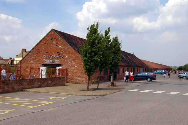
Ropewalk, Barton-upon-Humber
The Ropewalk, originally Halls' Barton Ropery is a former ropewalk in Barton-upon-Humber, North Lincolnshire, first built in 1767. It is a Grade II Listed...

Barton-on-Humber railway station
Barton-on-Humber railway station serves the town of Barton-upon-Humber in North Lincolnshire, England. The station, which was once the terminus of a 3...

Barton Waterside
Barton Waterside is a village in North Lincolnshire, England. It is in the civil parish of Barton-upon-Humber. Barton Waterside consists of the former...
Barton Town F.C.
Barton Town Football Club is a football club based in Barton-upon-Humber, Lincolnshire, England. They are currently members of the Northern Counties East...

51 Fleetgate
51 Fleetgate in Barton-upon-Humber is a Grade II* Listed building with parts dating back to the 14th century. It is considered to be the oldest surviving...
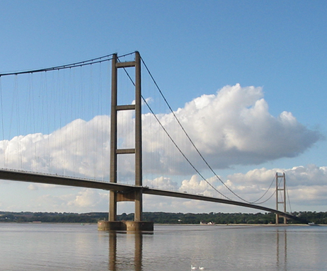
Humber Bridge
The Humber Bridge, near Kingston upon Hull, East Riding of Yorkshire, England, is a 2.22 km (2,430 yd; 7,300 ft; 1.38 mi) single-span road suspension bridge...
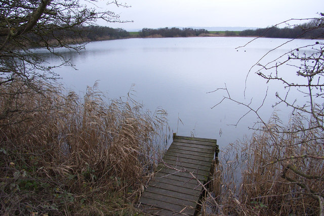
Far Ings National Nature Reserve
Far Ings national nature reserve is an area of over 90 ha (220 acres) on the southern shore of the Humber Estuary in North Lincolnshire, England. It is...
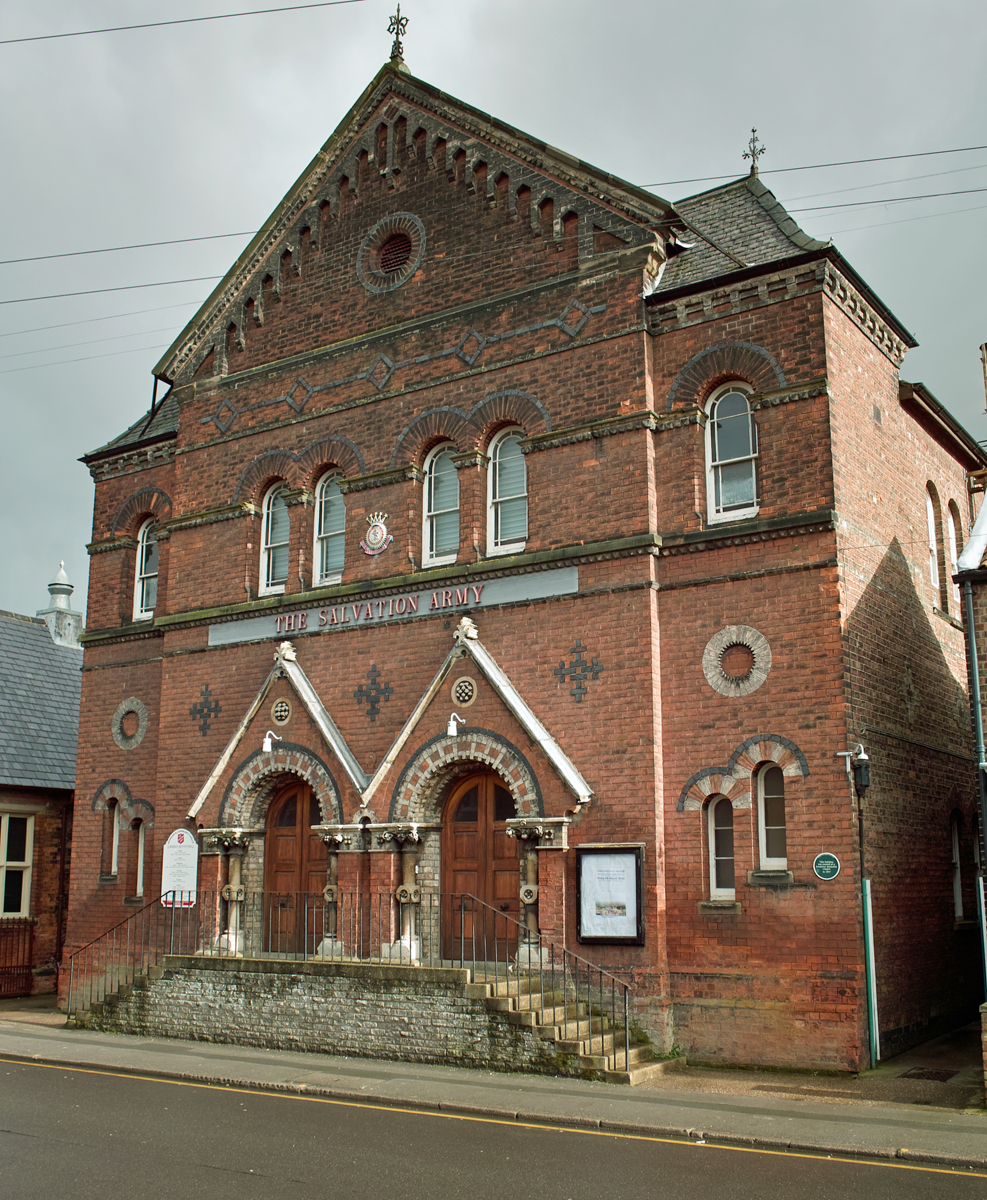
Salvation Army Citadel, Barton-upon-Humber
The Salvation Army Citadel is a Grade II Listed building in Barton-upon-Humber, North Lincolnshire, England. It was founded in 1867 by Joseph Wright as...
Related Videos

The BEST Hiking Shoe? Topo TRAVERSE 100 mile test and review - are they better than the MTN Racer 3?
In this follow up to my recent overview of the Topo Athletic Traverse hiking shoe, I take my pair out on the 80 mile Yorkshire Wolds ...
Walking in the Yorkshire Wolds
Yorkshire Wolds in the rain. But cinematic. Because who doesn't love 120fps? #yorkshirewolds #walking #cinematic ------- Gear: ...
YORKSHIRE WOLDS WAY #1 - Winter Adventure - UK National Trail
We visit Yorkshire in winter to spend four days hiking the 79 miles of the Wolds Way. Accommodation, well of course we use the ...
Nearby Amenities
Located within 500m of 53.697364,-0.44320083Have you been to Barton Haven?
Leave your review of Barton Haven below (or comments, questions and feedback).