Snarra Voe

Sea, Estuary, Creek in Shetland

Scotland

Snarra Voe

Tidal turbines awaiting installation, Belmont
Tidal turbines awaiting installation, Belmont Credit: Mike Pennington

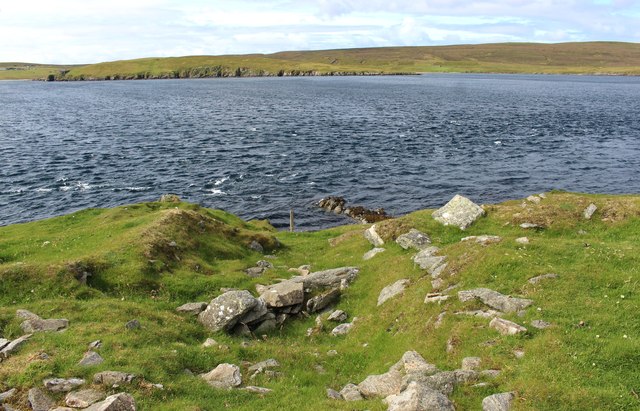
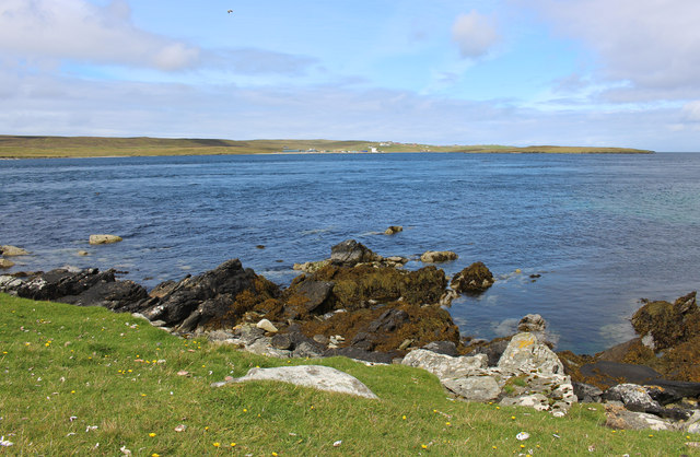
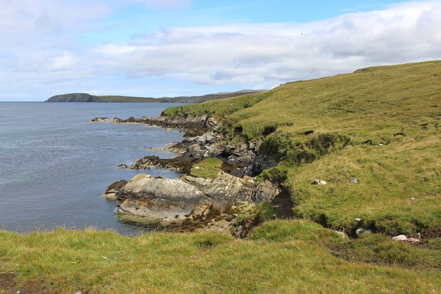
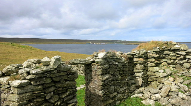
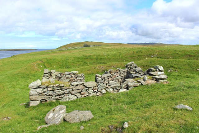
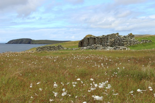
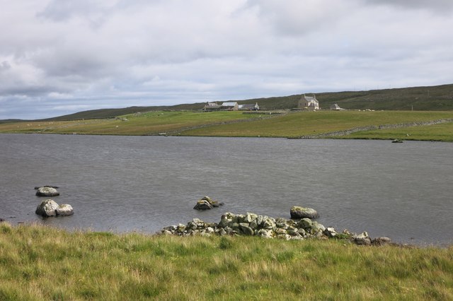
Snarra Voe is a picturesque inlet located in the Shetland Islands, an archipelago off the northeastern coast of Scotland. This sea inlet, also known as a sea loch, stretches approximately 3 kilometers inland and is surrounded by stunning natural beauty.

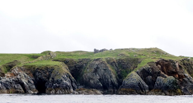
Situated on the eastern side of the Mainland, the largest island in the Shetland group, Snarra Voe offers breathtaking views of rugged cliffs, rolling hills, and crystal-clear waters. It is considered one of the most scenic spots on the island, attracting both locals and tourists alike.

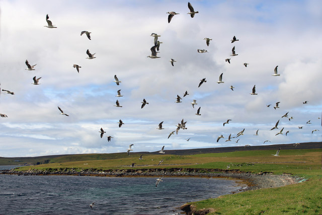
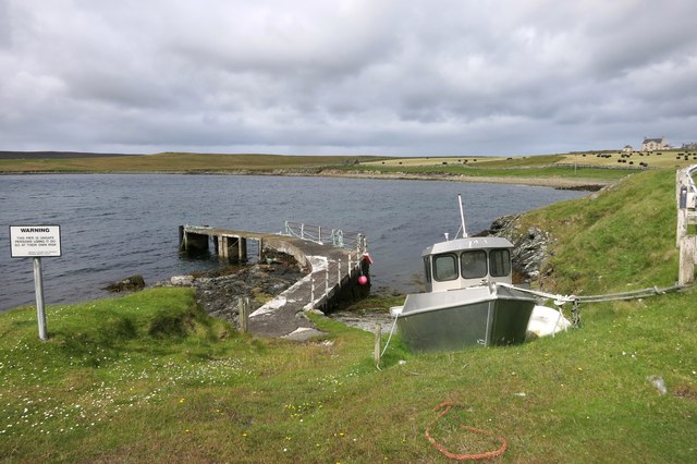
The calm and sheltered waters of Snarra Voe make it an ideal location for various water activities, such as sailing, kayaking, and fishing. The area is abundant in marine life, including seals, otters, and a variety of seabirds, making it a popular destination for wildlife enthusiasts.

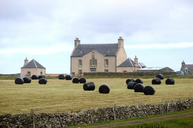
In addition to its natural beauty, Snarra Voe also has historical significance. The remains of several ancient settlements and Viking longhouses have been discovered in the surrounding areas, providing glimpses into the island's rich history.

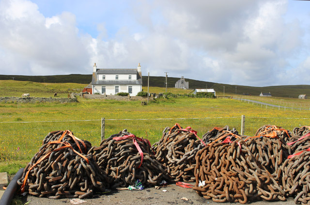
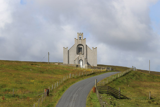
Access to Snarra Voe is relatively easy, with a road leading to the inlet from the nearby village of Vidlin. Visitors can enjoy peaceful walks along the shoreline, take in the panoramic views, or simply relax in the tranquility of this remote and idyllic location.

Overall, Snarra Voe offers a unique combination of natural beauty, wildlife, and historical significance, making it a must-visit destination for those exploring the Shetland Islands.

If you have any feedback on the listing, please let us know in the comments section below.
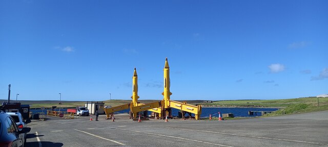
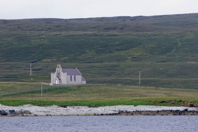
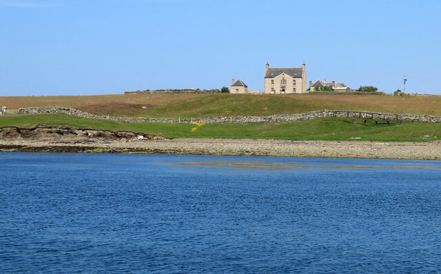
Snarra Voe Images

Images are sourced within 2km of 60.69697/-0.96977791 or Grid Reference HP5601. Thanks to Geograph Open Source API. All images are credited.

Tidal turbines awaiting installation, Belmont
Ness of Cullivoe from the sea
Cullivoe Kirk from the sea
Hoga Ness Brough, Belmont, from the sea
Belmont, Unst This was taken from the Gutcher-Belmont ferry as we come into port at Belmont, Unst, Shetland. We are on the Wick of Belmont and this is Belmont House, a category A-listed Georgian country house which was built in 1775 by Shetland landowner Thomas Mouat of Garth. Restored to its former glory between 1996 and 2010, it is now a private residence though it has been let out occasionally as a venue for cultural events and B&B accommodation.
Belmont, Unst
This was taken from the Gutcher-Belmont ferry as we come into port at Belmont, Unst, Shetland. We are on the Wick of Belmont and this is Belmont House, a category A-listed Georgian country house which was built in 1775 by Shetland landowner Thomas Mouat of Garth. Restored to its former glory between 1996 and 2010, it is now a private residence though it has been let out occasionally as a venue for cultural events and B&B accommodation.
Gulls, Wick of Belmont A stony bay next to the ferry terminal.
Gulls, Wick of Belmont
A stony bay next to the ferry terminal.
Unsafe Pier, Belmont This old pier is now a bit crumbly, which is what the warning sign is about.
Unsafe Pier, Belmont
This old pier is now a bit crumbly, which is what the warning sign is about.
Bales at Belmont
Bales at Belmont
Through the Broch Door Not much structure remains of the broch on Hoga Ness, although the surrounding earthworks are still substantial.
But this looks like it was probably the entrance.
Through the Broch Door
Not much structure remains of the broch on Hoga Ness, although the surrounding earthworks are still substantial. But this looks like it was probably the entrance.
Doogers and Bluemull Sound Looking over the Sound to Cullivoe on Yell in the distance.
Doogers is written on the map here. I'm guessing it's these rocks.
Doogers and Bluemull Sound
Looking over the Sound to Cullivoe on Yell in the distance. Doogers is written on the map here. I'm guessing it's these rocks.
Coast near Belmont HP5501 is 90% sea. This shot shows a large part of what land there is.
Coast near Belmont
HP5501 is 90% sea. This shot shows a large part of what land there is.
Chains on the Dockside Piles of chain in the yard at Cullivoe Pier.
Chains on the Dockside
Piles of chain in the yard at Cullivoe Pier.
Cullivoe Church Beside the road down to the pier.
Cullivoe Church
Beside the road down to the pier.
View from Braeside An abandoned homestead overlooking Bluemull Sound.
View from Braeside
An abandoned homestead overlooking Bluemull Sound.
Silage-making at Lund
Building in the Broch This is inside the original walls of the broch. The earthworks on the landward side of the site are still quite substantial, as can be seen here.
Building in the Broch
This is inside the original walls of the broch. The earthworks on the landward side of the site are still quite substantial, as can be seen here.
Cotton Grass at Braeside This long deserted place is still named on the map.
Cotton Grass at Braeside
This long deserted place is still named on the map.
Loch of Belmont Belmont House in the background.
Loch of Belmont
Belmont House in the background.
Show me another place!

Snarra Voe is located at Grid Ref: HP5601 (Lat: 60.69697, Lng: -0.96977791)

Unitary Authority: Shetland Islands

Police Authority: Highlands and Islands

What 3 Words

///responds.advancing.bats. Near Uyeasound, Shetland Islands

Related Wikis

Belmont House, Shetland

Belmont House is a neo classical Georgian Country House Estate on the island of Unst, the most northerly of the Shetland Islands, [United Kingdom] and...

Belmont, Shetland

Belmont is a settlement and ferry terminal in southern Unst in the Shetland Islands. The ferry crosses from here to Gutcher in Yell and to Hamars Ness...

Bluemull Sound

Bluemull Sound is the strait between Unst and Yell in Shetland's North Isles. A ferry service crosses it regularly. Cullivoe is on the Yell side, and the...

St Olaf's Church, Unst

St Olaf's Church, Unst is a ruined medieval church located on the island of Unst, in Shetland, Scotland, UK. The church was built in the Celtic style,...

Cullivoe

Cullivoe (Old Norse: Kollavágr - Bay of Kolli), is a village on Yell in the Shetland Islands. It is in the north east of the island, near Bluemull Sound...

Uyeasound

Uyeasound is a village on the Isle of Unst, the northernmost island of the Shetland Islands, Scotland. It takes its name from the neighbouring strait of...

Gutcher

Gutcher is a settlement on the northeast coast of Yell in the Shetland islands. From here, rollon/roll off ferry services to Belmont on Unst and Hamars...

Linga, Bluemull Sound

Linga is a very small uninhabited island in the Bluemull Sound, Shetland, Scotland. It is one of many islands in Shetland called Linga. It has an area...

Nearby Amenities

Located within 500m of 60.69697,-0.96977791
Power: pole
Lat/Long: 60.6941652/-0.9635851
Power: pole
Lat/Long: 60.6945262/-0.9648162
Power: pole
Lat/Long: 60.6949214/-0.9661305
Power: pole
Lat/Long: 60.6952667/-0.9681046
Location Transition: yes
Power: pole
Lat/Long: 60.6957169/-0.9688771
Marker: cable
Lat/Long: 60.6957154/-0.9691009
The data included in this document is from www.openstreetmap.org. The data is made available under ODbL.

Have you been to Snarra Voe?

Leave your review of Snarra Voe below (or comments, questions and feedback).