Burra Voe

Sea, Estuary, Creek in Shetland

Scotland

Burra Voe

Decorated bus shelter for Houlland The Shetlanders make a great thing of their bus shelters.
Decorated bus shelter for Houlland Credit: Oliver Dixon

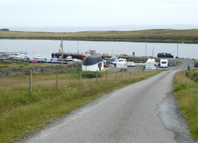
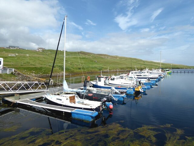
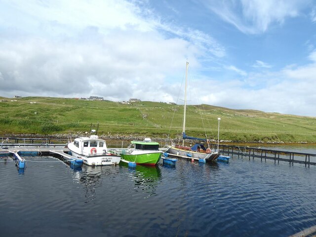
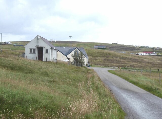
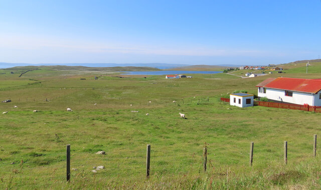
Burra Voe is a picturesque coastal inlet located in the Shetland Islands, Scotland. It is situated on the east coast of the mainland, about 10 miles north of the town of Lerwick. Burra Voe is classified as a sea loch, which is also known as an estuary or creek.

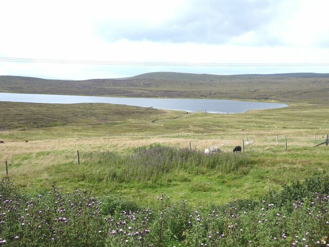
The Voe stretches inland for approximately 2 miles and is surrounded by stunning cliffs and rolling hills, providing a breathtaking backdrop. The water in Burra Voe is a mix of saltwater and freshwater, as it is influenced by both the North Sea and the freshwater rivers that flow into it. This unique combination of water sources creates a diverse ecosystem, supporting a variety of marine life.

The Voe is an important habitat for various bird species, such as oystercatchers, Arctic terns, and eiders, which can often be spotted along its shoreline. It is also a popular spot for fishing, with anglers attracted to the area in search of salmon and trout.

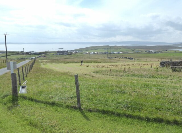
The surrounding area of Burra Voe offers excellent opportunities for outdoor activities, including hiking and wildlife watching. The cliffs that enclose the Voe provide spectacular views and are a haven for seabird colonies. Additionally, the nearby Burra Isle, connected to the mainland by a bridge, is a great place to explore, with its rugged coastline and historic sites.

Overall, Burra Voe is a stunning natural feature, offering both locals and visitors a chance to immerse themselves in the beauty of the Shetland Islands' coastline and wildlife.

If you have any feedback on the listing, please let us know in the comments section below.
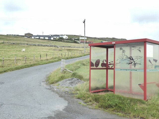
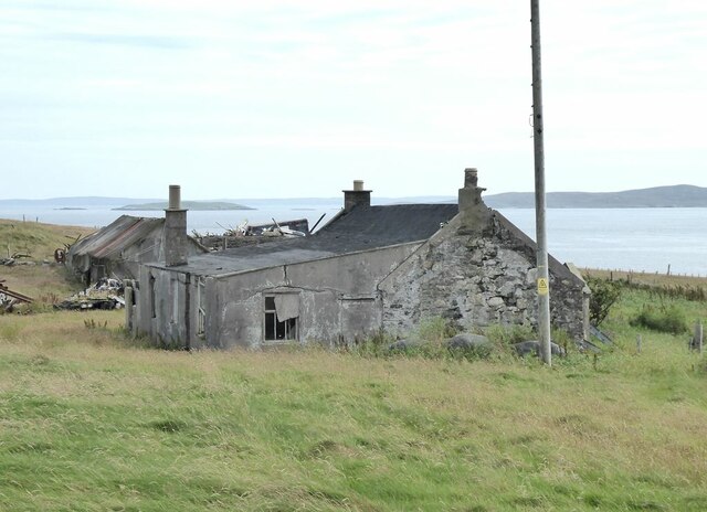
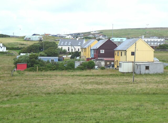
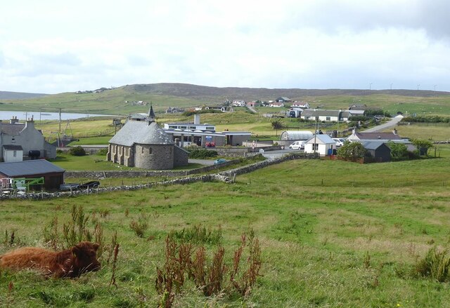
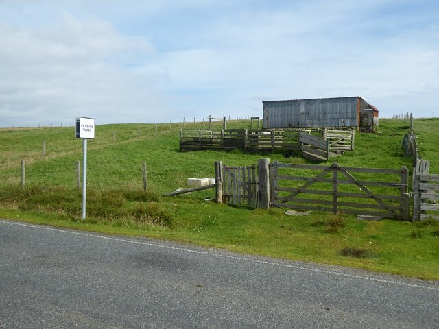
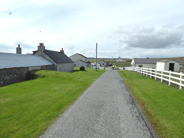
Burra Voe Images

Images are sourced within 2km of 60.493987/-1.0514297 or Grid Reference HU5279. Thanks to Geograph Open Source API. All images are credited.

Decorated bus shelter for Houlland The Shetlanders make a great thing of their bus shelters.
Decorated bus shelter for Houlland
The Shetlanders make a great thing of their bus shelters.
Derelict farm buildings at Burraness
Colourful houses at Burravoe Village in the south-east corner of the Isle of Yell.
Colourful houses at Burravoe
Village in the south-east corner of the Isle of Yell.
Old Haa Museum in Burravoe, unfortunately closed on Fridays as we discovered.
Old Haa
Museum in Burravoe, unfortunately closed on Fridays as we discovered.
Burravoe village Including St Colman's Church (Episcopalian) and Burravoe Primary School.
Burravoe village
Including St Colman's Church (Episcopalian) and Burravoe Primary School.
Burravoe Pier Marina and caravan site. The toilet block is the small building with the boat-shaped roof.
Burravoe Pier
Marina and caravan site. The toilet block is the small building with the boat-shaped roof.
Burravoe Marina
Burravoe Marina
Burravoe Marina
Burravoe Marina
Green Lacewing (Chrysoperla carnea) larva, Burravoe
The hoverfly Eristalis arbustorum, Burravoe
The hoverfly Platycheirus albimanus, Burravoe
Silver Y (Autographa gamma), Burravoe A very fresh locally bred individual.
Silver Y (Autographa gamma), Burravoe
A very fresh locally bred individual.
Houses at Kettlester
:Paddock and shed Beside the road north of Burravoe.
:Paddock and shed
Beside the road north of Burravoe.
Loch of Kettlester
Loch of Kettlester
Upper Neapaback Hamlet above Burravoe.
Upper Neapaback
Hamlet above Burravoe.
Turning hay by hand at Upper Neapaback On the hillside above Burravoe. Shetland Mainland on the horizon.
Turning hay by hand at Upper Neapaback
On the hillside above Burravoe. Shetland Mainland on the horizon.
Upper Neapaback Taken on the B9081 north of Burravoe, Yell, Shetland, on our way to up to East Yell, I am looking east across the crofting settlement of Upper Neapaback.
Upper Neapaback
Taken on the B9081 north of Burravoe, Yell, Shetland, on our way to up to East Yell, I am looking east across the crofting settlement of Upper Neapaback.
Show me another place!

Burra Voe is located at Grid Ref: HU5279 (Lat: 60.493987, Lng: -1.0514297)

Unitary Authority: Shetland Islands

Police Authority: Highlands and Islands

What 3 Words

///wasps.orbit.contents. Near Ulsta, Shetland Islands

Related Wikis

Old Haa Museum

The Old Haa of Brough in located in Burravoe, Yell, Shetland, Scotland. Built for Robert Tyrie, a merchant, in 1672, houses the local museum for Burravoe...

Burravoe

Burravoe is a community on the north shore of Burra Voe, in the south-east part of the island of Yell in the Shetland Islands, Scotland. The name Burravoe...

Burra Voe

Burra Voe (Old Norse: Borgavagr, Broch Bay) is sheltered bay (voe) at the southeast corner of the island of Yell. The village of Burravoe (HU525795) is...

Orfasay

Orfasay (Old Norse: Orfyrisey, meaning "tidal island") is one of the Shetland Islands. == Geography == Orfasay is a tidal island in Yell Sound, connected...

Gossabrough

Gossabrough is a coastal hamlet, wick and ness on the southeast side of the island of Yell, Shetland, Scotland. The Wick of Gossabrough lies between the...

Copister

Copister is a village in Yell. It is a former centre for haaf fishing, and has a shingle beach. == References == Blackadder, Jill Slee (2003). Shetland...

Lunna Holm

Lunna Holm is a small island near Lunna Ness (Mainland, Shetland), in the Shetland Islands. It is 27 metres (89 ft) at its highest point. == Lighthouse... ==

Ulsta

Ulsta is a village in the south-west of the island of Yell, Shetland, Scotland. North Ness Hall is the local community facility. The car ferry to Toft...

Nearby Amenities

Located within 500m of 60.493987,-1.0514297
Brough
Place: hamlet
Lat/Long: 60.4956539/-1.0564667
Turning Circle
Lat/Long: 60.4944388/-1.0561869
Power: pole
Lat/Long: 60.4952895/-1.0598281
Power: pole
Lat/Long: 60.4951924/-1.0592568
Power: pole
Lat/Long: 60.4950874/-1.0586037
Power: pole
Lat/Long: 60.4949903/-1.0580163
Power: pole
Lat/Long: 60.4948681/-1.0572921
Power: pole
Lat/Long: 60.4947558/-1.0566055
Power: pole
Lat/Long: 60.4944857/-1.0567396
Power: pole
Lat/Long: 60.494236/-1.0572023
Power: pole
Lat/Long: 60.4953087/-1.0563332
Power: pole
Lat/Long: 60.497187/-1.057392
Power: pole
Lat/Long: 60.4977656/-1.0563139
Power: pole
Lat/Long: 60.4966246/-1.0512018
Power: pole
Lat/Long: 60.4969707/-1.051478
Power: pole
Lat/Long: 60.4963413/-1.0507619
Power: pole
Lat/Long: 60.4965566/-1.0515236
Power: pole
Lat/Long: 60.4958915/-1.0513332
Power: pole
Lat/Long: 60.4953697/-1.0540664
Power: pole
Lat/Long: 60.4960779/-1.0503416
Power: pole
Lat/Long: 60.495639/-1.0482588
Power: pole
Lat/Long: 60.4955799/-1.0529272
Power: pole
Lat/Long: 60.4950023/-1.0564758
Power: pole
Lat/Long: 60.4953357/-1.0573483
Power: pole
Lat/Long: 60.495684/-1.0566989
Power: pole
Lat/Long: 60.4960581/-1.0559768
Power: pole
Lat/Long: 60.4966125/-1.0554704
Power: pole
Lat/Long: 60.4969706/-1.0552748
Power: pole
Lat/Long: 60.4973756/-1.0555005
Power: pole
Lat/Long: 60.4975719/-1.0556183
Power: pole
Lat/Long: 60.4959445/-1.0496886
Power: pole
Lat/Long: 60.495805/-1.0490316
Power: pole
Lat/Long: 60.4973299/-1.0517922
Power: pole
Lat/Long: 60.496615/-1.0566764
Telephone
Booth: K6
Covered: booth
Listed Status: Category B
Man Made: telephone_box
Lat/Long: 60.4946344/-1.0558973
The data included in this document is from www.openstreetmap.org. The data is made available under ODbL.

Have you been to Burra Voe?

Leave your review of Burra Voe below (or comments, questions and feedback).