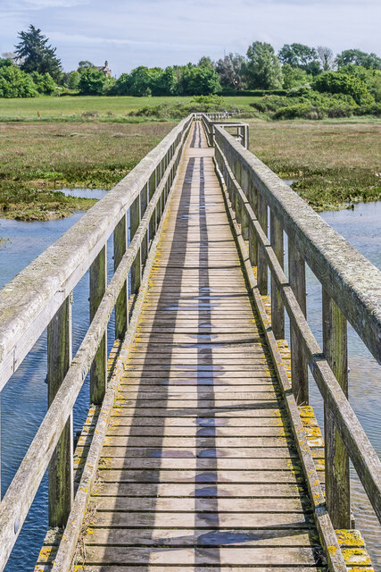
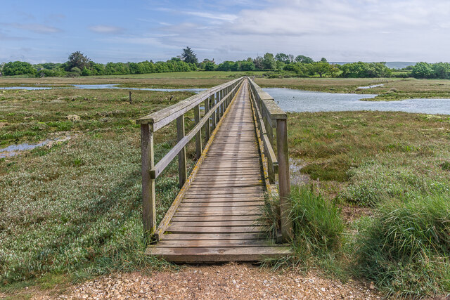
Causeway Lake

Sea, Estuary, Creek in Hampshire

England

Causeway Lake

Old Town Hall Former town hall, of what is now a small hamlet but was once an active port.  Now owned by the National Trust.  Grade II* listed - see <span class="nowrap"><a title="https://historicengland.org.uk/listing/the-list/list-entry/1209336?section=official-list-entry" rel="nofollow ugc noopener" href="https://historicengland.org.uk/listing/the-list/list-entry/1209336?section=official-list-entry">Link</a><img style="margin-left:2px;" alt="External link" title="External link - shift click to open in new window" src="https://s1.geograph.org.uk/img/external.png" width="10" height="10"/></span>.
Old Town Hall Credit: Ian Capper

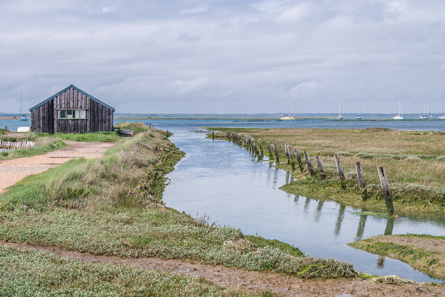
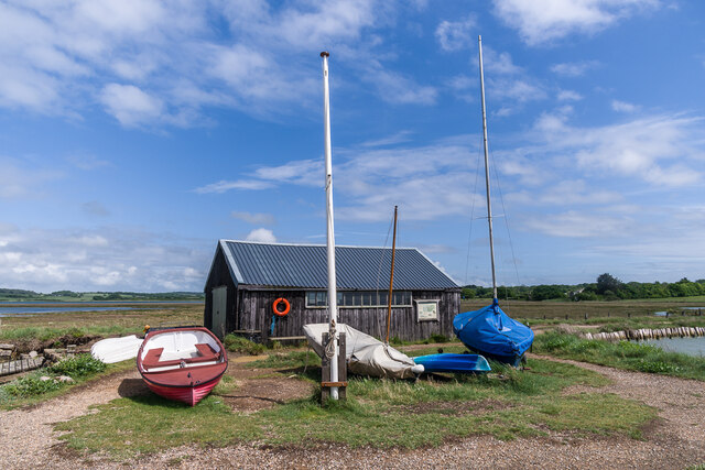
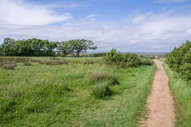
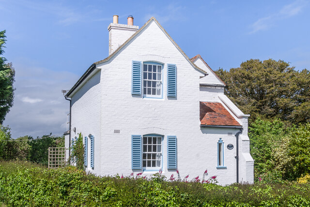
Causeway Lake is a picturesque body of water located in Hampshire, England. It is situated along the southern coast of the country, offering stunning views of the sea, estuary, and creek. The lake is known for its unique combination of coastal features, making it a popular destination for nature lovers and outdoor enthusiasts.

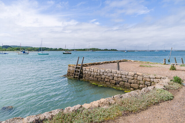
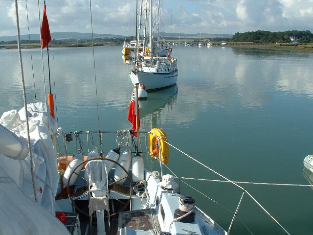
The main attraction of Causeway Lake is its proximity to the sea. Visitors can enjoy the refreshing ocean breeze and take in the panoramic views of the sparkling blue waters. The coastal setting also provides ample opportunities for various water activities, such as swimming, snorkeling, and fishing.

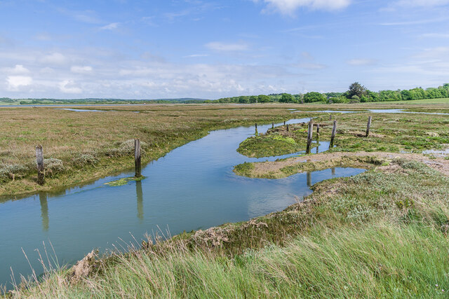
Adjacent to the sea, the estuary adds another layer of natural beauty to Causeway Lake. Estuaries are transitional zones where freshwater from rivers mixes with saltwater from the sea, creating a diverse ecosystem. This makes the lake a haven for a wide range of plant and animal species, including various types of fish, birds, and marine mammals.

The lake is also fed by a creek, which further enhances its charm. Creeks are small, narrow waterways that flow into larger bodies of water, and they often meander through scenic landscapes. The creek at Causeway Lake provides opportunities for peaceful walks along its banks, where visitors can observe the local flora and fauna up close.

Overall, Causeway Lake offers a unique blend of sea, estuary, and creek, making it a truly special place to visit. Its natural beauty, combined with its diverse ecosystem, provides a delightful experience for anyone seeking to immerse themselves in the beauty of Hampshire's coastal region.

If you have any feedback on the listing, please let us know in the comments section below.

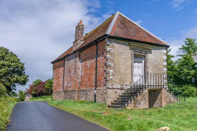
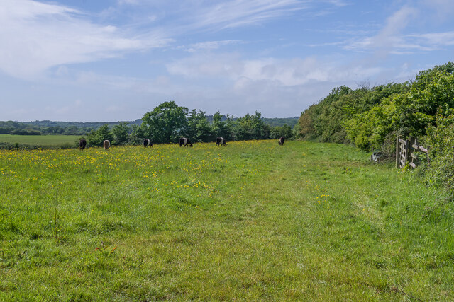
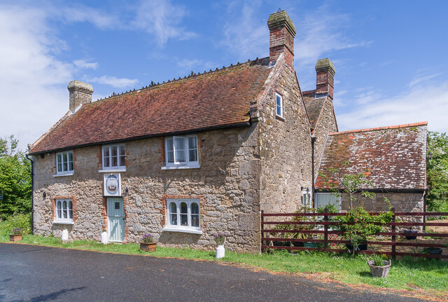
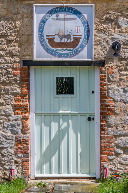
Causeway Lake Images

Images are sourced within 2km of 50.713878/-1.4078266 or Grid Reference SZ4190. Thanks to Geograph Open Source API. All images are credited.

Old Town Hall Former town hall, of what is now a small hamlet but was once an active port.  Now owned by the National Trust.  Grade II* listed - see <span class="nowrap"><a title="https://historicengland.org.uk/listing/the-list/list-entry/1209336?section=official-list-entry" rel="nofollow ugc noopener" href="https://historicengland.org.uk/listing/the-list/list-entry/1209336?section=official-list-entry">Link</a><img style="margin-left:2px;" alt="External link" title="External link - shift click to open in new window" src="https://s1.geograph.org.uk/img/external.png" width="10" height="10"/></span>.
Old Town Hall
Former town hall, of what is now a small hamlet but was once an active port. Now owned by the National Trust. Grade II* listed - see LinkExternal link.
Field Cattle grazing in a field in Newtown.
Field
Cattle grazing in a field in Newtown.
Noah's Ark 18th Century house, formerly an inn of the same name.  Grade II listed - see <span class="nowrap"><a title="https://historicengland.org.uk/listing/the-list/list-entry/1209337?section=official-list-entry" rel="nofollow ugc noopener" href="https://historicengland.org.uk/listing/the-list/list-entry/1209337?section=official-list-entry">Link</a><img style="margin-left:2px;" alt="External link" title="External link - shift click to open in new window" src="https://s1.geograph.org.uk/img/external.png" width="10" height="10"/></span>.  For a close up of the door, see <a href="https://www.geograph.org.uk/photo/7487172">SZ4290 : Door, Noah's Ark</a>.
Noah's Ark
18th Century house, formerly an inn of the same name. Grade II listed - see LinkExternal link. For a close up of the door, see SZ4290 : Door, Noah's Ark.
Door, Noah's Ark The door to Noah's Ark (see <a href="https://www.geograph.org.uk/photo/7487163">SZ4290 : Noah's Ark</a>).  Above it is the Newtown coat of arms with the motto "S. Comatis de Francheville de l’Ile de Wyht", Francheville being the old name for Newtown.
Door, Noah's Ark
The door to Noah's Ark (see SZ4290 : Noah's Ark). Above it is the Newtown coat of arms with the motto "S. Comatis de Francheville de l’Ile de Wyht", Francheville being the old name for Newtown.
Hollis Cottage 18th Century grade II listed cottage - see <span class="nowrap"><a title="https://historicengland.org.uk/listing/the-list/list-entry/1209334?section=official-list-entry" rel="nofollow ugc noopener" href="https://historicengland.org.uk/listing/the-list/list-entry/1209334?section=official-list-entry">Link</a><img style="margin-left:2px;" alt="External link" title="External link - shift click to open in new window" src="https://s1.geograph.org.uk/img/external.png" width="10" height="10"/></span>.
Hollis Cottage
18th Century grade II listed cottage - see LinkExternal link.
Church of the Holy Spirit, Newtown Church built in 1835, designed by A F Livesay, an architect working in Portsmouth and the Isle of Wight, replacing an earlier building then in ruins.  Grade II listed - see <span class="nowrap"><a title="https://historicengland.org.uk/listing/the-list/list-entry/1292702?section=official-list-entry" rel="nofollow ugc noopener" href="https://historicengland.org.uk/listing/the-list/list-entry/1292702?section=official-list-entry">Link</a><img style="margin-left:2px;" alt="External link" title="External link - shift click to open in new window" src="https://s1.geograph.org.uk/img/external.png" width="10" height="10"/></span>.
Church of the Holy Spirit, Newtown
Church built in 1835, designed by A F Livesay, an architect working in Portsmouth and the Isle of Wight, replacing an earlier building then in ruins. Grade II listed - see LinkExternal link.
Newtown Harbour Looking across the saltflats of Newtown Harbour.
Newtown Harbour
Looking across the saltflats of Newtown Harbour.
Footbridge, Newtown Harbour Looking back along the footbridge leading to the quay at Newtown Harbour.
Footbridge, Newtown Harbour
Looking back along the footbridge leading to the quay at Newtown Harbour.
Footbridge, Newtown Harbour Looking back along the footbridge leading to the quay at Newtown Harbour.
Footbridge, Newtown Harbour
Looking back along the footbridge leading to the quay at Newtown Harbour.
Newtown Quay Creek and building by the quay at Newtown Harbour.
Newtown Quay
Creek and building by the quay at Newtown Harbour.
Newtown Quay Building by the quay at Newtown Harbour.
Newtown Quay
Building by the quay at Newtown Harbour.
Newtown Quay The quay at Newtown Harbour.
Newtown Quay
The quay at Newtown Harbour.
Newtown Harbour A creek at Newtown Harbour.
Newtown Harbour
A creek at Newtown Harbour.
Footpath Footpath alongside Coastguard Meadows.
Footpath
Footpath alongside Coastguard Meadows.
The Cottage House on Town Lane.
The Cottage
House on Town Lane.
Newtown IOW - Old Town Hall The ancient Old Town Hall dates from around 1699, with alterations in 1813 and stands in a grassy space that was once a wide street. Newtown was known as a 'Rotten Borough', meaning it once sent two Members to Parliament, and has a fascinating local history dating back to the 13th century. (source <span class="nowrap"><a title="www.visitisleofwight.co.uk)" rel="nofollow ugc noopener" href="http://www.visitisleofwight.co.uk)">Link</a><img style="margin-left:2px;" alt="External link" title="External link - shift click to open in new window" src="https://s1.geograph.org.uk/img/external.png" width="10" height="10"/></span>
Newtown IOW - Old Town Hall
The ancient Old Town Hall dates from around 1699, with alterations in 1813 and stands in a grassy space that was once a wide street. Newtown was known as a 'Rotten Borough', meaning it once sent two Members to Parliament, and has a fascinating local history dating back to the 13th century. (source LinkExternal link
Newtown Creek, Isle of Wight A view south down the moorings in Newtown River.  The high ground in the distant left is Brighstone Down.
Newtown Creek, Isle of Wight
A view south down the moorings in Newtown River. The high ground in the distant left is Brighstone Down.
Show me another place!

Causeway Lake is located at Grid Ref: SZ4190 (Lat: 50.713878, Lng: -1.4078266)

Unitary Authority: Isle of Wight

Police Authority: Hampshire

What 3 Words

///micro.unpainted.dustbin. Near Shalfleet, Isle of Wight

Related Wikis

Holy Spirit Church, Newtown

Holy Spirit Church, Newtown is a parish church in the Church of England located in Newtown, Isle of Wight. == History == The church dates from 1835 by...

Newtown Old Town Hall

The Old Town Hall is a municipal building in the High Street in Town Lane, Newtown, Isle of Wight, England. The structure, which is used as a tourist attraction...

Newtown River

Newtown River is a large natural inland harbour located on the Isle of Wight's northwestern coast, named after the nearby village of Newtown. It is sometimes...

Newtown, Isle of Wight

Newtown is a small village in the civil parish of Calbourne, Newtown and Porchfield, on the Isle of Wight, England. In medieval times it was a thriving...

Nearby Amenities

Located within 500m of 50.713878,-1.4078266
Newtown
Is In: Isle of Wight, England, UK
Place: village
Wikidata: Q11790947
Wikipedia: en:Newtown, Isle of Wight
Lat/Long: 50.7142599/-1.402266
Toilets
Note: includes disabled
Lat/Long: 50.7135954/-1.4013277
Entrance: main
Lat/Long: 50.714259/-1.4034442
Barrier: stile
Foot: yes
Lat/Long: 50.714748/-1.4041615
Barrier: stile
Foot: yes
Lat/Long: 50.7145175/-1.4009546
Barrier: kissing_gate
Foot: yes
Lat/Long: 50.7166707/-1.4047644
Leisure: bird_hide
Lat/Long: 50.7167344/-1.4045923
Source: survey
Lat/Long: 50.7179451/-1.4077188
Source: survey
Lat/Long: 50.7183679/-1.4082568
Source: survey
Lat/Long: 50.7183716/-1.4081395
Source: survey
Lat/Long: 50.7183064/-1.4081619
Source: survey
Lat/Long: 50.7182889/-1.4081821
Source: survey
Lat/Long: 50.7180563/-1.4087329
Source: survey
Lat/Long: 50.7178037/-1.4093507
Source: survey
Lat/Long: 50.7171032/-1.4089709
Source: survey
Lat/Long: 50.7171649/-1.4088118
Source: survey
Lat/Long: 50.7177678/-1.4092763
Source: survey
Lat/Long: 50.7178533/-1.4092213
Source: survey
Lat/Long: 50.7182508/-1.4081764
Source: survey
Lat/Long: 50.7183026/-1.4080937
Source: survey
Lat/Long: 50.7183077/-1.4080214
Source: survey
Lat/Long: 50.7182948/-1.4079496
Source: survey
Lat/Long: 50.7179271/-1.4077804
Post Box
Check Date: 2018-06-04
Collection Plate: CPR
Collection Times: Mo-Fr 16:30; Sa 09:45
Operator: Royal Mail
Operator Wikidata: Q638098
Post Box Type: wall
Ref: PO30 17
Ref GB Uprn: 10015412810
Royal Cypher: VR
Royal Cypher Wikidata: Q33102356
Website: https://www.royalmail.com/services-near-you/postbox/newtown-po30-4pa/0000PO3017
Lat/Long: 50.7139627/-1.4010328
Barrier: kissing_gate
Foot: yes
Lat/Long: 50.7157614/-1.4091104
Leisure: slipway
Lat/Long: 50.7120254/-1.4140546
Causeway Lake
Place: locality
Lat/Long: 50.7139419/-1.4086723
Corf Lake
Place: locality
Lat/Long: 50.710859/-1.4112302
Newtown Quay
Waterway: boatyard
Lat/Long: 50.7183752/-1.4080247
Shalfleet Quay
Waterway: boatyard
Lat/Long: 50.7122186/-1.4141869
Information: board
Tourism: information
Lat/Long: 50.7167133/-1.4046206
Defibrillator
Emergency: defibrillator
Lat/Long: 50.7134852/-1.4013349
Vending Machine
Vending: parking_tickets
Lat/Long: 50.7134877/-1.4013577
National Trust Gift Shop
Shop: gift
Lat/Long: 50.7136631/-1.4012973
Newtown Cabin (National Trust)
Tourism: apartment
Lat/Long: 50.7137417/-1.4012718
Information: board
Tourism: information
Lat/Long: 50.7137128/-1.4014354
Newtown Village Pump
Drinking Water: no
Handle: wheel
Historic: yes
Man Made: water_well
Pump: manual
Lat/Long: 50.7139196/-1.4026297
Bench
Lat/Long: 50.7139595/-1.4026686
Bench
Lat/Long: 50.7139578/-1.4025915
Bench
Lat/Long: 50.7140686/-1.403482
Bench
Lat/Long: 50.7140643/-1.4033841
Bench
Lat/Long: 50.7142529/-1.4039218
Bench
Lat/Long: 50.7147709/-1.4051074
Addr Housename: Coastguard Cottages
Addr Housenumber: 2
Lat/Long: 50.7151156/-1.4058799
Addr Housename: Old Coastguard Station
Addr Housenumber: 1
Lat/Long: 50.7151114/-1.4061186
Bench
Lat/Long: 50.7149755/-1.4064042
Bench
Lat/Long: 50.7135056/-1.4038655
Hiking: yes
Information: guidepost
Tourism: information
Lat/Long: 50.7140236/-1.4039701
Coastguard Meadows
Place: locality
Lat/Long: 50.7156591/-1.4076233
The data included in this document is from www.openstreetmap.org. The data is made available under ODbL.

Have you been to Causeway Lake?

Leave your review of Causeway Lake below (or comments, questions and feedback).