Bury Reach
Sea, Estuary, Creek in Hampshire
England
Bury Reach

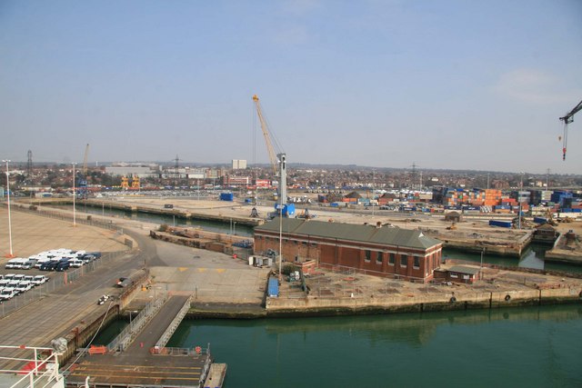
Bury Reach is a picturesque area located in the county of Hampshire, England. It is situated along the coast, where the sea meets an estuary and creek, creating a diverse and dynamic landscape. This beautiful stretch of coastline is renowned for its natural beauty and tranquil atmosphere, attracting visitors from near and far.
The sea at Bury Reach is a prominent feature, with its vast expanse of deep blue waters stretching out into the horizon. The crashing waves and salty breeze provide a sense of tranquility and a soothing ambiance. The estuary, formed by the convergence of a river and the sea, adds another dimension to the landscape. It is characterized by its calm, shallow waters and is home to a variety of marine life, making it a popular spot for fishing and birdwatching.
The creek at Bury Reach is a narrow waterway that winds its way through the marshlands and mudflats. It is a haven for wildlife, with numerous species of birds, fish, and other aquatic creatures inhabiting its shores and waters. The creek provides an idyllic setting for kayaking, canoeing, and other water-based activities, allowing visitors to explore the area's natural beauty up close.
Surrounding Bury Reach are rolling hills and lush green fields, offering breathtaking views and ample opportunities for hiking and walking. The area is also dotted with charming villages and historic landmarks, adding to its charm and appeal.
In summary, Bury Reach in Hampshire is a stunning coastal area where the sea, estuary, and creek come together. With its natural beauty, diverse wildlife, and peaceful ambiance, it is a haven for nature enthusiasts and a perfect destination for those seeking relaxation and tranquility.
If you have any feedback on the listing, please let us know in the comments section below.
Bury Reach Images
Images are sourced within 2km of 50.906653/-1.4577522 or Grid Reference SU3812. Thanks to Geograph Open Source API. All images are credited.


Bury Reach is located at Grid Ref: SU3812 (Lat: 50.906653, Lng: -1.4577522)
Unitary Authority: Southampton
Police Authority: Hampshire
What 3 Words
///wicked.rubble.herds. Near Marchwood, Hampshire
Nearby Locations
Related Wikis

Eling and Bury Marshes
Eling and Bury Marshes is a 112.3-hectare (277-acre) biological Site of Special Scientific Interest between Totton and Southampton in Hampshire. It is...

SS Shieldhall
SS Shieldhall is a preserved steamship that operates from Southampton. She is one of the last reciprocating steam engined ships built, using technology...

Millbrook, Southampton
Millbrook is a suburb and former civil parish of Southampton. As the area developed, several settlements grew within the parish, some of them becoming...
King George V Graving Dock
King George V Graving Dock, also known as No. 7 Dry Dock, is a former dry dock situated in Southampton's Western Docks. It was designed by F.E. Wentworth...

Marchwood ERF
Marchwood ERF (or Marchwood Energy Recovery Facility) is a waste incineration plant in Marchwood, near Southampton, England. It is situated beside the...
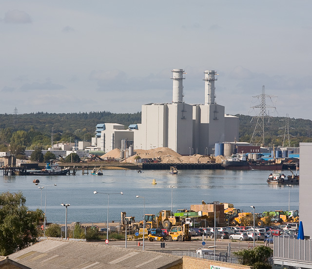
Marchwood Power Station
Marchwood Power Station is an 898.1 MW gas-fired power station in Marchwood, near Southampton, England. It is situated beside estuary of the River Test...

Bartley Water
Bartley Water is a two-branch small river in the New Forest district of Hampshire, England. It drains the north and north-east of the New Forest National...

Redbridge railway station
Redbridge railway station is a small station in the Redbridge area of Southampton, England. The station is located at the junction of the Wessex Main Line...
Nearby Amenities
Located within 500m of 50.906653,-1.4577522Have you been to Bury Reach?
Leave your review of Bury Reach below (or comments, questions and feedback).