Sprutties Hole

Sea, Estuary, Creek in Shetland

Scotland

Sprutties Hole

Loose Head, St Ninian's Isle, from the air
Loose Head, St Ninian's Isle, from the air Credit: Mike Pennington

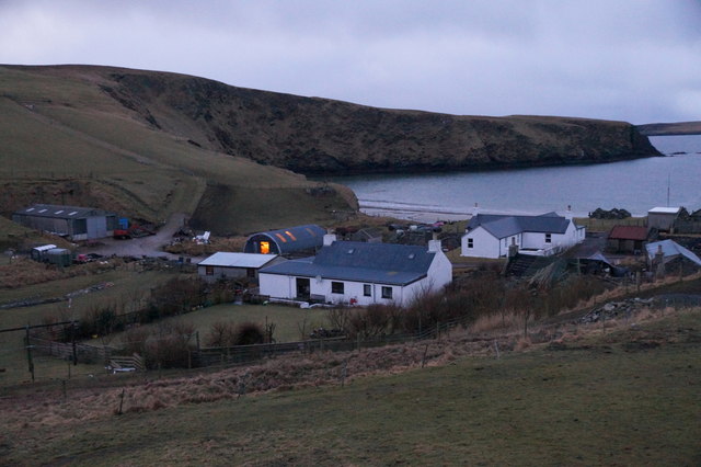
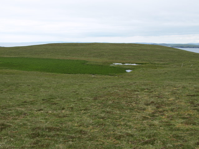
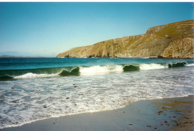
Sprutties Hole is a picturesque sea inlet located on the Shetland Islands, an archipelago in Scotland. Nestled on the eastern coast of the mainland, it is often referred to as a sea, estuary, or creek due to its unique characteristics.

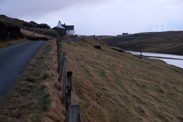
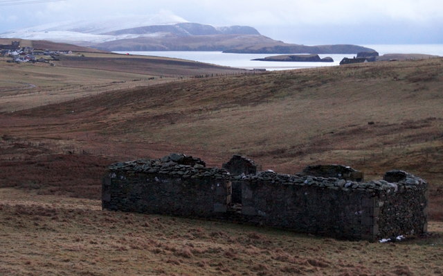
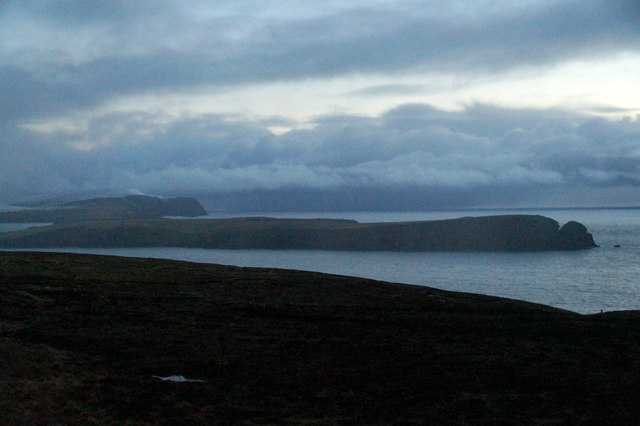
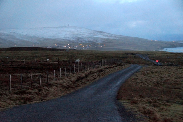
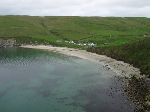
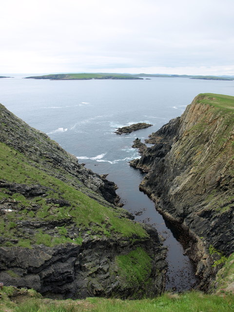
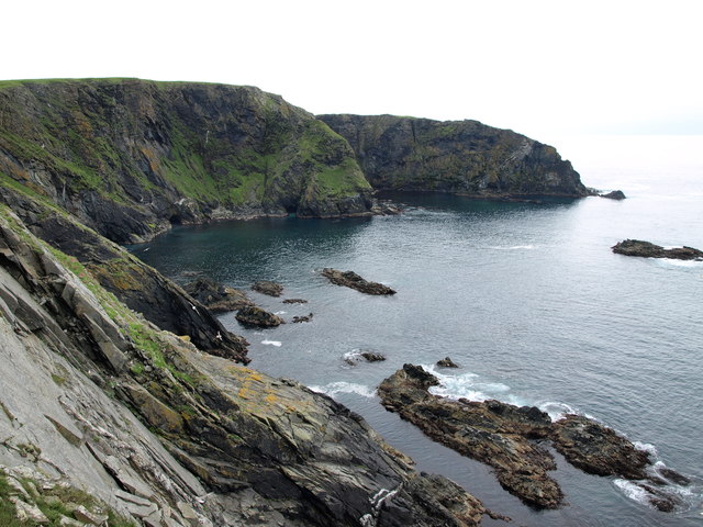
This natural marvel is surrounded by stunning cliffs and rolling hills, providing a dramatic backdrop to its serene waters. The inlet is accessible by a narrow, winding path that leads visitors through heather-covered moorland and offers breathtaking views along the way.

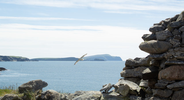
Sprutties Hole boasts crystal-clear, turquoise waters that are teeming with marine life. It is a haven for seals, which can often be spotted lounging on the rocky shores or playfully swimming in the shallows. The area is also frequented by a wide variety of seabirds, including puffins, fulmars, and kittiwakes, making it a paradise for birdwatchers.

The inlet is known for its tranquil atmosphere, making it a popular spot for fishing and boating enthusiasts. Its protected waters offer a safe haven for kayakers and paddleboarders, who can explore the hidden coves and caves that dot the coastline. The calm and secluded nature of Sprutties Hole also makes it a favored spot for picnickers and those seeking a peaceful retreat.

Visitors to Sprutties Hole can bask in the natural beauty of the Shetland Islands while immersing themselves in the rich wildlife and stunning vistas that this unique sea inlet has to offer.

If you have any feedback on the listing, please let us know in the comments section below.

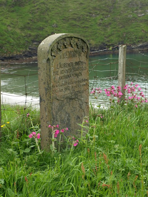
Sprutties Hole Images

Images are sourced within 2km of 59.994228/-1.3463911 or Grid Reference HU3623. Thanks to Geograph Open Source API. All images are credited.

Loose Head, St Ninian's Isle, from the air
Houses at Maywick The houses above the bay.
Houses at Maywick
The houses above the bay.
South Lochend, Maywick House above the Loch of Vatsetter.
South Lochend, Maywick
House above the Loch of Vatsetter.
Ruin near Ellister, Bigton Fitful Head in the distance.
Ruin near Ellister, Bigton
Fitful Head in the distance.
View to St Ninian's Isle from the Ness of Ireland
Road to the Ness of Ireland
May Wick May Wick & Maywick seen from the east side of Taing of Maywick Headland.
May Wick
May Wick & Maywick seen from the east side of Taing of Maywick Headland.
Hundi Geo Geo on the west side of Taing of Maywick Headland.
South Havra is the first island in the distance.
Hundi Geo
Geo on the west side of Taing of Maywick Headland. South Havra is the first island in the distance.
Corbie Geo Erne's Kame & Corbie Geo Cliffs.
Corbie Geo
Erne's Kame & Corbie Geo Cliffs.
Johnie's Water From Johnie's Water, looking north in the direction of Taing of Maywick Headland.
Johnie's Water
From Johnie's Water, looking north in the direction of Taing of Maywick Headland.
Tomb Stone Tomb Stone at Maywick on the east end of the Cliffs:
"In memory of 
Laurence Smith 
the beloved husband of 
Andrena Yonson.
He was drowned at the ling fishing 
27th jan 1857. Aged 44 yrs.
Erected by his sons"
Tomb Stone
Tomb Stone at Maywick on the east end of the Cliffs: "In memory of Laurence Smith the beloved husband of Andrena Yonson. He was drowned at the ling fishing 27th jan 1857. Aged 44 yrs. Erected by his sons"
The Neapack from Loose Head A day for walking round St. Ninian's Isle, looking down to see why we weren't sea kayaking round it. There are plenty of caves and geos, and skerries to rock-hop around in a bit of swell, but not this much ! There's quite a lot of wind waves, too, and whilst not as strong as it had been, the westerly was still quite gusty. The metamorphic rocks here are micaceous psammites of the Colla Firth group, Whiteness Division, and correlate with the Dalradian of mainland Scotland. They are dipping moderately steeply to the southwest, making for somewhat unstable and treacherous cliff edges, so the base of these cliffs is only readily seen from a bit that sticks out, as Loose Head does, offering a view back along the coast.
The Neapack from Loose Head
A day for walking round St. Ninian's Isle, looking down to see why we weren't sea kayaking round it. There are plenty of caves and geos, and skerries to rock-hop around in a bit of swell, but not this much ! There's quite a lot of wind waves, too, and whilst not as strong as it had been, the westerly was still quite gusty. The metamorphic rocks here are micaceous psammites of the Colla Firth group, Whiteness Division, and correlate with the Dalradian of mainland Scotland. They are dipping moderately steeply to the southwest, making for somewhat unstable and treacherous cliff edges, so the base of these cliffs is only readily seen from a bit that sticks out, as Loose Head does, offering a view back along the coast.
Slopes of Midi Field from Vatsetter
Shorewood, Vatsetter, Maywick
Bird and Headlands Taken from a derelict building on South Havra looking South
Bird and Headlands
Taken from a derelict building on South Havra looking South
Trig Point on the Edge
May Wick Crashing waves and overlooking cliffs at may Wick near Bigton.
May Wick
Crashing waves and overlooking cliffs at may Wick near Bigton.
Loch of Vatsetter north bay
Show me another place!

Sprutties Hole is located at Grid Ref: HU3623 (Lat: 59.994228, Lng: -1.3463911)

Unitary Authority: Shetland Islands

Police Authority: Highlands and Islands

What 3 Words

///entertainer.roughest.boosted. Near Sandwick, Shetland Islands

Related Wikis

St Ninian's Isle

St Ninian's Isle is a small tied island connected by the largest tombolo in the UK to the south-western coast of the Mainland, Shetland, in Scotland. It...

Bigton

Bigton is a small settlement on South Mainland, Shetland, UK. Bigton is within the civil parish of Dunrossness.Bigton lies on the Atlantic coast of the...

Little Havra

Little Havra is a small island off the west of South Mainland in Shetland. It is 35 metres (115 ft) at its highest point, upon which there is a cairn....

South Havra

South Havra (Scots: Sooth Haevra; Old Norse: Hafrey), formerly Hevera, is an uninhabited island in the Scalloway Islands, Shetland, Scotland. == Geography... ==

Levenwick

Levenwick is a small village about 17 miles (27 km) south of Lerwick, on the east side of the South Mainland of Shetland, Scotland. It is part of the parish...

Colsay

Colsay is an uninhabited island off the South West coast of Mainland, Shetland. Fora Ness lies to the south, across the Muckle Sound. The highest elevation...

Hoswick

Hoswick is a settlement in Sandwick in the south mainland of Shetland, Scotland, on the eastern part of the Dunrossness civil parish. It is separated from...

Scousburgh

Scousburgh is a small community in the parish of Dunrossness, in the South Mainland of Shetland, Scotland, overlooking the picturesque Scousburgh Sand...

Have you been to Sprutties Hole?

Leave your review of Sprutties Hole below (or comments, questions and feedback).