Gon Firth

Sea, Estuary, Creek in Shetland

Scotland

Gon Firth

Gon Firth Gon Firth is a short inlet to the south of Olna Firth. This is the head of the inlet, with the houses of South Voxter on the hill above it.
Gon Firth Credit: Anne Burgess

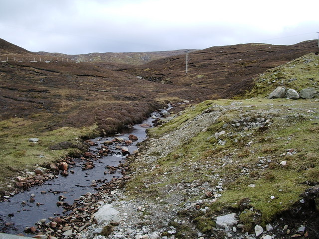
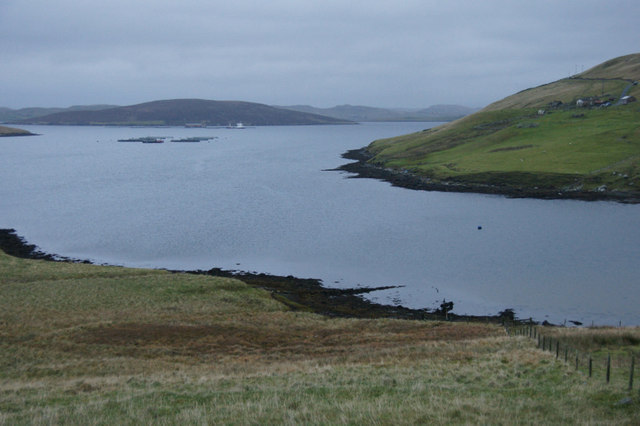
Gon Firth is a small body of water located in the Shetland Islands, Scotland. It is classified as a sea inlet, also known as a firth, and is situated on the eastern coast of the main island. The firth stretches approximately 5 kilometers in length and is characterized by its narrow width, with an average width of only 500 meters.

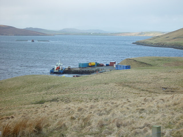
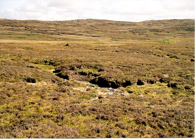
Due to its geographical features, Gon Firth acts as an estuary for several small rivers and streams that flow into it, including the Gon burn, which gives the firth its name. The firth is also influenced by the tidal movements of the North Sea, which causes the water levels to fluctuate throughout the day. During low tide, vast mudflats are exposed, creating a rich feeding ground for various bird species and marine life.

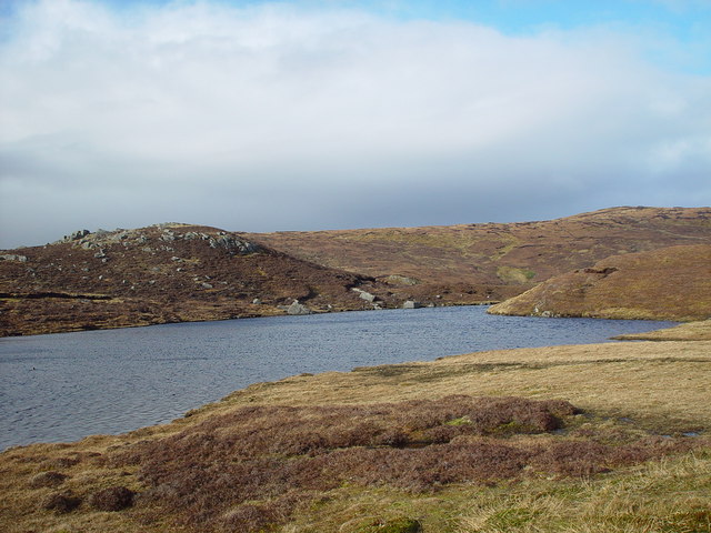
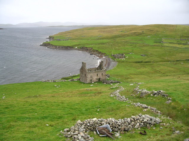
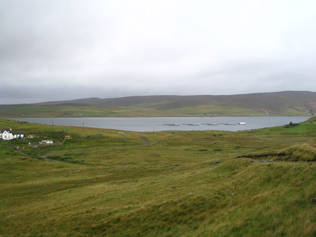
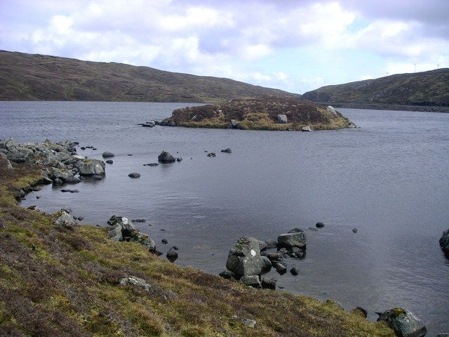
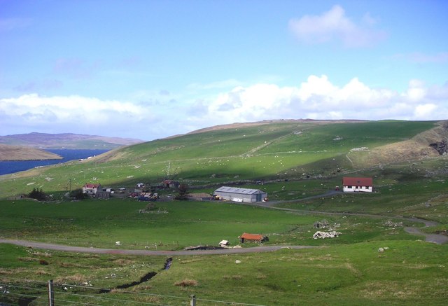
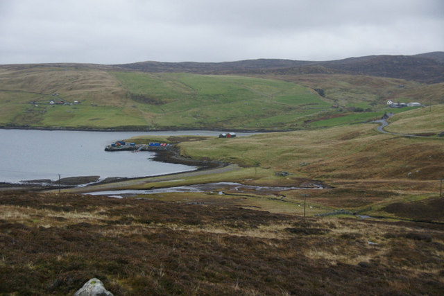
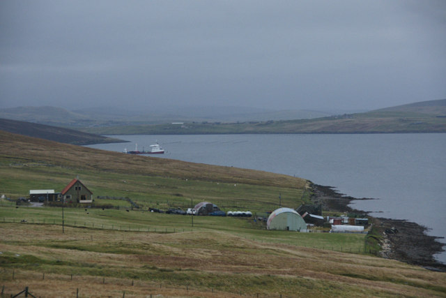
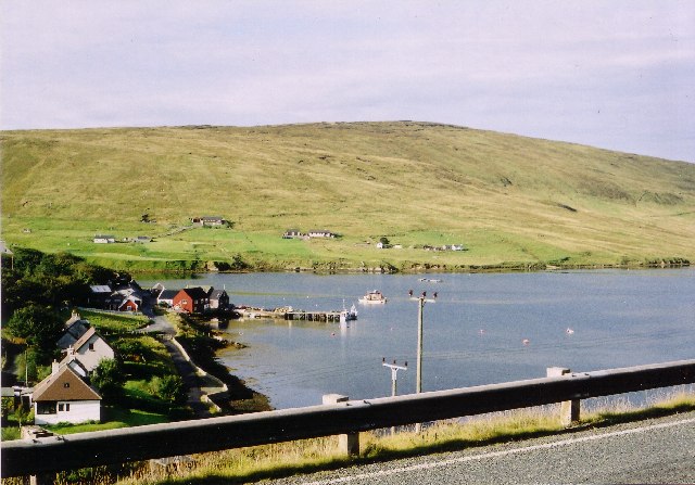
The surrounding landscape of Gon Firth is picturesque and diverse. It is flanked by rolling hills and cliffs, covered in lush green vegetation, providing a stunning backdrop to the tranquil waters. The firth is also home to a variety of wildlife, including seals, otters, and seabirds, making it a popular spot for nature enthusiasts and birdwatchers.

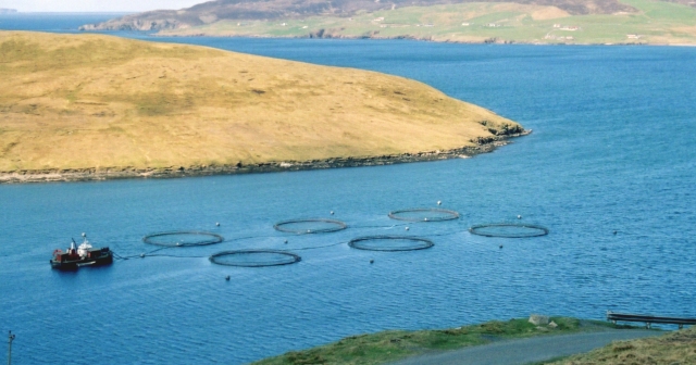
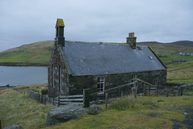
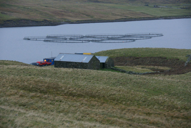
The area around Gon Firth is relatively remote, with few human settlements nearby. However, there are a few scattered fishing villages and small harbors along the coastline, where local fishermen can be seen bringing in their daily catch.

Overall, Gon Firth is a beautiful and ecologically diverse water body that offers a peaceful and natural environment for both wildlife and visitors alike.

If you have any feedback on the listing, please let us know in the comments section below.

Gon Firth Images

Images are sourced within 2km of 60.341569/-1.3398754 or Grid Reference HU3662. Thanks to Geograph Open Source API. All images are credited.

Gon Firth Gon Firth is a short inlet to the south of Olna Firth. This is the head of the inlet, with the houses of South Voxter on the hill above it.
Gon Firth
Gon Firth is a short inlet to the south of Olna Firth. This is the head of the inlet, with the houses of South Voxter on the hill above it.
Burn of Voxter, Shetland Looking southeast, upstream along the Burn of Voxter.  The disturbed ground to the right of the photo is from an old gravel pit.
Burn of Voxter, Shetland
Looking southeast, upstream along the Burn of Voxter. The disturbed ground to the right of the photo is from an old gravel pit.
Ayre of Voxter, Gon Firth, Shetland Where the Burn of Voxter enters Gon Firth a strip of land or 'ayre' extends across from east to west with the burn cutting through at the west end.
Ayre of Voxter, Gon Firth, Shetland
Where the Burn of Voxter enters Gon Firth a strip of land or 'ayre' extends across from east to west with the burn cutting through at the west end.
Pier at Gon Firth, Shetland The pier is used to work the salmon cages seen further out in Gon Firth.
Pier at Gon Firth, Shetland
The pier is used to work the salmon cages seen further out in Gon Firth.
Lochan near Loch of Gonfirth, Shetland Just SW of the Loch of Gonfirth lies another small lochan.
Lochan near Loch of Gonfirth, Shetland
Just SW of the Loch of Gonfirth lies another small lochan.
Gon Firth Fish farms take advantage of the sheltered waters of Shetland, such as Gon Firth.
Gon Firth
Fish farms take advantage of the sheltered waters of Shetland, such as Gon Firth.
Hill of Lee Heather moor above Lee of Gonfirth
Hill of Lee
Heather moor above Lee of Gonfirth
Ruined Haa at Grobsness
Valley between Grobs Ness and the Hills of Grobsness "The Houses" of Grobsness are on the extreme left and Olna is visible across Olna Firth.
Valley between Grobs Ness and the Hills of Grobsness
"The Houses" of Grobsness are on the extreme left and Olna is visible across Olna Firth.
Loch of Gonfirth View from the west shore looking out to the small holm with interesting archaeological features and may have been connected to the shore in the past.
Loch of Gonfirth
View from the west shore looking out to the small holm with interesting archaeological features and may have been connected to the shore in the past.
Gonfirth houses.
Gonfirth houses.
Signpost for South Voxter, between Aith and Voe
Ayre of Voxter, Gonfirth
Houses at Cole beside Gon Firth
Ruined crofthouse at Moon, South Voxter
Former church at Gonfirth
Head of Gon Firth
Head of Gon Firth
Fish farm in Gon Firth The buildings are beside a small pier.
Fish farm in Gon Firth
The buildings are beside a small pier.
Show me another place!

Gon Firth is located at Grid Ref: HU3662 (Lat: 60.341569, Lng: -1.3398754)

Unitary Authority: Shetland Islands

Police Authority: Highlands and Islands

What 3 Words

///doctors.proposals.grid. Near Brae, Shetland Islands

Nearby Locations

Gon Firth

Related Wikis

Shetland

Shetland, also called the Shetland Islands and formerly Zetland, is an archipelago in Scotland lying between Orkney, the Faroe Islands, and Norway. It...

Linga, Busta Voe

Linga is a small, uninhabited island, 1 km (0.62 mi) east of Muckle Roe in the Shetland Islands. The island is roughly circular in shape and its highest...

Papa Little

Papa Little (Scots: Papa Little; Old Norse: Papey Litla, meaning "the little island of the priests") is an island in St Magnus Bay, Shetland, Scotland...

Voe, Delting

Voe is a village in Delting parish on Mainland, Shetland, Scotland. It is one of the three main settlements in Delting. It is at the junction of the A968...

Busta Voe

Busta Voe, (HU665350), in the north central Mainland, Shetland, is a sea inlet lying between the village of Brae and the island of Muckle Roe. At the head...

Braewick, Sandsting

Braewick is a settlement on the west Mainland of Shetland, Scotland. Braewick is on the western shore of Aith Voe and 1.2 mi (2 km) north of Aith itself...

Mainland, Shetland

The Mainland is the main island of Shetland, Scotland. The island contains Shetland's only burgh, Lerwick, and is the centre of Shetland's ferry and air...

Muckle Roe

Muckle Roe is an island in Shetland, Scotland, in St. Magnus Bay, to the west of Mainland. It has a population of around 130 people, who mainly croft and...

Nearby Amenities

Located within 500m of 60.341569,-1.3398754
Barrier: cattle_grid
Lat/Long: 60.3424645/-1.3352599
Power: pole
Lat/Long: 60.3392253/-1.3475278
Power: pole
Lat/Long: 60.3397992/-1.3322564
Power: pole
Lat/Long: 60.3402685/-1.3332116
Power: pole
Lat/Long: 60.3407209/-1.3341372
Power: pole
Lat/Long: 60.34126/-1.3344647
Power: pole
Lat/Long: 60.3419104/-1.3348536
Power: pole
Lat/Long: 60.3423628/-1.3351128
Power: pole
Lat/Long: 60.3429637/-1.335463
Power: pole
Lat/Long: 60.3437368/-1.3359247
Power: pole
Lat/Long: 60.3446652/-1.3364774
Power: pole
Lat/Long: 60.345203/-1.3367957
Power: pole
Lat/Long: 60.3457746/-1.3371369
The data included in this document is from www.openstreetmap.org. The data is made available under ODbL.

Have you been to Gon Firth?

Leave your review of Gon Firth below (or comments, questions and feedback).