Bawburgh

Settlement in Norfolk South Norfolk

England

Bawburgh

Little Melton,  St. Mary and All Saints Church: A corner of the churchyard covered in primroses
Little Melton, St. Mary and All Saints Church: A corner of the churchyard covered in primroses Credit: Michael Garlick

Bawburgh is a charming village situated in the county of Norfolk, England. It is located approximately 6 miles west of the city of Norwich, making it easily accessible for both residents and visitors. The village is nestled in the picturesque Yare Valley, surrounded by beautiful countryside and rolling farmland.

Bawburgh is known for its rich history, with evidence of human settlement dating back to the Roman era. The village is home to several historic buildings, including the magnificent Bawburgh Mill, a Grade II listed windmill that dates back to the 18th century. The mill's striking presence adds to the village's character and serves as a popular attraction for tourists.

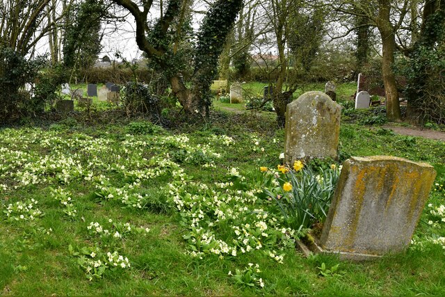
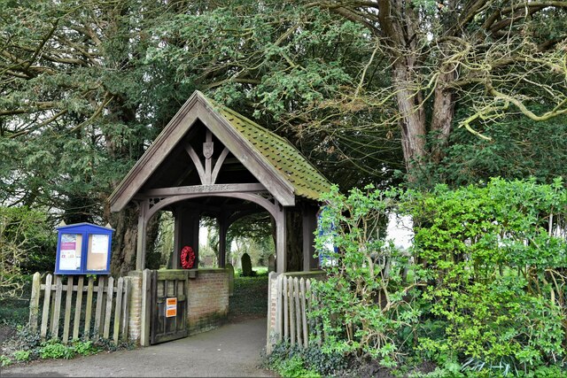
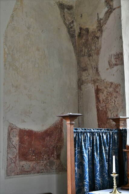
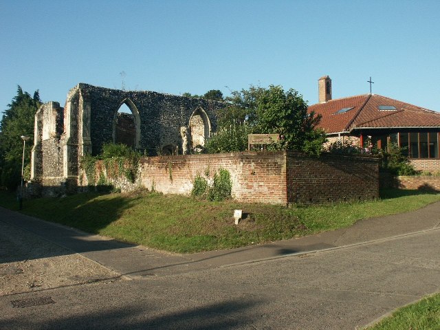
The village is also famous for its beautiful church, St. Mary and St. Walstan's Church, which dates back to the 13th century. The church's architecture and stunning stained glass windows make it a must-visit for history and art enthusiasts.

Bawburgh offers a range of amenities to its residents, including a primary school, a village hall, and a local pub, The Kings Head. The pub, with its traditional thatched roof and warm atmosphere, is a popular spot for locals and visitors alike to enjoy a meal or a pint of local ale.

For nature lovers, Bawburgh provides ample opportunities to explore the surrounding countryside. The Yare Valley offers scenic walking and cycling routes, with the River Yare flowing through the village, providing a tranquil setting for leisurely walks.

Overall, Bawburgh is a delightful village that combines a rich history with stunning natural beauty, making it an ideal destination for those seeking a peaceful and picturesque escape in the heart of Norfolk.

If you have any feedback on the listing, please let us know in the comments section below.
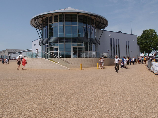
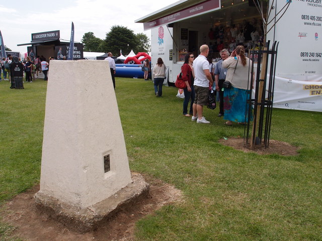
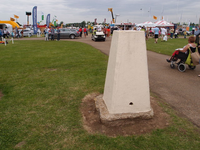
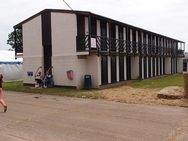
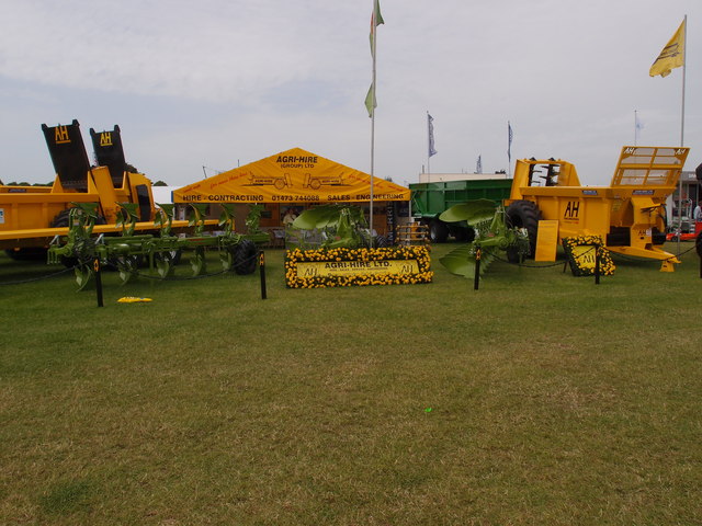
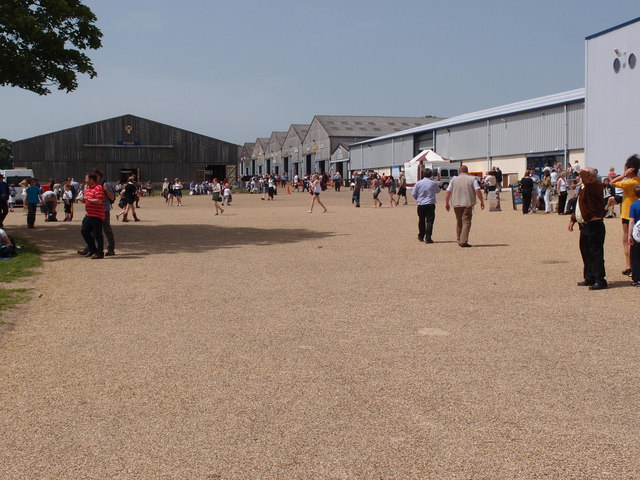
Bawburgh Images

Images are sourced within 2km of 52.635118/1.182699 or Grid Reference TG1508. Thanks to Geograph Open Source API. All images are credited.

Little Melton,  St. Mary and All Saints Church: A corner of the churchyard covered in primroses
Little Melton, St. Mary and All Saints Church: A corner of the churchyard covered in primroses
Little Melton,  St. Mary and All Saints Church: Lych gate
Little Melton, St. Mary and All Saints Church: Lych gate
Little Melton,  St. Mary and All Saints Church: North eastern aspect
Little Melton, St. Mary and All Saints Church: North eastern aspect
Little Melton,  St. Mary and All Saints Church: Part of a c14th St. Christopher wall painting
Little Melton, St. Mary and All Saints Church: Part of a c14th St. Christopher wall painting
Little Melton,  St. Mary and All Saints Church: Part of a c14th St. Christopher wall painting
Little Melton, St. Mary and All Saints Church: Part of a c14th St. Christopher wall painting
Little Melton,  St. Mary and All Saints Church: Part of a c14th 'Idle Gossip' wall painting
Little Melton, St. Mary and All Saints Church: Part of a c14th 'Idle Gossip' wall painting
Little Melton,  St. Mary and All Saints Church: Part of a c14th 'Idle Gossip' wall painting
Little Melton, St. Mary and All Saints Church: Part of a c14th 'Idle Gossip' wall painting
Little Melton,  St. Mary and All Saints Church: First World War memorial
Little Melton, St. Mary and All Saints Church: First World War memorial
Little Melton,  St. Mary and All Saints Church: Part of a c14th wall painting in the north aisle
Little Melton, St. Mary and All Saints Church: Part of a c14th wall painting in the north aisle
Little Melton,  St. Mary and All Saints Church: Part of a c14th wall painting in the north aisle
Little Melton, St. Mary and All Saints Church: Part of a c14th wall painting in the north aisle
Costessey Park & Ride bus terminal The site has 1100 parking spaces and bus services to Norwich via the University of East Anglia and to the Norfolk and Norwich University Hospital.
Costessey Park & Ride bus terminal
The site has 1100 parking spaces and bus services to Norwich via the University of East Anglia and to the Norfolk and Norwich University Hospital.
Exhibition Hall and Reception area, Royal Norfolk Showground The latest addition to the Royal Norfolk Show ground at Costessey.
A Norfolk show has been held since 1847 it gained its Royal prefix in 1908. From 1953 until 1962 the show moved round the county being held on suitable parkland sites.  The present site at Costessey covers 375 acres.  New exhibition hall and reception areas are the latest additions to the multipurpose site. Average attendance for the two day show hovers around the 100,000 mark.
Exhibition Hall and Reception area, Royal Norfolk Showground
The latest addition to the Royal Norfolk Show ground at Costessey. A Norfolk show has been held since 1847 it gained its Royal prefix in 1908. From 1953 until 1962 the show moved round the county being held on suitable parkland sites. The present site at Costessey covers 375 acres. New exhibition hall and reception areas are the latest additions to the multipurpose site. Average attendance for the two day show hovers around the 100,000 mark.
Triangulation Pillar on the Royal Norfolk Show ground A well maintained Triangulation Pillar in amongst the stall holders for the annual Royal Norfolk Show.
A Norfolk show has been held since 1847 it gained its Royal prefix in 1908. From 1953 until 1962 the show moved round the county being held on suitable parkland sites.  The present site at Costessey covers 375 acres.  New exhibition hall and reception areas are the latest additions to the multi purpose site. Average attendance for the two day show hovers around the 100,000 mark.
Triangulation Pillar on the Royal Norfolk Show ground
A well maintained Triangulation Pillar in amongst the stall holders for the annual Royal Norfolk Show. A Norfolk show has been held since 1847 it gained its Royal prefix in 1908. From 1953 until 1962 the show moved round the county being held on suitable parkland sites. The present site at Costessey covers 375 acres. New exhibition hall and reception areas are the latest additions to the multi purpose site. Average attendance for the two day show hovers around the 100,000 mark.
Triangulation Pillar on the Royal Norfolk Show ground A well maintained Triangulation Pillar. Not sure how many visitors to the show notice it or know what it was used for. Leaning against probably!
Triangulation Pillar on the Royal Norfolk Show ground
A well maintained Triangulation Pillar. Not sure how many visitors to the show notice it or know what it was used for. Leaning against probably!
Flush bracket no S5280 Flush bracket for the Triangulation Pillar on the Royal Norfolk show ground <a href="https://www.geograph.org.uk/photo/3016131">TG1510 : Triangulation Pillar on the Royal Norfolk Show ground</a>
Flush bracket no S5280
Flush bracket for the Triangulation Pillar on the Royal Norfolk show ground TG1510 : Triangulation Pillar on the Royal Norfolk Show ground
Stockman's quarters Overnight accommodation for stock men who attend The Royal Norfolk Show and need to keep an eye on livestock that are being shown over the two day event.
A Norfolk show has been held since 1847 it gained its Royal prefix in 1908. From 1953 until 1962 the show moved round the county being held on suitable parkland sites. The present site Costessey covers 375 acres. New exhibition hall and reception areas are the latest additions to the multipurpose site. Average attendance for the two day show hovers around the 100,000 mark.
Stockman's quarters
Overnight accommodation for stock men who attend The Royal Norfolk Show and need to keep an eye on livestock that are being shown over the two day event. A Norfolk show has been held since 1847 it gained its Royal prefix in 1908. From 1953 until 1962 the show moved round the county being held on suitable parkland sites. The present site Costessey covers 375 acres. New exhibition hall and reception areas are the latest additions to the multipurpose site. Average attendance for the two day show hovers around the 100,000 mark.
Muck spreaders and ploughs Two long standing bits of equipment that will keep a mixed enterprise farmer happy, a plough and a muck spreader. A trade stand showing off the goods available from the  Agri-Hire (group) Ltd.
A Norfolk show has been held since 1847 it gained its Royal prefix in 1908. From 1953 until 1962 the show moved round the county being held on suitable parkland sites. The present site at Costessey covers 375 acres. New exhibition hall and reception areas are the latest additions to the multipurpose site. Average attendance for the two day show hovers around the 100,000 mark.
Muck spreaders and ploughs
Two long standing bits of equipment that will keep a mixed enterprise farmer happy, a plough and a muck spreader. A trade stand showing off the goods available from the Agri-Hire (group) Ltd. A Norfolk show has been held since 1847 it gained its Royal prefix in 1908. From 1953 until 1962 the show moved round the county being held on suitable parkland sites. The present site at Costessey covers 375 acres. New exhibition hall and reception areas are the latest additions to the multipurpose site. Average attendance for the two day show hovers around the 100,000 mark.
Livestock and exhibition buildings Infrastructure on the Royal Norfolk Show ground.
A Norfolk show has been held since 1847 it gained its Royal prefix in 1908. From 1953 until 1962 the show moved round the county being held on suitable parkland sites. The present site Costessey covers 375 acres. New exhibition hall and reception areas are the latest additions to the multipurpose site. Average attendance for the two day show hovers around the 100,000 mark.
Livestock and exhibition buildings
Infrastructure on the Royal Norfolk Show ground. A Norfolk show has been held since 1847 it gained its Royal prefix in 1908. From 1953 until 1962 the show moved round the county being held on suitable parkland sites. The present site Costessey covers 375 acres. New exhibition hall and reception areas are the latest additions to the multipurpose site. Average attendance for the two day show hovers around the 100,000 mark.
Show me another place!

Bawburgh is located at Grid Ref: TG1508 (Lat: 52.635118, Lng: 1.182699)

Administrative County: Norfolk

District: South Norfolk

Police Authority: Norfolk

What 3 Words

///incline.slanting.encloses. Near Bowthorpe, Norfolk

Nearby Locations

Bawburgh Bawburgh

Related Wikis

Bawburgh

Bawburgh () is a village and civil parish in the South Norfolk district of Norfolk, England, lying in the valley of the River Yare about 5 miles (8.0 km...

Easton College

Easton College is a college of further and higher education in Norfolk, United Kingdom. It is located on a 200-hectare (490-acre) campus in the village...

Little Melton

Little Melton is a village on the outskirts of Norwich in the South Norfolk district of Norfolk, England. It covers an area of 2.75 km2 (1.06 sq mi) and...

Bowthorpe

Bowthorpe is a suburban village to the west of Norwich, in the county of Norfolk, England. == Geography == Bowthorpe is primarily a residential area, but...

Marlingford

Marlingford is a village and former civil parish, 6 miles (9.7 km) west of Norwich, now in the parish of Marlingford and Colton, in the South Norfolk district...

Ormiston Victory Academy

Ormiston Victory Academy (formerly Costessey High School) is a secondary school and sixth form located in Costessey, Norfolk, England. The academy has...

Costessey Hall

Costessey Hall (pronounced and sometimes spelt Cossey Hall, also written as Cotesby Hall) was a manor house in Costessey, Norfolk, England, four miles...

Earlham Institute

Earlham Institute (EI, formerly The Genome Analysis Centre (TGAC)) is a life science research institute located at the Norwich Research Park (NRP), Norwich...

Nearby Amenities

Located within 500m of 52.635118,1.182699
Bawburgh
Description: The carved sign depicts St Walstan
Man Made: village_sign
Material: wood
Place: village
Wikidata: Q1785668
Wikipedia: en:Bawburgh
Lat/Long: 52.6322959/1.1841943
Kings Head, adj
Naptan AtcoCode: 2900B121
Naptan Bearing: SE
Naptan BusStopType: CUS
Naptan CommonName: Kings Head
Naptan Indicator: adj
Naptan Landmark: public house
Naptan Locality: Bawburgh
Naptan NaptanCode: nfoadpwa
Naptan ShortCommonName: Kings Head
Naptan Street: Harts Lane
Naptan Verified: no
Source: naptan_import
Lat/Long: 52.6341733/1.1835679
Church Street, adj
Naptan AtcoCode: 2900B122
Naptan Bearing: N
Naptan BusStopType: CUS
Naptan CommonName: Church Street
Naptan Indicator: adj
Naptan Landmark: village green
Naptan Locality: Bawburgh
Naptan NaptanCode: nfoadpwd
Naptan Street: Stocks Hill
Naptan Verified: no
Source: naptan_import
Lat/Long: 52.6323636/1.1843086
Church Street, opp
Naptan AtcoCode: 2900B123
Naptan Bearing: SW
Naptan BusStopType: CUS
Naptan CommonName: Church Street
Naptan Indicator: opp
Naptan Landmark: Hockering Lane
Naptan Locality: Bawburgh
Naptan NaptanCode: nfoadpwg
Naptan Street: Stocks Hill
Naptan Verified: no
Source: naptan_import
Lat/Long: 52.6323878/1.1844138
Kings Head, opp
Naptan AtcoCode: 2900B124
Naptan Bearing: NW
Naptan BusStopType: CUS
Naptan CommonName: Kings Head
Naptan Indicator: opp
Naptan Landmark: Kings Head public house
Naptan Locality: Bawburgh
Naptan NaptanCode: nfoadpwj
Naptan Street: Harts Lane
Naptan Verified: no
Source: naptan_import
Lat/Long: 52.6338789/1.1838126
Give Way
Lat/Long: 52.6321832/1.1842713
Grit Bin
Source: bing
Lat/Long: 52.6326535/1.1845007
Give Way
Lat/Long: 52.6322643/1.1840554
Barrier: bollard
Lat/Long: 52.6340221/1.1837628
Power: pole
Lat/Long: 52.6353109/1.1841665
Power: pole
Lat/Long: 52.6366342/1.1850582
Power: pole
Lat/Long: 52.6378859/1.1861102
Location Transition: yes
Power: pole
Transformer: distribution
Lat/Long: 52.6311957/1.1844206
Power: pole
Lat/Long: 52.6312071/1.184611
Location Transition: yes
Power: pole
Lat/Long: 52.631711/1.1859937
Entrance: main
Lat/Long: 52.6327016/1.179614
Give Way
Lat/Long: 52.632463/1.1843133
Give Way
Lat/Long: 52.6335248/1.184649
Waste Basket
Lat/Long: 52.6330792/1.1846297
Entrance: yes
Lat/Long: 52.6311443/1.1840021
Bench
Lat/Long: 52.6312047/1.1840101
Entrance: main
Lat/Long: 52.6312363/1.1840001
Bicycle Parking
Bicycle Parking: wall_loops
Capacity: 5
Covered: no
Lat/Long: 52.6313129/1.18399
Post Box
Collection Times: Mo-Fr 16:45; Sa 08:45
Operator: Royal Mail
Post Box Mounting: pier
Post Box Type: lamp
Ref: NR9 900
Royal Cypher: EIIR
Royal Cypher Wikidata: Q33102113
Lat/Long: 52.6331345/1.1846457
Information: board
Lat/Long: 52.6330515/1.1846216
Defibrillator
Addr Postcode: NR9 3LL
Defibrillator Location: On exterior wall of Bawburgh Village Hall, just to the left of the main entrance.
Emergency: defibrillator
Ref GB The Circuit: 5EE9F6E7-660F-4FA2-A03B-B12B00C342D9
Lat/Long: 52.6312253/1.1840003
Turning Loop
Lat/Long: 52.6376245/1.1816338
Give Way
Lat/Long: 52.6388594/1.1820797
Give Way
Lat/Long: 52.6389595/1.1822446
Give Way
Lat/Long: 52.6389611/1.181963
Generator Method: photovoltaic
Generator Output Electricity: yes
Generator Solar Modules: 12
Generator Source: solar
Generator Type: solar_photovoltaic_panel
Location: roof
Power: generator
Lat/Long: 52.6323694/1.1857161
Generator Method: photovoltaic
Generator Output Electricity: yes
Generator Solar Modules: 8
Generator Source: solar
Generator Type: solar_photovoltaic_panel
Location: roof
Power: generator
Lat/Long: 52.6323645/1.1862619
Generator Method: photovoltaic
Generator Output Electricity: yes
Generator Solar Modules: 21
Generator Source: solar
Generator Type: solar_photovoltaic_panel
Location: roof
Power: generator
Lat/Long: 52.6323014/1.1865871
Generator Method: photovoltaic
Generator Output Electricity: yes
Generator Solar Modules: 14
Generator Source: solar
Generator Type: solar_photovoltaic_panel
Location: roof
Power: generator
Lat/Long: 52.6323014/1.186681
Generator Method: photovoltaic
Generator Output Electricity: yes
Generator Solar Modules: 20
Generator Source: solar
Generator Type: solar_photovoltaic_panel
Location: roof
Power: generator
Lat/Long: 52.6325452/1.1881435
Waste Basket
Waste: dog_excrement
Lat/Long: 52.6324558/1.1802486
Waste Basket
Waste: dog_excrement
Lat/Long: 52.6326755/1.1845394
The data included in this document is from www.openstreetmap.org. The data is made available under ODbL.

Have you been to Bawburgh?

Leave your review of Bawburgh below (or comments, questions and feedback).