Liverpool Hole

Sea, Estuary, Creek in Northumberland

England

Liverpool Hole

Dunstanburgh Castle Ruins of an impressive castle built in the 14th Century
Dunstanburgh Castle Credit: Paul Allison

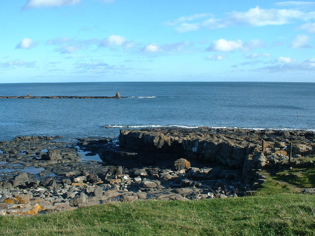
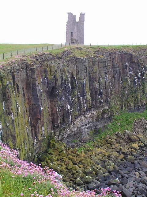
Liverpool Hole is a small but significant coastal feature located in the county of Northumberland in Northeast England. Situated on the North Sea coast, it is a natural opening that connects the sea to an estuary and creek system.

The hole serves as a vital link between the North Sea and the estuary, facilitating the exchange of water and marine life. It acts as a gateway for tidal water to flow into the estuary during high tide and then recede back into the sea during low tide. This constant ebb and flow of water helps maintain a healthy ecosystem within the estuary.

The Liverpool Hole is formed by the erosion of the surrounding coastal cliffs, which have created a narrow channel leading into the estuary. The hole itself varies in width and depth, depending on the tides and the volume of water flowing through it. During high tide, the hole can be several meters deep, allowing larger vessels to navigate through it. However, during low tide, the water level drops significantly, making it impassable for most boats.

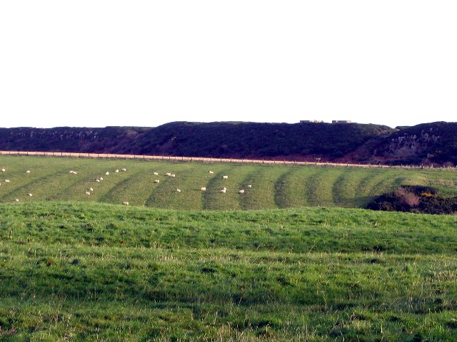
The estuary and creek system connected to Liverpool Hole are home to a diverse range of flora and fauna. The nutrient-rich waters support a variety of marine life, including fish, crustaceans, and seabirds. The surrounding salt marshes and mudflats provide important habitats for wading birds and other coastal species.

Due to its ecological significance, Liverpool Hole is a designated Site of Special Scientific Interest (SSSI) and is protected under national conservation laws. It also attracts visitors who appreciate the natural beauty of this coastal feature and the unique wildlife it supports.

If you have any feedback on the listing, please let us know in the comments section below.

Liverpool Hole Images

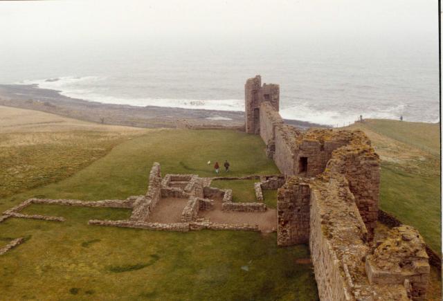
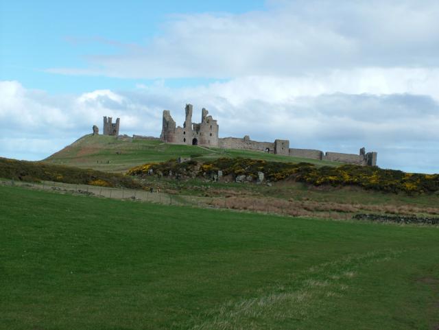
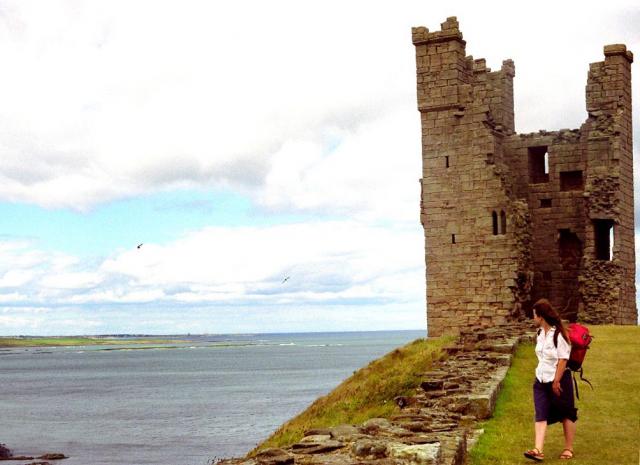
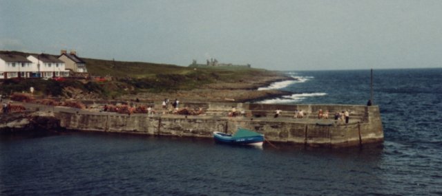
Images are sourced within 2km of 55.47734/-1.5913095 or Grid Reference NU2520. Thanks to Geograph Open Source API. All images are credited.

Dunstanburgh Castle Ruins of an impressive castle built in the 14th Century
Dunstanburgh Castle
Ruins of an impressive castle built in the 14th Century
Dunstanburgh Castle The photo is taken from the south looking north.
Dunstanburgh Castle
The photo is taken from the south looking north.
Dunstanburgh Castle and Embleton Bay Wish it was Embleton Castle!
Dunstanburgh Castle and Embleton Bay
Wish it was Embleton Castle!
Craster Harbour The ruin on the horizon is Dunstanburgh Castle.
Craster Harbour
The ruin on the horizon is Dunstanburgh Castle.
Craster WWII Chain Home Low radar station
Dunstanburgh Castle From the north west.
Dunstanburgh Castle
From the north west.
Dunstanburgh Castle North-west tower
Dunstanburgh Castle
North-west tower
Dunstanburgh Castle North-west tower
Dunstanburgh Castle
North-west tower
Craster View from the shore from the sleepy village of Craster made famous for its kippers
Craster
View from the shore from the sleepy village of Craster made famous for its kippers
Lilburn Tower, Dunstanburgh Castle, Northumberland Situated near to the edge of the cliff on the west curtain wall, the 14th century Lilburn Tower was used as a watchtower. This rectangular structure with its turrets still visible has survived better than the later buildings.  The Lilburn Tower of Dunstanburgh Castle is still a landmark from many miles away.
Lilburn Tower, Dunstanburgh Castle, Northumberland
Situated near to the edge of the cliff on the west curtain wall, the 14th century Lilburn Tower was used as a watchtower. This rectangular structure with its turrets still visible has survived better than the later buildings. The Lilburn Tower of Dunstanburgh Castle is still a landmark from many miles away.
Dunstanburgh Castle
Dunstanburgh Castle
Ridge and furrow field pattern, Dunstan. The concrete buildings that housed a radar station during the Second World can be seen on the skyline above Craster Heugh
Ridge and furrow field pattern, Dunstan.
The concrete buildings that housed a radar station during the Second World can be seen on the skyline above Craster Heugh
Dunstan Hall This is reputed to be the oldest continuously inhabited building in Northumberland.
Dunstan Hall
This is reputed to be the oldest continuously inhabited building in Northumberland.
Dunstan Square The ruins of Dunstanburgh Castle can be seen on the skyline above Dunstan Square farm.
Dunstan Square
The ruins of Dunstanburgh Castle can be seen on the skyline above Dunstan Square farm.
Ancient lime kiln This lime kiln is beside the Concrete Road between Dunstan Square and Dunstan Steads. Outcrops of limestone amongst the whinstone were exploited by local farmers.
Ancient lime kiln
This lime kiln is beside the Concrete Road between Dunstan Square and Dunstan Steads. Outcrops of limestone amongst the whinstone were exploited by local farmers.
World War Two pillbox The pillbox is constructed from cement filled sand bags. Dunstanburgh Castle is on the sky line.
World War Two pillbox
The pillbox is constructed from cement filled sand bags. Dunstanburgh Castle is on the sky line.
Dunstanburgh Castle & Whin Sill Dunstanburgh is a superbly located castle on an outcrop of the Whin Sill. 
The Castle is a scheduled monument and Grade I listed. <span class="nowrap"><a title="http://www.britishlistedbuildings.co.uk/en-236942-dunstanburgh-castle-craster" rel="nofollow ugc noopener" href="http://www.britishlistedbuildings.co.uk/en-236942-dunstanburgh-castle-craster">Link</a><img style="margin-left:2px;" alt="External link" title="External link - shift click to open in new window" src="https://s1.geograph.org.uk/img/external.png" width="10" height="10"/></span>
Wikipedia <span class="nowrap"><a title="http://en.wikipedia.org/wiki/Dunstanburgh_Castle" rel="nofollow ugc noopener" href="http://en.wikipedia.org/wiki/Dunstanburgh_Castle">Link</a><img style="margin-left:2px;" alt="External link" title="External link - shift click to open in new window" src="https://s1.geograph.org.uk/img/external.png" width="10" height="10"/></span> gives more information on the castle and its history.
Dunstanburgh Castle & Whin Sill
Dunstanburgh is a superbly located castle on an outcrop of the Whin Sill. The Castle is a scheduled monument and Grade I listed. LinkExternal link Wikipedia LinkExternal link gives more information on the castle and its history.
A Geo or Inlet Is this a natural feature or man made?
A Geo or Inlet
Is this a natural feature or man made?
Show me another place!

Liverpool Hole is located at Grid Ref: NU2520 (Lat: 55.47734, Lng: -1.5913095)

Unitary Authority: Northumberland

Police Authority: Northumbria

What 3 Words

///straddled.daunting.advice. Near Embleton, Northumberland

Related Wikis

Craster radar station

Craster radar station (also known as RAF Craster), was a Chain Home Low (later a Chain Home Extra Low) Second World War radar site at Craster in Northumberland...

Craster

Craster is a small fishing village on the Northumberland coast of England, eight miles (13 km) from Alnwick. The next village to the north is Embleton...

Craster Tower

Craster Tower is an 18th-century Georgian mansion incorporating a 14th-century pele tower situated near the fishing village of Craster, Northumberland...
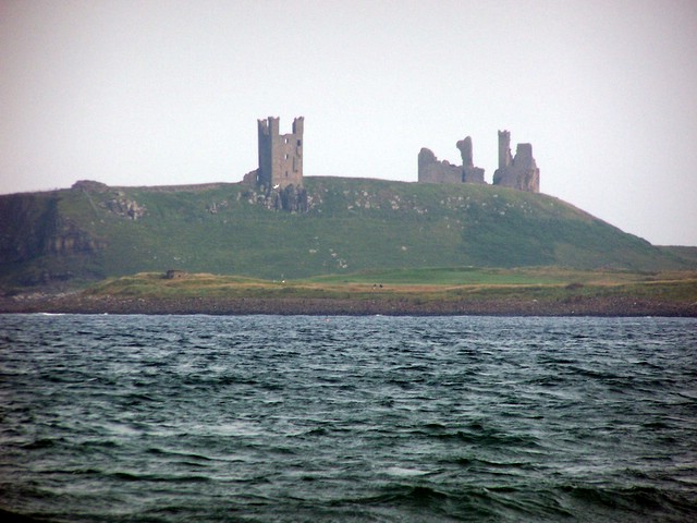
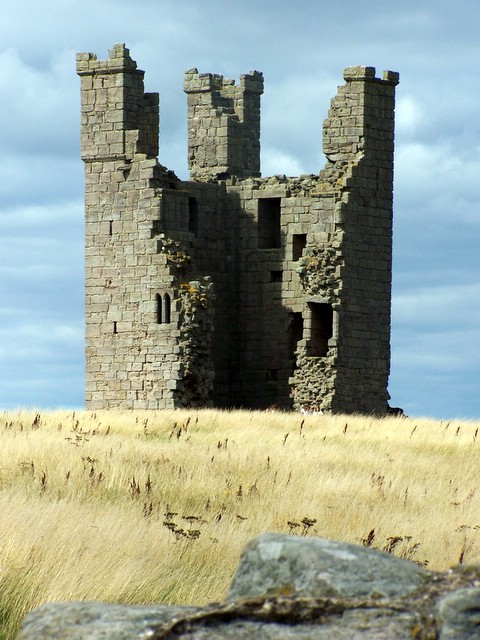
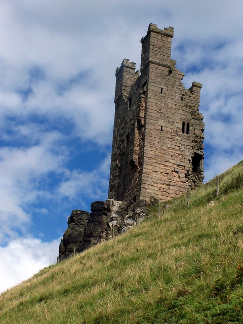
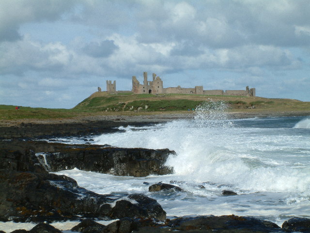
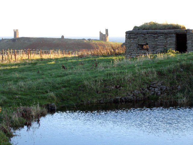
Dunstanburgh Castle

Dunstanburgh Castle is a 14th-century fortification on the coast of Northumberland in northern England, between the villages of Craster and Embleton. The...

Nearby Amenities

Located within 500m of 55.47734,-1.5913095
Little Carr
Place: locality
Lat/Long: 55.4762663/-1.5890741
Place Of Worship
Religion: christian
Lat/Long: 55.4739343/-1.5948841
Big Shaird
Place: locality
Lat/Long: 55.4756443/-1.5982526
Liverpool Hole
Place: locality
Lat/Long: 55.4772517/-1.591413
Oxberry Law
Place: locality
Lat/Long: 55.4782089/-1.5945008
Oxberrylaw Holes
Place: locality
Lat/Long: 55.478194/-1.5910435
Seahaven
Addr City: Craster
Addr Housenumber: 37
Addr Postcode: NE66 3TT
Addr Street: Dunstanburgh Road
Phone: +44 1665 602275
Tourism: guest_house
Website: www.seahavencraster.co.uk
Lat/Long: 55.4741235/-1.5935442
Bench
Lat/Long: 55.481458/-1.5937036
Bench
Lat/Long: 55.4731613/-1.5935098
Craster Memorial Harbour
Historic: memorial
Inscription: Hodie felix cras ter / Craster Memorial Harbour constructed in memory of Capt. John Charles Pulleine Craster, 46th Punjabis, who fell in action during the Thibetan expedition, June 1904. / He took a deep interest in the provision of a harbour at Craster…
Inscription Url: https://openplaques.org/plaques/60109
Memorial: plaque
Openplaques Id: 60109
Start Date: 1906
Lat/Long: 55.4734596/-1.5929177
The data included in this document is from www.openstreetmap.org. The data is made available under ODbL.

Have you been to Liverpool Hole?

Leave your review of Liverpool Hole below (or comments, questions and feedback).