The Houb

Sea, Estuary, Creek in Shetland

Scotland

The Houb

Linga and Walls from the air
Linga and Walls from the air Credit: Mike Pennington

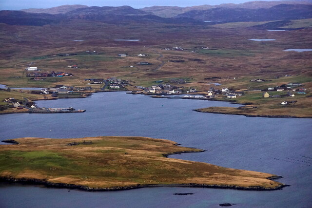
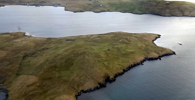
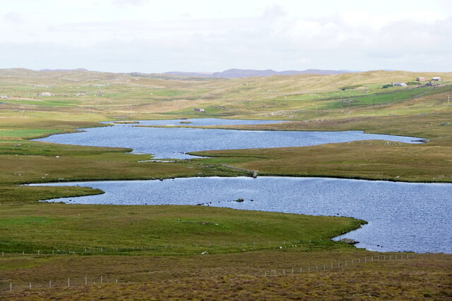
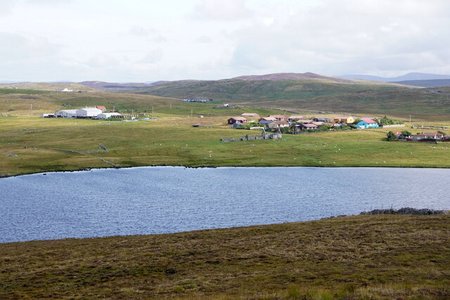
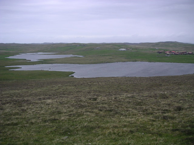
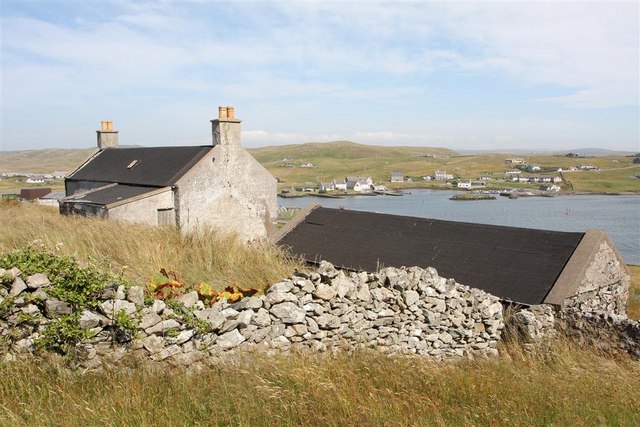
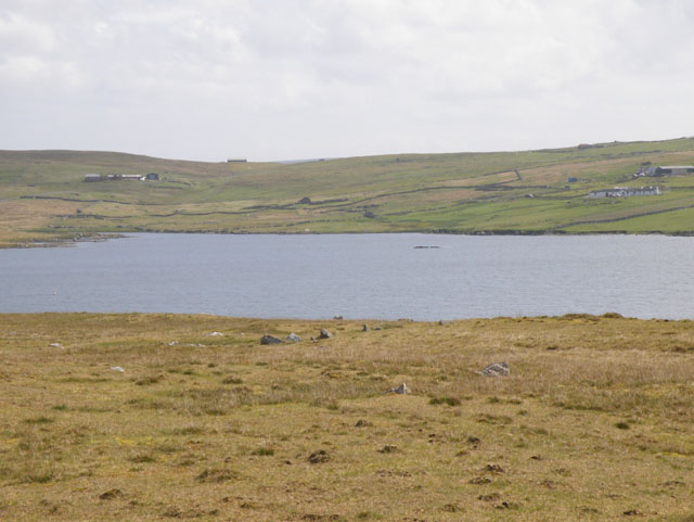
The Houb, located in Shetland, is an estuary that stretches from the North Sea into a creek-like formation. Situated on the east coast of Mainland Shetland, this water body is known for its stunning natural beauty and diverse wildlife.

The Houb is characterized by its ever-changing tides, which create a dynamic environment rich in biodiversity. The estuary serves as a crucial habitat for various marine species, including seals, otters, and seabirds. The abundance of fish in the area, such as mackerel and herring, attracts these creatures and makes The Houb an ideal feeding ground.

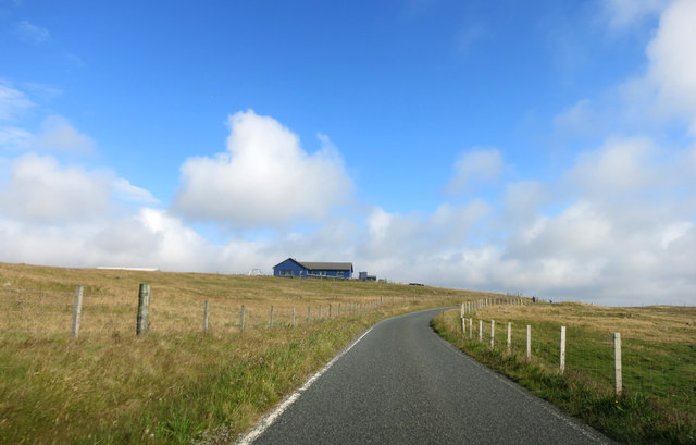
The surrounding landscape of The Houb is striking, with rugged cliffs and rolling hills providing a dramatic backdrop. The estuary itself is a mix of open water and intertidal mudflats, which are essential for wading birds like curlews and redshanks. During low tide, these mudflats are exposed and offer an opportunity for birdwatching and exploring the diverse range of marine life that inhabits them.

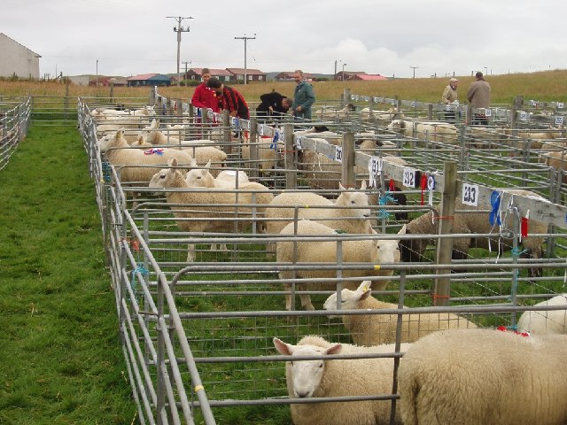
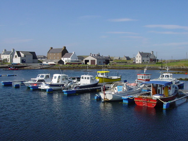
From a historical perspective, The Houb has served as a vital resource for the local community. In the past, it was used as a transportation route for fishing boats and small vessels, allowing for easy access to the sea and other parts of Shetland. Today, The Houb remains a popular spot for recreational activities such as boating, kayaking, and fishing.

Overall, The Houb in Shetland is a picturesque estuary that showcases the natural beauty of the region. With its diverse wildlife, stunning landscapes, and historical significance, it is a place of both ecological and cultural importance.

If you have any feedback on the listing, please let us know in the comments section below.

The Houb Images

Images are sourced within 2km of 60.221144/-1.5532873 or Grid Reference HU2448. Thanks to Geograph Open Source API. All images are credited.

Linga and Walls from the air
Linga, Vaila Sound, from the air
Loch of Grunnavoe, near Walls, from the air
Lochs of Kirkigarth and Bardister, Walls
Loch of Kirkigarth and Kirkidale, Walls
Road North of Walls
Road North of Walls
Stany Fields, near Walls
The A971 near Walls Many of Shetland's roads are single track with passing places.
The A971 near Walls
Many of Shetland's roads are single track with passing places.
At Walls Show 2005
At Walls Show 2005
Boats at Walls Boats at Walls on a warm summer afternoon.
Boats at Walls
Boats at Walls on a warm summer afternoon.
Loch of Kirkigarth Loch of Kirkigarth with Bardister Loch further north, both lochs are classed as Mesotrophic.
Loch of Kirkigarth
Loch of Kirkigarth with Bardister Loch further north, both lochs are classed as Mesotrophic.
Pinhoulland Looking along the track towards the farm buildings.
Pinhoulland
Looking along the track towards the farm buildings.
Lonely phone box on dull summer day Not much more to say really - except that the weather closed in completely just after I took this photo at 1:45pm...
Lonely phone box on dull summer day
Not much more to say really - except that the weather closed in completely just after I took this photo at 1:45pm...
The end of the road, Whitesness This was also the end of my Geographing session for the day, as the weather closed in making photography impossible - at 1:47 pm on a July afternoon!
The end of the road, Whitesness
This was also the end of my Geographing session for the day, as the weather closed in making photography impossible - at 1:47 pm on a July afternoon!
St Paul's Kirk, Walls The Church of Scotland Kirk, from the graveyard.
St Paul's Kirk, Walls
The Church of Scotland Kirk, from the graveyard.
Methodist Church, Walls
Walls from South Voe
Walls shop & Post Office
Show me another place!

The Houb is located at Grid Ref: HU2448 (Lat: 60.221144, Lng: -1.5532873)

Unitary Authority: Shetland Islands

Police Authority: Highlands and Islands

What 3 Words

///harp.clicker.slogged. Near Walls, Shetland Islands

Nearby Locations

The Houb Skeo Taing

Related Wikis

Walls, Shetland

Walls, known locally as Waas (Old Norse: Vagar = "Sheltered Bays" (voes) - the Ordnance Survey added the "ll" as they thought it was a corruption of "walls...

Linga, Vaila Sound

Linga is one of the Shetland Islands, near Vaila and Walls on Mainland, Shetland. Its highest elevation is 28 metres (91 ft). In 2014 and 2018 it was...

Burrastow

Burrastow is a location on the west shore of Vaila Sound near the village of Walls on the Shetland Mainland, Scotland. There are two small piers and the...

Browland

Browland is a village on Mainland in Shetland, Scotland situated about 1.9 miles (3 km) east north east of Walls. Browland is within the parish of Sandsting...

Nearby Amenities

Located within 500m of 60.221144,-1.5532873
Barrier: cattle_grid
Lat/Long: 60.2247079/-1.5576279
Barrier: cattle_grid
Lat/Long: 60.221666/-1.5516959
The Houb
Natural: bay
Lat/Long: 60.2211157/-1.5531804
Barrier: cattle_grid
Lat/Long: 60.2241191/-1.5573892
Power: pole
Lat/Long: 60.2171372/-1.5509122
Power: pole
Lat/Long: 60.2176835/-1.5511849
Power: pole
Lat/Long: 60.2181897/-1.5510485
Power: pole
Lat/Long: 60.2185604/-1.550933
Power: pole
Lat/Long: 60.2192203/-1.5507481
Power: pole
Lat/Long: 60.2195416/-1.5506673
Power: pole
Lat/Long: 60.2201293/-1.5505425
Power: pole
Lat/Long: 60.2206445/-1.5504431
Power: pole
Lat/Long: 60.2213251/-1.5503253
Power: pole
Lat/Long: 60.2216602/-1.5502537
Power: pole
Lat/Long: 60.2223763/-1.5512172
Power: pole
Lat/Long: 60.2228686/-1.5518896
Power: pole
Lat/Long: 60.2234229/-1.5526291
Power: pole
Lat/Long: 60.2239381/-1.5533338
Power: pole
Lat/Long: 60.2244728/-1.5540524
Power: pole
Lat/Long: 60.2249926/-1.5547526
Power: pole
Lat/Long: 60.2252428/-1.5551015
Power: pole
Lat/Long: 60.2231431/-1.5607003
Power: pole
Lat/Long: 60.2227197/-1.5604277
Power: pole
Lat/Long: 60.2225349/-1.5594179
Power: pole
Lat/Long: 60.2226876/-1.5589927
Power: pole
Lat/Long: 60.2228482/-1.5585352
Power: pole
Lat/Long: 60.2231546/-1.5576895
Power: pole
Lat/Long: 60.2234254/-1.5569662
Power: pole
Lat/Long: 60.2238741/-1.5557
Power: pole
Lat/Long: 60.2242115/-1.5547942
Power: pole
Lat/Long: 60.2187695/-1.5553025
Power: pole
Lat/Long: 60.2188797/-1.5541818
Power: pole
Lat/Long: 60.2189991/-1.5529641
Power: pole
Lat/Long: 60.219115/-1.5518296
Power: pole
Lat/Long: 60.2225894/-1.5482676
The data included in this document is from www.openstreetmap.org. The data is made available under ODbL.

Have you been to The Houb?

Leave your review of The Houb below (or comments, questions and feedback).