Redshin Cove

Sea, Estuary, Creek in Northumberland

England

Redshin Cove

Cocklawburn Beach on New Year’s Day The beach was reasonably busy on this beautiful January day.
Cocklawburn Beach on New Year’s Day Credit: Walter Baxter

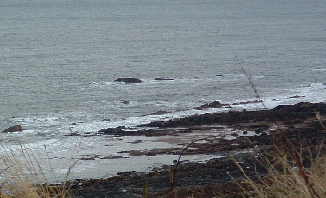
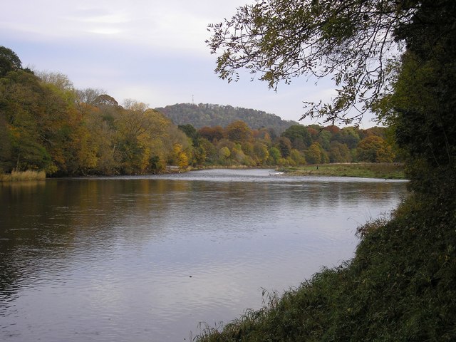
Redshin Cove, located in Northumberland, is a picturesque coastal area known for its stunning surroundings and diverse ecosystem. Situated along the North Sea, it encompasses an estuary and creek, offering a unique blend of marine and terrestrial habitats.

The cove's sandy shores are a haven for beach lovers and wildlife enthusiasts alike. The shallow waters of the estuary provide a safe haven for a variety of marine life, including seals, dolphins, and seabirds. The area is renowned for its rich biodiversity and is a designated nature reserve, attracting visitors from near and far.

The creek, meandering through the lush green landscape, is a tranquil spot where one can witness the ebb and flow of the tides. It is home to a myriad of plant and animal species, creating a vibrant ecosystem. The creek's calm waters make it an ideal location for kayaking and canoeing, allowing visitors to explore its hidden corners and soak in the natural beauty.

Redshin Cove is also a popular spot for fishing enthusiasts. The abundance of fish species, such as cod, herring, and mackerel, makes it a prime location for angling. Whether casting a line from the shore or venturing out into the estuary on a boat, fishermen are often rewarded with a plentiful catch.

For those seeking a respite from the hustle and bustle of everyday life, Redshin Cove offers a peaceful retreat amidst captivating scenery. Its combination of sea, estuary, and creek makes it a unique coastal destination, where visitors can immerse themselves in the splendor of nature.

If you have any feedback on the listing, please let us know in the comments section below.
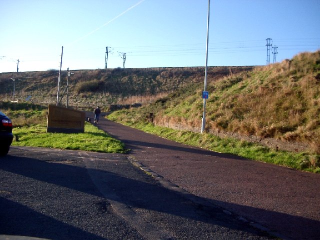
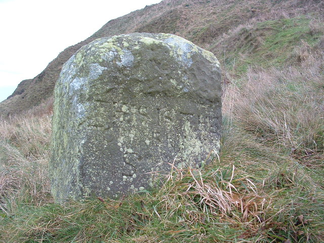
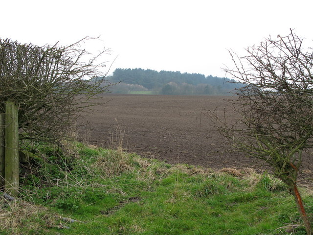
Redshin Cove Images

Images are sourced within 2km of 55.747405/-1.9736583 or Grid Reference NU0150. Thanks to Geograph Open Source API. All images are credited.

Cocklawburn Beach on New Year’s Day The beach was reasonably busy on this beautiful January day.
Cocklawburn Beach on New Year’s Day
The beach was reasonably busy on this beautiful January day.
The shore at Redshin Cove This narrow strip of rock appears to be covered in fossilised limpets but it is a piece of concretionary limestone.
The shore at Redshin Cove
This narrow strip of rock appears to be covered in fossilised limpets but it is a piece of concretionary limestone.
Colourful rock strata at The Skipper I haven’t noticed these colourful rocks before but a lot of seaweed has been stripped off rocks in this area by recent storms.
Colourful rock strata at The Skipper
I haven’t noticed these colourful rocks before but a lot of seaweed has been stripped off rocks in this area by recent storms.
Railway Embankment, Spittal the embankment is for the main line south (Edinburgh to London Kings Cross)
Railway Embankment, Spittal
the embankment is for the main line south (Edinburgh to London Kings Cross)
The Dryers Last Day The day following the taking of this photo the building on the left was demolished. The decision on the chimney's fate is still awaited.
The Dryers Last Day
The day following the taking of this photo the building on the left was demolished. The decision on the chimney's fate is still awaited.
Berwick Lighthouse Tide almost at lowest ebb and very calm. One or two dog walkers about and evidence on the beach of Lug Worm gatherers.
Berwick Lighthouse
Tide almost at lowest ebb and very calm. One or two dog walkers about and evidence on the beach of Lug Worm gatherers.
Bears Head Spittal The Bear's Head is extremely close to the grid line but my guess is that at least part of it is in NU0151. I await to be told otherwise!
Bears Head Spittal
The Bear's Head is extremely close to the grid line but my guess is that at least part of it is in NU0151. I await to be told otherwise!
Boundary Stone "This is the Boundary Stone" is the inscription roughly carved. There may be more below the grass line but I couldn't really tell. The OS has the name "Toppye Knowe" across its position so maybe that is what it is called.
Boundary Stone
"This is the Boundary Stone" is the inscription roughly carved. There may be more below the grass line but I couldn't really tell. The OS has the name "Toppye Knowe" across its position so maybe that is what it is called.
Hud's Head The fishing shiel that once stood beside "The Boundary Stone" was known as Huds Head Shiel. It, Huds Head, stand slightly higher than the Bears Head but both are usually covered at high tide.
Hud's Head
The fishing shiel that once stood beside "The Boundary Stone" was known as Huds Head Shiel. It, Huds Head, stand slightly higher than the Bears Head but both are usually covered at high tide.
Gone at Last Although a dramatic silhouette, the silo had been left to decay for over 30 years. The chimney remains - for the moment.
Gone at Last
Although a dramatic silhouette, the silo had been left to decay for over 30 years. The chimney remains - for the moment.
Spittal Beach Showing the "new" Promenade completed in 2001 & the old chemical works chimney in the background
Spittal Beach
Showing the "new" Promenade completed in 2001 & the old chemical works chimney in the background
Spittal Beach Tree debris on Spittal Beach.
Spittal Beach
Tree debris on Spittal Beach.
Beach Art Spittal Beach, Berwick-upon-Tweed
Beach Art
Spittal Beach, Berwick-upon-Tweed
View of Spittal From a train through Highcliffe. The chimney on the left is near Sandstell Point lifeboat station (NU0052); Berwick Lighthouse (NU0152) on the right is at the end of Meadow Haven pier.
View of Spittal
From a train through Highcliffe. The chimney on the left is near Sandstell Point lifeboat station (NU0052); Berwick Lighthouse (NU0152) on the right is at the end of Meadow Haven pier.
Spittal church
Spittal church
View North over Berwick upon Tweed from the train This view is fairly difficult at 100mph to pinpoint exactly but I'm fairly confident I'm within a couple of hundred yards.
Just past the upright of the electrification stanchion is the Royal Border Bridge which the train went over about a minute after this was taken.
View North over Berwick upon Tweed from the train
This view is fairly difficult at 100mph to pinpoint exactly but I'm fairly confident I'm within a couple of hundred yards. Just past the upright of the electrification stanchion is the Royal Border Bridge which the train went over about a minute after this was taken.
Heathery Tops Newly ploughed field, view towards Catchlaw Crag over the A1 near Scremerston.
Heathery Tops
Newly ploughed field, view towards Catchlaw Crag over the A1 near Scremerston.
On the Lowry trail The painter L S Lowry famed for his naive views of Lancashire was a big fan of this area.
On the Lowry trail
The painter L S Lowry famed for his naive views of Lancashire was a big fan of this area.
Show me another place!

Redshin Cove is located at Grid Ref: NU0150 (Lat: 55.747405, Lng: -1.9736583)

Unitary Authority: Northumberland

Police Authority: Northumbria

What 3 Words

///streaking.novelists.ignore. Near Berwick-Upon-Tweed, Northumberland

Related Wikis

Scremerston railway station

Scremerston railway station served the village of Scremerston, Northumberland, England from 1847 to 1951 on the East Coast Main Line. == History == The...

Spittal, Northumberland

Spittal is a village in northern Northumberland, England. It is part of Berwick-upon-Tweed and is situated on the coast to the east of Tweedmouth. Spittal...

Scremerston

Scremerston is a village in Northumberland, England. The village lies on the North Sea coast just under 2.5 miles (4 km) south of Berwick-upon-Tweed and...

Berwick Academy, Berwick-upon-Tweed

Berwick Academy (formerly Berwick Community High School) is a coeducational upper school and sixth form located in Berwick-upon-Tweed in the English county...

River Tweed

The River Tweed, or Tweed Water, Scots: Watter o Tweid, Welsh: Tuedd), is a river 97 miles (156 km) long that flows east across the Border region in Scotland...

Tweedmouth railway station

Tweedmouth railway station was a railway station which served the Tweedmouth area of Berwick-on-Tweed in Northumberland, England. It was located on the...

Tweedmouth

Tweedmouth is part of the town of Berwick-upon-Tweed in Northumberland, England. It is located on the south bank of the River Tweed and is connected to...

Berwick town walls

Berwick's town walls are a sequence of defensive structures built around the town of Berwick-upon-Tweed in England. == History == === Medieval fortification... ===

Nearby Amenities

Located within 500m of 55.747405,-1.9736583
Huds Head
Place: locality
Lat/Long: 55.7503965/-1.9795138
Redshin Cove
Place: locality
Lat/Long: 55.7472256/-1.9747415
The data included in this document is from www.openstreetmap.org. The data is made available under ODbL.

Have you been to Redshin Cove?

Leave your review of Redshin Cove below (or comments, questions and feedback).