Black Nook

Sea, Estuary, Creek in Aberdeenshire

Scotland

Black Nook

Frosty dawn at Bridge of Don Day breaks over the North Sea on the last day of the year
Frosty dawn at Bridge of Don Credit: Alan Reid

Black Nook is a picturesque coastal area located in Aberdeenshire, Scotland. Situated on the eastern coast of the country, it is a charming blend of sea, estuary, and creek. The area is known for its natural beauty and is a popular destination for nature enthusiasts and outdoor lovers.

The highlight of Black Nook is its stunning sea views. The coastline stretches for miles, offering breathtaking vistas of the North Sea. The crashing waves and jagged cliffs create a dramatic atmosphere, making it a perfect spot for photographers and artists.

Adjacent to the sea, Black Nook is also home to a tranquil estuary. This estuary provides a haven for various bird species, making it a favored spot for birdwatchers. Throughout the year, visitors can spot a variety of coastal and migratory birds, including gulls, herons, and wading birds.

In addition to the sea and estuary, Black Nook features a charming creek that winds its way through the landscape. This creek is surrounded by lush greenery and is a great place for leisurely walks or picnics.

The area offers various recreational activities, including hiking trails along the coastline and birdwatching opportunities. It is also a popular spot for fishing, as the waters are rich in marine life.

Overall, Black Nook in Aberdeenshire is a stunning coastal area that boasts a unique combination of sea, estuary, and creek. Its natural beauty and diverse wildlife make it an ideal destination for those seeking a peaceful and scenic escape.

If you have any feedback on the listing, please let us know in the comments section below.

Black Nook Images

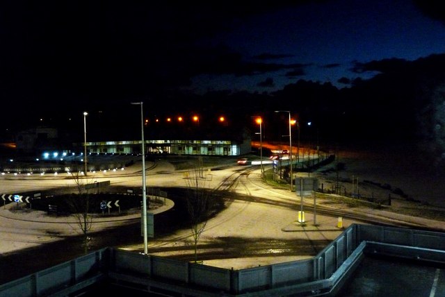
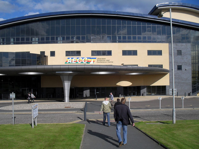
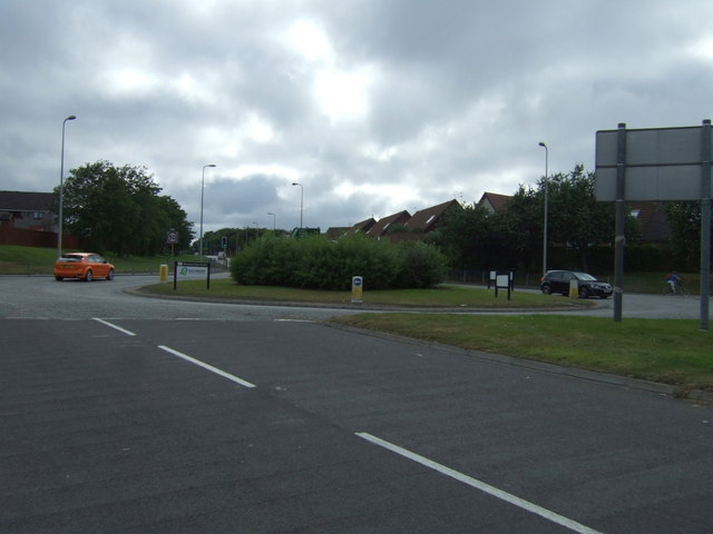
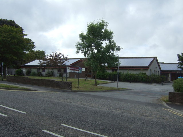
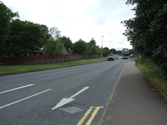
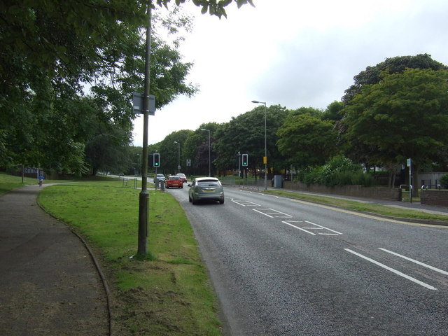
Images are sourced within 2km of 57.178009/-2.0984791 or Grid Reference NJ9409. Thanks to Geograph Open Source API. All images are credited.

Frosty dawn at Bridge of Don Day breaks over the North Sea on the last day of the year
Frosty dawn at Bridge of Don
Day breaks over the North Sea on the last day of the year
The AECC
The AECC
Bridge of Don Baptist Church Centre
Bridge of Don Library Bridge of Don must be the ultimate 1970s suburb, with unimpressive public buildings to match...
Bridge of Don Library
Bridge of Don must be the ultimate 1970s suburb, with unimpressive public buildings to match...
Scotstown Surgery, Bridge of Don
Scotstown School, Bridge of Don, Aberdeen Built in the 1970s with the school name on the end of the building in the Profil typeface.  I thought this typeface was classic (dated) 1970s, but in fact it dates from 1946: <span class="nowrap"><a title="http://ultraboldblog.printweek.com/2009/02/28/profil/" rel="nofollow ugc noopener" href="http://ultraboldblog.printweek.com/2009/02/28/profil/">Link</a><img style="margin-left:2px;" alt="External link" title="External link - shift click to open in new window" src="https://s1.geograph.org.uk/img/external.png" width="10" height="10"/></span> .
Scotstown School, Bridge of Don, Aberdeen
Built in the 1970s with the school name on the end of the building in the Profil typeface. I thought this typeface was classic (dated) 1970s, but in fact it dates from 1946: LinkExternal link .
The Black Dog, Bridge of Don Interesting 1970s architecture..
The Black Dog, Bridge of Don
Interesting 1970s architecture..
Farmland, Denmore East of the A90.
Farmland, Denmore
East of the A90.
Ellon Road (A90) heading south  Into Aberdeen.
Ellon Road (A90) heading south
Into Aberdeen.
Service station on the A90
Holiday Inn Express, Aberdeen Exhibition Centre
A90 heading south Into Aberdeen.
A90 heading south
Into Aberdeen.
Parkway East Heading east near the Aberdeen Exhibition Centre.
Parkway East
Heading east near the Aberdeen Exhibition Centre.
The Parkway (A90) Heading west.
The Parkway (A90)
Heading west.
Scotstown Roundabout A90 heading west.
Scotstown Roundabout
A90 heading west.
Glashieburn Primary School
Scotstown Road (B997) Heading north.
Scotstown Road (B997)
Heading north.
Jesmond Drive Heading west.
Jesmond Drive
Heading west.
Show me another place!

Black Nook is located at Grid Ref: NJ9409 (Lat: 57.178009, Lng: -2.0984791)

Unitary Authority: City of Aberdeen

Police Authority: North East

What 3 Words

///alien.edge.winter. Near Aberdeen

Nearby Locations

Tam's Hole Black Nook

Related Wikis

Hillhead Centre

The Hillhead Centre (formally known as Keith Park) is a sports stadium in the Old Aberdeen area of Aberdeen, Scotland. It is owned and managed by the University...

Bridge of Don

Bridge of Don is a suburb in the north of Aberdeen, Scotland. In 2020, the Bridge of Don electoral ward was estimated to have a population of 19,545.Bridge...

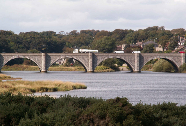
Bridge of Don (bridge)

Bridge of Don is a five-arch bridge of granite, built between 1827 and 1830, crossing the River Don just above its mouth in Aberdeen, Scotland. == History... ==
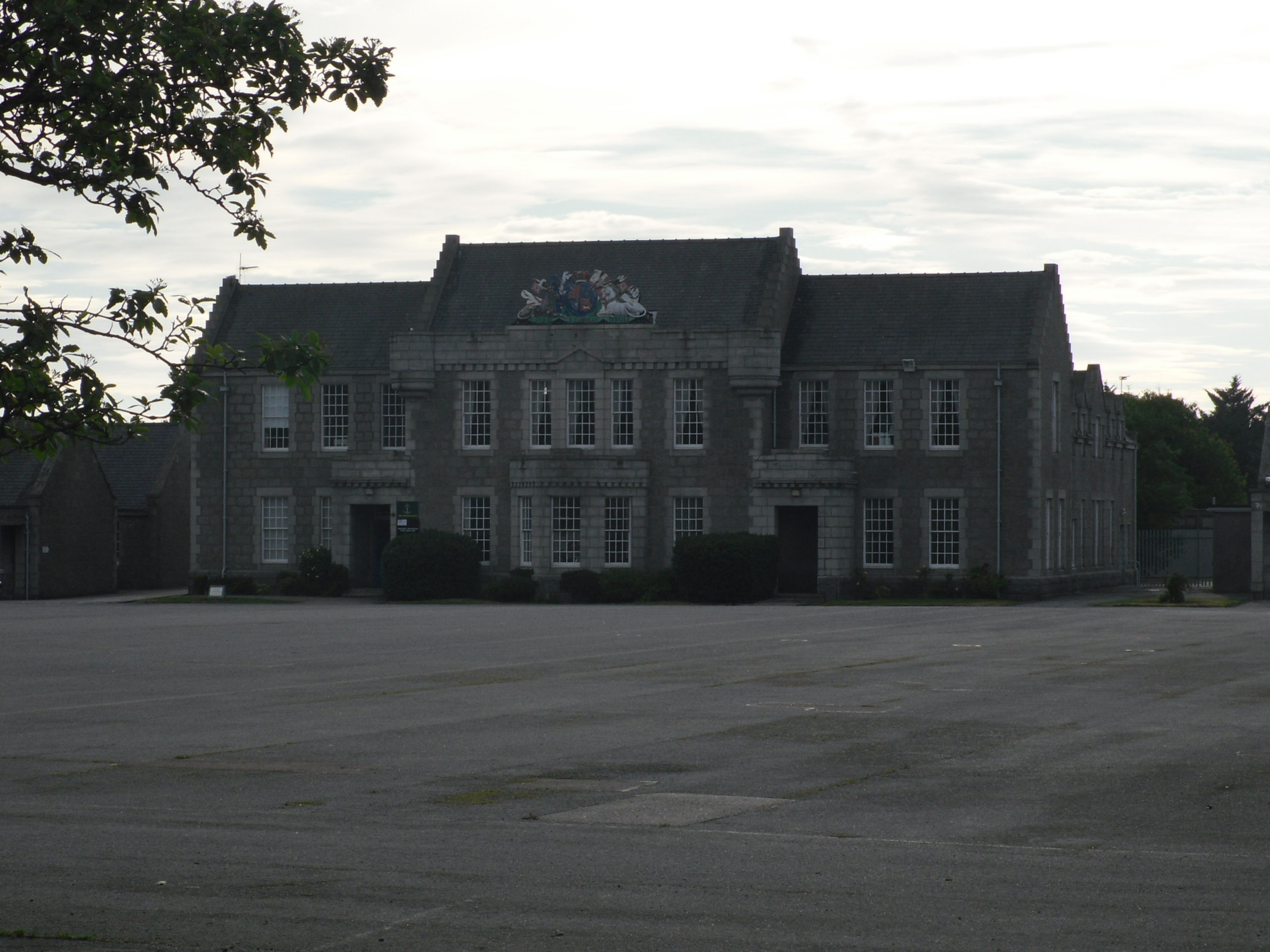
Gordon Barracks

Gordon Barracks is a military installation situated in Bridge of Don, Aberdeen. == History == The barrack buildings, which were built by J and W Wittet...

Nearby Amenities

Located within 500m of 57.178009,-2.0984791
Give Way
Direction: backward
Lat/Long: 57.1816406/-2.0998786
Co-op Food
Addr City: Aberdeen
Addr Housenumber: 21
Addr Postcode: AB22 8HH
Addr Street: Scotstown Road
Brand: Co-op Food
Brand Wikidata: Q3277439
Brand Wikipedia: en:Co-op Food
Fhrs Authority: Aberdeen City
Fhrs Id: 592224
Fhrs Local Authority Id: EHDC10283
Operator: The Co-operative Group
Operator Wikidata: Q117202
Shop: convenience
Website: https://www.coop.co.uk/store-finder/AB22-8HH/21-scotstown-road
Lat/Long: 57.1810477/-2.0998266
Access: no
Barrier: bollard
Bicycle: yes
Bollard: fixed
Foot: yes
Lat/Long: 57.1773556/-2.0979224
VT Wealth
Addr City: Aberdeen
Addr Country: GB
Addr Housenumber: 2-4
Addr Postcode: AB23 8ER
Addr Street: Balgownie Crescent
Contact Phone: +44 1224 034213
Contact Website: https://vtwealth.co.uk
Office: financial_advisor
Lat/Long: 57.1786021/-2.09076
Barrier: bollard
Bollard: fixed
Source: survey; gps
Lat/Long: 57.17744/-2.09928
Barrier: swing_gate
Bicycle: dismount
Foot: yes
Horse: no
Locked: yes
Swing Gate Type: single
Lat/Long: 57.1746296/-2.0990017
Barrier: entrance
Foot: yes
Source: survey
Lat/Long: 57.1772217/-2.1009356
Bus Stop
Hillhead of Seaton
Bench: yes
Bin: yes
Bus: yes
Departures Board: timetable
Lit: yes
Naptan AtcoCode: 639007251
Naptan CommonName: Hillhead Halls
Naptan Indicator: at
Naptan NaptanCode: 23235956
Naptan Verified: no
Operator: FirstBus
Public Transport: platform
Shelter: yes
Tactile Paving: no
Lat/Long: 57.1756861/-2.1020981
Aberdeen Hillhead Campus Co-op
Addr City: Aberdeen
Addr Postcode: AB24 1WU
Addr Street: Don Street
Addr Unit: Headspace Building
Air Conditioning: no
Brand: Co-op Food
Brand Wikidata: Q3277439
Fhrs Authority: Aberdeen City
Fhrs Id: 1024425
Fhrs Local Authority Id: EHDC12428
Level: 0
Note: Opening hours: Mo-Su 08:00-00:00 (when open, currently closed along with entire top floor of headspace building
Opening Hours: Mo-Su 08:00-00:00
Operator: The Co-operative Group
Organic: yes
Payment Apple Pay: yes
Payment Cash: yes
Payment Credit Cards: yes
Payment Debit Cards: yes
Payment Google Pay: yes
Shop: convenience
Lat/Long: 57.1760604/-2.1030663
Post Box
Collection Times: Mo-Fr 09:00; Sa 07:00
Colour: red
Drive Through: no
Operator: Royal Mail
Operator Wikidata: Q638098
Post Box Type: pillar
Ref: AB24 524D
Royal Cypher: scottish_crown
Lat/Long: 57.1757459/-2.1028101
Restaurant
The Works
Addr City: Aberdeen
Addr Postcode: AB24 1WU
Addr Street: Don Street
Addr Unit: Hillhead Halls Of Residence
Air Conditioning: yes
Bar: yes
Brewery: various
Delivery: no
Fhrs Authority: Aberdeen City
Fhrs Id: 1194239
Fhrs Local Authority Id: EHDC13204
Highchair: no
Level: -1
Microbrewery: no
Outdoor Seating: no
Payment Apple Pay: yes
Payment Cash: yes
Payment Credit Cards: yes
Payment Debit Cards: yes
Payment Google Pay: yes
Phone: +44 1224 274000
Smoking: no
Sport: table_soccer;darts;billiards
Takeaway: yes
Lat/Long: 57.1763498/-2.1031116
Bench
Backrest: yes
Source: survey
Lat/Long: 57.1760058/-2.0978506
Bench
Backrest: yes
Source: survey
Lat/Long: 57.1749046/-2.0950662
Bench
Backrest: yes
Source: survey
Lat/Long: 57.1754377/-2.0966519
Access: private
Entrance: service
Lat/Long: 57.1759017/-2.1010579
Access: private
Entrance: main
Lat/Long: 57.1763443/-2.1019954
Parking
Lat/Long: 57.1765865/-2.105345
Barrier: lift_gate
Locked: yes
Lat/Long: 57.1753683/-2.1013946
Bus Stop
Seaton Stables
Bench: no
Bin: no
Bus: yes
Departures Board: timetable
Lit: yes
Naptan AtcoCode: 639003722
Naptan CommonName: Seaton Stables
Naptan Indicator: adj
Naptan NaptanCode: 23235943
Naptan Verified: no
Note: services: 20, N20
Public Transport: platform
Ref: 03722
Shelter: no
Source: survey;gps
Tactile Paving: no
Lat/Long: 57.1745841/-2.0982016
Bus Stop
Seaton Stables
Bench: no
Bin: no
Bus: yes
Departures Board: timetable
Lit: yes
Naptan AtcoCode: 639003721
Naptan CommonName: Seaton Stables
Naptan Indicator: opp
Naptan NaptanCode: 23235954
Naptan Verified: no
Note: services: 20, N20
Public Transport: platform
Ref: 03721
Shelter: no
Source: survey;gps
Tactile Paving: no
Lat/Long: 57.1744538/-2.0977909
Parking
Access: private
Parking: surface
Lat/Long: 57.1751912/-2.098648
Bench
Backrest: yes
Check Date: 2021-05-22
Source: survey
Lat/Long: 57.1772401/-2.0979155
Donmouth Local Nature Reserve
Board Type: nature
Check Date: 2022-06-28
Information: board
Note: defaced
Source: survey; gps
Tourism: information
Lat/Long: 57.1763834/-2.0989591
Bench
Backrest: yes
Check Date: 2021-02-27
Fixme: position is approximate along this section
Note: path nearby was heavily waterlogged
Source: survey; estimate
Lat/Long: 57.1737929/-2.0976458
Barrier: entrance
Foot: yes
Source: survey; gps
Lat/Long: 57.1743406/-2.0987913
Bench
Backrest: yes
Check Date: 2021-05-22
Fixme: position by gps, but should check based on geometry
Material: metal
Source: survey; gps
Lat/Long: 57.1743917/-2.098496
Bench
Backrest: yes
Check Date: 2021-05-22
Material: metal
Source: survey; gps
Lat/Long: 57.1745509/-2.0982803
Bench
Backrest: yes
Check Date: 2021-05-22
Material: metal
Source: survey; gps
Lat/Long: 57.1742112/-2.0993252
Barrier: entrance
Foot: yes
Source: survey; gps
Lat/Long: 57.1742126/-2.0993665
Waste Basket
Check Date: 2021-05-22
Source: survey; gps
Lat/Long: 57.1743204/-2.0988115
Bench
Backrest: yes
Check Date: 2021-05-22
Material: metal
Source: survey; gps
Lat/Long: 57.1743785/-2.0994722
Bench
Backrest: yes
Check Date: 2021-05-22
Material: metal
Source: survey; gps
Lat/Long: 57.1742874/-2.0997843
Crossing
Crossing: unmarked
Crossing Markings: no
Lat/Long: 57.182116/-2.1003359
Entrance: yes
Lat/Long: 57.1757905/-2.1037634
Bus Stop
Balgownie Road
Bench: yes
Bus: yes
Naptan AtcoCode: 639004901
Naptan CommonName: Balgownie Road
Naptan Indicator: at
Naptan NaptanCode: 23236236
Naptan Verified: no
Public Transport: platform
Shelter: yes
Lat/Long: 57.1785013/-2.0992067
Turning Circle
Parking: no
Surface: paving_stones
Turning Circle: circle
Lat/Long: 57.1758642/-2.1029104
Scotstown
Place: neighbourhood
Lat/Long: 57.18137/-2.0991591
Atm
NoteMachine
Brand: NoteMachine
Brand Wikidata: Q104368525
Check Date: 2021-09-06
Covered: yes
Drive Through: no
Operator: NoteMachine
Operator Short: NMATM
Operator Wikidata: Q104368525
Short Name: NMATM
Lat/Long: 57.1758642/-2.1032269
Bicycle Parking
Access: yes
Bicycle Parking: stands
Capacity: 10
Covered: yes
Fee: no
Lit: yes
Operator: University of Aberdeen
Operator Type: university
Lat/Long: 57.1759559/-2.1025399
Bicycle Parking
Access: permissive
Bicycle Parking: shed
Capacity: 12
Covered: yes
Fee: no
Operator: University of Aberdeen
Operator Type: university
Lat/Long: 57.1758445/-2.1018583
Direction: 130
Information: map
Map Size: site
Map Type: scheme
Operator: University of Aberdeen
Tourism: information
Lat/Long: 57.1758561/-2.1003234
Inscription: The Saltire Society; Award for Reconstruction; 1973
Memorial: plaque
Lat/Long: 57.1773558/-2.1005406
Bench
Backrest: yes
Lat/Long: 57.1764121/-2.0927909
Life Ring
Check Date: 2023-07-22
Emergency: life_ring
Lat/Long: 57.1764172/-2.0928868
Bench
Backrest: yes
Lat/Long: 57.1764637/-2.0940328
Recycling
Opening Hours: 24/7
Recycling Cans: yes
Recycling Clothes: yes
Recycling Glass Bottles: yes
Recycling Paper: yes
Recycling Plastic: yes
Recycling Plastic Packaging: yes
Recycling Small Appliances: yes
Recycling Type: container
Lat/Long: 57.1754975/-2.1024778
Pharmacy
Boots
Addr City: Aberdeen
Addr Country: GB
Addr Housenumber: 27
Addr Postcode: AB22 8HH
Addr Street: Scotstown Road
Brand: Boots
Brand Wikidata: Q6123139
Brand Wikipedia: en:Boots UK
Dispensing: yes
Healthcare: pharmacy
Phone: +44 1224 705440
Website: https://www.boots.com/stores/2317-aberdeen-bridge-of-don-ab22-8hh
Lat/Long: 57.1812509/-2.0999138
William Hill
Addr Postcode: AB22 8HH
Brand: William Hill
Brand Wikidata: Q4053147
Brand Wikipedia: en:William Hill (bookmaker)
Shop: bookmaker
Lat/Long: 57.1811272/-2.0998602
Duncan's
Addr City: Aberdeen
Addr Housenumber: 25
Addr Postcode: AB22 8HH
Addr Street: Scotstown Road
Fhrs Authority: Aberdeen City
Fhrs Id: 1348353
Fhrs Local Authority Id: 681
Operator: Evening Express
Shop: convenience
Lat/Long: 57.1811933/-2.099887
Crossing
Button Operated: no
Crossing: uncontrolled
Crossing Island: yes
Crossing Markings: no
Kerb: lowered
Tactile Paving: yes
Traffic Signals Sound: no
Lat/Long: 57.1774537/-2.0904001
Bus Stop
Balgownie Road
Bench: no
Bin: no
Bus: yes
Lit: yes
Naptan AtcoCode: 639005141
Naptan CommonName: Balgownie Road
Naptan Indicator: adj
Naptan NaptanCode: 23236232
Naptan Verified: no
Public Transport: platform
Shelter: no
Tactile Paving: no
Lat/Long: 57.1781708/-2.0904333
Bus Stop
Danestone Terrace
Bench: yes
Bin: yes
Bus: yes
Departures Board: timetable
Lit: yes
Naptan AtcoCode: 639005232
Naptan CommonName: Danestone Terrace
Naptan Indicator: at
Naptan NaptanCode: 23236268
Naptan Verified: no
Public Transport: platform
Shelter: yes
Wheelchair: no
Lat/Long: 57.1799321/-2.0990631
Bus Stop
Danestone Terrace
Bench: yes
Bin: yes
Bus: yes
Departures Board: timetable
Lit: yes
Naptan AtcoCode: 639005231
Naptan CommonName: Danestone Terrace
Naptan Indicator: opp
Naptan NaptanCode: 23236273
Naptan Verified: no
Public Transport: platform
Shelter: yes
Tactile Paving: no
Wheelchair: yes
Lat/Long: 57.1802537/-2.0993694
Bus Stop
Broadfold Drive
Bus: yes
Naptan AtcoCode: 639005122
Naptan CommonName: Broadfold Drive
Naptan Indicator: opp
Naptan NaptanCode: 23236287
Naptan Verified: no
Public Transport: platform
Shelter: no
Lat/Long: 57.1815709/-2.0940223
Bus Stop
Kinord Circle
Bench: yes
Bin: no
Bus: yes
Lit: yes
Naptan AtcoCode: 639004912
Naptan CommonName: Kinord Circle
Naptan Indicator: opp
Naptan NaptanCode: 23236242
Naptan Verified: no
Public Transport: platform
Shelter: yes
Tactile Paving: yes
Wheelchair: yes
Lat/Long: 57.1786971/-2.104485
Bus Stop
Kinord Circle
Bench: no
Bin: no
Bus: yes
Naptan AtcoCode: 639004911
Naptan CommonName: Kinord Circle
Naptan Indicator: at
Naptan NaptanCode: 23236243
Naptan Verified: no
Public Transport: platform
Shelter: yes
Tactile Paving: no
Lat/Long: 57.1787913/-2.1034727
Bus Stop
Balgownie Road
Bus: yes
Naptan AtcoCode: 639004902
Naptan CommonName: Balgownie Road
Naptan Indicator: opp
Naptan NaptanCode: 23236237
Naptan Verified: no
Public Transport: platform
Lat/Long: 57.1785122/-2.0998532
Bus Stop
Fraserfield Gardens
Bench: yes
Bin: no
Bus: yes
Naptan AtcoCode: 639005112
Naptan CommonName: Fraserfield Gardens
Naptan Indicator: at
Naptan NaptanCode: 23236284
Naptan Verified: no
Public Transport: platform
Shelter: yes
Tactile Paving: yes
Lat/Long: 57.1812166/-2.0976812
Bus Stop
Fraserfield Gardens
Bench: yes
Bin: yes
Bus: yes
Naptan AtcoCode: 639005111
Naptan CommonName: Fraserfield Gardens
Naptan Indicator: opp
Naptan NaptanCode: 23236283
Naptan Verified: no
Public Transport: platform
Shelter: yes
Tactile Paving: yes
Lat/Long: 57.1813551/-2.0971249
Crossing
Crossing: traffic_signals
Crossing Island: yes
Crossing Markings: dots
Crossing Ref: toucan
Tactile Paving: yes
Lat/Long: 57.1778448/-2.0902963
Barrier: bollard
Lat/Long: 57.1803041/-2.0930692
Grit Bin
Access: yes
Material: plastic
Lat/Long: 57.1739308/-2.095317
Door: gate
Entrance: gate
Level: 0
Lat/Long: 57.1758198/-2.0997312
Waste Basket
Colour: black
Material: plastic
Waste: trash
Lat/Long: 57.175786/-2.0997203
Camera Mount: pole
Man Made: surveillance
Surveillance Type: camera
Lat/Long: 57.1758395/-2.1003476
Direction: both
Surface: asphalt
Traffic Calming: cushion
Lat/Long: 57.1754851/-2.1012119
Direction: both
Surface: asphalt
Traffic Calming: cushion
Lat/Long: 57.1754811/-2.1015668
Waste Basket
Colour: black
Material: plastic
Waste: trash
Lat/Long: 57.1753947/-2.1014822
Direction: both
Surface: asphalt
Traffic Calming: cushion
Lat/Long: 57.1757246/-2.1024295
Waste Basket
Colour: black
Material: plastic
Waste: trash
Lat/Long: 57.177411/-2.0979472
Grit Bin
Access: yes
Colour: yellow
Material: plastic
Lat/Long: 57.1798159/-2.091439
Grit Bin
Access: yes
Colour: yellow
Material: plastic
Lat/Long: 57.1784617/-2.0921269
Grit Bin
Access: yes
Colour: yellow
Material: plastic
Lat/Long: 57.1781718/-2.0936738
Colour: green
Man Made: street_cabinet
Lat/Long: 57.1782247/-2.0935499
Colour: gray
Man Made: street_cabinet
Lat/Long: 57.1773477/-2.0950634
Waste Basket
Waste: dog_excrement
Lat/Long: 57.178171/-2.0978563
Grit Bin
Access: yes
Colour: yellow
Material: plastic
Lat/Long: 57.1795828/-2.0984561
Grit Bin
Access: yes
Colour: yellow
Material: plastic
Lat/Long: 57.1790741/-2.0947034
Waste Basket
Waste: dog_excrement
Lat/Long: 57.1803966/-2.0992073
Grit Bin
Access: yes
Colour: yellow
Material: plastic
Lat/Long: 57.180416/-2.099063
Grit Bin
Access: yes
Colour: yellow
Material: plastic
Lat/Long: 57.1809432/-2.0996393
Waste Basket
Waste: dog_excrement
Lat/Long: 57.1804403/-2.1016427
Bench
Access: yes
Backrest: yes
Colour: brown
Material: wood
Seats: 3
Lat/Long: 57.1804578/-2.1013623
Post Box
Collection Times: Mo-Fr 09:00, Sa 07:00
Colour: red
Post Box Type: pillar
Ref: AB22 443D
Royal Cypher: scottish_crown
Lat/Long: 57.1806346/-2.0998377
Grit Bin
Access: yes
Colour: yellow
Material: plastic
Lat/Long: 57.1786338/-2.1055049
Post Box
Addr City: Aberdeen
Addr Country: GB
Addr Postcode: AB22 8RF
Addr Street: Tarbothill Road
Collection Times: Mo-Fr 09:00, Sa 07:00
Colour: red
Drive Through: no
Post Box Type: lamp
Ref: AB22 554D
Royal Cypher: scottish_crown
Lat/Long: 57.1787415/-2.1061667
Black Neuk
Note: depth in river
Place: locality
Lat/Long: 57.1777653/-2.0985319
Tam's Hole
Place: locality
Lat/Long: 57.1779179/-2.0997871
Lover's Loup
Place: locality
Lat/Long: 57.1775414/-2.1011926
Addr City: Aberdeen
Addr Housenumber: 2
Addr Postcode: AB24 1WS
Addr Street: Lord Hay's Grove
Entrance: yes
Lat/Long: 57.1739203/-2.0956086
Addr City: Aberdeen
Addr Housenumber: 1
Addr Postcode: AB24 1WS
Addr Street: Lord Hay's Grove
Entrance: yes
Lat/Long: 57.1739422/-2.0955676
Addr City: Aberdeen
Addr Housenumber: 3
Addr Postcode: AB24 1WS
Addr Street: Lord Hay's Grove
Entrance: yes
Lat/Long: 57.1738941/-2.0957453
Addr City: Aberdeen
Addr Housenumber: 4
Addr Postcode: AB24 1WS
Addr Street: Lord Hay's Grove
Entrance: yes
Lat/Long: 57.1738853/-2.0957286
Addr City: Aberdeen
Addr Housenumber: 5-8
Addr Postcode: AB24 1WS
Addr Street: Lord Hay's Grove
Entrance: yes
Lat/Long: 57.1738007/-2.0955849
Access: private
Addr City: Aberdeen
Addr Street: Ellon Road
Entrance: home
Lat/Long: 57.1787694/-2.0906271
Access: private
Addr City: Aberdeen
Addr Street: Ellon Road
Entrance: home
Lat/Long: 57.178768/-2.0906981
Waste Basket
Waste: trash
Lat/Long: 57.1741952/-2.0993902
Bench
Backrest: yes
Colour: green
Material: metal
Seats: 3
Lat/Long: 57.174224/-2.0999784
Grit Bin
Lat/Long: 57.1741509/-2.097493
Waste Basket
Waste: dog_excrement
Lat/Long: 57.1811932/-2.0957961
Waste Basket
Waste: trash
Lat/Long: 57.1745529/-2.0982249
Grit Bin
Lat/Long: 57.1774728/-2.0995354
The Barber's Pole
Addr City: Aberdeen
Addr Country: GB
Addr Housenumber: 25
Addr Postcode: AB23 8ET
Addr Street: Ellon Road
Female: no
Male: yes
Opening Hours: Mo-Fr 08:30-19:00; Sa 08:00-17:30; Su 10:00-16:00
Phone: +44 1224 822119
Shop: hairdresser
Unisex: no
Website: https://www.thebarberspole.co.uk
Lat/Long: 57.1786663/-2.0906089
Post Box
Collection Times: Mo-Fr 17:15, Sa 12:30
Colour: red
Drive Through: no
Operator: Royal Mail
Operator Wikidata: Q638098
Post Box Type: pillar
Ref: AB23 380
Royal Cypher: GR
Royal Cypher Wikidata: Q33102273
Lat/Long: 57.1786358/-2.0905593
Bicycle Parking
Bicycle Parking: stands
Capacity: 4
Covered: no
Lat/Long: 57.1785769/-2.0906384
Post Box
Collection Times: Mo-Fr 09:00; Sa 07:00
Colour: red
Drive Through: no
Operator: Royal Mail
Operator Wikidata: Q638098
Post Box Type: pillar
Ref: AB23 438D
Royal Cypher: GVIR
Royal Cypher Wikidata: Q33102169
Lat/Long: 57.1812646/-2.095343
Access: private
Entrance: main
Lat/Long: 57.1762389/-2.1015315
Access: private
Entrance: main
Lat/Long: 57.1756941/-2.1016075
Crossing
Button Operated: yes
Crossing: traffic_signals
Crossing Island: no
Tactile Paving: yes
Traffic Signals Sound: yes
Traffic Signals Vibration: yes
Lat/Long: 57.181604/-2.0996507
Crossing
Crossing: uncontrolled
Crossing Island: yes
Crossing Markings: no
Tactile Paving: yes
Lat/Long: 57.1813714/-2.0988455
Generator Method: photovoltaic
Generator Output Electricity: yes
Generator Source: solar
Generator Type: solar_photovoltaic_panel
Location: roof
Power: generator
Lat/Long: 57.1801659/-2.1051988
Generator Method: photovoltaic
Generator Output Electricity: yes
Generator Source: solar
Generator Type: solar_photovoltaic_panel
Location: roof
Power: generator
Lat/Long: 57.1788582/-2.1027915
Generator Method: photovoltaic
Generator Output Electricity: yes
Generator Source: solar
Generator Type: solar_photovoltaic_panel
Location: roof
Power: generator
Lat/Long: 57.1795717/-2.1023785
Generator Method: photovoltaic
Generator Output Electricity: yes
Generator Source: solar
Generator Type: solar_photovoltaic_panel
Location: roof
Power: generator
Lat/Long: 57.1766331/-2.0906867
Generator Method: photovoltaic
Generator Output Electricity: yes
Generator Source: solar
Generator Type: solar_photovoltaic_panel
Location: roof
Power: generator
Lat/Long: 57.1765401/-2.09206
Generator Method: photovoltaic
Generator Output Electricity: yes
Generator Source: solar
Generator Type: solar_photovoltaic_panel
Location: roof
Power: generator
Lat/Long: 57.1767792/-2.0927936
Generator Method: photovoltaic
Generator Output Electricity: yes
Generator Source: solar
Generator Type: solar_photovoltaic_panel
Location: roof
Power: generator
Lat/Long: 57.1805664/-2.0988648
Waste Basket
Waste: dog_excrement
Lat/Long: 57.180321/-2.0932353
Generator Method: photovoltaic
Generator Output Electricity: yes
Generator Source: solar
Generator Type: solar_photovoltaic_panel
Location: roof
Power: generator
Lat/Long: 57.1797218/-2.0993382
Generator Method: photovoltaic
Generator Output Electricity: yes
Generator Source: solar
Generator Type: solar_photovoltaic_panel
Location: roof
Power: generator
Lat/Long: 57.1765371/-2.0939013
Generator Method: photovoltaic
Generator Output Electricity: yes
Generator Source: solar
Generator Type: solar_photovoltaic_panel
Location: roof
Power: generator
Lat/Long: 57.1785158/-2.1050929
Generator Method: photovoltaic
Generator Output Electricity: yes
Generator Source: solar
Generator Type: solar_photovoltaic_panel
Location: roof
Power: generator
Lat/Long: 57.1798177/-2.1042976
Grit Bin
Lat/Long: 57.1790643/-2.1057466
Generator Method: photovoltaic
Generator Output Electricity: yes
Generator Source: solar
Generator Type: solar_photovoltaic_panel
Location: roof
Power: generator
Lat/Long: 57.1782702/-2.0914981
Historic: memorial
Memorial: war_memorial
Lat/Long: 57.1775636/-2.0904782
Barrier: swing_gate
Vehicle: no
Lat/Long: 57.1779785/-2.0911188
Post Box
Addr Postcode: AB23 8EN
Collection Times: Mo-Fr 09:00, Sa 07:00
Ref: AB23 279D
Royal Cypher: EIIR
Royal Cypher Wikidata: Q33102113
Lat/Long: 57.1772721/-2.0954403
Hillhead Student Village
Alt Name: Hillhead Halls of Residence;Hillhead of Seaton
Name Be: Студэнцкая вёска Хілхед
Name De: Hillhead Studentendorf
Name En: Hillhead Student Village
Name Gd: Baile Oileanach Hillhead
Name Nl: Hillhead-studentendorp
Name Ru: Студенческая деревня Хиллхед
Name Uk: Студентське селище Хілхед
Place: neighbourhood
Population: 2500
Source Population: https://www.abdn.ac.uk/about/campus/maps/view/69/
Wikidata: Q111927531
Wikipedia: en:Hillhead Student Village
Lat/Long: 57.175901/-2.1025682
Colour: gray
Man Made: street_cabinet
Operator: CityFibre
Ref: AB1-PN259-SN5
Utility: telecom
Lat/Long: 57.1780566/-2.0940676
Colour: green
Man Made: street_cabinet
Operator: CityFibre
Ref: AB1-PN259-SN7
Utility: telecom
Lat/Long: 57.1808844/-2.0955044
Charging Station
Capacity: 2
Motorcar: yes
Operator: eVolt
Lat/Long: 57.1814492/-2.0995467
Cotton of Balgownie Wastewater Pumping Station
Man Made: wastewater_plant
Lat/Long: 57.1774016/-2.0982222
Entrance: yes
Lat/Long: 57.1768788/-2.1053078
Waste Basket
Colour: red
Survey Date: 2022-06-28
Waste: dog_excrement
Lat/Long: 57.1768336/-2.0995463
Crossing
Crossing: unmarked
Crossing Island: no
Crossing Markings: no
Tactile Paving: yes
Lat/Long: 57.1816027/-2.0991672
Give Way
Direction: forward
Lat/Long: 57.1812831/-2.0982512
Parcel Locker
Brand: Amazon Hub
Brand Wikidata: Q100274430
Opening Hours: 24/7
Operator: Amazon
Parcel Mail In: yes
Parcel Pickup: yes
Ref: Centaur
Lat/Long: 57.1762968/-2.1034091
Recycling
Opening Hours: 24/7
Recycling Cans: yes
Recycling Clothes: yes
Recycling Glass Bottles: yes
Recycling Paper: yes
Recycling Plastic: yes
Recycling Plastic Packaging: yes
Recycling Small Appliances: yes
Recycling Type: container
Lat/Long: 57.1758228/-2.1021379
Noexit: yes
Lat/Long: 57.1745542/-2.1008845
Barrier: bollard
Bollard: fixed
Colour: yellow
Foot: yes
Material: metal
Motor Vehicle: no
Lat/Long: 57.1753181/-2.101542
Shelter
Shelter Type: weather_shelter
Lat/Long: 57.1756189/-2.10316
Power: transformer
Lat/Long: 57.1824461/-2.0988761
Power: transformer
Lat/Long: 57.1824804/-2.0987498
Access: yes
Door: automatic
Entrance: main
Wheelchair: yes
Lat/Long: 57.1760838/-2.1027211
Access: private
Entrance: service
Lat/Long: 57.176072/-2.1025753
Crossing
Crossing: unmarked
Crossing Island: no
Crossing Markings: no
Tactile Paving: no
Lat/Long: 57.1755881/-2.1018139
Crossing
Crossing: unmarked
Crossing Island: no
Crossing Markings: no
Tactile Paving: no
Lat/Long: 57.1757269/-2.1006225
Entrance: yes
Lat/Long: 57.1762238/-2.1027053
Entrance: yes
Level: -1
Lat/Long: 57.1761876/-2.1030716
Access: yes
Entrance: yes
Wheelchair: yes
Lat/Long: 57.1759148/-2.1033268
Vending Machine
Level: -1
Vending: sweets
Lat/Long: 57.1761605/-2.1031364
Vending Machine
Level: -1
Vending: drinks
Lat/Long: 57.1761691/-2.1031084
Access: private
Door: yes
Indoor: door
Note: upstairs is closed
Lat/Long: 57.1761811/-2.1032129
Waste Basket
Lat/Long: 57.1755247/-2.1030686
Waste Basket
Lat/Long: 57.1758668/-2.1032341
Waste Basket
Lat/Long: 57.1756417/-2.1033266
Waste Basket
Lat/Long: 57.1763396/-2.1035734
Cafe
Outdoor Seating: no
Lat/Long: 57.1761048/-2.1033179
Leisure: sports_hall
Sport: badminton;table_tennis
Lat/Long: 57.1762182/-2.1034945
Bicycle Parking
Access: private
Bicycle Parking: stands
Capacity: 10
Fee: no
Lat/Long: 57.1753148/-2.1032905
Bicycle Parking
Access: private
Bicycle Parking: stands
Capacity: 10
Fee: no
Lat/Long: 57.1762526/-2.103759
Toilets
Access: private
Changing Table: no
Check Date: 2024-01-27
Fee: no
Female: yes
Level: -1
Male: yes
Opening Hours: 24/7
Operator: University of Aberdeen
Portable: no
Toilets Disposal: flush
Toilets Handwashing: yes
Toilets Position: seated;urinal
Wheelchair: yes
Lat/Long: 57.1761036/-2.103021
Entrance: main
Lat/Long: 57.1763623/-2.1034441
Give Way
Direction: backward
Lat/Long: 57.1813908/-2.099231
Heritage Salons
Shop: beauty
Lat/Long: 57.1787302/-2.0906069
Entrance: yes
Lat/Long: 57.1762155/-2.1051251
Entrance: yes
Lat/Long: 57.1762916/-2.104771
Entrance: yes
Lat/Long: 57.1762422/-2.1045972
Give Way
Direction: forward
Lat/Long: 57.1785273/-2.0904423
Give Way
Direction: forward
Lat/Long: 57.1784308/-2.0984839
Give Way
Direction: backward
Lat/Long: 57.1812351/-2.0966861
Give Way
Direction: backward
Lat/Long: 57.1803021/-2.0992287
Give Way
Direction: backward
Lat/Long: 57.1796847/-2.1019996
Give Way
Direction: forward
Lat/Long: 57.1806181/-2.0994783
Give Way
Direction: backward
Lat/Long: 57.1787564/-2.1041493
Natural: stone
Lat/Long: 57.1757092/-2.1025749
The data included in this document is from www.openstreetmap.org. The data is made available under ODbL.

Have you been to Black Nook?

Leave your review of Black Nook below (or comments, questions and feedback).