Grange Pill

Sea, Estuary, Creek in Gloucestershire Forest of Dean

England

Grange Pill

Gloucester to Chepstow Railway Line This square is mostly flat farmland by the Severn with a railway running through it. There used to be a station here, nr Alvington but I've yet to get the identity of it.
Gloucester to Chepstow Railway Line Credit: Stuart Wilding

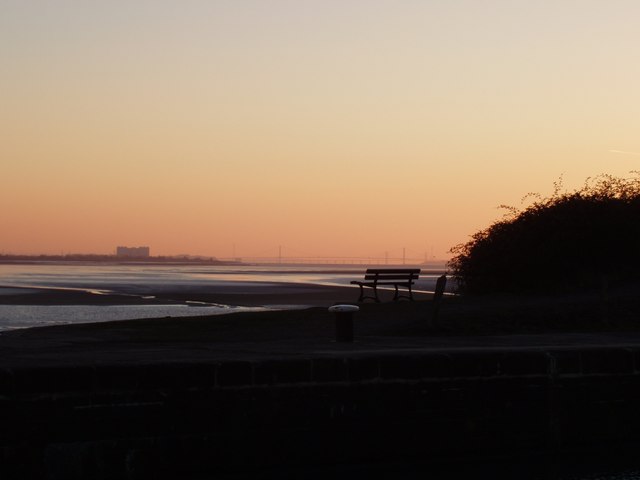
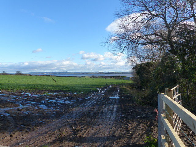
Grange Pill is a picturesque coastal area located in Gloucestershire, England. Situated where the River Severn meets the Bristol Channel, it is known for its stunning sea views, expansive estuary, and charming creek.

The area is characterized by its diverse ecosystem and natural beauty. Grange Pill is home to a wide range of marine life, making it a popular spot for nature enthusiasts and birdwatchers. The estuary provides a crucial habitat for numerous species, including migratory birds such as curlews, dunlins, and redshanks.

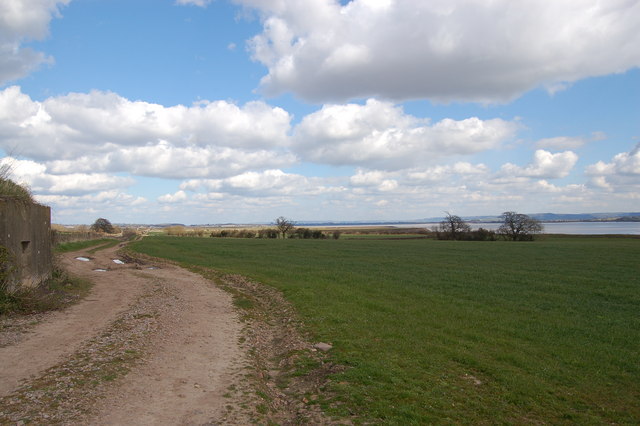
The creek at Grange Pill is a particularly tranquil and scenic location. Surrounded by lush greenery and rolling hills, it offers visitors the opportunity to relax and enjoy the peaceful ambiance. The creek is also an ideal spot for various recreational activities, including fishing and boating.

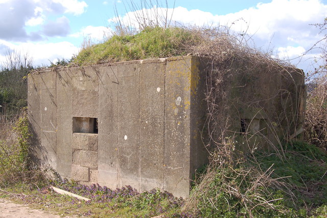
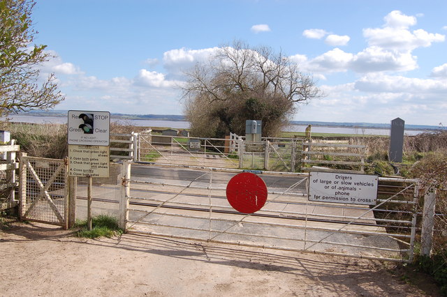
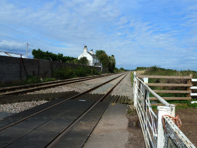
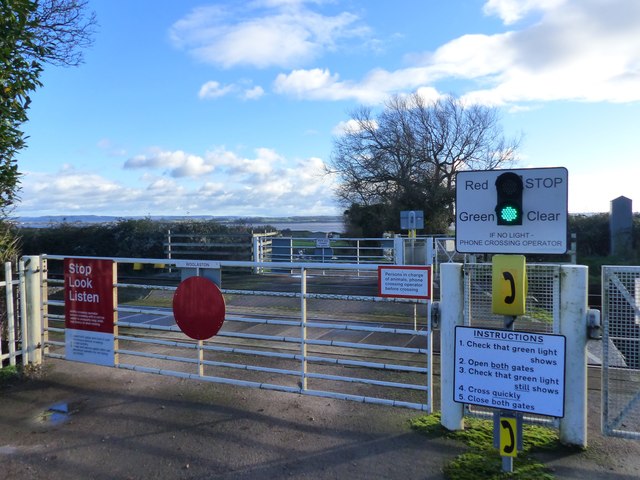
In addition to its natural attractions, Grange Pill boasts a rich history. It was once a thriving port, serving as an important trading hub during the medieval period. Today, remnants of its maritime past can still be seen in the form of old docks and structures.

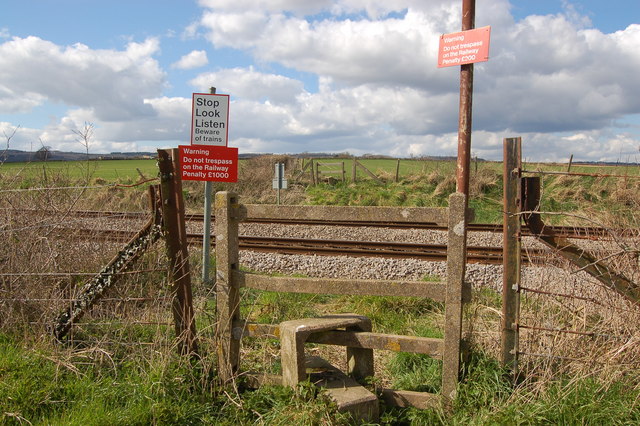
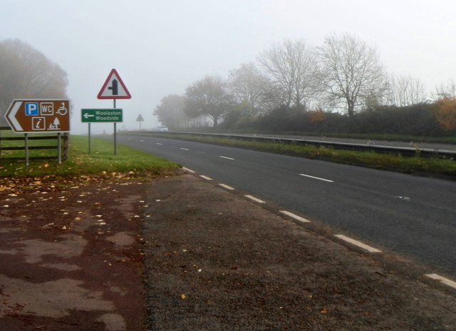
Access to Grange Pill is relatively easy, with nearby parking facilities and public transport options available. The area is well-maintained, with designated walking paths and picnic areas for visitors to enjoy. Its proximity to other popular tourist destinations, such as the Forest of Dean and the Cotswolds, makes it a convenient choice for day trips and weekend getaways.

If you have any feedback on the listing, please let us know in the comments section below.
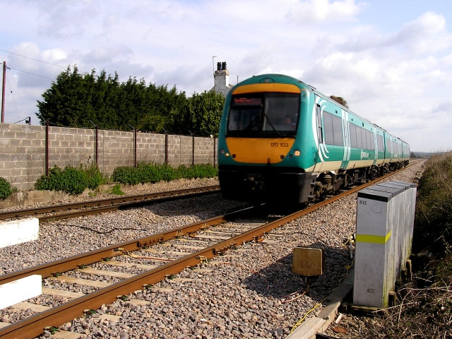
Grange Pill Images

Images are sourced within 2km of 51.680598/-2.5908855 or Grid Reference ST5998. Thanks to Geograph Open Source API. All images are credited.

Gloucester to Chepstow Railway Line This square is mostly flat farmland by the Severn with a railway running through it. There used to be a station here, nr Alvington but I've yet to get the identity of it.
Gloucester to Chepstow Railway Line
This square is mostly flat farmland by the Severn with a railway running through it. There used to be a station here, nr Alvington but I've yet to get the identity of it.
The River Severn This square is 80% River. The building at the top is Oldbury Nuclear Power Station.
The River Severn
This square is 80% River. The building at the top is Oldbury Nuclear Power Station.
Severn Sands, Bridges and Oldbury from Lydney Harbour
Pillbox near Plusterwine on river Severn This is the middle pillbox in a line of three along the Gloucester-Chepstow railway line near the level crossing south-east of Plusterwine. All three pillboxes are pre-fabricated type 26s built in 1940. The railway at this point is only a few hundred yards from the river Severn. The entrances to the pillboxes indicate that the would-be attacker was approaching from across the river Severn. A number of anti-tank vertical rails remain in the hedgerow bordering the railway line on its eastern flank.
Pillbox near Plusterwine on river Severn
This is the middle pillbox in a line of three along the Gloucester-Chepstow railway line near the level crossing south-east of Plusterwine. All three pillboxes are pre-fabricated type 26s built in 1940. The railway at this point is only a few hundred yards from the river Severn. The entrances to the pillboxes indicate that the would-be attacker was approaching from across the river Severn. A number of anti-tank vertical rails remain in the hedgerow bordering the railway line on its eastern flank.
Pedestrian railway crossing near Plusterwine This is a view looking north-west over the Gloucester-Chepstow railway line near Plusterwine in a location close to the river Severn. The railway boundary fence in the foreground (nearest the river) incorporates a number of WW2 anti-tank vertical rails but a gap here permitted access for the footpath.
Pedestrian railway crossing near Plusterwine
This is a view looking north-west over the Gloucester-Chepstow railway line near Plusterwine in a location close to the river Severn. The railway boundary fence in the foreground (nearest the river) incorporates a number of WW2 anti-tank vertical rails but a gap here permitted access for the footpath.
Woolaston level crossing This unmanned level crossing is to be found on the Gloucester-Chepstow line. The view here is to the south-east with the river Severn in the background.
Woolaston level crossing
This unmanned level crossing is to be found on the Gloucester-Chepstow line. The view here is to the south-east with the river Severn in the background.
The flood plain of the river Severn near Plusterwine View looks north-east towards Lydney with the Gloucester-Chepstow railway line in the top left. Berkeley nuclear power station is just visible on the far bank of the Severn. A WW2 pillbox adjoining the railway line commands the fields on this stretch of the river.
The flood plain of the river Severn near Plusterwine
View looks north-east towards Lydney with the Gloucester-Chepstow railway line in the top left. Berkeley nuclear power station is just visible on the far bank of the Severn. A WW2 pillbox adjoining the railway line commands the fields on this stretch of the river.
Woolaston level crossing from the far side
The railway line at Woolaston level crossing
Field edge view at Woolaston Triangulation Pillar Looking north-westward.
Field edge view at Woolaston Triangulation Pillar
Looking north-westward.
Severn Estuary at low tide The main channel of the Severn River hugs the west bank near Woolaston.  Oldbury Nuclear Power Station on the east bank in the distance.
Severn Estuary at low tide
The main channel of the Severn River hugs the west bank near Woolaston. Oldbury Nuclear Power Station on the east bank in the distance.
Clear instructions at Woolaston Level Crossing This is a user-operated gate for both farm vehicles and pedestrians.  The road ends at the crossing.
Clear instructions at Woolaston Level Crossing
This is a user-operated gate for both farm vehicles and pedestrians. The road ends at the crossing.
Farm track, field boundary, and a view of the River Severn, Woolaston
A picnic area off the A48
Public toilets in a picnic and parking area near the A48, Woolaston There was an unexpected bank of fog in the Woolaston area on a November Sunday that was clear 
and sunny with bright blue skies elsewhere, hence the poor visibility in the background.
Public toilets in a picnic and parking area near the A48, Woolaston
There was an unexpected bank of fog in the Woolaston area on a November Sunday that was clear and sunny with bright blue skies elsewhere, hence the poor visibility in the background.
Entrance from the A48 to a picnic area, Woolaston Facilities in the picnic area include public toilets. <a title="https://www.geograph.org.uk/photo/3230301" href="https://www.geograph.org.uk/photo/3230301">Link</a>
Entrance from the A48 to a picnic area, Woolaston
Facilities in the picnic area include public toilets. Link
Church Lane, Woolaston On the left, a sign pointing to the sky shows CHURCH.
The sign should of course be interpreted as pointing ahead, towards this <a title="https://www.geograph.org.uk/photo/1899890" href="https://www.geograph.org.uk/photo/1899890">Link</a> church.
Church Lane, Woolaston
On the left, a sign pointing to the sky shows CHURCH. The sign should of course be interpreted as pointing ahead, towards this Link church.
Keynsham Lane, Woolaston Keynsham Lane heads towards Keynsham Farm. Out of shot on the left is Church Lane. <a title="https://www.geograph.org.uk/photo/3230351" href="https://www.geograph.org.uk/photo/3230351">Link</a>
Keynsham Lane, Woolaston
Keynsham Lane heads towards Keynsham Farm. Out of shot on the left is Church Lane. Link
Show me another place!

Grange Pill is located at Grid Ref: ST5998 (Lat: 51.680598, Lng: -2.5908855)

Administrative County: Gloucestershire

District: Forest of Dean

Police Authority: Gloucestershire

What 3 Words

///steam.fled.icebergs. Near Hill, Gloucestershire

Related Wikis

Woolaston

Woolaston is a village and civil parish in the Forest of Dean district of Gloucestershire in South West England. It lies on the north side of the Severn...

Ridley Bottom, Tidenham

Ridley Bottom (grid reference ST563985) is a 1.1-hectare (2.7-acre) nature reserve in Gloucestershire. The site is listed in the 'Forest of Dean Local...

Alvington, Gloucestershire

Alvington is a village and civil parish in the Forest of Dean in Gloucestershire, England, situated on the A48 road, six miles north-east of Chepstow in...

Poor's Allotment

Poor's Allotment (grid reference ST560990) is a 28.57-hectare (70.6-acre) biological Site of Special Scientific Interest in Gloucestershire, notified in...

East Wood, Tidenham

East Wood (grid reference SO561001) (west site) and (grid reference SO563001) (east site) is a 0.82-hectare (2.0-acre) nature reserve in Gloucestershire...

Boughspring

Boughspring is a hamlet in Gloucestershire, England. == History == Settlement at Boughspring dates back to Roman times when a villa was built nearby. Boughspring...

Oldbury nuclear power station

Oldbury nuclear power station is a Magnox nuclear power station undergoing decommissioning. It is located on the south bank of the River Severn close...

Miss Grace's Lane

Miss Grace's Lane (also known as Miss Grace's Lane Swallett), near Tidenham in the Forest of Dean, Gloucestershire, England, is a natural cave system,...

Nearby Amenities

Located within 500m of 51.680598,-2.5908855
Source: Landsat photo
Lat/Long: 51.6808928/-2.5950721
Ford: yes
Lat/Long: 51.6840706/-2.5866996
The data included in this document is from www.openstreetmap.org. The data is made available under ODbL.

Have you been to Grange Pill?

Leave your review of Grange Pill below (or comments, questions and feedback).